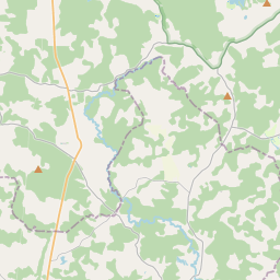
Building (cadastre designation: 32920120067007)
Cadastre designation: 32920120067007
Address: "Āriņi", Vietalvas pagasts, Aizkraukles novads, LV-5109
Cadastre designation of real estate | |
|---|---|
Cadastral object type | Cadastral object type: Building |
Address | Address: "Āriņi", Vietalvas pagasts, Aizkraukles novads, LV-5109 |
Address | |
|---|---|
Address ID | Address ID: 104726738 |
Companies registered at the address | |
Departments registered at the address | Departments registered at the address: 0 |
Institutions registered at the address | Institutions registered at the address: 0 |
Real estate registered at the address | |
Transactions with real estate at the address | Transactions with real estate at the address: 0 |
| Cadastral object type | Cadastre designation of the cadastral object | Person's property right status | Person status | Land Register |
|---|---|---|---|---|
| Cadastral object type: Building | 32920120067007 | Person's property right status: No data | Person status: No data | Land Register |
09.01.2025. State land service data
|
|
|
{"7201060210":{"name":"<div class='color_dot' style='background-color: #00ffff'><\/div><span>Specified land unit<\/span>","featureColor":"#00ffff","features":{"type":"FeatureCollection","features":[{"type":"Feature","geometry":{"type":"Polygon","coordinates":[[[25.720322227,56.693267759],[25.720592126,56.691241386],[25.720639027,56.690860964],[25.720669813,56.690611262],[25.720737531,56.690061912],[25.720967583,56.690137635],[25.723480458,56.690786087],[25.725165578,56.691261734],[25.726882487,56.691746326],[25.726940217,56.691995324],[25.727003848,56.692172069],[25.727105356,56.692326857],[25.727311271,56.692485409],[25.72761354,56.692711058],[25.727550417,56.69278292],[25.725502003,56.695114957],[25.720394714,56.693310643],[25.720322227,56.693267759]]]},"crs":{"type":"name","properties":{"name":"urn:ogc:def:crs:EPSG:3059"}},"properties":{"style":{"color":"#00ffff","dashArray":"8,12","weight":1},"name":"Land","object_type":"Parcel","parcel_code":"32920120055","code":null,"surveyor":null,"address":"","ownership":"<span>Owner - Natural person<br><\/span>","pro_cadastre_nr":"32920120067"}},{"type":"Feature","geometry":{"type":"Polygon","coordinates":[[[25.722648099,56.688033791],[25.72561481,56.687560589],[25.72703662,56.687337987],[25.727415523,56.687266347],[25.727683208,56.687269364],[25.72882558,56.687280091],[25.72973628,56.687288356],[25.729757243,56.687487005],[25.729660143,56.688897766],[25.726994518,56.691731915],[25.726882487,56.691746326],[25.725165578,56.691261734],[25.725213835,56.691208977],[25.726145713,56.690190151],[25.725392276,56.689478763],[25.725597416,56.689429564],[25.725266512,56.689030032],[25.725457919,56.6883202],[25.724414197,56.688415022],[25.72354198,56.688630932],[25.723454858,56.688652499],[25.722648099,56.688033791]],[[25.725520673,56.68952919],[25.726279351,56.689861611],[25.726581343,56.689628113],[25.726457167,56.68958577],[25.726309823,56.689530251],[25.725874063,56.689340872],[25.725520673,56.68952919]]]},"crs":{"type":"name","properties":{"name":"urn:ogc:def:crs:EPSG:3059"}},"properties":{"style":{"color":"#00ffff","dashArray":"8,12","weight":1},"name":"Land","object_type":"Parcel","parcel_code":"32920120016","code":null,"surveyor":null,"address":"","ownership":"<span>Owner - Natural person<br><\/span>","pro_cadastre_nr":"32920120067"}}]}},"7201060110":{"name":"<div class='color_dot' style='background-color: #00ffff'><\/div><span>Measured land unit<\/span>","featureColor":"#00ffff","features":{"type":"FeatureCollection","features":[{"type":"Feature","geometry":{"type":"Polygon","coordinates":[[[25.725520673,56.68952919],[25.725874063,56.689340872],[25.726309823,56.689530251],[25.726457167,56.68958577],[25.726581343,56.689628113],[25.726279351,56.689861611],[25.725520673,56.68952919]]]},"crs":{"type":"name","properties":{"name":"urn:ogc:def:crs:EPSG:3059"}},"properties":{"style":{"color":"#00ffff","dashArray":"0","weight":1},"name":"Land","object_type":"Parcel","parcel_code":"32920120067","code":null,"surveyor":null,"address":"\"\u0100ri\u0146i\", Vietalvas pag., Aizkraukles nov., LV-5109","ownership":"<span>Owner - Natural person<br><\/span>","pro_cadastre_nr":"32920120067"}},{"type":"Feature","geometry":{"type":"Polygon","coordinates":[[[25.74065891,56.737804735],[25.743548151,56.737453903],[25.744504654,56.738707945],[25.746892955,56.739394847],[25.745443126,56.740202605],[25.743514268,56.740428701],[25.742426145,56.739673319],[25.742253111,56.738589164],[25.742234449,56.73831241],[25.74065891,56.737804735]]]},"crs":{"type":"name","properties":{"name":"urn:ogc:def:crs:EPSG:3059"}},"properties":{"style":{"color":"#00ffff","dashArray":"0","weight":1},"name":"Land","object_type":"Parcel","parcel_code":"32920090021","code":null,"surveyor":null,"address":"","ownership":"<span>Owner - Natural person<br><\/span>","pro_cadastre_nr":"32920120067"}}]}},"5201011310":{"name":"<div class='color_dot' style='background-color: #960096'><\/div><span>Vectorized building<\/span>","featureColor":"#960096","features":{"type":"FeatureCollection","features":[{"type":"Feature","geometry":{"type":"Polygon","coordinates":[[[25.726473928,56.689407578],[25.726524243,56.689351719],[25.726588747,56.689369308],[25.726538432,56.689425168],[25.726473928,56.689407578]]]},"crs":{"type":"name","properties":{"name":"urn:ogc:def:crs:EPSG:3059"}},"properties":{"style":{"color":"#960096","dashArray":"0","weight":2},"name":"Building","object_type":"Building","parcel_code":"32920120016","code":"32920120067008","surveyor":null,"address":"","ownership":"<span>Owner - Natural person<br><\/span>","pro_cadastre_nr":"32920120067"}},{"type":"Feature","geometry":{"type":"Polygon","coordinates":[[[25.726050161,56.689317181],[25.726145462,56.689211358],[25.726273392,56.689246237],[25.726178092,56.68935206],[25.726050161,56.689317181]]]},"crs":{"type":"name","properties":{"name":"urn:ogc:def:crs:EPSG:3059"}},"properties":{"style":{"color":"#960096","dashArray":"0","weight":2},"name":"Building","object_type":"Building","parcel_code":"32920120016","code":"32920120067004","surveyor":null,"address":"","ownership":"<span>Owner - Natural person<br><\/span>","pro_cadastre_nr":"32920120067"}},{"type":"Feature","geometry":{"type":"Polygon","coordinates":[[[25.726455567,56.689333567],[25.726523824,56.689352183],[25.726473928,56.689407578],[25.726405671,56.689388954],[25.726455567,56.689333567]]]},"crs":{"type":"name","properties":{"name":"urn:ogc:def:crs:EPSG:3059"}},"properties":{"style":{"color":"#960096","dashArray":"0","weight":2},"name":"Building","object_type":"Building","parcel_code":"32920120016","code":"32920120067007","surveyor":null,"address":"","ownership":"<span>Owner - Natural person<br><\/span>","pro_cadastre_nr":"32920120067"}},{"type":"Feature","geometry":{"type":"Polygon","coordinates":[[[25.726178092,56.68935206],[25.726274355,56.689245163],[25.726396417,56.689278452],[25.726300154,56.689385349],[25.726178092,56.68935206]]]},"crs":{"type":"name","properties":{"name":"urn:ogc:def:crs:EPSG:3059"}},"properties":{"style":{"color":"#960096","dashArray":"0","weight":2},"name":"Building","object_type":"Building","parcel_code":"32920120016","code":"32920120067005","surveyor":null,"address":"","ownership":"<span>Owner - Natural person<br><\/span>","pro_cadastre_nr":"32920120067"}},{"type":"Feature","geometry":{"type":"Polygon","coordinates":[[[25.726538432,56.689425168],[25.726632131,56.689321137],[25.726698949,56.689339359],[25.726605234,56.68944339],[25.726538432,56.689425168]]]},"crs":{"type":"name","properties":{"name":"urn:ogc:def:crs:EPSG:3059"}},"properties":{"style":{"color":"#960096","dashArray":"0","weight":2},"name":"Building","object_type":"Building","parcel_code":"32920120016","code":"32920120067009","surveyor":null,"address":"","ownership":"<span>Owner - Natural person<br><\/span>","pro_cadastre_nr":"32920120067"}},{"type":"Feature","geometry":{"type":"Polygon","coordinates":[[[25.726006289,56.689212702],[25.725778698,56.68916374],[25.725836486,56.689082393],[25.726064076,56.689131355],[25.726006289,56.689212702]]]},"crs":{"type":"name","properties":{"name":"urn:ogc:def:crs:EPSG:3059"}},"properties":{"style":{"color":"#960096","dashArray":"0","weight":2},"name":"Building","object_type":"Building","parcel_code":"32920120016","code":"32920120067003","surveyor":null,"address":"","ownership":"<span>Owner - Natural person<br><\/span>","pro_cadastre_nr":"32920120067"}},{"type":"Feature","geometry":{"type":"Polygon","coordinates":[[[25.726605234,56.68944339],[25.72670591,56.689331624],[25.72683171,56.689365939],[25.726731033,56.689477705],[25.726605234,56.68944339]]]},"crs":{"type":"name","properties":{"name":"urn:ogc:def:crs:EPSG:3059"}},"properties":{"style":{"color":"#960096","dashArray":"0","weight":2},"name":"Building","object_type":"Building","parcel_code":"32920120016","code":"32920120067010","surveyor":null,"address":"","ownership":"<span>Owner - Natural person<br><\/span>","pro_cadastre_nr":"32920120067"}},{"type":"Feature","geometry":{"type":"Polygon","coordinates":[[[25.726300154,56.689385349],[25.726368229,56.689309753],[25.726455567,56.689333567],[25.726387475,56.689409163],[25.726300154,56.689385349]]]},"crs":{"type":"name","properties":{"name":"urn:ogc:def:crs:EPSG:3059"}},"properties":{"style":{"color":"#960096","dashArray":"0","weight":2},"name":"Building","object_type":"Building","parcel_code":"32920120016","code":"32920120067006","surveyor":null,"address":"","ownership":"<span>Owner - Natural person<br><\/span>","pro_cadastre_nr":"32920120067"}},{"type":"Feature","geometry":{"type":"Polygon","coordinates":[[[25.726605234,56.68944339],[25.72670591,56.689331624],[25.72683171,56.689365939],[25.726731033,56.689477705],[25.726605234,56.68944339]]]},"crs":{"type":"name","properties":{"name":"urn:ogc:def:crs:EPSG:3059"}},"properties":{"style":{"color":"#960096","dashArray":"0","weight":2},"name":"Building","object_type":"Building","parcel_code":"32920120016","code":"32920120067010","surveyor":null,"address":"\"\u0100ri\u0146i\", Vietalvas pag., Aizkraukles nov., LV-5109","ownership":"<span>Owner - Natural person<br><\/span>","pro_cadastre_nr":"32920120067"}},{"type":"Feature","geometry":{"type":"Polygon","coordinates":[[[25.726538432,56.689425168],[25.726632131,56.689321137],[25.726698949,56.689339359],[25.726605234,56.68944339],[25.726538432,56.689425168]]]},"crs":{"type":"name","properties":{"name":"urn:ogc:def:crs:EPSG:3059"}},"properties":{"style":{"color":"#960096","dashArray":"0","weight":2},"name":"Building","object_type":"Building","parcel_code":"32920120016","code":"32920120067009","surveyor":null,"address":"\"\u0100ri\u0146i\", Vietalvas pag., Aizkraukles nov., LV-5109","ownership":"<span>Owner - Natural person<br><\/span>","pro_cadastre_nr":"32920120067"}},{"type":"Feature","geometry":{"type":"Polygon","coordinates":[[[25.726473928,56.689407578],[25.726524243,56.689351719],[25.726588747,56.689369308],[25.726538432,56.689425168],[25.726473928,56.689407578]]]},"crs":{"type":"name","properties":{"name":"urn:ogc:def:crs:EPSG:3059"}},"properties":{"style":{"color":"#960096","dashArray":"0","weight":2},"name":"Building","object_type":"Building","parcel_code":"32920120016","code":"32920120067008","surveyor":null,"address":"\"\u0100ri\u0146i\", Vietalvas pag., Aizkraukles nov., LV-5109","ownership":"<span>Owner - Natural person<br><\/span>","pro_cadastre_nr":"32920120067"}},{"type":"Feature","geometry":{"type":"Polygon","coordinates":[[[25.726455567,56.689333567],[25.726523824,56.689352183],[25.726473928,56.689407578],[25.726405671,56.689388954],[25.726455567,56.689333567]]]},"crs":{"type":"name","properties":{"name":"urn:ogc:def:crs:EPSG:3059"}},"properties":{"style":{"color":"#960096","dashArray":"0","weight":2},"name":"Building","object_type":"Building","parcel_code":"32920120016","code":"32920120067007","surveyor":null,"address":"\"\u0100ri\u0146i\", Vietalvas pag., Aizkraukles nov., LV-5109","ownership":"<span>Owner - Natural person<br><\/span>","pro_cadastre_nr":"32920120067"}},{"type":"Feature","geometry":{"type":"Polygon","coordinates":[[[25.726300154,56.689385349],[25.726368229,56.689309753],[25.726455567,56.689333567],[25.726387475,56.689409163],[25.726300154,56.689385349]]]},"crs":{"type":"name","properties":{"name":"urn:ogc:def:crs:EPSG:3059"}},"properties":{"style":{"color":"#960096","dashArray":"0","weight":2},"name":"Building","object_type":"Building","parcel_code":"32920120016","code":"32920120067006","surveyor":null,"address":"\"\u0100ri\u0146i\", Vietalvas pag., Aizkraukles nov., LV-5109","ownership":"<span>Owner - Natural person<br><\/span>","pro_cadastre_nr":"32920120067"}},{"type":"Feature","geometry":{"type":"Polygon","coordinates":[[[25.726178092,56.68935206],[25.726274355,56.689245163],[25.726396417,56.689278452],[25.726300154,56.689385349],[25.726178092,56.68935206]]]},"crs":{"type":"name","properties":{"name":"urn:ogc:def:crs:EPSG:3059"}},"properties":{"style":{"color":"#960096","dashArray":"0","weight":2},"name":"Building","object_type":"Building","parcel_code":"32920120016","code":"32920120067005","surveyor":null,"address":"\"\u0100ri\u0146i\", Vietalvas pag., Aizkraukles nov., LV-5109","ownership":"<span>Owner - Natural person<br><\/span>","pro_cadastre_nr":"32920120067"}},{"type":"Feature","geometry":{"type":"Polygon","coordinates":[[[25.726050161,56.689317181],[25.726145462,56.689211358],[25.726273392,56.689246237],[25.726178092,56.68935206],[25.726050161,56.689317181]]]},"crs":{"type":"name","properties":{"name":"urn:ogc:def:crs:EPSG:3059"}},"properties":{"style":{"color":"#960096","dashArray":"0","weight":2},"name":"Building","object_type":"Building","parcel_code":"32920120016","code":"32920120067004","surveyor":null,"address":"\"\u0100ri\u0146i\", Vietalvas pag., Aizkraukles nov., LV-5109","ownership":"<span>Owner - Natural person<br><\/span>","pro_cadastre_nr":"32920120067"}},{"type":"Feature","geometry":{"type":"Polygon","coordinates":[[[25.726006289,56.689212702],[25.725778698,56.68916374],[25.725836486,56.689082393],[25.726064076,56.689131355],[25.726006289,56.689212702]]]},"crs":{"type":"name","properties":{"name":"urn:ogc:def:crs:EPSG:3059"}},"properties":{"style":{"color":"#960096","dashArray":"0","weight":2},"name":"Building","object_type":"Building","parcel_code":"32920120016","code":"32920120067003","surveyor":null,"address":"\"\u0100ri\u0146i\", Vietalvas pag., Aizkraukles nov., LV-5109","ownership":"<span>Owner - Natural person<br><\/span>","pro_cadastre_nr":"32920120067"}}]}},"5201011110":{"name":"<div class='color_dot' style='background-color: #ff0000'><\/div><span>Measured building<\/span>","featureColor":"#ff0000","features":{"type":"FeatureCollection","features":[{"type":"Feature","geometry":{"type":"Polygon","coordinates":[[[25.725978632,56.689588152],[25.725830615,56.689537179],[25.725883796,56.6894904],[25.72603183,56.689541373],[25.725978632,56.689588152]]]},"crs":{"type":"name","properties":{"name":"urn:ogc:def:crs:EPSG:3059"}},"properties":{"style":{"color":"#ff0000","dashArray":"0","weight":1},"name":"Building","object_type":"Building","parcel_code":"32920120067","code":"32920120067002","surveyor":null,"address":"\"\u0100ri\u0146i\", Vietalvas pag., Aizkraukles nov., LV-5109","ownership":"<span>Owner - Natural person<br><\/span>","pro_cadastre_nr":"32920120067"}},{"type":"Feature","geometry":{"type":"Polygon","coordinates":[[[25.726336158,56.689782398],[25.726233229,56.689743686],[25.72640887,56.689602245],[25.726511815,56.689640956],[25.726336158,56.689782398]]]},"crs":{"type":"name","properties":{"name":"urn:ogc:def:crs:EPSG:3059"}},"properties":{"style":{"color":"#ff0000","dashArray":"0","weight":1},"name":"Building","object_type":"Building","parcel_code":"32920120067","code":"32920120067001","surveyor":null,"address":"\"\u0100ri\u0146i\", Vietalvas pag., Aizkraukles nov., LV-5109","ownership":"<span>Owner - Natural person<br><\/span>","pro_cadastre_nr":"32920120067"}},{"type":"Feature","geometry":{"type":"Polygon","coordinates":[[[25.725978632,56.689588152],[25.725830615,56.689537179],[25.725883796,56.6894904],[25.72603183,56.689541373],[25.725978632,56.689588152]]]},"crs":{"type":"name","properties":{"name":"urn:ogc:def:crs:EPSG:3059"}},"properties":{"style":{"color":"#ff0000","dashArray":"0","weight":1},"name":"Building","object_type":"Building","parcel_code":"32920120067","code":"32920120067002","surveyor":null,"address":"\"\u0100ri\u0146i\", Vietalvas pag., Aizkraukles nov., LV-5109","ownership":"<span>Owner - Natural person<br><\/span>","pro_cadastre_nr":"32920120067"}},{"type":"Feature","geometry":{"type":"Polygon","coordinates":[[[25.726336158,56.689782398],[25.726233229,56.689743686],[25.72640887,56.689602245],[25.726511815,56.689640956],[25.726336158,56.689782398]]]},"crs":{"type":"name","properties":{"name":"urn:ogc:def:crs:EPSG:3059"}},"properties":{"style":{"color":"#ff0000","dashArray":"0","weight":1},"name":"Building","object_type":"Building","parcel_code":"32920120067","code":"32920120067001","surveyor":null,"address":"\"\u0100ri\u0146i\", Vietalvas pag., Aizkraukles nov., LV-5109","ownership":"<span>Owner - Natural person<br><\/span>","pro_cadastre_nr":"32920120067"}}]}}}
[]
https://tile.openstreetmap.org/{z}/{x}/{y}.png|© OpenStreetMap contributors|minZoom: 7|maxZoom: 19
|
Building data updated: 11.01.2025.
Data source and license: Cadastre Information System open text and spatial data, Real Estate Market Database open data, open data license Creative Commons Attribution, OpenStreetMap

