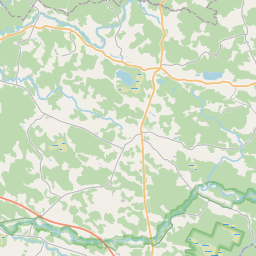
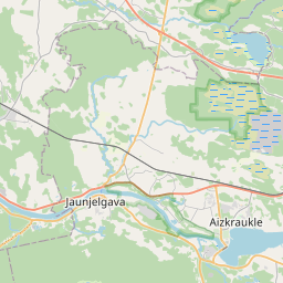
Building (cadastre designation: 32460010002001)
Cadastre designation: 32460010002001
Address: "Bitenieki", Bebru pagasts, Aizkraukles novads, LV-5135
Cadastre designation of real estate | |
|---|---|
Cadastral object type | Cadastral object type: Building |
Address | Address: "Bitenieki", Bebru pagasts, Aizkraukles novads, LV-5135 |
Address | |
|---|---|
Address ID | Address ID: 103218137 |
Companies registered at the address | |
Departments registered at the address | Departments registered at the address: 0 |
Institutions registered at the address | Institutions registered at the address: 0 |
Real estate registered at the address | |
Transactions with real estate at the address | Transactions with real estate at the address: 0 |
| Cadastral object type | Cadastre designation of the cadastral object | Person's property right status | Person status | Land Register |
|---|---|---|---|---|
| Cadastral object type: Building | 32460010002001 | Person's property right status: No data | Person status: No data | Land Register |
05.02.2025. State land service data
|
|
|
{"7201060210":{"name":"<div class='color_dot' style='background-color: #00ffff'><\/div><span>Specified land unit<\/span>","featureColor":"#00ffff","features":{"type":"FeatureCollection","features":[{"type":"Feature","geometry":{"type":"Polygon","coordinates":[[[25.357594116,56.725986451],[25.358462984,56.724760718],[25.358468694,56.724714194],[25.358567947,56.723904949],[25.358573132,56.723849329],[25.358861103,56.723848454],[25.359029765,56.724001317],[25.359076213,56.724082025],[25.359330759,56.724358571],[25.360149176,56.725327872],[25.360644809,56.725653053],[25.361293554,56.726004897],[25.361031069,56.726310824],[25.360909352,56.726299341],[25.357594116,56.725986451]]]},"crs":{"type":"name","properties":{"name":"urn:ogc:def:crs:EPSG:3059"}},"properties":{"style":{"color":"#00ffff","dashArray":"8,12","weight":1},"name":"Land","object_type":"Parcel","parcel_code":"32460010003","code":null,"surveyor":null,"address":"","ownership":"<span>Owner - Natural person<br><\/span>","pro_cadastre_nr":"32460010002"}},{"type":"Feature","geometry":{"type":"Polygon","coordinates":[[[25.308127471,56.73890225],[25.308408866,56.738735683],[25.309586636,56.738043859],[25.309969988,56.73781867],[25.313693263,56.735655524],[25.313768954,56.735648563],[25.314717258,56.734971631],[25.31575077,56.734460119],[25.317930557,56.733171499],[25.322930072,56.730891378],[25.324484843,56.730737812],[25.325010842,56.730659454],[25.326606984,56.730729629],[25.328085764,56.730869103],[25.329542508,56.731281826],[25.329603368,56.731317619],[25.329587426,56.731325804],[25.329544763,56.731298918],[25.329362655,56.73127157],[25.328191232,56.731393502],[25.326025536,56.731619277],[25.324331819,56.731991043],[25.322867847,56.732552696],[25.321816648,56.733276569],[25.321290477,56.73364385],[25.320864748,56.734116453],[25.320337653,56.734697147],[25.319184094,56.73578266],[25.31859262,56.736192426],[25.317740898,56.737391372],[25.316165386,56.738999245],[25.315069039,56.739851937],[25.308127471,56.73890225]]]},"crs":{"type":"name","properties":{"name":"urn:ogc:def:crs:EPSG:3059"}},"properties":{"style":{"color":"#00ffff","dashArray":"8,12","weight":1},"name":"Land","object_type":"Parcel","parcel_code":"32460010002","code":null,"surveyor":null,"address":"\"Bitenieki\", Bebru pag., Aizkraukles nov., LV-5135","ownership":"<span>Owner - Natural person<br><\/span>","pro_cadastre_nr":"32460010002"}}]}},"7114100000":{"name":"<div class='color_dot' style='background-color: #b40000'><\/div><span>Burdened access road servitude area<\/span>","featureColor":"#b40000","features":{"type":"FeatureCollection","features":[{"type":"Feature","geometry":{"type":"Polygon","coordinates":[[[25.320878418,56.73399867],[25.321226274,56.733616066],[25.32175278,56.733248549],[25.322821078,56.73251586],[25.324301518,56.731949334],[25.326023955,56.731574369],[25.328176027,56.731349369],[25.329345047,56.731227472],[25.329542508,56.731281826],[25.329603368,56.731317619],[25.329587426,56.731325804],[25.329544763,56.731298918],[25.329362655,56.73127157],[25.328191232,56.731393502],[25.326025536,56.731619277],[25.324331819,56.731991043],[25.322867847,56.732552696],[25.321816648,56.733276569],[25.321290477,56.73364385],[25.320950582,56.734011975],[25.320878418,56.73399867]]]},"crs":{"type":"name","properties":{"name":"urn:ogc:def:crs:EPSG:3059"}},"properties":{"style":{"color":"#b40000","dashArray":"4,2,1,2","weight":1},"name":"Burdened access road servitude area","object_type":"WayRestriction","parcel_code":"32460010002","code":"7315030100001","surveyor":null,"address":"\"Bitenieki\", Bebru pag., Aizkraukles nov., LV-5135","ownership":"<span>Owner - Natural person<br><\/span>","pro_cadastre_nr":"32460010002"}}]}},"5201011310":{"name":"<div class='color_dot' style='background-color: #960096'><\/div><span>Vectorized building<\/span>","featureColor":"#960096","features":{"type":"FeatureCollection","features":[{"type":"Feature","geometry":{"type":"Polygon","coordinates":[[[25.320559649,56.73380643],[25.320377951,56.733830538],[25.320319949,56.733698492],[25.320501647,56.733674383],[25.320559649,56.73380643]]]},"crs":{"type":"name","properties":{"name":"urn:ogc:def:crs:EPSG:3059"}},"properties":{"style":{"color":"#960096","dashArray":"0","weight":2},"name":"Building","object_type":"Building","parcel_code":"32460010002","code":"32460010002001","surveyor":null,"address":"\"Bitenieki\", Bebru pag., Aizkraukles nov., LV-5135","ownership":"<span>Owner - Natural person<br><\/span>","pro_cadastre_nr":"32460010002"}},{"type":"Feature","geometry":{"type":"Polygon","coordinates":[[[25.320559649,56.73380643],[25.320377951,56.733830538],[25.320319949,56.733698492],[25.320501647,56.733674383],[25.320559649,56.73380643]]]},"crs":{"type":"name","properties":{"name":"urn:ogc:def:crs:EPSG:3059"}},"properties":{"style":{"color":"#960096","dashArray":"0","weight":2},"name":"Building","object_type":"Building","parcel_code":"32460010002","code":"32460010002001","surveyor":null,"address":"\"Bitenieki\", Bebru pag., Aizkraukles nov., LV-5135","ownership":"<span>Owner - Natural person<br><\/span>","pro_cadastre_nr":"32460010002"}}]}}}
[]
https://tile.openstreetmap.org/{z}/{x}/{y}.png|© OpenStreetMap contributors|minZoom: 7|maxZoom: 19
|
Building data updated: 13.02.2025.
Data source and license: Cadastre Information System open text and spatial data, Real Estate Market Database open data, open data license Creative Commons Attribution, OpenStreetMap


