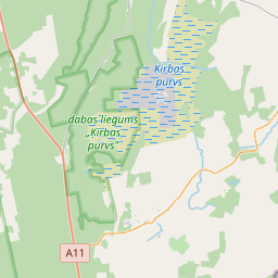
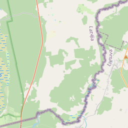
Карточка недвижимого имущества (кадастровый номер: 64840080217)
Кадастровый номер: 64840080217
Адрес: "Aizstrauti", Rucava, Rucavas pag., Dienvidkurzemes nov., LV-3477
Адрес: "Aizstrauti", Rucava, Rucavas pag., Dienvidkurzemes nov., LV-3477
Кадастровый номер недвижимого имущества | |
|---|---|
Вид недвижимого имущества | Вид недвижимого имущества: Недвижимость земли и сооружений |
Адрес | Адрес: "Aizstrauti", Rucava, Rucavas pag., Dienvidkurzemes nov., LV-3477 |
Адрес | |
|---|---|
Идентификатор адреса | Идентификатор адреса: 104189267 |
Kомпании, зарегистрированные по адресу
| Kомпании, зарегистрированные по адресу
: 0 |
Подразделения, зарегистрированные по адресу
| Подразделения, зарегистрированные по адресу
: 0 |
Учреждения, зарегистрированные по адресу
| Учреждения, зарегистрированные по адресу
: 0 |
Недвижимость по адресу
| |
Сделки по адресу
| Сделки по адресу
: 0 |
| Тип кадастрового объекта | Кадастровое обозначение кадастрового объекта | Статус права собственности лица | Статус персоны | Земельная книга |
|---|---|---|---|---|
| Тип кадастрового объекта: Недвижимость | 64840080217 | Статус права собственности лица: Владелец | Статус персоны: Физическое лицо | Земельная книга |
|
|
|
{"7201060210":{"name":"<div class='color_dot' style='background-color: #00ffff'><\/div><span>\u0423\u043a\u0430\u0437\u0430\u043d\u043d\u0430\u044f \u0437\u0435\u043c\u0435\u043b\u044c\u043d\u0430\u044f \u0435\u0434\u0438\u043d\u0438\u0446\u0430<\/span>","featureColor":"#00ffff","features":{"type":"FeatureCollection","features":[{"type":"Feature","geometry":{"type":"Polygon","coordinates":[[[21.181046367,56.169936775],[21.18159501,56.169780564],[21.181620286,56.169799074],[21.181624735,56.16980278],[21.183207717,56.171118022],[21.182606851,56.171386002],[21.181070653,56.169959334],[21.181046367,56.169936775]]]},"crs":{"type":"name","properties":{"name":"urn:ogc:def:crs:EPSG:3059"}},"properties":{"style":{"color":"#00ffff","dashArray":"8,12","weight":1},"name":"\u0417\u0435\u043c\u043b\u044f","object_type":"Parcel","parcel_code":"64840080514","code":null,"surveyor":null,"address":"","ownership":"<span>\u0412\u043b\u0430\u0434\u0435\u043b\u0435\u0446 - \u0424\u0438\u0437\u0438\u0447\u0435\u0441\u043a\u043e\u0435 \u043b\u0438\u0446\u043e<br><\/span>","pro_cadastre_nr":"64840080217"}},{"type":"Feature","geometry":{"type":"Polygon","coordinates":[[[21.158911711,56.173854797],[21.159120452,56.172890092],[21.160333778,56.172894428],[21.16188524,56.173036105],[21.161960027,56.1730391],[21.162077711,56.174052909],[21.16022867,56.173948035],[21.158911711,56.173854797]]]},"crs":{"type":"name","properties":{"name":"urn:ogc:def:crs:EPSG:3059"}},"properties":{"style":{"color":"#00ffff","dashArray":"8,12","weight":1},"name":"\u0417\u0435\u043c\u043b\u044f","object_type":"Parcel","parcel_code":"64840080217","code":null,"surveyor":null,"address":"\"Aizstrauti\", Rucava, Rucavas pag., Dienvidkurzemes nov., LV-3477","ownership":"<span>\u0412\u043b\u0430\u0434\u0435\u043b\u0435\u0446 - \u0424\u0438\u0437\u0438\u0447\u0435\u0441\u043a\u043e\u0435 \u043b\u0438\u0446\u043e<br><\/span>","pro_cadastre_nr":"64840080217"}},{"type":"Feature","geometry":{"type":"Polygon","coordinates":[[[21.169102259,56.170974302],[21.169705213,56.170825824],[21.169788906,56.170805413],[21.169800748,56.170827968],[21.170647473,56.171667445],[21.169749584,56.171851094],[21.169115301,56.170986691],[21.169102259,56.170974302]]]},"crs":{"type":"name","properties":{"name":"urn:ogc:def:crs:EPSG:3059"}},"properties":{"style":{"color":"#00ffff","dashArray":"8,12","weight":1},"name":"\u0417\u0435\u043c\u043b\u044f","object_type":"Parcel","parcel_code":"64840080193","code":null,"surveyor":null,"address":"","ownership":"<span>\u0412\u043b\u0430\u0434\u0435\u043b\u0435\u0446 - \u0424\u0438\u0437\u0438\u0447\u0435\u0441\u043a\u043e\u0435 \u043b\u0438\u0446\u043e<br><\/span>","pro_cadastre_nr":"64840080217"}}]}},"7114100000":{"name":"<div class='color_dot' style='background-color: #b40000'><\/div><span>\u0422\u0435\u0440\u0440\u0438\u0442\u043e\u0440\u0438\u044f \u0441\u0435\u0440\u0432\u0438\u0442\u0443\u0442\u0430 \u0434\u043e\u0440\u043e\u0436\u043d\u044b\u0445 \u043e\u0431\u0440\u0435\u043c\u0435\u043d\u0435\u043d\u0438\u0439<\/span>","featureColor":"#b40000","features":{"type":"FeatureCollection","features":[{"type":"Feature","geometry":{"type":"Polygon","coordinates":[[[21.181642731,56.169817743],[21.181087569,56.169974965],[21.181058626,56.169948012],[21.181046447,56.169936777],[21.181320681,56.169858665],[21.181595009,56.169780573],[21.18160759,56.169789831],[21.181620269,56.169799091],[21.181622469,56.169800939],[21.181624685,56.169802805],[21.181642731,56.169817743]]]},"crs":{"type":"name","properties":{"name":"urn:ogc:def:crs:EPSG:3059"}},"properties":{"style":{"color":"#b40000","dashArray":"4,2,1,2","weight":1},"name":"\u0422\u0435\u0440\u0440\u0438\u0442\u043e\u0440\u0438\u044f \u0441\u0435\u0440\u0432\u0438\u0442\u0443\u0442\u0430 \u0434\u043e\u0440\u043e\u0436\u043d\u044b\u0445 \u043e\u0431\u0440\u0435\u043c\u0435\u043d\u0435\u043d\u0438\u0439","object_type":"WayRestriction","parcel_code":"64840080514","code":"7315030100001","surveyor":null,"address":"","ownership":"<span>\u0412\u043b\u0430\u0434\u0435\u043b\u0435\u0446 - \u0424\u0438\u0437\u0438\u0447\u0435\u0441\u043a\u043e\u0435 \u043b\u0438\u0446\u043e<br><\/span>","pro_cadastre_nr":"64840080217"}},{"type":"Feature","geometry":{"type":"Polygon","coordinates":[[[21.169102356,56.170974304],[21.169788888,56.170805431],[21.169800748,56.170827968],[21.169804349,56.170831574],[21.169124154,56.170998624],[21.169115367,56.170986665],[21.169102356,56.170974304]]]},"crs":{"type":"name","properties":{"name":"urn:ogc:def:crs:EPSG:3059"}},"properties":{"style":{"color":"#b40000","dashArray":"4,2,1,2","weight":1},"name":"\u0422\u0435\u0440\u0440\u0438\u0442\u043e\u0440\u0438\u044f \u0441\u0435\u0440\u0432\u0438\u0442\u0443\u0442\u0430 \u0434\u043e\u0440\u043e\u0436\u043d\u044b\u0445 \u043e\u0431\u0440\u0435\u043c\u0435\u043d\u0435\u043d\u0438\u0439","object_type":"WayRestriction","parcel_code":"64840080193","code":"7315030100001","surveyor":null,"address":"","ownership":"<span>\u0412\u043b\u0430\u0434\u0435\u043b\u0435\u0446 - \u0424\u0438\u0437\u0438\u0447\u0435\u0441\u043a\u043e\u0435 \u043b\u0438\u0446\u043e<br><\/span>","pro_cadastre_nr":"64840080217"}}]}},"5201011310":{"name":"<div class='color_dot' style='background-color: #960096'><\/div><span>\u0412\u0435\u043a\u0442\u043e\u0440\u0438\u0437\u043e\u0432\u0430\u043d\u043d\u043e\u0435 \u0437\u0434\u0430\u043d\u0438\u0435<\/span>","featureColor":"#960096","features":{"type":"FeatureCollection","features":[{"type":"Feature","geometry":{"type":"Polygon","coordinates":[[[21.159772761,56.173495913],[21.159869649,56.17349814],[21.159865249,56.173557689],[21.159768361,56.173555462],[21.159772761,56.173495913]]]},"crs":{"type":"name","properties":{"name":"urn:ogc:def:crs:EPSG:3059"}},"properties":{"style":{"color":"#960096","dashArray":"0","weight":2},"name":"\u0417\u0434\u0430\u043d\u0438\u044f","object_type":"Building","parcel_code":"64840080217","code":"64840080217002","surveyor":null,"address":"\"Aizstrauti\", Rucava, Rucavas pag., Dienvidkurzemes nov., LV-3477","ownership":"<span>\u0412\u043b\u0430\u0434\u0435\u043b\u0435\u0446 - \u0424\u0438\u0437\u0438\u0447\u0435\u0441\u043a\u043e\u0435 \u043b\u0438\u0446\u043e<br><\/span>","pro_cadastre_nr":"64840080217"}},{"type":"Feature","geometry":{"type":"Polygon","coordinates":[[[21.159411184,56.173564858],[21.159413829,56.173529054],[21.159375254,56.173528167],[21.159377086,56.173503372],[21.159416289,56.173504274],[21.159419546,56.173460186],[21.159553143,56.173463258],[21.159548665,56.173523866],[21.159578296,56.173524548],[21.159575039,56.173568626],[21.159411184,56.173564858]]]},"crs":{"type":"name","properties":{"name":"urn:ogc:def:crs:EPSG:3059"}},"properties":{"style":{"color":"#960096","dashArray":"0","weight":2},"name":"\u0417\u0434\u0430\u043d\u0438\u044f","object_type":"Building","parcel_code":"64840080217","code":"64840080217001","surveyor":null,"address":"\"Aizstrauti\", Rucava, Rucavas pag., Dienvidkurzemes nov., LV-3477","ownership":"<span>\u0412\u043b\u0430\u0434\u0435\u043b\u0435\u0446 - \u0424\u0438\u0437\u0438\u0447\u0435\u0441\u043a\u043e\u0435 \u043b\u0438\u0446\u043e<br><\/span>","pro_cadastre_nr":"64840080217"}},{"type":"Feature","geometry":{"type":"Polygon","coordinates":[[[21.16006194,56.173426506],[21.160087051,56.173362947],[21.160166894,56.173372765],[21.160141783,56.173436323],[21.16006194,56.173426506]]]},"crs":{"type":"name","properties":{"name":"urn:ogc:def:crs:EPSG:3059"}},"properties":{"style":{"color":"#960096","dashArray":"0","weight":2},"name":"\u0417\u0434\u0430\u043d\u0438\u044f","object_type":"Building","parcel_code":"64840080217","code":"64840080217005","surveyor":null,"address":"\"Aizstrauti\", Rucava, Rucavas pag., Dienvidkurzemes nov., LV-3477","ownership":null,"pro_cadastre_nr":null}},{"type":"Feature","geometry":{"type":"Polygon","coordinates":[[[21.159631275,56.173645408],[21.159633972,56.173608903],[21.159685207,56.173610081],[21.159686937,56.173586669],[21.159748033,56.173588073],[21.159746839,56.173604244],[21.1600122,56.173610345],[21.160008968,56.173654091],[21.159631275,56.173645408]]]},"crs":{"type":"name","properties":{"name":"urn:ogc:def:crs:EPSG:3059"}},"properties":{"style":{"color":"#960096","dashArray":"0","weight":2},"name":"\u0417\u0434\u0430\u043d\u0438\u044f","object_type":"Building","parcel_code":"64840080217","code":"64840080217004","surveyor":null,"address":"\"Aizstrauti\", Rucava, Rucavas pag., Dienvidkurzemes nov., LV-3477","ownership":null,"pro_cadastre_nr":null}},{"type":"Feature","geometry":{"type":"Polygon","coordinates":[[[21.159768361,56.173555462],[21.159865249,56.173557689],[21.159861968,56.173602109],[21.159765079,56.173599881],[21.159768361,56.173555462]]]},"crs":{"type":"name","properties":{"name":"urn:ogc:def:crs:EPSG:3059"}},"properties":{"style":{"color":"#960096","dashArray":"0","weight":2},"name":"\u0417\u0434\u0430\u043d\u0438\u044f","object_type":"Building","parcel_code":"64840080217","code":"64840080217003","surveyor":null,"address":"\"Aizstrauti\", Rucava, Rucavas pag., Dienvidkurzemes nov., LV-3477","ownership":"<span>\u0412\u043b\u0430\u0434\u0435\u043b\u0435\u0446 - \u0424\u0438\u0437\u0438\u0447\u0435\u0441\u043a\u043e\u0435 \u043b\u0438\u0446\u043e<br><\/span>","pro_cadastre_nr":"64840080217"}},{"type":"Feature","geometry":{"type":"Polygon","coordinates":[[[21.159768361,56.173555462],[21.159865249,56.173557689],[21.159861968,56.173602109],[21.159765079,56.173599881],[21.159768361,56.173555462]]]},"crs":{"type":"name","properties":{"name":"urn:ogc:def:crs:EPSG:3059"}},"properties":{"style":{"color":"#960096","dashArray":"0","weight":2},"name":"\u0417\u0434\u0430\u043d\u0438\u044f","object_type":"Building","parcel_code":"64840080217","code":"64840080217003","surveyor":null,"address":"\"Aizstrauti\", Rucava, Rucavas pag., Dienvidkurzemes nov., LV-3477","ownership":"<span>\u0412\u043b\u0430\u0434\u0435\u043b\u0435\u0446 - \u0424\u0438\u0437\u0438\u0447\u0435\u0441\u043a\u043e\u0435 \u043b\u0438\u0446\u043e<br><\/span>","pro_cadastre_nr":"64840080217"}},{"type":"Feature","geometry":{"type":"Polygon","coordinates":[[[21.159772761,56.173495913],[21.159869649,56.17349814],[21.159865249,56.173557689],[21.159768361,56.173555462],[21.159772761,56.173495913]]]},"crs":{"type":"name","properties":{"name":"urn:ogc:def:crs:EPSG:3059"}},"properties":{"style":{"color":"#960096","dashArray":"0","weight":2},"name":"\u0417\u0434\u0430\u043d\u0438\u044f","object_type":"Building","parcel_code":"64840080217","code":"64840080217002","surveyor":null,"address":"\"Aizstrauti\", Rucava, Rucavas pag., Dienvidkurzemes nov., LV-3477","ownership":"<span>\u0412\u043b\u0430\u0434\u0435\u043b\u0435\u0446 - \u0424\u0438\u0437\u0438\u0447\u0435\u0441\u043a\u043e\u0435 \u043b\u0438\u0446\u043e<br><\/span>","pro_cadastre_nr":"64840080217"}},{"type":"Feature","geometry":{"type":"Polygon","coordinates":[[[21.159411184,56.173564858],[21.159413829,56.173529054],[21.159375254,56.173528167],[21.159377086,56.173503372],[21.159416289,56.173504274],[21.159419546,56.173460186],[21.159553143,56.173463258],[21.159548665,56.173523866],[21.159578296,56.173524548],[21.159575039,56.173568626],[21.159411184,56.173564858]]]},"crs":{"type":"name","properties":{"name":"urn:ogc:def:crs:EPSG:3059"}},"properties":{"style":{"color":"#960096","dashArray":"0","weight":2},"name":"\u0417\u0434\u0430\u043d\u0438\u044f","object_type":"Building","parcel_code":"64840080217","code":"64840080217001","surveyor":null,"address":"\"Aizstrauti\", Rucava, Rucavas pag., Dienvidkurzemes nov., LV-3477","ownership":"<span>\u0412\u043b\u0430\u0434\u0435\u043b\u0435\u0446 - \u0424\u0438\u0437\u0438\u0447\u0435\u0441\u043a\u043e\u0435 \u043b\u0438\u0446\u043e<br><\/span>","pro_cadastre_nr":"64840080217"}}]}}}
[]
https://tile.openstreetmap.org/{z}/{x}/{y}.png|© OpenStreetMap contributors|minZoom: 7|maxZoom: 19
|
Источник данных и лицензия: Открытые текстовые и пространственные данные Кадастровой информационной системы, Открытые данные Базы данных рынка недвижимости, Oткрытые данные Управления государственного строительного контроля, Открытые данные Минюста «Сведения о примененных санкциях в государственных реестрах», лицензия открытых данных Creative Commons Attribution , данные электронного аукциона судебной администрации, OpenStreetMap

