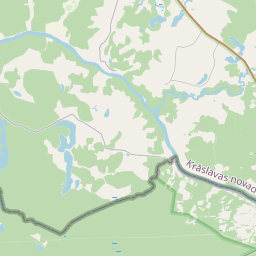
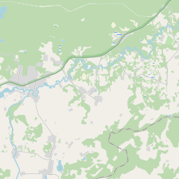
Карточка недвижимого имущества (кадастровый номер: 60840030200)
Кадастровый номер: 60840030200
Адрес: "Vilkastes", Piedruja, Piedrujas pag., Krāslavas nov., LV-5662
Адрес: "Vilkastes", Piedruja, Piedrujas pag., Krāslavas nov., LV-5662
Кадастровый номер недвижимого имущества | |
|---|---|
Вид недвижимого имущества | Вид недвижимого имущества: Недвижимость земли и сооружений |
Адрес | Адрес: "Vilkastes", Piedruja, Piedrujas pag., Krāslavas nov., LV-5662 |
Адрес | |
|---|---|
Идентификатор адреса | Идентификатор адреса: 102699731 |
Kомпании, зарегистрированные по адресу
| Kомпании, зарегистрированные по адресу
: 0 |
Подразделения, зарегистрированные по адресу
| Подразделения, зарегистрированные по адресу
: 0 |
Учреждения, зарегистрированные по адресу
| Учреждения, зарегистрированные по адресу
: 0 |
Недвижимость по адресу
| |
Сделки по адресу
| Сделки по адресу
: 0 |
| Тип кадастрового объекта | Кадастровое обозначение кадастрового объекта | Статус права собственности лица | Статус персоны | Земельная книга |
|---|---|---|---|---|
| Тип кадастрового объекта: Недвижимость | 60840030200 | Статус права собственности лица: Владелец | Статус персоны: Физическое лицо | Земельная книга |
|
|
|
{"7201060210":{"name":"<div class='color_dot' style='background-color: #00ffff'><\/div><span>\u0423\u043a\u0430\u0437\u0430\u043d\u043d\u0430\u044f \u0437\u0435\u043c\u0435\u043b\u044c\u043d\u0430\u044f \u0435\u0434\u0438\u043d\u0438\u0446\u0430<\/span>","featureColor":"#00ffff","features":{"type":"FeatureCollection","features":[{"type":"Feature","geometry":{"type":"Polygon","coordinates":[[[27.45505687,55.795991532],[27.455523335,55.795937859],[27.455534215,55.795958682],[27.456036214,55.796919644],[27.455865369,55.79702589],[27.455562785,55.797128038],[27.455306399,55.796658803],[27.455208616,55.796428986],[27.455091331,55.796124622],[27.45505687,55.795991532]]]},"crs":{"type":"name","properties":{"name":"urn:ogc:def:crs:EPSG:3059"}},"properties":{"style":{"color":"#00ffff","dashArray":"8,12","weight":1},"name":"\u0417\u0435\u043c\u043b\u044f","object_type":"Parcel","parcel_code":"60840030202","code":null,"surveyor":null,"address":"","ownership":"<span>\u0412\u043b\u0430\u0434\u0435\u043b\u0435\u0446 - \u0424\u0438\u0437\u0438\u0447\u0435\u0441\u043a\u043e\u0435 \u043b\u0438\u0446\u043e<br><\/span>","pro_cadastre_nr":"60840030200"}},{"type":"Feature","geometry":{"type":"Polygon","coordinates":[[[27.441766066,55.797398965],[27.442225139,55.797185309],[27.442511825,55.797052755],[27.443561265,55.797522325],[27.444453104,55.797973746],[27.443804535,55.798414618],[27.443634848,55.79856746],[27.443441765,55.798548372],[27.443289944,55.798438583],[27.443270615,55.798151856],[27.443128428,55.798011802],[27.442906173,55.79784728],[27.442667712,55.797787114],[27.442573062,55.797712307],[27.441991104,55.797577914],[27.441968,55.797510948],[27.441766066,55.797398965]]]},"crs":{"type":"name","properties":{"name":"urn:ogc:def:crs:EPSG:3059"}},"properties":{"style":{"color":"#00ffff","dashArray":"8,12","weight":1},"name":"\u0417\u0435\u043c\u043b\u044f","object_type":"Parcel","parcel_code":"60840030201","code":null,"surveyor":null,"address":"","ownership":"<span>\u0412\u043b\u0430\u0434\u0435\u043b\u0435\u0446 - \u0424\u0438\u0437\u0438\u0447\u0435\u0441\u043a\u043e\u0435 \u043b\u0438\u0446\u043e<br><\/span>","pro_cadastre_nr":"60840030200"}},{"type":"Feature","geometry":{"type":"Polygon","coordinates":[[[27.443098607,55.796353551],[27.443108288,55.796161758],[27.443337634,55.796111433],[27.443722312,55.79607613],[27.443960729,55.796061101],[27.444055324,55.796027645],[27.444058744,55.796034014],[27.444174915,55.796281414],[27.443125912,55.796447652],[27.443098607,55.796353551]]]},"crs":{"type":"name","properties":{"name":"urn:ogc:def:crs:EPSG:3059"}},"properties":{"style":{"color":"#00ffff","dashArray":"8,12","weight":1},"name":"\u0417\u0435\u043c\u043b\u044f","object_type":"Parcel","parcel_code":"60840030200","code":null,"surveyor":null,"address":"\"Vilkastes\", Piedruja, Piedrujas pag., Kr\u0101slavas nov., LV-5662","ownership":"<span>\u0412\u043b\u0430\u0434\u0435\u043b\u0435\u0446 - \u0424\u0438\u0437\u0438\u0447\u0435\u0441\u043a\u043e\u0435 \u043b\u0438\u0446\u043e<br><\/span>","pro_cadastre_nr":"60840030200"}},{"type":"Feature","geometry":{"type":"Polygon","coordinates":[[[27.416682454,55.837594722],[27.419857529,55.837281115],[27.417716711,55.838519003],[27.416682454,55.837594722]]]},"crs":{"type":"name","properties":{"name":"urn:ogc:def:crs:EPSG:3059"}},"properties":{"style":{"color":"#00ffff","dashArray":"8,12","weight":1},"name":"\u0417\u0435\u043c\u043b\u044f","object_type":"Parcel","parcel_code":"60840020079","code":null,"surveyor":null,"address":"","ownership":"<span>\u0412\u043b\u0430\u0434\u0435\u043b\u0435\u0446 - \u0424\u0438\u0437\u0438\u0447\u0435\u0441\u043a\u043e\u0435 \u043b\u0438\u0446\u043e<br><\/span>","pro_cadastre_nr":"60840030200"}},{"type":"Feature","geometry":{"type":"Polygon","coordinates":[[[27.414401497,55.836283887],[27.416023292,55.834420569],[27.416060548,55.834430215],[27.416239733,55.834601819],[27.416342309,55.834650883],[27.416399536,55.834683278],[27.416536888,55.834765226],[27.416674695,55.83484744],[27.416975021,55.834978668],[27.417150263,55.835055066],[27.417110609,55.835103291],[27.415806601,55.836689056],[27.414401497,55.836283887]]]},"crs":{"type":"name","properties":{"name":"urn:ogc:def:crs:EPSG:3059"}},"properties":{"style":{"color":"#00ffff","dashArray":"8,12","weight":1},"name":"\u0417\u0435\u043c\u043b\u044f","object_type":"Parcel","parcel_code":"60840020016","code":null,"surveyor":null,"address":"","ownership":"<span>\u0412\u043b\u0430\u0434\u0435\u043b\u0435\u0446 - \u0424\u0438\u0437\u0438\u0447\u0435\u0441\u043a\u043e\u0435 \u043b\u0438\u0446\u043e<br><\/span>","pro_cadastre_nr":"60840030200"}}]}},"7114100000":{"name":"<div class='color_dot' style='background-color: #b40000'><\/div><span>\u0422\u0435\u0440\u0440\u0438\u0442\u043e\u0440\u0438\u044f \u0441\u0435\u0440\u0432\u0438\u0442\u0443\u0442\u0430 \u0434\u043e\u0440\u043e\u0436\u043d\u044b\u0445 \u043e\u0431\u0440\u0435\u043c\u0435\u043d\u0435\u043d\u0438\u0439<\/span>","featureColor":"#b40000","features":{"type":"FeatureCollection","features":[{"type":"Feature","geometry":{"type":"Polygon","coordinates":[[[27.455531215,55.795955089],[27.45509358,55.796005757],[27.45508887,55.795988096],[27.455523219,55.795937988],[27.455531215,55.795955089]]]},"crs":{"type":"name","properties":{"name":"urn:ogc:def:crs:EPSG:3059"}},"properties":{"style":{"color":"#b40000","dashArray":"4,2,1,2","weight":1},"name":"\u0422\u0435\u0440\u0440\u0438\u0442\u043e\u0440\u0438\u044f \u0441\u0435\u0440\u0432\u0438\u0442\u0443\u0442\u0430 \u0434\u043e\u0440\u043e\u0436\u043d\u044b\u0445 \u043e\u0431\u0440\u0435\u043c\u0435\u043d\u0435\u043d\u0438\u0439","object_type":"WayRestriction","parcel_code":"60840030202","code":"7315030100002","surveyor":null,"address":"","ownership":"<span>\u0412\u043b\u0430\u0434\u0435\u043b\u0435\u0446 - \u0424\u0438\u0437\u0438\u0447\u0435\u0441\u043a\u043e\u0435 \u043b\u0438\u0446\u043e<br><\/span>","pro_cadastre_nr":"60840030200"}},{"type":"Feature","geometry":{"type":"Polygon","coordinates":[[[27.455591368,55.797118108],[27.455581836,55.7971006],[27.455844924,55.797011854],[27.456025343,55.796899647],[27.456035901,55.796919535],[27.455865057,55.797025782],[27.455591368,55.797118108]]]},"crs":{"type":"name","properties":{"name":"urn:ogc:def:crs:EPSG:3059"}},"properties":{"style":{"color":"#b40000","dashArray":"4,2,1,2","weight":1},"name":"\u0422\u0435\u0440\u0440\u0438\u0442\u043e\u0440\u0438\u044f \u0441\u0435\u0440\u0432\u0438\u0442\u0443\u0442\u0430 \u0434\u043e\u0440\u043e\u0436\u043d\u044b\u0445 \u043e\u0431\u0440\u0435\u043c\u0435\u043d\u0435\u043d\u0438\u0439","object_type":"WayRestriction","parcel_code":"60840030202","code":"7315030100004","surveyor":null,"address":"","ownership":"<span>\u0412\u043b\u0430\u0434\u0435\u043b\u0435\u0446 - \u0424\u0438\u0437\u0438\u0447\u0435\u0441\u043a\u043e\u0435 \u043b\u0438\u0446\u043e<br><\/span>","pro_cadastre_nr":"60840030200"}},{"type":"Feature","geometry":{"type":"Polygon","coordinates":[[[27.455562875,55.797127981],[27.455306399,55.796658803],[27.455208764,55.796429036],[27.455091479,55.796124672],[27.455057018,55.795991582],[27.455088616,55.795988112],[27.455123127,55.796121408],[27.455240103,55.79642498],[27.45533758,55.796654051],[27.455591224,55.797118282],[27.455562875,55.797127981]]]},"crs":{"type":"name","properties":{"name":"urn:ogc:def:crs:EPSG:3059"}},"properties":{"style":{"color":"#b40000","dashArray":"4,2,1,2","weight":1},"name":"\u0422\u0435\u0440\u0440\u0438\u0442\u043e\u0440\u0438\u044f \u0441\u0435\u0440\u0432\u0438\u0442\u0443\u0442\u0430 \u0434\u043e\u0440\u043e\u0436\u043d\u044b\u0445 \u043e\u0431\u0440\u0435\u043c\u0435\u043d\u0435\u043d\u0438\u0439","object_type":"WayRestriction","parcel_code":"60840030202","code":"7315030100003","surveyor":null,"address":"","ownership":"<span>\u0412\u043b\u0430\u0434\u0435\u043b\u0435\u0446 - \u0424\u0438\u0437\u0438\u0447\u0435\u0441\u043a\u043e\u0435 \u043b\u0438\u0446\u043e<br><\/span>","pro_cadastre_nr":"60840030200"}},{"type":"Feature","geometry":{"type":"Polygon","coordinates":[[[27.443639666,55.798560024],[27.443534494,55.7985228],[27.443441085,55.79843191],[27.443471905,55.79829259],[27.443376961,55.798159385],[27.443244101,55.79790882],[27.44312376,55.797769422],[27.442839991,55.797602173],[27.442491155,55.797431181],[27.442273609,55.797285201],[27.442200195,55.797197625],[27.442250942,55.79717403],[27.442327747,55.797265665],[27.442536777,55.797405932],[27.442884061,55.797576158],[27.443176754,55.797748668],[27.44330371,55.797895739],[27.443437222,55.798147527],[27.443537213,55.798287819],[27.443507027,55.79842437],[27.443581769,55.798497108],[27.443674055,55.798529767],[27.443639666,55.798560024]]]},"crs":{"type":"name","properties":{"name":"urn:ogc:def:crs:EPSG:3059"}},"properties":{"style":{"color":"#b40000","dashArray":"4,2,1,2","weight":1},"name":"\u0422\u0435\u0440\u0440\u0438\u0442\u043e\u0440\u0438\u044f \u0441\u0435\u0440\u0432\u0438\u0442\u0443\u0442\u0430 \u0434\u043e\u0440\u043e\u0436\u043d\u044b\u0445 \u043e\u0431\u0440\u0435\u043c\u0435\u043d\u0435\u043d\u0438\u0439","object_type":"WayRestriction","parcel_code":"60840030201","code":"7315030100001","surveyor":null,"address":"","ownership":"<span>\u0412\u043b\u0430\u0434\u0435\u043b\u0435\u0446 - \u0424\u0438\u0437\u0438\u0447\u0435\u0441\u043a\u043e\u0435 \u043b\u0438\u0446\u043e<br><\/span>","pro_cadastre_nr":"60840030200"}},{"type":"Feature","geometry":{"type":"Polygon","coordinates":[[[27.417134716,55.83507197],[27.416651124,55.834860835],[27.416318332,55.834664029],[27.416212888,55.834613598],[27.416036056,55.83444423],[27.416010145,55.834437523],[27.416023574,55.834421416],[27.416058492,55.834430272],[27.416237677,55.834601877],[27.416340253,55.83465094],[27.416534832,55.834765283],[27.416672639,55.834847497],[27.416972965,55.834978725],[27.417148207,55.835055123],[27.417134716,55.83507197]]]},"crs":{"type":"name","properties":{"name":"urn:ogc:def:crs:EPSG:3059"}},"properties":{"style":{"color":"#b40000","dashArray":"4,2,1,2","weight":1},"name":"\u0422\u0435\u0440\u0440\u0438\u0442\u043e\u0440\u0438\u044f \u0441\u0435\u0440\u0432\u0438\u0442\u0443\u0442\u0430 \u0434\u043e\u0440\u043e\u0436\u043d\u044b\u0445 \u043e\u0431\u0440\u0435\u043c\u0435\u043d\u0435\u043d\u0438\u0439","object_type":"WayRestriction","parcel_code":"60840020016","code":"7315030100005","surveyor":null,"address":"","ownership":"<span>\u0412\u043b\u0430\u0434\u0435\u043b\u0435\u0446 - \u0424\u0438\u0437\u0438\u0447\u0435\u0441\u043a\u043e\u0435 \u043b\u0438\u0446\u043e<br><\/span>","pro_cadastre_nr":"60840030200"}}]}},"5201011310":{"name":"<div class='color_dot' style='background-color: #960096'><\/div><span>\u0412\u0435\u043a\u0442\u043e\u0440\u0438\u0437\u043e\u0432\u0430\u043d\u043d\u043e\u0435 \u0437\u0434\u0430\u043d\u0438\u0435<\/span>","featureColor":"#960096","features":{"type":"FeatureCollection","features":[{"type":"Feature","geometry":{"type":"Polygon","coordinates":[[[27.443838727,55.79631981],[27.443775201,55.796322859],[27.443771597,55.796299052],[27.44383514,55.796296012],[27.443838727,55.79631981]]]},"crs":{"type":"name","properties":{"name":"urn:ogc:def:crs:EPSG:3059"}},"properties":{"style":{"color":"#960096","dashArray":"0","weight":2},"name":"\u0417\u0434\u0430\u043d\u0438\u044f","object_type":"Building","parcel_code":"60840030200","code":"60840030200005","surveyor":null,"address":"\"Vilkastes\", Piedruja, Piedrujas pag., Kr\u0101slavas nov., LV-5662","ownership":"<span>\u0412\u043b\u0430\u0434\u0435\u043b\u0435\u0446 - \u0424\u0438\u0437\u0438\u0447\u0435\u0441\u043a\u043e\u0435 \u043b\u0438\u0446\u043e<br><\/span>","pro_cadastre_nr":"60840030200"}},{"type":"Feature","geometry":{"type":"Polygon","coordinates":[[[27.443316078,55.796319105],[27.443292196,55.796319775],[27.44329054,55.79630103],[27.443314422,55.79630036],[27.443316078,55.796319105]]]},"crs":{"type":"name","properties":{"name":"urn:ogc:def:crs:EPSG:3059"}},"properties":{"style":{"color":"#960096","dashArray":"0","weight":2},"name":"\u0417\u0434\u0430\u043d\u0438\u044f","object_type":"Building","parcel_code":"60840030200","code":"60840030200002","surveyor":null,"address":"\"Vilkastes\", Piedruja, Piedrujas pag., Kr\u0101slavas nov., LV-5662","ownership":"<span>\u0412\u043b\u0430\u0434\u0435\u043b\u0435\u0446 - \u0424\u0438\u0437\u0438\u0447\u0435\u0441\u043a\u043e\u0435 \u043b\u0438\u0446\u043e<br><\/span>","pro_cadastre_nr":"60840030200"}},{"type":"Feature","geometry":{"type":"Polygon","coordinates":[[[27.443260842,55.796399201],[27.443164158,55.796405778],[27.443152682,55.796352287],[27.443249382,55.79634571],[27.443260842,55.796399201]]]},"crs":{"type":"name","properties":{"name":"urn:ogc:def:crs:EPSG:3059"}},"properties":{"style":{"color":"#960096","dashArray":"0","weight":2},"name":"\u0417\u0434\u0430\u043d\u0438\u044f","object_type":"Building","parcel_code":"60840030200","code":"60840030200003","surveyor":null,"address":"\"Vilkastes\", Piedruja, Piedrujas pag., Kr\u0101slavas nov., LV-5662","ownership":"<span>\u0412\u043b\u0430\u0434\u0435\u043b\u0435\u0446 - \u0424\u0438\u0437\u0438\u0447\u0435\u0441\u043a\u043e\u0435 \u043b\u0438\u0446\u043e<br><\/span>","pro_cadastre_nr":"60840030200"}},{"type":"Feature","geometry":{"type":"Polygon","coordinates":[[[27.443276482,55.796193017],[27.443293171,55.79626179],[27.443185767,55.796270052],[27.443181978,55.796254441],[27.443140125,55.796257656],[27.443130936,55.796219755],[27.443172787,55.796216531],[27.443169094,55.796201278],[27.443276482,55.796193017]]]},"crs":{"type":"name","properties":{"name":"urn:ogc:def:crs:EPSG:3059"}},"properties":{"style":{"color":"#960096","dashArray":"0","weight":2},"name":"\u0417\u0434\u0430\u043d\u0438\u044f","object_type":"Building","parcel_code":"60840030200","code":"60840030200001","surveyor":null,"address":"\"Vilkastes\", Piedruja, Piedrujas pag., Kr\u0101slavas nov., LV-5662","ownership":"<span>\u0412\u043b\u0430\u0434\u0435\u043b\u0435\u0446 - \u0424\u0438\u0437\u0438\u0447\u0435\u0441\u043a\u043e\u0435 \u043b\u0438\u0446\u043e<br><\/span>","pro_cadastre_nr":"60840030200"}},{"type":"Feature","geometry":{"type":"Polygon","coordinates":[[[27.443345834,55.79639342],[27.443260842,55.796399201],[27.443251683,55.796356408],[27.443336659,55.796350627],[27.443345834,55.79639342]]]},"crs":{"type":"name","properties":{"name":"urn:ogc:def:crs:EPSG:3059"}},"properties":{"style":{"color":"#960096","dashArray":"0","weight":2},"name":"\u0417\u0434\u0430\u043d\u0438\u044f","object_type":"Building","parcel_code":"60840030200","code":"60840030200004","surveyor":null,"address":"\"Vilkastes\", Piedruja, Piedrujas pag., Kr\u0101slavas nov., LV-5662","ownership":"<span>\u0412\u043b\u0430\u0434\u0435\u043b\u0435\u0446 - \u0424\u0438\u0437\u0438\u0447\u0435\u0441\u043a\u043e\u0435 \u043b\u0438\u0446\u043e<br><\/span>","pro_cadastre_nr":"60840030200"}},{"type":"Feature","geometry":{"type":"Polygon","coordinates":[[[27.443838727,55.79631981],[27.443775201,55.796322859],[27.443771597,55.796299052],[27.44383514,55.796296012],[27.443838727,55.79631981]]]},"crs":{"type":"name","properties":{"name":"urn:ogc:def:crs:EPSG:3059"}},"properties":{"style":{"color":"#960096","dashArray":"0","weight":2},"name":"\u0417\u0434\u0430\u043d\u0438\u044f","object_type":"Building","parcel_code":"60840030200","code":"60840030200005","surveyor":null,"address":"\"Vilkastes\", Piedruja, Piedrujas pag., Kr\u0101slavas nov., LV-5662","ownership":"<span>\u0412\u043b\u0430\u0434\u0435\u043b\u0435\u0446 - \u0424\u0438\u0437\u0438\u0447\u0435\u0441\u043a\u043e\u0435 \u043b\u0438\u0446\u043e<br><\/span>","pro_cadastre_nr":"60840030200"}},{"type":"Feature","geometry":{"type":"Polygon","coordinates":[[[27.443345834,55.79639342],[27.443260842,55.796399201],[27.443251683,55.796356408],[27.443336659,55.796350627],[27.443345834,55.79639342]]]},"crs":{"type":"name","properties":{"name":"urn:ogc:def:crs:EPSG:3059"}},"properties":{"style":{"color":"#960096","dashArray":"0","weight":2},"name":"\u0417\u0434\u0430\u043d\u0438\u044f","object_type":"Building","parcel_code":"60840030200","code":"60840030200004","surveyor":null,"address":"\"Vilkastes\", Piedruja, Piedrujas pag., Kr\u0101slavas nov., LV-5662","ownership":"<span>\u0412\u043b\u0430\u0434\u0435\u043b\u0435\u0446 - \u0424\u0438\u0437\u0438\u0447\u0435\u0441\u043a\u043e\u0435 \u043b\u0438\u0446\u043e<br><\/span>","pro_cadastre_nr":"60840030200"}},{"type":"Feature","geometry":{"type":"Polygon","coordinates":[[[27.443260842,55.796399201],[27.443164158,55.796405778],[27.443152682,55.796352287],[27.443249382,55.79634571],[27.443260842,55.796399201]]]},"crs":{"type":"name","properties":{"name":"urn:ogc:def:crs:EPSG:3059"}},"properties":{"style":{"color":"#960096","dashArray":"0","weight":2},"name":"\u0417\u0434\u0430\u043d\u0438\u044f","object_type":"Building","parcel_code":"60840030200","code":"60840030200003","surveyor":null,"address":"\"Vilkastes\", Piedruja, Piedrujas pag., Kr\u0101slavas nov., LV-5662","ownership":"<span>\u0412\u043b\u0430\u0434\u0435\u043b\u0435\u0446 - \u0424\u0438\u0437\u0438\u0447\u0435\u0441\u043a\u043e\u0435 \u043b\u0438\u0446\u043e<br><\/span>","pro_cadastre_nr":"60840030200"}},{"type":"Feature","geometry":{"type":"Polygon","coordinates":[[[27.443316078,55.796319105],[27.443292196,55.796319775],[27.44329054,55.79630103],[27.443314422,55.79630036],[27.443316078,55.796319105]]]},"crs":{"type":"name","properties":{"name":"urn:ogc:def:crs:EPSG:3059"}},"properties":{"style":{"color":"#960096","dashArray":"0","weight":2},"name":"\u0417\u0434\u0430\u043d\u0438\u044f","object_type":"Building","parcel_code":"60840030200","code":"60840030200002","surveyor":null,"address":"\"Vilkastes\", Piedruja, Piedrujas pag., Kr\u0101slavas nov., LV-5662","ownership":"<span>\u0412\u043b\u0430\u0434\u0435\u043b\u0435\u0446 - \u0424\u0438\u0437\u0438\u0447\u0435\u0441\u043a\u043e\u0435 \u043b\u0438\u0446\u043e<br><\/span>","pro_cadastre_nr":"60840030200"}},{"type":"Feature","geometry":{"type":"Polygon","coordinates":[[[27.443276482,55.796193017],[27.443293171,55.79626179],[27.443185767,55.796270052],[27.443181978,55.796254441],[27.443140125,55.796257656],[27.443130936,55.796219755],[27.443172787,55.796216531],[27.443169094,55.796201278],[27.443276482,55.796193017]]]},"crs":{"type":"name","properties":{"name":"urn:ogc:def:crs:EPSG:3059"}},"properties":{"style":{"color":"#960096","dashArray":"0","weight":2},"name":"\u0417\u0434\u0430\u043d\u0438\u044f","object_type":"Building","parcel_code":"60840030200","code":"60840030200001","surveyor":null,"address":"\"Vilkastes\", Piedruja, Piedrujas pag., Kr\u0101slavas nov., LV-5662","ownership":"<span>\u0412\u043b\u0430\u0434\u0435\u043b\u0435\u0446 - \u0424\u0438\u0437\u0438\u0447\u0435\u0441\u043a\u043e\u0435 \u043b\u0438\u0446\u043e<br><\/span>","pro_cadastre_nr":"60840030200"}}]}}}
[]
https://tile.openstreetmap.org/{z}/{x}/{y}.png|© OpenStreetMap contributors|minZoom: 7|maxZoom: 19
|
Источник данных и лицензия: Открытые текстовые и пространственные данные Кадастровой информационной системы, Открытые данные Базы данных рынка недвижимости, Oткрытые данные Управления государственного строительного контроля, Открытые данные Минюста «Сведения о примененных санкциях в государственных реестрах», лицензия открытых данных Creative Commons Attribution , данные электронного аукциона судебной администрации, OpenStreetMap


