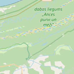
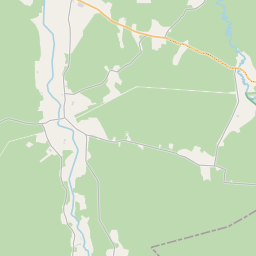
Карточка земельного участка (kадастровое обозначение:98440070127)
Кадастровое обозначение: 98440070127
Административная территория: Ventspils novads
Кадастровое обозначение недвижимого имущества | |
|---|---|
Тип кадастрового объекта | Тип кадастрового объекта: Земельная единица |
Административная территория | |
Кадастровый номер недвижимого имущества, в которое входит данный земельный участок | Кадастровый номер недвижимого имущества, в которое входит данный земельный участок: 98440070006 |
|
|
|
{"7201060210":{"name":"<div class='color_dot' style='background-color: #00ffff'><\/div><span>\u0423\u043a\u0430\u0437\u0430\u043d\u043d\u0430\u044f \u0437\u0435\u043c\u0435\u043b\u044c\u043d\u0430\u044f \u0435\u0434\u0438\u043d\u0438\u0446\u0430<\/span>","featureColor":"#00ffff","features":{"type":"FeatureCollection","features":[{"type":"Feature","geometry":{"type":"Polygon","coordinates":[[[22.020964629,57.500583332],[22.025571472,57.499422859],[22.025673127,57.499397253],[22.026287614,57.500017042],[22.020997535,57.501480338],[22.020964629,57.500583332]]]},"crs":{"type":"name","properties":{"name":"urn:ogc:def:crs:EPSG:3059"}},"properties":{"style":{"color":"#00ffff","dashArray":"8,12","weight":1},"name":"\u0417\u0435\u043c\u043b\u044f","object_type":"Parcel","parcel_code":"98440070127","code":null,"surveyor":null,"address":"","ownership":"<span>\u0412\u043b\u0430\u0434\u0435\u043b\u0435\u0446 - \u0424\u0438\u0437\u0438\u0447\u0435\u0441\u043a\u043e\u0435 \u043b\u0438\u0446\u043e<br><\/span>","pro_cadastre_nr":"98440070006"}},{"type":"Feature","geometry":{"type":"Polygon","coordinates":[[[21.995325538,57.499450459],[21.995842646,57.499425126],[21.996688226,57.499428782],[21.997487303,57.4992637],[21.998542358,57.498989544],[21.999476765,57.498726656],[22.000105268,57.498606339],[22.000106071,57.498751829],[21.999866728,57.500245658],[21.999744925,57.50029806],[21.997388499,57.501059482],[21.995388425,57.499519251],[21.995325538,57.499450459]]]},"crs":{"type":"name","properties":{"name":"urn:ogc:def:crs:EPSG:3059"}},"properties":{"style":{"color":"#00ffff","dashArray":"8,12","weight":1},"name":"\u0417\u0435\u043c\u043b\u044f","object_type":"Parcel","parcel_code":"98440070009","code":null,"surveyor":null,"address":"","ownership":"<span>\u0412\u043b\u0430\u0434\u0435\u043b\u0435\u0446 - \u0424\u0438\u0437\u0438\u0447\u0435\u0441\u043a\u043e\u0435 \u043b\u0438\u0446\u043e<br><\/span>","pro_cadastre_nr":"98440070006"}},{"type":"Feature","geometry":{"type":"Polygon","coordinates":[[[21.997137156,57.502559145],[21.997388499,57.501059482],[21.999744925,57.50029806],[21.999866728,57.500245658],[21.99981353,57.500577649],[21.999427749,57.502624353],[21.999359958,57.502600096],[21.998624848,57.502486769],[21.997137156,57.502559145]]]},"crs":{"type":"name","properties":{"name":"urn:ogc:def:crs:EPSG:3059"}},"properties":{"style":{"color":"#00ffff","dashArray":"8,12","weight":1},"name":"\u0417\u0435\u043c\u043b\u044f","object_type":"Parcel","parcel_code":"98440070008","code":null,"surveyor":null,"address":"","ownership":"<span>\u0412\u043b\u0430\u0434\u0435\u043b\u0435\u0446 - \u0424\u0438\u0437\u0438\u0447\u0435\u0441\u043a\u043e\u0435 \u043b\u0438\u0446\u043e<br><\/span>","pro_cadastre_nr":"98440070006"}},{"type":"Feature","geometry":{"type":"Polygon","coordinates":[[[22.020811001,57.498290475],[22.023849772,57.497519223],[22.023956865,57.497492355],[22.024384012,57.497978289],[22.024471796,57.49795854],[22.025502235,57.49772676],[22.026472288,57.498818104],[22.026361612,57.498906052],[22.027072477,57.499610456],[22.026287614,57.500017042],[22.025673127,57.499397253],[22.025571472,57.499422859],[22.020964629,57.500583332],[22.020811001,57.498290475]]]},"crs":{"type":"name","properties":{"name":"urn:ogc:def:crs:EPSG:3059"}},"properties":{"style":{"color":"#00ffff","dashArray":"8,12","weight":1},"name":"\u0417\u0435\u043c\u043b\u044f","object_type":"Parcel","parcel_code":"98440070006","code":null,"surveyor":null,"address":"\"Mauri\u0146i\", Ances pag., Ventspils nov., LV-3612","ownership":"<span>\u0412\u043b\u0430\u0434\u0435\u043b\u0435\u0446 - \u0424\u0438\u0437\u0438\u0447\u0435\u0441\u043a\u043e\u0435 \u043b\u0438\u0446\u043e<br><\/span>","pro_cadastre_nr":"98440070006"}}]}},"5201011310":{"name":"<div class='color_dot' style='background-color: #960096'><\/div><span>\u0412\u0435\u043a\u0442\u043e\u0440\u0438\u0437\u043e\u0432\u0430\u043d\u043d\u043e\u0435 \u0437\u0434\u0430\u043d\u0438\u0435<\/span>","featureColor":"#960096","features":{"type":"FeatureCollection","features":[{"type":"Feature","geometry":{"type":"Polygon","coordinates":[[[22.023338814,57.499217761],[22.023473463,57.499172772],[22.023591881,57.499275484],[22.023457216,57.499320473],[22.023338814,57.499217761]]]},"crs":{"type":"name","properties":{"name":"urn:ogc:def:crs:EPSG:3059"}},"properties":{"style":{"color":"#960096","dashArray":"0","weight":2},"name":"\u0417\u0434\u0430\u043d\u0438\u044f","object_type":"Building","parcel_code":"98440070006","code":"98440070006001","surveyor":null,"address":"\"Mauri\u0146i\", Ances pag., Ventspils nov., LV-3612","ownership":"<span>\u0412\u043b\u0430\u0434\u0435\u043b\u0435\u0446 - \u0424\u0438\u0437\u0438\u0447\u0435\u0441\u043a\u043e\u0435 \u043b\u0438\u0446\u043e<br><\/span>","pro_cadastre_nr":"98440070006"}},{"type":"Feature","geometry":{"type":"Polygon","coordinates":[[[22.023510309,57.499772066],[22.023571351,57.499757119],[22.023613139,57.499806581],[22.023552097,57.499821528],[22.023510309,57.499772066]]]},"crs":{"type":"name","properties":{"name":"urn:ogc:def:crs:EPSG:3059"}},"properties":{"style":{"color":"#960096","dashArray":"0","weight":2},"name":"\u0417\u0434\u0430\u043d\u0438\u044f","object_type":"Building","parcel_code":"98440070006","code":"98440070006002","surveyor":null,"address":"\"Mauri\u0146i\", Ances pag., Ventspils nov., LV-3612","ownership":"<span>\u0412\u043b\u0430\u0434\u0435\u043b\u0435\u0446 - \u0424\u0438\u0437\u0438\u0447\u0435\u0441\u043a\u043e\u0435 \u043b\u0438\u0446\u043e<br><\/span>","pro_cadastre_nr":"98440070006"}},{"type":"Feature","geometry":{"type":"Polygon","coordinates":[[[22.023793919,57.499523258],[22.023849455,57.499514136],[22.023892574,57.49959025],[22.023837037,57.499599372],[22.023793919,57.499523258]]]},"crs":{"type":"name","properties":{"name":"urn:ogc:def:crs:EPSG:3059"}},"properties":{"style":{"color":"#960096","dashArray":"0","weight":2},"name":"\u0417\u0434\u0430\u043d\u0438\u044f","object_type":"Building","parcel_code":"98440070006","code":"98440070006004","surveyor":null,"address":"\"Mauri\u0146i\", Ances pag., Ventspils nov., LV-3612","ownership":"<span>\u0412\u043b\u0430\u0434\u0435\u043b\u0435\u0446 - \u0424\u0438\u0437\u0438\u0447\u0435\u0441\u043a\u043e\u0435 \u043b\u0438\u0446\u043e<br><\/span>","pro_cadastre_nr":"98440070006"}},{"type":"Feature","geometry":{"type":"Polygon","coordinates":[[[22.023849455,57.499514136],[22.024025628,57.499485215],[22.024068746,57.499561329],[22.023892574,57.49959025],[22.023849455,57.499514136]]]},"crs":{"type":"name","properties":{"name":"urn:ogc:def:crs:EPSG:3059"}},"properties":{"style":{"color":"#960096","dashArray":"0","weight":2},"name":"\u0417\u0434\u0430\u043d\u0438\u044f","object_type":"Building","parcel_code":"98440070006","code":"98440070006005","surveyor":null,"address":"\"Mauri\u0146i\", Ances pag., Ventspils nov., LV-3612","ownership":"<span>\u0412\u043b\u0430\u0434\u0435\u043b\u0435\u0446 - \u0424\u0438\u0437\u0438\u0447\u0435\u0441\u043a\u043e\u0435 \u043b\u0438\u0446\u043e<br><\/span>","pro_cadastre_nr":"98440070006"}},{"type":"Feature","geometry":{"type":"Polygon","coordinates":[[[22.023849455,57.499514136],[22.024025628,57.499485215],[22.024068746,57.499561329],[22.023892574,57.49959025],[22.023849455,57.499514136]]]},"crs":{"type":"name","properties":{"name":"urn:ogc:def:crs:EPSG:3059"}},"properties":{"style":{"color":"#960096","dashArray":"0","weight":2},"name":"\u0417\u0434\u0430\u043d\u0438\u044f","object_type":"Building","parcel_code":"98440070006","code":"98440070006005","surveyor":null,"address":"\"Mauri\u0146i\", Ances pag., Ventspils nov., LV-3612","ownership":"<span>\u0412\u043b\u0430\u0434\u0435\u043b\u0435\u0446 - \u0424\u0438\u0437\u0438\u0447\u0435\u0441\u043a\u043e\u0435 \u043b\u0438\u0446\u043e<br><\/span>","pro_cadastre_nr":"98440070006"}},{"type":"Feature","geometry":{"type":"Polygon","coordinates":[[[22.023793919,57.499523258],[22.023849455,57.499514136],[22.023892574,57.49959025],[22.023837037,57.499599372],[22.023793919,57.499523258]]]},"crs":{"type":"name","properties":{"name":"urn:ogc:def:crs:EPSG:3059"}},"properties":{"style":{"color":"#960096","dashArray":"0","weight":2},"name":"\u0417\u0434\u0430\u043d\u0438\u044f","object_type":"Building","parcel_code":"98440070006","code":"98440070006004","surveyor":null,"address":"\"Mauri\u0146i\", Ances pag., Ventspils nov., LV-3612","ownership":"<span>\u0412\u043b\u0430\u0434\u0435\u043b\u0435\u0446 - \u0424\u0438\u0437\u0438\u0447\u0435\u0441\u043a\u043e\u0435 \u043b\u0438\u0446\u043e<br><\/span>","pro_cadastre_nr":"98440070006"}},{"type":"Feature","geometry":{"type":"Polygon","coordinates":[[[22.023510309,57.499772066],[22.023571351,57.499757119],[22.023613139,57.499806581],[22.023552097,57.499821528],[22.023510309,57.499772066]]]},"crs":{"type":"name","properties":{"name":"urn:ogc:def:crs:EPSG:3059"}},"properties":{"style":{"color":"#960096","dashArray":"0","weight":2},"name":"\u0417\u0434\u0430\u043d\u0438\u044f","object_type":"Building","parcel_code":"98440070006","code":"98440070006002","surveyor":null,"address":"\"Mauri\u0146i\", Ances pag., Ventspils nov., LV-3612","ownership":"<span>\u0412\u043b\u0430\u0434\u0435\u043b\u0435\u0446 - \u0424\u0438\u0437\u0438\u0447\u0435\u0441\u043a\u043e\u0435 \u043b\u0438\u0446\u043e<br><\/span>","pro_cadastre_nr":"98440070006"}},{"type":"Feature","geometry":{"type":"Polygon","coordinates":[[[22.023338814,57.499217761],[22.023473463,57.499172772],[22.023591881,57.499275484],[22.023457216,57.499320473],[22.023338814,57.499217761]]]},"crs":{"type":"name","properties":{"name":"urn:ogc:def:crs:EPSG:3059"}},"properties":{"style":{"color":"#960096","dashArray":"0","weight":2},"name":"\u0417\u0434\u0430\u043d\u0438\u044f","object_type":"Building","parcel_code":"98440070006","code":"98440070006001","surveyor":null,"address":"\"Mauri\u0146i\", Ances pag., Ventspils nov., LV-3612","ownership":"<span>\u0412\u043b\u0430\u0434\u0435\u043b\u0435\u0446 - \u0424\u0438\u0437\u0438\u0447\u0435\u0441\u043a\u043e\u0435 \u043b\u0438\u0446\u043e<br><\/span>","pro_cadastre_nr":"98440070006"}}]}}}
[]
https://tile.openstreetmap.org/{z}/{x}/{y}.png|© OpenStreetMap contributors|minZoom: 7|maxZoom: 19
|
Обновлены данные о земельных единицах: 23.01.2025.
Источник данных и лицензия: открытые текстовые и пространственные данные кадастровой информационной системы, открытые данные базы данных рынка недвижимости, лицензия на открытые данные Creative Commons Attribution, OpenStreetMap

