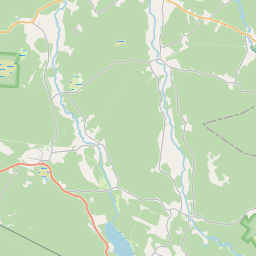
Карточка земельного участка (kадастровое обозначение:98440070108)
Кадастровое обозначение: 98440070108
Административная территория: Ventspils novads
Кадастровое обозначение недвижимого имущества | |
|---|---|
Тип кадастрового объекта | Тип кадастрового объекта: Земельная единица |
Административная территория | |
Кадастровый номер недвижимого имущества, в которое входит данный земельный участок | Кадастровый номер недвижимого имущества, в которое входит данный земельный участок: 98440070089 |
|
|
|
{"7201060210":{"name":"<div class='color_dot' style='background-color: #00ffff'><\/div><span>\u0423\u043a\u0430\u0437\u0430\u043d\u043d\u0430\u044f \u0437\u0435\u043c\u0435\u043b\u044c\u043d\u0430\u044f \u0435\u0434\u0438\u043d\u0438\u0446\u0430<\/span>","featureColor":"#00ffff","features":{"type":"FeatureCollection","features":[{"type":"Feature","geometry":{"type":"Polygon","coordinates":[[[22.10768848,57.512726392],[22.112328067,57.511690013],[22.11473694,57.51139113],[22.115524811,57.511520861],[22.115698028,57.511601023],[22.115634824,57.511821761],[22.115196722,57.512995228],[22.112310216,57.514558353],[22.112081742,57.5144401],[22.110307021,57.513653382],[22.109143109,57.513186255],[22.107985765,57.512817886],[22.10768848,57.512726392]]]},"crs":{"type":"name","properties":{"name":"urn:ogc:def:crs:EPSG:3059"}},"properties":{"style":{"color":"#00ffff","dashArray":"8,12","weight":1},"name":"\u0417\u0435\u043c\u043b\u044f","object_type":"Parcel","parcel_code":"98440080034","code":null,"surveyor":null,"address":"","ownership":"<span>\u0412\u043b\u0430\u0434\u0435\u043b\u0435\u0446 - \u0424\u0438\u0437\u0438\u0447\u0435\u0441\u043a\u043e\u0435 \u043b\u0438\u0446\u043e<br><\/span>","pro_cadastre_nr":"98440070089"}},{"type":"Feature","geometry":{"type":"Polygon","coordinates":[[[22.025086582,57.512071508],[22.025524981,57.511976542],[22.02543312,57.511761837],[22.025411049,57.511710241],[22.026725524,57.511489604],[22.026745644,57.511528832],[22.027356074,57.512718612],[22.02888228,57.512423309],[22.029361589,57.513117556],[22.029012241,57.513294278],[22.028728256,57.513336061],[22.028681868,57.513361563],[22.028635717,57.513354804],[22.028523466,57.513364443],[22.027793864,57.513515013],[22.027780731,57.513490126],[22.02776516,57.513460619],[22.02663054,57.513697944],[22.026616589,57.513675569],[22.026413416,57.513349982],[22.025466507,57.513460319],[22.025463092,57.513361924],[22.025428723,57.513189988],[22.025284371,57.512782757],[22.025086582,57.512071508]]]},"crs":{"type":"name","properties":{"name":"urn:ogc:def:crs:EPSG:3059"}},"properties":{"style":{"color":"#00ffff","dashArray":"8,12","weight":1},"name":"\u0417\u0435\u043c\u043b\u044f","object_type":"Parcel","parcel_code":"98440070109","code":null,"surveyor":null,"address":"","ownership":"<span>\u0412\u043b\u0430\u0434\u0435\u043b\u0435\u0446 - \u0424\u0438\u0437\u0438\u0447\u0435\u0441\u043a\u043e\u0435 \u043b\u0438\u0446\u043e<br><\/span>","pro_cadastre_nr":"98440070089"}},{"type":"Feature","geometry":{"type":"Polygon","coordinates":[[[22.02139299,57.514369607],[22.021953774,57.514320384],[22.022106794,57.514561056],[22.021457635,57.514612345],[22.02139299,57.514369607]]]},"crs":{"type":"name","properties":{"name":"urn:ogc:def:crs:EPSG:3059"}},"properties":{"style":{"color":"#00ffff","dashArray":"8,12","weight":1},"name":"\u0417\u0435\u043c\u043b\u044f","object_type":"Parcel","parcel_code":"98440070108","code":null,"surveyor":null,"address":"","ownership":"<span>\u0412\u043b\u0430\u0434\u0435\u043b\u0435\u0446 - \u0424\u0438\u0437\u0438\u0447\u0435\u0441\u043a\u043e\u0435 \u043b\u0438\u0446\u043e<br><\/span>","pro_cadastre_nr":"98440070089"}},{"type":"Feature","geometry":{"type":"Polygon","coordinates":[[[22.021637958,57.515041942],[22.022112344,57.515053198],[22.0221554,57.515679131],[22.022088921,57.515670937],[22.021855516,57.515408995],[22.021673296,57.515138321],[22.021637958,57.515041942]]]},"crs":{"type":"name","properties":{"name":"urn:ogc:def:crs:EPSG:3059"}},"properties":{"style":{"color":"#00ffff","dashArray":"8,12","weight":1},"name":"\u0417\u0435\u043c\u043b\u044f","object_type":"Parcel","parcel_code":"98440070090","code":null,"surveyor":null,"address":"","ownership":"<span>\u0412\u043b\u0430\u0434\u0435\u043b\u0435\u0446 - \u0424\u0438\u0437\u0438\u0447\u0435\u0441\u043a\u043e\u0435 \u043b\u0438\u0446\u043e<br><\/span>","pro_cadastre_nr":"98440070089"}},{"type":"Feature","geometry":{"type":"Polygon","coordinates":[[[22.021477181,57.514677828],[22.021568042,57.51465352],[22.021661671,57.514634529],[22.021858673,57.514609908],[22.021960439,57.514607775],[22.022640243,57.514647973],[22.022707989,57.514931074],[22.022711054,57.514943854],[22.022289095,57.514967493],[22.021604682,57.514951256],[22.021477181,57.514677828]]]},"crs":{"type":"name","properties":{"name":"urn:ogc:def:crs:EPSG:3059"}},"properties":{"style":{"color":"#00ffff","dashArray":"8,12","weight":1},"name":"\u0417\u0435\u043c\u043b\u044f","object_type":"Parcel","parcel_code":"98440070089","code":null,"surveyor":null,"address":"\"O\u0161nieki\", Ance, Ances pag., Ventspils nov., LV-3612","ownership":"<span>\u0412\u043b\u0430\u0434\u0435\u043b\u0435\u0446 - \u0424\u0438\u0437\u0438\u0447\u0435\u0441\u043a\u043e\u0435 \u043b\u0438\u0446\u043e<br><\/span>","pro_cadastre_nr":"98440070089"}}]}},"7114100000":{"name":"<div class='color_dot' style='background-color: #b40000'><\/div><span>\u0422\u0435\u0440\u0440\u0438\u0442\u043e\u0440\u0438\u044f \u0441\u0435\u0440\u0432\u0438\u0442\u0443\u0442\u0430 \u0434\u043e\u0440\u043e\u0436\u043d\u044b\u0445 \u043e\u0431\u0440\u0435\u043c\u0435\u043d\u0435\u043d\u0438\u0439<\/span>","featureColor":"#b40000","features":{"type":"FeatureCollection","features":[{"type":"Feature","geometry":{"type":"Polygon","coordinates":[[[22.11231022,57.514558281],[22.112274288,57.514539568],[22.115145801,57.51298745],[22.115585268,57.511816673],[22.115634044,57.511821678],[22.115195971,57.512995217],[22.11231022,57.514558281]]]},"crs":{"type":"name","properties":{"name":"urn:ogc:def:crs:EPSG:3059"}},"properties":{"style":{"color":"#b40000","dashArray":"4,2,1,2","weight":1},"name":"\u0422\u0435\u0440\u0440\u0438\u0442\u043e\u0440\u0438\u044f \u0441\u0435\u0440\u0432\u0438\u0442\u0443\u0442\u0430 \u0434\u043e\u0440\u043e\u0436\u043d\u044b\u0445 \u043e\u0431\u0440\u0435\u043c\u0435\u043d\u0435\u043d\u0438\u0439","object_type":"WayRestriction","parcel_code":"98440080034","code":"7315030100001","surveyor":null,"address":"","ownership":"<span>\u0412\u043b\u0430\u0434\u0435\u043b\u0435\u0446 - \u0424\u0438\u0437\u0438\u0447\u0435\u0441\u043a\u043e\u0435 \u043b\u0438\u0446\u043e<br><\/span>","pro_cadastre_nr":"98440070089"}}]}},"5201011310":{"name":"<div class='color_dot' style='background-color: #960096'><\/div><span>\u0412\u0435\u043a\u0442\u043e\u0440\u0438\u0437\u043e\u0432\u0430\u043d\u043d\u043e\u0435 \u0437\u0434\u0430\u043d\u0438\u0435<\/span>","featureColor":"#960096","features":{"type":"FeatureCollection","features":[{"type":"Feature","geometry":{"type":"Polygon","coordinates":[[[22.022323458,57.514762662],[22.022348387,57.514761417],[22.022350092,57.514771247],[22.022325163,57.5147725],[22.022323458,57.514762662]]]},"crs":{"type":"name","properties":{"name":"urn:ogc:def:crs:EPSG:3059"}},"properties":{"style":{"color":"#960096","dashArray":"0","weight":2},"name":"\u0417\u0434\u0430\u043d\u0438\u044f","object_type":"Building","parcel_code":"98440070089","code":"98440070089003","surveyor":null,"address":"\"O\u0161nieki\", Ance, Ances pag., Ventspils nov., LV-3612","ownership":"<span>\u0412\u043b\u0430\u0434\u0435\u043b\u0435\u0446 - \u0424\u0438\u0437\u0438\u0447\u0435\u0441\u043a\u043e\u0435 \u043b\u0438\u0446\u043e<br><\/span>","pro_cadastre_nr":"98440070089"}},{"type":"Feature","geometry":{"type":"Polygon","coordinates":[[[22.022322907,57.514762357],[22.022311369,57.514695732],[22.022377836,57.514692398],[22.022389374,57.514759023],[22.022322907,57.514762357]]]},"crs":{"type":"name","properties":{"name":"urn:ogc:def:crs:EPSG:3059"}},"properties":{"style":{"color":"#960096","dashArray":"0","weight":2},"name":"\u0417\u0434\u0430\u043d\u0438\u044f","object_type":"Building","parcel_code":"98440070089","code":"98440070089002","surveyor":null,"address":"\"O\u0161nieki\", Ance, Ances pag., Ventspils nov., LV-3612","ownership":"<span>\u0412\u043b\u0430\u0434\u0435\u043b\u0435\u0446 - \u0424\u0438\u0437\u0438\u0447\u0435\u0441\u043a\u043e\u0435 \u043b\u0438\u0446\u043e<br><\/span>","pro_cadastre_nr":"98440070089"}},{"type":"Feature","geometry":{"type":"Polygon","coordinates":[[[22.021870939,57.514941549],[22.021838718,57.514698772],[22.022067289,57.514689983],[22.022099512,57.51493276],[22.021870939,57.514941549]]]},"crs":{"type":"name","properties":{"name":"urn:ogc:def:crs:EPSG:3059"}},"properties":{"style":{"color":"#960096","dashArray":"0","weight":2},"name":"\u0417\u0434\u0430\u043d\u0438\u044f","object_type":"Building","parcel_code":"98440070089","code":"98440070089001","surveyor":null,"address":"\"O\u0161nieki\", Ance, Ances pag., Ventspils nov., LV-3612","ownership":"<span>\u0412\u043b\u0430\u0434\u0435\u043b\u0435\u0446 - \u0424\u0438\u0437\u0438\u0447\u0435\u0441\u043a\u043e\u0435 \u043b\u0438\u0446\u043e<br><\/span>","pro_cadastre_nr":"98440070089"}},{"type":"Feature","geometry":{"type":"Polygon","coordinates":[[[22.022314376,57.5149539],[22.022296322,57.514858654],[22.022354433,57.514855468],[22.022372486,57.514950714],[22.022314376,57.5149539]]]},"crs":{"type":"name","properties":{"name":"urn:ogc:def:crs:EPSG:3059"}},"properties":{"style":{"color":"#960096","dashArray":"0","weight":2},"name":"\u0417\u0434\u0430\u043d\u0438\u044f","object_type":"Building","parcel_code":"98440070089","code":"98440070089005","surveyor":null,"address":"\"O\u0161nieki\", Ance, Ances pag., Ventspils nov., LV-3612","ownership":"<span>\u0412\u043b\u0430\u0434\u0435\u043b\u0435\u0446 - \u0424\u0438\u0437\u0438\u0447\u0435\u0441\u043a\u043e\u0435 \u043b\u0438\u0446\u043e<br><\/span>","pro_cadastre_nr":"98440070089"}},{"type":"Feature","geometry":{"type":"Polygon","coordinates":[[[22.022353517,57.514833225],[22.022343409,57.514776272],[22.022430642,57.51477179],[22.02244075,57.514828743],[22.022353517,57.514833225]]]},"crs":{"type":"name","properties":{"name":"urn:ogc:def:crs:EPSG:3059"}},"properties":{"style":{"color":"#960096","dashArray":"0","weight":2},"name":"\u0417\u0434\u0430\u043d\u0438\u044f","object_type":"Building","parcel_code":"98440070089","code":"98440070089004","surveyor":null,"address":"\"O\u0161nieki\", Ance, Ances pag., Ventspils nov., LV-3612","ownership":"<span>\u0412\u043b\u0430\u0434\u0435\u043b\u0435\u0446 - \u0424\u0438\u0437\u0438\u0447\u0435\u0441\u043a\u043e\u0435 \u043b\u0438\u0446\u043e<br><\/span>","pro_cadastre_nr":"98440070089"}},{"type":"Feature","geometry":{"type":"Polygon","coordinates":[[[22.022314376,57.5149539],[22.022296322,57.514858654],[22.022354433,57.514855468],[22.022372486,57.514950714],[22.022314376,57.5149539]]]},"crs":{"type":"name","properties":{"name":"urn:ogc:def:crs:EPSG:3059"}},"properties":{"style":{"color":"#960096","dashArray":"0","weight":2},"name":"\u0417\u0434\u0430\u043d\u0438\u044f","object_type":"Building","parcel_code":"98440070089","code":"98440070089005","surveyor":null,"address":"\"O\u0161nieki\", Ance, Ances pag., Ventspils nov., LV-3612","ownership":"<span>\u0412\u043b\u0430\u0434\u0435\u043b\u0435\u0446 - \u0424\u0438\u0437\u0438\u0447\u0435\u0441\u043a\u043e\u0435 \u043b\u0438\u0446\u043e<br><\/span>","pro_cadastre_nr":"98440070089"}},{"type":"Feature","geometry":{"type":"Polygon","coordinates":[[[22.022353517,57.514833225],[22.022343409,57.514776272],[22.022430642,57.51477179],[22.02244075,57.514828743],[22.022353517,57.514833225]]]},"crs":{"type":"name","properties":{"name":"urn:ogc:def:crs:EPSG:3059"}},"properties":{"style":{"color":"#960096","dashArray":"0","weight":2},"name":"\u0417\u0434\u0430\u043d\u0438\u044f","object_type":"Building","parcel_code":"98440070089","code":"98440070089004","surveyor":null,"address":"\"O\u0161nieki\", Ance, Ances pag., Ventspils nov., LV-3612","ownership":"<span>\u0412\u043b\u0430\u0434\u0435\u043b\u0435\u0446 - \u0424\u0438\u0437\u0438\u0447\u0435\u0441\u043a\u043e\u0435 \u043b\u0438\u0446\u043e<br><\/span>","pro_cadastre_nr":"98440070089"}},{"type":"Feature","geometry":{"type":"Polygon","coordinates":[[[22.022323458,57.514762662],[22.022348387,57.514761417],[22.022350092,57.514771247],[22.022325163,57.5147725],[22.022323458,57.514762662]]]},"crs":{"type":"name","properties":{"name":"urn:ogc:def:crs:EPSG:3059"}},"properties":{"style":{"color":"#960096","dashArray":"0","weight":2},"name":"\u0417\u0434\u0430\u043d\u0438\u044f","object_type":"Building","parcel_code":"98440070089","code":"98440070089003","surveyor":null,"address":"\"O\u0161nieki\", Ance, Ances pag., Ventspils nov., LV-3612","ownership":"<span>\u0412\u043b\u0430\u0434\u0435\u043b\u0435\u0446 - \u0424\u0438\u0437\u0438\u0447\u0435\u0441\u043a\u043e\u0435 \u043b\u0438\u0446\u043e<br><\/span>","pro_cadastre_nr":"98440070089"}},{"type":"Feature","geometry":{"type":"Polygon","coordinates":[[[22.022322907,57.514762357],[22.022311369,57.514695732],[22.022377836,57.514692398],[22.022389374,57.514759023],[22.022322907,57.514762357]]]},"crs":{"type":"name","properties":{"name":"urn:ogc:def:crs:EPSG:3059"}},"properties":{"style":{"color":"#960096","dashArray":"0","weight":2},"name":"\u0417\u0434\u0430\u043d\u0438\u044f","object_type":"Building","parcel_code":"98440070089","code":"98440070089002","surveyor":null,"address":"\"O\u0161nieki\", Ance, Ances pag., Ventspils nov., LV-3612","ownership":"<span>\u0412\u043b\u0430\u0434\u0435\u043b\u0435\u0446 - \u0424\u0438\u0437\u0438\u0447\u0435\u0441\u043a\u043e\u0435 \u043b\u0438\u0446\u043e<br><\/span>","pro_cadastre_nr":"98440070089"}},{"type":"Feature","geometry":{"type":"Polygon","coordinates":[[[22.021870939,57.514941549],[22.021838718,57.514698772],[22.022067289,57.514689983],[22.022099512,57.51493276],[22.021870939,57.514941549]]]},"crs":{"type":"name","properties":{"name":"urn:ogc:def:crs:EPSG:3059"}},"properties":{"style":{"color":"#960096","dashArray":"0","weight":2},"name":"\u0417\u0434\u0430\u043d\u0438\u044f","object_type":"Building","parcel_code":"98440070089","code":"98440070089001","surveyor":null,"address":"\"O\u0161nieki\", Ance, Ances pag., Ventspils nov., LV-3612","ownership":"<span>\u0412\u043b\u0430\u0434\u0435\u043b\u0435\u0446 - \u0424\u0438\u0437\u0438\u0447\u0435\u0441\u043a\u043e\u0435 \u043b\u0438\u0446\u043e<br><\/span>","pro_cadastre_nr":"98440070089"}}]}}}
[]
https://tile.openstreetmap.org/{z}/{x}/{y}.png|© OpenStreetMap contributors|minZoom: 7|maxZoom: 19
|
Обновлены данные о земельных единицах: 23.01.2025.
Источник данных и лицензия: открытые текстовые и пространственные данные кадастровой информационной системы, открытые данные базы данных рынка недвижимости, лицензия на открытые данные Creative Commons Attribution, OpenStreetMap

