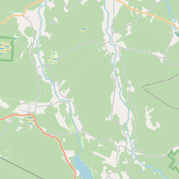
Карточка земельного участка (kадастровое обозначение:98440070106)
Кадастровое обозначение: 98440070106
Адрес: "Tīrumi", Ances pagasts, Ventspils novads, LV-3612
Кадастровое обозначение недвижимого имущества | |
|---|---|
Тип кадастрового объекта | Тип кадастрового объекта: Земельная единица |
Адрес | Адрес: "Tīrumi", Ances pagasts, Ventspils novads, LV-3612 |
Кадастровый номер недвижимого имущества, в которое входит данный земельный участок | Кадастровый номер недвижимого имущества, в которое входит данный земельный участок: 98440070106 |
Адрес | |
|---|---|
Идентификатор адреса | Идентификатор адреса: 102784696 |
Kомпании, зарегистрированные по адресу
| Kомпании, зарегистрированные по адресу
: 0 |
Подразделения, зарегистрированные по адресу
| Подразделения, зарегистрированные по адресу
: 0 |
Учреждения, зарегистрированные по адресу
| Учреждения, зарегистрированные по адресу
: 0 |
Недвижимость по адресу
| |
Сделки по адресу
| Сделки по адресу
: 0 |
|
|
|
{"7201060510":{"name":"<div class='color_dot' style='background-color: #ff00ff'><\/div><span>\u041e\u0448\u0438\u0431\u043e\u0447\u043d\u044b\u0435 \u0437\u0435\u043c\u0435\u043b\u044c\u043d\u044b\u0435 \u0435\u0434\u0438\u043d\u0438\u0446\u044b<\/span>","featureColor":"#ff00ff","features":{"type":"FeatureCollection","features":[{"type":"Feature","geometry":{"type":"Polygon","coordinates":[[[21.978972977,57.517796501],[21.979284688,57.517862277],[21.979584059,57.518008991],[21.979841514,57.51811956],[21.980193278,57.518113367],[21.980571553,57.5180248],[21.981027432,57.517724598],[21.98113845,57.517702716],[21.981180385,57.51773887],[21.981262934,57.517834803],[21.981552125,57.517768475],[21.981833483,57.51784393],[21.981965803,57.517834222],[21.982235012,57.517732081],[21.982351919,57.517603856],[21.982661741,57.517561503],[21.983008279,57.517649832],[21.983246413,57.517712778],[21.986769863,57.517544329],[21.98687062,57.517524345],[21.983812793,57.515311182],[21.982787294,57.514063445],[21.98542987,57.513002513],[21.990838368,57.511416516],[21.991611553,57.510251241],[21.991910943,57.510296493],[21.991629948,57.511101828],[21.991528354,57.511235544],[21.991527638,57.511248561],[21.99147388,57.51222265],[21.99727631,57.512096741],[22.002707056,57.511944996],[22.002782656,57.51194312],[22.002884879,57.513132419],[22.003051425,57.515339278],[22.003137742,57.515940935],[22.003386137,57.516624972],[22.004611849,57.518011518],[22.004506079,57.518075436],[22.002706358,57.519163012],[22.004001497,57.519771451],[22.004144991,57.52201823],[22.00438942,57.525842328],[21.998586065,57.525131523],[21.99233563,57.524963069],[21.992301737,57.524945835],[21.995777822,57.523010883],[21.989050621,57.522115299],[21.990218385,57.521693239],[21.985494251,57.520510065],[21.980474138,57.518738805],[21.979281834,57.518525494],[21.97904803,57.518362282],[21.979080981,57.518075439],[21.978972977,57.517796501]]]},"crs":{"type":"name","properties":{"name":"urn:ogc:def:crs:EPSG:3059"}},"properties":{"style":{"color":"#ff00ff","dashArray":"0","weight":1},"name":"\u041e\u0448\u0438\u0431\u043e\u0447\u043d\u044b\u0435 \u0437\u0435\u043c\u0435\u043b\u044c\u043d\u044b\u0435 \u0435\u0434\u0438\u043d\u0438\u0446\u044b","object_type":"ParcelError","parcel_code":"98440070159","code":null,"surveyor":null,"address":"","ownership":"<span>\u0412\u043b\u0430\u0434\u0435\u043b\u0435\u0446 - \u0424\u0438\u0437\u0438\u0447\u0435\u0441\u043a\u043e\u0435 \u043b\u0438\u0446\u043e<br><\/span>","pro_cadastre_nr":"98440070106"}},{"type":"Feature","geometry":{"type":"Polygon","coordinates":[[[21.978972977,57.517796501],[21.979284688,57.517862277],[21.979584059,57.518008991],[21.979841514,57.51811956],[21.980193278,57.518113367],[21.980571553,57.5180248],[21.981027432,57.517724598],[21.98113845,57.517702716],[21.981180385,57.51773887],[21.981262934,57.517834803],[21.981552125,57.517768475],[21.981833483,57.51784393],[21.981965803,57.517834222],[21.982235012,57.517732081],[21.982351919,57.517603856],[21.982661741,57.517561503],[21.983008279,57.517649832],[21.983246413,57.517712778],[21.986769863,57.517544329],[21.98687062,57.517524345],[21.983812793,57.515311182],[21.982787294,57.514063445],[21.98542987,57.513002513],[21.990838368,57.511416516],[21.991611553,57.510251241],[21.991910943,57.510296493],[21.991629948,57.511101828],[21.991528354,57.511235544],[21.991527638,57.511248561],[21.99147388,57.51222265],[21.99727631,57.512096741],[22.002707056,57.511944996],[22.002782656,57.51194312],[22.002884879,57.513132419],[22.003051425,57.515339278],[22.003137742,57.515940935],[22.003386137,57.516624972],[22.004611849,57.518011518],[22.004506079,57.518075436],[22.002706358,57.519163012],[22.004001497,57.519771451],[22.004144991,57.52201823],[22.00438942,57.525842328],[21.998586065,57.525131523],[21.99233563,57.524963069],[21.992301737,57.524945835],[21.995777822,57.523010883],[21.989050621,57.522115299],[21.990218385,57.521693239],[21.985494251,57.520510065],[21.980474138,57.518738805],[21.979281834,57.518525494],[21.97904803,57.518362282],[21.979080981,57.518075439],[21.978972977,57.517796501]]]},"crs":{"type":"name","properties":{"name":"urn:ogc:def:crs:EPSG:3059"}},"properties":{"style":{"color":"#ff00ff","dashArray":"0","weight":1},"name":"\u041e\u0448\u0438\u0431\u043e\u0447\u043d\u044b\u0435 \u0437\u0435\u043c\u0435\u043b\u044c\u043d\u044b\u0435 \u0435\u0434\u0438\u043d\u0438\u0446\u044b","object_type":"ParcelError","parcel_code":"98440070159","code":null,"surveyor":null,"address":"","ownership":"<span>\u0412\u043b\u0430\u0434\u0435\u043b\u0435\u0446 - \u0424\u0438\u0437\u0438\u0447\u0435\u0441\u043a\u043e\u0435 \u043b\u0438\u0446\u043e<br><\/span>","pro_cadastre_nr":"98440070106"}},{"type":"Feature","geometry":{"type":"Polygon","coordinates":[[[21.978972977,57.517796501],[21.979284688,57.517862277],[21.979584059,57.518008991],[21.979841514,57.51811956],[21.980193278,57.518113367],[21.980571553,57.5180248],[21.981027432,57.517724598],[21.98113845,57.517702716],[21.981180385,57.51773887],[21.981262934,57.517834803],[21.981552125,57.517768475],[21.981833483,57.51784393],[21.981965803,57.517834222],[21.982235012,57.517732081],[21.982351919,57.517603856],[21.982661741,57.517561503],[21.983008279,57.517649832],[21.983246413,57.517712778],[21.986769863,57.517544329],[21.98687062,57.517524345],[21.983812793,57.515311182],[21.982787294,57.514063445],[21.98542987,57.513002513],[21.990838368,57.511416516],[21.991611553,57.510251241],[21.991910943,57.510296493],[21.991629948,57.511101828],[21.991528354,57.511235544],[21.991527638,57.511248561],[21.99147388,57.51222265],[21.99727631,57.512096741],[22.002707056,57.511944996],[22.002782656,57.51194312],[22.002884879,57.513132419],[22.003051425,57.515339278],[22.003137742,57.515940935],[22.003386137,57.516624972],[22.004611849,57.518011518],[22.004506079,57.518075436],[22.002706358,57.519163012],[22.004001497,57.519771451],[22.004144991,57.52201823],[22.00438942,57.525842328],[21.998586065,57.525131523],[21.99233563,57.524963069],[21.992301737,57.524945835],[21.995777822,57.523010883],[21.989050621,57.522115299],[21.990218385,57.521693239],[21.985494251,57.520510065],[21.980474138,57.518738805],[21.979281834,57.518525494],[21.97904803,57.518362282],[21.979080981,57.518075439],[21.978972977,57.517796501]]]},"crs":{"type":"name","properties":{"name":"urn:ogc:def:crs:EPSG:3059"}},"properties":{"style":{"color":"#ff00ff","dashArray":"0","weight":1},"name":"\u041e\u0448\u0438\u0431\u043e\u0447\u043d\u044b\u0435 \u0437\u0435\u043c\u0435\u043b\u044c\u043d\u044b\u0435 \u0435\u0434\u0438\u043d\u0438\u0446\u044b","object_type":"ParcelError","parcel_code":"98440070159","code":null,"surveyor":null,"address":"","ownership":"<span>\u0412\u043b\u0430\u0434\u0435\u043b\u0435\u0446 - \u0424\u0438\u0437\u0438\u0447\u0435\u0441\u043a\u043e\u0435 \u043b\u0438\u0446\u043e<br><\/span>","pro_cadastre_nr":"98440070106"}},{"type":"Feature","geometry":{"type":"Polygon","coordinates":[[[21.978972977,57.517796501],[21.979284688,57.517862277],[21.979584059,57.518008991],[21.979841514,57.51811956],[21.980193278,57.518113367],[21.980571553,57.5180248],[21.981027432,57.517724598],[21.98113845,57.517702716],[21.981180385,57.51773887],[21.981262934,57.517834803],[21.981552125,57.517768475],[21.981833483,57.51784393],[21.981965803,57.517834222],[21.982235012,57.517732081],[21.982351919,57.517603856],[21.982661741,57.517561503],[21.983008279,57.517649832],[21.983246413,57.517712778],[21.986769863,57.517544329],[21.98687062,57.517524345],[21.983812793,57.515311182],[21.982787294,57.514063445],[21.98542987,57.513002513],[21.990838368,57.511416516],[21.991611553,57.510251241],[21.991910943,57.510296493],[21.991629948,57.511101828],[21.991528354,57.511235544],[21.991527638,57.511248561],[21.99147388,57.51222265],[21.99727631,57.512096741],[22.002707056,57.511944996],[22.002782656,57.51194312],[22.002884879,57.513132419],[22.003051425,57.515339278],[22.003137742,57.515940935],[22.003386137,57.516624972],[22.004611849,57.518011518],[22.004506079,57.518075436],[22.002706358,57.519163012],[22.004001497,57.519771451],[22.004144991,57.52201823],[22.00438942,57.525842328],[21.998586065,57.525131523],[21.99233563,57.524963069],[21.992301737,57.524945835],[21.995777822,57.523010883],[21.989050621,57.522115299],[21.990218385,57.521693239],[21.985494251,57.520510065],[21.980474138,57.518738805],[21.979281834,57.518525494],[21.97904803,57.518362282],[21.979080981,57.518075439],[21.978972977,57.517796501]]]},"crs":{"type":"name","properties":{"name":"urn:ogc:def:crs:EPSG:3059"}},"properties":{"style":{"color":"#ff00ff","dashArray":"0","weight":1},"name":"\u041e\u0448\u0438\u0431\u043e\u0447\u043d\u044b\u0435 \u0437\u0435\u043c\u0435\u043b\u044c\u043d\u044b\u0435 \u0435\u0434\u0438\u043d\u0438\u0446\u044b","object_type":"ParcelError","parcel_code":"98440070159","code":null,"surveyor":null,"address":"","ownership":"<span>\u0412\u043b\u0430\u0434\u0435\u043b\u0435\u0446 - \u0424\u0438\u0437\u0438\u0447\u0435\u0441\u043a\u043e\u0435 \u043b\u0438\u0446\u043e<br><\/span>","pro_cadastre_nr":"98440070106"}},{"type":"Feature","geometry":{"type":"Polygon","coordinates":[[[21.978972977,57.517796501],[21.979284688,57.517862277],[21.979584059,57.518008991],[21.979841514,57.51811956],[21.980193278,57.518113367],[21.980571553,57.5180248],[21.981027432,57.517724598],[21.98113845,57.517702716],[21.981180385,57.51773887],[21.981262934,57.517834803],[21.981552125,57.517768475],[21.981833483,57.51784393],[21.981965803,57.517834222],[21.982235012,57.517732081],[21.982351919,57.517603856],[21.982661741,57.517561503],[21.983008279,57.517649832],[21.983246413,57.517712778],[21.986769863,57.517544329],[21.98687062,57.517524345],[21.983812793,57.515311182],[21.982787294,57.514063445],[21.98542987,57.513002513],[21.990838368,57.511416516],[21.991611553,57.510251241],[21.991910943,57.510296493],[21.991629948,57.511101828],[21.991528354,57.511235544],[21.991527638,57.511248561],[21.99147388,57.51222265],[21.99727631,57.512096741],[22.002707056,57.511944996],[22.002782656,57.51194312],[22.002884879,57.513132419],[22.003051425,57.515339278],[22.003137742,57.515940935],[22.003386137,57.516624972],[22.004611849,57.518011518],[22.004506079,57.518075436],[22.002706358,57.519163012],[22.004001497,57.519771451],[22.004144991,57.52201823],[22.00438942,57.525842328],[21.998586065,57.525131523],[21.99233563,57.524963069],[21.992301737,57.524945835],[21.995777822,57.523010883],[21.989050621,57.522115299],[21.990218385,57.521693239],[21.985494251,57.520510065],[21.980474138,57.518738805],[21.979281834,57.518525494],[21.97904803,57.518362282],[21.979080981,57.518075439],[21.978972977,57.517796501]]]},"crs":{"type":"name","properties":{"name":"urn:ogc:def:crs:EPSG:3059"}},"properties":{"style":{"color":"#ff00ff","dashArray":"0","weight":1},"name":"\u041e\u0448\u0438\u0431\u043e\u0447\u043d\u044b\u0435 \u0437\u0435\u043c\u0435\u043b\u044c\u043d\u044b\u0435 \u0435\u0434\u0438\u043d\u0438\u0446\u044b","object_type":"ParcelError","parcel_code":"98440070159","code":null,"surveyor":null,"address":"","ownership":"<span>\u0412\u043b\u0430\u0434\u0435\u043b\u0435\u0446 - \u0424\u0438\u0437\u0438\u0447\u0435\u0441\u043a\u043e\u0435 \u043b\u0438\u0446\u043e<br><\/span>","pro_cadastre_nr":"98440070106"}},{"type":"Feature","geometry":{"type":"Polygon","coordinates":[[[21.978972977,57.517796501],[21.979284688,57.517862277],[21.979584059,57.518008991],[21.979841514,57.51811956],[21.980193278,57.518113367],[21.980571553,57.5180248],[21.981027432,57.517724598],[21.98113845,57.517702716],[21.981180385,57.51773887],[21.981262934,57.517834803],[21.981552125,57.517768475],[21.981833483,57.51784393],[21.981965803,57.517834222],[21.982235012,57.517732081],[21.982351919,57.517603856],[21.982661741,57.517561503],[21.983008279,57.517649832],[21.983246413,57.517712778],[21.986769863,57.517544329],[21.98687062,57.517524345],[21.983812793,57.515311182],[21.982787294,57.514063445],[21.98542987,57.513002513],[21.990838368,57.511416516],[21.991611553,57.510251241],[21.991910943,57.510296493],[21.991629948,57.511101828],[21.991528354,57.511235544],[21.991527638,57.511248561],[21.99147388,57.51222265],[21.99727631,57.512096741],[22.002707056,57.511944996],[22.002782656,57.51194312],[22.002884879,57.513132419],[22.003051425,57.515339278],[22.003137742,57.515940935],[22.003386137,57.516624972],[22.004611849,57.518011518],[22.004506079,57.518075436],[22.002706358,57.519163012],[22.004001497,57.519771451],[22.004144991,57.52201823],[22.00438942,57.525842328],[21.998586065,57.525131523],[21.99233563,57.524963069],[21.992301737,57.524945835],[21.995777822,57.523010883],[21.989050621,57.522115299],[21.990218385,57.521693239],[21.985494251,57.520510065],[21.980474138,57.518738805],[21.979281834,57.518525494],[21.97904803,57.518362282],[21.979080981,57.518075439],[21.978972977,57.517796501]]]},"crs":{"type":"name","properties":{"name":"urn:ogc:def:crs:EPSG:3059"}},"properties":{"style":{"color":"#ff00ff","dashArray":"0","weight":1},"name":"\u041e\u0448\u0438\u0431\u043e\u0447\u043d\u044b\u0435 \u0437\u0435\u043c\u0435\u043b\u044c\u043d\u044b\u0435 \u0435\u0434\u0438\u043d\u0438\u0446\u044b","object_type":"ParcelError","parcel_code":"98440070159","code":null,"surveyor":null,"address":"","ownership":"<span>\u0412\u043b\u0430\u0434\u0435\u043b\u0435\u0446 - \u0424\u0438\u0437\u0438\u0447\u0435\u0441\u043a\u043e\u0435 \u043b\u0438\u0446\u043e<br><\/span>","pro_cadastre_nr":"98440070106"}},{"type":"Feature","geometry":{"type":"Polygon","coordinates":[[[21.978972977,57.517796501],[21.979284688,57.517862277],[21.979584059,57.518008991],[21.979841514,57.51811956],[21.980193278,57.518113367],[21.980571553,57.5180248],[21.981027432,57.517724598],[21.98113845,57.517702716],[21.981180385,57.51773887],[21.981262934,57.517834803],[21.981552125,57.517768475],[21.981833483,57.51784393],[21.981965803,57.517834222],[21.982235012,57.517732081],[21.982351919,57.517603856],[21.982661741,57.517561503],[21.983008279,57.517649832],[21.983246413,57.517712778],[21.986769863,57.517544329],[21.98687062,57.517524345],[21.983812793,57.515311182],[21.982787294,57.514063445],[21.98542987,57.513002513],[21.990838368,57.511416516],[21.991611553,57.510251241],[21.991910943,57.510296493],[21.991629948,57.511101828],[21.991528354,57.511235544],[21.991527638,57.511248561],[21.99147388,57.51222265],[21.99727631,57.512096741],[22.002707056,57.511944996],[22.002782656,57.51194312],[22.002884879,57.513132419],[22.003051425,57.515339278],[22.003137742,57.515940935],[22.003386137,57.516624972],[22.004611849,57.518011518],[22.004506079,57.518075436],[22.002706358,57.519163012],[22.004001497,57.519771451],[22.004144991,57.52201823],[22.00438942,57.525842328],[21.998586065,57.525131523],[21.99233563,57.524963069],[21.992301737,57.524945835],[21.995777822,57.523010883],[21.989050621,57.522115299],[21.990218385,57.521693239],[21.985494251,57.520510065],[21.980474138,57.518738805],[21.979281834,57.518525494],[21.97904803,57.518362282],[21.979080981,57.518075439],[21.978972977,57.517796501]]]},"crs":{"type":"name","properties":{"name":"urn:ogc:def:crs:EPSG:3059"}},"properties":{"style":{"color":"#ff00ff","dashArray":"0","weight":1},"name":"\u041e\u0448\u0438\u0431\u043e\u0447\u043d\u044b\u0435 \u0437\u0435\u043c\u0435\u043b\u044c\u043d\u044b\u0435 \u0435\u0434\u0438\u043d\u0438\u0446\u044b","object_type":"ParcelError","parcel_code":"98440070159","code":null,"surveyor":null,"address":"","ownership":"<span>\u0412\u043b\u0430\u0434\u0435\u043b\u0435\u0446 - \u0424\u0438\u0437\u0438\u0447\u0435\u0441\u043a\u043e\u0435 \u043b\u0438\u0446\u043e<br><\/span>","pro_cadastre_nr":"98440070106"}},{"type":"Feature","geometry":{"type":"Polygon","coordinates":[[[21.978972977,57.517796501],[21.979284688,57.517862277],[21.979584059,57.518008991],[21.979841514,57.51811956],[21.980193278,57.518113367],[21.980571553,57.5180248],[21.981027432,57.517724598],[21.98113845,57.517702716],[21.981180385,57.51773887],[21.981262934,57.517834803],[21.981552125,57.517768475],[21.981833483,57.51784393],[21.981965803,57.517834222],[21.982235012,57.517732081],[21.982351919,57.517603856],[21.982661741,57.517561503],[21.983008279,57.517649832],[21.983246413,57.517712778],[21.986769863,57.517544329],[21.98687062,57.517524345],[21.983812793,57.515311182],[21.982787294,57.514063445],[21.98542987,57.513002513],[21.990838368,57.511416516],[21.991611553,57.510251241],[21.991910943,57.510296493],[21.991629948,57.511101828],[21.991528354,57.511235544],[21.991527638,57.511248561],[21.99147388,57.51222265],[21.99727631,57.512096741],[22.002707056,57.511944996],[22.002782656,57.51194312],[22.002884879,57.513132419],[22.003051425,57.515339278],[22.003137742,57.515940935],[22.003386137,57.516624972],[22.004611849,57.518011518],[22.004506079,57.518075436],[22.002706358,57.519163012],[22.004001497,57.519771451],[22.004144991,57.52201823],[22.00438942,57.525842328],[21.998586065,57.525131523],[21.99233563,57.524963069],[21.992301737,57.524945835],[21.995777822,57.523010883],[21.989050621,57.522115299],[21.990218385,57.521693239],[21.985494251,57.520510065],[21.980474138,57.518738805],[21.979281834,57.518525494],[21.97904803,57.518362282],[21.979080981,57.518075439],[21.978972977,57.517796501]]]},"crs":{"type":"name","properties":{"name":"urn:ogc:def:crs:EPSG:3059"}},"properties":{"style":{"color":"#ff00ff","dashArray":"0","weight":1},"name":"\u041e\u0448\u0438\u0431\u043e\u0447\u043d\u044b\u0435 \u0437\u0435\u043c\u0435\u043b\u044c\u043d\u044b\u0435 \u0435\u0434\u0438\u043d\u0438\u0446\u044b","object_type":"ParcelError","parcel_code":"98440070159","code":null,"surveyor":null,"address":"","ownership":"<span>\u0412\u043b\u0430\u0434\u0435\u043b\u0435\u0446 - \u0424\u0438\u0437\u0438\u0447\u0435\u0441\u043a\u043e\u0435 \u043b\u0438\u0446\u043e<br><\/span>","pro_cadastre_nr":"98440070106"}},{"type":"Feature","geometry":{"type":"Polygon","coordinates":[[[21.978972977,57.517796501],[21.979284688,57.517862277],[21.979584059,57.518008991],[21.979841514,57.51811956],[21.980193278,57.518113367],[21.980571553,57.5180248],[21.981027432,57.517724598],[21.98113845,57.517702716],[21.981180385,57.51773887],[21.981262934,57.517834803],[21.981552125,57.517768475],[21.981833483,57.51784393],[21.981965803,57.517834222],[21.982235012,57.517732081],[21.982351919,57.517603856],[21.982661741,57.517561503],[21.983008279,57.517649832],[21.983246413,57.517712778],[21.986769863,57.517544329],[21.98687062,57.517524345],[21.983812793,57.515311182],[21.982787294,57.514063445],[21.98542987,57.513002513],[21.990838368,57.511416516],[21.991611553,57.510251241],[21.991910943,57.510296493],[21.991629948,57.511101828],[21.991528354,57.511235544],[21.991527638,57.511248561],[21.99147388,57.51222265],[21.99727631,57.512096741],[22.002707056,57.511944996],[22.002782656,57.51194312],[22.002884879,57.513132419],[22.003051425,57.515339278],[22.003137742,57.515940935],[22.003386137,57.516624972],[22.004611849,57.518011518],[22.004506079,57.518075436],[22.002706358,57.519163012],[22.004001497,57.519771451],[22.004144991,57.52201823],[22.00438942,57.525842328],[21.998586065,57.525131523],[21.99233563,57.524963069],[21.992301737,57.524945835],[21.995777822,57.523010883],[21.989050621,57.522115299],[21.990218385,57.521693239],[21.985494251,57.520510065],[21.980474138,57.518738805],[21.979281834,57.518525494],[21.97904803,57.518362282],[21.979080981,57.518075439],[21.978972977,57.517796501]]]},"crs":{"type":"name","properties":{"name":"urn:ogc:def:crs:EPSG:3059"}},"properties":{"style":{"color":"#ff00ff","dashArray":"0","weight":1},"name":"\u041e\u0448\u0438\u0431\u043e\u0447\u043d\u044b\u0435 \u0437\u0435\u043c\u0435\u043b\u044c\u043d\u044b\u0435 \u0435\u0434\u0438\u043d\u0438\u0446\u044b","object_type":"ParcelError","parcel_code":"98440070159","code":null,"surveyor":null,"address":"","ownership":"<span>\u0412\u043b\u0430\u0434\u0435\u043b\u0435\u0446 - \u0424\u0438\u0437\u0438\u0447\u0435\u0441\u043a\u043e\u0435 \u043b\u0438\u0446\u043e<br><\/span>","pro_cadastre_nr":"98440070106"}},{"type":"Feature","geometry":{"type":"Polygon","coordinates":[[[21.978972977,57.517796501],[21.979284688,57.517862277],[21.979584059,57.518008991],[21.979841514,57.51811956],[21.980193278,57.518113367],[21.980571553,57.5180248],[21.981027432,57.517724598],[21.98113845,57.517702716],[21.981180385,57.51773887],[21.981262934,57.517834803],[21.981552125,57.517768475],[21.981833483,57.51784393],[21.981965803,57.517834222],[21.982235012,57.517732081],[21.982351919,57.517603856],[21.982661741,57.517561503],[21.983008279,57.517649832],[21.983246413,57.517712778],[21.986769863,57.517544329],[21.98687062,57.517524345],[21.983812793,57.515311182],[21.982787294,57.514063445],[21.98542987,57.513002513],[21.990838368,57.511416516],[21.991611553,57.510251241],[21.991910943,57.510296493],[21.991629948,57.511101828],[21.991528354,57.511235544],[21.991527638,57.511248561],[21.99147388,57.51222265],[21.99727631,57.512096741],[22.002707056,57.511944996],[22.002782656,57.51194312],[22.002884879,57.513132419],[22.003051425,57.515339278],[22.003137742,57.515940935],[22.003386137,57.516624972],[22.004611849,57.518011518],[22.004506079,57.518075436],[22.002706358,57.519163012],[22.004001497,57.519771451],[22.004144991,57.52201823],[22.00438942,57.525842328],[21.998586065,57.525131523],[21.99233563,57.524963069],[21.992301737,57.524945835],[21.995777822,57.523010883],[21.989050621,57.522115299],[21.990218385,57.521693239],[21.985494251,57.520510065],[21.980474138,57.518738805],[21.979281834,57.518525494],[21.97904803,57.518362282],[21.979080981,57.518075439],[21.978972977,57.517796501]]]},"crs":{"type":"name","properties":{"name":"urn:ogc:def:crs:EPSG:3059"}},"properties":{"style":{"color":"#ff00ff","dashArray":"0","weight":1},"name":"\u041e\u0448\u0438\u0431\u043e\u0447\u043d\u044b\u0435 \u0437\u0435\u043c\u0435\u043b\u044c\u043d\u044b\u0435 \u0435\u0434\u0438\u043d\u0438\u0446\u044b","object_type":"ParcelError","parcel_code":"98440070159","code":null,"surveyor":null,"address":"","ownership":"<span>\u0412\u043b\u0430\u0434\u0435\u043b\u0435\u0446 - \u0424\u0438\u0437\u0438\u0447\u0435\u0441\u043a\u043e\u0435 \u043b\u0438\u0446\u043e<br><\/span>","pro_cadastre_nr":"98440070106"}},{"type":"Feature","geometry":{"type":"Polygon","coordinates":[[[21.978972977,57.517796501],[21.979284688,57.517862277],[21.979584059,57.518008991],[21.979841514,57.51811956],[21.980193278,57.518113367],[21.980571553,57.5180248],[21.981027432,57.517724598],[21.98113845,57.517702716],[21.981180385,57.51773887],[21.981262934,57.517834803],[21.981552125,57.517768475],[21.981833483,57.51784393],[21.981965803,57.517834222],[21.982235012,57.517732081],[21.982351919,57.517603856],[21.982661741,57.517561503],[21.983008279,57.517649832],[21.983246413,57.517712778],[21.986769863,57.517544329],[21.98687062,57.517524345],[21.983812793,57.515311182],[21.982787294,57.514063445],[21.98542987,57.513002513],[21.990838368,57.511416516],[21.991611553,57.510251241],[21.991910943,57.510296493],[21.991629948,57.511101828],[21.991528354,57.511235544],[21.991527638,57.511248561],[21.99147388,57.51222265],[21.99727631,57.512096741],[22.002707056,57.511944996],[22.002782656,57.51194312],[22.002884879,57.513132419],[22.003051425,57.515339278],[22.003137742,57.515940935],[22.003386137,57.516624972],[22.004611849,57.518011518],[22.004506079,57.518075436],[22.002706358,57.519163012],[22.004001497,57.519771451],[22.004144991,57.52201823],[22.00438942,57.525842328],[21.998586065,57.525131523],[21.99233563,57.524963069],[21.992301737,57.524945835],[21.995777822,57.523010883],[21.989050621,57.522115299],[21.990218385,57.521693239],[21.985494251,57.520510065],[21.980474138,57.518738805],[21.979281834,57.518525494],[21.97904803,57.518362282],[21.979080981,57.518075439],[21.978972977,57.517796501]]]},"crs":{"type":"name","properties":{"name":"urn:ogc:def:crs:EPSG:3059"}},"properties":{"style":{"color":"#ff00ff","dashArray":"0","weight":1},"name":"\u041e\u0448\u0438\u0431\u043e\u0447\u043d\u044b\u0435 \u0437\u0435\u043c\u0435\u043b\u044c\u043d\u044b\u0435 \u0435\u0434\u0438\u043d\u0438\u0446\u044b","object_type":"ParcelError","parcel_code":"98440070159","code":null,"surveyor":null,"address":"","ownership":"<span>\u0412\u043b\u0430\u0434\u0435\u043b\u0435\u0446 - \u0424\u0438\u0437\u0438\u0447\u0435\u0441\u043a\u043e\u0435 \u043b\u0438\u0446\u043e<br><\/span>","pro_cadastre_nr":"98440070106"}},{"type":"Feature","geometry":{"type":"Polygon","coordinates":[[[21.978972977,57.517796501],[21.979284688,57.517862277],[21.979584059,57.518008991],[21.979841514,57.51811956],[21.980193278,57.518113367],[21.980571553,57.5180248],[21.981027432,57.517724598],[21.98113845,57.517702716],[21.981180385,57.51773887],[21.981262934,57.517834803],[21.981552125,57.517768475],[21.981833483,57.51784393],[21.981965803,57.517834222],[21.982235012,57.517732081],[21.982351919,57.517603856],[21.982661741,57.517561503],[21.983008279,57.517649832],[21.983246413,57.517712778],[21.986769863,57.517544329],[21.98687062,57.517524345],[21.983812793,57.515311182],[21.982787294,57.514063445],[21.98542987,57.513002513],[21.990838368,57.511416516],[21.991611553,57.510251241],[21.991910943,57.510296493],[21.991629948,57.511101828],[21.991528354,57.511235544],[21.991527638,57.511248561],[21.99147388,57.51222265],[21.99727631,57.512096741],[22.002707056,57.511944996],[22.002782656,57.51194312],[22.002884879,57.513132419],[22.003051425,57.515339278],[22.003137742,57.515940935],[22.003386137,57.516624972],[22.004611849,57.518011518],[22.004506079,57.518075436],[22.002706358,57.519163012],[22.004001497,57.519771451],[22.004144991,57.52201823],[22.00438942,57.525842328],[21.998586065,57.525131523],[21.99233563,57.524963069],[21.992301737,57.524945835],[21.995777822,57.523010883],[21.989050621,57.522115299],[21.990218385,57.521693239],[21.985494251,57.520510065],[21.980474138,57.518738805],[21.979281834,57.518525494],[21.97904803,57.518362282],[21.979080981,57.518075439],[21.978972977,57.517796501]]]},"crs":{"type":"name","properties":{"name":"urn:ogc:def:crs:EPSG:3059"}},"properties":{"style":{"color":"#ff00ff","dashArray":"0","weight":1},"name":"\u041e\u0448\u0438\u0431\u043e\u0447\u043d\u044b\u0435 \u0437\u0435\u043c\u0435\u043b\u044c\u043d\u044b\u0435 \u0435\u0434\u0438\u043d\u0438\u0446\u044b","object_type":"ParcelError","parcel_code":"98440070159","code":null,"surveyor":null,"address":"","ownership":"<span>\u0412\u043b\u0430\u0434\u0435\u043b\u0435\u0446 - \u0424\u0438\u0437\u0438\u0447\u0435\u0441\u043a\u043e\u0435 \u043b\u0438\u0446\u043e<br><\/span>","pro_cadastre_nr":"98440070106"}},{"type":"Feature","geometry":{"type":"Polygon","coordinates":[[[21.978972977,57.517796501],[21.979284688,57.517862277],[21.979584059,57.518008991],[21.979841514,57.51811956],[21.980193278,57.518113367],[21.980571553,57.5180248],[21.981027432,57.517724598],[21.98113845,57.517702716],[21.981180385,57.51773887],[21.981262934,57.517834803],[21.981552125,57.517768475],[21.981833483,57.51784393],[21.981965803,57.517834222],[21.982235012,57.517732081],[21.982351919,57.517603856],[21.982661741,57.517561503],[21.983008279,57.517649832],[21.983246413,57.517712778],[21.986769863,57.517544329],[21.98687062,57.517524345],[21.983812793,57.515311182],[21.982787294,57.514063445],[21.98542987,57.513002513],[21.990838368,57.511416516],[21.991611553,57.510251241],[21.991910943,57.510296493],[21.991629948,57.511101828],[21.991528354,57.511235544],[21.991527638,57.511248561],[21.99147388,57.51222265],[21.99727631,57.512096741],[22.002707056,57.511944996],[22.002782656,57.51194312],[22.002884879,57.513132419],[22.003051425,57.515339278],[22.003137742,57.515940935],[22.003386137,57.516624972],[22.004611849,57.518011518],[22.004506079,57.518075436],[22.002706358,57.519163012],[22.004001497,57.519771451],[22.004144991,57.52201823],[22.00438942,57.525842328],[21.998586065,57.525131523],[21.99233563,57.524963069],[21.992301737,57.524945835],[21.995777822,57.523010883],[21.989050621,57.522115299],[21.990218385,57.521693239],[21.985494251,57.520510065],[21.980474138,57.518738805],[21.979281834,57.518525494],[21.97904803,57.518362282],[21.979080981,57.518075439],[21.978972977,57.517796501]]]},"crs":{"type":"name","properties":{"name":"urn:ogc:def:crs:EPSG:3059"}},"properties":{"style":{"color":"#ff00ff","dashArray":"0","weight":1},"name":"\u041e\u0448\u0438\u0431\u043e\u0447\u043d\u044b\u0435 \u0437\u0435\u043c\u0435\u043b\u044c\u043d\u044b\u0435 \u0435\u0434\u0438\u043d\u0438\u0446\u044b","object_type":"ParcelError","parcel_code":"98440070159","code":null,"surveyor":null,"address":"","ownership":"<span>\u0412\u043b\u0430\u0434\u0435\u043b\u0435\u0446 - \u0424\u0438\u0437\u0438\u0447\u0435\u0441\u043a\u043e\u0435 \u043b\u0438\u0446\u043e<br><\/span>","pro_cadastre_nr":"98440070106"}}]}},"7201060210":{"name":"<div class='color_dot' style='background-color: #00ffff'><\/div><span>\u0423\u043a\u0430\u0437\u0430\u043d\u043d\u0430\u044f \u0437\u0435\u043c\u0435\u043b\u044c\u043d\u0430\u044f \u0435\u0434\u0438\u043d\u0438\u0446\u0430<\/span>","featureColor":"#00ffff","features":{"type":"FeatureCollection","features":[{"type":"Feature","geometry":{"type":"Polygon","coordinates":[[[21.979162157,57.517862238],[21.979284688,57.517862277],[21.979584059,57.518008991],[21.979841514,57.51811956],[21.980193278,57.518113367],[21.980571553,57.5180248],[21.981027432,57.517724598],[21.98113845,57.517702716],[21.981180385,57.51773887],[21.981262934,57.517834803],[21.981552125,57.517768475],[21.981833483,57.51784393],[21.981965803,57.517834222],[21.982235012,57.517732081],[21.982351919,57.517603856],[21.982661741,57.517561503],[21.983008279,57.517649832],[21.983246413,57.517712778],[21.986769863,57.517544329],[21.98687062,57.517524345],[21.983812793,57.515311182],[21.982787294,57.514063445],[21.98542987,57.513002513],[21.990838368,57.511416516],[21.991611553,57.510251241],[21.991910943,57.510296493],[21.991629948,57.511101828],[21.991528354,57.511235544],[21.991527638,57.511248561],[21.99147388,57.51222265],[21.99727631,57.512096741],[22.002707056,57.511944996],[22.002782656,57.51194312],[22.002884879,57.513132419],[22.003051425,57.515339278],[22.003137742,57.515940935],[22.003386137,57.516624972],[22.004611849,57.518011518],[22.004506079,57.518075436],[22.002706358,57.519163012],[22.004001497,57.519771451],[22.004144991,57.52201823],[22.00438942,57.525842328],[21.998586065,57.525131523],[21.99233563,57.524963069],[21.992301737,57.524945835],[21.995777822,57.523010883],[21.989050621,57.522115299],[21.990218385,57.521693239],[21.985494251,57.520510065],[21.980474138,57.518738805],[21.979281834,57.518525494],[21.97922922,57.51851608],[21.979162157,57.517862238]]]},"crs":{"type":"name","properties":{"name":"urn:ogc:def:crs:EPSG:3059"}},"properties":{"style":{"color":"#00ffff","dashArray":"8,12","weight":1},"name":"\u0417\u0435\u043c\u043b\u044f","object_type":"Parcel","parcel_code":"98440070159","code":null,"surveyor":null,"address":"","ownership":"<span>\u0412\u043b\u0430\u0434\u0435\u043b\u0435\u0446 - \u0424\u0438\u0437\u0438\u0447\u0435\u0441\u043a\u043e\u0435 \u043b\u0438\u0446\u043e<br><\/span>","pro_cadastre_nr":"98440070106"}},{"type":"Feature","geometry":{"type":"Polygon","coordinates":[[[22.042010338,57.531619263],[22.042523845,57.53031035],[22.042527216,57.530247462],[22.045264341,57.530138831],[22.045242355,57.530113315],[22.044984485,57.528825355],[22.050317568,57.528996547],[22.050440327,57.529010492],[22.051419377,57.529764146],[22.051772897,57.530105613],[22.051926977,57.530504407],[22.051241514,57.531751076],[22.051054121,57.531749871],[22.042745976,57.531633485],[22.042010338,57.531619263]]]},"crs":{"type":"name","properties":{"name":"urn:ogc:def:crs:EPSG:3059"}},"properties":{"style":{"color":"#00ffff","dashArray":"8,12","weight":1},"name":"\u0417\u0435\u043c\u043b\u044f","object_type":"Parcel","parcel_code":"98440070106","code":null,"surveyor":null,"address":"\"T\u012brumi\", Ances pag., Ventspils nov., LV-3612","ownership":"<span>\u0412\u043b\u0430\u0434\u0435\u043b\u0435\u0446 - \u0424\u0438\u0437\u0438\u0447\u0435\u0441\u043a\u043e\u0435 \u043b\u0438\u0446\u043e<br><\/span>","pro_cadastre_nr":"98440070106"}}]}},"7114100000":{"name":"<div class='color_dot' style='background-color: #b40000'><\/div><span>\u0422\u0435\u0440\u0440\u0438\u0442\u043e\u0440\u0438\u044f \u0441\u0435\u0440\u0432\u0438\u0442\u0443\u0442\u0430 \u0434\u043e\u0440\u043e\u0436\u043d\u044b\u0445 \u043e\u0431\u0440\u0435\u043c\u0435\u043d\u0435\u043d\u0438\u0439<\/span>","featureColor":"#b40000","features":{"type":"FeatureCollection","features":[{"type":"Feature","geometry":{"type":"Polygon","coordinates":[[[22.042525931,57.530292313],[22.042527216,57.530247462],[22.045264341,57.530138831],[22.045273263,57.530183103],[22.042525931,57.530292313]]]},"crs":{"type":"name","properties":{"name":"urn:ogc:def:crs:EPSG:3059"}},"properties":{"style":{"color":"#b40000","dashArray":"4,2,1,2","weight":1},"name":"\u0422\u0435\u0440\u0440\u0438\u0442\u043e\u0440\u0438\u044f \u0441\u0435\u0440\u0432\u0438\u0442\u0443\u0442\u0430 \u0434\u043e\u0440\u043e\u0436\u043d\u044b\u0445 \u043e\u0431\u0440\u0435\u043c\u0435\u043d\u0435\u043d\u0438\u0439","object_type":"WayRestriction","parcel_code":"98440070106","code":"7315030100001","surveyor":null,"address":"\"T\u012brumi\", Ances pag., Ventspils nov., LV-3612","ownership":"<span>\u0412\u043b\u0430\u0434\u0435\u043b\u0435\u0446 - \u0424\u0438\u0437\u0438\u0447\u0435\u0441\u043a\u043e\u0435 \u043b\u0438\u0446\u043e<br><\/span>","pro_cadastre_nr":"98440070106"}}]}},"5201011310":{"name":"<div class='color_dot' style='background-color: #960096'><\/div><span>\u0412\u0435\u043a\u0442\u043e\u0440\u0438\u0437\u043e\u0432\u0430\u043d\u043d\u043e\u0435 \u0437\u0434\u0430\u043d\u0438\u0435<\/span>","featureColor":"#960096","features":{"type":"FeatureCollection","features":[{"type":"Feature","geometry":{"type":"Polygon","coordinates":[[[22.044824391,57.530245954],[22.044971363,57.530241052],[22.04498302,57.530342169],[22.044836031,57.530347071],[22.044824391,57.530245954]]]},"crs":{"type":"name","properties":{"name":"urn:ogc:def:crs:EPSG:3059"}},"properties":{"style":{"color":"#960096","dashArray":"0","weight":2},"name":"\u0417\u0434\u0430\u043d\u0438\u044f","object_type":"Building","parcel_code":"98440070106","code":"98440070106001","surveyor":null,"address":"\"T\u012brumi\", Ances pag., Ventspils nov., LV-3612","ownership":"<span>\u0412\u043b\u0430\u0434\u0435\u043b\u0435\u0446 - \u0424\u0438\u0437\u0438\u0447\u0435\u0441\u043a\u043e\u0435 \u043b\u0438\u0446\u043e<br><\/span>","pro_cadastre_nr":"98440070106"}},{"type":"Feature","geometry":{"type":"Polygon","coordinates":[[[22.045363364,57.530330064],[22.045597048,57.530326998],[22.04560041,57.530400888],[22.045366725,57.530403954],[22.045363364,57.530330064]]]},"crs":{"type":"name","properties":{"name":"urn:ogc:def:crs:EPSG:3059"}},"properties":{"style":{"color":"#960096","dashArray":"0","weight":2},"name":"\u0417\u0434\u0430\u043d\u0438\u044f","object_type":"Building","parcel_code":"98440070106","code":"98440070106002","surveyor":null,"address":"\"T\u012brumi\", Ances pag., Ventspils nov., LV-3612","ownership":"<span>\u0412\u043b\u0430\u0434\u0435\u043b\u0435\u0446 - \u0424\u0438\u0437\u0438\u0447\u0435\u0441\u043a\u043e\u0435 \u043b\u0438\u0446\u043e<br><\/span>","pro_cadastre_nr":"98440070106"}},{"type":"Feature","geometry":{"type":"Polygon","coordinates":[[[22.04528659,57.530331067],[22.045363364,57.530330064],[22.045366725,57.530403954],[22.045289933,57.530404966],[22.04528659,57.530331067]]]},"crs":{"type":"name","properties":{"name":"urn:ogc:def:crs:EPSG:3059"}},"properties":{"style":{"color":"#960096","dashArray":"0","weight":2},"name":"\u0417\u0434\u0430\u043d\u0438\u044f","object_type":"Building","parcel_code":"98440070106","code":"98440070106003","surveyor":null,"address":"\"T\u012brumi\", Ances pag., Ventspils nov., LV-3612","ownership":"<span>\u0412\u043b\u0430\u0434\u0435\u043b\u0435\u0446 - \u0424\u0438\u0437\u0438\u0447\u0435\u0441\u043a\u043e\u0435 \u043b\u0438\u0446\u043e<br><\/span>","pro_cadastre_nr":"98440070106"}},{"type":"Feature","geometry":{"type":"Polygon","coordinates":[[[22.04528659,57.530331067],[22.045363364,57.530330064],[22.045366725,57.530403954],[22.045289933,57.530404966],[22.04528659,57.530331067]]]},"crs":{"type":"name","properties":{"name":"urn:ogc:def:crs:EPSG:3059"}},"properties":{"style":{"color":"#960096","dashArray":"0","weight":2},"name":"\u0417\u0434\u0430\u043d\u0438\u044f","object_type":"Building","parcel_code":"98440070106","code":"98440070106003","surveyor":null,"address":"\"T\u012brumi\", Ances pag., Ventspils nov., LV-3612","ownership":"<span>\u0412\u043b\u0430\u0434\u0435\u043b\u0435\u0446 - \u0424\u0438\u0437\u0438\u0447\u0435\u0441\u043a\u043e\u0435 \u043b\u0438\u0446\u043e<br><\/span>","pro_cadastre_nr":"98440070106"}},{"type":"Feature","geometry":{"type":"Polygon","coordinates":[[[22.045363364,57.530330064],[22.045597048,57.530326998],[22.04560041,57.530400888],[22.045366725,57.530403954],[22.045363364,57.530330064]]]},"crs":{"type":"name","properties":{"name":"urn:ogc:def:crs:EPSG:3059"}},"properties":{"style":{"color":"#960096","dashArray":"0","weight":2},"name":"\u0417\u0434\u0430\u043d\u0438\u044f","object_type":"Building","parcel_code":"98440070106","code":"98440070106002","surveyor":null,"address":"\"T\u012brumi\", Ances pag., Ventspils nov., LV-3612","ownership":"<span>\u0412\u043b\u0430\u0434\u0435\u043b\u0435\u0446 - \u0424\u0438\u0437\u0438\u0447\u0435\u0441\u043a\u043e\u0435 \u043b\u0438\u0446\u043e<br><\/span>","pro_cadastre_nr":"98440070106"}},{"type":"Feature","geometry":{"type":"Polygon","coordinates":[[[22.044824391,57.530245954],[22.044971363,57.530241052],[22.04498302,57.530342169],[22.044836031,57.530347071],[22.044824391,57.530245954]]]},"crs":{"type":"name","properties":{"name":"urn:ogc:def:crs:EPSG:3059"}},"properties":{"style":{"color":"#960096","dashArray":"0","weight":2},"name":"\u0417\u0434\u0430\u043d\u0438\u044f","object_type":"Building","parcel_code":"98440070106","code":"98440070106001","surveyor":null,"address":"\"T\u012brumi\", Ances pag., Ventspils nov., LV-3612","ownership":"<span>\u0412\u043b\u0430\u0434\u0435\u043b\u0435\u0446 - \u0424\u0438\u0437\u0438\u0447\u0435\u0441\u043a\u043e\u0435 \u043b\u0438\u0446\u043e<br><\/span>","pro_cadastre_nr":"98440070106"}}]}}}
[]
https://tile.openstreetmap.org/{z}/{x}/{y}.png|© OpenStreetMap contributors|minZoom: 7|maxZoom: 19
|
Обновлены данные о земельных единицах: 23.01.2025.
Источник данных и лицензия: открытые текстовые и пространственные данные кадастровой информационной системы, открытые данные базы данных рынка недвижимости, лицензия на открытые данные Creative Commons Attribution, OpenStreetMap

