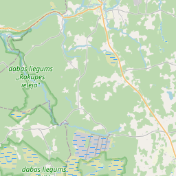
Карточка земельного участка (kадастровое обозначение:88500270028)
Кадастровое обозначение: 88500270028
Адрес: "Dīriņi", Saustere, Dundagas pagasts, Talsu novads, LV-3270
Кадастровое обозначение недвижимого имущества | |
|---|---|
Тип кадастрового объекта | Тип кадастрового объекта: Земельная единица |
Адрес | Адрес: "Dīriņi", Saustere, Dundagas pagasts, Talsu novads, LV-3270 |
Кадастровый номер недвижимого имущества, в которое входит данный земельный участок | Кадастровый номер недвижимого имущества, в которое входит данный земельный участок: 88500270028 |
Адрес | |
|---|---|
Идентификатор адреса | Идентификатор адреса: 103467934 |
Kомпании, зарегистрированные по адресу
| Kомпании, зарегистрированные по адресу
: 0 |
Подразделения, зарегистрированные по адресу
| Подразделения, зарегистрированные по адресу
: 0 |
Учреждения, зарегистрированные по адресу
| Учреждения, зарегистрированные по адресу
: 0 |
Недвижимость по адресу
| |
Сделки по адресу
| Сделки по адресу
: 0 |
|
|
|
{"7206040110":{"name":"<div class='color_dot' style='background-color: #ff7f00'><\/div><span>\u0427\u0430\u0441\u0442\u0438 \u0437\u0435\u043c\u0435\u043b\u044c\u043d\u043e\u0433\u043e \u0443\u0447\u0430\u0441\u0442\u043a\u0430<\/span>","featureColor":"#ff7f00","features":{"type":"FeatureCollection","features":[{"type":"Feature","geometry":{"type":"Polygon","coordinates":[[[22.424511684,57.473027512],[22.425407434,57.469919714],[22.427512216,57.469618467],[22.426489821,57.473191978],[22.424511684,57.473027512]]]},"crs":{"type":"name","properties":{"name":"urn:ogc:def:crs:EPSG:3059"}},"properties":{"style":{"color":"#ff7f00","dashArray":"0","weight":1},"name":"\u0427\u0430\u0441\u0442\u0438 \u0437\u0435\u043c\u0435\u043b\u044c\u043d\u043e\u0433\u043e \u0443\u0447\u0430\u0441\u0442\u043a\u0430","object_type":"ParcelPart","parcel_code":"88500280014","code":"885002800148001","surveyor":null,"address":"","ownership":null,"pro_cadastre_nr":null}},{"type":"Feature","geometry":{"type":"Polygon","coordinates":[[[22.393310661,57.469576393],[22.391433811,57.470773997],[22.389311043,57.469883356],[22.385313581,57.468354437],[22.38699661,57.466892667],[22.391116243,57.46855996],[22.393310661,57.469576393]]]},"crs":{"type":"name","properties":{"name":"urn:ogc:def:crs:EPSG:3059"}},"properties":{"style":{"color":"#ff7f00","dashArray":"0","weight":1},"name":"\u0427\u0430\u0441\u0442\u0438 \u0437\u0435\u043c\u0435\u043b\u044c\u043d\u043e\u0433\u043e \u0443\u0447\u0430\u0441\u0442\u043a\u0430","object_type":"ParcelPart","parcel_code":"88500270079","code":"885002700798001","surveyor":null,"address":"","ownership":null,"pro_cadastre_nr":null}},{"type":"Feature","geometry":{"type":"Polygon","coordinates":[[[22.384382267,57.473691409],[22.38034965,57.471720989],[22.38236565,57.470523472],[22.385329265,57.471971552],[22.384382267,57.473691409]]]},"crs":{"type":"name","properties":{"name":"urn:ogc:def:crs:EPSG:3059"}},"properties":{"style":{"color":"#ff7f00","dashArray":"0","weight":1},"name":"\u0427\u0430\u0441\u0442\u0438 \u0437\u0435\u043c\u0435\u043b\u044c\u043d\u043e\u0433\u043e \u0443\u0447\u0430\u0441\u0442\u043a\u0430","object_type":"ParcelPart","parcel_code":"88500270028","code":"885002700288001","surveyor":null,"address":"\"D\u012bri\u0146i\", Saustere, Dundagas pag., Talsu nov., LV-3270","ownership":null,"pro_cadastre_nr":null}}]}},"7201060210":{"name":"<div class='color_dot' style='background-color: #00ffff'><\/div><span>\u0423\u043a\u0430\u0437\u0430\u043d\u043d\u0430\u044f \u0437\u0435\u043c\u0435\u043b\u044c\u043d\u0430\u044f \u0435\u0434\u0438\u043d\u0438\u0446\u0430<\/span>","featureColor":"#00ffff","features":{"type":"FeatureCollection","features":[{"type":"Feature","geometry":{"type":"Polygon","coordinates":[[[22.405413094,57.475289361],[22.409826356,57.473747811],[22.414899104,57.472007277],[22.418699837,57.472457786],[22.418796153,57.472484536],[22.419111906,57.472154613],[22.419308082,57.472045686],[22.421247257,57.471162803],[22.422607904,57.470827684],[22.422830088,57.470764941],[22.423836772,57.470247161],[22.424281365,57.470080867],[22.427512216,57.469618467],[22.427495963,57.469676186],[22.427413513,57.469969095],[22.42622834,57.474104478],[22.426135264,57.474197238],[22.424967111,57.474784588],[22.42326975,57.475609962],[22.421246904,57.475017812],[22.421180664,57.474998826],[22.417421131,57.473921191],[22.414653125,57.473653048],[22.409037457,57.475949787],[22.408180288,57.476315689],[22.408104236,57.476259341],[22.405413094,57.475289361]]]},"crs":{"type":"name","properties":{"name":"urn:ogc:def:crs:EPSG:3059"}},"properties":{"style":{"color":"#00ffff","dashArray":"8,12","weight":1},"name":"\u0417\u0435\u043c\u043b\u044f","object_type":"Parcel","parcel_code":"88500280014","code":null,"surveyor":null,"address":"","ownership":"<span>\u0412\u043b\u0430\u0434\u0435\u043b\u0435\u0446 - \u0424\u0438\u0437\u0438\u0447\u0435\u0441\u043a\u043e\u0435 \u043b\u0438\u0446\u043e<br><\/span>","pro_cadastre_nr":"88500270028"}},{"type":"Feature","geometry":{"type":"Polygon","coordinates":[[[22.366231254,57.468108139],[22.366265445,57.468054137],[22.366346743,57.467942554],[22.366947862,57.467214064],[22.367744445,57.46632792],[22.368290347,57.465787775],[22.37485189,57.466837705],[22.374894811,57.466844386],[22.374942833,57.46685186],[22.38035157,57.469539269],[22.385329332,57.471971553],[22.383215712,57.475809721],[22.377027079,57.474726561],[22.37237714,57.473912468],[22.368443982,57.47023291],[22.368387973,57.470242194],[22.367726104,57.46965093],[22.366271141,57.468135735],[22.366231254,57.468108139]]]},"crs":{"type":"name","properties":{"name":"urn:ogc:def:crs:EPSG:3059"}},"properties":{"style":{"color":"#00ffff","dashArray":"8,12","weight":1},"name":"\u0417\u0435\u043c\u043b\u044f","object_type":"Parcel","parcel_code":"88500270028","code":null,"surveyor":null,"address":"\"D\u012bri\u0146i\", Saustere, Dundagas pag., Talsu nov., LV-3270","ownership":"<span>\u0412\u043b\u0430\u0434\u0435\u043b\u0435\u0446 - \u0424\u0438\u0437\u0438\u0447\u0435\u0441\u043a\u043e\u0435 \u043b\u0438\u0446\u043e<br><\/span>","pro_cadastre_nr":"88500270028"}}]}},"7201060110":{"name":"<div class='color_dot' style='background-color: #00ffff'><\/div><span>\u0418\u0437\u043c\u0435\u0440\u0435\u043d\u043d\u0430\u044f \u0437\u0435\u043c\u0435\u043b\u044c\u043d\u0430\u044f \u0435\u0434\u0438\u043d\u0438\u0446\u0430<\/span>","featureColor":"#00ffff","features":{"type":"FeatureCollection","features":[{"type":"Feature","geometry":{"type":"Polygon","coordinates":[[[22.385313149,57.468354413],[22.386996578,57.466892622],[22.391119209,57.468559997],[22.396506728,57.471058444],[22.395046163,57.472153241],[22.393783369,57.47175781],[22.389310964,57.469885152],[22.385313149,57.468354413]]]},"crs":{"type":"name","properties":{"name":"urn:ogc:def:crs:EPSG:3059"}},"properties":{"style":{"color":"#00ffff","dashArray":"0","weight":1},"name":"\u0417\u0435\u043c\u043b\u044f","object_type":"Parcel","parcel_code":"88500270079","code":null,"surveyor":null,"address":"","ownership":"<span>\u0412\u043b\u0430\u0434\u0435\u043b\u0435\u0446 - \u0424\u0438\u0437\u0438\u0447\u0435\u0441\u043a\u043e\u0435 \u043b\u0438\u0446\u043e<br><\/span>","pro_cadastre_nr":"88500270028"}}]}},"7114100000":{"name":"<div class='color_dot' style='background-color: #b40000'><\/div><span>\u0422\u0435\u0440\u0440\u0438\u0442\u043e\u0440\u0438\u044f \u0441\u0435\u0440\u0432\u0438\u0442\u0443\u0442\u0430 \u0434\u043e\u0440\u043e\u0436\u043d\u044b\u0445 \u043e\u0431\u0440\u0435\u043c\u0435\u043d\u0435\u043d\u0438\u0439<\/span>","featureColor":"#b40000","features":{"type":"FeatureCollection","features":[{"type":"Feature","geometry":{"type":"Polygon","coordinates":[[[22.409574488,57.473838395],[22.409733388,57.473784948],[22.410187383,57.473924555],[22.411521968,57.474928636],[22.411362843,57.474995271],[22.410071964,57.473992486],[22.409574488,57.473838395]]]},"crs":{"type":"name","properties":{"name":"urn:ogc:def:crs:EPSG:3059"}},"properties":{"style":{"color":"#b40000","dashArray":"4,2,1,2","weight":1},"name":"\u0422\u0435\u0440\u0440\u0438\u0442\u043e\u0440\u0438\u044f \u0441\u0435\u0440\u0432\u0438\u0442\u0443\u0442\u0430 \u0434\u043e\u0440\u043e\u0436\u043d\u044b\u0445 \u043e\u0431\u0440\u0435\u043c\u0435\u043d\u0435\u043d\u0438\u0439","object_type":"WayRestriction","parcel_code":"88500280014","code":"7315030100005","surveyor":null,"address":"","ownership":"<span>\u0412\u043b\u0430\u0434\u0435\u043b\u0435\u0446 - \u0424\u0438\u0437\u0438\u0447\u0435\u0441\u043a\u043e\u0435 \u043b\u0438\u0446\u043e<br><\/span>","pro_cadastre_nr":"88500270028"}}]}},"5201011310":{"name":"<div class='color_dot' style='background-color: #960096'><\/div><span>\u0412\u0435\u043a\u0442\u043e\u0440\u0438\u0437\u043e\u0432\u0430\u043d\u043d\u043e\u0435 \u0437\u0434\u0430\u043d\u0438\u0435<\/span>","featureColor":"#960096","features":{"type":"FeatureCollection","features":[{"type":"Feature","geometry":{"type":"Polygon","coordinates":[[[22.368728589,57.469364554],[22.368798914,57.469329203],[22.368925146,57.4694021],[22.368854804,57.46943745],[22.368728589,57.469364554]]]},"crs":{"type":"name","properties":{"name":"urn:ogc:def:crs:EPSG:3059"}},"properties":{"style":{"color":"#960096","dashArray":"0","weight":2},"name":"\u0417\u0434\u0430\u043d\u0438\u044f","object_type":"Building","parcel_code":"88500270028","code":"88500270028005","surveyor":null,"address":"\"D\u012bri\u0146i\", Saustere, Dundagas pag., Talsu nov., LV-3270","ownership":"<span>\u0412\u043b\u0430\u0434\u0435\u043b\u0435\u0446 - \u0424\u0438\u0437\u0438\u0447\u0435\u0441\u043a\u043e\u0435 \u043b\u0438\u0446\u043e<br><\/span>","pro_cadastre_nr":"88500270028"}},{"type":"Feature","geometry":{"type":"Polygon","coordinates":[[[22.368728589,57.469364554],[22.368798914,57.469329203],[22.368925146,57.4694021],[22.368854804,57.46943745],[22.368728589,57.469364554]]]},"crs":{"type":"name","properties":{"name":"urn:ogc:def:crs:EPSG:3059"}},"properties":{"style":{"color":"#960096","dashArray":"0","weight":2},"name":"\u0417\u0434\u0430\u043d\u0438\u044f","object_type":"Building","parcel_code":"88500270028","code":"88500270028005","surveyor":null,"address":"\"D\u012bri\u0146i\", Saustere, Dundagas pag., Talsu nov., LV-3270","ownership":"<span>\u0412\u043b\u0430\u0434\u0435\u043b\u0435\u0446 - \u0424\u0438\u0437\u0438\u0447\u0435\u0441\u043a\u043e\u0435 \u043b\u0438\u0446\u043e<br><\/span>","pro_cadastre_nr":"88500270028"}}]}},"5201011110":{"name":"<div class='color_dot' style='background-color: #ff0000'><\/div><span>\u0418\u0437\u043c\u0435\u0440\u0435\u043d\u043d\u043e\u0435 \u0437\u0434\u0430\u043d\u0438\u0435 <\/span>","featureColor":"#ff0000","features":{"type":"FeatureCollection","features":[{"type":"Feature","geometry":{"type":"Polygon","coordinates":[[[22.368742637,57.469861678],[22.368807813,57.469792955],[22.36890113,57.469819076],[22.368835943,57.469888787],[22.368742637,57.469861678]]]},"crs":{"type":"name","properties":{"name":"urn:ogc:def:crs:EPSG:3059"}},"properties":{"style":{"color":"#ff0000","dashArray":"0","weight":1},"name":"\u0417\u0434\u0430\u043d\u0438\u044f","object_type":"Building","parcel_code":"88500270028","code":"88500270028007","surveyor":null,"address":"\"D\u012bri\u0146i\", Saustere, Dundagas pag., Talsu nov., LV-3270","ownership":null,"pro_cadastre_nr":null}},{"type":"Feature","geometry":{"type":"Polygon","coordinates":[[[22.368462547,57.469308724],[22.368365737,57.469236432],[22.368491441,57.469188321],[22.368464113,57.469168067],[22.36851526,57.469148488],[22.368542588,57.469168741],[22.368667121,57.469121082],[22.368763533,57.469193683],[22.36861293,57.469251247],[22.368637852,57.469269727],[22.368609692,57.469280503],[22.368584753,57.469262014],[22.368462547,57.469308724]]]},"crs":{"type":"name","properties":{"name":"urn:ogc:def:crs:EPSG:3059"}},"properties":{"style":{"color":"#ff0000","dashArray":"0","weight":1},"name":"\u0417\u0434\u0430\u043d\u0438\u044f","object_type":"Building","parcel_code":"88500270028","code":"88500270028001","surveyor":null,"address":"\"D\u012bri\u0146i\", Saustere, Dundagas pag., Talsu nov., LV-3270","ownership":"<span>\u0412\u043b\u0430\u0434\u0435\u043b\u0435\u0446 - \u0424\u0438\u0437\u0438\u0447\u0435\u0441\u043a\u043e\u0435 \u043b\u0438\u0446\u043e<br><\/span>","pro_cadastre_nr":"88500270028"}},{"type":"Feature","geometry":{"type":"Polygon","coordinates":[[[22.369251369,57.469246829],[22.369273551,57.468974603],[22.369439122,57.468978514],[22.369416941,57.469250749],[22.369251369,57.469246829]]]},"crs":{"type":"name","properties":{"name":"urn:ogc:def:crs:EPSG:3059"}},"properties":{"style":{"color":"#ff0000","dashArray":"0","weight":1},"name":"\u0417\u0434\u0430\u043d\u0438\u044f","object_type":"Building","parcel_code":"88500270028","code":"88500270028003","surveyor":null,"address":"\"D\u012bri\u0146i\", Saustere, Dundagas pag., Talsu nov., LV-3270","ownership":"<span>\u0412\u043b\u0430\u0434\u0435\u043b\u0435\u0446 - \u0424\u0438\u0437\u0438\u0447\u0435\u0441\u043a\u043e\u0435 \u043b\u0438\u0446\u043e<br><\/span>","pro_cadastre_nr":"88500270028"}},{"type":"Feature","geometry":{"type":"Polygon","coordinates":[[[22.368809091,57.468909244],[22.368948209,57.468899832],[22.368979805,57.469035365],[22.368840669,57.469044777],[22.368809091,57.468909244]]]},"crs":{"type":"name","properties":{"name":"urn:ogc:def:crs:EPSG:3059"}},"properties":{"style":{"color":"#ff0000","dashArray":"0","weight":1},"name":"\u0417\u0434\u0430\u043d\u0438\u044f","object_type":"Building","parcel_code":"88500270028","code":"88500270028002","surveyor":null,"address":"\"D\u012bri\u0146i\", Saustere, Dundagas pag., Talsu nov., LV-3270","ownership":"<span>\u0412\u043b\u0430\u0434\u0435\u043b\u0435\u0446 - \u0424\u0438\u0437\u0438\u0447\u0435\u0441\u043a\u043e\u0435 \u043b\u0438\u0446\u043e<br><\/span>","pro_cadastre_nr":"88500270028"}},{"type":"Feature","geometry":{"type":"Polygon","coordinates":[[[22.369055308,57.469575788],[22.369056384,57.469570726],[22.369038591,57.469569625],[22.369040913,57.469559053],[22.369058656,57.469560154],[22.369059794,57.469554814],[22.369144884,57.469560101],[22.369140398,57.469581076],[22.369055308,57.469575788]]]},"crs":{"type":"name","properties":{"name":"urn:ogc:def:crs:EPSG:3059"}},"properties":{"style":{"color":"#ff0000","dashArray":"0","weight":1},"name":"\u0417\u0434\u0430\u043d\u0438\u044f","object_type":"Building","parcel_code":"88500270028","code":"88500270028004","surveyor":null,"address":"\"D\u012bri\u0146i\", Saustere, Dundagas pag., Talsu nov., LV-3270","ownership":"<span>\u0412\u043b\u0430\u0434\u0435\u043b\u0435\u0446 - \u0424\u0438\u0437\u0438\u0447\u0435\u0441\u043a\u043e\u0435 \u043b\u0438\u0446\u043e<br><\/span>","pro_cadastre_nr":"88500270028"}},{"type":"Feature","geometry":{"type":"Polygon","coordinates":[[[22.369055308,57.469575788],[22.369056384,57.469570726],[22.369038591,57.469569625],[22.369040913,57.469559053],[22.369058656,57.469560154],[22.369059794,57.469554814],[22.369144884,57.469560101],[22.369140398,57.469581076],[22.369055308,57.469575788]]]},"crs":{"type":"name","properties":{"name":"urn:ogc:def:crs:EPSG:3059"}},"properties":{"style":{"color":"#ff0000","dashArray":"0","weight":1},"name":"\u0417\u0434\u0430\u043d\u0438\u044f","object_type":"Building","parcel_code":"88500270028","code":"88500270028004","surveyor":null,"address":"\"D\u012bri\u0146i\", Saustere, Dundagas pag., Talsu nov., LV-3270","ownership":"<span>\u0412\u043b\u0430\u0434\u0435\u043b\u0435\u0446 - \u0424\u0438\u0437\u0438\u0447\u0435\u0441\u043a\u043e\u0435 \u043b\u0438\u0446\u043e<br><\/span>","pro_cadastre_nr":"88500270028"}},{"type":"Feature","geometry":{"type":"Polygon","coordinates":[[[22.369251369,57.469246829],[22.369273551,57.468974603],[22.369439122,57.468978514],[22.369416941,57.469250749],[22.369251369,57.469246829]]]},"crs":{"type":"name","properties":{"name":"urn:ogc:def:crs:EPSG:3059"}},"properties":{"style":{"color":"#ff0000","dashArray":"0","weight":1},"name":"\u0417\u0434\u0430\u043d\u0438\u044f","object_type":"Building","parcel_code":"88500270028","code":"88500270028003","surveyor":null,"address":"\"D\u012bri\u0146i\", Saustere, Dundagas pag., Talsu nov., LV-3270","ownership":"<span>\u0412\u043b\u0430\u0434\u0435\u043b\u0435\u0446 - \u0424\u0438\u0437\u0438\u0447\u0435\u0441\u043a\u043e\u0435 \u043b\u0438\u0446\u043e<br><\/span>","pro_cadastre_nr":"88500270028"}},{"type":"Feature","geometry":{"type":"Polygon","coordinates":[[[22.368809091,57.468909244],[22.368948209,57.468899832],[22.368979805,57.469035365],[22.368840669,57.469044777],[22.368809091,57.468909244]]]},"crs":{"type":"name","properties":{"name":"urn:ogc:def:crs:EPSG:3059"}},"properties":{"style":{"color":"#ff0000","dashArray":"0","weight":1},"name":"\u0417\u0434\u0430\u043d\u0438\u044f","object_type":"Building","parcel_code":"88500270028","code":"88500270028002","surveyor":null,"address":"\"D\u012bri\u0146i\", Saustere, Dundagas pag., Talsu nov., LV-3270","ownership":"<span>\u0412\u043b\u0430\u0434\u0435\u043b\u0435\u0446 - \u0424\u0438\u0437\u0438\u0447\u0435\u0441\u043a\u043e\u0435 \u043b\u0438\u0446\u043e<br><\/span>","pro_cadastre_nr":"88500270028"}},{"type":"Feature","geometry":{"type":"Polygon","coordinates":[[[22.368462547,57.469308724],[22.368365737,57.469236432],[22.368491441,57.469188321],[22.368464113,57.469168067],[22.36851526,57.469148488],[22.368542588,57.469168741],[22.368667121,57.469121082],[22.368763533,57.469193683],[22.36861293,57.469251247],[22.368637852,57.469269727],[22.368609692,57.469280503],[22.368584753,57.469262014],[22.368462547,57.469308724]]]},"crs":{"type":"name","properties":{"name":"urn:ogc:def:crs:EPSG:3059"}},"properties":{"style":{"color":"#ff0000","dashArray":"0","weight":1},"name":"\u0417\u0434\u0430\u043d\u0438\u044f","object_type":"Building","parcel_code":"88500270028","code":"88500270028001","surveyor":null,"address":"\"D\u012bri\u0146i\", Saustere, Dundagas pag., Talsu nov., LV-3270","ownership":"<span>\u0412\u043b\u0430\u0434\u0435\u043b\u0435\u0446 - \u0424\u0438\u0437\u0438\u0447\u0435\u0441\u043a\u043e\u0435 \u043b\u0438\u0446\u043e<br><\/span>","pro_cadastre_nr":"88500270028"}}]}}}
[]
https://tile.openstreetmap.org/{z}/{x}/{y}.png|© OpenStreetMap contributors|minZoom: 7|maxZoom: 19
|
Обновлены данные о земельных единицах: 20.12.2024.
Источник данных и лицензия: открытые текстовые и пространственные данные кадастровой информационной системы, открытые данные базы данных рынка недвижимости, лицензия на открытые данные Creative Commons Attribution, OpenStreetMap

