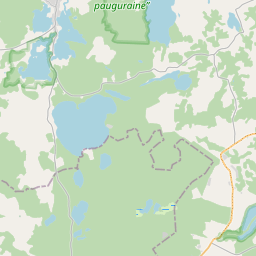
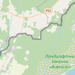
Карточка земельного участка (kадастровое обозначение:68840070110)
Кадастровое обозначение: 68840070110
Административная территория: Ludzas novads
Кадастровое обозначение недвижимого имущества | |
|---|---|
Тип кадастрового объекта | Тип кадастрового объекта: Земельная единица |
Административная территория | |
Кадастровый номер недвижимого имущества, в которое входит данный земельный участок | Кадастровый номер недвижимого имущества, в которое входит данный земельный участок: 68840070109 |
|
|
|
{"7201060210":{"name":"<div class='color_dot' style='background-color: #00ffff'><\/div><span>\u0423\u043a\u0430\u0437\u0430\u043d\u043d\u0430\u044f \u0437\u0435\u043c\u0435\u043b\u044c\u043d\u0430\u044f \u0435\u0434\u0438\u043d\u0438\u0446\u0430<\/span>","featureColor":"#00ffff","features":{"type":"FeatureCollection","features":[{"type":"Feature","geometry":{"type":"Polygon","coordinates":[[[28.092567626,56.207475525],[28.093193016,56.207231329],[28.09434648,56.20677218],[28.094622506,56.20682832],[28.094928847,56.206878975],[28.095417285,56.206945076],[28.095909645,56.206993031],[28.09626597,56.207026539],[28.096466889,56.207063348],[28.096658812,56.207116859],[28.097070062,56.207263631],[28.097429041,56.207386145],[28.097604322,56.207436547],[28.097752061,56.207467483],[28.097899444,56.20749237],[28.098146562,56.207520241],[28.09829872,56.207530301],[28.098294501,56.207558626],[28.098511597,56.207570406],[28.097773273,56.207980394],[28.096673553,56.208353928],[28.09669468,56.208371951],[28.095911597,56.208625272],[28.094674641,56.209100036],[28.094656895,56.209084661],[28.094607123,56.209040769],[28.092567626,56.207475525]]]},"crs":{"type":"name","properties":{"name":"urn:ogc:def:crs:EPSG:3059"}},"properties":{"style":{"color":"#00ffff","dashArray":"8,12","weight":1},"name":"\u0417\u0435\u043c\u043b\u044f","object_type":"Parcel","parcel_code":"68840070147","code":null,"surveyor":null,"address":"","ownership":"<span>\u0412\u043b\u0430\u0434\u0435\u043b\u0435\u0446 - \u0424\u0438\u0437\u0438\u0447\u0435\u0441\u043a\u043e\u0435 \u043b\u0438\u0446\u043e<br><\/span>","pro_cadastre_nr":"68840070109"}},{"type":"Feature","geometry":{"type":"Polygon","coordinates":[[[28.111982437,56.211111995],[28.112350272,56.21091324],[28.112797082,56.210709821],[28.113191095,56.210576464],[28.113625549,56.210504083],[28.113905463,56.210482645],[28.113927402,56.210514461],[28.114038729,56.210649963],[28.115526651,56.210679456],[28.115706151,56.210798879],[28.115588755,56.211377782],[28.114487029,56.211347789],[28.112024483,56.211136901],[28.111982437,56.211111995]]]},"crs":{"type":"name","properties":{"name":"urn:ogc:def:crs:EPSG:3059"}},"properties":{"style":{"color":"#00ffff","dashArray":"8,12","weight":1},"name":"\u0417\u0435\u043c\u043b\u044f","object_type":"Parcel","parcel_code":"68840070110","code":null,"surveyor":null,"address":"","ownership":"<span>\u0412\u043b\u0430\u0434\u0435\u043b\u0435\u0446 - \u0424\u0438\u0437\u0438\u0447\u0435\u0441\u043a\u043e\u0435 \u043b\u0438\u0446\u043e<br><\/span>","pro_cadastre_nr":"68840070109"}},{"type":"Feature","geometry":{"type":"Polygon","coordinates":[[[28.110379711,56.212622448],[28.110380175,56.212531607],[28.111623885,56.212488011],[28.11159701,56.212274061],[28.111551687,56.212071678],[28.111527673,56.212003777],[28.111589051,56.211995546],[28.114224591,56.21237992],[28.113736129,56.213322045],[28.112999889,56.21314049],[28.112806494,56.213320119],[28.1126032,56.21322385],[28.112393945,56.21335644],[28.111720522,56.213102475],[28.110938708,56.212812103],[28.110379711,56.212622448]]]},"crs":{"type":"name","properties":{"name":"urn:ogc:def:crs:EPSG:3059"}},"properties":{"style":{"color":"#00ffff","dashArray":"8,12","weight":1},"name":"\u0417\u0435\u043c\u043b\u044f","object_type":"Parcel","parcel_code":"68840070109","code":null,"surveyor":null,"address":"\"Kasecki\", \u0160u\u0161kova, Pasienes pag., Ludzas nov., LV-5711","ownership":"<span>\u0412\u043b\u0430\u0434\u0435\u043b\u0435\u0446 - \u0424\u0438\u0437\u0438\u0447\u0435\u0441\u043a\u043e\u0435 \u043b\u0438\u0446\u043e<br><\/span>","pro_cadastre_nr":"68840070109"}}]}},"7201060110":{"name":"<div class='color_dot' style='background-color: #00ffff'><\/div><span>\u0418\u0437\u043c\u0435\u0440\u0435\u043d\u043d\u0430\u044f \u0437\u0435\u043c\u0435\u043b\u044c\u043d\u0430\u044f \u0435\u0434\u0438\u043d\u0438\u0446\u0430<\/span>","featureColor":"#00ffff","features":{"type":"FeatureCollection","features":[{"type":"Feature","geometry":{"type":"Polygon","coordinates":[[[28.088323995,56.215247344],[28.088323224,56.214367502],[28.0884356,56.214384161],[28.088654068,56.214347781],[28.088735723,56.214321821],[28.088919703,56.214321782],[28.089136776,56.214414449],[28.089288952,56.214448369],[28.089441145,56.214482289],[28.089549871,56.214509806],[28.089658613,56.214537323],[28.09000027,56.21454574],[28.090178629,56.214587858],[28.090380394,56.214590528],[28.090722445,56.214491873],[28.091085095,56.214419164],[28.091500425,56.21439277],[28.091764536,56.214345087],[28.092141304,56.214178142],[28.092173418,56.21420065],[28.09239999,56.214963624],[28.092405386,56.214991352],[28.09228255,56.214998759],[28.091621251,56.215151002],[28.09118647,56.215279558],[28.090550483,56.215342057],[28.089951146,56.215335547],[28.08953697,56.215290985],[28.089526572,56.215317284],[28.089036648,56.215257215],[28.088593714,56.215238397],[28.08834346,56.215282017],[28.088323995,56.215247344]]]},"crs":{"type":"name","properties":{"name":"urn:ogc:def:crs:EPSG:3059"}},"properties":{"style":{"color":"#00ffff","dashArray":"0","weight":1},"name":"\u0417\u0435\u043c\u043b\u044f","object_type":"Parcel","parcel_code":"68840070150","code":null,"surveyor":null,"address":"","ownership":"<span>\u0412\u043b\u0430\u0434\u0435\u043b\u0435\u0446 - \u0424\u0438\u0437\u0438\u0447\u0435\u0441\u043a\u043e\u0435 \u043b\u0438\u0446\u043e<br><\/span>","pro_cadastre_nr":"68840070109"}}]}},"7114100000":{"name":"<div class='color_dot' style='background-color: #b40000'><\/div><span>\u0422\u0435\u0440\u0440\u0438\u0442\u043e\u0440\u0438\u044f \u0441\u0435\u0440\u0432\u0438\u0442\u0443\u0442\u0430 \u0434\u043e\u0440\u043e\u0436\u043d\u044b\u0445 \u043e\u0431\u0440\u0435\u043c\u0435\u043d\u0435\u043d\u0438\u0439<\/span>","featureColor":"#b40000","features":{"type":"FeatureCollection","features":[{"type":"Feature","geometry":{"type":"Polygon","coordinates":[[[28.08834346,56.215282017],[28.088332641,56.215262742],[28.088589534,56.215217959],[28.089041952,56.215237182],[28.08953697,56.215290985],[28.089526572,56.215317284],[28.089036648,56.215257215],[28.088593714,56.215238397],[28.08834346,56.215282017]]]},"crs":{"type":"name","properties":{"name":"urn:ogc:def:crs:EPSG:3059"}},"properties":{"style":{"color":"#b40000","dashArray":"4,2,1,2","weight":1},"name":"\u0422\u0435\u0440\u0440\u0438\u0442\u043e\u0440\u0438\u044f \u0441\u0435\u0440\u0432\u0438\u0442\u0443\u0442\u0430 \u0434\u043e\u0440\u043e\u0436\u043d\u044b\u0445 \u043e\u0431\u0440\u0435\u043c\u0435\u043d\u0435\u043d\u0438\u0439","object_type":"WayRestriction","parcel_code":"68840070150","code":"7315030100001","surveyor":null,"address":"","ownership":"<span>\u0412\u043b\u0430\u0434\u0435\u043b\u0435\u0446 - \u0424\u0438\u0437\u0438\u0447\u0435\u0441\u043a\u043e\u0435 \u043b\u0438\u0446\u043e<br><\/span>","pro_cadastre_nr":"68840070109"}},{"type":"Feature","geometry":{"type":"Polygon","coordinates":[[[28.111568971,56.211999263],[28.111630205,56.212272695],[28.111657249,56.21248762],[28.111627391,56.212773914],[28.111452462,56.21300194],[28.11139795,56.212981658],[28.111564072,56.212765104],[28.111592461,56.212490092],[28.111625107,56.21248887],[28.111598232,56.212274919],[28.111575571,56.212173733],[28.111552602,56.212071477],[28.111528895,56.212004635],[28.111568971,56.211999263]]]},"crs":{"type":"name","properties":{"name":"urn:ogc:def:crs:EPSG:3059"}},"properties":{"style":{"color":"#b40000","dashArray":"4,2,1,2","weight":1},"name":"\u0422\u0435\u0440\u0440\u0438\u0442\u043e\u0440\u0438\u044f \u0441\u0435\u0440\u0432\u0438\u0442\u0443\u0442\u0430 \u0434\u043e\u0440\u043e\u0436\u043d\u044b\u0445 \u043e\u0431\u0440\u0435\u043c\u0435\u043d\u0435\u043d\u0438\u0439","object_type":"WayRestriction","parcel_code":"68840070109","code":"7315030100002","surveyor":null,"address":"\"Kasecki\", \u0160u\u0161kova, Pasienes pag., Ludzas nov., LV-5711","ownership":"<span>\u0412\u043b\u0430\u0434\u0435\u043b\u0435\u0446 - \u0424\u0438\u0437\u0438\u0447\u0435\u0441\u043a\u043e\u0435 \u043b\u0438\u0446\u043e<br><\/span>","pro_cadastre_nr":"68840070109"}}]}},"5201011310":{"name":"<div class='color_dot' style='background-color: #960096'><\/div><span>\u0412\u0435\u043a\u0442\u043e\u0440\u0438\u0437\u043e\u0432\u0430\u043d\u043d\u043e\u0435 \u0437\u0434\u0430\u043d\u0438\u0435<\/span>","featureColor":"#960096","features":{"type":"FeatureCollection","features":[{"type":"Feature","geometry":{"type":"Polygon","coordinates":[[[28.112147156,56.212750663],[28.112300853,56.212777553],[28.112258862,56.212852068],[28.112122072,56.212828132],[28.112131726,56.212811011],[28.112114818,56.212808048],[28.112147156,56.212750663]]]},"crs":{"type":"name","properties":{"name":"urn:ogc:def:crs:EPSG:3059"}},"properties":{"style":{"color":"#960096","dashArray":"0","weight":2},"name":"\u0417\u0434\u0430\u043d\u0438\u044f","object_type":"Building","parcel_code":"68840070109","code":"68840070109001","surveyor":null,"address":"\"Kasecki\", \u0160u\u0161kova, Pasienes pag., Ludzas nov., LV-5711","ownership":"<span>\u0412\u043b\u0430\u0434\u0435\u043b\u0435\u0446 - \u0424\u0438\u0437\u0438\u0447\u0435\u0441\u043a\u043e\u0435 \u043b\u0438\u0446\u043e<br><\/span>","pro_cadastre_nr":"68840070109"}},{"type":"Feature","geometry":{"type":"Polygon","coordinates":[[[28.111957583,56.212770583],[28.112034275,56.212784298],[28.111994902,56.212852683],[28.111918194,56.212838968],[28.111957583,56.212770583]]]},"crs":{"type":"name","properties":{"name":"urn:ogc:def:crs:EPSG:3059"}},"properties":{"style":{"color":"#960096","dashArray":"0","weight":2},"name":"\u0417\u0434\u0430\u043d\u0438\u044f","object_type":"Building","parcel_code":"68840070109","code":"68840070109002","surveyor":null,"address":"\"Kasecki\", \u0160u\u0161kova, Pasienes pag., Ludzas nov., LV-5711","ownership":"<span>\u0412\u043b\u0430\u0434\u0435\u043b\u0435\u0446 - \u0424\u0438\u0437\u0438\u0447\u0435\u0441\u043a\u043e\u0435 \u043b\u0438\u0446\u043e<br><\/span>","pro_cadastre_nr":"68840070109"}},{"type":"Feature","geometry":{"type":"Polygon","coordinates":[[[28.112280384,56.213111479],[28.112310947,56.213117162],[28.112288008,56.213155491],[28.112257446,56.213149809],[28.112280384,56.213111479]]]},"crs":{"type":"name","properties":{"name":"urn:ogc:def:crs:EPSG:3059"}},"properties":{"style":{"color":"#960096","dashArray":"0","weight":2},"name":"\u0417\u0434\u0430\u043d\u0438\u044f","object_type":"Building","parcel_code":"68840070109","code":"68840070109003","surveyor":null,"address":"\"Kasecki\", \u0160u\u0161kova, Pasienes pag., Ludzas nov., LV-5711","ownership":"<span>\u0412\u043b\u0430\u0434\u0435\u043b\u0435\u0446 - \u0424\u0438\u0437\u0438\u0447\u0435\u0441\u043a\u043e\u0435 \u043b\u0438\u0446\u043e<br><\/span>","pro_cadastre_nr":"68840070109"}},{"type":"Feature","geometry":{"type":"Polygon","coordinates":[[[28.112280384,56.213111479],[28.112310947,56.213117162],[28.112288008,56.213155491],[28.112257446,56.213149809],[28.112280384,56.213111479]]]},"crs":{"type":"name","properties":{"name":"urn:ogc:def:crs:EPSG:3059"}},"properties":{"style":{"color":"#960096","dashArray":"0","weight":2},"name":"\u0417\u0434\u0430\u043d\u0438\u044f","object_type":"Building","parcel_code":"68840070109","code":"68840070109003","surveyor":null,"address":"\"Kasecki\", \u0160u\u0161kova, Pasienes pag., Ludzas nov., LV-5711","ownership":"<span>\u0412\u043b\u0430\u0434\u0435\u043b\u0435\u0446 - \u0424\u0438\u0437\u0438\u0447\u0435\u0441\u043a\u043e\u0435 \u043b\u0438\u0446\u043e<br><\/span>","pro_cadastre_nr":"68840070109"}},{"type":"Feature","geometry":{"type":"Polygon","coordinates":[[[28.111957583,56.212770583],[28.112034275,56.212784298],[28.111994902,56.212852683],[28.111918194,56.212838968],[28.111957583,56.212770583]]]},"crs":{"type":"name","properties":{"name":"urn:ogc:def:crs:EPSG:3059"}},"properties":{"style":{"color":"#960096","dashArray":"0","weight":2},"name":"\u0417\u0434\u0430\u043d\u0438\u044f","object_type":"Building","parcel_code":"68840070109","code":"68840070109002","surveyor":null,"address":"\"Kasecki\", \u0160u\u0161kova, Pasienes pag., Ludzas nov., LV-5711","ownership":"<span>\u0412\u043b\u0430\u0434\u0435\u043b\u0435\u0446 - \u0424\u0438\u0437\u0438\u0447\u0435\u0441\u043a\u043e\u0435 \u043b\u0438\u0446\u043e<br><\/span>","pro_cadastre_nr":"68840070109"}},{"type":"Feature","geometry":{"type":"Polygon","coordinates":[[[28.112147156,56.212750663],[28.112300853,56.212777553],[28.112258862,56.212852068],[28.112122072,56.212828132],[28.112131726,56.212811011],[28.112114818,56.212808048],[28.112147156,56.212750663]]]},"crs":{"type":"name","properties":{"name":"urn:ogc:def:crs:EPSG:3059"}},"properties":{"style":{"color":"#960096","dashArray":"0","weight":2},"name":"\u0417\u0434\u0430\u043d\u0438\u044f","object_type":"Building","parcel_code":"68840070109","code":"68840070109001","surveyor":null,"address":"\"Kasecki\", \u0160u\u0161kova, Pasienes pag., Ludzas nov., LV-5711","ownership":"<span>\u0412\u043b\u0430\u0434\u0435\u043b\u0435\u0446 - \u0424\u0438\u0437\u0438\u0447\u0435\u0441\u043a\u043e\u0435 \u043b\u0438\u0446\u043e<br><\/span>","pro_cadastre_nr":"68840070109"}}]}}}
{"7201060210":{"name":"<div class='color_dot' style='background-color: #00ffff'><\/div><span>\u0423\u043a\u0430\u0437\u0430\u043d\u043d\u0430\u044f \u0437\u0435\u043c\u0435\u043b\u044c\u043d\u0430\u044f \u0435\u0434\u0438\u043d\u0438\u0446\u0430<\/span>","featureColor":"#00ffff","features":{"type":"FeatureCollection","features":[{"type":"Feature","geometry":{"type":"Polygon","coordinates":[[[28.092567626,56.207475525],[28.093193016,56.207231329],[28.09434648,56.20677218],[28.094622506,56.20682832],[28.094928847,56.206878975],[28.095417285,56.206945076],[28.095909645,56.206993031],[28.09626597,56.207026539],[28.096466889,56.207063348],[28.096658812,56.207116859],[28.097070062,56.207263631],[28.097429041,56.207386145],[28.097604322,56.207436547],[28.097752061,56.207467483],[28.097899444,56.20749237],[28.098146562,56.207520241],[28.09829872,56.207530301],[28.098294501,56.207558626],[28.097683248,56.207959998],[28.096673553,56.208353928],[28.09669468,56.208371951],[28.095911597,56.208625272],[28.094674641,56.209100036],[28.094656895,56.209084661],[28.094607123,56.209040769],[28.092567626,56.207475525]]]},"crs":{"type":"name","properties":{"name":"urn:ogc:def:crs:EPSG:3059"}},"properties":{"style":{"color":"#00ffff","dashArray":"8,12","weight":1},"name":"\u0417\u0435\u043c\u043b\u044f","object_type":"Parcel","parcel_code":"68840070147","code":null,"surveyor":null,"address":"","ownership":"<span>\u0412\u043b\u0430\u0434\u0435\u043b\u0435\u0446 - \u0424\u0438\u0437\u0438\u0447\u0435\u0441\u043a\u043e\u0435 \u043b\u0438\u0446\u043e<br><\/span>","pro_cadastre_nr":"68840070109"}}]}}}
https://tile.openstreetmap.org/{z}/{x}/{y}.png|© OpenStreetMap contributors|minZoom: 7|maxZoom: 19
|
Обновлены данные о земельных единицах: 10.01.2025.
Источник данных и лицензия: открытые текстовые и пространственные данные кадастровой информационной системы, открытые данные базы данных рынка недвижимости, лицензия на открытые данные Creative Commons Attribution, OpenStreetMap


