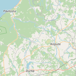
Карточка земельного участка (kадастровое обозначение:62420090123)
Кадастровое обозначение: 62420090123
Административная территория: Kuldīgas novads
Кадастровое обозначение недвижимого имущества | |
|---|---|
Тип кадастрового объекта | Тип кадастрового объекта: Земельная единица |
Административная территория | |
Кадастровый номер недвижимого имущества, в которое входит данный земельный участок | Кадастровый номер недвижимого имущества, в которое входит данный земельный участок: 62420090123 |
|
|
|
{"7201060210":{"name":"<div class='color_dot' style='background-color: #00ffff'><\/div><span>\u0423\u043a\u0430\u0437\u0430\u043d\u043d\u0430\u044f \u0437\u0435\u043c\u0435\u043b\u044c\u043d\u0430\u044f \u0435\u0434\u0438\u043d\u0438\u0446\u0430<\/span>","featureColor":"#00ffff","features":{"type":"FeatureCollection","features":[{"type":"Feature","geometry":{"type":"Polygon","coordinates":[[[21.642275172,56.975077906],[21.643638354,56.973616556],[21.645593333,56.974089162],[21.646113905,56.974241758],[21.646174545,56.975045143],[21.646457978,56.975902442],[21.645680879,56.97670211],[21.64567446,56.976596541],[21.645586251,56.976465168],[21.64538981,56.976344698],[21.644538338,56.975948154],[21.643646071,56.97554982],[21.642281131,56.97507996],[21.642275172,56.975077906]]]},"crs":{"type":"name","properties":{"name":"urn:ogc:def:crs:EPSG:3059"}},"properties":{"style":{"color":"#00ffff","dashArray":"8,12","weight":1},"name":"\u0417\u0435\u043c\u043b\u044f","object_type":"Parcel","parcel_code":"62420090212","code":null,"surveyor":null,"address":"","ownership":"<span>\u0412\u043b\u0430\u0434\u0435\u043b\u0435\u0446 - \u0424\u0438\u0437\u0438\u0447\u0435\u0441\u043a\u043e\u0435 \u043b\u0438\u0446\u043e<br><\/span>","pro_cadastre_nr":"62420090123"}},{"type":"Feature","geometry":{"type":"Polygon","coordinates":[[[21.638415499,56.978428663],[21.639172086,56.977464484],[21.63963712,56.976664079],[21.640165223,56.975645014],[21.641551184,56.975846657],[21.642208534,56.975149334],[21.643603172,56.975612807],[21.644366922,56.975947459],[21.644793422,56.976160683],[21.645167244,56.976325751],[21.645472287,56.976494898],[21.645542595,56.976592576],[21.64553524,56.97665564],[21.645437596,56.976952642],[21.642900971,56.979543159],[21.642765705,56.979510307],[21.640911691,56.978698234],[21.638415499,56.978428663]]]},"crs":{"type":"name","properties":{"name":"urn:ogc:def:crs:EPSG:3059"}},"properties":{"style":{"color":"#00ffff","dashArray":"8,12","weight":1},"name":"\u0417\u0435\u043c\u043b\u044f","object_type":"Parcel","parcel_code":"62420090211","code":null,"surveyor":null,"address":"","ownership":"<span>\u0412\u043b\u0430\u0434\u0435\u043b\u0435\u0446 - \u0424\u0438\u0437\u0438\u0447\u0435\u0441\u043a\u043e\u0435 \u043b\u0438\u0446\u043e<br><\/span>","pro_cadastre_nr":"62420090123"}},{"type":"Feature","geometry":{"type":"Polygon","coordinates":[[[21.636031356,56.981302506],[21.636090031,56.981248509],[21.636136641,56.981205445],[21.636229852,56.981106961],[21.636390358,56.98092132],[21.636503936,56.980805822],[21.636605035,56.981187408],[21.636344446,56.981442063],[21.636332179,56.981455383],[21.63621372,56.981394938],[21.636031356,56.981302506]]]},"crs":{"type":"name","properties":{"name":"urn:ogc:def:crs:EPSG:3059"}},"properties":{"style":{"color":"#00ffff","dashArray":"8,12","weight":1},"name":"\u0417\u0435\u043c\u043b\u044f","object_type":"Parcel","parcel_code":"62420090124","code":null,"surveyor":null,"address":"\"Imantas\", Alm\u0101le, Alsungas pag., Kuld\u012bgas nov., LV-3306","ownership":"<span>\u0412\u043b\u0430\u0434\u0435\u043b\u0435\u0446 - \u0424\u0438\u0437\u0438\u0447\u0435\u0441\u043a\u043e\u0435 \u043b\u0438\u0446\u043e<br><\/span>","pro_cadastre_nr":"62420090123"}},{"type":"Feature","geometry":{"type":"Polygon","coordinates":[[[21.631727983,56.978268728],[21.633615047,56.976818596],[21.635269965,56.975497635],[21.637457619,56.975536669],[21.639800432,56.975709547],[21.639328858,56.976692293],[21.638879843,56.977403583],[21.638001462,56.978513308],[21.637328616,56.979381801],[21.63692476,56.979872021],[21.636645324,56.980207136],[21.636488849,56.980403],[21.636469345,56.980398326],[21.635384452,56.97987217],[21.634916474,56.979774912],[21.634743124,56.980103851],[21.634708234,56.980125892],[21.634463793,56.980062856],[21.634437932,56.980079271],[21.631727983,56.978268728]]]},"crs":{"type":"name","properties":{"name":"urn:ogc:def:crs:EPSG:3059"}},"properties":{"style":{"color":"#00ffff","dashArray":"8,12","weight":1},"name":"\u0417\u0435\u043c\u043b\u044f","object_type":"Parcel","parcel_code":"62420090123","code":null,"surveyor":null,"address":"","ownership":"<span>\u0412\u043b\u0430\u0434\u0435\u043b\u0435\u0446 - \u0424\u0438\u0437\u0438\u0447\u0435\u0441\u043a\u043e\u0435 \u043b\u0438\u0446\u043e<br><\/span>","pro_cadastre_nr":"62420090123"}},{"type":"Feature","geometry":{"type":"Polygon","coordinates":[[[21.526631283,56.992771959],[21.526901226,56.992724713],[21.527729202,56.992591538],[21.527879621,56.992560261],[21.528776234,56.992388533],[21.528799624,56.992428843],[21.529963564,56.994420356],[21.529980988,56.994465015],[21.528969303,56.994702069],[21.527972866,56.994930727],[21.527944142,56.994884425],[21.526683176,56.992857363],[21.526631283,56.992771959]]]},"crs":{"type":"name","properties":{"name":"urn:ogc:def:crs:EPSG:3059"}},"properties":{"style":{"color":"#00ffff","dashArray":"8,12","weight":1},"name":"\u0417\u0435\u043c\u043b\u044f","object_type":"Parcel","parcel_code":"62420040053","code":null,"surveyor":null,"address":"","ownership":"<span>\u0412\u043b\u0430\u0434\u0435\u043b\u0435\u0446 - \u0424\u0438\u0437\u0438\u0447\u0435\u0441\u043a\u043e\u0435 \u043b\u0438\u0446\u043e<br><\/span>","pro_cadastre_nr":"62420090123"}}]}},"5201011310":{"name":"<div class='color_dot' style='background-color: #960096'><\/div><span>\u0412\u0435\u043a\u0442\u043e\u0440\u0438\u0437\u043e\u0432\u0430\u043d\u043d\u043e\u0435 \u0437\u0434\u0430\u043d\u0438\u0435<\/span>","featureColor":"#960096","features":{"type":"FeatureCollection","features":[{"type":"Feature","geometry":{"type":"Polygon","coordinates":[[[21.636326888,56.981244672],[21.636263408,56.98122283],[21.63635186,56.981146193],[21.636415356,56.981168044],[21.636326888,56.981244672]]]},"crs":{"type":"name","properties":{"name":"urn:ogc:def:crs:EPSG:3059"}},"properties":{"style":{"color":"#960096","dashArray":"0","weight":2},"name":"\u0417\u0434\u0430\u043d\u0438\u044f","object_type":"Building","parcel_code":"62420090124","code":"62420090124001","surveyor":null,"address":"\"Imantas\", Alm\u0101le, Alsungas pag., Kuld\u012bgas nov., LV-3306","ownership":"<span>\u0412\u043b\u0430\u0434\u0435\u043b\u0435\u0446 - \u0424\u0438\u0437\u0438\u0447\u0435\u0441\u043a\u043e\u0435 \u043b\u0438\u0446\u043e<br><\/span>","pro_cadastre_nr":"62420090123"}},{"type":"Feature","geometry":{"type":"Polygon","coordinates":[[[21.637752069,56.978186356],[21.6378784,56.978234115],[21.637780075,56.978311664],[21.637713228,56.978286389],[21.637683328,56.978309981],[21.637623827,56.978287487],[21.637752069,56.978186356]]]},"crs":{"type":"name","properties":{"name":"urn:ogc:def:crs:EPSG:3059"}},"properties":{"style":{"color":"#960096","dashArray":"0","weight":2},"name":"\u0417\u0434\u0430\u043d\u0438\u044f","object_type":"Building","parcel_code":"62420090123","code":"62420090123003","surveyor":null,"address":"","ownership":null,"pro_cadastre_nr":null}},{"type":"Feature","geometry":{"type":"Polygon","coordinates":[[[21.637177033,56.978217407],[21.637222674,56.978173453],[21.637426244,56.978236476],[21.63738062,56.97828043],[21.637177033,56.978217407]]]},"crs":{"type":"name","properties":{"name":"urn:ogc:def:crs:EPSG:3059"}},"properties":{"style":{"color":"#960096","dashArray":"0","weight":2},"name":"\u0417\u0434\u0430\u043d\u0438\u044f","object_type":"Building","parcel_code":"62420090123","code":"62420090123002","surveyor":null,"address":"","ownership":"<span>\u0412\u043b\u0430\u0434\u0435\u043b\u0435\u0446 - \u0424\u0438\u0437\u0438\u0447\u0435\u0441\u043a\u043e\u0435 \u043b\u0438\u0446\u043e<br><\/span>","pro_cadastre_nr":"62420090123"}},{"type":"Feature","geometry":{"type":"Polygon","coordinates":[[[21.637193822,56.978807013],[21.637263001,56.978707167],[21.637525783,56.978761449],[21.637456621,56.978861296],[21.637193822,56.978807013]]]},"crs":{"type":"name","properties":{"name":"urn:ogc:def:crs:EPSG:3059"}},"properties":{"style":{"color":"#960096","dashArray":"0","weight":2},"name":"\u0417\u0434\u0430\u043d\u0438\u044f","object_type":"Building","parcel_code":"62420090123","code":"62420090123001","surveyor":null,"address":"","ownership":"<span>\u0412\u043b\u0430\u0434\u0435\u043b\u0435\u0446 - \u0424\u0438\u0437\u0438\u0447\u0435\u0441\u043a\u043e\u0435 \u043b\u0438\u0446\u043e<br><\/span>","pro_cadastre_nr":"62420090123"}},{"type":"Feature","geometry":{"type":"Polygon","coordinates":[[[21.636326888,56.981244672],[21.636263408,56.98122283],[21.63635186,56.981146193],[21.636415356,56.981168044],[21.636326888,56.981244672]]]},"crs":{"type":"name","properties":{"name":"urn:ogc:def:crs:EPSG:3059"}},"properties":{"style":{"color":"#960096","dashArray":"0","weight":2},"name":"\u0417\u0434\u0430\u043d\u0438\u044f","object_type":"Building","parcel_code":"62420090124","code":"62420090124001","surveyor":null,"address":"\"Imantas\", Alm\u0101le, Alsungas pag., Kuld\u012bgas nov., LV-3306","ownership":"<span>\u0412\u043b\u0430\u0434\u0435\u043b\u0435\u0446 - \u0424\u0438\u0437\u0438\u0447\u0435\u0441\u043a\u043e\u0435 \u043b\u0438\u0446\u043e<br><\/span>","pro_cadastre_nr":"62420090123"}},{"type":"Feature","geometry":{"type":"Polygon","coordinates":[[[21.637177033,56.978217407],[21.637222674,56.978173453],[21.637426244,56.978236476],[21.63738062,56.97828043],[21.637177033,56.978217407]]]},"crs":{"type":"name","properties":{"name":"urn:ogc:def:crs:EPSG:3059"}},"properties":{"style":{"color":"#960096","dashArray":"0","weight":2},"name":"\u0417\u0434\u0430\u043d\u0438\u044f","object_type":"Building","parcel_code":"62420090123","code":"62420090123002","surveyor":null,"address":"\"Imantas\", Alm\u0101le, Alsungas pag., Kuld\u012bgas nov., LV-3306","ownership":"<span>\u0412\u043b\u0430\u0434\u0435\u043b\u0435\u0446 - \u0424\u0438\u0437\u0438\u0447\u0435\u0441\u043a\u043e\u0435 \u043b\u0438\u0446\u043e<br><\/span>","pro_cadastre_nr":"62420090123"}},{"type":"Feature","geometry":{"type":"Polygon","coordinates":[[[21.637193822,56.978807013],[21.637263001,56.978707167],[21.637525783,56.978761449],[21.637456621,56.978861296],[21.637193822,56.978807013]]]},"crs":{"type":"name","properties":{"name":"urn:ogc:def:crs:EPSG:3059"}},"properties":{"style":{"color":"#960096","dashArray":"0","weight":2},"name":"\u0417\u0434\u0430\u043d\u0438\u044f","object_type":"Building","parcel_code":"62420090123","code":"62420090123001","surveyor":null,"address":"\"Imantas\", Alm\u0101le, Alsungas pag., Kuld\u012bgas nov., LV-3306","ownership":"<span>\u0412\u043b\u0430\u0434\u0435\u043b\u0435\u0446 - \u0424\u0438\u0437\u0438\u0447\u0435\u0441\u043a\u043e\u0435 \u043b\u0438\u0446\u043e<br><\/span>","pro_cadastre_nr":"62420090123"}}]}}}
[]
https://tile.openstreetmap.org/{z}/{x}/{y}.png|© OpenStreetMap contributors|minZoom: 7|maxZoom: 19
|
Обновлены данные о земельных единицах: 10.01.2025.
Источник данных и лицензия: открытые текстовые и пространственные данные кадастровой информационной системы, открытые данные базы данных рынка недвижимости, лицензия на открытые данные Creative Commons Attribution, OpenStreetMap

