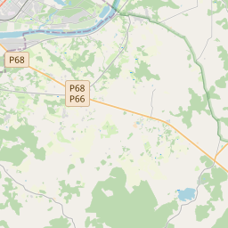
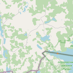
Карточка земельного участка (kадастровое обозначение:44860040041)
Кадастровое обозначение: 44860040041
Административная территория: Augšdaugavas novads
Историческая запись. Последняя дата подготовки открытых данных, когда объект был актуальным:
Кадастровое обозначение недвижимого имущества | |
|---|---|
Тип кадастрового объекта | Тип кадастрового объекта: Земельная единица |
Административная территория | |
Кадастровый номер недвижимого имущества, в которое входит данный земельный участок | Кадастровый номер недвижимого имущества, в которое входит данный земельный участок: 44860040041 |
| Hет данных |
|
{"7201070000":{"name":"<div class='color_dot' style='background-color: #00ff00'><\/div><span>\u0422\u0435\u0440\u0440\u0438\u0442\u043e\u0440\u0438\u0438 \u0441 \u043d\u0430\u0447\u0430\u0442\u044b\u043c \u0438\u0437\u043c\u0435\u0440\u0435\u043d\u0438\u0435\u043c \u0437\u0435\u043c\u043b\u0438<\/span>","featureColor":"#00ff00","features":{"type":"FeatureCollection","features":[{"type":"Feature","geometry":{"type":"Polygon","coordinates":[[[26.725333483,55.785096438],[26.725333324,55.785038661],[26.72560504,55.784434532],[26.725708892,55.784337116],[26.725955596,55.784042943],[26.729006054,55.784477666],[26.72817942,55.785249563],[26.734530095,55.786666479],[26.732319539,55.78841503],[26.730116656,55.787772454],[26.73008941,55.787764053],[26.730053178,55.787752857],[26.727746902,55.787041164],[26.725704966,55.786484027],[26.725705351,55.786384502],[26.725333483,55.785096438]]]},"crs":{"type":"name","properties":{"name":"urn:ogc:def:crs:EPSG:3059"}},"properties":{"style":{"color":"#00ff00","dashArray":"0","weight":1},"name":"\u0422\u0435\u0440\u0440\u0438\u0442\u043e\u0440\u0438\u0438 \u0441 \u043d\u0430\u0447\u0430\u0442\u044b\u043c \u0438\u0437\u043c\u0435\u0440\u0435\u043d\u0438\u0435\u043c \u0437\u0435\u043c\u043b\u0438","object_type":"SurveyingStatus","parcel_code":"44860040175","code":null,"surveyor":"Geo Forest SIA 08.07.2024.","address":"","ownership":"<span>\u041f\u0440\u0430\u0432\u043e\u0432\u043e\u0439 \u0432\u043b\u0430\u0434\u0435\u043b\u0435\u0446 - \u0424\u0438\u0437\u0438\u0447\u0435\u0441\u043a\u043e\u0435 \u043b\u0438\u0446\u043e<br><\/span>","pro_cadastre_nr":"44860040041"}},{"type":"Feature","geometry":{"type":"Polygon","coordinates":[[[26.725333483,55.785096438],[26.725333324,55.785038661],[26.72560504,55.784434532],[26.725708892,55.784337116],[26.725955596,55.784042943],[26.729006054,55.784477666],[26.72817942,55.785249563],[26.734530095,55.786666479],[26.732319539,55.78841503],[26.730116656,55.787772454],[26.73008941,55.787764053],[26.730053178,55.787752857],[26.727746902,55.787041164],[26.725704966,55.786484027],[26.725705351,55.786384502],[26.725333483,55.785096438]]]},"crs":{"type":"name","properties":{"name":"urn:ogc:def:crs:EPSG:3059"}},"properties":{"style":{"color":"#00ff00","dashArray":"0","weight":1},"name":"\u0422\u0435\u0440\u0440\u0438\u0442\u043e\u0440\u0438\u0438 \u0441 \u043d\u0430\u0447\u0430\u0442\u044b\u043c \u0438\u0437\u043c\u0435\u0440\u0435\u043d\u0438\u0435\u043c \u0437\u0435\u043c\u043b\u0438","object_type":"SurveyingStatus","parcel_code":"44860040175","code":null,"surveyor":"Geo Forest SIA 08.07.2024.","address":"","ownership":"<span>\u041f\u0440\u0430\u0432\u043e\u0432\u043e\u0439 \u0432\u043b\u0430\u0434\u0435\u043b\u0435\u0446 - \u0424\u0438\u0437\u0438\u0447\u0435\u0441\u043a\u043e\u0435 \u043b\u0438\u0446\u043e<br><\/span>","pro_cadastre_nr":"44860040041"}},{"type":"Feature","geometry":{"type":"Polygon","coordinates":[[[26.736952039,55.78863894],[26.737251466,55.788403976],[26.738211555,55.787720362],[26.738454778,55.787547179],[26.739331297,55.786962176],[26.74021715,55.786316472],[26.740263936,55.786282366],[26.741505557,55.787064222],[26.741519109,55.787008942],[26.746420002,55.788514286],[26.747517878,55.788847128],[26.746467868,55.78953128],[26.74597639,55.789839092],[26.744834889,55.790554273],[26.744803054,55.790573915],[26.736952039,55.78863894]]]},"crs":{"type":"name","properties":{"name":"urn:ogc:def:crs:EPSG:3059"}},"properties":{"style":{"color":"#00ff00","dashArray":"0","weight":1},"name":"\u0422\u0435\u0440\u0440\u0438\u0442\u043e\u0440\u0438\u0438 \u0441 \u043d\u0430\u0447\u0430\u0442\u044b\u043c \u0438\u0437\u043c\u0435\u0440\u0435\u043d\u0438\u0435\u043c \u0437\u0435\u043c\u043b\u0438","object_type":"SurveyingStatus","parcel_code":"44860040158","code":null,"surveyor":"Geo Forest SIA 08.07.2024.","address":"","ownership":"<span>\u041f\u0440\u0430\u0432\u043e\u0432\u043e\u0439 \u0432\u043b\u0430\u0434\u0435\u043b\u0435\u0446 - \u0424\u0438\u0437\u0438\u0447\u0435\u0441\u043a\u043e\u0435 \u043b\u0438\u0446\u043e<br><\/span>","pro_cadastre_nr":"44860040041"}},{"type":"Feature","geometry":{"type":"Polygon","coordinates":[[[26.736952039,55.78863894],[26.737251466,55.788403976],[26.738211555,55.787720362],[26.738454778,55.787547179],[26.739331297,55.786962176],[26.74021715,55.786316472],[26.740263936,55.786282366],[26.741505557,55.787064222],[26.741519109,55.787008942],[26.746420002,55.788514286],[26.747517878,55.788847128],[26.746467868,55.78953128],[26.74597639,55.789839092],[26.744834889,55.790554273],[26.744803054,55.790573915],[26.736952039,55.78863894]]]},"crs":{"type":"name","properties":{"name":"urn:ogc:def:crs:EPSG:3059"}},"properties":{"style":{"color":"#00ff00","dashArray":"0","weight":1},"name":"\u0422\u0435\u0440\u0440\u0438\u0442\u043e\u0440\u0438\u0438 \u0441 \u043d\u0430\u0447\u0430\u0442\u044b\u043c \u0438\u0437\u043c\u0435\u0440\u0435\u043d\u0438\u0435\u043c \u0437\u0435\u043c\u043b\u0438","object_type":"SurveyingStatus","parcel_code":"44860040158","code":null,"surveyor":"Geo Forest SIA 08.07.2024.","address":"","ownership":"<span>\u041f\u0440\u0430\u0432\u043e\u0432\u043e\u0439 \u0432\u043b\u0430\u0434\u0435\u043b\u0435\u0446 - \u0424\u0438\u0437\u0438\u0447\u0435\u0441\u043a\u043e\u0435 \u043b\u0438\u0446\u043e<br><\/span>","pro_cadastre_nr":"44860040041"}},{"type":"Feature","geometry":{"type":"Polygon","coordinates":[[[26.736951957,55.788638906],[26.737251466,55.788403976],[26.738211555,55.787720362],[26.738454778,55.787547179],[26.739331297,55.786962176],[26.74021715,55.786316472],[26.740263936,55.786282366],[26.741505557,55.787064222],[26.741519109,55.787008942],[26.746420002,55.788514286],[26.747517878,55.788847128],[26.746467868,55.78953128],[26.74597639,55.789839092],[26.744834889,55.790554273],[26.744796147,55.790554662],[26.742073341,55.789889769],[26.736951957,55.788638906]]]},"crs":{"type":"name","properties":{"name":"urn:ogc:def:crs:EPSG:3059"}},"properties":{"style":{"color":"#00ff00","dashArray":"0","weight":1},"name":"\u0422\u0435\u0440\u0440\u0438\u0442\u043e\u0440\u0438\u0438 \u0441 \u043d\u0430\u0447\u0430\u0442\u044b\u043c \u0438\u0437\u043c\u0435\u0440\u0435\u043d\u0438\u0435\u043c \u0437\u0435\u043c\u043b\u0438","object_type":"SurveyingStatus","parcel_code":"44860040158","code":null,"surveyor":"Geo Forest SIA 08.07.2024.","address":"","ownership":"<span>\u041f\u0440\u0430\u0432\u043e\u0432\u043e\u0439 \u0432\u043b\u0430\u0434\u0435\u043b\u0435\u0446 - \u0424\u0438\u0437\u0438\u0447\u0435\u0441\u043a\u043e\u0435 \u043b\u0438\u0446\u043e<br><\/span>","pro_cadastre_nr":"44860040041"}},{"type":"Feature","geometry":{"type":"Polygon","coordinates":[[[26.743821327,55.791318524],[26.744252811,55.791046669],[26.744952635,55.790614826],[26.74611978,55.78989339],[26.746616453,55.789585497],[26.747364267,55.789104117],[26.747885027,55.788744128],[26.751728461,55.79013712],[26.751713471,55.790145132],[26.747357601,55.792318778],[26.743821327,55.791318524]]]},"crs":{"type":"name","properties":{"name":"urn:ogc:def:crs:EPSG:3059"}},"properties":{"style":{"color":"#00ff00","dashArray":"0","weight":1},"name":"\u0422\u0435\u0440\u0440\u0438\u0442\u043e\u0440\u0438\u0438 \u0441 \u043d\u0430\u0447\u0430\u0442\u044b\u043c \u0438\u0437\u043c\u0435\u0440\u0435\u043d\u0438\u0435\u043c \u0437\u0435\u043c\u043b\u0438","object_type":"SurveyingStatus","parcel_code":"44860030016","code":null,"surveyor":"Geo Forest SIA 08.07.2024.","address":"","ownership":"<span>\u041f\u0440\u0430\u0432\u043e\u0432\u043e\u0439 \u0432\u043b\u0430\u0434\u0435\u043b\u0435\u0446 - \u0424\u0438\u0437\u0438\u0447\u0435\u0441\u043a\u043e\u0435 \u043b\u0438\u0446\u043e<br><\/span>","pro_cadastre_nr":"44860040041"}},{"type":"Feature","geometry":{"type":"Polygon","coordinates":[[[26.743821327,55.791318524],[26.744252811,55.791046669],[26.744952635,55.790614826],[26.74611978,55.78989339],[26.746616453,55.789585497],[26.747364267,55.789104117],[26.747885027,55.788744128],[26.751728461,55.79013712],[26.751713471,55.790145132],[26.747357601,55.792318778],[26.743821327,55.791318524]]]},"crs":{"type":"name","properties":{"name":"urn:ogc:def:crs:EPSG:3059"}},"properties":{"style":{"color":"#00ff00","dashArray":"0","weight":1},"name":"\u0422\u0435\u0440\u0440\u0438\u0442\u043e\u0440\u0438\u0438 \u0441 \u043d\u0430\u0447\u0430\u0442\u044b\u043c \u0438\u0437\u043c\u0435\u0440\u0435\u043d\u0438\u0435\u043c \u0437\u0435\u043c\u043b\u0438","object_type":"SurveyingStatus","parcel_code":"44860030016","code":null,"surveyor":"Geo Forest SIA 08.07.2024.","address":"","ownership":"<span>\u041f\u0440\u0430\u0432\u043e\u0432\u043e\u0439 \u0432\u043b\u0430\u0434\u0435\u043b\u0435\u0446 - \u0424\u0438\u0437\u0438\u0447\u0435\u0441\u043a\u043e\u0435 \u043b\u0438\u0446\u043e<br><\/span>","pro_cadastre_nr":"44860040041"}}]}},"7201060110":{"name":"<div class='color_dot' style='background-color: #00ffff'><\/div><span>\u0418\u0437\u043c\u0435\u0440\u0435\u043d\u043d\u0430\u044f \u0437\u0435\u043c\u0435\u043b\u044c\u043d\u0430\u044f \u0435\u0434\u0438\u043d\u0438\u0446\u0430<\/span>","featureColor":"#00ffff","features":{"type":"FeatureCollection","features":[{"type":"Feature","geometry":{"type":"Polygon","coordinates":[[[26.725344922,55.785035257],[26.725394111,55.784927593],[26.725500545,55.78472644],[26.725555222,55.784601449],[26.725620812,55.784380123],[26.725609519,55.784337666],[26.725692711,55.78427812],[26.725905519,55.784035802],[26.725948168,55.784041885],[26.729007115,55.784478245],[26.72817942,55.785249563],[26.734530095,55.786666479],[26.7324468,55.78832142],[26.729827319,55.787627355],[26.72977863,55.787615551],[26.729727189,55.78760308],[26.728050636,55.787162838],[26.725666322,55.786529605],[26.725566789,55.786268103],[26.725545447,55.786175441],[26.7254772,55.785900723],[26.725379963,55.785634828],[26.725347815,55.785533831],[26.725306142,55.785272052],[26.725317756,55.78513802],[26.725344922,55.785035257]]]},"crs":{"type":"name","properties":{"name":"urn:ogc:def:crs:EPSG:3059"}},"properties":{"style":{"color":"#00ffff","dashArray":"0","weight":1},"name":"\u0417\u0435\u043c\u043b\u044f","object_type":"Parcel","parcel_code":"44860040175","code":null,"surveyor":null,"address":"","ownership":"<span>\u041f\u0440\u0430\u0432\u043e\u0432\u043e\u0439 \u0432\u043b\u0430\u0434\u0435\u043b\u0435\u0446 - \u0424\u0438\u0437\u0438\u0447\u0435\u0441\u043a\u043e\u0435 \u043b\u0438\u0446\u043e<br><\/span>","pro_cadastre_nr":"44860040041"}},{"type":"Feature","geometry":{"type":"Polygon","coordinates":[[[26.736951957,55.788638906],[26.737251466,55.788403976],[26.738454778,55.787547179],[26.739331297,55.786962176],[26.74021715,55.786316472],[26.740263936,55.786282366],[26.741505557,55.787064222],[26.741519109,55.787008942],[26.746420002,55.788514286],[26.747517878,55.788847128],[26.747417295,55.788911078],[26.746370657,55.789573921],[26.745853675,55.789893176],[26.744796147,55.790554662],[26.742073341,55.789889769],[26.736951957,55.788638906]]]},"crs":{"type":"name","properties":{"name":"urn:ogc:def:crs:EPSG:3059"}},"properties":{"style":{"color":"#00ffff","dashArray":"0","weight":1},"name":"\u0417\u0435\u043c\u043b\u044f","object_type":"Parcel","parcel_code":"44860040158","code":null,"surveyor":null,"address":"","ownership":"<span>\u041f\u0440\u0430\u0432\u043e\u0432\u043e\u0439 \u0432\u043b\u0430\u0434\u0435\u043b\u0435\u0446 - \u0424\u0438\u0437\u0438\u0447\u0435\u0441\u043a\u043e\u0435 \u043b\u0438\u0446\u043e<br><\/span>","pro_cadastre_nr":"44860040041"}},{"type":"Feature","geometry":{"type":"Polygon","coordinates":[[[26.743841968,55.791324364],[26.746012964,55.789974719],[26.746530548,55.789655086],[26.747579099,55.78899104],[26.747681655,55.7889242],[26.747885027,55.788744128],[26.751728461,55.79013712],[26.751713471,55.790145132],[26.747357601,55.792318778],[26.743841968,55.791324364]]]},"crs":{"type":"name","properties":{"name":"urn:ogc:def:crs:EPSG:3059"}},"properties":{"style":{"color":"#00ffff","dashArray":"0","weight":1},"name":"\u0417\u0435\u043c\u043b\u044f","object_type":"Parcel","parcel_code":"44860030016","code":null,"surveyor":null,"address":"","ownership":"<span>\u041f\u0440\u0430\u0432\u043e\u0432\u043e\u0439 \u0432\u043b\u0430\u0434\u0435\u043b\u0435\u0446 - \u0424\u0438\u0437\u0438\u0447\u0435\u0441\u043a\u043e\u0435 \u043b\u0438\u0446\u043e<br><\/span>","pro_cadastre_nr":"44860040041"}}]}}}
{"7201060310":{"name":"<div class='color_dot' style='background-color: #00ffff'><\/div><span>\u041f\u0440\u043e\u0435\u043a\u0442\u0438\u0440\u0443\u0435\u043c\u0430\u044f \u0437\u0435\u043c\u0435\u043b\u044c\u043d\u0430\u044f \u0435\u0434\u0438\u043d\u0438\u0446\u0430<\/span>","featureColor":"#00ffff","features":{"type":"FeatureCollection","features":[{"type":"Feature","geometry":{"type":"Polygon","coordinates":[[[26.725333483,55.785096438],[26.725333324,55.785038661],[26.72560504,55.784434532],[26.725708892,55.784337116],[26.725955596,55.784042943],[26.729006054,55.784477666],[26.72817942,55.785249563],[26.734530095,55.786666479],[26.732319539,55.78841503],[26.730116656,55.787772454],[26.73008941,55.787764053],[26.730053178,55.787752857],[26.727746902,55.787041164],[26.725704966,55.786484027],[26.725705351,55.786384502],[26.725333483,55.785096438]]]},"crs":{"type":"name","properties":{"name":"urn:ogc:def:crs:EPSG:3059"}},"properties":{"style":{"color":"#00ffff","dashArray":"2,4","weight":1},"name":"\u0417\u0435\u043c\u043b\u044f","object_type":"Parcel","parcel_code":"44860040175","code":null,"surveyor":null,"address":"","ownership":"<span>\u041f\u0440\u0430\u0432\u043e\u0432\u043e\u0439 \u0432\u043b\u0430\u0434\u0435\u043b\u0435\u0446 - \u0424\u0438\u0437\u0438\u0447\u0435\u0441\u043a\u043e\u0435 \u043b\u0438\u0446\u043e<br><\/span>","pro_cadastre_nr":"44860040041"}},{"type":"Feature","geometry":{"type":"Polygon","coordinates":[[[26.736951957,55.788638906],[26.737251466,55.788403976],[26.738211555,55.787720362],[26.738454778,55.787547179],[26.739331297,55.786962176],[26.74021715,55.786316472],[26.740263936,55.786282366],[26.741505557,55.787064222],[26.741519109,55.787008942],[26.746420002,55.788514286],[26.747517878,55.788847128],[26.746467868,55.78953128],[26.74597639,55.789839092],[26.744834889,55.790554273],[26.744796147,55.790554662],[26.742073341,55.789889769],[26.736951957,55.788638906]]]},"crs":{"type":"name","properties":{"name":"urn:ogc:def:crs:EPSG:3059"}},"properties":{"style":{"color":"#00ffff","dashArray":"2,4","weight":1},"name":"\u0417\u0435\u043c\u043b\u044f","object_type":"Parcel","parcel_code":"44860040158","code":null,"surveyor":null,"address":"","ownership":"<span>\u041f\u0440\u0430\u0432\u043e\u0432\u043e\u0439 \u0432\u043b\u0430\u0434\u0435\u043b\u0435\u0446 - \u0424\u0438\u0437\u0438\u0447\u0435\u0441\u043a\u043e\u0435 \u043b\u0438\u0446\u043e<br><\/span>","pro_cadastre_nr":"44860040041"}},{"type":"Feature","geometry":{"type":"Polygon","coordinates":[[[26.743821327,55.791318524],[26.744252811,55.791046669],[26.744952635,55.790614826],[26.74611978,55.78989339],[26.746616453,55.789585497],[26.747364267,55.789104117],[26.747885027,55.788744128],[26.751728461,55.79013712],[26.751713471,55.790145132],[26.747357601,55.792318778],[26.743821327,55.791318524]]]},"crs":{"type":"name","properties":{"name":"urn:ogc:def:crs:EPSG:3059"}},"properties":{"style":{"color":"#00ffff","dashArray":"2,4","weight":1},"name":"\u0417\u0435\u043c\u043b\u044f","object_type":"Parcel","parcel_code":"44860030016","code":null,"surveyor":null,"address":"","ownership":"<span>\u041f\u0440\u0430\u0432\u043e\u0432\u043e\u0439 \u0432\u043b\u0430\u0434\u0435\u043b\u0435\u0446 - \u0424\u0438\u0437\u0438\u0447\u0435\u0441\u043a\u043e\u0435 \u043b\u0438\u0446\u043e<br><\/span>","pro_cadastre_nr":"44860040041"}}]}}}
https://tile.openstreetmap.org/{z}/{x}/{y}.png|© OpenStreetMap contributors|minZoom: 7|maxZoom: 19
|
Обновлены данные о земельных единицах: 28.04.2023.
Источник данных и лицензия: открытые текстовые и пространственные данные кадастровой информационной системы, открытые данные базы данных рынка недвижимости, лицензия на открытые данные Creative Commons Attribution, OpenStreetMap


