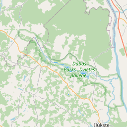
Карточка земельного участка (kадастровое обозначение:44800080088)
Кадастровое обозначение: 44800080088
Адрес: "Rubuļi", Pilskalnes pagasts, Augšdaugavas novads, LV-5447
Кадастровое обозначение недвижимого имущества | |
|---|---|
Тип кадастрового объекта | Тип кадастрового объекта: Земельная единица |
Адрес | Адрес: "Rubuļi", Pilskalnes pagasts, Augšdaugavas novads, LV-5447 |
Кадастровый номер недвижимого имущества, в которое входит данный земельный участок | Кадастровый номер недвижимого имущества, в которое входит данный земельный участок: 44800080088 |
Адрес | |
|---|---|
Идентификатор адреса | Идентификатор адреса: 103569543 |
Kомпании, зарегистрированные по адресу
| Kомпании, зарегистрированные по адресу
: 0 |
Подразделения, зарегистрированные по адресу
| Подразделения, зарегистрированные по адресу
: 0 |
Учреждения, зарегистрированные по адресу
| Учреждения, зарегистрированные по адресу
: 0 |
Недвижимость по адресу
| |
Сделки по адресу
| Сделки по адресу
: 0 |
|
|
|
{"7201060210":{"name":"<div class='color_dot' style='background-color: #00ffff'><\/div><span>\u0423\u043a\u0430\u0437\u0430\u043d\u043d\u0430\u044f \u0437\u0435\u043c\u0435\u043b\u044c\u043d\u0430\u044f \u0435\u0434\u0438\u043d\u0438\u0446\u0430<\/span>","featureColor":"#00ffff","features":{"type":"FeatureCollection","features":[{"type":"Feature","geometry":{"type":"Polygon","coordinates":[[[26.226446868,55.963168642],[26.227126152,55.962959421],[26.227126546,55.962959297],[26.227126924,55.962959183],[26.22802892,55.96268779],[26.228606245,55.962965381],[26.228968176,55.963069317],[26.229331009,55.963185585],[26.229149935,55.963282332],[26.228550597,55.963590778],[26.227986922,55.96387254],[26.227389004,55.964159996],[26.227269357,55.964243955],[26.227141701,55.964443701],[26.226959083,55.964402774],[26.226446868,55.963168642]]]},"crs":{"type":"name","properties":{"name":"urn:ogc:def:crs:EPSG:3059"}},"properties":{"style":{"color":"#00ffff","dashArray":"8,12","weight":1},"name":"\u0417\u0435\u043c\u043b\u044f","object_type":"Parcel","parcel_code":"44800090080","code":null,"surveyor":null,"address":"","ownership":"<span>\u0412\u043b\u0430\u0434\u0435\u043b\u0435\u0446 - \u0424\u0438\u0437\u0438\u0447\u0435\u0441\u043a\u043e\u0435 \u043b\u0438\u0446\u043e<br><\/span>","pro_cadastre_nr":"44800080088"}},{"type":"Feature","geometry":{"type":"Polygon","coordinates":[[[26.276156296,55.980150799],[26.276167227,55.980124039],[26.276224197,55.980000979],[26.276311018,55.979888325],[26.279173181,55.979909794],[26.279215711,55.979910365],[26.279225619,55.98009619],[26.279226704,55.980116536],[26.279234866,55.980186587],[26.279197521,55.980186154],[26.276222065,55.980151562],[26.276156296,55.980150799]]]},"crs":{"type":"name","properties":{"name":"urn:ogc:def:crs:EPSG:3059"}},"properties":{"style":{"color":"#00ffff","dashArray":"8,12","weight":1},"name":"\u0417\u0435\u043c\u043b\u044f","object_type":"Parcel","parcel_code":"44800080339","code":null,"surveyor":null,"address":"","ownership":"<span>\u0412\u043b\u0430\u0434\u0435\u043b\u0435\u0446 - \u0424\u0438\u0437\u0438\u0447\u0435\u0441\u043a\u043e\u0435 \u043b\u0438\u0446\u043e<br><\/span>","pro_cadastre_nr":"44800080088"}},{"type":"Feature","geometry":{"type":"Polygon","coordinates":[[[26.250960625,55.989191118],[26.251333736,55.989010996],[26.251334785,55.989010564],[26.251335817,55.989010114],[26.251700116,55.988846149],[26.251700366,55.988846037],[26.251700631,55.988845915],[26.252085367,55.988667834],[26.252461541,55.988503885],[26.252462432,55.988503491],[26.252463306,55.988503079],[26.252814581,55.988334523],[26.253233939,55.988158655],[26.253739042,55.987991059],[26.253740033,55.987990726],[26.253741006,55.987990376],[26.254134416,55.987845105],[26.254135075,55.987844859],[26.254459997,55.987728396],[26.254909647,55.987590839],[26.255516032,55.98795892],[26.253383988,55.988445868],[26.252420782,55.989658057],[26.250960625,55.989191118]]]},"crs":{"type":"name","properties":{"name":"urn:ogc:def:crs:EPSG:3059"}},"properties":{"style":{"color":"#00ffff","dashArray":"8,12","weight":1},"name":"\u0417\u0435\u043c\u043b\u044f","object_type":"Parcel","parcel_code":"44800080335","code":null,"surveyor":null,"address":"","ownership":"<span>\u0412\u043b\u0430\u0434\u0435\u043b\u0435\u0446 - \u0424\u0438\u0437\u0438\u0447\u0435\u0441\u043a\u043e\u0435 \u043b\u0438\u0446\u043e<br><\/span>","pro_cadastre_nr":"44800080088"}},{"type":"Feature","geometry":{"type":"Polygon","coordinates":[[[26.225334022,55.992519953],[26.22557889,55.991463896],[26.225978711,55.990356948],[26.225978767,55.990356794],[26.226113548,55.990039034],[26.228883231,55.990423649],[26.229191687,55.990460699],[26.229300468,55.992358536],[26.225334022,55.992519953]]]},"crs":{"type":"name","properties":{"name":"urn:ogc:def:crs:EPSG:3059"}},"properties":{"style":{"color":"#00ffff","dashArray":"8,12","weight":1},"name":"\u0417\u0435\u043c\u043b\u044f","object_type":"Parcel","parcel_code":"44800080101","code":null,"surveyor":null,"address":"","ownership":"<span>\u0412\u043b\u0430\u0434\u0435\u043b\u0435\u0446 - \u0424\u0438\u0437\u0438\u0447\u0435\u0441\u043a\u043e\u0435 \u043b\u0438\u0446\u043e<br><\/span>","pro_cadastre_nr":"44800080088"}},{"type":"Feature","geometry":{"type":"Polygon","coordinates":[[[26.25003991,55.989018527],[26.250741745,55.988603258],[26.25126114,55.987820734],[26.251542947,55.987740792],[26.252600119,55.988066138],[26.253149816,55.988092885],[26.252755711,55.988291902],[26.252754459,55.988292437],[26.252753242,55.988293008],[26.252401639,55.988461722],[26.252025794,55.988625531],[26.252025231,55.988625775],[26.252024684,55.988626028],[26.251639652,55.98880424],[26.251276635,55.988967632],[26.250942474,55.989102006],[26.250512775,55.989245151],[26.25003991,55.989018527]]]},"crs":{"type":"name","properties":{"name":"urn:ogc:def:crs:EPSG:3059"}},"properties":{"style":{"color":"#00ffff","dashArray":"8,12","weight":1},"name":"\u0417\u0435\u043c\u043b\u044f","object_type":"Parcel","parcel_code":"44800080090","code":null,"surveyor":null,"address":"","ownership":"<span>\u0412\u043b\u0430\u0434\u0435\u043b\u0435\u0446 - \u0424\u0438\u0437\u0438\u0447\u0435\u0441\u043a\u043e\u0435 \u043b\u0438\u0446\u043e<br><\/span>","pro_cadastre_nr":"44800080088"}},{"type":"Feature","geometry":{"type":"Polygon","coordinates":[[[26.240433189,55.999258032],[26.241548702,55.997957273],[26.241737935,55.997762667],[26.241886017,55.997660321],[26.241984288,55.997618665],[26.242067746,55.997528098],[26.242180036,55.997611356],[26.2446245,55.99926355],[26.247031697,55.998558282],[26.247106956,55.998527773],[26.247552956,55.998849592],[26.247524927,55.998864879],[26.247369564,55.998965388],[26.247144566,55.999050764],[26.246933815,55.999146207],[26.246782454,55.999236127],[26.246612518,55.999393459],[26.246515341,55.99946749],[26.246314164,55.999541133],[26.246113038,55.999591084],[26.245917312,55.999622422],[26.24575074,55.999653417],[26.24560416,55.999677657],[26.245598248,55.999663106],[26.24367798,56.000517124],[26.2404719,55.999273183],[26.240433189,55.999258032]]]},"crs":{"type":"name","properties":{"name":"urn:ogc:def:crs:EPSG:3059"}},"properties":{"style":{"color":"#00ffff","dashArray":"8,12","weight":1},"name":"\u0417\u0435\u043c\u043b\u044f","object_type":"Parcel","parcel_code":"44800080089","code":null,"surveyor":null,"address":"","ownership":"<span>\u0412\u043b\u0430\u0434\u0435\u043b\u0435\u0446 - \u0424\u0438\u0437\u0438\u0447\u0435\u0441\u043a\u043e\u0435 \u043b\u0438\u0446\u043e<br><\/span>","pro_cadastre_nr":"44800080088"}},{"type":"Feature","geometry":{"type":"Polygon","coordinates":[[[26.256253767,55.987000382],[26.256272445,55.986992383],[26.256532326,55.986854789],[26.256532668,55.986854612],[26.256532994,55.986854426],[26.256831244,55.986690208],[26.257136642,55.98653286],[26.257371118,55.986421083],[26.257574367,55.986336625],[26.257831234,55.986254195],[26.258084747,55.986178045],[26.258087501,55.98617715],[26.258090137,55.986176158],[26.258312315,55.986086444],[26.258312691,55.986086294],[26.258313066,55.986086134],[26.258647514,55.985945425],[26.258648092,55.985945181],[26.258648671,55.985944928],[26.258913338,55.98582642],[26.259277019,55.985675188],[26.25951726,55.985581331],[26.259632881,55.986364105],[26.256529093,55.987385402],[26.256253767,55.987000382]]]},"crs":{"type":"name","properties":{"name":"urn:ogc:def:crs:EPSG:3059"}},"properties":{"style":{"color":"#00ffff","dashArray":"8,12","weight":1},"name":"\u0417\u0435\u043c\u043b\u044f","object_type":"Parcel","parcel_code":"44800080088","code":null,"surveyor":null,"address":"\"Rubu\u013ci\", Pilskalnes pag., Aug\u0161daugavas nov., LV-5447","ownership":"<span>\u0412\u043b\u0430\u0434\u0435\u043b\u0435\u0446 - \u0424\u0438\u0437\u0438\u0447\u0435\u0441\u043a\u043e\u0435 \u043b\u0438\u0446\u043e<br><\/span>","pro_cadastre_nr":"44800080088"}}]}},"7201060110":{"name":"<div class='color_dot' style='background-color: #00ffff'><\/div><span>\u0418\u0437\u043c\u0435\u0440\u0435\u043d\u043d\u0430\u044f \u0437\u0435\u043c\u0435\u043b\u044c\u043d\u0430\u044f \u0435\u0434\u0438\u043d\u0438\u0446\u0430<\/span>","featureColor":"#00ffff","features":{"type":"FeatureCollection","features":[{"type":"Feature","geometry":{"type":"Polygon","coordinates":[[[26.273273455,55.982990327],[26.273568356,55.982942815],[26.274029043,55.98290356],[26.274462324,55.982866633],[26.274962331,55.982814209],[26.275488157,55.982775327],[26.275698491,55.982759777],[26.275771021,55.982807052],[26.275724685,55.98283124],[26.275689018,55.982854493],[26.27566531,55.982875009],[26.275650455,55.982892306],[26.275633692,55.982919686],[26.275626754,55.982947317],[26.275631725,55.982975707],[26.275641887,55.98300596],[26.275698127,55.98313286],[26.27556446,55.983152045],[26.274629834,55.983286157],[26.273476603,55.983386843],[26.273438403,55.983390181],[26.273403303,55.983220989],[26.273329695,55.983067922],[26.273273455,55.982990327]]]},"crs":{"type":"name","properties":{"name":"urn:ogc:def:crs:EPSG:3059"}},"properties":{"style":{"color":"#00ffff","dashArray":"0","weight":1},"name":"\u0417\u0435\u043c\u043b\u044f","object_type":"Parcel","parcel_code":"44800080182","code":null,"surveyor":null,"address":"","ownership":"<span>\u0412\u043b\u0430\u0434\u0435\u043b\u0435\u0446 - \u0424\u0438\u0437\u0438\u0447\u0435\u0441\u043a\u043e\u0435 \u043b\u0438\u0446\u043e<br><\/span>","pro_cadastre_nr":"44800080088"}},{"type":"Feature","geometry":{"type":"Polygon","coordinates":[[[26.226113548,55.990039034],[26.226068314,55.987861174],[26.226950065,55.987990159],[26.228883231,55.990423649],[26.226113548,55.990039034]]]},"crs":{"type":"name","properties":{"name":"urn:ogc:def:crs:EPSG:3059"}},"properties":{"style":{"color":"#00ffff","dashArray":"0","weight":1},"name":"\u0417\u0435\u043c\u043b\u044f","object_type":"Parcel","parcel_code":"44800080103","code":null,"surveyor":null,"address":"","ownership":"<span>\u0412\u043b\u0430\u0434\u0435\u043b\u0435\u0446 - \u0424\u0438\u0437\u0438\u0447\u0435\u0441\u043a\u043e\u0435 \u043b\u0438\u0446\u043e<br><\/span>","pro_cadastre_nr":"44800080088"}}]}},"7114100000":{"name":"<div class='color_dot' style='background-color: #b40000'><\/div><span>\u0422\u0435\u0440\u0440\u0438\u0442\u043e\u0440\u0438\u044f \u0441\u0435\u0440\u0432\u0438\u0442\u0443\u0442\u0430 \u0434\u043e\u0440\u043e\u0436\u043d\u044b\u0445 \u043e\u0431\u0440\u0435\u043c\u0435\u043d\u0435\u043d\u0438\u0439<\/span>","featureColor":"#b40000","features":{"type":"FeatureCollection","features":[{"type":"Feature","geometry":{"type":"Polygon","coordinates":[[[26.279197458,55.980185904],[26.279173181,55.979909794],[26.279210596,55.979910603],[26.279226704,55.980116536],[26.279231377,55.980186418],[26.279197458,55.980185904]]]},"crs":{"type":"name","properties":{"name":"urn:ogc:def:crs:EPSG:3059"}},"properties":{"style":{"color":"#b40000","dashArray":"4,2,1,2","weight":1},"name":"\u0422\u0435\u0440\u0440\u0438\u0442\u043e\u0440\u0438\u044f \u0441\u0435\u0440\u0432\u0438\u0442\u0443\u0442\u0430 \u0434\u043e\u0440\u043e\u0436\u043d\u044b\u0445 \u043e\u0431\u0440\u0435\u043c\u0435\u043d\u0435\u043d\u0438\u0439","object_type":"WayRestriction","parcel_code":"44800080339","code":"7315030100002","surveyor":null,"address":"","ownership":"<span>\u0412\u043b\u0430\u0434\u0435\u043b\u0435\u0446 - \u0424\u0438\u0437\u0438\u0447\u0435\u0441\u043a\u043e\u0435 \u043b\u0438\u0446\u043e<br><\/span>","pro_cadastre_nr":"44800080088"}},{"type":"Feature","geometry":{"type":"Polygon","coordinates":[[[26.240433189,55.999258032],[26.241548702,55.997957273],[26.241737935,55.997762667],[26.241886017,55.997660321],[26.241984288,55.997618665],[26.24210744,55.997599007],[26.242133895,55.997619377],[26.242020442,55.997632603],[26.241911717,55.997681504],[26.241790637,55.997757997],[26.241646657,55.997920944],[26.2404719,55.999273183],[26.240433189,55.999258032]]]},"crs":{"type":"name","properties":{"name":"urn:ogc:def:crs:EPSG:3059"}},"properties":{"style":{"color":"#b40000","dashArray":"4,2,1,2","weight":1},"name":"\u0422\u0435\u0440\u0440\u0438\u0442\u043e\u0440\u0438\u044f \u0441\u0435\u0440\u0432\u0438\u0442\u0443\u0442\u0430 \u0434\u043e\u0440\u043e\u0436\u043d\u044b\u0445 \u043e\u0431\u0440\u0435\u043c\u0435\u043d\u0435\u043d\u0438\u0439","object_type":"WayRestriction","parcel_code":"44800080089","code":"7315030100001","surveyor":null,"address":"","ownership":"<span>\u0412\u043b\u0430\u0434\u0435\u043b\u0435\u0446 - \u0424\u0438\u0437\u0438\u0447\u0435\u0441\u043a\u043e\u0435 \u043b\u0438\u0446\u043e<br><\/span>","pro_cadastre_nr":"44800080088"}},{"type":"Feature","geometry":{"type":"Polygon","coordinates":[[[26.247552956,55.998849592],[26.247526979,55.998863754],[26.247031697,55.998558282],[26.247106956,55.998527773],[26.247552956,55.998849592]]]},"crs":{"type":"name","properties":{"name":"urn:ogc:def:crs:EPSG:3059"}},"properties":{"style":{"color":"#b40000","dashArray":"4,2,1,2","weight":1},"name":"\u0422\u0435\u0440\u0440\u0438\u0442\u043e\u0440\u0438\u044f \u0441\u0435\u0440\u0432\u0438\u0442\u0443\u0442\u0430 \u0434\u043e\u0440\u043e\u0436\u043d\u044b\u0445 \u043e\u0431\u0440\u0435\u043c\u0435\u043d\u0435\u043d\u0438\u0439","object_type":"WayRestriction","parcel_code":"44800080089","code":"7315030100002","surveyor":null,"address":"","ownership":"<span>\u0412\u043b\u0430\u0434\u0435\u043b\u0435\u0446 - \u0424\u0438\u0437\u0438\u0447\u0435\u0441\u043a\u043e\u0435 \u043b\u0438\u0446\u043e<br><\/span>","pro_cadastre_nr":"44800080088"}}]}},"5201011310":{"name":"<div class='color_dot' style='background-color: #960096'><\/div><span>\u0412\u0435\u043a\u0442\u043e\u0440\u0438\u0437\u043e\u0432\u0430\u043d\u043d\u043e\u0435 \u0437\u0434\u0430\u043d\u0438\u0435<\/span>","featureColor":"#960096","features":{"type":"FeatureCollection","features":[{"type":"Feature","geometry":{"type":"Polygon","coordinates":[[[26.258254874,55.98619568],[26.258362562,55.986147763],[26.258427542,55.986193649],[26.258319853,55.986241567],[26.258254874,55.98619568]]]},"crs":{"type":"name","properties":{"name":"urn:ogc:def:crs:EPSG:3059"}},"properties":{"style":{"color":"#960096","dashArray":"0","weight":2},"name":"\u0417\u0434\u0430\u043d\u0438\u044f","object_type":"Building","parcel_code":"44800080088","code":"44800080088001","surveyor":null,"address":"\"Rubu\u013ci\", Pilskalnes pag., Aug\u0161daugavas nov., LV-5447","ownership":"<span>\u0412\u043b\u0430\u0434\u0435\u043b\u0435\u0446 - \u0424\u0438\u0437\u0438\u0447\u0435\u0441\u043a\u043e\u0435 \u043b\u0438\u0446\u043e<br><\/span>","pro_cadastre_nr":"44805080009"}},{"type":"Feature","geometry":{"type":"Polygon","coordinates":[[[26.258253471,55.986374253],[26.258326967,55.986338808],[26.258377448,55.986371694],[26.258303952,55.986407139],[26.258253471,55.986374253]]]},"crs":{"type":"name","properties":{"name":"urn:ogc:def:crs:EPSG:3059"}},"properties":{"style":{"color":"#960096","dashArray":"0","weight":2},"name":"\u0417\u0434\u0430\u043d\u0438\u044f","object_type":"Building","parcel_code":"44800080088","code":"44800080088006","surveyor":null,"address":"\"Rubu\u013ci\", Pilskalnes pag., Aug\u0161daugavas nov., LV-5447","ownership":"<span>\u0412\u043b\u0430\u0434\u0435\u043b\u0435\u0446 - \u0424\u0438\u0437\u0438\u0447\u0435\u0441\u043a\u043e\u0435 \u043b\u0438\u0446\u043e<br><\/span>","pro_cadastre_nr":"44805080009"}},{"type":"Feature","geometry":{"type":"Polygon","coordinates":[[[26.258711394,55.986489836],[26.258733701,55.98647644],[26.258775277,55.986498201],[26.25875297,55.986511597],[26.258711394,55.986489836]]]},"crs":{"type":"name","properties":{"name":"urn:ogc:def:crs:EPSG:3059"}},"properties":{"style":{"color":"#960096","dashArray":"0","weight":2},"name":"\u0417\u0434\u0430\u043d\u0438\u044f","object_type":"Building","parcel_code":"44800080088","code":"44800080088005","surveyor":null,"address":"\"Rubu\u013ci\", Pilskalnes pag., Aug\u0161daugavas nov., LV-5447","ownership":"<span>\u0412\u043b\u0430\u0434\u0435\u043b\u0435\u0446 - \u0424\u0438\u0437\u0438\u0447\u0435\u0441\u043a\u043e\u0435 \u043b\u0438\u0446\u043e<br><\/span>","pro_cadastre_nr":"44805080009"}},{"type":"Feature","geometry":{"type":"Polygon","coordinates":[[[26.258052983,55.986259102],[26.258129571,55.986223627],[26.258216827,55.98628282],[26.258140238,55.986318295],[26.258052983,55.986259102]]]},"crs":{"type":"name","properties":{"name":"urn:ogc:def:crs:EPSG:3059"}},"properties":{"style":{"color":"#960096","dashArray":"0","weight":2},"name":"\u0417\u0434\u0430\u043d\u0438\u044f","object_type":"Building","parcel_code":"44800080088","code":"44800080088002","surveyor":null,"address":"\"Rubu\u013ci\", Pilskalnes pag., Aug\u0161daugavas nov., LV-5447","ownership":"<span>\u0412\u043b\u0430\u0434\u0435\u043b\u0435\u0446 - \u0424\u0438\u0437\u0438\u0447\u0435\u0441\u043a\u043e\u0435 \u043b\u0438\u0446\u043e<br><\/span>","pro_cadastre_nr":"44805080009"}},{"type":"Feature","geometry":{"type":"Polygon","coordinates":[[[26.258733701,55.98647644],[26.258786616,55.986444661],[26.258828208,55.986466422],[26.258775277,55.986498201],[26.258733701,55.98647644]]]},"crs":{"type":"name","properties":{"name":"urn:ogc:def:crs:EPSG:3059"}},"properties":{"style":{"color":"#960096","dashArray":"0","weight":2},"name":"\u0417\u0434\u0430\u043d\u0438\u044f","object_type":"Building","parcel_code":"44800080088","code":"44800080088004","surveyor":null,"address":"\"Rubu\u013ci\", Pilskalnes pag., Aug\u0161daugavas nov., LV-5447","ownership":"<span>\u0412\u043b\u0430\u0434\u0435\u043b\u0435\u0446 - \u0424\u0438\u0437\u0438\u0447\u0435\u0441\u043a\u043e\u0435 \u043b\u0438\u0446\u043e<br><\/span>","pro_cadastre_nr":"44805080009"}}]}}}
{"7201060110":{"name":"<div class='color_dot' style='background-color: #00ffff'><\/div><span>\u0418\u0437\u043c\u0435\u0440\u0435\u043d\u043d\u0430\u044f \u0437\u0435\u043c\u0435\u043b\u044c\u043d\u0430\u044f \u0435\u0434\u0438\u043d\u0438\u0446\u0430<\/span>","featureColor":"#00ffff","features":{"type":"FeatureCollection","features":[{"type":"Feature","geometry":{"type":"Polygon","coordinates":[[[26.273273455,55.982990327],[26.273568356,55.982942815],[26.274029043,55.98290356],[26.274462324,55.982866633],[26.274962331,55.982814209],[26.275436743,55.982779135],[26.275698491,55.982759777],[26.275771021,55.982807052],[26.275724685,55.98283124],[26.275689018,55.982854493],[26.27566531,55.982875009],[26.275650455,55.982892306],[26.275633692,55.982919686],[26.275626754,55.982947317],[26.275631725,55.982975707],[26.275641887,55.98300596],[26.275698127,55.98313286],[26.27556446,55.983152045],[26.274629834,55.983286157],[26.273476603,55.983386843],[26.273438403,55.983390181],[26.273403303,55.983220989],[26.273329695,55.983067922],[26.273273455,55.982990327]]]},"crs":{"type":"name","properties":{"name":"urn:ogc:def:crs:EPSG:3059"}},"properties":{"style":{"color":"#00ffff","dashArray":"0","weight":1},"name":"\u0417\u0435\u043c\u043b\u044f","object_type":"Parcel","parcel_code":"44800080182","code":null,"surveyor":null,"address":"","ownership":null,"pro_cadastre_nr":null}}]}}}
https://tile.openstreetmap.org/{z}/{x}/{y}.png|© OpenStreetMap contributors|minZoom: 7|maxZoom: 19
|
Обновлены данные о земельных единицах: 10.01.2025.
Источник данных и лицензия: открытые текстовые и пространственные данные кадастровой информационной системы, открытые данные базы данных рынка недвижимости, лицензия на открытые данные Creative Commons Attribution, OpenStreetMap

