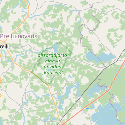
Строение (кадастровое обозначение):76700120114005)
Кадастровое обозначение: 76700120114005
Адрес: Preiļu šoseja 7, Aglonas stacija, Rušonas pagasts, Preiļu novads, LV-5329
Кадастровое обозначение недвижимого имущества | |
|---|---|
Тип кадастрового объекта | Тип кадастрового объекта: Здание |
Адрес | Адрес: Preiļu šoseja 7, Aglonas stacija, Rušonas pagasts, Preiļu novads, LV-5329 |
Адрес | |
|---|---|
Идентификатор адреса | Идентификатор адреса: 104344093 |
Kомпании, зарегистрированные по адресу
| Kомпании, зарегистрированные по адресу
: 0 |
Подразделения, зарегистрированные по адресу
| Подразделения, зарегистрированные по адресу
: 0 |
Учреждения, зарегистрированные по адресу
| Учреждения, зарегистрированные по адресу
: 0 |
Недвижимость по адресу
| Недвижимость по адресу
: 0 |
Сделки по адресу
| Сделки по адресу
: 0 |
| Тип кадастрового объекта | Кадастровое обозначение кадастрового объекта | Статус права собственности лица | Статус персоны | Земельная книга |
|---|---|---|---|---|
| Тип кадастрового объекта: Здание | 76700120114005 | Статус права собственности лица: Hет данных | Статус персоны: Hет данных | Земельная книга |
09.01.2025. State land service data
|
|
|
{"7201060210":{"name":"<div class='color_dot' style='background-color: #00ffff'><\/div><span>\u0423\u043a\u0430\u0437\u0430\u043d\u043d\u0430\u044f \u0437\u0435\u043c\u0435\u043b\u044c\u043d\u0430\u044f \u0435\u0434\u0438\u043d\u0438\u0446\u0430<\/span>","featureColor":"#00ffff","features":{"type":"FeatureCollection","features":[{"type":"Feature","geometry":{"type":"Polygon","coordinates":[[[26.949284179,56.171531058],[26.951776213,56.169793334],[26.952645869,56.169187898],[26.95321472,56.168791861],[26.953616366,56.168914956],[26.955718521,56.169559315],[26.95708695,56.169986642],[26.955369756,56.170407085],[26.950147848,56.171845876],[26.949755887,56.171699111],[26.949284179,56.171531058]]]},"crs":{"type":"name","properties":{"name":"urn:ogc:def:crs:EPSG:3059"}},"properties":{"style":{"color":"#00ffff","dashArray":"8,12","weight":1},"name":"\u0417\u0435\u043c\u043b\u044f","object_type":"Parcel","parcel_code":"76700120134","code":null,"surveyor":null,"address":"\"Z\u012bles\", Breidaki, Ru\u0161onas pag., Prei\u013cu nov., LV-5329","ownership":"<span>\u0412\u043b\u0430\u0434\u0435\u043b\u0435\u0446 - \u0424\u0438\u0437\u0438\u0447\u0435\u0441\u043a\u043e\u0435 \u043b\u0438\u0446\u043e<br><\/span>","pro_cadastre_nr":"76700120134"}}]}},"7201060110":{"name":"<div class='color_dot' style='background-color: #00ffff'><\/div><span>\u0418\u0437\u043c\u0435\u0440\u0435\u043d\u043d\u0430\u044f \u0437\u0435\u043c\u0435\u043b\u044c\u043d\u0430\u044f \u0435\u0434\u0438\u043d\u0438\u0446\u0430<\/span>","featureColor":"#00ffff","features":{"type":"FeatureCollection","features":[{"type":"Feature","geometry":{"type":"Polygon","coordinates":[[[26.889869311,56.175530137],[26.890578406,56.175258367],[26.891353847,56.175754573],[26.890611712,56.175952413],[26.890305478,56.175792517],[26.890064042,56.175631742],[26.889869311,56.175530137]]]},"crs":{"type":"name","properties":{"name":"urn:ogc:def:crs:EPSG:3059"}},"properties":{"style":{"color":"#00ffff","dashArray":"0","weight":1},"name":"\u0417\u0435\u043c\u043b\u044f","object_type":"Parcel","parcel_code":"76700120114","code":null,"surveyor":null,"address":"Prei\u013cu \u0161oseja 7, Aglonas stacija, Ru\u0161onas pag., Prei\u013cu nov., LV-5329","ownership":"<span>\u0412\u043b\u0430\u0434\u0435\u043b\u0435\u0446 - \u0424\u0438\u0437\u0438\u0447\u0435\u0441\u043a\u043e\u0435 \u043b\u0438\u0446\u043e<br><\/span>","pro_cadastre_nr":"76700120134"}}]}},"5201011310":{"name":"<div class='color_dot' style='background-color: #960096'><\/div><span>\u0412\u0435\u043a\u0442\u043e\u0440\u0438\u0437\u043e\u0432\u0430\u043d\u043d\u043e\u0435 \u0437\u0434\u0430\u043d\u0438\u0435<\/span>","featureColor":"#960096","features":{"type":"FeatureCollection","features":[{"type":"Feature","geometry":{"type":"Polygon","coordinates":[[[26.949921827,56.171619981],[26.949888784,56.171601578],[26.949866612,56.171613973],[26.94983357,56.171595579],[26.949978004,56.17151485],[26.950044089,56.171551646],[26.949921827,56.171619981]]]},"crs":{"type":"name","properties":{"name":"urn:ogc:def:crs:EPSG:3059"}},"properties":{"style":{"color":"#960096","dashArray":"0","weight":2},"name":"\u0417\u0434\u0430\u043d\u0438\u044f","object_type":"Building","parcel_code":"76700120134","code":"76700120134001","surveyor":null,"address":"\"Z\u012bles\", Breidaki, Ru\u0161onas pag., Prei\u013cu nov., LV-5329","ownership":"<span>\u0412\u043b\u0430\u0434\u0435\u043b\u0435\u0446 - \u0424\u0438\u0437\u0438\u0447\u0435\u0441\u043a\u043e\u0435 \u043b\u0438\u0446\u043e<br><\/span>","pro_cadastre_nr":"76700120134"}},{"type":"Feature","geometry":{"type":"Polygon","coordinates":[[[26.949921827,56.171619981],[26.949888784,56.171601578],[26.949866612,56.171613973],[26.94983357,56.171595579],[26.949978004,56.17151485],[26.950044089,56.171551646],[26.949921827,56.171619981]]]},"crs":{"type":"name","properties":{"name":"urn:ogc:def:crs:EPSG:3059"}},"properties":{"style":{"color":"#960096","dashArray":"0","weight":2},"name":"\u0417\u0434\u0430\u043d\u0438\u044f","object_type":"Building","parcel_code":"76700120134","code":"76700120134001","surveyor":null,"address":"\"Z\u012bles\", Breidaki, Ru\u0161onas pag., Prei\u013cu nov., LV-5329","ownership":"<span>\u0412\u043b\u0430\u0434\u0435\u043b\u0435\u0446 - \u0424\u0438\u0437\u0438\u0447\u0435\u0441\u043a\u043e\u0435 \u043b\u0438\u0446\u043e<br><\/span>","pro_cadastre_nr":"76700120134"}}]}},"5201011110":{"name":"<div class='color_dot' style='background-color: #ff0000'><\/div><span>\u0418\u0437\u043c\u0435\u0440\u0435\u043d\u043d\u043e\u0435 \u0437\u0434\u0430\u043d\u0438\u0435 <\/span>","featureColor":"#ff0000","features":{"type":"FeatureCollection","features":[{"type":"Feature","geometry":{"type":"Polygon","coordinates":[[[26.890231977,56.175720068],[26.890213436,56.175704735],[26.890256007,56.175686246],[26.890279082,56.17570079],[26.890231977,56.175720068]]]},"crs":{"type":"name","properties":{"name":"urn:ogc:def:crs:EPSG:3059"}},"properties":{"style":{"color":"#ff0000","dashArray":"0","weight":1},"name":"\u0417\u0434\u0430\u043d\u0438\u044f","object_type":"Building","parcel_code":"76700120114","code":"76700120114002","surveyor":null,"address":"Prei\u013cu \u0161oseja 7, Aglonas stacija, Ru\u0161onas pag., Prei\u013cu nov., LV-5329","ownership":"<span>\u0412\u043b\u0430\u0434\u0435\u043b\u0435\u0446 - \u0424\u0438\u0437\u0438\u0447\u0435\u0441\u043a\u043e\u0435 \u043b\u0438\u0446\u043e<br><\/span>","pro_cadastre_nr":"76700120134"}},{"type":"Feature","geometry":{"type":"Polygon","coordinates":[[[26.890240868,56.175727087],[26.890318222,56.175696899],[26.89030085,56.175683399],[26.890334189,56.175670709],[26.890351287,56.175683999],[26.890385259,56.175670736],[26.890384009,56.175669768],[26.890391756,56.175666701],[26.890397233,56.17567096],[26.890395527,56.175671638],[26.890430904,56.175699135],[26.890432576,56.175698439],[26.890438245,56.175702684],[26.890430447,56.175705914],[26.8904292,56.175704972],[26.890286755,56.175762761],[26.890240868,56.175727087]]]},"crs":{"type":"name","properties":{"name":"urn:ogc:def:crs:EPSG:3059"}},"properties":{"style":{"color":"#ff0000","dashArray":"0","weight":1},"name":"\u0417\u0434\u0430\u043d\u0438\u044f","object_type":"Building","parcel_code":"76700120114","code":"76700120114001","surveyor":null,"address":"Prei\u013cu \u0161oseja 7, Aglonas stacija, Ru\u0161onas pag., Prei\u013cu nov., LV-5329","ownership":"<span>\u0412\u043b\u0430\u0434\u0435\u043b\u0435\u0446 - \u0424\u0438\u0437\u0438\u0447\u0435\u0441\u043a\u043e\u0435 \u043b\u0438\u0446\u043e<br><\/span>","pro_cadastre_nr":"76700120134"}},{"type":"Feature","geometry":{"type":"Polygon","coordinates":[[[26.890212278,56.175703899],[26.890177838,56.17567923],[26.890184783,56.175676218],[26.890394314,56.175585219],[26.890434112,56.175612567],[26.890256007,56.175686246],[26.890213436,56.175704735],[26.890212278,56.175703899]]]},"crs":{"type":"name","properties":{"name":"urn:ogc:def:crs:EPSG:3059"}},"properties":{"style":{"color":"#ff0000","dashArray":"0","weight":1},"name":"\u0417\u0434\u0430\u043d\u0438\u044f","object_type":"Building","parcel_code":"76700120114","code":"76700120114005","surveyor":null,"address":"Prei\u013cu \u0161oseja 7, Aglonas stacija, Ru\u0161onas pag., Prei\u013cu nov., LV-5329","ownership":"<span>\u0412\u043b\u0430\u0434\u0435\u043b\u0435\u0446 - \u0424\u0438\u0437\u0438\u0447\u0435\u0441\u043a\u043e\u0435 \u043b\u0438\u0446\u043e<br><\/span>","pro_cadastre_nr":"76700120134"}},{"type":"Feature","geometry":{"type":"Polygon","coordinates":[[[26.890212278,56.175703899],[26.890193692,56.175711975],[26.89013022,56.175662734],[26.890151621,56.175652454],[26.890184783,56.175676218],[26.890177838,56.17567923],[26.890212278,56.175703899]]]},"crs":{"type":"name","properties":{"name":"urn:ogc:def:crs:EPSG:3059"}},"properties":{"style":{"color":"#ff0000","dashArray":"0","weight":1},"name":"\u0417\u0434\u0430\u043d\u0438\u044f","object_type":"Building","parcel_code":"76700120114","code":"76700120114004","surveyor":null,"address":"Prei\u013cu \u0161oseja 7, Aglonas stacija, Ru\u0161onas pag., Prei\u013cu nov., LV-5329","ownership":"<span>\u0412\u043b\u0430\u0434\u0435\u043b\u0435\u0446 - \u0424\u0438\u0437\u0438\u0447\u0435\u0441\u043a\u043e\u0435 \u043b\u0438\u0446\u043e<br><\/span>","pro_cadastre_nr":"76700120134"}},{"type":"Feature","geometry":{"type":"Polygon","coordinates":[[[26.890241605,56.175592648],[26.890205775,56.175568119],[26.890242503,56.17555036],[26.890279268,56.175575532],[26.890241605,56.175592648]]]},"crs":{"type":"name","properties":{"name":"urn:ogc:def:crs:EPSG:3059"}},"properties":{"style":{"color":"#ff0000","dashArray":"0","weight":1},"name":"\u0417\u0434\u0430\u043d\u0438\u044f","object_type":"Building","parcel_code":"76700120114","code":"76700120114008","surveyor":null,"address":"Prei\u013cu \u0161oseja 7, Aglonas stacija, Ru\u0161onas pag., Prei\u013cu nov., LV-5329","ownership":"<span>\u0412\u043b\u0430\u0434\u0435\u043b\u0435\u0446 - \u0424\u0438\u0437\u0438\u0447\u0435\u0441\u043a\u043e\u0435 \u043b\u0438\u0446\u043e<br><\/span>","pro_cadastre_nr":"76700120134"}},{"type":"Feature","geometry":{"type":"Polygon","coordinates":[[[26.890550213,56.175518836],[26.890490961,56.175483296],[26.890485872,56.175480116],[26.890482854,56.17547642],[26.890483391,56.175472407],[26.890487129,56.17546876],[26.89050812,56.17545581],[26.890513229,56.175453686],[26.890519716,56.175452941],[26.890526527,56.175453726],[26.890531883,56.175455731],[26.890596735,56.175494817],[26.890550213,56.175518836]]]},"crs":{"type":"name","properties":{"name":"urn:ogc:def:crs:EPSG:3059"}},"properties":{"style":{"color":"#ff0000","dashArray":"0","weight":1},"name":"\u0417\u0434\u0430\u043d\u0438\u044f","object_type":"Building","parcel_code":"76700120114","code":"76700120114012","surveyor":null,"address":"Prei\u013cu \u0161oseja 7, Aglonas stacija, Ru\u0161onas pag., Prei\u013cu nov., LV-5329","ownership":"<span>\u0412\u043b\u0430\u0434\u0435\u043b\u0435\u0446 - \u0424\u0438\u0437\u0438\u0447\u0435\u0441\u043a\u043e\u0435 \u043b\u0438\u0446\u043e<br><\/span>","pro_cadastre_nr":"76700120134"}},{"type":"Feature","geometry":{"type":"Polygon","coordinates":[[[26.890042917,56.175609467],[26.890119238,56.175575186],[26.890160889,56.175604047],[26.890084568,56.175638327],[26.890042917,56.175609467]]]},"crs":{"type":"name","properties":{"name":"urn:ogc:def:crs:EPSG:3059"}},"properties":{"style":{"color":"#ff0000","dashArray":"0","weight":1},"name":"\u0417\u0434\u0430\u043d\u0438\u044f","object_type":"Building","parcel_code":"76700120114","code":"76700120114009","surveyor":null,"address":"Prei\u013cu \u0161oseja 7, Aglonas stacija, Ru\u0161onas pag., Prei\u013cu nov., LV-5329","ownership":"<span>\u0412\u043b\u0430\u0434\u0435\u043b\u0435\u0446 - \u0424\u0438\u0437\u0438\u0447\u0435\u0441\u043a\u043e\u0435 \u043b\u0438\u0446\u043e<br><\/span>","pro_cadastre_nr":"76700120134"}},{"type":"Feature","geometry":{"type":"Polygon","coordinates":[[[26.890550213,56.175518836],[26.890490961,56.175483296],[26.890485872,56.175480116],[26.890482854,56.17547642],[26.890483391,56.175472407],[26.890487129,56.17546876],[26.89050812,56.17545581],[26.890513229,56.175453686],[26.890519716,56.175452941],[26.890526527,56.175453726],[26.890531883,56.175455731],[26.890596735,56.175494817],[26.890550213,56.175518836]]]},"crs":{"type":"name","properties":{"name":"urn:ogc:def:crs:EPSG:3059"}},"properties":{"style":{"color":"#ff0000","dashArray":"0","weight":1},"name":"\u0417\u0434\u0430\u043d\u0438\u044f","object_type":"Building","parcel_code":"76700120114","code":"76700120114012","surveyor":null,"address":"Prei\u013cu \u0161oseja 7, Aglonas stacija, Ru\u0161onas pag., Prei\u013cu nov., LV-5329","ownership":"<span>\u0412\u043b\u0430\u0434\u0435\u043b\u0435\u0446 - \u0424\u0438\u0437\u0438\u0447\u0435\u0441\u043a\u043e\u0435 \u043b\u0438\u0446\u043e<br><\/span>","pro_cadastre_nr":"76700120134"}},{"type":"Feature","geometry":{"type":"Polygon","coordinates":[[[26.890042917,56.175609467],[26.890119238,56.175575186],[26.890160889,56.175604047],[26.890084568,56.175638327],[26.890042917,56.175609467]]]},"crs":{"type":"name","properties":{"name":"urn:ogc:def:crs:EPSG:3059"}},"properties":{"style":{"color":"#ff0000","dashArray":"0","weight":1},"name":"\u0417\u0434\u0430\u043d\u0438\u044f","object_type":"Building","parcel_code":"76700120114","code":"76700120114009","surveyor":null,"address":"Prei\u013cu \u0161oseja 7, Aglonas stacija, Ru\u0161onas pag., Prei\u013cu nov., LV-5329","ownership":"<span>\u0412\u043b\u0430\u0434\u0435\u043b\u0435\u0446 - \u0424\u0438\u0437\u0438\u0447\u0435\u0441\u043a\u043e\u0435 \u043b\u0438\u0446\u043e<br><\/span>","pro_cadastre_nr":"76700120134"}},{"type":"Feature","geometry":{"type":"Polygon","coordinates":[[[26.890241605,56.175592648],[26.890205775,56.175568119],[26.890242503,56.17555036],[26.890279268,56.175575532],[26.890241605,56.175592648]]]},"crs":{"type":"name","properties":{"name":"urn:ogc:def:crs:EPSG:3059"}},"properties":{"style":{"color":"#ff0000","dashArray":"0","weight":1},"name":"\u0417\u0434\u0430\u043d\u0438\u044f","object_type":"Building","parcel_code":"76700120114","code":"76700120114008","surveyor":null,"address":"Prei\u013cu \u0161oseja 7, Aglonas stacija, Ru\u0161onas pag., Prei\u013cu nov., LV-5329","ownership":"<span>\u0412\u043b\u0430\u0434\u0435\u043b\u0435\u0446 - \u0424\u0438\u0437\u0438\u0447\u0435\u0441\u043a\u043e\u0435 \u043b\u0438\u0446\u043e<br><\/span>","pro_cadastre_nr":"76700120134"}},{"type":"Feature","geometry":{"type":"Polygon","coordinates":[[[26.890212278,56.175703899],[26.890177838,56.17567923],[26.890184783,56.175676218],[26.890394314,56.175585219],[26.890434112,56.175612567],[26.890256007,56.175686246],[26.890213436,56.175704735],[26.890212278,56.175703899]]]},"crs":{"type":"name","properties":{"name":"urn:ogc:def:crs:EPSG:3059"}},"properties":{"style":{"color":"#ff0000","dashArray":"0","weight":1},"name":"\u0417\u0434\u0430\u043d\u0438\u044f","object_type":"Building","parcel_code":"76700120114","code":"76700120114005","surveyor":null,"address":"Prei\u013cu \u0161oseja 7, Aglonas stacija, Ru\u0161onas pag., Prei\u013cu nov., LV-5329","ownership":"<span>\u0412\u043b\u0430\u0434\u0435\u043b\u0435\u0446 - \u0424\u0438\u0437\u0438\u0447\u0435\u0441\u043a\u043e\u0435 \u043b\u0438\u0446\u043e<br><\/span>","pro_cadastre_nr":"76700120134"}},{"type":"Feature","geometry":{"type":"Polygon","coordinates":[[[26.890212278,56.175703899],[26.890193692,56.175711975],[26.89013022,56.175662734],[26.890151621,56.175652454],[26.890184783,56.175676218],[26.890177838,56.17567923],[26.890212278,56.175703899]]]},"crs":{"type":"name","properties":{"name":"urn:ogc:def:crs:EPSG:3059"}},"properties":{"style":{"color":"#ff0000","dashArray":"0","weight":1},"name":"\u0417\u0434\u0430\u043d\u0438\u044f","object_type":"Building","parcel_code":"76700120114","code":"76700120114004","surveyor":null,"address":"Prei\u013cu \u0161oseja 7, Aglonas stacija, Ru\u0161onas pag., Prei\u013cu nov., LV-5329","ownership":"<span>\u0412\u043b\u0430\u0434\u0435\u043b\u0435\u0446 - \u0424\u0438\u0437\u0438\u0447\u0435\u0441\u043a\u043e\u0435 \u043b\u0438\u0446\u043e<br><\/span>","pro_cadastre_nr":"76700120134"}},{"type":"Feature","geometry":{"type":"Polygon","coordinates":[[[26.890231977,56.175720068],[26.890213436,56.175704735],[26.890256007,56.175686246],[26.890279082,56.17570079],[26.890231977,56.175720068]]]},"crs":{"type":"name","properties":{"name":"urn:ogc:def:crs:EPSG:3059"}},"properties":{"style":{"color":"#ff0000","dashArray":"0","weight":1},"name":"\u0417\u0434\u0430\u043d\u0438\u044f","object_type":"Building","parcel_code":"76700120114","code":"76700120114002","surveyor":null,"address":"Prei\u013cu \u0161oseja 7, Aglonas stacija, Ru\u0161onas pag., Prei\u013cu nov., LV-5329","ownership":"<span>\u0412\u043b\u0430\u0434\u0435\u043b\u0435\u0446 - \u0424\u0438\u0437\u0438\u0447\u0435\u0441\u043a\u043e\u0435 \u043b\u0438\u0446\u043e<br><\/span>","pro_cadastre_nr":"76700120134"}},{"type":"Feature","geometry":{"type":"Polygon","coordinates":[[[26.890240868,56.175727087],[26.890318222,56.175696899],[26.89030085,56.175683399],[26.890334189,56.175670709],[26.890351287,56.175683999],[26.890385259,56.175670736],[26.890384009,56.175669768],[26.890391756,56.175666701],[26.890397233,56.17567096],[26.890395527,56.175671638],[26.890430904,56.175699135],[26.890432576,56.175698439],[26.890438245,56.175702684],[26.890430447,56.175705914],[26.8904292,56.175704972],[26.890286755,56.175762761],[26.890240868,56.175727087]]]},"crs":{"type":"name","properties":{"name":"urn:ogc:def:crs:EPSG:3059"}},"properties":{"style":{"color":"#ff0000","dashArray":"0","weight":1},"name":"\u0417\u0434\u0430\u043d\u0438\u044f","object_type":"Building","parcel_code":"76700120114","code":"76700120114001","surveyor":null,"address":"Prei\u013cu \u0161oseja 7, Aglonas stacija, Ru\u0161onas pag., Prei\u013cu nov., LV-5329","ownership":"<span>\u0412\u043b\u0430\u0434\u0435\u043b\u0435\u0446 - \u0424\u0438\u0437\u0438\u0447\u0435\u0441\u043a\u043e\u0435 \u043b\u0438\u0446\u043e<br><\/span>","pro_cadastre_nr":"76700120134"}}]}}}
[]
https://tile.openstreetmap.org/{z}/{x}/{y}.png|© OpenStreetMap contributors|minZoom: 7|maxZoom: 19
|
Building data updated: 12.01.2025.
Источник данных и лицензия: открытые текстовые и пространственные данные кадастровой информационной системы, открытые данные базы данных рынка недвижимости, лицензия на открытые данные Creative Commons Attribution, OpenStreetMap

