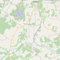
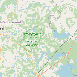
Строение (кадастровое обозначение):76480030145001)
Кадастровое обозначение: 76480030145001
Адрес: "Rūķēni", Marinski, Galēnu pagasts, Preiļu novads, LV-5311
Кадастровое обозначение недвижимого имущества | |
|---|---|
Тип кадастрового объекта | Тип кадастрового объекта: Здание |
Адрес | Адрес: "Rūķēni", Marinski, Galēnu pagasts, Preiļu novads, LV-5311 |
Адрес | |
|---|---|
Идентификатор адреса | Идентификатор адреса: 103921008 |
Kомпании, зарегистрированные по адресу
| |
Подразделения, зарегистрированные по адресу
| Подразделения, зарегистрированные по адресу
: 0 |
Учреждения, зарегистрированные по адресу
| Учреждения, зарегистрированные по адресу
: 0 |
Недвижимость по адресу
| |
Сделки по адресу
| Сделки по адресу
: 0 |
| Тип кадастрового объекта | Кадастровое обозначение кадастрового объекта | Статус права собственности лица | Статус персоны | Земельная книга |
|---|---|---|---|---|
| Тип кадастрового объекта: Здание | 76480030145001 | Статус права собственности лица: Hет данных | Статус персоны: Hет данных | Земельная книга |
09.01.2025. State land service data
|
|
|
{"7201060210":{"name":"<div class='color_dot' style='background-color: #00ffff'><\/div><span>\u0423\u043a\u0430\u0437\u0430\u043d\u043d\u0430\u044f \u0437\u0435\u043c\u0435\u043b\u044c\u043d\u0430\u044f \u0435\u0434\u0438\u043d\u0438\u0446\u0430<\/span>","featureColor":"#00ffff","features":{"type":"FeatureCollection","features":[{"type":"Feature","geometry":{"type":"Polygon","coordinates":[[[26.824990608,56.400117092],[26.82993699,56.398994556],[26.830978521,56.399472669],[26.829393042,56.399982041],[26.826726956,56.400872043],[26.826094981,56.400582487],[26.824990608,56.400117092]]]},"crs":{"type":"name","properties":{"name":"urn:ogc:def:crs:EPSG:3059"}},"properties":{"style":{"color":"#00ffff","dashArray":"8,12","weight":1},"name":"\u0417\u0435\u043c\u043b\u044f","object_type":"Parcel","parcel_code":"76480050075","code":null,"surveyor":null,"address":"","ownership":"<span>\u0412\u043b\u0430\u0434\u0435\u043b\u0435\u0446 - \u0424\u0438\u0437\u0438\u0447\u0435\u0441\u043a\u043e\u0435 \u043b\u0438\u0446\u043e<br><\/span>","pro_cadastre_nr":"76480030144"}},{"type":"Feature","geometry":{"type":"Polygon","coordinates":[[[26.902410024,56.457550876],[26.903651398,56.457537987],[26.907190028,56.457283573],[26.910017088,56.457080242],[26.909831785,56.458972072],[26.907987211,56.459199893],[26.907034518,56.459904651],[26.907027048,56.459911846],[26.903994618,56.458773324],[26.902410024,56.457550876]]]},"crs":{"type":"name","properties":{"name":"urn:ogc:def:crs:EPSG:3059"}},"properties":{"style":{"color":"#00ffff","dashArray":"8,12","weight":1},"name":"\u0417\u0435\u043c\u043b\u044f","object_type":"Parcel","parcel_code":"76480030284","code":null,"surveyor":null,"address":"","ownership":"<span>\u0412\u043b\u0430\u0434\u0435\u043b\u0435\u0446 - \u0424\u0438\u0437\u0438\u0447\u0435\u0441\u043a\u043e\u0435 \u043b\u0438\u0446\u043e<br><\/span>","pro_cadastre_nr":"76480030144"}},{"type":"Feature","geometry":{"type":"Polygon","coordinates":[[[26.902170396,56.459992447],[26.904502508,56.459070719],[26.906945306,56.459982813],[26.906424747,56.460402256],[26.903180039,56.46042991],[26.902347957,56.460434414],[26.902170396,56.459992447]]]},"crs":{"type":"name","properties":{"name":"urn:ogc:def:crs:EPSG:3059"}},"properties":{"style":{"color":"#00ffff","dashArray":"8,12","weight":1},"name":"\u0417\u0435\u043c\u043b\u044f","object_type":"Parcel","parcel_code":"76480030271","code":null,"surveyor":null,"address":"","ownership":"<span>\u0412\u043b\u0430\u0434\u0435\u043b\u0435\u0446 - \u0424\u0438\u0437\u0438\u0447\u0435\u0441\u043a\u043e\u0435 \u043b\u0438\u0446\u043e<br><\/span>","pro_cadastre_nr":"76480030144"}},{"type":"Feature","geometry":{"type":"Polygon","coordinates":[[[26.888812894,56.468777668],[26.888976517,56.46844711],[26.889044051,56.468316504],[26.889102993,56.468087178],[26.88917621,56.46779378],[26.88913929,56.467311829],[26.889123383,56.466979222],[26.889091231,56.46680594],[26.889002014,56.466368038],[26.888905692,56.465957132],[26.888832858,56.465608709],[26.88875673,56.465215212],[26.888727269,56.464953122],[26.888688269,56.464684952],[26.888626497,56.464238213],[26.888591697,56.463901344],[26.888589504,56.463628417],[26.888564566,56.463300155],[26.88852908,56.463078402],[26.888491082,56.462699837],[26.888473521,56.462347268],[26.888485709,56.462026393],[26.888475792,56.461773385],[26.888485485,56.461412819],[26.888486126,56.461304553],[26.888547225,56.461008381],[26.888631385,56.461023267],[26.889378365,56.461095614],[26.890335003,56.461193635],[26.890796943,56.461243203],[26.890781811,56.461290396],[26.890186239,56.463147312],[26.891646148,56.463138532],[26.890892922,56.466072702],[26.89016393,56.468912045],[26.890155198,56.468946073],[26.889961737,56.468936396],[26.88944209,56.468879169],[26.888812894,56.468777668]]]},"crs":{"type":"name","properties":{"name":"urn:ogc:def:crs:EPSG:3059"}},"properties":{"style":{"color":"#00ffff","dashArray":"8,12","weight":1},"name":"\u0417\u0435\u043c\u043b\u044f","object_type":"Parcel","parcel_code":"76480030145","code":null,"surveyor":null,"address":"","ownership":"<span>\u0412\u043b\u0430\u0434\u0435\u043b\u0435\u0446 - \u0424\u0438\u0437\u0438\u0447\u0435\u0441\u043a\u043e\u0435 \u043b\u0438\u0446\u043e<br><\/span>","pro_cadastre_nr":"76480030144"}},{"type":"Feature","geometry":{"type":"Polygon","coordinates":[[[26.885746659,56.462161921],[26.888173288,56.461920714],[26.888177423,56.462026451],[26.888165205,56.462347831],[26.888183096,56.462706918],[26.888221614,56.463090666],[26.888224279,56.463107359],[26.886358377,56.46335269],[26.885746659,56.462161921]]]},"crs":{"type":"name","properties":{"name":"urn:ogc:def:crs:EPSG:3059"}},"properties":{"style":{"color":"#00ffff","dashArray":"8,12","weight":1},"name":"\u0417\u0435\u043c\u043b\u044f","object_type":"Parcel","parcel_code":"76480030144","code":null,"surveyor":null,"address":"\"R\u016b\u0137\u0113ni\", Marinski, Gal\u0113nu pag., Prei\u013cu nov., LV-5311","ownership":"<span>\u0412\u043b\u0430\u0434\u0435\u043b\u0435\u0446 - \u0424\u0438\u0437\u0438\u0447\u0435\u0441\u043a\u043e\u0435 \u043b\u0438\u0446\u043e<br><\/span>","pro_cadastre_nr":"76480030144"}}]}},"7114100000":{"name":"<div class='color_dot' style='background-color: #b40000'><\/div><span>\u0422\u0435\u0440\u0440\u0438\u0442\u043e\u0440\u0438\u044f \u0441\u0435\u0440\u0432\u0438\u0442\u0443\u0442\u0430 \u0434\u043e\u0440\u043e\u0436\u043d\u044b\u0445 \u043e\u0431\u0440\u0435\u043c\u0435\u043d\u0435\u043d\u0438\u0439<\/span>","featureColor":"#b40000","features":{"type":"FeatureCollection","features":[{"type":"Feature","geometry":{"type":"Polygon","coordinates":[[[26.88963405,56.461179861],[26.890669823,56.461246903],[26.890789229,56.461247446],[26.890778165,56.461276809],[26.890661909,56.461273514],[26.889627817,56.461206585],[26.888861026,56.461146413],[26.888530942,56.461163987],[26.888537663,56.461135776],[26.888862131,56.461119286],[26.88963405,56.461179861]]]},"crs":{"type":"name","properties":{"name":"urn:ogc:def:crs:EPSG:3059"}},"properties":{"style":{"color":"#b40000","dashArray":"4,2,1,2","weight":1},"name":"\u0422\u0435\u0440\u0440\u0438\u0442\u043e\u0440\u0438\u044f \u0441\u0435\u0440\u0432\u0438\u0442\u0443\u0442\u0430 \u0434\u043e\u0440\u043e\u0436\u043d\u044b\u0445 \u043e\u0431\u0440\u0435\u043c\u0435\u043d\u0435\u043d\u0438\u0439","object_type":"WayRestriction","parcel_code":"76480030145","code":"7315030100004","surveyor":null,"address":"","ownership":"<span>\u0412\u043b\u0430\u0434\u0435\u043b\u0435\u0446 - \u0424\u0438\u0437\u0438\u0447\u0435\u0441\u043a\u043e\u0435 \u043b\u0438\u0446\u043e<br><\/span>","pro_cadastre_nr":"76480030144"}}]}},"5201011310":{"name":"<div class='color_dot' style='background-color: #960096'><\/div><span>\u0412\u0435\u043a\u0442\u043e\u0440\u0438\u0437\u043e\u0432\u0430\u043d\u043d\u043e\u0435 \u0437\u0434\u0430\u043d\u0438\u0435<\/span>","featureColor":"#960096","features":{"type":"FeatureCollection","features":[{"type":"Feature","geometry":{"type":"Polygon","coordinates":[[[26.888570232,56.462564305],[26.888557185,56.462392565],[26.888668644,56.46238997],[26.888681692,56.46256171],[26.888570232,56.462564305]]]},"crs":{"type":"name","properties":{"name":"urn:ogc:def:crs:EPSG:3059"}},"properties":{"style":{"color":"#960096","dashArray":"0","weight":2},"name":"\u0417\u0434\u0430\u043d\u0438\u044f","object_type":"Building","parcel_code":"76480030145","code":"76480030145001","surveyor":null,"address":"","ownership":"<span>\u0412\u043b\u0430\u0434\u0435\u043b\u0435\u0446 - \u0424\u0438\u0437\u0438\u0447\u0435\u0441\u043a\u043e\u0435 \u043b\u0438\u0446\u043e<br><\/span>","pro_cadastre_nr":"76480030144"}},{"type":"Feature","geometry":{"type":"Polygon","coordinates":[[[26.887628123,56.462288549],[26.887628709,56.462296266],[26.887633691,56.462361876],[26.887536171,56.462364146],[26.887530602,56.462290819],[26.887628123,56.462288549]]]},"crs":{"type":"name","properties":{"name":"urn:ogc:def:crs:EPSG:3059"}},"properties":{"style":{"color":"#960096","dashArray":"0","weight":2},"name":"\u0417\u0434\u0430\u043d\u0438\u044f","object_type":"Building","parcel_code":"76480030144","code":"76480030144005","surveyor":null,"address":"\"R\u016b\u0137\u0113ni\", Marinski, Gal\u0113nu pag., Prei\u013cu nov., LV-5311","ownership":"<span>\u0412\u043b\u0430\u0434\u0435\u043b\u0435\u0446 - \u0424\u0438\u0437\u0438\u0447\u0435\u0441\u043a\u043e\u0435 \u043b\u0438\u0446\u043e<br><\/span>","pro_cadastre_nr":"76480030144"}},{"type":"Feature","geometry":{"type":"Polygon","coordinates":[[[26.887656862,56.462483115],[26.887653345,56.462436806],[26.887893671,56.462431212],[26.887897189,56.462477521],[26.887656862,56.462483115]]]},"crs":{"type":"name","properties":{"name":"urn:ogc:def:crs:EPSG:3059"}},"properties":{"style":{"color":"#960096","dashArray":"0","weight":2},"name":"\u0417\u0434\u0430\u043d\u0438\u044f","object_type":"Building","parcel_code":"76480030144","code":"76480030144001","surveyor":null,"address":"\"R\u016b\u0137\u0113ni\", Marinski, Gal\u0113nu pag., Prei\u013cu nov., LV-5311","ownership":"<span>\u0412\u043b\u0430\u0434\u0435\u043b\u0435\u0446 - \u0424\u0438\u0437\u0438\u0447\u0435\u0441\u043a\u043e\u0435 \u043b\u0438\u0446\u043e<br><\/span>","pro_cadastre_nr":"76480030144"}},{"type":"Feature","geometry":{"type":"Polygon","coordinates":[[[26.887893427,56.462290104],[26.887628709,56.462296266],[26.887628123,56.462288549],[26.887624459,56.462240302],[26.887889176,56.46223414],[26.887893427,56.462290104]]]},"crs":{"type":"name","properties":{"name":"urn:ogc:def:crs:EPSG:3059"}},"properties":{"style":{"color":"#960096","dashArray":"0","weight":2},"name":"\u0417\u0434\u0430\u043d\u0438\u044f","object_type":"Building","parcel_code":"76480030144","code":"76480030144003","surveyor":null,"address":"\"R\u016b\u0137\u0113ni\", Marinski, Gal\u0113nu pag., Prei\u013cu nov., LV-5311","ownership":"<span>\u0412\u043b\u0430\u0434\u0435\u043b\u0435\u0446 - \u0424\u0438\u0437\u0438\u0447\u0435\u0441\u043a\u043e\u0435 \u043b\u0438\u0446\u043e<br><\/span>","pro_cadastre_nr":"76480030144"}},{"type":"Feature","geometry":{"type":"Polygon","coordinates":[[[26.887624459,56.462240302],[26.887628123,56.462288549],[26.887530602,56.462290819],[26.887526938,56.462242572],[26.887624459,56.462240302]]]},"crs":{"type":"name","properties":{"name":"urn:ogc:def:crs:EPSG:3059"}},"properties":{"style":{"color":"#960096","dashArray":"0","weight":2},"name":"\u0417\u0434\u0430\u043d\u0438\u044f","object_type":"Building","parcel_code":"76480030144","code":"76480030144004","surveyor":null,"address":"\"R\u016b\u0137\u0113ni\", Marinski, Gal\u0113nu pag., Prei\u013cu nov., LV-5311","ownership":"<span>\u0412\u043b\u0430\u0434\u0435\u043b\u0435\u0446 - \u0424\u0438\u0437\u0438\u0447\u0435\u0441\u043a\u043e\u0435 \u043b\u0438\u0446\u043e<br><\/span>","pro_cadastre_nr":"76480030144"}},{"type":"Feature","geometry":{"type":"Polygon","coordinates":[[[26.887536171,56.462364146],[26.887633691,56.462361876],[26.887635622,56.462387296],[26.887538101,56.462389566],[26.887536171,56.462364146]]]},"crs":{"type":"name","properties":{"name":"urn:ogc:def:crs:EPSG:3059"}},"properties":{"style":{"color":"#960096","dashArray":"0","weight":2},"name":"\u0417\u0434\u0430\u043d\u0438\u044f","object_type":"Building","parcel_code":"76480030144","code":"76480030144006","surveyor":null,"address":"\"R\u016b\u0137\u0113ni\", Marinski, Gal\u0113nu pag., Prei\u013cu nov., LV-5311","ownership":null,"pro_cadastre_nr":null}},{"type":"Feature","geometry":{"type":"Polygon","coordinates":[[[26.888570232,56.462564305],[26.888557185,56.462392565],[26.888668644,56.46238997],[26.888681692,56.46256171],[26.888570232,56.462564305]]]},"crs":{"type":"name","properties":{"name":"urn:ogc:def:crs:EPSG:3059"}},"properties":{"style":{"color":"#960096","dashArray":"0","weight":2},"name":"\u0417\u0434\u0430\u043d\u0438\u044f","object_type":"Building","parcel_code":"76480030145","code":"76480030145001","surveyor":null,"address":"\"R\u016b\u0137\u0113ni\", Marinski, Gal\u0113nu pag., Prei\u013cu nov., LV-5311","ownership":"<span>\u0412\u043b\u0430\u0434\u0435\u043b\u0435\u0446 - \u0424\u0438\u0437\u0438\u0447\u0435\u0441\u043a\u043e\u0435 \u043b\u0438\u0446\u043e<br><\/span>","pro_cadastre_nr":"76480030144"}},{"type":"Feature","geometry":{"type":"Polygon","coordinates":[[[26.887628123,56.462288549],[26.887628709,56.462296266],[26.887633691,56.462361876],[26.887536171,56.462364146],[26.887530602,56.462290819],[26.887628123,56.462288549]]]},"crs":{"type":"name","properties":{"name":"urn:ogc:def:crs:EPSG:3059"}},"properties":{"style":{"color":"#960096","dashArray":"0","weight":2},"name":"\u0417\u0434\u0430\u043d\u0438\u044f","object_type":"Building","parcel_code":"76480030144","code":"76480030144005","surveyor":null,"address":"\"R\u016b\u0137\u0113ni\", Marinski, Gal\u0113nu pag., Prei\u013cu nov., LV-5311","ownership":"<span>\u0412\u043b\u0430\u0434\u0435\u043b\u0435\u0446 - \u0424\u0438\u0437\u0438\u0447\u0435\u0441\u043a\u043e\u0435 \u043b\u0438\u0446\u043e<br><\/span>","pro_cadastre_nr":"76480030144"}},{"type":"Feature","geometry":{"type":"Polygon","coordinates":[[[26.887624459,56.462240302],[26.887628123,56.462288549],[26.887530602,56.462290819],[26.887526938,56.462242572],[26.887624459,56.462240302]]]},"crs":{"type":"name","properties":{"name":"urn:ogc:def:crs:EPSG:3059"}},"properties":{"style":{"color":"#960096","dashArray":"0","weight":2},"name":"\u0417\u0434\u0430\u043d\u0438\u044f","object_type":"Building","parcel_code":"76480030144","code":"76480030144004","surveyor":null,"address":"\"R\u016b\u0137\u0113ni\", Marinski, Gal\u0113nu pag., Prei\u013cu nov., LV-5311","ownership":"<span>\u0412\u043b\u0430\u0434\u0435\u043b\u0435\u0446 - \u0424\u0438\u0437\u0438\u0447\u0435\u0441\u043a\u043e\u0435 \u043b\u0438\u0446\u043e<br><\/span>","pro_cadastre_nr":"76480030144"}},{"type":"Feature","geometry":{"type":"Polygon","coordinates":[[[26.887893427,56.462290104],[26.887628709,56.462296266],[26.887628123,56.462288549],[26.887624459,56.462240302],[26.887889176,56.46223414],[26.887893427,56.462290104]]]},"crs":{"type":"name","properties":{"name":"urn:ogc:def:crs:EPSG:3059"}},"properties":{"style":{"color":"#960096","dashArray":"0","weight":2},"name":"\u0417\u0434\u0430\u043d\u0438\u044f","object_type":"Building","parcel_code":"76480030144","code":"76480030144003","surveyor":null,"address":"\"R\u016b\u0137\u0113ni\", Marinski, Gal\u0113nu pag., Prei\u013cu nov., LV-5311","ownership":"<span>\u0412\u043b\u0430\u0434\u0435\u043b\u0435\u0446 - \u0424\u0438\u0437\u0438\u0447\u0435\u0441\u043a\u043e\u0435 \u043b\u0438\u0446\u043e<br><\/span>","pro_cadastre_nr":"76480030144"}},{"type":"Feature","geometry":{"type":"Polygon","coordinates":[[[26.887656862,56.462483115],[26.887653345,56.462436806],[26.887893671,56.462431212],[26.887897189,56.462477521],[26.887656862,56.462483115]]]},"crs":{"type":"name","properties":{"name":"urn:ogc:def:crs:EPSG:3059"}},"properties":{"style":{"color":"#960096","dashArray":"0","weight":2},"name":"\u0417\u0434\u0430\u043d\u0438\u044f","object_type":"Building","parcel_code":"76480030144","code":"76480030144001","surveyor":null,"address":"\"R\u016b\u0137\u0113ni\", Marinski, Gal\u0113nu pag., Prei\u013cu nov., LV-5311","ownership":"<span>\u0412\u043b\u0430\u0434\u0435\u043b\u0435\u0446 - \u0424\u0438\u0437\u0438\u0447\u0435\u0441\u043a\u043e\u0435 \u043b\u0438\u0446\u043e<br><\/span>","pro_cadastre_nr":"76480030144"}}]}}}
[]
https://tile.openstreetmap.org/{z}/{x}/{y}.png|© OpenStreetMap contributors|minZoom: 7|maxZoom: 19
|
Building data updated: 12.01.2025.
Источник данных и лицензия: открытые текстовые и пространственные данные кадастровой информационной системы, открытые данные базы данных рынка недвижимости, лицензия на открытые данные Creative Commons Attribution, OpenStreetMap

