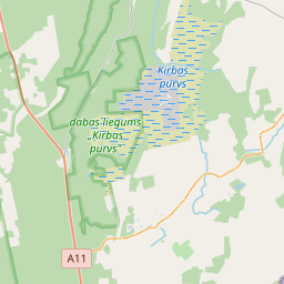
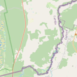
Строение (кадастровое обозначение):64840100036005)
Кадастровое обозначение: 64840100036005
Адрес: "Prīlapi", Rucavas pagasts, Dienvidkurzemes novads, LV-3477
Кадастровое обозначение недвижимого имущества | |
|---|---|
Тип кадастрового объекта | Тип кадастрового объекта: Здание |
Адрес | Адрес: "Prīlapi", Rucavas pagasts, Dienvidkurzemes novads, LV-3477 |
Адрес | |
|---|---|
Идентификатор адреса | Идентификатор адреса: 104216266 |
Kомпании, зарегистрированные по адресу
| |
Подразделения, зарегистрированные по адресу
| Подразделения, зарегистрированные по адресу
: 0 |
Учреждения, зарегистрированные по адресу
| Учреждения, зарегистрированные по адресу
: 0 |
Недвижимость по адресу
| |
Сделки по адресу
| Сделки по адресу
: 0 |
| Тип кадастрового объекта | Кадастровое обозначение кадастрового объекта | Статус права собственности лица | Статус персоны | Земельная книга |
|---|---|---|---|---|
| Тип кадастрового объекта: Здание | 64840100036005 | Статус права собственности лица: Hет данных | Статус персоны: Hет данных | Земельная книга |
09.01.2025. State land service data
|
|
|
{"7201060210":{"name":"<div class='color_dot' style='background-color: #00ffff'><\/div><span>\u0423\u043a\u0430\u0437\u0430\u043d\u043d\u0430\u044f \u0437\u0435\u043c\u0435\u043b\u044c\u043d\u0430\u044f \u0435\u0434\u0438\u043d\u0438\u0446\u0430<\/span>","featureColor":"#00ffff","features":{"type":"FeatureCollection","features":[{"type":"Feature","geometry":{"type":"Polygon","coordinates":[[[21.235979293,56.180158601],[21.236081833,56.180143906],[21.243903891,56.179474659],[21.246896642,56.179207194],[21.246971222,56.179193287],[21.247049656,56.179302656],[21.247347566,56.179748271],[21.247478095,56.180122184],[21.247480353,56.180445097],[21.247390803,56.180986869],[21.247144968,56.181974599],[21.24699255,56.181976866],[21.23634853,56.182045975],[21.236287722,56.182044615],[21.236369442,56.181825538],[21.236412242,56.181724546],[21.236410403,56.181534502],[21.235979293,56.180158601]]]},"crs":{"type":"name","properties":{"name":"urn:ogc:def:crs:EPSG:3059"}},"properties":{"style":{"color":"#00ffff","dashArray":"8,12","weight":1},"name":"\u0417\u0435\u043c\u043b\u044f","object_type":"Parcel","parcel_code":"64840100037","code":null,"surveyor":null,"address":"","ownership":"<span>\u0412\u043b\u0430\u0434\u0435\u043b\u0435\u0446 - \u0424\u0438\u0437\u0438\u0447\u0435\u0441\u043a\u043e\u0435 \u043b\u0438\u0446\u043e<br><\/span>","pro_cadastre_nr":"64840100036"}},{"type":"Feature","geometry":{"type":"Polygon","coordinates":[[[21.241031956,56.173404203],[21.241083958,56.173380115],[21.243742427,56.171991762],[21.24369167,56.169555011],[21.243719007,56.168718275],[21.243560955,56.167740621],[21.243608605,56.167075877],[21.24747955,56.164885807],[21.247603118,56.164817739],[21.247772636,56.164910288],[21.248103972,56.164918937],[21.248293979,56.164852376],[21.248233067,56.164559939],[21.248466198,56.164571047],[21.248615027,56.164743843],[21.248300048,56.164936869],[21.248272367,56.165065941],[21.248437841,56.165115307],[21.248610342,56.16508155],[21.248658584,56.165110696],[21.248570831,56.165209594],[21.248254372,56.165352322],[21.248212763,56.165450226],[21.248315571,56.165539229],[21.248548292,56.165611315],[21.248725292,56.165637199],[21.248842392,56.16561809],[21.248897863,56.165748421],[21.248701671,56.165782262],[21.248544296,56.165749121],[21.248295185,56.16564627],[21.248134128,56.165647707],[21.248021818,56.165707469],[21.247992343,56.165802389],[21.248058534,56.16590984],[21.248285682,56.166132101],[21.248404749,56.166211175],[21.24866913,56.166257369],[21.248883773,56.166221233],[21.24903346,56.166121359],[21.249126343,56.166235875],[21.24778705,56.167419105],[21.24717601,56.167305159],[21.246549865,56.168325374],[21.246538066,56.168945319],[21.246321325,56.171331969],[21.246773483,56.171459573],[21.246813213,56.171499218],[21.244998742,56.173413977],[21.243946417,56.174580143],[21.243250547,56.175358531],[21.243308585,56.175493199],[21.24307242,56.175384191],[21.242145023,56.174540789],[21.241374255,56.173818655],[21.241031956,56.173404203]]]},"crs":{"type":"name","properties":{"name":"urn:ogc:def:crs:EPSG:3059"}},"properties":{"style":{"color":"#00ffff","dashArray":"8,12","weight":1},"name":"\u0417\u0435\u043c\u043b\u044f","object_type":"Parcel","parcel_code":"64840100036","code":null,"surveyor":null,"address":"\"Pr\u012blapi\", Rucavas pag., Dienvidkurzemes nov., LV-3477","ownership":"<span>\u0412\u043b\u0430\u0434\u0435\u043b\u0435\u0446 - \u0424\u0438\u0437\u0438\u0447\u0435\u0441\u043a\u043e\u0435 \u043b\u0438\u0446\u043e<br><\/span>","pro_cadastre_nr":"64840100036"}},{"type":"Feature","geometry":{"type":"Polygon","coordinates":[[[21.221222364,56.175858709],[21.22122619,56.175805789],[21.221564246,56.174205735],[21.221578211,56.174138706],[21.221668548,56.174133969],[21.222147369,56.174095765],[21.224346991,56.173943938],[21.227754298,56.173715656],[21.226342261,56.174345287],[21.226446524,56.17616009],[21.223849889,56.17591155],[21.221222364,56.175858709]]]},"crs":{"type":"name","properties":{"name":"urn:ogc:def:crs:EPSG:3059"}},"properties":{"style":{"color":"#00ffff","dashArray":"8,12","weight":1},"name":"\u0417\u0435\u043c\u043b\u044f","object_type":"Parcel","parcel_code":"64840040054","code":null,"surveyor":null,"address":"","ownership":"<span>\u0412\u043b\u0430\u0434\u0435\u043b\u0435\u0446 - \u0424\u0438\u0437\u0438\u0447\u0435\u0441\u043a\u043e\u0435 \u043b\u0438\u0446\u043e<br><\/span>","pro_cadastre_nr":"64840100036"}}]}},"5201011310":{"name":"<div class='color_dot' style='background-color: #960096'><\/div><span>\u0412\u0435\u043a\u0442\u043e\u0440\u0438\u0437\u043e\u0432\u0430\u043d\u043d\u043e\u0435 \u0437\u0434\u0430\u043d\u0438\u0435<\/span>","featureColor":"#960096","features":{"type":"FeatureCollection","features":[{"type":"Feature","geometry":{"type":"Polygon","coordinates":[[[21.244631587,56.172134947],[21.244637014,56.172058764],[21.244864389,56.172063799],[21.244858962,56.172139982],[21.244631587,56.172134947]]]},"crs":{"type":"name","properties":{"name":"urn:ogc:def:crs:EPSG:3059"}},"properties":{"style":{"color":"#960096","dashArray":"0","weight":2},"name":"\u0417\u0434\u0430\u043d\u0438\u044f","object_type":"Building","parcel_code":"64840100036","code":"64840100036003","surveyor":null,"address":"\"Pr\u012blapi\", Rucavas pag., Dienvidkurzemes nov., LV-3477","ownership":"<span>\u0412\u043b\u0430\u0434\u0435\u043b\u0435\u0446 - \u0424\u0438\u0437\u0438\u0447\u0435\u0441\u043a\u043e\u0435 \u043b\u0438\u0446\u043e<br><\/span>","pro_cadastre_nr":"64840100036"}},{"type":"Feature","geometry":{"type":"Polygon","coordinates":[[[21.245100147,56.171727425],[21.245104697,56.171663923],[21.245190021,56.171665826],[21.245185471,56.171729328],[21.245100147,56.171727425]]]},"crs":{"type":"name","properties":{"name":"urn:ogc:def:crs:EPSG:3059"}},"properties":{"style":{"color":"#960096","dashArray":"0","weight":2},"name":"\u0417\u0434\u0430\u043d\u0438\u044f","object_type":"Building","parcel_code":"64840100036","code":"64840100036006","surveyor":null,"address":"\"Pr\u012blapi\", Rucavas pag., Dienvidkurzemes nov., LV-3477","ownership":"<span>\u0412\u043b\u0430\u0434\u0435\u043b\u0435\u0446 - \u0424\u0438\u0437\u0438\u0447\u0435\u0441\u043a\u043e\u0435 \u043b\u0438\u0446\u043e<br><\/span>","pro_cadastre_nr":"64840100036"}},{"type":"Feature","geometry":{"type":"Polygon","coordinates":[[[21.244771999,56.171536109],[21.244755884,56.17146465],[21.244822213,56.171459999],[21.244838328,56.171531459],[21.244771999,56.171536109]]]},"crs":{"type":"name","properties":{"name":"urn:ogc:def:crs:EPSG:3059"}},"properties":{"style":{"color":"#960096","dashArray":"0","weight":2},"name":"\u0417\u0434\u0430\u043d\u0438\u044f","object_type":"Building","parcel_code":"64840100036","code":"64840100036008","surveyor":null,"address":"\"Pr\u012blapi\", Rucavas pag., Dienvidkurzemes nov., LV-3477","ownership":"<span>\u0412\u043b\u0430\u0434\u0435\u043b\u0435\u0446 - \u0424\u0438\u0437\u0438\u0447\u0435\u0441\u043a\u043e\u0435 \u043b\u0438\u0446\u043e<br><\/span>","pro_cadastre_nr":"64840100036"}},{"type":"Feature","geometry":{"type":"Polygon","coordinates":[[[21.244983288,56.171597612],[21.244991972,56.17156435],[21.245060854,56.171569949],[21.245052171,56.171603211],[21.244983288,56.171597612]]]},"crs":{"type":"name","properties":{"name":"urn:ogc:def:crs:EPSG:3059"}},"properties":{"style":{"color":"#960096","dashArray":"0","weight":2},"name":"\u0417\u0434\u0430\u043d\u0438\u044f","object_type":"Building","parcel_code":"64840100036","code":"64840100036007","surveyor":null,"address":"\"Pr\u012blapi\", Rucavas pag., Dienvidkurzemes nov., LV-3477","ownership":"<span>\u0412\u043b\u0430\u0434\u0435\u043b\u0435\u0446 - \u0424\u0438\u0437\u0438\u0447\u0435\u0441\u043a\u043e\u0435 \u043b\u0438\u0446\u043e<br><\/span>","pro_cadastre_nr":"64840100036"}},{"type":"Feature","geometry":{"type":"Polygon","coordinates":[[[21.244631587,56.172134947],[21.244473116,56.172129148],[21.244478543,56.172052964],[21.244637014,56.172058764],[21.244631587,56.172134947]]]},"crs":{"type":"name","properties":{"name":"urn:ogc:def:crs:EPSG:3059"}},"properties":{"style":{"color":"#960096","dashArray":"0","weight":2},"name":"\u0417\u0434\u0430\u043d\u0438\u044f","object_type":"Building","parcel_code":"64840100036","code":"64840100036002","surveyor":null,"address":"\"Pr\u012blapi\", Rucavas pag., Dienvidkurzemes nov., LV-3477","ownership":"<span>\u0412\u043b\u0430\u0434\u0435\u043b\u0435\u0446 - \u0424\u0438\u0437\u0438\u0447\u0435\u0441\u043a\u043e\u0435 \u043b\u0438\u0446\u043e<br><\/span>","pro_cadastre_nr":"64840100036"}},{"type":"Feature","geometry":{"type":"Polygon","coordinates":[[[21.244381527,56.171761195],[21.244476918,56.171707395],[21.244676398,56.1718188],[21.244581008,56.171872591],[21.244381527,56.171761195]]]},"crs":{"type":"name","properties":{"name":"urn:ogc:def:crs:EPSG:3059"}},"properties":{"style":{"color":"#960096","dashArray":"0","weight":2},"name":"\u0417\u0434\u0430\u043d\u0438\u044f","object_type":"Building","parcel_code":"64840100036","code":"64840100036001","surveyor":null,"address":"\"Pr\u012blapi\", Rucavas pag., Dienvidkurzemes nov., LV-3477","ownership":"<span>\u0412\u043b\u0430\u0434\u0435\u043b\u0435\u0446 - \u0424\u0438\u0437\u0438\u0447\u0435\u0441\u043a\u043e\u0435 \u043b\u0438\u0446\u043e<br><\/span>","pro_cadastre_nr":"64840100036"}},{"type":"Feature","geometry":{"type":"Polygon","coordinates":[[[21.244556959,56.171981087],[21.244492386,56.171955593],[21.244541192,56.171917132],[21.244605765,56.171942626],[21.244556959,56.171981087]]]},"crs":{"type":"name","properties":{"name":"urn:ogc:def:crs:EPSG:3059"}},"properties":{"style":{"color":"#960096","dashArray":"0","weight":2},"name":"\u0417\u0434\u0430\u043d\u0438\u044f","object_type":"Building","parcel_code":"64840100036","code":"64840100036004","surveyor":null,"address":"\"Pr\u012blapi\", Rucavas pag., Dienvidkurzemes nov., LV-3477","ownership":"<span>\u0412\u043b\u0430\u0434\u0435\u043b\u0435\u0446 - \u0424\u0438\u0437\u0438\u0447\u0435\u0441\u043a\u043e\u0435 \u043b\u0438\u0446\u043e<br><\/span>","pro_cadastre_nr":"64840100036"}},{"type":"Feature","geometry":{"type":"Polygon","coordinates":[[[21.244640352,56.171618296],[21.244506246,56.171552897],[21.244569783,56.171512355],[21.244703888,56.171577754],[21.244640352,56.171618296]]]},"crs":{"type":"name","properties":{"name":"urn:ogc:def:crs:EPSG:3059"}},"properties":{"style":{"color":"#960096","dashArray":"0","weight":2},"name":"\u0417\u0434\u0430\u043d\u0438\u044f","object_type":"Building","parcel_code":"64840100036","code":"64840100036009","surveyor":null,"address":"\"Pr\u012blapi\", Rucavas pag., Dienvidkurzemes nov., LV-3477","ownership":"<span>\u0412\u043b\u0430\u0434\u0435\u043b\u0435\u0446 - \u0424\u0438\u0437\u0438\u0447\u0435\u0441\u043a\u043e\u0435 \u043b\u0438\u0446\u043e<br><\/span>","pro_cadastre_nr":"64840100036"}},{"type":"Feature","geometry":{"type":"Polygon","coordinates":[[[21.244647155,56.171985607],[21.244746789,56.171911281],[21.244819845,56.171941836],[21.244720227,56.172016171],[21.244647155,56.171985607]]]},"crs":{"type":"name","properties":{"name":"urn:ogc:def:crs:EPSG:3059"}},"properties":{"style":{"color":"#960096","dashArray":"0","weight":2},"name":"\u0417\u0434\u0430\u043d\u0438\u044f","object_type":"Building","parcel_code":"64840100036","code":"64840100036005","surveyor":null,"address":"\"Pr\u012blapi\", Rucavas pag., Dienvidkurzemes nov., LV-3477","ownership":"<span>\u0412\u043b\u0430\u0434\u0435\u043b\u0435\u0446 - \u0424\u0438\u0437\u0438\u0447\u0435\u0441\u043a\u043e\u0435 \u043b\u0438\u0446\u043e<br><\/span>","pro_cadastre_nr":"64840100036"}},{"type":"Feature","geometry":{"type":"Polygon","coordinates":[[[21.244640352,56.171618296],[21.244506246,56.171552897],[21.244569783,56.171512355],[21.244703888,56.171577754],[21.244640352,56.171618296]]]},"crs":{"type":"name","properties":{"name":"urn:ogc:def:crs:EPSG:3059"}},"properties":{"style":{"color":"#960096","dashArray":"0","weight":2},"name":"\u0417\u0434\u0430\u043d\u0438\u044f","object_type":"Building","parcel_code":"64840100036","code":"64840100036009","surveyor":null,"address":"\"Pr\u012blapi\", Rucavas pag., Dienvidkurzemes nov., LV-3477","ownership":"<span>\u0412\u043b\u0430\u0434\u0435\u043b\u0435\u0446 - \u0424\u0438\u0437\u0438\u0447\u0435\u0441\u043a\u043e\u0435 \u043b\u0438\u0446\u043e<br><\/span>","pro_cadastre_nr":"64840100036"}},{"type":"Feature","geometry":{"type":"Polygon","coordinates":[[[21.244771999,56.171536109],[21.244755884,56.17146465],[21.244822213,56.171459999],[21.244838328,56.171531459],[21.244771999,56.171536109]]]},"crs":{"type":"name","properties":{"name":"urn:ogc:def:crs:EPSG:3059"}},"properties":{"style":{"color":"#960096","dashArray":"0","weight":2},"name":"\u0417\u0434\u0430\u043d\u0438\u044f","object_type":"Building","parcel_code":"64840100036","code":"64840100036008","surveyor":null,"address":"\"Pr\u012blapi\", Rucavas pag., Dienvidkurzemes nov., LV-3477","ownership":"<span>\u0412\u043b\u0430\u0434\u0435\u043b\u0435\u0446 - \u0424\u0438\u0437\u0438\u0447\u0435\u0441\u043a\u043e\u0435 \u043b\u0438\u0446\u043e<br><\/span>","pro_cadastre_nr":"64840100036"}},{"type":"Feature","geometry":{"type":"Polygon","coordinates":[[[21.244983288,56.171597612],[21.244991972,56.17156435],[21.245060854,56.171569949],[21.245052171,56.171603211],[21.244983288,56.171597612]]]},"crs":{"type":"name","properties":{"name":"urn:ogc:def:crs:EPSG:3059"}},"properties":{"style":{"color":"#960096","dashArray":"0","weight":2},"name":"\u0417\u0434\u0430\u043d\u0438\u044f","object_type":"Building","parcel_code":"64840100036","code":"64840100036007","surveyor":null,"address":"\"Pr\u012blapi\", Rucavas pag., Dienvidkurzemes nov., LV-3477","ownership":"<span>\u0412\u043b\u0430\u0434\u0435\u043b\u0435\u0446 - \u0424\u0438\u0437\u0438\u0447\u0435\u0441\u043a\u043e\u0435 \u043b\u0438\u0446\u043e<br><\/span>","pro_cadastre_nr":"64840100036"}},{"type":"Feature","geometry":{"type":"Polygon","coordinates":[[[21.245100147,56.171727425],[21.245104697,56.171663923],[21.245190021,56.171665826],[21.245185471,56.171729328],[21.245100147,56.171727425]]]},"crs":{"type":"name","properties":{"name":"urn:ogc:def:crs:EPSG:3059"}},"properties":{"style":{"color":"#960096","dashArray":"0","weight":2},"name":"\u0417\u0434\u0430\u043d\u0438\u044f","object_type":"Building","parcel_code":"64840100036","code":"64840100036006","surveyor":null,"address":"\"Pr\u012blapi\", Rucavas pag., Dienvidkurzemes nov., LV-3477","ownership":"<span>\u0412\u043b\u0430\u0434\u0435\u043b\u0435\u0446 - \u0424\u0438\u0437\u0438\u0447\u0435\u0441\u043a\u043e\u0435 \u043b\u0438\u0446\u043e<br><\/span>","pro_cadastre_nr":"64840100036"}},{"type":"Feature","geometry":{"type":"Polygon","coordinates":[[[21.244647155,56.171985607],[21.244746789,56.171911281],[21.244819845,56.171941836],[21.244720227,56.172016171],[21.244647155,56.171985607]]]},"crs":{"type":"name","properties":{"name":"urn:ogc:def:crs:EPSG:3059"}},"properties":{"style":{"color":"#960096","dashArray":"0","weight":2},"name":"\u0417\u0434\u0430\u043d\u0438\u044f","object_type":"Building","parcel_code":"64840100036","code":"64840100036005","surveyor":null,"address":"\"Pr\u012blapi\", Rucavas pag., Dienvidkurzemes nov., LV-3477","ownership":"<span>\u0412\u043b\u0430\u0434\u0435\u043b\u0435\u0446 - \u0424\u0438\u0437\u0438\u0447\u0435\u0441\u043a\u043e\u0435 \u043b\u0438\u0446\u043e<br><\/span>","pro_cadastre_nr":"64840100036"}},{"type":"Feature","geometry":{"type":"Polygon","coordinates":[[[21.244556959,56.171981087],[21.244492386,56.171955593],[21.244541192,56.171917132],[21.244605765,56.171942626],[21.244556959,56.171981087]]]},"crs":{"type":"name","properties":{"name":"urn:ogc:def:crs:EPSG:3059"}},"properties":{"style":{"color":"#960096","dashArray":"0","weight":2},"name":"\u0417\u0434\u0430\u043d\u0438\u044f","object_type":"Building","parcel_code":"64840100036","code":"64840100036004","surveyor":null,"address":"\"Pr\u012blapi\", Rucavas pag., Dienvidkurzemes nov., LV-3477","ownership":"<span>\u0412\u043b\u0430\u0434\u0435\u043b\u0435\u0446 - \u0424\u0438\u0437\u0438\u0447\u0435\u0441\u043a\u043e\u0435 \u043b\u0438\u0446\u043e<br><\/span>","pro_cadastre_nr":"64840100036"}},{"type":"Feature","geometry":{"type":"Polygon","coordinates":[[[21.244631587,56.172134947],[21.244637014,56.172058764],[21.244864389,56.172063799],[21.244858962,56.172139982],[21.244631587,56.172134947]]]},"crs":{"type":"name","properties":{"name":"urn:ogc:def:crs:EPSG:3059"}},"properties":{"style":{"color":"#960096","dashArray":"0","weight":2},"name":"\u0417\u0434\u0430\u043d\u0438\u044f","object_type":"Building","parcel_code":"64840100036","code":"64840100036003","surveyor":null,"address":"\"Pr\u012blapi\", Rucavas pag., Dienvidkurzemes nov., LV-3477","ownership":"<span>\u0412\u043b\u0430\u0434\u0435\u043b\u0435\u0446 - \u0424\u0438\u0437\u0438\u0447\u0435\u0441\u043a\u043e\u0435 \u043b\u0438\u0446\u043e<br><\/span>","pro_cadastre_nr":"64840100036"}},{"type":"Feature","geometry":{"type":"Polygon","coordinates":[[[21.244631587,56.172134947],[21.244473116,56.172129148],[21.244478543,56.172052964],[21.244637014,56.172058764],[21.244631587,56.172134947]]]},"crs":{"type":"name","properties":{"name":"urn:ogc:def:crs:EPSG:3059"}},"properties":{"style":{"color":"#960096","dashArray":"0","weight":2},"name":"\u0417\u0434\u0430\u043d\u0438\u044f","object_type":"Building","parcel_code":"64840100036","code":"64840100036002","surveyor":null,"address":"\"Pr\u012blapi\", Rucavas pag., Dienvidkurzemes nov., LV-3477","ownership":"<span>\u0412\u043b\u0430\u0434\u0435\u043b\u0435\u0446 - \u0424\u0438\u0437\u0438\u0447\u0435\u0441\u043a\u043e\u0435 \u043b\u0438\u0446\u043e<br><\/span>","pro_cadastre_nr":"64840100036"}},{"type":"Feature","geometry":{"type":"Polygon","coordinates":[[[21.244381527,56.171761195],[21.244476918,56.171707395],[21.244676398,56.1718188],[21.244581008,56.171872591],[21.244381527,56.171761195]]]},"crs":{"type":"name","properties":{"name":"urn:ogc:def:crs:EPSG:3059"}},"properties":{"style":{"color":"#960096","dashArray":"0","weight":2},"name":"\u0417\u0434\u0430\u043d\u0438\u044f","object_type":"Building","parcel_code":"64840100036","code":"64840100036001","surveyor":null,"address":"\"Pr\u012blapi\", Rucavas pag., Dienvidkurzemes nov., LV-3477","ownership":"<span>\u0412\u043b\u0430\u0434\u0435\u043b\u0435\u0446 - \u0424\u0438\u0437\u0438\u0447\u0435\u0441\u043a\u043e\u0435 \u043b\u0438\u0446\u043e<br><\/span>","pro_cadastre_nr":"64840100036"}}]}}}
[]
https://tile.openstreetmap.org/{z}/{x}/{y}.png|© OpenStreetMap contributors|minZoom: 7|maxZoom: 19
|
Building data updated: 11.01.2025.
Источник данных и лицензия: открытые текстовые и пространственные данные кадастровой информационной системы, открытые данные базы данных рынка недвижимости, лицензия на открытые данные Creative Commons Attribution, OpenStreetMap

