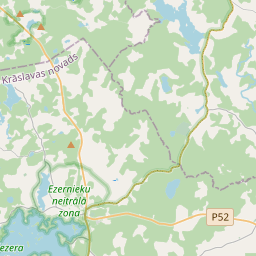
Строение (кадастровое обозначение):60560050141001)
Кадастровое обозначение: 60560050141001
Адрес: "Kristīnes", Primisļi, Ezernieku pagasts, Krāslavas novads, LV-5692
Кадастровое обозначение недвижимого имущества | |
|---|---|
Тип кадастрового объекта | Тип кадастрового объекта: Здание |
Адрес | Адрес: "Kristīnes", Primisļi, Ezernieku pagasts, Krāslavas novads, LV-5692 |
Адрес | |
|---|---|
Идентификатор адреса | Идентификатор адреса: 103885491 |
Kомпании, зарегистрированные по адресу
| Kомпании, зарегистрированные по адресу
: 0 |
Подразделения, зарегистрированные по адресу
| Подразделения, зарегистрированные по адресу
: 0 |
Учреждения, зарегистрированные по адресу
| Учреждения, зарегистрированные по адресу
: 0 |
Недвижимость по адресу
| |
Сделки по адресу
| Сделки по адресу
: 0 |
| Тип кадастрового объекта | Кадастровое обозначение кадастрового объекта | Статус права собственности лица | Статус персоны | Земельная книга |
|---|---|---|---|---|
| Тип кадастрового объекта: Здание | 60560050141001 | Статус права собственности лица: Hет данных | Статус персоны: Hет данных | Земельная книга |
09.01.2025. State land service data
|
|
|
{"7201060210":{"name":"<div class='color_dot' style='background-color: #00ffff'><\/div><span>\u0423\u043a\u0430\u0437\u0430\u043d\u043d\u0430\u044f \u0437\u0435\u043c\u0435\u043b\u044c\u043d\u0430\u044f \u0435\u0434\u0438\u043d\u0438\u0446\u0430<\/span>","featureColor":"#00ffff","features":{"type":"FeatureCollection","features":[{"type":"Feature","geometry":{"type":"Polygon","coordinates":[[[27.804489976,56.171559708],[27.80866198,56.170795369],[27.809109726,56.171244961],[27.809273286,56.172458293],[27.808946337,56.173400797],[27.808086215,56.174014444],[27.807756529,56.173867401],[27.807616617,56.174011429],[27.80763881,56.174206398],[27.806571819,56.174377773],[27.804489976,56.171559708]]]},"crs":{"type":"name","properties":{"name":"urn:ogc:def:crs:EPSG:3059"}},"properties":{"style":{"color":"#00ffff","dashArray":"8,12","weight":1},"name":"\u0417\u0435\u043c\u043b\u044f","object_type":"Parcel","parcel_code":"60560050142","code":null,"surveyor":null,"address":"","ownership":"<span>\u0412\u043b\u0430\u0434\u0435\u043b\u0435\u0446 - \u0424\u0438\u0437\u0438\u0447\u0435\u0441\u043a\u043e\u0435 \u043b\u0438\u0446\u043e<br><\/span>","pro_cadastre_nr":"60560050030"}},{"type":"Feature","geometry":{"type":"Polygon","coordinates":[[[27.777585008,56.176513831],[27.777736311,56.175776091],[27.77874516,56.174812446],[27.782958256,56.176784476],[27.783448565,56.17656801],[27.784419324,56.177736813],[27.78420175,56.177795232],[27.784033252,56.177853674],[27.783175555,56.177728036],[27.782527501,56.177461393],[27.782546535,56.177419923],[27.781653388,56.177279561],[27.779867364,56.176922233],[27.779585439,56.176873872],[27.778099616,56.176603014],[27.777585008,56.176513831]]]},"crs":{"type":"name","properties":{"name":"urn:ogc:def:crs:EPSG:3059"}},"properties":{"style":{"color":"#00ffff","dashArray":"8,12","weight":1},"name":"\u0417\u0435\u043c\u043b\u044f","object_type":"Parcel","parcel_code":"60560050141","code":null,"surveyor":null,"address":"","ownership":"<span>\u0412\u043b\u0430\u0434\u0435\u043b\u0435\u0446 - \u0424\u0438\u0437\u0438\u0447\u0435\u0441\u043a\u043e\u0435 \u043b\u0438\u0446\u043e<br><\/span>","pro_cadastre_nr":"60560050030"}},{"type":"Feature","geometry":{"type":"Polygon","coordinates":[[[27.783272684,56.175733344],[27.786842333,56.17515064],[27.786970585,56.175129702],[27.787255855,56.175605926],[27.787473067,56.175713076],[27.787723897,56.175855766],[27.787616173,56.175920928],[27.787681422,56.175953555],[27.787842148,56.176065586],[27.788054302,56.176174527],[27.788202389,56.176268717],[27.78857459,56.176490589],[27.78876187,56.176595734],[27.788932854,56.176701378],[27.789049702,56.176785421],[27.789150024,56.176864368],[27.789265121,56.176955011],[27.789352754,56.177043241],[27.789377671,56.177086493],[27.787426436,56.177292767],[27.786059755,56.177442635],[27.785462381,56.177526855],[27.785007315,56.177608041],[27.784641866,56.177692018],[27.784429475,56.177749037],[27.784419324,56.177736813],[27.783448565,56.17656801],[27.783272684,56.175733344]]]},"crs":{"type":"name","properties":{"name":"urn:ogc:def:crs:EPSG:3059"}},"properties":{"style":{"color":"#00ffff","dashArray":"8,12","weight":1},"name":"\u0417\u0435\u043c\u043b\u044f","object_type":"Parcel","parcel_code":"60560050031","code":null,"surveyor":null,"address":"","ownership":"<span>\u0412\u043b\u0430\u0434\u0435\u043b\u0435\u0446 - \u0424\u0438\u0437\u0438\u0447\u0435\u0441\u043a\u043e\u0435 \u043b\u0438\u0446\u043e<br><\/span>","pro_cadastre_nr":"60560050030"}},{"type":"Feature","geometry":{"type":"Polygon","coordinates":[[[27.777970442,56.179465771],[27.777977332,56.179423872],[27.778199972,56.178070659],[27.7819858,56.178921649],[27.781624251,56.179196076],[27.781266835,56.179449819],[27.7811287,56.179533486],[27.780552195,56.179554809],[27.780308385,56.179559927],[27.78005538,56.179563186],[27.779847142,56.179571809],[27.779412185,56.179564919],[27.779154529,56.179557123],[27.779079737,56.179555626],[27.77900468,56.179550128],[27.77888461,56.179536924],[27.778799498,56.179523937],[27.778700594,56.179512675],[27.778607084,56.179509045],[27.778508673,56.179502965],[27.778376998,56.179490108],[27.778254613,56.179476966],[27.778162907,56.179468082],[27.778051029,56.179462756],[27.777970442,56.179465771]]]},"crs":{"type":"name","properties":{"name":"urn:ogc:def:crs:EPSG:3059"}},"properties":{"style":{"color":"#00ffff","dashArray":"8,12","weight":1},"name":"\u0417\u0435\u043c\u043b\u044f","object_type":"Parcel","parcel_code":"60560050030","code":null,"surveyor":null,"address":"\"Krist\u012bnes\", Primis\u013ci, Ezernieku pag., Kr\u0101slavas nov., LV-5692","ownership":"<span>\u0412\u043b\u0430\u0434\u0435\u043b\u0435\u0446 - \u0424\u0438\u0437\u0438\u0447\u0435\u0441\u043a\u043e\u0435 \u043b\u0438\u0446\u043e<br><\/span>","pro_cadastre_nr":"60560050030"}},{"type":"Feature","geometry":{"type":"Polygon","coordinates":[[[27.773899182,56.181096024],[27.776346548,56.179989612],[27.777042062,56.180927266],[27.775477593,56.181364059],[27.774692197,56.181589549],[27.774496268,56.181639546],[27.774445313,56.181654079],[27.774019166,56.181256157],[27.773899182,56.181096024]]]},"crs":{"type":"name","properties":{"name":"urn:ogc:def:crs:EPSG:3059"}},"properties":{"style":{"color":"#00ffff","dashArray":"8,12","weight":1},"name":"\u0417\u0435\u043c\u043b\u044f","object_type":"Parcel","parcel_code":"60560050029","code":null,"surveyor":null,"address":"\"Krist\u012bnes\", Eg\u013cova, Ezernieku pag., Kr\u0101slavas nov., LV-5692","ownership":"<span>\u0412\u043b\u0430\u0434\u0435\u043b\u0435\u0446 - \u0424\u0438\u0437\u0438\u0447\u0435\u0441\u043a\u043e\u0435 \u043b\u0438\u0446\u043e<br><\/span>","pro_cadastre_nr":"60560050030"}}]}},"5201011310":{"name":"<div class='color_dot' style='background-color: #960096'><\/div><span>\u0412\u0435\u043a\u0442\u043e\u0440\u0438\u0437\u043e\u0432\u0430\u043d\u043d\u043e\u0435 \u0437\u0434\u0430\u043d\u0438\u0435<\/span>","featureColor":"#960096","features":{"type":"FeatureCollection","features":[{"type":"Feature","geometry":{"type":"Polygon","coordinates":[[[27.783821475,56.177193882],[27.783961045,56.177460745],[27.783793967,56.177487933],[27.783654398,56.17722107],[27.783821475,56.177193882]]]},"crs":{"type":"name","properties":{"name":"urn:ogc:def:crs:EPSG:3059"}},"properties":{"style":{"color":"#960096","dashArray":"0","weight":2},"name":"\u0417\u0434\u0430\u043d\u0438\u044f","object_type":"Building","parcel_code":"60560050141","code":"60560050141001","surveyor":null,"address":"","ownership":"<span>\u0412\u043b\u0430\u0434\u0435\u043b\u0435\u0446 - \u0424\u0438\u0437\u0438\u0447\u0435\u0441\u043a\u043e\u0435 \u043b\u0438\u0446\u043e<br><\/span>","pro_cadastre_nr":"60560050030"}},{"type":"Feature","geometry":{"type":"Polygon","coordinates":[[[27.783689117,56.176940817],[27.783821475,56.177193882],[27.783704965,56.177212839],[27.783572624,56.176959773],[27.783689117,56.176940817]]]},"crs":{"type":"name","properties":{"name":"urn:ogc:def:crs:EPSG:3059"}},"properties":{"style":{"color":"#960096","dashArray":"0","weight":2},"name":"\u0417\u0434\u0430\u043d\u0438\u044f","object_type":"Building","parcel_code":"60560050141","code":"60560050141002","surveyor":null,"address":"","ownership":"<span>\u0412\u043b\u0430\u0434\u0435\u043b\u0435\u0446 - \u0424\u0438\u0437\u0438\u0447\u0435\u0441\u043a\u043e\u0435 \u043b\u0438\u0446\u043e<br><\/span>","pro_cadastre_nr":"60560050030"}},{"type":"Feature","geometry":{"type":"Polygon","coordinates":[[[27.780540211,56.179304637],[27.7806126,56.179328075],[27.780554008,56.17938437],[27.780481619,56.179360932],[27.780540211,56.179304637]]]},"crs":{"type":"name","properties":{"name":"urn:ogc:def:crs:EPSG:3059"}},"properties":{"style":{"color":"#960096","dashArray":"0","weight":2},"name":"\u0417\u0434\u0430\u043d\u0438\u044f","object_type":"Building","parcel_code":"60560050030","code":"60560050030003","surveyor":null,"address":"\"Krist\u012bnes\", Primis\u013ci, Ezernieku pag., Kr\u0101slavas nov., LV-5692","ownership":"<span>\u0412\u043b\u0430\u0434\u0435\u043b\u0435\u0446 - \u0424\u0438\u0437\u0438\u0447\u0435\u0441\u043a\u043e\u0435 \u043b\u0438\u0446\u043e<br><\/span>","pro_cadastre_nr":"60560050030"}},{"type":"Feature","geometry":{"type":"Polygon","coordinates":[[[27.780481619,56.179360932],[27.780566531,56.179388429],[27.780517233,56.179435798],[27.780432304,56.179408293],[27.780481619,56.179360932]]]},"crs":{"type":"name","properties":{"name":"urn:ogc:def:crs:EPSG:3059"}},"properties":{"style":{"color":"#960096","dashArray":"0","weight":2},"name":"\u0417\u0434\u0430\u043d\u0438\u044f","object_type":"Building","parcel_code":"60560050030","code":"60560050030002","surveyor":null,"address":"\"Krist\u012bnes\", Primis\u013ci, Ezernieku pag., Kr\u0101slavas nov., LV-5692","ownership":"<span>\u0412\u043b\u0430\u0434\u0435\u043b\u0435\u0446 - \u0424\u0438\u0437\u0438\u0447\u0435\u0441\u043a\u043e\u0435 \u043b\u0438\u0446\u043e<br><\/span>","pro_cadastre_nr":"60560050030"}},{"type":"Feature","geometry":{"type":"Polygon","coordinates":[[[27.780337282,56.179314609],[27.780404381,56.179341302],[27.780319128,56.179407973],[27.78025203,56.179381279],[27.780337282,56.179314609]]]},"crs":{"type":"name","properties":{"name":"urn:ogc:def:crs:EPSG:3059"}},"properties":{"style":{"color":"#960096","dashArray":"0","weight":2},"name":"\u0417\u0434\u0430\u043d\u0438\u044f","object_type":"Building","parcel_code":"60560050030","code":"60560050030001","surveyor":null,"address":"\"Krist\u012bnes\", Primis\u013ci, Ezernieku pag., Kr\u0101slavas nov., LV-5692","ownership":"<span>\u0412\u043b\u0430\u0434\u0435\u043b\u0435\u0446 - \u0424\u0438\u0437\u0438\u0447\u0435\u0441\u043a\u043e\u0435 \u043b\u0438\u0446\u043e<br><\/span>","pro_cadastre_nr":"60560050030"}},{"type":"Feature","geometry":{"type":"Polygon","coordinates":[[[27.774433828,56.181078827],[27.774385231,56.181029076],[27.774456055,56.18100756],[27.774504652,56.181057302],[27.774433828,56.181078827]]]},"crs":{"type":"name","properties":{"name":"urn:ogc:def:crs:EPSG:3059"}},"properties":{"style":{"color":"#960096","dashArray":"0","weight":2},"name":"\u0417\u0434\u0430\u043d\u0438\u044f","object_type":"Building","parcel_code":"60560050029","code":"60560050029002","surveyor":null,"address":"\"Krist\u012bnes\", Eg\u013cova, Ezernieku pag., Kr\u0101slavas nov., LV-5692","ownership":"<span>\u0412\u043b\u0430\u0434\u0435\u043b\u0435\u0446 - \u0424\u0438\u0437\u0438\u0447\u0435\u0441\u043a\u043e\u0435 \u043b\u0438\u0446\u043e<br><\/span>","pro_cadastre_nr":"60560050030"}},{"type":"Feature","geometry":{"type":"Polygon","coordinates":[[[27.774674553,56.181321926],[27.774600723,56.181243146],[27.774712007,56.181210708],[27.774785835,56.181289479],[27.774674553,56.181321926]]]},"crs":{"type":"name","properties":{"name":"urn:ogc:def:crs:EPSG:3059"}},"properties":{"style":{"color":"#960096","dashArray":"0","weight":2},"name":"\u0417\u0434\u0430\u043d\u0438\u044f","object_type":"Building","parcel_code":"60560050029","code":"60560050029001","surveyor":null,"address":"\"Krist\u012bnes\", Eg\u013cova, Ezernieku pag., Kr\u0101slavas nov., LV-5692","ownership":"<span>\u0412\u043b\u0430\u0434\u0435\u043b\u0435\u0446 - \u0424\u0438\u0437\u0438\u0447\u0435\u0441\u043a\u043e\u0435 \u043b\u0438\u0446\u043e<br><\/span>","pro_cadastre_nr":"60560050030"}},{"type":"Feature","geometry":{"type":"Polygon","coordinates":[[[27.774504652,56.181057302],[27.774456055,56.18100756],[27.774529977,56.180985086],[27.774578591,56.181034837],[27.774504652,56.181057302]]]},"crs":{"type":"name","properties":{"name":"urn:ogc:def:crs:EPSG:3059"}},"properties":{"style":{"color":"#960096","dashArray":"0","weight":2},"name":"\u0417\u0434\u0430\u043d\u0438\u044f","object_type":"Building","parcel_code":"60560050029","code":"60560050029003","surveyor":null,"address":"\"Krist\u012bnes\", Eg\u013cova, Ezernieku pag., Kr\u0101slavas nov., LV-5692","ownership":"<span>\u0412\u043b\u0430\u0434\u0435\u043b\u0435\u0446 - \u0424\u0438\u0437\u0438\u0447\u0435\u0441\u043a\u043e\u0435 \u043b\u0438\u0446\u043e<br><\/span>","pro_cadastre_nr":"60560050030"}},{"type":"Feature","geometry":{"type":"Polygon","coordinates":[[[27.783689117,56.176940817],[27.783821475,56.177193882],[27.783704965,56.177212839],[27.783572624,56.176959773],[27.783689117,56.176940817]]]},"crs":{"type":"name","properties":{"name":"urn:ogc:def:crs:EPSG:3059"}},"properties":{"style":{"color":"#960096","dashArray":"0","weight":2},"name":"\u0417\u0434\u0430\u043d\u0438\u044f","object_type":"Building","parcel_code":"60560050141","code":"60560050141002","surveyor":null,"address":"\"Krist\u012bnes\", Primis\u013ci, Ezernieku pag., Kr\u0101slavas nov., LV-5692","ownership":"<span>\u0412\u043b\u0430\u0434\u0435\u043b\u0435\u0446 - \u0424\u0438\u0437\u0438\u0447\u0435\u0441\u043a\u043e\u0435 \u043b\u0438\u0446\u043e<br><\/span>","pro_cadastre_nr":"60560050030"}},{"type":"Feature","geometry":{"type":"Polygon","coordinates":[[[27.783821475,56.177193882],[27.783961045,56.177460745],[27.783793967,56.177487933],[27.783654398,56.17722107],[27.783821475,56.177193882]]]},"crs":{"type":"name","properties":{"name":"urn:ogc:def:crs:EPSG:3059"}},"properties":{"style":{"color":"#960096","dashArray":"0","weight":2},"name":"\u0417\u0434\u0430\u043d\u0438\u044f","object_type":"Building","parcel_code":"60560050141","code":"60560050141001","surveyor":null,"address":"\"Krist\u012bnes\", Primis\u013ci, Ezernieku pag., Kr\u0101slavas nov., LV-5692","ownership":"<span>\u0412\u043b\u0430\u0434\u0435\u043b\u0435\u0446 - \u0424\u0438\u0437\u0438\u0447\u0435\u0441\u043a\u043e\u0435 \u043b\u0438\u0446\u043e<br><\/span>","pro_cadastre_nr":"60560050030"}},{"type":"Feature","geometry":{"type":"Polygon","coordinates":[[[27.780540211,56.179304637],[27.7806126,56.179328075],[27.780554008,56.17938437],[27.780481619,56.179360932],[27.780540211,56.179304637]]]},"crs":{"type":"name","properties":{"name":"urn:ogc:def:crs:EPSG:3059"}},"properties":{"style":{"color":"#960096","dashArray":"0","weight":2},"name":"\u0417\u0434\u0430\u043d\u0438\u044f","object_type":"Building","parcel_code":"60560050030","code":"60560050030003","surveyor":null,"address":"\"Krist\u012bnes\", Primis\u013ci, Ezernieku pag., Kr\u0101slavas nov., LV-5692","ownership":"<span>\u0412\u043b\u0430\u0434\u0435\u043b\u0435\u0446 - \u0424\u0438\u0437\u0438\u0447\u0435\u0441\u043a\u043e\u0435 \u043b\u0438\u0446\u043e<br><\/span>","pro_cadastre_nr":"60560050030"}},{"type":"Feature","geometry":{"type":"Polygon","coordinates":[[[27.780481619,56.179360932],[27.780566531,56.179388429],[27.780517233,56.179435798],[27.780432304,56.179408293],[27.780481619,56.179360932]]]},"crs":{"type":"name","properties":{"name":"urn:ogc:def:crs:EPSG:3059"}},"properties":{"style":{"color":"#960096","dashArray":"0","weight":2},"name":"\u0417\u0434\u0430\u043d\u0438\u044f","object_type":"Building","parcel_code":"60560050030","code":"60560050030002","surveyor":null,"address":"\"Krist\u012bnes\", Primis\u013ci, Ezernieku pag., Kr\u0101slavas nov., LV-5692","ownership":"<span>\u0412\u043b\u0430\u0434\u0435\u043b\u0435\u0446 - \u0424\u0438\u0437\u0438\u0447\u0435\u0441\u043a\u043e\u0435 \u043b\u0438\u0446\u043e<br><\/span>","pro_cadastre_nr":"60560050030"}},{"type":"Feature","geometry":{"type":"Polygon","coordinates":[[[27.780337282,56.179314609],[27.780404381,56.179341302],[27.780319128,56.179407973],[27.78025203,56.179381279],[27.780337282,56.179314609]]]},"crs":{"type":"name","properties":{"name":"urn:ogc:def:crs:EPSG:3059"}},"properties":{"style":{"color":"#960096","dashArray":"0","weight":2},"name":"\u0417\u0434\u0430\u043d\u0438\u044f","object_type":"Building","parcel_code":"60560050030","code":"60560050030001","surveyor":null,"address":"\"Krist\u012bnes\", Primis\u013ci, Ezernieku pag., Kr\u0101slavas nov., LV-5692","ownership":"<span>\u0412\u043b\u0430\u0434\u0435\u043b\u0435\u0446 - \u0424\u0438\u0437\u0438\u0447\u0435\u0441\u043a\u043e\u0435 \u043b\u0438\u0446\u043e<br><\/span>","pro_cadastre_nr":"60560050030"}},{"type":"Feature","geometry":{"type":"Polygon","coordinates":[[[27.774504652,56.181057302],[27.774456055,56.18100756],[27.774529977,56.180985086],[27.774578591,56.181034837],[27.774504652,56.181057302]]]},"crs":{"type":"name","properties":{"name":"urn:ogc:def:crs:EPSG:3059"}},"properties":{"style":{"color":"#960096","dashArray":"0","weight":2},"name":"\u0417\u0434\u0430\u043d\u0438\u044f","object_type":"Building","parcel_code":"60560050029","code":"60560050029003","surveyor":null,"address":"\"Krist\u012bnes\", Eg\u013cova, Ezernieku pag., Kr\u0101slavas nov., LV-5692","ownership":"<span>\u0412\u043b\u0430\u0434\u0435\u043b\u0435\u0446 - \u0424\u0438\u0437\u0438\u0447\u0435\u0441\u043a\u043e\u0435 \u043b\u0438\u0446\u043e<br><\/span>","pro_cadastre_nr":"60560050030"}},{"type":"Feature","geometry":{"type":"Polygon","coordinates":[[[27.774433828,56.181078827],[27.774385231,56.181029076],[27.774456055,56.18100756],[27.774504652,56.181057302],[27.774433828,56.181078827]]]},"crs":{"type":"name","properties":{"name":"urn:ogc:def:crs:EPSG:3059"}},"properties":{"style":{"color":"#960096","dashArray":"0","weight":2},"name":"\u0417\u0434\u0430\u043d\u0438\u044f","object_type":"Building","parcel_code":"60560050029","code":"60560050029002","surveyor":null,"address":"\"Krist\u012bnes\", Eg\u013cova, Ezernieku pag., Kr\u0101slavas nov., LV-5692","ownership":"<span>\u0412\u043b\u0430\u0434\u0435\u043b\u0435\u0446 - \u0424\u0438\u0437\u0438\u0447\u0435\u0441\u043a\u043e\u0435 \u043b\u0438\u0446\u043e<br><\/span>","pro_cadastre_nr":"60560050030"}},{"type":"Feature","geometry":{"type":"Polygon","coordinates":[[[27.774674553,56.181321926],[27.774600723,56.181243146],[27.774712007,56.181210708],[27.774785835,56.181289479],[27.774674553,56.181321926]]]},"crs":{"type":"name","properties":{"name":"urn:ogc:def:crs:EPSG:3059"}},"properties":{"style":{"color":"#960096","dashArray":"0","weight":2},"name":"\u0417\u0434\u0430\u043d\u0438\u044f","object_type":"Building","parcel_code":"60560050029","code":"60560050029001","surveyor":null,"address":"\"Krist\u012bnes\", Eg\u013cova, Ezernieku pag., Kr\u0101slavas nov., LV-5692","ownership":"<span>\u0412\u043b\u0430\u0434\u0435\u043b\u0435\u0446 - \u0424\u0438\u0437\u0438\u0447\u0435\u0441\u043a\u043e\u0435 \u043b\u0438\u0446\u043e<br><\/span>","pro_cadastre_nr":"60560050030"}}]}}}
[]
https://tile.openstreetmap.org/{z}/{x}/{y}.png|© OpenStreetMap contributors|minZoom: 7|maxZoom: 19
|
Building data updated: 12.01.2025.
Источник данных и лицензия: открытые текстовые и пространственные данные кадастровой информационной системы, открытые данные базы данных рынка недвижимости, лицензия на открытые данные Creative Commons Attribution, OpenStreetMap


