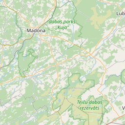
Строение (кадастровое обозначение):56460060147003)
Кадастровое обозначение: 56460060147003
Адрес: "Stūrīši", Atašiene, Atašienes pagasts, Jēkabpils novads, LV-5211
Кадастровое обозначение недвижимого имущества | |
|---|---|
Тип кадастрового объекта | Тип кадастрового объекта: Здание |
Адрес | Адрес: "Stūrīši", Atašiene, Atašienes pagasts, Jēkabpils novads, LV-5211 |
Адрес | |
|---|---|
Идентификатор адреса | Идентификатор адреса: 103619135 |
Kомпании, зарегистрированные по адресу
| |
Подразделения, зарегистрированные по адресу
| Подразделения, зарегистрированные по адресу
: 0 |
Учреждения, зарегистрированные по адресу
| Учреждения, зарегистрированные по адресу
: 0 |
Недвижимость по адресу
| |
Сделки по адресу
| Сделки по адресу
: 0 |
| Тип кадастрового объекта | Кадастровое обозначение кадастрового объекта | Статус права собственности лица | Статус персоны | Земельная книга |
|---|---|---|---|---|
| Тип кадастрового объекта: Здание | 56460060147003 | Статус права собственности лица: Hет данных | Статус персоны: Hет данных | Земельная книга |
09.01.2025. State land service data
|
|
|
{"7201060210":{"name":"<div class='color_dot' style='background-color: #00ffff'><\/div><span>\u0423\u043a\u0430\u0437\u0430\u043d\u043d\u0430\u044f \u0437\u0435\u043c\u0435\u043b\u044c\u043d\u0430\u044f \u0435\u0434\u0438\u043d\u0438\u0446\u0430<\/span>","featureColor":"#00ffff","features":{"type":"FeatureCollection","features":[{"type":"Feature","geometry":{"type":"Polygon","coordinates":[[[26.539475793,56.526994074],[26.539694733,56.52626319],[26.539718102,56.526262712],[26.540508679,56.526181788],[26.542207597,56.526030464],[26.542215205,56.525984804],[26.542626426,56.52199832],[26.542640611,56.52196856],[26.543281762,56.522268741],[26.544119668,56.522679678],[26.544070209,56.52294021],[26.544058936,56.523159865],[26.543672967,56.525959387],[26.543425296,56.527235645],[26.539475793,56.526994074]]]},"crs":{"type":"name","properties":{"name":"urn:ogc:def:crs:EPSG:3059"}},"properties":{"style":{"color":"#00ffff","dashArray":"8,12","weight":1},"name":"\u0417\u0435\u043c\u043b\u044f","object_type":"Parcel","parcel_code":"56460100038","code":null,"surveyor":null,"address":"","ownership":"<span>\u0412\u043b\u0430\u0434\u0435\u043b\u0435\u0446 - \u0424\u0438\u0437\u0438\u0447\u0435\u0441\u043a\u043e\u0435 \u043b\u0438\u0446\u043e<br><\/span>","pro_cadastre_nr":"56460060147"}},{"type":"Feature","geometry":{"type":"Polygon","coordinates":[[[26.411557435,56.543952087],[26.411629288,56.543478295],[26.411665147,56.543241755],[26.415373591,56.543512578],[26.415220924,56.544244747],[26.411662038,56.543960446],[26.411557435,56.543952087]]]},"crs":{"type":"name","properties":{"name":"urn:ogc:def:crs:EPSG:3059"}},"properties":{"style":{"color":"#00ffff","dashArray":"8,12","weight":1},"name":"\u0417\u0435\u043c\u043b\u044f","object_type":"Parcel","parcel_code":"56460060251","code":null,"surveyor":null,"address":"","ownership":"<span>\u0412\u043b\u0430\u0434\u0435\u043b\u0435\u0446 - \u0424\u0438\u0437\u0438\u0447\u0435\u0441\u043a\u043e\u0435 \u043b\u0438\u0446\u043e<br><\/span>","pro_cadastre_nr":"56460060147"}},{"type":"Feature","geometry":{"type":"Polygon","coordinates":[[[26.442103613,56.53848948],[26.442537335,56.537443273],[26.444122308,56.536971647],[26.444270227,56.536628376],[26.444321924,56.536686738],[26.445540384,56.538062117],[26.445642217,56.538809056],[26.445556999,56.538798251],[26.443946855,56.538593983],[26.442213766,56.538495727],[26.442103613,56.53848948]]]},"crs":{"type":"name","properties":{"name":"urn:ogc:def:crs:EPSG:3059"}},"properties":{"style":{"color":"#00ffff","dashArray":"8,12","weight":1},"name":"\u0417\u0435\u043c\u043b\u044f","object_type":"Parcel","parcel_code":"56460060150","code":null,"surveyor":null,"address":"","ownership":"<span>\u0412\u043b\u0430\u0434\u0435\u043b\u0435\u0446 - \u0424\u0438\u0437\u0438\u0447\u0435\u0441\u043a\u043e\u0435 \u043b\u0438\u0446\u043e<br><\/span>","pro_cadastre_nr":"56460060147"}},{"type":"Feature","geometry":{"type":"Polygon","coordinates":[[[26.432411729,56.550151971],[26.435106975,56.547020076],[26.439894734,56.547730505],[26.441480174,56.547938864],[26.4414553,56.547980344],[26.439781353,56.550770865],[26.438869086,56.552216304],[26.438259592,56.552134429],[26.437700279,56.552077253],[26.437096387,56.552013326],[26.436436485,56.551796453],[26.43567872,56.551535372],[26.434911502,56.55126223],[26.434267756,56.551011722],[26.433474636,56.550596612],[26.433058097,56.550423459],[26.432411729,56.550151971]]]},"crs":{"type":"name","properties":{"name":"urn:ogc:def:crs:EPSG:3059"}},"properties":{"style":{"color":"#00ffff","dashArray":"8,12","weight":1},"name":"\u0417\u0435\u043c\u043b\u044f","object_type":"Parcel","parcel_code":"56460060149","code":null,"surveyor":null,"address":"","ownership":"<span>\u0412\u043b\u0430\u0434\u0435\u043b\u0435\u0446 - \u0424\u0438\u0437\u0438\u0447\u0435\u0441\u043a\u043e\u0435 \u043b\u0438\u0446\u043e<br><\/span>","pro_cadastre_nr":"56460060147"}},{"type":"Feature","geometry":{"type":"Polygon","coordinates":[[[26.43660482,56.534075175],[26.43748042,56.53333457],[26.438550023,56.53227631],[26.438973615,56.5318572],[26.442689797,56.530414063],[26.442722588,56.530453798],[26.444966491,56.533173618],[26.446528859,56.535066145],[26.446048576,56.535017599],[26.445441731,56.534945514],[26.445093115,56.53489644],[26.444321102,56.534738015],[26.443481776,56.534599298],[26.443173987,56.534583755],[26.442898403,56.534589175],[26.442759388,56.534610899],[26.44259505,56.534645532],[26.442373244,56.534723554],[26.442099441,56.534833945],[26.441435354,56.53514138],[26.440709528,56.535473031],[26.440668731,56.535491673],[26.43660482,56.534075175]]]},"crs":{"type":"name","properties":{"name":"urn:ogc:def:crs:EPSG:3059"}},"properties":{"style":{"color":"#00ffff","dashArray":"8,12","weight":1},"name":"\u0417\u0435\u043c\u043b\u044f","object_type":"Parcel","parcel_code":"56460060148","code":null,"surveyor":null,"address":"","ownership":"<span>\u0412\u043b\u0430\u0434\u0435\u043b\u0435\u0446 - \u0424\u0438\u0437\u0438\u0447\u0435\u0441\u043a\u043e\u0435 \u043b\u0438\u0446\u043e<br><\/span>","pro_cadastre_nr":"56460060147"}},{"type":"Feature","geometry":{"type":"Polygon","coordinates":[[[26.405892904,56.543869096],[26.406102954,56.543636392],[26.406218241,56.543489896],[26.406341322,56.543302662],[26.406426551,56.543187557],[26.406494189,56.543107482],[26.406553198,56.543034756],[26.406595432,56.543046304],[26.407113017,56.543047987],[26.407525861,56.543063409],[26.407958589,56.543113215],[26.408285501,56.543160586],[26.407954999,56.543598983],[26.407681402,56.543961871],[26.407535918,56.544145684],[26.405892904,56.543869096]]]},"crs":{"type":"name","properties":{"name":"urn:ogc:def:crs:EPSG:3059"}},"properties":{"style":{"color":"#00ffff","dashArray":"8,12","weight":1},"name":"\u0417\u0435\u043c\u043b\u044f","object_type":"Parcel","parcel_code":"56460060147","code":null,"surveyor":null,"address":"\"St\u016br\u012b\u0161i\", Ata\u0161iene, Ata\u0161ienes pag., J\u0113kabpils nov., LV-5211","ownership":"<span>\u0412\u043b\u0430\u0434\u0435\u043b\u0435\u0446 - \u0424\u0438\u0437\u0438\u0447\u0435\u0441\u043a\u043e\u0435 \u043b\u0438\u0446\u043e<br><\/span>","pro_cadastre_nr":"56460060147"}}]}},"7201060110":{"name":"<div class='color_dot' style='background-color: #00ffff'><\/div><span>\u0418\u0437\u043c\u0435\u0440\u0435\u043d\u043d\u0430\u044f \u0437\u0435\u043c\u0435\u043b\u044c\u043d\u0430\u044f \u0435\u0434\u0438\u043d\u0438\u0446\u0430<\/span>","featureColor":"#00ffff","features":{"type":"FeatureCollection","features":[{"type":"Feature","geometry":{"type":"Polygon","coordinates":[[[26.443401802,56.55894921],[26.444161525,56.558349796],[26.444198629,56.558364138],[26.445147468,56.559273693],[26.447607712,56.558663353],[26.447632881,56.558655406],[26.448376432,56.559373326],[26.448485623,56.559482358],[26.449638417,56.560772546],[26.449742649,56.560906965],[26.449823537,56.561026726],[26.449922051,56.561202086],[26.450117017,56.561610214],[26.446483257,56.562164226],[26.446467988,56.5621337],[26.443428158,56.558959396],[26.443401802,56.55894921]]]},"crs":{"type":"name","properties":{"name":"urn:ogc:def:crs:EPSG:3059"}},"properties":{"style":{"color":"#00ffff","dashArray":"0","weight":1},"name":"\u0417\u0435\u043c\u043b\u044f","object_type":"Parcel","parcel_code":"56460060043","code":null,"surveyor":null,"address":"","ownership":"<span>\u0412\u043b\u0430\u0434\u0435\u043b\u0435\u0446 - \u0424\u0438\u0437\u0438\u0447\u0435\u0441\u043a\u043e\u0435 \u043b\u0438\u0446\u043e<br><\/span>","pro_cadastre_nr":"56460060147"}}]}},"7114100000":{"name":"<div class='color_dot' style='background-color: #b40000'><\/div><span>\u0422\u0435\u0440\u0440\u0438\u0442\u043e\u0440\u0438\u044f \u0441\u0435\u0440\u0432\u0438\u0442\u0443\u0442\u0430 \u0434\u043e\u0440\u043e\u0436\u043d\u044b\u0445 \u043e\u0431\u0440\u0435\u043c\u0435\u043d\u0435\u043d\u0438\u0439<\/span>","featureColor":"#b40000","features":{"type":"FeatureCollection","features":[{"type":"Feature","geometry":{"type":"Polygon","coordinates":[[[26.411589681,56.543954661],[26.411557435,56.543952087],[26.411629288,56.543478295],[26.411665147,56.543241755],[26.41169738,56.543244391],[26.411661693,56.543479796],[26.411589681,56.543954661]]]},"crs":{"type":"name","properties":{"name":"urn:ogc:def:crs:EPSG:3059"}},"properties":{"style":{"color":"#b40000","dashArray":"4,2,1,2","weight":1},"name":"\u0422\u0435\u0440\u0440\u0438\u0442\u043e\u0440\u0438\u044f \u0441\u0435\u0440\u0432\u0438\u0442\u0443\u0442\u0430 \u0434\u043e\u0440\u043e\u0436\u043d\u044b\u0445 \u043e\u0431\u0440\u0435\u043c\u0435\u043d\u0435\u043d\u0438\u0439","object_type":"WayRestriction","parcel_code":"56460060251","code":"7315030100003","surveyor":null,"address":"","ownership":"<span>\u0412\u043b\u0430\u0434\u0435\u043b\u0435\u0446 - \u0424\u0438\u0437\u0438\u0447\u0435\u0441\u043a\u043e\u0435 \u043b\u0438\u0446\u043e<br><\/span>","pro_cadastre_nr":"56460060147"}}]}},"5201011310":{"name":"<div class='color_dot' style='background-color: #960096'><\/div><span>\u0412\u0435\u043a\u0442\u043e\u0440\u0438\u0437\u043e\u0432\u0430\u043d\u043d\u043e\u0435 \u0437\u0434\u0430\u043d\u0438\u0435<\/span>","featureColor":"#960096","features":{"type":"FeatureCollection","features":[{"type":"Feature","geometry":{"type":"Polygon","coordinates":[[[26.4070469,56.543452329],[26.407126966,56.543357652],[26.407223656,56.543382605],[26.407143574,56.543477283],[26.4070469,56.543452329]]]},"crs":{"type":"name","properties":{"name":"urn:ogc:def:crs:EPSG:3059"}},"properties":{"style":{"color":"#960096","dashArray":"0","weight":2},"name":"\u0417\u0434\u0430\u043d\u0438\u044f","object_type":"Building","parcel_code":"56460060147","code":"56460060147005","surveyor":null,"address":"\"St\u016br\u012b\u0161i\", Ata\u0161iene, Ata\u0161ienes pag., J\u0113kabpils nov., LV-5211","ownership":"<span>\u0412\u043b\u0430\u0434\u0435\u043b\u0435\u0446 - \u0424\u0438\u0437\u0438\u0447\u0435\u0441\u043a\u043e\u0435 \u043b\u0438\u0446\u043e<br><\/span>","pro_cadastre_nr":"56460060147"}},{"type":"Feature","geometry":{"type":"Polygon","coordinates":[[[26.406383109,56.543572738],[26.406452207,56.543475425],[26.40646542,56.543478287],[26.406515484,56.543489136],[26.406494801,56.543518269],[26.406530183,56.543525933],[26.406565665,56.543475959],[26.406694148,56.543503802],[26.406642583,56.543576439],[26.406596429,56.543566431],[26.406564113,56.543611958],[26.406383109,56.543572738]]]},"crs":{"type":"name","properties":{"name":"urn:ogc:def:crs:EPSG:3059"}},"properties":{"style":{"color":"#960096","dashArray":"0","weight":2},"name":"\u0417\u0434\u0430\u043d\u0438\u044f","object_type":"Building","parcel_code":"56460060147","code":"56460060147001","surveyor":null,"address":"\"St\u016br\u012b\u0161i\", Ata\u0161iene, Ata\u0161ienes pag., J\u0113kabpils nov., LV-5211","ownership":"<span>\u0412\u043b\u0430\u0434\u0435\u043b\u0435\u0446 - \u0424\u0438\u0437\u0438\u0447\u0435\u0441\u043a\u043e\u0435 \u043b\u0438\u0446\u043e<br><\/span>","pro_cadastre_nr":"56460060147"}},{"type":"Feature","geometry":{"type":"Polygon","coordinates":[[[26.407126966,56.543357652],[26.407179929,56.543295018],[26.407276619,56.543319971],[26.407223656,56.543382605],[26.407126966,56.543357652]]]},"crs":{"type":"name","properties":{"name":"urn:ogc:def:crs:EPSG:3059"}},"properties":{"style":{"color":"#960096","dashArray":"0","weight":2},"name":"\u0417\u0434\u0430\u043d\u0438\u044f","object_type":"Building","parcel_code":"56460060147","code":"56460060147006","surveyor":null,"address":"\"St\u016br\u012b\u0161i\", Ata\u0161iene, Ata\u0161ienes pag., J\u0113kabpils nov., LV-5211","ownership":"<span>\u0412\u043b\u0430\u0434\u0435\u043b\u0435\u0446 - \u0424\u0438\u0437\u0438\u0447\u0435\u0441\u043a\u043e\u0435 \u043b\u0438\u0446\u043e<br><\/span>","pro_cadastre_nr":"56460060147"}},{"type":"Feature","geometry":{"type":"Polygon","coordinates":[[[26.40692241,56.543422027],[26.406978455,56.543436903],[26.406946964,56.543473111],[26.406890919,56.543458236],[26.40692241,56.543422027]]]},"crs":{"type":"name","properties":{"name":"urn:ogc:def:crs:EPSG:3059"}},"properties":{"style":{"color":"#960096","dashArray":"0","weight":2},"name":"\u0417\u0434\u0430\u043d\u0438\u044f","object_type":"Building","parcel_code":"56460060147","code":"56460060147003","surveyor":null,"address":"\"St\u016br\u012b\u0161i\", Ata\u0161iene, Ata\u0161ienes pag., J\u0113kabpils nov., LV-5211","ownership":"<span>\u0412\u043b\u0430\u0434\u0435\u043b\u0435\u0446 - \u0424\u0438\u0437\u0438\u0447\u0435\u0441\u043a\u043e\u0435 \u043b\u0438\u0446\u043e<br><\/span>","pro_cadastre_nr":"56460060147"}},{"type":"Feature","geometry":{"type":"Polygon","coordinates":[[[26.406831018,56.543442338],[26.406862509,56.54340613],[26.40692241,56.543422027],[26.406890919,56.543458236],[26.406831018,56.543442338]]]},"crs":{"type":"name","properties":{"name":"urn:ogc:def:crs:EPSG:3059"}},"properties":{"style":{"color":"#960096","dashArray":"0","weight":2},"name":"\u0417\u0434\u0430\u043d\u0438\u044f","object_type":"Building","parcel_code":"56460060147","code":"56460060147002","surveyor":null,"address":"\"St\u016br\u012b\u0161i\", Ata\u0161iene, Ata\u0161ienes pag., J\u0113kabpils nov., LV-5211","ownership":"<span>\u0412\u043b\u0430\u0434\u0435\u043b\u0435\u0446 - \u0424\u0438\u0437\u0438\u0447\u0435\u0441\u043a\u043e\u0435 \u043b\u0438\u0446\u043e<br><\/span>","pro_cadastre_nr":"56460060147"}},{"type":"Feature","geometry":{"type":"Polygon","coordinates":[[[26.407091503,56.543538866],[26.406994813,56.543513912],[26.4070469,56.543452329],[26.407143574,56.543477283],[26.407091503,56.543538866]]]},"crs":{"type":"name","properties":{"name":"urn:ogc:def:crs:EPSG:3059"}},"properties":{"style":{"color":"#960096","dashArray":"0","weight":2},"name":"\u0417\u0434\u0430\u043d\u0438\u044f","object_type":"Building","parcel_code":"56460060147","code":"56460060147004","surveyor":null,"address":"\"St\u016br\u012b\u0161i\", Ata\u0161iene, Ata\u0161ienes pag., J\u0113kabpils nov., LV-5211","ownership":"<span>\u0412\u043b\u0430\u0434\u0435\u043b\u0435\u0446 - \u0424\u0438\u0437\u0438\u0447\u0435\u0441\u043a\u043e\u0435 \u043b\u0438\u0446\u043e<br><\/span>","pro_cadastre_nr":"56460060147"}},{"type":"Feature","geometry":{"type":"Polygon","coordinates":[[[26.406867094,56.543180299],[26.406897955,56.543128285],[26.407073639,56.543160093],[26.407042778,56.543212107],[26.406867094,56.543180299]]]},"crs":{"type":"name","properties":{"name":"urn:ogc:def:crs:EPSG:3059"}},"properties":{"style":{"color":"#960096","dashArray":"0","weight":2},"name":"\u0417\u0434\u0430\u043d\u0438\u044f","object_type":"Building","parcel_code":"56460060147","code":"56460060147007","surveyor":null,"address":"\"St\u016br\u012b\u0161i\", Ata\u0161iene, Ata\u0161ienes pag., J\u0113kabpils nov., LV-5211","ownership":"<span>\u0412\u043b\u0430\u0434\u0435\u043b\u0435\u0446 - \u0424\u0438\u0437\u0438\u0447\u0435\u0441\u043a\u043e\u0435 \u043b\u0438\u0446\u043e<br><\/span>","pro_cadastre_nr":"56460060147"}},{"type":"Feature","geometry":{"type":"Polygon","coordinates":[[[26.406867094,56.543180299],[26.406897955,56.543128285],[26.407073639,56.543160093],[26.407042778,56.543212107],[26.406867094,56.543180299]]]},"crs":{"type":"name","properties":{"name":"urn:ogc:def:crs:EPSG:3059"}},"properties":{"style":{"color":"#960096","dashArray":"0","weight":2},"name":"\u0417\u0434\u0430\u043d\u0438\u044f","object_type":"Building","parcel_code":"56460060147","code":"56460060147007","surveyor":null,"address":"\"St\u016br\u012b\u0161i\", Ata\u0161iene, Ata\u0161ienes pag., J\u0113kabpils nov., LV-5211","ownership":"<span>\u0412\u043b\u0430\u0434\u0435\u043b\u0435\u0446 - \u0424\u0438\u0437\u0438\u0447\u0435\u0441\u043a\u043e\u0435 \u043b\u0438\u0446\u043e<br><\/span>","pro_cadastre_nr":"56460060147"}},{"type":"Feature","geometry":{"type":"Polygon","coordinates":[[[26.407126966,56.543357652],[26.407179929,56.543295018],[26.407276619,56.543319971],[26.407223656,56.543382605],[26.407126966,56.543357652]]]},"crs":{"type":"name","properties":{"name":"urn:ogc:def:crs:EPSG:3059"}},"properties":{"style":{"color":"#960096","dashArray":"0","weight":2},"name":"\u0417\u0434\u0430\u043d\u0438\u044f","object_type":"Building","parcel_code":"56460060147","code":"56460060147006","surveyor":null,"address":"\"St\u016br\u012b\u0161i\", Ata\u0161iene, Ata\u0161ienes pag., J\u0113kabpils nov., LV-5211","ownership":"<span>\u0412\u043b\u0430\u0434\u0435\u043b\u0435\u0446 - \u0424\u0438\u0437\u0438\u0447\u0435\u0441\u043a\u043e\u0435 \u043b\u0438\u0446\u043e<br><\/span>","pro_cadastre_nr":"56460060147"}},{"type":"Feature","geometry":{"type":"Polygon","coordinates":[[[26.4070469,56.543452329],[26.407126966,56.543357652],[26.407223656,56.543382605],[26.407143574,56.543477283],[26.4070469,56.543452329]]]},"crs":{"type":"name","properties":{"name":"urn:ogc:def:crs:EPSG:3059"}},"properties":{"style":{"color":"#960096","dashArray":"0","weight":2},"name":"\u0417\u0434\u0430\u043d\u0438\u044f","object_type":"Building","parcel_code":"56460060147","code":"56460060147005","surveyor":null,"address":"\"St\u016br\u012b\u0161i\", Ata\u0161iene, Ata\u0161ienes pag., J\u0113kabpils nov., LV-5211","ownership":"<span>\u0412\u043b\u0430\u0434\u0435\u043b\u0435\u0446 - \u0424\u0438\u0437\u0438\u0447\u0435\u0441\u043a\u043e\u0435 \u043b\u0438\u0446\u043e<br><\/span>","pro_cadastre_nr":"56460060147"}},{"type":"Feature","geometry":{"type":"Polygon","coordinates":[[[26.407091503,56.543538866],[26.406994813,56.543513912],[26.4070469,56.543452329],[26.407143574,56.543477283],[26.407091503,56.543538866]]]},"crs":{"type":"name","properties":{"name":"urn:ogc:def:crs:EPSG:3059"}},"properties":{"style":{"color":"#960096","dashArray":"0","weight":2},"name":"\u0417\u0434\u0430\u043d\u0438\u044f","object_type":"Building","parcel_code":"56460060147","code":"56460060147004","surveyor":null,"address":"\"St\u016br\u012b\u0161i\", Ata\u0161iene, Ata\u0161ienes pag., J\u0113kabpils nov., LV-5211","ownership":"<span>\u0412\u043b\u0430\u0434\u0435\u043b\u0435\u0446 - \u0424\u0438\u0437\u0438\u0447\u0435\u0441\u043a\u043e\u0435 \u043b\u0438\u0446\u043e<br><\/span>","pro_cadastre_nr":"56460060147"}},{"type":"Feature","geometry":{"type":"Polygon","coordinates":[[[26.40692241,56.543422027],[26.406978455,56.543436903],[26.406946964,56.543473111],[26.406890919,56.543458236],[26.40692241,56.543422027]]]},"crs":{"type":"name","properties":{"name":"urn:ogc:def:crs:EPSG:3059"}},"properties":{"style":{"color":"#960096","dashArray":"0","weight":2},"name":"\u0417\u0434\u0430\u043d\u0438\u044f","object_type":"Building","parcel_code":"56460060147","code":"56460060147003","surveyor":null,"address":"\"St\u016br\u012b\u0161i\", Ata\u0161iene, Ata\u0161ienes pag., J\u0113kabpils nov., LV-5211","ownership":"<span>\u0412\u043b\u0430\u0434\u0435\u043b\u0435\u0446 - \u0424\u0438\u0437\u0438\u0447\u0435\u0441\u043a\u043e\u0435 \u043b\u0438\u0446\u043e<br><\/span>","pro_cadastre_nr":"56460060147"}},{"type":"Feature","geometry":{"type":"Polygon","coordinates":[[[26.406831018,56.543442338],[26.406862509,56.54340613],[26.40692241,56.543422027],[26.406890919,56.543458236],[26.406831018,56.543442338]]]},"crs":{"type":"name","properties":{"name":"urn:ogc:def:crs:EPSG:3059"}},"properties":{"style":{"color":"#960096","dashArray":"0","weight":2},"name":"\u0417\u0434\u0430\u043d\u0438\u044f","object_type":"Building","parcel_code":"56460060147","code":"56460060147002","surveyor":null,"address":"\"St\u016br\u012b\u0161i\", Ata\u0161iene, Ata\u0161ienes pag., J\u0113kabpils nov., LV-5211","ownership":"<span>\u0412\u043b\u0430\u0434\u0435\u043b\u0435\u0446 - \u0424\u0438\u0437\u0438\u0447\u0435\u0441\u043a\u043e\u0435 \u043b\u0438\u0446\u043e<br><\/span>","pro_cadastre_nr":"56460060147"}},{"type":"Feature","geometry":{"type":"Polygon","coordinates":[[[26.406383109,56.543572738],[26.406452207,56.543475425],[26.40646542,56.543478287],[26.406515484,56.543489136],[26.406494801,56.543518269],[26.406530183,56.543525933],[26.406565665,56.543475959],[26.406694148,56.543503802],[26.406642583,56.543576439],[26.406596429,56.543566431],[26.406564113,56.543611958],[26.406383109,56.543572738]]]},"crs":{"type":"name","properties":{"name":"urn:ogc:def:crs:EPSG:3059"}},"properties":{"style":{"color":"#960096","dashArray":"0","weight":2},"name":"\u0417\u0434\u0430\u043d\u0438\u044f","object_type":"Building","parcel_code":"56460060147","code":"56460060147001","surveyor":null,"address":"\"St\u016br\u012b\u0161i\", Ata\u0161iene, Ata\u0161ienes pag., J\u0113kabpils nov., LV-5211","ownership":"<span>\u0412\u043b\u0430\u0434\u0435\u043b\u0435\u0446 - \u0424\u0438\u0437\u0438\u0447\u0435\u0441\u043a\u043e\u0435 \u043b\u0438\u0446\u043e<br><\/span>","pro_cadastre_nr":"56460060147"}}]}}}
[]
https://tile.openstreetmap.org/{z}/{x}/{y}.png|© OpenStreetMap contributors|minZoom: 7|maxZoom: 19
|
Building data updated: 12.01.2025.
Источник данных и лицензия: открытые текстовые и пространственные данные кадастровой информационной системы, открытые данные базы данных рынка недвижимости, лицензия на открытые данные Creative Commons Attribution, OpenStreetMap

