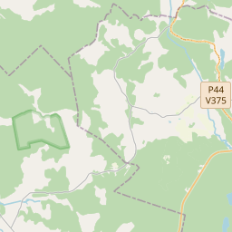
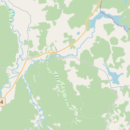
Строение (кадастровое обозначение):50640120071003)
Кадастровое обозначение: 50640120071003
Адрес: Annas Sakses iela 10, Lejasciems, Lejasciema pagasts, Gulbenes novads, LV-4412
Кадастровое обозначение недвижимого имущества | |
|---|---|
Тип кадастрового объекта | Тип кадастрового объекта: Здание |
Адрес | Адрес: Annas Sakses iela 10, Lejasciems, Lejasciema pagasts, Gulbenes novads, LV-4412 |
Адрес | |
|---|---|
Идентификатор адреса | Идентификатор адреса: 102260413 |
Kомпании, зарегистрированные по адресу
| Kомпании, зарегистрированные по адресу
: 0 |
Подразделения, зарегистрированные по адресу
| Подразделения, зарегистрированные по адресу
: 0 |
Учреждения, зарегистрированные по адресу
| Учреждения, зарегистрированные по адресу
: 0 |
Недвижимость по адресу
| |
Сделки по адресу
| Сделки по адресу
: 0 |
| Тип кадастрового объекта | Кадастровое обозначение кадастрового объекта | Статус права собственности лица | Статус персоны | Земельная книга |
|---|---|---|---|---|
| Тип кадастрового объекта: Здание | 50640120071003 | Статус права собственности лица: Hет данных | Статус персоны: Hет данных | Земельная книга |
09.01.2025. State land service data
|
|
|
{"7201060210":{"name":"<div class='color_dot' style='background-color: #00ffff'><\/div><span>\u0423\u043a\u0430\u0437\u0430\u043d\u043d\u0430\u044f \u0437\u0435\u043c\u0435\u043b\u044c\u043d\u0430\u044f \u0435\u0434\u0438\u043d\u0438\u0446\u0430<\/span>","featureColor":"#00ffff","features":{"type":"FeatureCollection","features":[{"type":"Feature","geometry":{"type":"Polygon","coordinates":[[[26.579792452,57.277431126],[26.580773543,57.27718539],[26.581114421,57.277096698],[26.581825355,57.277492118],[26.580901897,57.277779474],[26.580371969,57.277881574],[26.579792452,57.277431126]]]},"crs":{"type":"name","properties":{"name":"urn:ogc:def:crs:EPSG:3059"}},"properties":{"style":{"color":"#00ffff","dashArray":"8,12","weight":1},"name":"\u0417\u0435\u043c\u043b\u044f","object_type":"Parcel","parcel_code":"50640120071","code":null,"surveyor":null,"address":"Annas Sakses iela 10, Lejasciems, Lejasciema pag., Gulbenes nov., LV-4412","ownership":"<span>\u0412\u043b\u0430\u0434\u0435\u043b\u0435\u0446 - \u0424\u0438\u0437\u0438\u0447\u0435\u0441\u043a\u043e\u0435 \u043b\u0438\u0446\u043e<br><\/span>","pro_cadastre_nr":"50640120071"}},{"type":"Feature","geometry":{"type":"Polygon","coordinates":[[[26.582420691,57.349186651],[26.582450753,57.34918625],[26.586987887,57.349126161],[26.587102539,57.349124639],[26.588267899,57.349190985],[26.5873634,57.350788484],[26.586749876,57.350450373],[26.586535036,57.350430373],[26.585191589,57.350222462],[26.585053838,57.350221806],[26.584297408,57.350319074],[26.584203783,57.350254612],[26.583612709,57.349888597],[26.583139771,57.349623933],[26.582825545,57.349435074],[26.582420691,57.349186651]]]},"crs":{"type":"name","properties":{"name":"urn:ogc:def:crs:EPSG:3059"}},"properties":{"style":{"color":"#00ffff","dashArray":"8,12","weight":1},"name":"\u0417\u0435\u043c\u043b\u044f","object_type":"Parcel","parcel_code":"50640050195","code":null,"surveyor":null,"address":"","ownership":"<span>\u0412\u043b\u0430\u0434\u0435\u043b\u0435\u0446 - \u0424\u0438\u0437\u0438\u0447\u0435\u0441\u043a\u043e\u0435 \u043b\u0438\u0446\u043e<br><\/span>","pro_cadastre_nr":"50640120071"}}]}},"5201011310":{"name":"<div class='color_dot' style='background-color: #960096'><\/div><span>\u0412\u0435\u043a\u0442\u043e\u0440\u0438\u0437\u043e\u0432\u0430\u043d\u043d\u043e\u0435 \u0437\u0434\u0430\u043d\u0438\u0435<\/span>","featureColor":"#960096","features":{"type":"FeatureCollection","features":[{"type":"Feature","geometry":{"type":"Polygon","coordinates":[[[26.580616747,57.277492763],[26.580588596,57.277453268],[26.580689329,57.27743221],[26.580717464,57.277471705],[26.580616747,57.277492763]]]},"crs":{"type":"name","properties":{"name":"urn:ogc:def:crs:EPSG:3059"}},"properties":{"style":{"color":"#960096","dashArray":"0","weight":2},"name":"\u0417\u0434\u0430\u043d\u0438\u044f","object_type":"Building","parcel_code":"50640120071","code":"50640120071004","surveyor":null,"address":"Annas Sakses iela 10, Lejasciems, Lejasciema pag., Gulbenes nov., LV-4412","ownership":"<span>\u0412\u043b\u0430\u0434\u0435\u043b\u0435\u0446 - \u0424\u0438\u0437\u0438\u0447\u0435\u0441\u043a\u043e\u0435 \u043b\u0438\u0446\u043e<br><\/span>","pro_cadastre_nr":"50640120071"}},{"type":"Feature","geometry":{"type":"Polygon","coordinates":[[[26.580674156,57.277573346],[26.58064525,57.27753278],[26.580741911,57.277512569],[26.580770817,57.277553136],[26.580674156,57.277573346]]]},"crs":{"type":"name","properties":{"name":"urn:ogc:def:crs:EPSG:3059"}},"properties":{"style":{"color":"#960096","dashArray":"0","weight":2},"name":"\u0417\u0434\u0430\u043d\u0438\u044f","object_type":"Building","parcel_code":"50640120071","code":"50640120071005","surveyor":null,"address":"Annas Sakses iela 10, Lejasciems, Lejasciema pag., Gulbenes nov., LV-4412","ownership":null,"pro_cadastre_nr":null}},{"type":"Feature","geometry":{"type":"Polygon","coordinates":[[[26.580417856,57.277758446],[26.580333847,57.277664785],[26.580542092,57.277609984],[26.580626102,57.277703654],[26.580417856,57.277758446]]]},"crs":{"type":"name","properties":{"name":"urn:ogc:def:crs:EPSG:3059"}},"properties":{"style":{"color":"#960096","dashArray":"0","weight":2},"name":"\u0417\u0434\u0430\u043d\u0438\u044f","object_type":"Building","parcel_code":"50640120071","code":"50640120071001","surveyor":null,"address":"Annas Sakses iela 10, Lejasciems, Lejasciema pag., Gulbenes nov., LV-4412","ownership":"<span>\u0412\u043b\u0430\u0434\u0435\u043b\u0435\u0446 - \u0424\u0438\u0437\u0438\u0447\u0435\u0441\u043a\u043e\u0435 \u043b\u0438\u0446\u043e<br><\/span>","pro_cadastre_nr":"50640120071"}},{"type":"Feature","geometry":{"type":"Polygon","coordinates":[[[26.58064525,57.27753278],[26.580616747,57.277492763],[26.580714063,57.277472422],[26.580742565,57.27751243],[26.58064525,57.27753278]]]},"crs":{"type":"name","properties":{"name":"urn:ogc:def:crs:EPSG:3059"}},"properties":{"style":{"color":"#960096","dashArray":"0","weight":2},"name":"\u0417\u0434\u0430\u043d\u0438\u044f","object_type":"Building","parcel_code":"50640120071","code":"50640120071003","surveyor":null,"address":"Annas Sakses iela 10, Lejasciems, Lejasciema pag., Gulbenes nov., LV-4412","ownership":"<span>\u0412\u043b\u0430\u0434\u0435\u043b\u0435\u0446 - \u0424\u0438\u0437\u0438\u0447\u0435\u0441\u043a\u043e\u0435 \u043b\u0438\u0446\u043e<br><\/span>","pro_cadastre_nr":"50640120071"}},{"type":"Feature","geometry":{"type":"Polygon","coordinates":[[[26.58088059,57.27776546],[26.580819217,57.27770481],[26.580979469,57.277657241],[26.581040859,57.27771789],[26.58088059,57.27776546]]]},"crs":{"type":"name","properties":{"name":"urn:ogc:def:crs:EPSG:3059"}},"properties":{"style":{"color":"#960096","dashArray":"0","weight":2},"name":"\u0417\u0434\u0430\u043d\u0438\u044f","object_type":"Building","parcel_code":"50640120071","code":"50640120071002","surveyor":null,"address":"Annas Sakses iela 10, Lejasciems, Lejasciema pag., Gulbenes nov., LV-4412","ownership":"<span>\u0412\u043b\u0430\u0434\u0435\u043b\u0435\u0446 - \u0424\u0438\u0437\u0438\u0447\u0435\u0441\u043a\u043e\u0435 \u043b\u0438\u0446\u043e<br><\/span>","pro_cadastre_nr":"50640120071"}},{"type":"Feature","geometry":{"type":"Polygon","coordinates":[[[26.580616747,57.277492763],[26.580588596,57.277453268],[26.580689329,57.27743221],[26.580717464,57.277471705],[26.580616747,57.277492763]]]},"crs":{"type":"name","properties":{"name":"urn:ogc:def:crs:EPSG:3059"}},"properties":{"style":{"color":"#960096","dashArray":"0","weight":2},"name":"\u0417\u0434\u0430\u043d\u0438\u044f","object_type":"Building","parcel_code":"50640120071","code":"50640120071004","surveyor":null,"address":"Annas Sakses iela 10, Lejasciems, Lejasciema pag., Gulbenes nov., LV-4412","ownership":"<span>\u0412\u043b\u0430\u0434\u0435\u043b\u0435\u0446 - \u0424\u0438\u0437\u0438\u0447\u0435\u0441\u043a\u043e\u0435 \u043b\u0438\u0446\u043e<br><\/span>","pro_cadastre_nr":"50640120071"}},{"type":"Feature","geometry":{"type":"Polygon","coordinates":[[[26.58064525,57.27753278],[26.580616747,57.277492763],[26.580714063,57.277472422],[26.580742565,57.27751243],[26.58064525,57.27753278]]]},"crs":{"type":"name","properties":{"name":"urn:ogc:def:crs:EPSG:3059"}},"properties":{"style":{"color":"#960096","dashArray":"0","weight":2},"name":"\u0417\u0434\u0430\u043d\u0438\u044f","object_type":"Building","parcel_code":"50640120071","code":"50640120071003","surveyor":null,"address":"Annas Sakses iela 10, Lejasciems, Lejasciema pag., Gulbenes nov., LV-4412","ownership":"<span>\u0412\u043b\u0430\u0434\u0435\u043b\u0435\u0446 - \u0424\u0438\u0437\u0438\u0447\u0435\u0441\u043a\u043e\u0435 \u043b\u0438\u0446\u043e<br><\/span>","pro_cadastre_nr":"50640120071"}},{"type":"Feature","geometry":{"type":"Polygon","coordinates":[[[26.58088059,57.27776546],[26.580819217,57.27770481],[26.580979469,57.277657241],[26.581040859,57.27771789],[26.58088059,57.27776546]]]},"crs":{"type":"name","properties":{"name":"urn:ogc:def:crs:EPSG:3059"}},"properties":{"style":{"color":"#960096","dashArray":"0","weight":2},"name":"\u0417\u0434\u0430\u043d\u0438\u044f","object_type":"Building","parcel_code":"50640120071","code":"50640120071002","surveyor":null,"address":"Annas Sakses iela 10, Lejasciems, Lejasciema pag., Gulbenes nov., LV-4412","ownership":"<span>\u0412\u043b\u0430\u0434\u0435\u043b\u0435\u0446 - \u0424\u0438\u0437\u0438\u0447\u0435\u0441\u043a\u043e\u0435 \u043b\u0438\u0446\u043e<br><\/span>","pro_cadastre_nr":"50640120071"}},{"type":"Feature","geometry":{"type":"Polygon","coordinates":[[[26.580417856,57.277758446],[26.580333847,57.277664785],[26.580542092,57.277609984],[26.580626102,57.277703654],[26.580417856,57.277758446]]]},"crs":{"type":"name","properties":{"name":"urn:ogc:def:crs:EPSG:3059"}},"properties":{"style":{"color":"#960096","dashArray":"0","weight":2},"name":"\u0417\u0434\u0430\u043d\u0438\u044f","object_type":"Building","parcel_code":"50640120071","code":"50640120071001","surveyor":null,"address":"Annas Sakses iela 10, Lejasciems, Lejasciema pag., Gulbenes nov., LV-4412","ownership":"<span>\u0412\u043b\u0430\u0434\u0435\u043b\u0435\u0446 - \u0424\u0438\u0437\u0438\u0447\u0435\u0441\u043a\u043e\u0435 \u043b\u0438\u0446\u043e<br><\/span>","pro_cadastre_nr":"50640120071"}}]}}}
[]
https://tile.openstreetmap.org/{z}/{x}/{y}.png|© OpenStreetMap contributors|minZoom: 7|maxZoom: 19
|
Building data updated: 12.01.2025.
Источник данных и лицензия: открытые текстовые и пространственные данные кадастровой информационной системы, открытые данные базы данных рынка недвижимости, лицензия на открытые данные Creative Commons Attribution, OpenStreetMap

