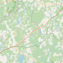
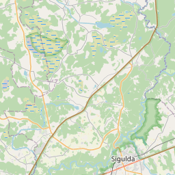
Строение (кадастровое обозначение):42820040089003)
Кадастровое обозначение: 42820040089003
Адрес: "Jaunzemnieki", Straupe, Straupes pagasts, Cēsu novads, LV-4152
Кадастровое обозначение недвижимого имущества | |
|---|---|
Тип кадастрового объекта | Тип кадастрового объекта: Здание |
Адрес | Адрес: "Jaunzemnieki", Straupe, Straupes pagasts, Cēsu novads, LV-4152 |
Адрес | |
|---|---|
Идентификатор адреса | Идентификатор адреса: 104061594 |
Kомпании, зарегистрированные по адресу
| |
Подразделения, зарегистрированные по адресу
| Подразделения, зарегистрированные по адресу
: 0 |
Учреждения, зарегистрированные по адресу
| Учреждения, зарегистрированные по адресу
: 0 |
Недвижимость по адресу
| |
Сделки по адресу
| Сделки по адресу
: 0 |
| Тип кадастрового объекта | Кадастровое обозначение кадастрового объекта | Статус права собственности лица | Статус персоны | Земельная книга |
|---|---|---|---|---|
| Тип кадастрового объекта: Здание | 42820040089003 | Статус права собственности лица: Hет данных | Статус персоны: Hет данных | Земельная книга |
17.12.2024. State land service data
|
|
|
{"7201060210":{"name":"<div class='color_dot' style='background-color: #00ffff'><\/div><span>\u0423\u043a\u0430\u0437\u0430\u043d\u043d\u0430\u044f \u0437\u0435\u043c\u0435\u043b\u044c\u043d\u0430\u044f \u0435\u0434\u0438\u043d\u0438\u0446\u0430<\/span>","featureColor":"#00ffff","features":{"type":"FeatureCollection","features":[{"type":"Feature","geometry":{"type":"Polygon","coordinates":[[[24.957085642,57.358760448],[24.95758136,57.358582821],[24.957632161,57.35856507],[24.958060724,57.358968815],[24.958250784,57.359365328],[24.958290811,57.359448822],[24.95788207,57.359527439],[24.957773021,57.359548409],[24.957528488,57.359268574],[24.957335629,57.359068748],[24.957085642,57.358760448]]]},"crs":{"type":"name","properties":{"name":"urn:ogc:def:crs:EPSG:3059"}},"properties":{"style":{"color":"#00ffff","dashArray":"8,12","weight":1},"name":"\u0417\u0435\u043c\u043b\u044f","object_type":"Parcel","parcel_code":"42820040090","code":null,"surveyor":null,"address":"","ownership":"<span>\u0412\u043b\u0430\u0434\u0435\u043b\u0435\u0446 - \u0424\u0438\u0437\u0438\u0447\u0435\u0441\u043a\u043e\u0435 \u043b\u0438\u0446\u043e<br><\/span>","pro_cadastre_nr":"42820020028"}},{"type":"Feature","geometry":{"type":"Polygon","coordinates":[[[24.94965506,57.361633644],[24.949772966,57.361285202],[24.949860854,57.360282611],[24.951233547,57.360087277],[24.952191662,57.359951067],[24.953047512,57.359828012],[24.954035898,57.359688495],[24.954919554,57.359562549],[24.9547742,57.35904587],[24.956932283,57.358864646],[24.957007284,57.358838455],[24.957340139,57.359250917],[24.957528414,57.359545302],[24.955649225,57.360059513],[24.954030469,57.360809236],[24.951198885,57.362190213],[24.94965506,57.361633644]]]},"crs":{"type":"name","properties":{"name":"urn:ogc:def:crs:EPSG:3059"}},"properties":{"style":{"color":"#00ffff","dashArray":"8,12","weight":1},"name":"\u0417\u0435\u043c\u043b\u044f","object_type":"Parcel","parcel_code":"42820040089","code":null,"surveyor":null,"address":"\"Jaunzemnieki\", Straupe, Straupes pag., C\u0113su nov., LV-4152","ownership":"<span>\u0412\u043b\u0430\u0434\u0435\u043b\u0435\u0446 - \u0424\u0438\u0437\u0438\u0447\u0435\u0441\u043a\u043e\u0435 \u043b\u0438\u0446\u043e<br><\/span>","pro_cadastre_nr":"42820020028"}},{"type":"Feature","geometry":{"type":"Polygon","coordinates":[[[24.91417338,57.372474247],[24.919477143,57.370572421],[24.919526027,57.370485248],[24.921199332,57.368408182],[24.921845188,57.36900469],[24.921894363,57.369049391],[24.923610547,57.370609482],[24.9252532,57.372254913],[24.92516288,57.372286228],[24.919090874,57.374333739],[24.915986394,57.375139661],[24.91417338,57.372474247]]]},"crs":{"type":"name","properties":{"name":"urn:ogc:def:crs:EPSG:3059"}},"properties":{"style":{"color":"#00ffff","dashArray":"8,12","weight":1},"name":"\u0417\u0435\u043c\u043b\u044f","object_type":"Parcel","parcel_code":"42820020028","code":null,"surveyor":null,"address":"","ownership":"<span>\u0412\u043b\u0430\u0434\u0435\u043b\u0435\u0446 - \u0424\u0438\u0437\u0438\u0447\u0435\u0441\u043a\u043e\u0435 \u043b\u0438\u0446\u043e<br><\/span>","pro_cadastre_nr":"42820020028"}},{"type":"Feature","geometry":{"type":"Polygon","coordinates":[[[24.90134965,57.368365841],[24.90315672,57.36769199],[24.905057115,57.366995828],[24.907739192,57.368247316],[24.907618071,57.368322303],[24.904457878,57.370285472],[24.904145815,57.37046695],[24.902867731,57.369943215],[24.902377525,57.369734406],[24.901843519,57.369014285],[24.901457725,57.368441776],[24.90134965,57.368365841]]]},"crs":{"type":"name","properties":{"name":"urn:ogc:def:crs:EPSG:3059"}},"properties":{"style":{"color":"#00ffff","dashArray":"8,12","weight":1},"name":"\u0417\u0435\u043c\u043b\u044f","object_type":"Parcel","parcel_code":"42820020021","code":null,"surveyor":null,"address":"","ownership":"<span>\u0412\u043b\u0430\u0434\u0435\u043b\u0435\u0446 - \u0424\u0438\u0437\u0438\u0447\u0435\u0441\u043a\u043e\u0435 \u043b\u0438\u0446\u043e<br><\/span>","pro_cadastre_nr":"42820020028"}}]}},"7201060110":{"name":"<div class='color_dot' style='background-color: #00ffff'><\/div><span>\u0418\u0437\u043c\u0435\u0440\u0435\u043d\u043d\u0430\u044f \u0437\u0435\u043c\u0435\u043b\u044c\u043d\u0430\u044f \u0435\u0434\u0438\u043d\u0438\u0446\u0430<\/span>","featureColor":"#00ffff","features":{"type":"FeatureCollection","features":[{"type":"Feature","geometry":{"type":"Polygon","coordinates":[[[24.919090874,57.374333739],[24.92516288,57.372286228],[24.9252532,57.372254913],[24.92632922,57.373269739],[24.926417601,57.373433855],[24.922981949,57.374845192],[24.922364944,57.375475868],[24.921392883,57.376482292],[24.921347711,57.376443051],[24.920537551,57.37571626],[24.919090874,57.374333739]]]},"crs":{"type":"name","properties":{"name":"urn:ogc:def:crs:EPSG:3059"}},"properties":{"style":{"color":"#00ffff","dashArray":"0","weight":1},"name":"\u0417\u0435\u043c\u043b\u044f","object_type":"Parcel","parcel_code":"42820020095","code":null,"surveyor":null,"address":"","ownership":"<span>\u0412\u043b\u0430\u0434\u0435\u043b\u0435\u0446 - \u0424\u0438\u0437\u0438\u0447\u0435\u0441\u043a\u043e\u0435 \u043b\u0438\u0446\u043e<br><\/span>","pro_cadastre_nr":"42820020028"}}]}},"5201011310":{"name":"<div class='color_dot' style='background-color: #960096'><\/div><span>\u0412\u0435\u043a\u0442\u043e\u0440\u0438\u0437\u043e\u0432\u0430\u043d\u043d\u043e\u0435 \u0437\u0434\u0430\u043d\u0438\u0435<\/span>","featureColor":"#960096","features":{"type":"FeatureCollection","features":[{"type":"Feature","geometry":{"type":"Polygon","coordinates":[[[24.956497266,57.35959124],[24.956497114,57.359535552],[24.956549625,57.359535504],[24.956549487,57.359486096],[24.956625286,57.359486032],[24.956625594,57.359591136],[24.956497266,57.35959124]]]},"crs":{"type":"name","properties":{"name":"urn:ogc:def:crs:EPSG:3059"}},"properties":{"style":{"color":"#960096","dashArray":"0","weight":2},"name":"\u0417\u0434\u0430\u043d\u0438\u044f","object_type":"Building","parcel_code":"42820040089","code":"42820040089004","surveyor":null,"address":"\"Jaunzemnieki\", Straupe, Straupes pag., C\u0113su nov., LV-4152","ownership":"<span>\u0412\u043b\u0430\u0434\u0435\u043b\u0435\u0446 - \u0424\u0438\u0437\u0438\u0447\u0435\u0441\u043a\u043e\u0435 \u043b\u0438\u0446\u043e<br><\/span>","pro_cadastre_nr":"42820020028"}},{"type":"Feature","geometry":{"type":"Polygon","coordinates":[[[24.956390656,57.359308549],[24.956351475,57.359220332],[24.956591333,57.359189223],[24.956630514,57.35927744],[24.956390656,57.359308549]]]},"crs":{"type":"name","properties":{"name":"urn:ogc:def:crs:EPSG:3059"}},"properties":{"style":{"color":"#960096","dashArray":"0","weight":2},"name":"\u0417\u0434\u0430\u043d\u0438\u044f","object_type":"Building","parcel_code":"42820040089","code":"42820040089005","surveyor":null,"address":"\"Jaunzemnieki\", Straupe, Straupes pag., C\u0113su nov., LV-4152","ownership":"<span>\u0412\u043b\u0430\u0434\u0435\u043b\u0435\u0446 - \u0424\u0438\u0437\u0438\u0447\u0435\u0441\u043a\u043e\u0435 \u043b\u0438\u0446\u043e<br><\/span>","pro_cadastre_nr":"42820020028"}},{"type":"Feature","geometry":{"type":"Polygon","coordinates":[[[24.956164675,57.35962272],[24.956159146,57.35954625],[24.956355124,57.359542111],[24.956360654,57.359618581],[24.956164675,57.35962272]]]},"crs":{"type":"name","properties":{"name":"urn:ogc:def:crs:EPSG:3059"}},"properties":{"style":{"color":"#960096","dashArray":"0","weight":2},"name":"\u0417\u0434\u0430\u043d\u0438\u044f","object_type":"Building","parcel_code":"42820040089","code":"42820040089003","surveyor":null,"address":"\"Jaunzemnieki\", Straupe, Straupes pag., C\u0113su nov., LV-4152","ownership":"<span>\u0412\u043b\u0430\u0434\u0435\u043b\u0435\u0446 - \u0424\u0438\u0437\u0438\u0447\u0435\u0441\u043a\u043e\u0435 \u043b\u0438\u0446\u043e<br><\/span>","pro_cadastre_nr":"42820020028"}},{"type":"Feature","geometry":{"type":"Polygon","coordinates":[[[24.955796518,57.359490162],[24.955793962,57.359391812],[24.95594437,57.35939067],[24.955945269,57.359425249],[24.955996957,57.359424857],[24.955998615,57.359488627],[24.955796518,57.359490162]]]},"crs":{"type":"name","properties":{"name":"urn:ogc:def:crs:EPSG:3059"}},"properties":{"style":{"color":"#960096","dashArray":"0","weight":2},"name":"\u0417\u0434\u0430\u043d\u0438\u044f","object_type":"Building","parcel_code":"42820040089","code":"42820040089001","surveyor":null,"address":"\"Jaunzemnieki\", Straupe, Straupes pag., C\u0113su nov., LV-4152","ownership":"<span>\u0412\u043b\u0430\u0434\u0435\u043b\u0435\u0446 - \u0424\u0438\u0437\u0438\u0447\u0435\u0441\u043a\u043e\u0435 \u043b\u0438\u0446\u043e<br><\/span>","pro_cadastre_nr":"42820020028"}},{"type":"Feature","geometry":{"type":"Polygon","coordinates":[[[24.955830166,57.359694227],[24.955831346,57.359645006],[24.955993069,57.359646141],[24.955991872,57.359695361],[24.955830166,57.359694227]]]},"crs":{"type":"name","properties":{"name":"urn:ogc:def:crs:EPSG:3059"}},"properties":{"style":{"color":"#960096","dashArray":"0","weight":2},"name":"\u0417\u0434\u0430\u043d\u0438\u044f","object_type":"Building","parcel_code":"42820040089","code":"42820040089002","surveyor":null,"address":"\"Jaunzemnieki\", Straupe, Straupes pag., C\u0113su nov., LV-4152","ownership":"<span>\u0412\u043b\u0430\u0434\u0435\u043b\u0435\u0446 - \u0424\u0438\u0437\u0438\u0447\u0435\u0441\u043a\u043e\u0435 \u043b\u0438\u0446\u043e<br><\/span>","pro_cadastre_nr":"42820020028"}},{"type":"Feature","geometry":{"type":"Polygon","coordinates":[[[24.955618598,57.359643513],[24.955820373,57.359644928],[24.955818334,57.35972955],[24.955616558,57.359728126],[24.955618598,57.359643513]]]},"crs":{"type":"name","properties":{"name":"urn:ogc:def:crs:EPSG:3059"}},"properties":{"style":{"color":"#960096","dashArray":"0","weight":2},"name":"\u0417\u0434\u0430\u043d\u0438\u044f","object_type":"Building","parcel_code":"42820040089","code":"42820040089006","surveyor":null,"address":"\"Jaunzemnieki\", Straupe, Straupes pag., C\u0113su nov., LV-4152","ownership":null,"pro_cadastre_nr":null}},{"type":"Feature","geometry":{"type":"Polygon","coordinates":[[[24.956390656,57.359308549],[24.956351475,57.359220332],[24.956591333,57.359189223],[24.956630514,57.35927744],[24.956390656,57.359308549]]]},"crs":{"type":"name","properties":{"name":"urn:ogc:def:crs:EPSG:3059"}},"properties":{"style":{"color":"#960096","dashArray":"0","weight":2},"name":"\u0417\u0434\u0430\u043d\u0438\u044f","object_type":"Building","parcel_code":"42820040089","code":"42820040089005","surveyor":null,"address":"\"Jaunzemnieki\", Straupe, Straupes pag., C\u0113su nov., LV-4152","ownership":"<span>\u0412\u043b\u0430\u0434\u0435\u043b\u0435\u0446 - \u0424\u0438\u0437\u0438\u0447\u0435\u0441\u043a\u043e\u0435 \u043b\u0438\u0446\u043e<br><\/span>","pro_cadastre_nr":"42820020028"}},{"type":"Feature","geometry":{"type":"Polygon","coordinates":[[[24.956497266,57.35959124],[24.956497114,57.359535552],[24.956549625,57.359535504],[24.956549487,57.359486096],[24.956625286,57.359486032],[24.956625594,57.359591136],[24.956497266,57.35959124]]]},"crs":{"type":"name","properties":{"name":"urn:ogc:def:crs:EPSG:3059"}},"properties":{"style":{"color":"#960096","dashArray":"0","weight":2},"name":"\u0417\u0434\u0430\u043d\u0438\u044f","object_type":"Building","parcel_code":"42820040089","code":"42820040089004","surveyor":null,"address":"\"Jaunzemnieki\", Straupe, Straupes pag., C\u0113su nov., LV-4152","ownership":"<span>\u0412\u043b\u0430\u0434\u0435\u043b\u0435\u0446 - \u0424\u0438\u0437\u0438\u0447\u0435\u0441\u043a\u043e\u0435 \u043b\u0438\u0446\u043e<br><\/span>","pro_cadastre_nr":"42820020028"}},{"type":"Feature","geometry":{"type":"Polygon","coordinates":[[[24.956164675,57.35962272],[24.956159146,57.35954625],[24.956355124,57.359542111],[24.956360654,57.359618581],[24.956164675,57.35962272]]]},"crs":{"type":"name","properties":{"name":"urn:ogc:def:crs:EPSG:3059"}},"properties":{"style":{"color":"#960096","dashArray":"0","weight":2},"name":"\u0417\u0434\u0430\u043d\u0438\u044f","object_type":"Building","parcel_code":"42820040089","code":"42820040089003","surveyor":null,"address":"\"Jaunzemnieki\", Straupe, Straupes pag., C\u0113su nov., LV-4152","ownership":"<span>\u0412\u043b\u0430\u0434\u0435\u043b\u0435\u0446 - \u0424\u0438\u0437\u0438\u0447\u0435\u0441\u043a\u043e\u0435 \u043b\u0438\u0446\u043e<br><\/span>","pro_cadastre_nr":"42820020028"}},{"type":"Feature","geometry":{"type":"Polygon","coordinates":[[[24.955830166,57.359694227],[24.955831346,57.359645006],[24.955993069,57.359646141],[24.955991872,57.359695361],[24.955830166,57.359694227]]]},"crs":{"type":"name","properties":{"name":"urn:ogc:def:crs:EPSG:3059"}},"properties":{"style":{"color":"#960096","dashArray":"0","weight":2},"name":"\u0417\u0434\u0430\u043d\u0438\u044f","object_type":"Building","parcel_code":"42820040089","code":"42820040089002","surveyor":null,"address":"\"Jaunzemnieki\", Straupe, Straupes pag., C\u0113su nov., LV-4152","ownership":"<span>\u0412\u043b\u0430\u0434\u0435\u043b\u0435\u0446 - \u0424\u0438\u0437\u0438\u0447\u0435\u0441\u043a\u043e\u0435 \u043b\u0438\u0446\u043e<br><\/span>","pro_cadastre_nr":"42820020028"}},{"type":"Feature","geometry":{"type":"Polygon","coordinates":[[[24.955796518,57.359490162],[24.955793962,57.359391812],[24.95594437,57.35939067],[24.955945269,57.359425249],[24.955996957,57.359424857],[24.955998615,57.359488627],[24.955796518,57.359490162]]]},"crs":{"type":"name","properties":{"name":"urn:ogc:def:crs:EPSG:3059"}},"properties":{"style":{"color":"#960096","dashArray":"0","weight":2},"name":"\u0417\u0434\u0430\u043d\u0438\u044f","object_type":"Building","parcel_code":"42820040089","code":"42820040089001","surveyor":null,"address":"\"Jaunzemnieki\", Straupe, Straupes pag., C\u0113su nov., LV-4152","ownership":"<span>\u0412\u043b\u0430\u0434\u0435\u043b\u0435\u0446 - \u0424\u0438\u0437\u0438\u0447\u0435\u0441\u043a\u043e\u0435 \u043b\u0438\u0446\u043e<br><\/span>","pro_cadastre_nr":"42820020028"}}]}}}
[]
https://tile.openstreetmap.org/{z}/{x}/{y}.png|© OpenStreetMap contributors|minZoom: 7|maxZoom: 19
|
Building data updated: 23.11.2024.
Источник данных и лицензия: открытые текстовые и пространственные данные кадастровой информационной системы, открытые данные базы данных рынка недвижимости, лицензия на открытые данные Creative Commons Attribution, OpenStreetMap


