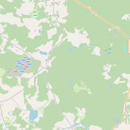
Kinnisvarakaart (katastrinumber: 90500060160)
Katastrinumber: 90500060160
Aadress: "Veckausi", Ķesterciems, Engures pag., Tukuma nov., LV-3113
Aadress: "Veckausi", Ķesterciems, Engures pag., Tukuma nov., LV-3113
Katastriobjekti number/tähis | |
|---|---|
Kinnisvara tüüp | Kinnisvara tüüp: Maa ja hoonete omand |
Aadress | Aadress: "Veckausi", Ķesterciems, Engures pag., Tukuma nov., LV-3113 |
Aadress | |
|---|---|
Aadressi ID | Aadressi ID: 103293012 |
Aadressil registreeritud ettevõtted | Aadressil registreeritud ettevõtted: 0 |
Aadressil registreeritud struktuuriüksused | Aadressil registreeritud struktuuriüksused: 0 |
Asutused registreeritud aadressil | Asutused registreeritud aadressil: 0 |
Kinnisvara aadressil | |
Tehingud aadressil | Tehingud aadressil: 0 |
| Katastriobjekti tüüp | Katastriobjekti katastritunnus | Isikliku omandiõiguse staatus | Isiklik staatus | Kinnistusraamat |
|---|---|---|---|---|
| Katastriobjekti tüüp: Kinnisvara | 90500060160 | Isikliku omandiõiguse staatus: Omanik | Isiklik staatus: Füüsiline isik | Kinnistusraamat |
17.12.2024. Riigi maateenistuse andmed
|
|
|
{"7201070000":{"name":"<div class='color_dot' style='background-color: #00ff00'><\/div><span>Algatatud m\u00f5\u00f5distamisega alad<\/span>","featureColor":"#00ff00","features":{"type":"FeatureCollection","features":[{"type":"Feature","geometry":{"type":"Polygon","coordinates":[[[23.218025408,57.125020776],[23.2198632,57.125053692],[23.219941282,57.125055094],[23.219943664,57.125063553],[23.219950837,57.12507357],[23.219863287,57.125466671],[23.219814964,57.125666616],[23.219755254,57.125931199],[23.219645342,57.126418184],[23.219604447,57.126599399],[23.219566462,57.126630461],[23.219353925,57.126833625],[23.219321422,57.126856951],[23.219273192,57.126852078],[23.218443091,57.126711902],[23.218427885,57.126537497],[23.218025408,57.125020776]]]},"crs":{"type":"name","properties":{"name":"urn:ogc:def:crs:EPSG:3059"}},"properties":{"style":{"color":"#00ff00","dashArray":"0","weight":1},"name":"Ala, kus alustati m\u00f5\u00f5distamist","object_type":"SurveyingStatus","parcel_code":"90500060239","code":null,"surveyor":"BaltSurvey SIA 27.09.2023","address":"","ownership":"<span>Omanik - F\u00fc\u00fcsiline isik<br><\/span>","pro_cadastre_nr":"90500060160"}},{"type":"Feature","geometry":{"type":"Polygon","coordinates":[[[23.218025408,57.125020776],[23.2198632,57.125053692],[23.219941282,57.125055094],[23.219943664,57.125063553],[23.219950837,57.12507357],[23.219863287,57.125466671],[23.219814964,57.125666616],[23.219755254,57.125931199],[23.219645342,57.126418184],[23.219604447,57.126599399],[23.219566462,57.126630461],[23.219353925,57.126833625],[23.219321422,57.126856951],[23.219273192,57.126852078],[23.218443091,57.126711902],[23.218427885,57.126537497],[23.218025408,57.125020776]]]},"crs":{"type":"name","properties":{"name":"urn:ogc:def:crs:EPSG:3059"}},"properties":{"style":{"color":"#00ff00","dashArray":"0","weight":1},"name":"Ala, kus alustati m\u00f5\u00f5distamist","object_type":"SurveyingStatus","parcel_code":"90500060239","code":null,"surveyor":"BaltSurvey SIA 27.09.2023","address":"","ownership":"<span>Omanik - F\u00fc\u00fcsiline isik<br><\/span>","pro_cadastre_nr":"90500060160"}},{"type":"Feature","geometry":{"type":"Polygon","coordinates":[[[23.218025408,57.125020776],[23.2198632,57.125053692],[23.219941282,57.125055094],[23.219943664,57.125063553],[23.219950837,57.12507357],[23.219863287,57.125466671],[23.219814964,57.125666616],[23.219755254,57.125931199],[23.219645342,57.126418184],[23.219604447,57.126599399],[23.219566462,57.126630461],[23.219353925,57.126833625],[23.219321422,57.126856951],[23.219273192,57.126852078],[23.218443091,57.126711902],[23.218427885,57.126537497],[23.218025408,57.125020776]]]},"crs":{"type":"name","properties":{"name":"urn:ogc:def:crs:EPSG:3059"}},"properties":{"style":{"color":"#00ff00","dashArray":"0","weight":1},"name":"Ala, kus alustati m\u00f5\u00f5distamist","object_type":"SurveyingStatus","parcel_code":"90500060239","code":null,"surveyor":"BaltSurvey SIA 27.09.2023","address":"","ownership":"<span>Omanik - F\u00fc\u00fcsiline isik<br><\/span>","pro_cadastre_nr":"90500060160"}},{"type":"Feature","geometry":{"type":"Polygon","coordinates":[[[23.218025408,57.125020776],[23.2198632,57.125053692],[23.219941282,57.125055094],[23.219943664,57.125063553],[23.219950837,57.12507357],[23.219863287,57.125466671],[23.219814964,57.125666616],[23.219755254,57.125931199],[23.219645342,57.126418184],[23.219604447,57.126599399],[23.219566462,57.126630461],[23.219353925,57.126833625],[23.219321422,57.126856951],[23.219273192,57.126852078],[23.218443091,57.126711902],[23.218427885,57.126537497],[23.218025408,57.125020776]]]},"crs":{"type":"name","properties":{"name":"urn:ogc:def:crs:EPSG:3059"}},"properties":{"style":{"color":"#00ff00","dashArray":"0","weight":1},"name":"Ala, kus alustati m\u00f5\u00f5distamist","object_type":"SurveyingStatus","parcel_code":"90500060239","code":null,"surveyor":"BaltSurvey SIA 27.09.2023","address":"","ownership":"<span>Omanik - F\u00fc\u00fcsiline isik<br><\/span>","pro_cadastre_nr":"90500060160"}},{"type":"Feature","geometry":{"type":"Polygon","coordinates":[[[23.202750925,57.13192224],[23.20371844,57.13161208],[23.204266204,57.131750975],[23.204908906,57.131720787],[23.205348001,57.132468207],[23.205549326,57.133848041],[23.205245669,57.134075138],[23.20442862,57.133973007],[23.205136939,57.133178617],[23.203624063,57.132639867],[23.202968997,57.132387398],[23.203227393,57.132156956],[23.202750925,57.13192224]]]},"crs":{"type":"name","properties":{"name":"urn:ogc:def:crs:EPSG:3059"}},"properties":{"style":{"color":"#00ff00","dashArray":"0","weight":1},"name":"Ala, kus alustati m\u00f5\u00f5distamist","object_type":"SurveyingStatus","parcel_code":"90500050929","code":null,"surveyor":"BaltSurvey SIA 26.09.2023","address":"","ownership":"<span>Omanik - F\u00fc\u00fcsiline isik<br><\/span>","pro_cadastre_nr":"90500060160"}},{"type":"Feature","geometry":{"type":"Polygon","coordinates":[[[23.202750925,57.13192224],[23.20371844,57.13161208],[23.204266204,57.131750975],[23.204908906,57.131720787],[23.205348001,57.132468207],[23.205549326,57.133848041],[23.205245669,57.134075138],[23.20442862,57.133973007],[23.205136939,57.133178617],[23.203624063,57.132639867],[23.202968997,57.132387398],[23.203227393,57.132156956],[23.202750925,57.13192224]]]},"crs":{"type":"name","properties":{"name":"urn:ogc:def:crs:EPSG:3059"}},"properties":{"style":{"color":"#00ff00","dashArray":"0","weight":1},"name":"Ala, kus alustati m\u00f5\u00f5distamist","object_type":"SurveyingStatus","parcel_code":"90500050929","code":null,"surveyor":"BaltSurvey SIA 26.09.2023","address":"","ownership":"<span>Omanik - F\u00fc\u00fcsiline isik<br><\/span>","pro_cadastre_nr":"90500060160"}},{"type":"Feature","geometry":{"type":"Polygon","coordinates":[[[23.202750925,57.13192224],[23.20371844,57.13161208],[23.204266204,57.131750975],[23.204908906,57.131720787],[23.205348001,57.132468207],[23.205549326,57.133848041],[23.205245669,57.134075138],[23.20442862,57.133973007],[23.205136939,57.133178617],[23.203624063,57.132639867],[23.202968997,57.132387398],[23.203227393,57.132156956],[23.202750925,57.13192224]]]},"crs":{"type":"name","properties":{"name":"urn:ogc:def:crs:EPSG:3059"}},"properties":{"style":{"color":"#00ff00","dashArray":"0","weight":1},"name":"Ala, kus alustati m\u00f5\u00f5distamist","object_type":"SurveyingStatus","parcel_code":"90500050929","code":null,"surveyor":"BaltSurvey SIA 26.09.2023","address":"","ownership":"<span>Omanik - F\u00fc\u00fcsiline isik<br><\/span>","pro_cadastre_nr":"90500060160"}},{"type":"Feature","geometry":{"type":"Polygon","coordinates":[[[23.202750925,57.13192224],[23.20371844,57.13161208],[23.204266204,57.131750975],[23.204908906,57.131720787],[23.205348001,57.132468207],[23.205549326,57.133848041],[23.205245669,57.134075138],[23.20442862,57.133973007],[23.205136939,57.133178617],[23.203624063,57.132639867],[23.202968997,57.132387398],[23.203227393,57.132156956],[23.202750925,57.13192224]]]},"crs":{"type":"name","properties":{"name":"urn:ogc:def:crs:EPSG:3059"}},"properties":{"style":{"color":"#00ff00","dashArray":"0","weight":1},"name":"Ala, kus alustati m\u00f5\u00f5distamist","object_type":"SurveyingStatus","parcel_code":"90500050929","code":null,"surveyor":"BaltSurvey SIA 26.09.2023","address":"","ownership":"<span>Omanik - F\u00fc\u00fcsiline isik<br><\/span>","pro_cadastre_nr":"90500060160"}},{"type":"Feature","geometry":{"type":"Polygon","coordinates":[[[23.202750925,57.13192224],[23.20371844,57.13161208],[23.204266204,57.131750975],[23.204908906,57.131720787],[23.205348001,57.132468207],[23.205549326,57.133848041],[23.205245669,57.134075138],[23.20442862,57.133973007],[23.205136939,57.133178617],[23.203624063,57.132639867],[23.202968997,57.132387398],[23.203227393,57.132156956],[23.202750925,57.13192224]]]},"crs":{"type":"name","properties":{"name":"urn:ogc:def:crs:EPSG:3059"}},"properties":{"style":{"color":"#00ff00","dashArray":"0","weight":1},"name":"Ala, kus alustati m\u00f5\u00f5distamist","object_type":"SurveyingStatus","parcel_code":"90500050929","code":null,"surveyor":"BaltSurvey SIA 26.09.2023","address":"","ownership":"<span>Omanik - F\u00fc\u00fcsiline isik<br><\/span>","pro_cadastre_nr":"90500060160"}},{"type":"Feature","geometry":{"type":"Polygon","coordinates":[[[23.202750925,57.13192224],[23.20371844,57.13161208],[23.204266204,57.131750975],[23.204908906,57.131720787],[23.205348001,57.132468207],[23.205549326,57.133848041],[23.205245669,57.134075138],[23.20442862,57.133973007],[23.205136939,57.133178617],[23.203624063,57.132639867],[23.202968997,57.132387398],[23.203227393,57.132156956],[23.202750925,57.13192224]]]},"crs":{"type":"name","properties":{"name":"urn:ogc:def:crs:EPSG:3059"}},"properties":{"style":{"color":"#00ff00","dashArray":"0","weight":1},"name":"Ala, kus alustati m\u00f5\u00f5distamist","object_type":"SurveyingStatus","parcel_code":"90500050929","code":null,"surveyor":"BaltSurvey SIA 26.09.2023","address":"","ownership":"<span>Omanik - F\u00fc\u00fcsiline isik<br><\/span>","pro_cadastre_nr":"90500060160"}},{"type":"Feature","geometry":{"type":"Polygon","coordinates":[[[23.202750925,57.13192224],[23.20371844,57.13161208],[23.204266204,57.131750975],[23.204908906,57.131720787],[23.205348001,57.132468207],[23.205549326,57.133848041],[23.205245669,57.134075138],[23.20442862,57.133973007],[23.205136939,57.133178617],[23.203624063,57.132639867],[23.202968997,57.132387398],[23.203227393,57.132156956],[23.202750925,57.13192224]]]},"crs":{"type":"name","properties":{"name":"urn:ogc:def:crs:EPSG:3059"}},"properties":{"style":{"color":"#00ff00","dashArray":"0","weight":1},"name":"Ala, kus alustati m\u00f5\u00f5distamist","object_type":"SurveyingStatus","parcel_code":"90500050929","code":null,"surveyor":"BaltSurvey SIA 26.09.2023","address":"","ownership":"<span>Omanik - F\u00fc\u00fcsiline isik<br><\/span>","pro_cadastre_nr":"90500060160"}},{"type":"Feature","geometry":{"type":"Polygon","coordinates":[[[23.202750925,57.13192224],[23.20371844,57.13161208],[23.204266204,57.131750975],[23.204908906,57.131720787],[23.205348001,57.132468207],[23.205549326,57.133848041],[23.205245669,57.134075138],[23.20442862,57.133973007],[23.205136939,57.133178617],[23.203624063,57.132639867],[23.202968997,57.132387398],[23.203227393,57.132156956],[23.202750925,57.13192224]]]},"crs":{"type":"name","properties":{"name":"urn:ogc:def:crs:EPSG:3059"}},"properties":{"style":{"color":"#00ff00","dashArray":"0","weight":1},"name":"Ala, kus alustati m\u00f5\u00f5distamist","object_type":"SurveyingStatus","parcel_code":"90500050929","code":null,"surveyor":"BaltSurvey SIA 26.09.2023","address":"","ownership":"<span>Omanik - F\u00fc\u00fcsiline isik<br><\/span>","pro_cadastre_nr":"90500060160"}}]}},"7201060110":{"name":"<div class='color_dot' style='background-color: #00ffff'><\/div><span>M\u00f5\u00f5distatud maa\u00fcksus<\/span>","featureColor":"#00ffff","features":{"type":"FeatureCollection","features":[{"type":"Feature","geometry":{"type":"Polygon","coordinates":[[[23.218025408,57.125020776],[23.2198632,57.125053692],[23.219941282,57.125055094],[23.21994742,57.125062481],[23.219950837,57.12507357],[23.219897276,57.125326288],[23.219863287,57.125466671],[23.219814964,57.125666616],[23.219755254,57.125931199],[23.219645342,57.126418184],[23.219604447,57.126599399],[23.219566462,57.126630461],[23.219353925,57.126833625],[23.219321422,57.126856951],[23.219273192,57.126852078],[23.218619,57.126744575],[23.218415431,57.126706797],[23.218404228,57.12665836],[23.218025408,57.125020776]]]},"crs":{"type":"name","properties":{"name":"urn:ogc:def:crs:EPSG:3059"}},"properties":{"style":{"color":"#00ffff","dashArray":"0","weight":1},"name":"Maa","object_type":"Parcel","parcel_code":"90500060239","code":null,"surveyor":null,"address":"","ownership":"<span>Omanik - F\u00fc\u00fcsiline isik<br><\/span>","pro_cadastre_nr":"90500060160"}},{"type":"Feature","geometry":{"type":"Polygon","coordinates":[[[23.231204733,57.115711799],[23.231958797,57.115767797],[23.232817789,57.115711948],[23.232979643,57.115701233],[23.232875421,57.115825396],[23.232857057,57.115926916],[23.232084975,57.115937813],[23.231977772,57.116212218],[23.232457936,57.116267398],[23.232403527,57.116443719],[23.233134065,57.116466632],[23.233165312,57.116271473],[23.23365558,57.116305311],[23.233852875,57.116974532],[23.232373121,57.116969274],[23.232378627,57.116687904],[23.231324056,57.116545926],[23.231204733,57.115711799]]]},"crs":{"type":"name","properties":{"name":"urn:ogc:def:crs:EPSG:3059"}},"properties":{"style":{"color":"#00ffff","dashArray":"0","weight":1},"name":"Maa","object_type":"Parcel","parcel_code":"90500060160","code":null,"surveyor":null,"address":"\"Veckausi\", \u0136esterciems, Engures pag., Tukuma nov., LV-3113","ownership":"<span>Omanik - F\u00fc\u00fcsiline isik<br><\/span>","pro_cadastre_nr":"90500060160"}},{"type":"Feature","geometry":{"type":"Polygon","coordinates":[[[23.202750925,57.13192224],[23.20371844,57.13161208],[23.204266204,57.131750975],[23.204908906,57.131720787],[23.205367886,57.132482419],[23.205541795,57.133820944],[23.205245669,57.134075138],[23.20442862,57.133973007],[23.205136939,57.133178617],[23.203624063,57.132639867],[23.202968997,57.132387398],[23.203227393,57.132156956],[23.202750925,57.13192224]]]},"crs":{"type":"name","properties":{"name":"urn:ogc:def:crs:EPSG:3059"}},"properties":{"style":{"color":"#00ffff","dashArray":"0","weight":1},"name":"Maa","object_type":"Parcel","parcel_code":"90500050929","code":null,"surveyor":null,"address":"","ownership":"<span>Omanik - F\u00fc\u00fcsiline isik<br><\/span>","pro_cadastre_nr":"90500060160"}}]}},"7114100000":{"name":"<div class='color_dot' style='background-color: #b40000'><\/div><span>Koormatud tee servituudi ala<\/span>","featureColor":"#b40000","features":{"type":"FeatureCollection","features":[{"type":"Feature","geometry":{"type":"Polygon","coordinates":[[[23.23318744,57.11657999],[23.233432342,57.116562263],[23.233505657,57.116556961],[23.233724228,57.116541219],[23.233728584,57.116558997],[23.233336424,57.116587352],[23.233140123,57.116601819],[23.23318744,57.11657999]]]},"crs":{"type":"name","properties":{"name":"urn:ogc:def:crs:EPSG:3059"}},"properties":{"style":{"color":"#b40000","dashArray":"4,2,1,2","weight":1},"name":"Koormatud tee servituudi ala","object_type":"WayRestriction","parcel_code":"90500060160","code":"7315030100006","surveyor":null,"address":"\"Veckausi\", \u0136esterciems, Engures pag., Tukuma nov., LV-3113","ownership":"<span>Omanik - F\u00fc\u00fcsiline isik<br><\/span>","pro_cadastre_nr":"90500060160"}},{"type":"Feature","geometry":{"type":"Polygon","coordinates":[[[23.232470057,57.116488595],[23.232404636,57.116481125],[23.23241725,57.116444477],[23.232484568,57.116446488],[23.232470057,57.116488595]]]},"crs":{"type":"name","properties":{"name":"urn:ogc:def:crs:EPSG:3059"}},"properties":{"style":{"color":"#b40000","dashArray":"4,2,1,2","weight":1},"name":"Koormatud tee servituudi ala","object_type":"WayRestriction","parcel_code":"90500060160","code":"7315030100004","surveyor":null,"address":"\"Veckausi\", \u0136esterciems, Engures pag., Tukuma nov., LV-3113","ownership":"<span>Omanik - F\u00fc\u00fcsiline isik<br><\/span>","pro_cadastre_nr":"90500060160"}},{"type":"Feature","geometry":{"type":"Polygon","coordinates":[[[23.231951542,57.116467894],[23.231327324,57.116538867],[23.231321516,57.116502735],[23.231735195,57.116455959],[23.231930056,57.116432061],[23.231957029,57.116434158],[23.232000242,57.116437504],[23.232082043,57.116452262],[23.232229566,57.116465544],[23.232404599,57.116481304],[23.232469967,57.116488972],[23.232500013,57.116494995],[23.232537419,57.116505259],[23.232600025,57.116531506],[23.232675865,57.116570187],[23.232744087,57.116599558],[23.232786391,57.116612556],[23.232842288,57.116619842],[23.232919685,57.116617612],[23.232983025,57.11660835],[23.233038643,57.116595566],[23.233114452,57.116566302],[23.23317808,57.116533506],[23.233262542,57.116473796],[23.233292842,57.116452375],[23.233305189,57.11643584],[23.233317536,57.116419305],[23.233317257,57.116411236],[23.233313966,57.116314704],[23.233312874,57.116282833],[23.233377892,57.11628747],[23.233380023,57.116314623],[23.233379531,57.116418345],[23.233350359,57.116456383],[23.233297445,57.116510105],[23.233183008,57.116580296],[23.23313264,57.116602716],[23.233082321,57.116619576],[23.233019571,57.116633854],[23.23293774,57.116645329],[23.232812686,57.116653053],[23.232784343,57.116651721],[23.232727927,57.116634388],[23.232680765,57.116615961],[23.232574044,57.116561263],[23.232508614,57.116534226],[23.232445094,57.116518672],[23.232094312,57.116489826],[23.232020187,57.116476813],[23.231979183,57.116469608],[23.231951542,57.116467894]]]},"crs":{"type":"name","properties":{"name":"urn:ogc:def:crs:EPSG:3059"}},"properties":{"style":{"color":"#b40000","dashArray":"4,2,1,2","weight":1},"name":"Koormatud tee servituudi ala","object_type":"WayRestriction","parcel_code":"90500060160","code":"7315030100003","surveyor":null,"address":"\"Veckausi\", \u0136esterciems, Engures pag., Tukuma nov., LV-3113","ownership":"<span>Omanik - F\u00fc\u00fcsiline isik<br><\/span>","pro_cadastre_nr":"90500060160"}},{"type":"Feature","geometry":{"type":"Polygon","coordinates":[[[23.232185932,57.115933337],[23.232119257,57.115935409],[23.232133091,57.115827878],[23.231212474,57.115747853],[23.231207179,57.115713305],[23.231295828,57.115719401],[23.23144922,57.115733825],[23.232203245,57.115797296],[23.232185932,57.115933337]]]},"crs":{"type":"name","properties":{"name":"urn:ogc:def:crs:EPSG:3059"}},"properties":{"style":{"color":"#b40000","dashArray":"4,2,1,2","weight":1},"name":"Koormatud tee servituudi ala","object_type":"WayRestriction","parcel_code":"90500060160","code":"7315030100005","surveyor":null,"address":"\"Veckausi\", \u0136esterciems, Engures pag., Tukuma nov., LV-3113","ownership":"<span>Omanik - F\u00fc\u00fcsiline isik<br><\/span>","pro_cadastre_nr":"90500060160"}}]}},"5201011310":{"name":"<div class='color_dot' style='background-color: #960096'><\/div><span>Vektoriseeritud hoone<\/span>","featureColor":"#960096","features":{"type":"FeatureCollection","features":[{"type":"Feature","geometry":{"type":"Polygon","coordinates":[[[23.232776728,57.115886501],[23.232704298,57.115890622],[23.232706177,57.115900362],[23.232597787,57.115906536],[23.232595908,57.115896795],[23.232464521,57.115904283],[23.232466475,57.115914374],[23.232429028,57.115916508],[23.232412641,57.115831368],[23.232705703,57.115814673],[23.232703495,57.115803242],[23.232707473,57.115800122],[23.232737514,57.11579841],[23.232742596,57.11580101],[23.232744786,57.115812451],[23.232762278,57.115811453],[23.232776728,57.115886501]]]},"crs":{"type":"name","properties":{"name":"urn:ogc:def:crs:EPSG:3059"}},"properties":{"style":{"color":"#960096","dashArray":"0","weight":2},"name":"Hoone","object_type":"Building","parcel_code":"90500060160","code":"90500060160001","surveyor":null,"address":"\"Veckausi\", \u0136esterciems, Engures pag., Tukuma nov., LV-3113","ownership":"<span>Omanik - F\u00fc\u00fcsiline isik<br><\/span>","pro_cadastre_nr":"90500060160"}},{"type":"Feature","geometry":{"type":"Polygon","coordinates":[[[23.232776728,57.115886501],[23.232704298,57.115890622],[23.232706177,57.115900362],[23.232597787,57.115906536],[23.232595908,57.115896795],[23.232464521,57.115904283],[23.232466475,57.115914374],[23.232429028,57.115916508],[23.232412641,57.115831368],[23.232705703,57.115814673],[23.232703495,57.115803242],[23.232707473,57.115800122],[23.232737514,57.11579841],[23.232742596,57.11580101],[23.232744786,57.115812451],[23.232762278,57.115811453],[23.232776728,57.115886501]]]},"crs":{"type":"name","properties":{"name":"urn:ogc:def:crs:EPSG:3059"}},"properties":{"style":{"color":"#960096","dashArray":"0","weight":2},"name":"Hoone","object_type":"Building","parcel_code":"90500060160","code":"90500060160001","surveyor":null,"address":"\"Veckausi\", \u0136esterciems, Engures pag., Tukuma nov., LV-3113","ownership":"<span>Omanik - F\u00fc\u00fcsiline isik<br><\/span>","pro_cadastre_nr":"90500060160"}}]}}}
{"7201060310":{"name":"<div class='color_dot' style='background-color: #00ffff'><\/div><span>Projekteeritav maa\u00fcksus<\/span>","featureColor":"#00ffff","features":{"type":"FeatureCollection","features":[{"type":"Feature","geometry":{"type":"Polygon","coordinates":[[[23.218025408,57.125020776],[23.2198632,57.125053692],[23.219941282,57.125055094],[23.219943664,57.125063553],[23.219950837,57.12507357],[23.219863287,57.125466671],[23.219814964,57.125666616],[23.219755254,57.125931199],[23.219645342,57.126418184],[23.219604447,57.126599399],[23.219566462,57.126630461],[23.219353925,57.126833625],[23.219321422,57.126856951],[23.219273192,57.126852078],[23.218443091,57.126711902],[23.218427885,57.126537497],[23.218025408,57.125020776]]]},"crs":{"type":"name","properties":{"name":"urn:ogc:def:crs:EPSG:3059"}},"properties":{"style":{"color":"#00ffff","dashArray":"2,4","weight":1},"name":"Maa","object_type":"Parcel","parcel_code":"90500060239","code":null,"surveyor":null,"address":"","ownership":"<span>Omanik - F\u00fc\u00fcsiline isik<br><\/span>","pro_cadastre_nr":"90500060160"}},{"type":"Feature","geometry":{"type":"Polygon","coordinates":[[[23.202750925,57.13192224],[23.20371844,57.13161208],[23.204266204,57.131750975],[23.204908906,57.131720787],[23.205348001,57.132468207],[23.205549326,57.133848041],[23.205245669,57.134075138],[23.20442862,57.133973007],[23.205136939,57.133178617],[23.203624063,57.132639867],[23.202968997,57.132387398],[23.203227393,57.132156956],[23.202750925,57.13192224]]]},"crs":{"type":"name","properties":{"name":"urn:ogc:def:crs:EPSG:3059"}},"properties":{"style":{"color":"#00ffff","dashArray":"2,4","weight":1},"name":"Maa","object_type":"Parcel","parcel_code":"90500050929","code":null,"surveyor":null,"address":"","ownership":"<span>Omanik - F\u00fc\u00fcsiline isik<br><\/span>","pro_cadastre_nr":"90500060160"}}]}}}
https://tile.openstreetmap.org/{z}/{x}/{y}.png|© OpenStreetMap contributors|minZoom: 7|maxZoom: 19
|
Kinnisvara andmeid värskendati: 30.12.2024.
Andmeallikas ja tegevusluba: Katastri infosüsteemi avatekst ja ruumiandmed, Kinnisvaraturu andmebaasi avaandmed, Riigi Ehituskontrolli Ameti avaandmed, Justiitsministeeriumi avaandmed „Andmed rakendatud mõjutusmeetmete kohta riigi- peetavad registrid", avaandmete litsents Creative Commons Attribution, kohtuhalduse e-oksjoni andmed, OpenStreetMap nimeandmed, Keskstatistikaameti avaandmed: "Naabruskonnad".


