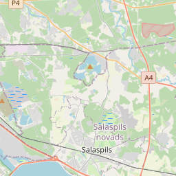
Kinnisvarakaart (katastrinumber: 80310070062)
Katastrinumber: 80310070062
Aadress: "Baloži", Salaspils pag., Salaspils nov., LV-2117
Aadress: "Baloži", Salaspils pag., Salaspils nov., LV-2117
Katastriobjekti number/tähis | |
|---|---|
Kinnisvara tüüp | Kinnisvara tüüp: Maa ja hoonete omand |
Aadress | Aadress: "Baloži", Salaspils pag., Salaspils nov., LV-2117 |
Aadress | |
|---|---|
Aadressi ID | Aadressi ID: 103109676 |
Aadressil registreeritud ettevõtted | |
Aadressil registreeritud struktuuriüksused | Aadressil registreeritud struktuuriüksused: 0 |
Asutused registreeritud aadressil | Asutused registreeritud aadressil: 0 |
Kinnisvara aadressil | |
Tehingud aadressil | Tehingud aadressil: 0 |
| Katastriobjekti tüüp | Katastriobjekti katastritunnus | Isikliku omandiõiguse staatus | Isiklik staatus | Kinnistusraamat |
|---|---|---|---|---|
| Katastriobjekti tüüp: Kinnisvara | 80310070062 | Isikliku omandiõiguse staatus: Omanik | Isiklik staatus: Füüsiline isik | Kinnistusraamat |
09.01.2025. Riigi maateenistuse andmed
|
|
|
{"7201070000":{"name":"<div class='color_dot' style='background-color: #00ff00'><\/div><span>Algatatud m\u00f5\u00f5distamisega alad<\/span>","featureColor":"#00ff00","features":{"type":"FeatureCollection","features":[{"type":"Feature","geometry":{"type":"Polygon","coordinates":[[[24.420303221,56.863273995],[24.420318661,56.862667618],[24.420345203,56.862622637],[24.420508223,56.8616308],[24.420538966,56.861567208],[24.42068518,56.860734404],[24.422080611,56.86042113],[24.42248449,56.86032698],[24.423124082,56.860190238],[24.424171835,56.859965018],[24.424492299,56.859909057],[24.424824259,56.859819806],[24.426541439,56.85974168],[24.427133752,56.859709479],[24.427010658,56.860187775],[24.426951975,56.860224998],[24.427061382,56.860462577],[24.427231003,56.860890668],[24.427251862,56.861171007],[24.42727767,56.861249581],[24.427114671,56.862041709],[24.426468071,56.862897387],[24.426175995,56.863128216],[24.426118135,56.863125665],[24.426050825,56.863316306],[24.425983515,56.863506947],[24.425930618,56.863729044],[24.425799271,56.863740416],[24.424506334,56.864061684],[24.423797867,56.864248545],[24.422521513,56.864492852],[24.421690164,56.863229729],[24.42084523,56.8632567],[24.420303221,56.863273995]]]},"crs":{"type":"name","properties":{"name":"urn:ogc:def:crs:EPSG:3059"}},"properties":{"style":{"color":"#00ff00","dashArray":"0","weight":1},"name":"Ala, kus alustati m\u00f5\u00f5distamist","object_type":"SurveyingStatus","parcel_code":"80310070062","code":null,"surveyor":"Topohaus SIA, 07.11.2023.","address":"\"Balo\u017ei\", Salaspils pag., Salaspils nov., LV-2117","ownership":"<span>Omanik - F\u00fc\u00fcsiline isik<br><\/span>","pro_cadastre_nr":"80310070062"}},{"type":"Feature","geometry":{"type":"Polygon","coordinates":[[[24.420303221,56.863273995],[24.420318661,56.862667618],[24.420345203,56.862622637],[24.420508223,56.8616308],[24.420538966,56.861567208],[24.42068518,56.860734404],[24.422080611,56.86042113],[24.42248449,56.86032698],[24.423124082,56.860190238],[24.424171835,56.859965018],[24.424492299,56.859909057],[24.424824259,56.859819806],[24.426541439,56.85974168],[24.427133752,56.859709479],[24.427010658,56.860187775],[24.426951975,56.860224998],[24.427061382,56.860462577],[24.427231003,56.860890668],[24.427251862,56.861171007],[24.42727767,56.861249581],[24.427114671,56.862041709],[24.426468071,56.862897387],[24.426175995,56.863128216],[24.426118135,56.863125665],[24.426050825,56.863316306],[24.425983515,56.863506947],[24.425930618,56.863729044],[24.425799271,56.863740416],[24.424506334,56.864061684],[24.423797867,56.864248545],[24.422521513,56.864492852],[24.421690164,56.863229729],[24.42084523,56.8632567],[24.420303221,56.863273995]]]},"crs":{"type":"name","properties":{"name":"urn:ogc:def:crs:EPSG:3059"}},"properties":{"style":{"color":"#00ff00","dashArray":"0","weight":1},"name":"Ala, kus alustati m\u00f5\u00f5distamist","object_type":"SurveyingStatus","parcel_code":"80310070062","code":null,"surveyor":"Topohaus SIA 07.11.2023.","address":"\"Balo\u017ei\", Salaspils pag., Salaspils nov., LV-2117","ownership":"<span>Omanik - F\u00fc\u00fcsiline isik<br><\/span>","pro_cadastre_nr":"80310070062"}},{"type":"Feature","geometry":{"type":"Polygon","coordinates":[[[24.420303221,56.863273995],[24.420318661,56.862667618],[24.420345203,56.862622637],[24.420508223,56.8616308],[24.420538966,56.861567208],[24.42068518,56.860734404],[24.422080611,56.86042113],[24.42248449,56.86032698],[24.423124082,56.860190238],[24.424171835,56.859965018],[24.424492299,56.859909057],[24.424824259,56.859819806],[24.426541439,56.85974168],[24.427133752,56.859709479],[24.427010658,56.860187775],[24.426951975,56.860224998],[24.427061382,56.860462577],[24.427231003,56.860890668],[24.427251862,56.861171007],[24.42727767,56.861249581],[24.427114671,56.862041709],[24.426468071,56.862897387],[24.426175995,56.863128216],[24.426118135,56.863125665],[24.426050825,56.863316306],[24.425983515,56.863506947],[24.425930618,56.863729044],[24.425799271,56.863740416],[24.424506334,56.864061684],[24.423797867,56.864248545],[24.422521513,56.864492852],[24.421690164,56.863229729],[24.42084523,56.8632567],[24.420303221,56.863273995]]]},"crs":{"type":"name","properties":{"name":"urn:ogc:def:crs:EPSG:3059"}},"properties":{"style":{"color":"#00ff00","dashArray":"0","weight":1},"name":"Ala, kus alustati m\u00f5\u00f5distamist","object_type":"SurveyingStatus","parcel_code":"80310070062","code":null,"surveyor":"Topohaus SIA 07.11.2023.","address":"\"Balo\u017ei\", Salaspils pag., Salaspils nov., LV-2117","ownership":"<span>Omanik - F\u00fc\u00fcsiline isik<br><\/span>","pro_cadastre_nr":"80310070062"}},{"type":"Feature","geometry":{"type":"Polygon","coordinates":[[[24.420303221,56.863273995],[24.420318661,56.862667618],[24.420345203,56.862622637],[24.420508223,56.8616308],[24.420538966,56.861567208],[24.42068518,56.860734404],[24.422080611,56.86042113],[24.42248449,56.86032698],[24.423124082,56.860190238],[24.424171835,56.859965018],[24.424492299,56.859909057],[24.424824259,56.859819806],[24.426541439,56.85974168],[24.427133752,56.859709479],[24.427010658,56.860187775],[24.426951975,56.860224998],[24.427061382,56.860462577],[24.427231003,56.860890668],[24.427251862,56.861171007],[24.42727767,56.861249581],[24.427114671,56.862041709],[24.426468071,56.862897387],[24.426175995,56.863128216],[24.426118135,56.863125665],[24.426050825,56.863316306],[24.425983515,56.863506947],[24.425930618,56.863729044],[24.425799271,56.863740416],[24.424506334,56.864061684],[24.423797867,56.864248545],[24.422521513,56.864492852],[24.421690164,56.863229729],[24.42084523,56.8632567],[24.420303221,56.863273995]]]},"crs":{"type":"name","properties":{"name":"urn:ogc:def:crs:EPSG:3059"}},"properties":{"style":{"color":"#00ff00","dashArray":"0","weight":1},"name":"Ala, kus alustati m\u00f5\u00f5distamist","object_type":"SurveyingStatus","parcel_code":"80310070062","code":null,"surveyor":"Topohaus SIA 07.11.2023.","address":"\"Balo\u017ei\", Salaspils pag., Salaspils nov., LV-2117","ownership":"<span>Omanik - F\u00fc\u00fcsiline isik<br><\/span>","pro_cadastre_nr":"80310070062"}},{"type":"Feature","geometry":{"type":"Polygon","coordinates":[[[24.420303221,56.863273995],[24.420318661,56.862667618],[24.420345203,56.862622637],[24.420508223,56.8616308],[24.420538966,56.861567208],[24.42068518,56.860734404],[24.422080611,56.86042113],[24.42248449,56.86032698],[24.423124082,56.860190238],[24.424171835,56.859965018],[24.424492299,56.859909057],[24.424824259,56.859819806],[24.426541439,56.85974168],[24.427133752,56.859709479],[24.427010658,56.860187775],[24.426951975,56.860224998],[24.427061382,56.860462577],[24.427231003,56.860890668],[24.427251862,56.861171007],[24.42727767,56.861249581],[24.427114671,56.862041709],[24.426468071,56.862897387],[24.426175995,56.863128216],[24.426118135,56.863125665],[24.426050825,56.863316306],[24.425983515,56.863506947],[24.425930618,56.863729044],[24.425799271,56.863740416],[24.424506334,56.864061684],[24.423797867,56.864248545],[24.422521513,56.864492852],[24.421690164,56.863229729],[24.42084523,56.8632567],[24.420303221,56.863273995]]]},"crs":{"type":"name","properties":{"name":"urn:ogc:def:crs:EPSG:3059"}},"properties":{"style":{"color":"#00ff00","dashArray":"0","weight":1},"name":"Ala, kus alustati m\u00f5\u00f5distamist","object_type":"SurveyingStatus","parcel_code":"80310070062","code":null,"surveyor":"Topohaus SIA, 07.11.2023.","address":"\"Balo\u017ei\", Salaspils pag., Salaspils nov., LV-2117","ownership":"<span>Omanik - F\u00fc\u00fcsiline isik<br><\/span>","pro_cadastre_nr":"80310070062"}},{"type":"Feature","geometry":{"type":"Polygon","coordinates":[[[24.420303221,56.863273995],[24.420318661,56.862667618],[24.420345203,56.862622637],[24.420508223,56.8616308],[24.420538966,56.861567208],[24.42068518,56.860734404],[24.422080611,56.86042113],[24.42248449,56.86032698],[24.423124082,56.860190238],[24.424171835,56.859965018],[24.424492299,56.859909057],[24.424824259,56.859819806],[24.426541439,56.85974168],[24.427133752,56.859709479],[24.427010658,56.860187775],[24.426951975,56.860224998],[24.427061382,56.860462577],[24.427231003,56.860890668],[24.427251862,56.861171007],[24.42727767,56.861249581],[24.427114671,56.862041709],[24.426468071,56.862897387],[24.426175995,56.863128216],[24.426118135,56.863125665],[24.426050825,56.863316306],[24.425983515,56.863506947],[24.425930618,56.863729044],[24.425799271,56.863740416],[24.424506334,56.864061684],[24.423797867,56.864248545],[24.422521513,56.864492852],[24.421690164,56.863229729],[24.42084523,56.8632567],[24.420303221,56.863273995]]]},"crs":{"type":"name","properties":{"name":"urn:ogc:def:crs:EPSG:3059"}},"properties":{"style":{"color":"#00ff00","dashArray":"0","weight":1},"name":"Ala, kus alustati m\u00f5\u00f5distamist","object_type":"SurveyingStatus","parcel_code":"80310070062","code":null,"surveyor":"Topohaus SIA 07.11.2023.","address":"\"Balo\u017ei\", Salaspils pag., Salaspils nov., LV-2117","ownership":"<span>Omanik - F\u00fc\u00fcsiline isik<br><\/span>","pro_cadastre_nr":"80310070062"}},{"type":"Feature","geometry":{"type":"Polygon","coordinates":[[[24.420303221,56.863273995],[24.420318661,56.862667618],[24.420345203,56.862622637],[24.420508223,56.8616308],[24.420538966,56.861567208],[24.42068518,56.860734404],[24.422080611,56.86042113],[24.42248449,56.86032698],[24.423124082,56.860190238],[24.424171835,56.859965018],[24.424492299,56.859909057],[24.424824259,56.859819806],[24.426541439,56.85974168],[24.427133752,56.859709479],[24.427010658,56.860187775],[24.426951975,56.860224998],[24.427061382,56.860462577],[24.427231003,56.860890668],[24.427251862,56.861171007],[24.42727767,56.861249581],[24.427114671,56.862041709],[24.426468071,56.862897387],[24.426175995,56.863128216],[24.426118135,56.863125665],[24.426050825,56.863316306],[24.425983515,56.863506947],[24.425930618,56.863729044],[24.425799271,56.863740416],[24.424506334,56.864061684],[24.423797867,56.864248545],[24.422521513,56.864492852],[24.421690164,56.863229729],[24.42084523,56.8632567],[24.420303221,56.863273995]]]},"crs":{"type":"name","properties":{"name":"urn:ogc:def:crs:EPSG:3059"}},"properties":{"style":{"color":"#00ff00","dashArray":"0","weight":1},"name":"Ala, kus alustati m\u00f5\u00f5distamist","object_type":"SurveyingStatus","parcel_code":"80310070062","code":null,"surveyor":"Topohaus SIA 07.11.2023.","address":"\"Balo\u017ei\", Salaspils pag., Salaspils nov., LV-2117","ownership":"<span>Omanik - F\u00fc\u00fcsiline isik<br><\/span>","pro_cadastre_nr":"80310070062"}},{"type":"Feature","geometry":{"type":"Polygon","coordinates":[[[24.420303221,56.863273995],[24.420318661,56.862667618],[24.420345203,56.862622637],[24.420508223,56.8616308],[24.420538966,56.861567208],[24.42068518,56.860734404],[24.422080611,56.86042113],[24.42248449,56.86032698],[24.423124082,56.860190238],[24.424171835,56.859965018],[24.424492299,56.859909057],[24.424824259,56.859819806],[24.426541439,56.85974168],[24.427133752,56.859709479],[24.427010658,56.860187775],[24.426951975,56.860224998],[24.427061382,56.860462577],[24.427231003,56.860890668],[24.427251862,56.861171007],[24.42727767,56.861249581],[24.427114671,56.862041709],[24.426468071,56.862897387],[24.426175995,56.863128216],[24.426118135,56.863125665],[24.426050825,56.863316306],[24.425983515,56.863506947],[24.425930618,56.863729044],[24.425799271,56.863740416],[24.424506334,56.864061684],[24.423797867,56.864248545],[24.422521513,56.864492852],[24.421690164,56.863229729],[24.42084523,56.8632567],[24.420303221,56.863273995]]]},"crs":{"type":"name","properties":{"name":"urn:ogc:def:crs:EPSG:3059"}},"properties":{"style":{"color":"#00ff00","dashArray":"0","weight":1},"name":"Ala, kus alustati m\u00f5\u00f5distamist","object_type":"SurveyingStatus","parcel_code":"80310070062","code":null,"surveyor":"Topohaus SIA, 07.11.2023.","address":"\"Balo\u017ei\", Salaspils pag., Salaspils nov., LV-2117","ownership":"<span>Omanik - F\u00fc\u00fcsiline isik<br><\/span>","pro_cadastre_nr":"80310070062"}},{"type":"Feature","geometry":{"type":"Polygon","coordinates":[[[24.420303221,56.863273995],[24.420318661,56.862667618],[24.420345203,56.862622637],[24.420508223,56.8616308],[24.420538966,56.861567208],[24.42068518,56.860734404],[24.422080611,56.86042113],[24.42248449,56.86032698],[24.423124082,56.860190238],[24.424171835,56.859965018],[24.424492299,56.859909057],[24.424824259,56.859819806],[24.426541439,56.85974168],[24.427133752,56.859709479],[24.427010658,56.860187775],[24.426951975,56.860224998],[24.427061382,56.860462577],[24.427231003,56.860890668],[24.427251862,56.861171007],[24.42727767,56.861249581],[24.427114671,56.862041709],[24.426468071,56.862897387],[24.426175995,56.863128216],[24.426118135,56.863125665],[24.426050825,56.863316306],[24.425983515,56.863506947],[24.425930618,56.863729044],[24.425799271,56.863740416],[24.424506334,56.864061684],[24.423797867,56.864248545],[24.422521513,56.864492852],[24.421690164,56.863229729],[24.42084523,56.8632567],[24.420303221,56.863273995]]]},"crs":{"type":"name","properties":{"name":"urn:ogc:def:crs:EPSG:3059"}},"properties":{"style":{"color":"#00ff00","dashArray":"0","weight":1},"name":"Ala, kus alustati m\u00f5\u00f5distamist","object_type":"SurveyingStatus","parcel_code":"80310070062","code":null,"surveyor":"Topohaus SIA, 07.11.2023.","address":"\"Balo\u017ei\", Salaspils pag., Salaspils nov., LV-2117","ownership":"<span>Omanik - F\u00fc\u00fcsiline isik<br><\/span>","pro_cadastre_nr":"80310070062"}},{"type":"Feature","geometry":{"type":"Polygon","coordinates":[[[24.420303221,56.863273995],[24.420318661,56.862667618],[24.420345203,56.862622637],[24.420508223,56.8616308],[24.420538966,56.861567208],[24.42068518,56.860734404],[24.422080611,56.86042113],[24.42248449,56.86032698],[24.423124082,56.860190238],[24.424171835,56.859965018],[24.424492299,56.859909057],[24.424824259,56.859819806],[24.426541439,56.85974168],[24.427133752,56.859709479],[24.427010658,56.860187775],[24.426951975,56.860224998],[24.427061382,56.860462577],[24.427231003,56.860890668],[24.427251862,56.861171007],[24.42727767,56.861249581],[24.427114671,56.862041709],[24.426468071,56.862897387],[24.426175995,56.863128216],[24.426118135,56.863125665],[24.426050825,56.863316306],[24.425983515,56.863506947],[24.425930618,56.863729044],[24.425799271,56.863740416],[24.424506334,56.864061684],[24.423797867,56.864248545],[24.422521513,56.864492852],[24.421690164,56.863229729],[24.42084523,56.8632567],[24.420303221,56.863273995]]]},"crs":{"type":"name","properties":{"name":"urn:ogc:def:crs:EPSG:3059"}},"properties":{"style":{"color":"#00ff00","dashArray":"0","weight":1},"name":"Ala, kus alustati m\u00f5\u00f5distamist","object_type":"SurveyingStatus","parcel_code":"80310070062","code":null,"surveyor":"Topohaus SIA 07.11.2023.","address":"\"Balo\u017ei\", Salaspils pag., Salaspils nov., LV-2117","ownership":"<span>Omanik - F\u00fc\u00fcsiline isik<br><\/span>","pro_cadastre_nr":"80310070062"}},{"type":"Feature","geometry":{"type":"Polygon","coordinates":[[[24.420303221,56.863273995],[24.420318661,56.862667618],[24.420345203,56.862622637],[24.420508223,56.8616308],[24.420538966,56.861567208],[24.42068518,56.860734404],[24.422080611,56.86042113],[24.42248449,56.86032698],[24.423124082,56.860190238],[24.424171835,56.859965018],[24.424492299,56.859909057],[24.424824259,56.859819806],[24.426541439,56.85974168],[24.427133752,56.859709479],[24.427010658,56.860187775],[24.426951975,56.860224998],[24.427061382,56.860462577],[24.427231003,56.860890668],[24.427251862,56.861171007],[24.42727767,56.861249581],[24.427114671,56.862041709],[24.426468071,56.862897387],[24.426175995,56.863128216],[24.426118135,56.863125665],[24.426050825,56.863316306],[24.425983515,56.863506947],[24.425930618,56.863729044],[24.425799271,56.863740416],[24.424506334,56.864061684],[24.423797867,56.864248545],[24.422521513,56.864492852],[24.421690164,56.863229729],[24.42084523,56.8632567],[24.420303221,56.863273995]]]},"crs":{"type":"name","properties":{"name":"urn:ogc:def:crs:EPSG:3059"}},"properties":{"style":{"color":"#00ff00","dashArray":"0","weight":1},"name":"Ala, kus alustati m\u00f5\u00f5distamist","object_type":"SurveyingStatus","parcel_code":"80310070062","code":null,"surveyor":"Topohaus SIA 07.11.2023.","address":"\"Balo\u017ei\", Salaspils pag., Salaspils nov., LV-2117","ownership":"<span>Omanik - F\u00fc\u00fcsiline isik<br><\/span>","pro_cadastre_nr":"80310070062"}},{"type":"Feature","geometry":{"type":"Polygon","coordinates":[[[24.420303221,56.863273995],[24.420318661,56.862667618],[24.420345203,56.862622637],[24.420508223,56.8616308],[24.420538966,56.861567208],[24.42068518,56.860734404],[24.422080611,56.86042113],[24.42248449,56.86032698],[24.423124082,56.860190238],[24.424171835,56.859965018],[24.424492299,56.859909057],[24.424824259,56.859819806],[24.426541439,56.85974168],[24.427133752,56.859709479],[24.427010658,56.860187775],[24.426951975,56.860224998],[24.427061382,56.860462577],[24.427231003,56.860890668],[24.427251862,56.861171007],[24.42727767,56.861249581],[24.427114671,56.862041709],[24.426468071,56.862897387],[24.426175995,56.863128216],[24.426118135,56.863125665],[24.426050825,56.863316306],[24.425983515,56.863506947],[24.425930618,56.863729044],[24.425799271,56.863740416],[24.424506334,56.864061684],[24.423797867,56.864248545],[24.422521513,56.864492852],[24.421690164,56.863229729],[24.42084523,56.8632567],[24.420303221,56.863273995]]]},"crs":{"type":"name","properties":{"name":"urn:ogc:def:crs:EPSG:3059"}},"properties":{"style":{"color":"#00ff00","dashArray":"0","weight":1},"name":"Ala, kus alustati m\u00f5\u00f5distamist","object_type":"SurveyingStatus","parcel_code":"80310070062","code":null,"surveyor":"Topohaus SIA 07.11.2023.","address":"\"Balo\u017ei\", Salaspils pag., Salaspils nov., LV-2117","ownership":"<span>Omanik - F\u00fc\u00fcsiline isik<br><\/span>","pro_cadastre_nr":"80310070062"}},{"type":"Feature","geometry":{"type":"Polygon","coordinates":[[[24.420303221,56.863273995],[24.420318661,56.862667618],[24.420345203,56.862622637],[24.420508223,56.8616308],[24.420538966,56.861567208],[24.42068518,56.860734404],[24.422080611,56.86042113],[24.42248449,56.86032698],[24.423124082,56.860190238],[24.424171835,56.859965018],[24.424492299,56.859909057],[24.424824259,56.859819806],[24.426541439,56.85974168],[24.427133752,56.859709479],[24.427010658,56.860187775],[24.426951975,56.860224998],[24.427061382,56.860462577],[24.427231003,56.860890668],[24.427251862,56.861171007],[24.42727767,56.861249581],[24.427114671,56.862041709],[24.426468071,56.862897387],[24.426175995,56.863128216],[24.426118135,56.863125665],[24.426050825,56.863316306],[24.425983515,56.863506947],[24.425930618,56.863729044],[24.425799271,56.863740416],[24.424506334,56.864061684],[24.423797867,56.864248545],[24.422521513,56.864492852],[24.421690164,56.863229729],[24.42084523,56.8632567],[24.420303221,56.863273995]]]},"crs":{"type":"name","properties":{"name":"urn:ogc:def:crs:EPSG:3059"}},"properties":{"style":{"color":"#00ff00","dashArray":"0","weight":1},"name":"Ala, kus alustati m\u00f5\u00f5distamist","object_type":"SurveyingStatus","parcel_code":"80310070062","code":null,"surveyor":"Topohaus SIA, 07.11.2023.","address":"\"Balo\u017ei\", Salaspils pag., Salaspils nov., LV-2117","ownership":"<span>Omanik - F\u00fc\u00fcsiline isik<br><\/span>","pro_cadastre_nr":"80310070062"}},{"type":"Feature","geometry":{"type":"Polygon","coordinates":[[[24.420303221,56.863273995],[24.420318661,56.862667618],[24.420345203,56.862622637],[24.420508223,56.8616308],[24.420538966,56.861567208],[24.42068518,56.860734404],[24.422080611,56.86042113],[24.42248449,56.86032698],[24.423124082,56.860190238],[24.424171835,56.859965018],[24.424492299,56.859909057],[24.424824259,56.859819806],[24.426541439,56.85974168],[24.427133752,56.859709479],[24.427010658,56.860187775],[24.426951975,56.860224998],[24.427061382,56.860462577],[24.427231003,56.860890668],[24.427251862,56.861171007],[24.42727767,56.861249581],[24.427114671,56.862041709],[24.426468071,56.862897387],[24.426175995,56.863128216],[24.426118135,56.863125665],[24.426050825,56.863316306],[24.425983515,56.863506947],[24.425930618,56.863729044],[24.425799271,56.863740416],[24.424506334,56.864061684],[24.423797867,56.864248545],[24.422521513,56.864492852],[24.421690164,56.863229729],[24.42084523,56.8632567],[24.420303221,56.863273995]]]},"crs":{"type":"name","properties":{"name":"urn:ogc:def:crs:EPSG:3059"}},"properties":{"style":{"color":"#00ff00","dashArray":"0","weight":1},"name":"Ala, kus alustati m\u00f5\u00f5distamist","object_type":"SurveyingStatus","parcel_code":"80310070062","code":null,"surveyor":"Topohaus SIA, 07.11.2023.","address":"\"Balo\u017ei\", Salaspils pag., Salaspils nov., LV-2117","ownership":"<span>Omanik - F\u00fc\u00fcsiline isik<br><\/span>","pro_cadastre_nr":"80310070062"}},{"type":"Feature","geometry":{"type":"Polygon","coordinates":[[[24.420303221,56.863273995],[24.420318661,56.862667618],[24.420345203,56.862622637],[24.420508223,56.8616308],[24.420538966,56.861567208],[24.42068518,56.860734404],[24.422080611,56.86042113],[24.42248449,56.86032698],[24.423124082,56.860190238],[24.424171835,56.859965018],[24.424492299,56.859909057],[24.424824259,56.859819806],[24.426541439,56.85974168],[24.427133752,56.859709479],[24.427010658,56.860187775],[24.426951975,56.860224998],[24.427061382,56.860462577],[24.427231003,56.860890668],[24.427251862,56.861171007],[24.42727767,56.861249581],[24.427114671,56.862041709],[24.426468071,56.862897387],[24.426175995,56.863128216],[24.426118135,56.863125665],[24.426050825,56.863316306],[24.425983515,56.863506947],[24.425930618,56.863729044],[24.425799271,56.863740416],[24.424506334,56.864061684],[24.423797867,56.864248545],[24.422521513,56.864492852],[24.421690164,56.863229729],[24.42084523,56.8632567],[24.420303221,56.863273995]]]},"crs":{"type":"name","properties":{"name":"urn:ogc:def:crs:EPSG:3059"}},"properties":{"style":{"color":"#00ff00","dashArray":"0","weight":1},"name":"Ala, kus alustati m\u00f5\u00f5distamist","object_type":"SurveyingStatus","parcel_code":"80310070062","code":null,"surveyor":"Topohaus SIA 07.11.2023.","address":"\"Balo\u017ei\", Salaspils pag., Salaspils nov., LV-2117","ownership":"<span>Omanik - F\u00fc\u00fcsiline isik<br><\/span>","pro_cadastre_nr":"80310070062"}},{"type":"Feature","geometry":{"type":"Polygon","coordinates":[[[24.420303221,56.863273995],[24.420318661,56.862667618],[24.420345203,56.862622637],[24.420508223,56.8616308],[24.420538966,56.861567208],[24.42068518,56.860734404],[24.422080611,56.86042113],[24.42248449,56.86032698],[24.423124082,56.860190238],[24.424171835,56.859965018],[24.424492299,56.859909057],[24.424824259,56.859819806],[24.426541439,56.85974168],[24.427133752,56.859709479],[24.427010658,56.860187775],[24.426951975,56.860224998],[24.427061382,56.860462577],[24.427231003,56.860890668],[24.427251862,56.861171007],[24.42727767,56.861249581],[24.427114671,56.862041709],[24.426468071,56.862897387],[24.426175995,56.863128216],[24.426118135,56.863125665],[24.426050825,56.863316306],[24.425983515,56.863506947],[24.425930618,56.863729044],[24.425799271,56.863740416],[24.424506334,56.864061684],[24.423797867,56.864248545],[24.422521513,56.864492852],[24.421690164,56.863229729],[24.42084523,56.8632567],[24.420303221,56.863273995]]]},"crs":{"type":"name","properties":{"name":"urn:ogc:def:crs:EPSG:3059"}},"properties":{"style":{"color":"#00ff00","dashArray":"0","weight":1},"name":"Ala, kus alustati m\u00f5\u00f5distamist","object_type":"SurveyingStatus","parcel_code":"80310070062","code":null,"surveyor":"Topohaus SIA 07.11.2023.","address":"\"Balo\u017ei\", Salaspils pag., Salaspils nov., LV-2117","ownership":"<span>Omanik - F\u00fc\u00fcsiline isik<br><\/span>","pro_cadastre_nr":"80310070062"}},{"type":"Feature","geometry":{"type":"Polygon","coordinates":[[[24.420303221,56.863273995],[24.420318661,56.862667618],[24.420345203,56.862622637],[24.420508223,56.8616308],[24.420538966,56.861567208],[24.42068518,56.860734404],[24.422080611,56.86042113],[24.42248449,56.86032698],[24.423124082,56.860190238],[24.424171835,56.859965018],[24.424492299,56.859909057],[24.424824259,56.859819806],[24.426541439,56.85974168],[24.427133752,56.859709479],[24.427010658,56.860187775],[24.426951975,56.860224998],[24.427061382,56.860462577],[24.427231003,56.860890668],[24.427251862,56.861171007],[24.42727767,56.861249581],[24.427114671,56.862041709],[24.426468071,56.862897387],[24.426175995,56.863128216],[24.426118135,56.863125665],[24.426050825,56.863316306],[24.425983515,56.863506947],[24.425930618,56.863729044],[24.425799271,56.863740416],[24.424506334,56.864061684],[24.423797867,56.864248545],[24.422521513,56.864492852],[24.421690164,56.863229729],[24.42084523,56.8632567],[24.420303221,56.863273995]]]},"crs":{"type":"name","properties":{"name":"urn:ogc:def:crs:EPSG:3059"}},"properties":{"style":{"color":"#00ff00","dashArray":"0","weight":1},"name":"Ala, kus alustati m\u00f5\u00f5distamist","object_type":"SurveyingStatus","parcel_code":"80310070062","code":null,"surveyor":"Topohaus SIA, 07.11.2023.","address":"\"Balo\u017ei\", Salaspils pag., Salaspils nov., LV-2117","ownership":"<span>Omanik - F\u00fc\u00fcsiline isik<br><\/span>","pro_cadastre_nr":"80310070062"}},{"type":"Feature","geometry":{"type":"Polygon","coordinates":[[[24.420303221,56.863273995],[24.420318661,56.862667618],[24.420345203,56.862622637],[24.420508223,56.8616308],[24.420538966,56.861567208],[24.42068518,56.860734404],[24.422080611,56.86042113],[24.42248449,56.86032698],[24.423124082,56.860190238],[24.424171835,56.859965018],[24.424492299,56.859909057],[24.424824259,56.859819806],[24.426541439,56.85974168],[24.427133752,56.859709479],[24.427010658,56.860187775],[24.426951975,56.860224998],[24.427061382,56.860462577],[24.427231003,56.860890668],[24.427251862,56.861171007],[24.42727767,56.861249581],[24.427114671,56.862041709],[24.426468071,56.862897387],[24.426175995,56.863128216],[24.426118135,56.863125665],[24.426050825,56.863316306],[24.425983515,56.863506947],[24.425930618,56.863729044],[24.425799271,56.863740416],[24.424506334,56.864061684],[24.423797867,56.864248545],[24.422521513,56.864492852],[24.421690164,56.863229729],[24.42084523,56.8632567],[24.420303221,56.863273995]]]},"crs":{"type":"name","properties":{"name":"urn:ogc:def:crs:EPSG:3059"}},"properties":{"style":{"color":"#00ff00","dashArray":"0","weight":1},"name":"Ala, kus alustati m\u00f5\u00f5distamist","object_type":"SurveyingStatus","parcel_code":"80310070062","code":null,"surveyor":"Topohaus SIA 07.11.2023.","address":"\"Balo\u017ei\", Salaspils pag., Salaspils nov., LV-2117","ownership":"<span>Omanik - F\u00fc\u00fcsiline isik<br><\/span>","pro_cadastre_nr":"80310070062"}},{"type":"Feature","geometry":{"type":"Polygon","coordinates":[[[24.420303221,56.863273995],[24.420318661,56.862667618],[24.420345203,56.862622637],[24.420508223,56.8616308],[24.420538966,56.861567208],[24.42068518,56.860734404],[24.422080611,56.86042113],[24.42248449,56.86032698],[24.423124082,56.860190238],[24.424171835,56.859965018],[24.424492299,56.859909057],[24.424824259,56.859819806],[24.426541439,56.85974168],[24.427133752,56.859709479],[24.427010658,56.860187775],[24.426951975,56.860224998],[24.427061382,56.860462577],[24.427231003,56.860890668],[24.427251862,56.861171007],[24.42727767,56.861249581],[24.427114671,56.862041709],[24.426468071,56.862897387],[24.426175995,56.863128216],[24.426118135,56.863125665],[24.426050825,56.863316306],[24.425983515,56.863506947],[24.425930618,56.863729044],[24.425799271,56.863740416],[24.424506334,56.864061684],[24.423797867,56.864248545],[24.422521513,56.864492852],[24.421690164,56.863229729],[24.42084523,56.8632567],[24.420303221,56.863273995]]]},"crs":{"type":"name","properties":{"name":"urn:ogc:def:crs:EPSG:3059"}},"properties":{"style":{"color":"#00ff00","dashArray":"0","weight":1},"name":"Ala, kus alustati m\u00f5\u00f5distamist","object_type":"SurveyingStatus","parcel_code":"80310070062","code":null,"surveyor":"Topohaus SIA, 07.11.2023.","address":"\"Balo\u017ei\", Salaspils pag., Salaspils nov., LV-2117","ownership":"<span>Omanik - F\u00fc\u00fcsiline isik<br><\/span>","pro_cadastre_nr":"80310070062"}},{"type":"Feature","geometry":{"type":"Polygon","coordinates":[[[24.420303221,56.863273995],[24.420318661,56.862667618],[24.420345203,56.862622637],[24.420508223,56.8616308],[24.420538966,56.861567208],[24.42068518,56.860734404],[24.422080611,56.86042113],[24.42248449,56.86032698],[24.423124082,56.860190238],[24.424171835,56.859965018],[24.424492299,56.859909057],[24.424824259,56.859819806],[24.426541439,56.85974168],[24.427133752,56.859709479],[24.427010658,56.860187775],[24.426951975,56.860224998],[24.427061382,56.860462577],[24.427231003,56.860890668],[24.427251862,56.861171007],[24.42727767,56.861249581],[24.427114671,56.862041709],[24.426468071,56.862897387],[24.426175995,56.863128216],[24.426118135,56.863125665],[24.426050825,56.863316306],[24.425983515,56.863506947],[24.425930618,56.863729044],[24.425799271,56.863740416],[24.424506334,56.864061684],[24.423797867,56.864248545],[24.422521513,56.864492852],[24.421690164,56.863229729],[24.42084523,56.8632567],[24.420303221,56.863273995]]]},"crs":{"type":"name","properties":{"name":"urn:ogc:def:crs:EPSG:3059"}},"properties":{"style":{"color":"#00ff00","dashArray":"0","weight":1},"name":"Ala, kus alustati m\u00f5\u00f5distamist","object_type":"SurveyingStatus","parcel_code":"80310070062","code":null,"surveyor":"Topohaus SIA 07.11.2023.","address":"\"Balo\u017ei\", Salaspils pag., Salaspils nov., LV-2117","ownership":"<span>Omanik - F\u00fc\u00fcsiline isik<br><\/span>","pro_cadastre_nr":"80310070062"}},{"type":"Feature","geometry":{"type":"Polygon","coordinates":[[[24.420303221,56.863273995],[24.420318661,56.862667618],[24.420345203,56.862622637],[24.420508223,56.8616308],[24.420538966,56.861567208],[24.42068518,56.860734404],[24.422080611,56.86042113],[24.42248449,56.86032698],[24.423124082,56.860190238],[24.424171835,56.859965018],[24.424492299,56.859909057],[24.424824259,56.859819806],[24.426541439,56.85974168],[24.427133752,56.859709479],[24.427010658,56.860187775],[24.426951975,56.860224998],[24.427061382,56.860462577],[24.427231003,56.860890668],[24.427251862,56.861171007],[24.42727767,56.861249581],[24.427114671,56.862041709],[24.426468071,56.862897387],[24.426175995,56.863128216],[24.426118135,56.863125665],[24.426050825,56.863316306],[24.425983515,56.863506947],[24.425930618,56.863729044],[24.425799271,56.863740416],[24.424506334,56.864061684],[24.423797867,56.864248545],[24.422521513,56.864492852],[24.421690164,56.863229729],[24.42084523,56.8632567],[24.420303221,56.863273995]]]},"crs":{"type":"name","properties":{"name":"urn:ogc:def:crs:EPSG:3059"}},"properties":{"style":{"color":"#00ff00","dashArray":"0","weight":1},"name":"Ala, kus alustati m\u00f5\u00f5distamist","object_type":"SurveyingStatus","parcel_code":"80310070062","code":null,"surveyor":"Topohaus SIA 07.11.2023.","address":"\"Balo\u017ei\", Salaspils pag., Salaspils nov., LV-2117","ownership":"<span>Omanik - F\u00fc\u00fcsiline isik<br><\/span>","pro_cadastre_nr":"80310070062"}}]}},"7201060210":{"name":"<div class='color_dot' style='background-color: #00ffff'><\/div><span>M\u00e4\u00e4ratud maa\u00fcksus<\/span>","featureColor":"#00ffff","features":{"type":"FeatureCollection","features":[{"type":"Feature","geometry":{"type":"Polygon","coordinates":[[[24.403812746,56.868471062],[24.403823127,56.868449467],[24.404307093,56.867408569],[24.406560921,56.867141561],[24.406613848,56.867520405],[24.406659773,56.867970441],[24.406685172,56.868336762],[24.406694117,56.86845963],[24.403812746,56.868471062]]]},"crs":{"type":"name","properties":{"name":"urn:ogc:def:crs:EPSG:3059"}},"properties":{"style":{"color":"#00ffff","dashArray":"8,12","weight":1},"name":"Maa","object_type":"Parcel","parcel_code":"80310070343","code":null,"surveyor":null,"address":"","ownership":"<span>Omanik - F\u00fc\u00fcsiline isik<br><\/span>","pro_cadastre_nr":"80310070062"}},{"type":"Feature","geometry":{"type":"Polygon","coordinates":[[[24.407107252,56.867401713],[24.408913701,56.867187955],[24.410855611,56.866454347],[24.411224286,56.865071879],[24.411212061,56.865019121],[24.413240446,56.865269831],[24.411695184,56.866093418],[24.412392921,56.866736915],[24.412441775,56.866771692],[24.411988945,56.866962124],[24.411115425,56.867319241],[24.41066139,56.867508567],[24.410149546,56.867722131],[24.410082,56.867752394],[24.407193273,56.868325656],[24.407167749,56.867957413],[24.407121268,56.867502007],[24.407107252,56.867401713]]]},"crs":{"type":"name","properties":{"name":"urn:ogc:def:crs:EPSG:3059"}},"properties":{"style":{"color":"#00ffff","dashArray":"8,12","weight":1},"name":"Maa","object_type":"Parcel","parcel_code":"80310070105","code":null,"surveyor":null,"address":"","ownership":"<span>Omanik - F\u00fc\u00fcsiline isik<br><\/span>","pro_cadastre_nr":"80310070062"}},{"type":"Feature","geometry":{"type":"Polygon","coordinates":[[[24.420318661,56.862667618],[24.420345203,56.862622637],[24.420508223,56.8616308],[24.420538966,56.861567208],[24.42068518,56.860734404],[24.422080611,56.86042113],[24.42248449,56.86032698],[24.423124082,56.860190238],[24.424171835,56.859965018],[24.424492299,56.859909057],[24.424824259,56.859819806],[24.426541439,56.85974168],[24.427133752,56.859709479],[24.427010658,56.860187775],[24.426951975,56.860224998],[24.427061382,56.860462577],[24.427231003,56.860890668],[24.427251862,56.861171007],[24.42727767,56.861249581],[24.427114671,56.862041709],[24.426468071,56.862897387],[24.426175995,56.863128216],[24.426118135,56.863125665],[24.426050825,56.863316306],[24.425983515,56.863506947],[24.425930618,56.863729044],[24.425799271,56.863740416],[24.424506334,56.864061684],[24.423797867,56.864248545],[24.422678211,56.864466035],[24.421626109,56.862867513],[24.420318661,56.862667618]]]},"crs":{"type":"name","properties":{"name":"urn:ogc:def:crs:EPSG:3059"}},"properties":{"style":{"color":"#00ffff","dashArray":"8,12","weight":1},"name":"Maa","object_type":"Parcel","parcel_code":"80310070062","code":null,"surveyor":null,"address":"\"Balo\u017ei\", Salaspils pag., Salaspils nov., LV-2117","ownership":"<span>Omanik - F\u00fc\u00fcsiline isik<br><\/span>","pro_cadastre_nr":"80310070062"}}]}},"7114100000":{"name":"<div class='color_dot' style='background-color: #b40000'><\/div><span>Koormatud tee servituudi ala<\/span>","featureColor":"#b40000","features":{"type":"FeatureCollection","features":[{"type":"Feature","geometry":{"type":"Polygon","coordinates":[[[24.426175979,56.863128207],[24.426094881,56.863124567],[24.42652272,56.861750151],[24.427218375,56.861238914],[24.427202006,56.861175508],[24.427181526,56.860892373],[24.426899014,56.860218827],[24.426981732,56.860175189],[24.427010641,56.860187775],[24.426951959,56.860224998],[24.4270613,56.860462533],[24.42723097,56.860890668],[24.427251862,56.861171007],[24.427277572,56.861249582],[24.426588794,56.861756897],[24.426175979,56.863128207]]]},"crs":{"type":"name","properties":{"name":"urn:ogc:def:crs:EPSG:3059"}},"properties":{"style":{"color":"#b40000","dashArray":"4,2,1,2","weight":1},"name":"Koormatud tee servituudi ala","object_type":"WayRestriction","parcel_code":"80310070062","code":"7315030100001","surveyor":null,"address":"\"Balo\u017ei\", Salaspils pag., Salaspils nov., LV-2117","ownership":"<span>Omanik - F\u00fc\u00fcsiline isik<br><\/span>","pro_cadastre_nr":"80310070062"}}]}},"5201013310":{"name":"<div class='color_dot' style='background-color: #960096'><\/div><span>Vektoriseeritud maa-alune hoone<\/span>","featureColor":"#960096","features":{"type":"FeatureCollection","features":[{"type":"Feature","geometry":{"type":"Polygon","coordinates":[[[24.426241594,56.861519544],[24.426254601,56.861470655],[24.426319525,56.861475833],[24.426306501,56.861524731],[24.426241594,56.861519544]]]},"crs":{"type":"name","properties":{"name":"urn:ogc:def:crs:EPSG:3059"}},"properties":{"style":{"color":"#960096","dashArray":"4,6","weight":1},"name":"Hoone","object_type":"Building","parcel_code":"80310070062","code":"80310070062004","surveyor":null,"address":"\"Balo\u017ei\", Salaspils pag., Salaspils nov., LV-2117","ownership":"<span>Omanik - F\u00fc\u00fcsiline isik<br><\/span>","pro_cadastre_nr":"80310070062"}},{"type":"Feature","geometry":{"type":"Polygon","coordinates":[[[24.426241594,56.861519544],[24.426254601,56.861470655],[24.426319525,56.861475833],[24.426306501,56.861524731],[24.426241594,56.861519544]]]},"crs":{"type":"name","properties":{"name":"urn:ogc:def:crs:EPSG:3059"}},"properties":{"style":{"color":"#960096","dashArray":"4,6","weight":1},"name":"Hoone","object_type":"Building","parcel_code":"80310070062","code":"80310070062004","surveyor":null,"address":"","ownership":"<span>Omanik - F\u00fc\u00fcsiline isik<br><\/span>","pro_cadastre_nr":"80310070062"}}]}},"5201011310":{"name":"<div class='color_dot' style='background-color: #960096'><\/div><span>Vektoriseeritud hoone<\/span>","featureColor":"#960096","features":{"type":"FeatureCollection","features":[{"type":"Feature","geometry":{"type":"Polygon","coordinates":[[[24.42646285,56.86104617],[24.426462216,56.860990472],[24.426634415,56.860989884],[24.426635049,56.861045582],[24.426576502,56.861045782],[24.426576691,56.861062401],[24.426568655,56.861062429],[24.426568742,56.861070064],[24.426547422,56.861070137],[24.426547335,56.861062501],[24.426539299,56.861062529],[24.42653911,56.861045909],[24.42646285,56.86104617]]]},"crs":{"type":"name","properties":{"name":"urn:ogc:def:crs:EPSG:3059"}},"properties":{"style":{"color":"#960096","dashArray":"0","weight":2},"name":"Hoone","object_type":"Building","parcel_code":"80310070062","code":"80310070062001","surveyor":null,"address":"\"Balo\u017ei\", Salaspils pag., Salaspils nov., LV-2117","ownership":"<span>Omanik - F\u00fc\u00fcsiline isik<br><\/span>","pro_cadastre_nr":"80310070062"}},{"type":"Feature","geometry":{"type":"Polygon","coordinates":[[[24.426019529,56.86136676],[24.426037844,56.861310144],[24.426330132,56.861338515],[24.426311833,56.861395122],[24.426357051,56.861399513],[24.426348891,56.861424722],[24.426269752,56.861417042],[24.426277912,56.861391832],[24.426019529,56.86136676]]]},"crs":{"type":"name","properties":{"name":"urn:ogc:def:crs:EPSG:3059"}},"properties":{"style":{"color":"#960096","dashArray":"0","weight":2},"name":"Hoone","object_type":"Building","parcel_code":"80310070062","code":"80310070062002","surveyor":null,"address":"\"Balo\u017ei\", Salaspils pag., Salaspils nov., LV-2117","ownership":"<span>Omanik - F\u00fc\u00fcsiline isik<br><\/span>","pro_cadastre_nr":"80310070062"}},{"type":"Feature","geometry":{"type":"Polygon","coordinates":[[[24.426019529,56.86136676],[24.426037844,56.861310144],[24.426330132,56.861338515],[24.426311833,56.861395122],[24.426357051,56.861399513],[24.426348891,56.861424722],[24.426269752,56.861417042],[24.426277912,56.861391832],[24.426019529,56.86136676]]]},"crs":{"type":"name","properties":{"name":"urn:ogc:def:crs:EPSG:3059"}},"properties":{"style":{"color":"#960096","dashArray":"0","weight":2},"name":"Hoone","object_type":"Building","parcel_code":"80310070062","code":"80310070062002","surveyor":null,"address":"\"Balo\u017ei\", Salaspils pag., Salaspils nov., LV-2117","ownership":"<span>Omanik - F\u00fc\u00fcsiline isik<br><\/span>","pro_cadastre_nr":"80310070062"}},{"type":"Feature","geometry":{"type":"Polygon","coordinates":[[[24.42646285,56.86104617],[24.426462216,56.860990472],[24.426634415,56.860989884],[24.426635049,56.861045582],[24.426576502,56.861045782],[24.426576691,56.861062401],[24.426568655,56.861062429],[24.426568742,56.861070064],[24.426547422,56.861070137],[24.426547335,56.861062501],[24.426539299,56.861062529],[24.42653911,56.861045909],[24.42646285,56.86104617]]]},"crs":{"type":"name","properties":{"name":"urn:ogc:def:crs:EPSG:3059"}},"properties":{"style":{"color":"#960096","dashArray":"0","weight":2},"name":"Hoone","object_type":"Building","parcel_code":"80310070062","code":"80310070062001","surveyor":null,"address":"\"Balo\u017ei\", Salaspils pag., Salaspils nov., LV-2117","ownership":"<span>Omanik - F\u00fc\u00fcsiline isik<br><\/span>","pro_cadastre_nr":"80310070062"}}]}}}
{"7201060210":{"name":"<div class='color_dot' style='background-color: #00ffff'><\/div><span>M\u00e4\u00e4ratud maa\u00fcksus<\/span>","featureColor":"#00ffff","features":{"type":"FeatureCollection","features":[{"type":"Feature","geometry":{"type":"Polygon","coordinates":[[[24.420303221,56.863273995],[24.420318661,56.862667618],[24.420345203,56.862622637],[24.420508223,56.8616308],[24.420538966,56.861567208],[24.42068518,56.860734404],[24.422080611,56.86042113],[24.42248449,56.86032698],[24.423124082,56.860190238],[24.424171835,56.859965018],[24.424492299,56.859909057],[24.424824259,56.859819806],[24.426541439,56.85974168],[24.427133752,56.859709479],[24.427010658,56.860187775],[24.426951975,56.860224998],[24.427061382,56.860462577],[24.427231003,56.860890668],[24.427251862,56.861171007],[24.42727767,56.861249581],[24.427114671,56.862041709],[24.426468071,56.862897387],[24.426175995,56.863128216],[24.426118135,56.863125665],[24.426050825,56.863316306],[24.425983515,56.863506947],[24.425930618,56.863729044],[24.425799271,56.863740416],[24.424506334,56.864061684],[24.423797867,56.864248545],[24.422521513,56.864492852],[24.421690164,56.863229729],[24.42084523,56.8632567],[24.420303221,56.863273995]]]},"crs":{"type":"name","properties":{"name":"urn:ogc:def:crs:EPSG:3059"}},"properties":{"style":{"color":"#00ffff","dashArray":"8,12","weight":1},"name":"Maa","object_type":"Parcel","parcel_code":"80310070062","code":null,"surveyor":null,"address":"\"Balo\u017ei\", Salaspils pag., Salaspils nov., LV-2117","ownership":"<span>Omanik - F\u00fc\u00fcsiline isik<br><\/span>","pro_cadastre_nr":"80310070062"}}]}}}
https://tile.openstreetmap.org/{z}/{x}/{y}.png|© OpenStreetMap contributors|minZoom: 7|maxZoom: 19
|
Kinnisvara andmeid värskendati: 19.01.2025.
Andmeallikas ja tegevusluba: Katastri infosüsteemi avatekst ja ruumiandmed, Kinnisvaraturu andmebaasi avaandmed, Riigi Ehituskontrolli Ameti avaandmed, Justiitsministeeriumi avaandmed „Andmed rakendatud mõjutusmeetmete kohta riigi- peetavad registrid", avaandmete litsents Creative Commons Attribution, kohtuhalduse e-oksjoni andmed, OpenStreetMap nimeandmed, Keskstatistikaameti avaandmed: "Naabruskonnad".


