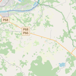
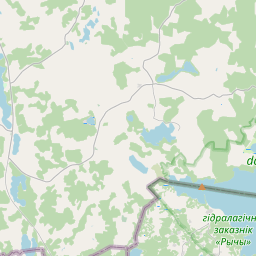
Kinnisvarakaart (katastrinumber: 44500040009)
Katastrinumber: 44500040009
Aadress: "Zemliepas", Demenes pag., Augšdaugavas nov., LV-5442
Aadress: "Zemliepas", Demenes pag., Augšdaugavas nov., LV-5442
Katastriobjekti number/tähis | |
|---|---|
Kinnisvara tüüp | Kinnisvara tüüp: Maa ja hoonete omand |
Aadress | Aadress: "Zemliepas", Demenes pag., Augšdaugavas nov., LV-5442 |
Aadress | |
|---|---|
Aadressi ID | Aadressi ID: 103801036 |
Aadressil registreeritud ettevõtted | Aadressil registreeritud ettevõtted: 0 |
Aadressil registreeritud struktuuriüksused | Aadressil registreeritud struktuuriüksused: 0 |
Asutused registreeritud aadressil | Asutused registreeritud aadressil: 0 |
Kinnisvara aadressil | |
Tehingud aadressil | Tehingud aadressil: 0 |
| Katastriobjekti tüüp | Katastriobjekti katastritunnus | Isikliku omandiõiguse staatus | Isiklik staatus | Kinnistusraamat |
|---|---|---|---|---|
| Katastriobjekti tüüp: Kinnisvara | 44500040009 | Isikliku omandiõiguse staatus: Omanik | Isiklik staatus: Füüsiline isik | Kinnistusraamat |
22.01.2025. Riigi maateenistuse andmed
|
|
|
{"7201060210":{"name":"<div class='color_dot' style='background-color: #00ffff'><\/div><span>M\u00e4\u00e4ratud maa\u00fcksus<\/span>","featureColor":"#00ffff","features":{"type":"FeatureCollection","features":[{"type":"Feature","geometry":{"type":"Polygon","coordinates":[[[26.608588339,55.755766507],[26.608790574,55.754797704],[26.610706507,55.75552704],[26.608588339,55.755766507]]]},"crs":{"type":"name","properties":{"name":"urn:ogc:def:crs:EPSG:3059"}},"properties":{"style":{"color":"#00ffff","dashArray":"8,12","weight":1},"name":"Maa","object_type":"Parcel","parcel_code":"44500040024","code":null,"surveyor":null,"address":"","ownership":"<span>Omanik - F\u00fc\u00fcsiline isik<br><\/span>","pro_cadastre_nr":"44500040009"}},{"type":"Feature","geometry":{"type":"Polygon","coordinates":[[[26.588546928,55.755422094],[26.589091968,55.754968696],[26.589695187,55.754567911],[26.591385726,55.754828522],[26.591541937,55.754852641],[26.591541436,55.754853991],[26.590951135,55.756344623],[26.590871394,55.756615776],[26.590869968,55.756627195],[26.589441221,55.756560975],[26.589353984,55.756556926],[26.589474464,55.755988882],[26.589381087,55.75597682],[26.588966772,55.755701296],[26.588546928,55.755422094]]]},"crs":{"type":"name","properties":{"name":"urn:ogc:def:crs:EPSG:3059"}},"properties":{"style":{"color":"#00ffff","dashArray":"8,12","weight":1},"name":"Maa","object_type":"Parcel","parcel_code":"44500040009","code":null,"surveyor":null,"address":"\"Zemliepas\", Demenes pag., Aug\u0161daugavas nov., LV-5442","ownership":"<span>Omanik - F\u00fc\u00fcsiline isik<br><\/span>","pro_cadastre_nr":"44500040009"}}]}},"7201060110":{"name":"<div class='color_dot' style='background-color: #00ffff'><\/div><span>M\u00f5\u00f5distatud maa\u00fcksus<\/span>","featureColor":"#00ffff","features":{"type":"FeatureCollection","features":[{"type":"Feature","geometry":{"type":"Polygon","coordinates":[[[26.586952144,55.754297451],[26.589091968,55.754968696],[26.588546928,55.755422094],[26.588966772,55.755701296],[26.588619431,55.755924201],[26.588150548,55.755773077],[26.58711059,55.755437867],[26.58740779,55.755172841],[26.587247392,55.754916313],[26.586952144,55.754297451]]]},"crs":{"type":"name","properties":{"name":"urn:ogc:def:crs:EPSG:3059"}},"properties":{"style":{"color":"#00ffff","dashArray":"0","weight":1},"name":"Maa","object_type":"Parcel","parcel_code":"44500040401","code":null,"surveyor":null,"address":"","ownership":"<span>Omanik - F\u00fc\u00fcsiline isik<br><\/span>","pro_cadastre_nr":"44500040009"}},{"type":"Feature","geometry":{"type":"Polygon","coordinates":[[[26.579263117,55.764602127],[26.579535355,55.764484016],[26.580020438,55.764251414],[26.580759612,55.763869466],[26.581111847,55.763727334],[26.581555868,55.763616639],[26.581658136,55.7635968],[26.581702082,55.763433667],[26.581911716,55.762655654],[26.583235498,55.76192296],[26.583232607,55.761927461],[26.582861527,55.762506205],[26.582820582,55.762714613],[26.582852006,55.762823344],[26.582897515,55.762870243],[26.582966335,55.76290298],[26.583052489,55.762929258],[26.584530049,55.763074724],[26.584582165,55.763098086],[26.586391023,55.763904722],[26.58331044,55.763843111],[26.582694435,55.764388479],[26.579747426,55.764853895],[26.579329541,55.764636956],[26.579263117,55.764602127]]]},"crs":{"type":"name","properties":{"name":"urn:ogc:def:crs:EPSG:3059"}},"properties":{"style":{"color":"#00ffff","dashArray":"0","weight":1},"name":"Maa","object_type":"Parcel","parcel_code":"44500040352","code":null,"surveyor":null,"address":"","ownership":"<span>Omanik - F\u00fc\u00fcsiline isik<br><\/span>","pro_cadastre_nr":"44500040009"}}]}},"7114100000":{"name":"<div class='color_dot' style='background-color: #b40000'><\/div><span>Koormatud tee servituudi ala<\/span>","featureColor":"#b40000","features":{"type":"FeatureCollection","features":[{"type":"Feature","geometry":{"type":"Polygon","coordinates":[[[26.589354062,55.756556889],[26.589474541,55.755988845],[26.589426889,55.755982703],[26.589444694,55.755488868],[26.589406218,55.755113081],[26.589423729,55.75490813],[26.589493173,55.754774164],[26.589652187,55.754636485],[26.589746592,55.754575879],[26.589849156,55.754591676],[26.589728516,55.754669131],[26.589580944,55.754796915],[26.589518636,55.754917113],[26.589501916,55.755112825],[26.589540253,55.755485766],[26.5895222,55.755990761],[26.589401709,55.756559093],[26.589354062,55.756556889]]]},"crs":{"type":"name","properties":{"name":"urn:ogc:def:crs:EPSG:3059"}},"properties":{"style":{"color":"#b40000","dashArray":"4,2,1,2","weight":1},"name":"Koormatud tee servituudi ala","object_type":"WayRestriction","parcel_code":"44500040009","code":"7315030100001","surveyor":null,"address":"\"Zemliepas\", Demenes pag., Aug\u0161daugavas nov., LV-5442","ownership":"<span>Omanik - F\u00fc\u00fcsiline isik<br><\/span>","pro_cadastre_nr":"44500040009"}}]}},"5201011310":{"name":"<div class='color_dot' style='background-color: #960096'><\/div><span>Vektoriseeritud hoone<\/span>","featureColor":"#960096","features":{"type":"FeatureCollection","features":[{"type":"Feature","geometry":{"type":"Polygon","coordinates":[[[26.590000523,55.755467306],[26.590048275,55.755466299],[26.590051102,55.755508936],[26.59000335,55.755509943],[26.590000523,55.755467306]]]},"crs":{"type":"name","properties":{"name":"urn:ogc:def:crs:EPSG:3059"}},"properties":{"style":{"color":"#960096","dashArray":"0","weight":2},"name":"Hoone","object_type":"Building","parcel_code":"44500040009","code":"44500040009006","surveyor":null,"address":"\"Zemliepas\", Demenes pag., Aug\u0161daugavas nov., LV-5442","ownership":"<span>Omanik - F\u00fc\u00fcsiline isik<br><\/span>","pro_cadastre_nr":"44500040009"}},{"type":"Feature","geometry":{"type":"Polygon","coordinates":[[[26.590121811,55.755383967],[26.590140911,55.755383564],[26.590145673,55.755455373],[26.590126573,55.755455776],[26.590121811,55.755383967]]]},"crs":{"type":"name","properties":{"name":"urn:ogc:def:crs:EPSG:3059"}},"properties":{"style":{"color":"#960096","dashArray":"0","weight":2},"name":"Hoone","object_type":"Building","parcel_code":"44500040009","code":"44500040009003","surveyor":null,"address":"\"Zemliepas\", Demenes pag., Aug\u0161daugavas nov., LV-5442","ownership":"<span>Omanik - F\u00fc\u00fcsiline isik<br><\/span>","pro_cadastre_nr":"44500040009"}},{"type":"Feature","geometry":{"type":"Polygon","coordinates":[[[26.589684428,55.755234333],[26.589783113,55.755232253],[26.589786089,55.755277133],[26.589687403,55.755279214],[26.589684428,55.755234333]]]},"crs":{"type":"name","properties":{"name":"urn:ogc:def:crs:EPSG:3059"}},"properties":{"style":{"color":"#960096","dashArray":"0","weight":2},"name":"Hoone","object_type":"Building","parcel_code":"44500040009","code":"44500040009007","surveyor":null,"address":"\"Zemliepas\", Demenes pag., Aug\u0161daugavas nov., LV-5442","ownership":"<span>Omanik - F\u00fc\u00fcsiline isik<br><\/span>","pro_cadastre_nr":"44500040009"}},{"type":"Feature","geometry":{"type":"Polygon","coordinates":[[[26.59046026,55.755746282],[26.590531092,55.755744788],[26.59053258,55.755767228],[26.590461748,55.755768722],[26.59046026,55.755746282]]]},"crs":{"type":"name","properties":{"name":"urn:ogc:def:crs:EPSG:3059"}},"properties":{"style":{"color":"#960096","dashArray":"0","weight":2},"name":"Hoone","object_type":"Building","parcel_code":"44500040009","code":"44500040009005","surveyor":null,"address":"\"Zemliepas\", Demenes pag., Aug\u0161daugavas nov., LV-5442","ownership":"<span>Omanik - F\u00fc\u00fcsiline isik<br><\/span>","pro_cadastre_nr":"44500040009"}},{"type":"Feature","geometry":{"type":"Polygon","coordinates":[[[26.590123034,55.755365883],[26.590138952,55.755365548],[26.590139547,55.755374524],[26.59012363,55.755374859],[26.590123034,55.755365883]]]},"crs":{"type":"name","properties":{"name":"urn:ogc:def:crs:EPSG:3059"}},"properties":{"style":{"color":"#960096","dashArray":"0","weight":2},"name":"Hoone","object_type":"Building","parcel_code":"44500040009","code":"44500040009004","surveyor":null,"address":"\"Zemliepas\", Demenes pag., Aug\u0161daugavas nov., LV-5442","ownership":"<span>Omanik - F\u00fc\u00fcsiline isik<br><\/span>","pro_cadastre_nr":"44500040009"}},{"type":"Feature","geometry":{"type":"Polygon","coordinates":[[[26.589838978,55.755446893],[26.589916972,55.755445248],[26.589915544,55.755423705],[26.589997517,55.755421977],[26.589998946,55.755443519],[26.590000523,55.755467306],[26.59000335,55.755509943],[26.589843383,55.755513316],[26.589838978,55.755446893]]]},"crs":{"type":"name","properties":{"name":"urn:ogc:def:crs:EPSG:3059"}},"properties":{"style":{"color":"#960096","dashArray":"0","weight":2},"name":"Hoone","object_type":"Building","parcel_code":"44500040009","code":"44500040009001","surveyor":null,"address":"\"Zemliepas\", Demenes pag., Aug\u0161daugavas nov., LV-5442","ownership":"<span>Omanik - F\u00fc\u00fcsiline isik<br><\/span>","pro_cadastre_nr":"44500040009"}},{"type":"Feature","geometry":{"type":"Polygon","coordinates":[[[26.590140911,55.755383564],[26.590226864,55.755381752],[26.590231626,55.755453561],[26.590145673,55.755455373],[26.590140911,55.755383564]]]},"crs":{"type":"name","properties":{"name":"urn:ogc:def:crs:EPSG:3059"}},"properties":{"style":{"color":"#960096","dashArray":"0","weight":2},"name":"Hoone","object_type":"Building","parcel_code":"44500040009","code":"44500040009002","surveyor":null,"address":"\"Zemliepas\", Demenes pag., Aug\u0161daugavas nov., LV-5442","ownership":"<span>Omanik - F\u00fc\u00fcsiline isik<br><\/span>","pro_cadastre_nr":"44500040009"}},{"type":"Feature","geometry":{"type":"Polygon","coordinates":[[[26.589641451,55.755235239],[26.589684428,55.755234333],[26.589687403,55.755279214],[26.589644427,55.75528012],[26.589641451,55.755235239]]]},"crs":{"type":"name","properties":{"name":"urn:ogc:def:crs:EPSG:3059"}},"properties":{"style":{"color":"#960096","dashArray":"0","weight":2},"name":"Hoone","object_type":"Building","parcel_code":"44500040009","code":"44500040009009","surveyor":null,"address":"\"Zemliepas\", Demenes pag., Aug\u0161daugavas nov., LV-5442","ownership":"<span>Omanik - F\u00fc\u00fcsiline isik<br><\/span>","pro_cadastre_nr":"44500040009"}},{"type":"Feature","geometry":{"type":"Polygon","coordinates":[[[26.589687403,55.755279214],[26.589786089,55.755277133],[26.589787696,55.755301369],[26.58968901,55.755303449],[26.589687403,55.755279214]]]},"crs":{"type":"name","properties":{"name":"urn:ogc:def:crs:EPSG:3059"}},"properties":{"style":{"color":"#960096","dashArray":"0","weight":2},"name":"Hoone","object_type":"Building","parcel_code":"44500040009","code":"44500040009008","surveyor":null,"address":"\"Zemliepas\", Demenes pag., Aug\u0161daugavas nov., LV-5442","ownership":"<span>Omanik - F\u00fc\u00fcsiline isik<br><\/span>","pro_cadastre_nr":"44500040009"}},{"type":"Feature","geometry":{"type":"Polygon","coordinates":[[[26.589641451,55.755235239],[26.589684428,55.755234333],[26.589687403,55.755279214],[26.589644427,55.75528012],[26.589641451,55.755235239]]]},"crs":{"type":"name","properties":{"name":"urn:ogc:def:crs:EPSG:3059"}},"properties":{"style":{"color":"#960096","dashArray":"0","weight":2},"name":"Hoone","object_type":"Building","parcel_code":"44500040009","code":"44500040009009","surveyor":null,"address":"\"Zemliepas\", Demenes pag., Aug\u0161daugavas nov., LV-5442","ownership":"<span>Omanik - F\u00fc\u00fcsiline isik<br><\/span>","pro_cadastre_nr":"44500040009"}},{"type":"Feature","geometry":{"type":"Polygon","coordinates":[[[26.589687403,55.755279214],[26.589786089,55.755277133],[26.589787696,55.755301369],[26.58968901,55.755303449],[26.589687403,55.755279214]]]},"crs":{"type":"name","properties":{"name":"urn:ogc:def:crs:EPSG:3059"}},"properties":{"style":{"color":"#960096","dashArray":"0","weight":2},"name":"Hoone","object_type":"Building","parcel_code":"44500040009","code":"44500040009008","surveyor":null,"address":"\"Zemliepas\", Demenes pag., Aug\u0161daugavas nov., LV-5442","ownership":"<span>Omanik - F\u00fc\u00fcsiline isik<br><\/span>","pro_cadastre_nr":"44500040009"}},{"type":"Feature","geometry":{"type":"Polygon","coordinates":[[[26.589684428,55.755234333],[26.589783113,55.755232253],[26.589786089,55.755277133],[26.589687403,55.755279214],[26.589684428,55.755234333]]]},"crs":{"type":"name","properties":{"name":"urn:ogc:def:crs:EPSG:3059"}},"properties":{"style":{"color":"#960096","dashArray":"0","weight":2},"name":"Hoone","object_type":"Building","parcel_code":"44500040009","code":"44500040009007","surveyor":null,"address":"\"Zemliepas\", Demenes pag., Aug\u0161daugavas nov., LV-5442","ownership":"<span>Omanik - F\u00fc\u00fcsiline isik<br><\/span>","pro_cadastre_nr":"44500040009"}},{"type":"Feature","geometry":{"type":"Polygon","coordinates":[[[26.590000523,55.755467306],[26.590048275,55.755466299],[26.590051102,55.755508936],[26.59000335,55.755509943],[26.590000523,55.755467306]]]},"crs":{"type":"name","properties":{"name":"urn:ogc:def:crs:EPSG:3059"}},"properties":{"style":{"color":"#960096","dashArray":"0","weight":2},"name":"Hoone","object_type":"Building","parcel_code":"44500040009","code":"44500040009006","surveyor":null,"address":"\"Zemliepas\", Demenes pag., Aug\u0161daugavas nov., LV-5442","ownership":"<span>Omanik - F\u00fc\u00fcsiline isik<br><\/span>","pro_cadastre_nr":"44500040009"}},{"type":"Feature","geometry":{"type":"Polygon","coordinates":[[[26.59046026,55.755746282],[26.590531092,55.755744788],[26.59053258,55.755767228],[26.590461748,55.755768722],[26.59046026,55.755746282]]]},"crs":{"type":"name","properties":{"name":"urn:ogc:def:crs:EPSG:3059"}},"properties":{"style":{"color":"#960096","dashArray":"0","weight":2},"name":"Hoone","object_type":"Building","parcel_code":"44500040009","code":"44500040009005","surveyor":null,"address":"\"Zemliepas\", Demenes pag., Aug\u0161daugavas nov., LV-5442","ownership":"<span>Omanik - F\u00fc\u00fcsiline isik<br><\/span>","pro_cadastre_nr":"44500040009"}},{"type":"Feature","geometry":{"type":"Polygon","coordinates":[[[26.590123034,55.755365883],[26.590138952,55.755365548],[26.590139547,55.755374524],[26.59012363,55.755374859],[26.590123034,55.755365883]]]},"crs":{"type":"name","properties":{"name":"urn:ogc:def:crs:EPSG:3059"}},"properties":{"style":{"color":"#960096","dashArray":"0","weight":2},"name":"Hoone","object_type":"Building","parcel_code":"44500040009","code":"44500040009004","surveyor":null,"address":"\"Zemliepas\", Demenes pag., Aug\u0161daugavas nov., LV-5442","ownership":"<span>Omanik - F\u00fc\u00fcsiline isik<br><\/span>","pro_cadastre_nr":"44500040009"}},{"type":"Feature","geometry":{"type":"Polygon","coordinates":[[[26.590121811,55.755383967],[26.590140911,55.755383564],[26.590145673,55.755455373],[26.590126573,55.755455776],[26.590121811,55.755383967]]]},"crs":{"type":"name","properties":{"name":"urn:ogc:def:crs:EPSG:3059"}},"properties":{"style":{"color":"#960096","dashArray":"0","weight":2},"name":"Hoone","object_type":"Building","parcel_code":"44500040009","code":"44500040009003","surveyor":null,"address":"\"Zemliepas\", Demenes pag., Aug\u0161daugavas nov., LV-5442","ownership":"<span>Omanik - F\u00fc\u00fcsiline isik<br><\/span>","pro_cadastre_nr":"44500040009"}},{"type":"Feature","geometry":{"type":"Polygon","coordinates":[[[26.590140911,55.755383564],[26.590226864,55.755381752],[26.590231626,55.755453561],[26.590145673,55.755455373],[26.590140911,55.755383564]]]},"crs":{"type":"name","properties":{"name":"urn:ogc:def:crs:EPSG:3059"}},"properties":{"style":{"color":"#960096","dashArray":"0","weight":2},"name":"Hoone","object_type":"Building","parcel_code":"44500040009","code":"44500040009002","surveyor":null,"address":"\"Zemliepas\", Demenes pag., Aug\u0161daugavas nov., LV-5442","ownership":"<span>Omanik - F\u00fc\u00fcsiline isik<br><\/span>","pro_cadastre_nr":"44500040009"}},{"type":"Feature","geometry":{"type":"Polygon","coordinates":[[[26.589838978,55.755446893],[26.589916972,55.755445248],[26.589915544,55.755423705],[26.589997517,55.755421977],[26.589998946,55.755443519],[26.590000523,55.755467306],[26.59000335,55.755509943],[26.589843383,55.755513316],[26.589838978,55.755446893]]]},"crs":{"type":"name","properties":{"name":"urn:ogc:def:crs:EPSG:3059"}},"properties":{"style":{"color":"#960096","dashArray":"0","weight":2},"name":"Hoone","object_type":"Building","parcel_code":"44500040009","code":"44500040009001","surveyor":null,"address":"\"Zemliepas\", Demenes pag., Aug\u0161daugavas nov., LV-5442","ownership":"<span>Omanik - F\u00fc\u00fcsiline isik<br><\/span>","pro_cadastre_nr":"44500040009"}}]}}}
[]
https://tile.openstreetmap.org/{z}/{x}/{y}.png|© OpenStreetMap contributors|minZoom: 7|maxZoom: 19
|
Kinnisvara andmeid värskendati: 21.01.2025.
Andmeallikas ja tegevusluba: Katastri infosüsteemi avatekst ja ruumiandmed, Kinnisvaraturu andmebaasi avaandmed, Riigi Ehituskontrolli Ameti avaandmed, Justiitsministeeriumi avaandmed „Andmed rakendatud mõjutusmeetmete kohta riigi- peetavad registrid", avaandmete litsents Creative Commons Attribution, kohtuhalduse e-oksjoni andmed, OpenStreetMap nimeandmed, Keskstatistikaameti avaandmed: "Naabruskonnad".

