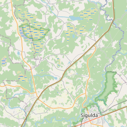
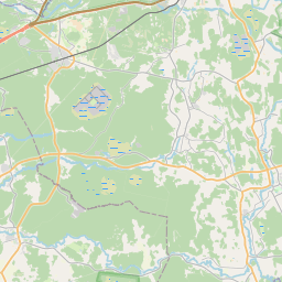
Maaüksuse kaart (katastritunnus: 80940050060)
Katastri tähis: 80940050060
Haldusterritoorium: Siguldas novads
Kinnisasja katastri määramine | |
|---|---|
Katastriobjekti tüüp | Katastriobjekti tüüp: Maa üksus |
Haldusterritoorium | |
Kinnistu katastrinumber, mille koosseisu see maaüksus kuulub | Kinnistu katastrinumber, mille koosseisu see maaüksus kuulub: 80940050056 |
|
|
|
{"7201060210":{"name":"<div class='color_dot' style='background-color: #00ffff'><\/div><span>M\u00e4\u00e4ratud maa\u00fcksus<\/span>","featureColor":"#00ffff","features":{"type":"FeatureCollection","features":[{"type":"Feature","geometry":{"type":"Polygon","coordinates":[[[24.911882999,57.082985789],[24.915285416,57.081831307],[24.915956754,57.081655719],[24.91952759,57.080756927],[24.919716917,57.080778024],[24.92087354,57.080587204],[24.920045326,57.085901237],[24.919222947,57.085567771],[24.91781258,57.085000904],[24.917408122,57.084844087],[24.916973055,57.084684403],[24.916315701,57.084462925],[24.915159542,57.084073451],[24.913685775,57.083583193],[24.912427108,57.083166645],[24.911882999,57.082985789]]]},"crs":{"type":"name","properties":{"name":"urn:ogc:def:crs:EPSG:3059"}},"properties":{"style":{"color":"#00ffff","dashArray":"8,12","weight":1},"name":"Maa","object_type":"Parcel","parcel_code":"80940050062","code":null,"surveyor":null,"address":"","ownership":"<span>Omanik - F\u00fc\u00fcsiline isik<br><\/span>","pro_cadastre_nr":"80940050056"}},{"type":"Feature","geometry":{"type":"Polygon","coordinates":[[[24.916300265,57.089379764],[24.919974561,57.086174694],[24.921402246,57.086754742],[24.920057772,57.088784112],[24.920058963,57.089381951],[24.916300265,57.089379764]]]},"crs":{"type":"name","properties":{"name":"urn:ogc:def:crs:EPSG:3059"}},"properties":{"style":{"color":"#00ffff","dashArray":"8,12","weight":1},"name":"Maa","object_type":"Parcel","parcel_code":"80940050061","code":null,"surveyor":null,"address":"","ownership":"<span>Omanik - F\u00fc\u00fcsiline isik<br><\/span>","pro_cadastre_nr":"80940050056"}},{"type":"Feature","geometry":{"type":"Polygon","coordinates":[[[24.911656777,57.083194826],[24.913453985,57.083790306],[24.914793529,57.084235496],[24.914864857,57.084259618],[24.914869702,57.084341138],[24.914871926,57.084688814],[24.914832868,57.085013757],[24.914799082,57.085127919],[24.914185384,57.08504696],[24.913534593,57.084946334],[24.912988835,57.084864874],[24.912758205,57.084840923],[24.912199357,57.084805426],[24.911656777,57.083194826]]]},"crs":{"type":"name","properties":{"name":"urn:ogc:def:crs:EPSG:3059"}},"properties":{"style":{"color":"#00ffff","dashArray":"8,12","weight":1},"name":"Maa","object_type":"Parcel","parcel_code":"80940050060","code":null,"surveyor":null,"address":"","ownership":"<span>Omanik - F\u00fc\u00fcsiline isik<br><\/span>","pro_cadastre_nr":"80940050056"}},{"type":"Feature","geometry":{"type":"Polygon","coordinates":[[[24.969285775,57.124166771],[24.972102744,57.1224322],[24.973010642,57.123091886],[24.973872959,57.122595205],[24.974477852,57.123354232],[24.973791867,57.12371188],[24.9729857,57.124441596],[24.973718516,57.124673621],[24.971494693,57.125519239],[24.970545516,57.124893605],[24.969285775,57.124166771]]]},"crs":{"type":"name","properties":{"name":"urn:ogc:def:crs:EPSG:3059"}},"properties":{"style":{"color":"#00ffff","dashArray":"8,12","weight":1},"name":"Maa","object_type":"Parcel","parcel_code":"80940050059","code":null,"surveyor":null,"address":"","ownership":"<span>Omanik - F\u00fc\u00fcsiline isik<br><\/span>","pro_cadastre_nr":"80940050056"}},{"type":"Feature","geometry":{"type":"Polygon","coordinates":[[[24.937278155,57.112338804],[24.937442225,57.112288696],[24.938004844,57.112081562],[24.938311268,57.111943452],[24.938604671,57.111803121],[24.9388018,57.111702321],[24.939059597,57.11156513],[24.9393363,57.111386911],[24.939375502,57.111353072],[24.939416379,57.111380239],[24.939958401,57.111740498],[24.940304614,57.111927209],[24.941834524,57.112673288],[24.942094125,57.112765444],[24.942705954,57.112944771],[24.9435125,57.113148532],[24.944631602,57.113444963],[24.94449277,57.113900788],[24.944217043,57.114639655],[24.938988377,57.114081249],[24.939344064,57.112540646],[24.937326326,57.112378251],[24.937278155,57.112338804]]]},"crs":{"type":"name","properties":{"name":"urn:ogc:def:crs:EPSG:3059"}},"properties":{"style":{"color":"#00ffff","dashArray":"8,12","weight":1},"name":"Maa","object_type":"Parcel","parcel_code":"80940050058","code":null,"surveyor":null,"address":"","ownership":"<span>Omanik - F\u00fc\u00fcsiline isik<br><\/span>","pro_cadastre_nr":"80940050056"}},{"type":"Feature","geometry":{"type":"Polygon","coordinates":[[[24.934340725,57.110210179],[24.93439112,57.10985868],[24.934404347,57.109862687],[24.934894436,57.110014445],[24.934996262,57.10992011],[24.935437304,57.110028786],[24.935075544,57.110438433],[24.934340725,57.110210179]]]},"crs":{"type":"name","properties":{"name":"urn:ogc:def:crs:EPSG:3059"}},"properties":{"style":{"color":"#00ffff","dashArray":"8,12","weight":1},"name":"Maa","object_type":"Parcel","parcel_code":"80940050057","code":null,"surveyor":null,"address":"","ownership":"<span>Omanik - F\u00fc\u00fcsiline isik<br><\/span>","pro_cadastre_nr":"80940050056"}},{"type":"Feature","geometry":{"type":"Polygon","coordinates":[[[24.934231179,57.110537809],[24.934377181,57.110403014],[24.934305021,57.110379844],[24.934360937,57.110317187],[24.935330255,57.110628141],[24.935173819,57.110853975],[24.934231179,57.110537809]]]},"crs":{"type":"name","properties":{"name":"urn:ogc:def:crs:EPSG:3059"}},"properties":{"style":{"color":"#00ffff","dashArray":"8,12","weight":1},"name":"Maa","object_type":"Parcel","parcel_code":"80940050056","code":null,"surveyor":null,"address":"Meldru iela 15, J\u016bda\u017ei, Siguldas pag., Siguldas nov., LV-2151","ownership":"<span>Omanik - F\u00fc\u00fcsiline isik<br><\/span>","pro_cadastre_nr":"80940050056"}}]}},"5201011110":{"name":"<div class='color_dot' style='background-color: #ff0000'><\/div><span>M\u00f5\u00f5distatud hoone<\/span>","featureColor":"#ff0000","features":{"type":"FeatureCollection","features":[{"type":"Feature","geometry":{"type":"Polygon","coordinates":[[[24.934226483,57.110502124],[24.934331499,57.110401217],[24.934417983,57.110428683],[24.934310587,57.110528826],[24.934226483,57.110502124]]]},"crs":{"type":"name","properties":{"name":"urn:ogc:def:crs:EPSG:3059"}},"properties":{"style":{"color":"#ff0000","dashArray":"0","weight":1},"name":"Hoone","object_type":"Building","parcel_code":"80940050056","code":"80940050056002","surveyor":null,"address":"Meldru iela 15, J\u016bda\u017ei, Siguldas pag., Siguldas nov., LV-2151","ownership":"<span>Omanik - F\u00fc\u00fcsiline isik<br><\/span>","pro_cadastre_nr":"80940050056"}},{"type":"Feature","geometry":{"type":"Polygon","coordinates":[[[24.934832219,57.110724397],[24.934915419,57.110640425],[24.935124354,57.110706623],[24.935044939,57.110786785],[24.934832219,57.110724397]]]},"crs":{"type":"name","properties":{"name":"urn:ogc:def:crs:EPSG:3059"}},"properties":{"style":{"color":"#ff0000","dashArray":"0","weight":1},"name":"Hoone","object_type":"Building","parcel_code":"80940050056","code":"80940050056001","surveyor":null,"address":"Meldru iela 15, J\u016bda\u017ei, Siguldas pag., Siguldas nov., LV-2151","ownership":"<span>Omanik - F\u00fc\u00fcsiline isik<br><\/span>","pro_cadastre_nr":"80940050056"}},{"type":"Feature","geometry":{"type":"Polygon","coordinates":[[[24.934226483,57.110502124],[24.934331499,57.110401217],[24.934417983,57.110428683],[24.934310587,57.110528826],[24.934226483,57.110502124]]]},"crs":{"type":"name","properties":{"name":"urn:ogc:def:crs:EPSG:3059"}},"properties":{"style":{"color":"#ff0000","dashArray":"0","weight":1},"name":"Hoone","object_type":"Building","parcel_code":"80940050056","code":"80940050056002","surveyor":null,"address":"Meldru iela 15, J\u016bda\u017ei, Siguldas pag., Siguldas nov., LV-2151","ownership":"<span>Omanik - F\u00fc\u00fcsiline isik<br><\/span>","pro_cadastre_nr":"80940050056"}},{"type":"Feature","geometry":{"type":"Polygon","coordinates":[[[24.934832219,57.110724397],[24.934915419,57.110640425],[24.935124354,57.110706623],[24.935044939,57.110786785],[24.934832219,57.110724397]]]},"crs":{"type":"name","properties":{"name":"urn:ogc:def:crs:EPSG:3059"}},"properties":{"style":{"color":"#ff0000","dashArray":"0","weight":1},"name":"Hoone","object_type":"Building","parcel_code":"80940050056","code":"80940050056001","surveyor":null,"address":"Meldru iela 15, J\u016bda\u017ei, Siguldas pag., Siguldas nov., LV-2151","ownership":"<span>Omanik - F\u00fc\u00fcsiline isik<br><\/span>","pro_cadastre_nr":"80940050056"}}]}}}
{"7201060210":{"name":"<div class='color_dot' style='background-color: #00ffff'><\/div><span>M\u00e4\u00e4ratud maa\u00fcksus<\/span>","featureColor":"#00ffff","features":{"type":"FeatureCollection","features":[{"type":"Feature","geometry":{"type":"Polygon","coordinates":[[[24.937278155,57.112338804],[24.937442225,57.112288696],[24.938004844,57.112081562],[24.938311268,57.111943452],[24.938604671,57.111803121],[24.9388018,57.111702321],[24.939059597,57.11156513],[24.9393363,57.111386911],[24.939375502,57.111353072],[24.939416379,57.111380239],[24.939958401,57.111740498],[24.940304614,57.111927209],[24.941834524,57.112673288],[24.942094125,57.112765444],[24.942705954,57.112944771],[24.9435125,57.113148532],[24.944631602,57.113444963],[24.94454834,57.113862638],[24.944217043,57.114639655],[24.938988377,57.114081249],[24.939344064,57.112540646],[24.937326326,57.112378251],[24.937278155,57.112338804]]]},"crs":{"type":"name","properties":{"name":"urn:ogc:def:crs:EPSG:3059"}},"properties":{"style":{"color":"#00ffff","dashArray":"8,12","weight":1},"name":"Maa","object_type":"Parcel","parcel_code":"80940050058","code":null,"surveyor":null,"address":"","ownership":null,"pro_cadastre_nr":null}}]}}}
https://tile.openstreetmap.org/{z}/{x}/{y}.png|© OpenStreetMap contributors|minZoom: 7|maxZoom: 19
|
Maaüksuse andmeid värskendati: 20.12.2024.
Andmeallikas ja litsents: katastri infosüsteem avatud teksti- ja ruumiandmed, kinnisvaraturu andmebaasi avaandmed, avaandmete litsents Creative Commons Attribution, OpenStreetMap


