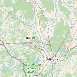
Maaüksuse kaart (katastritunnus: 76900060071)
Katastri tähis: 76900060071
Aadress: "Ievāji", Čukuri, Upmalas pagasts, Preiļu novads, LV-5335
Kinnisasja katastri määramine | |
|---|---|
Katastriobjekti tüüp | Katastriobjekti tüüp: Maa üksus |
Aadress | Aadress: "Ievāji", Čukuri, Upmalas pagasts, Preiļu novads, LV-5335 |
Kinnistu katastrinumber, mille koosseisu see maaüksus kuulub | Kinnistu katastrinumber, mille koosseisu see maaüksus kuulub: 76900050072 |
Aadress | |
|---|---|
Aadressi ID | Aadressi ID: 103722518 |
Aadressil registreeritud ettevõtted | Aadressil registreeritud ettevõtted: 0 |
Aadressil registreeritud struktuuriüksused | Aadressil registreeritud struktuuriüksused: 0 |
Asutused registreeritud aadressil | Asutused registreeritud aadressil: 0 |
Kinnisvara aadressil | Kinnisvara aadressil: 0 |
Tehingud aadressil | Tehingud aadressil: 0 |
|
|
|
{"7201060210":{"name":"<div class='color_dot' style='background-color: #00ffff'><\/div><span>M\u00e4\u00e4ratud maa\u00fcksus<\/span>","featureColor":"#00ffff","features":{"type":"FeatureCollection","features":[{"type":"Feature","geometry":{"type":"Polygon","coordinates":[[[26.600120498,56.203628542],[26.600159272,56.203231402],[26.600162001,56.203088091],[26.600573809,56.203508316],[26.600432033,56.203646364],[26.600317637,56.203757752],[26.600120498,56.203628542]]]},"crs":{"type":"name","properties":{"name":"urn:ogc:def:crs:EPSG:3059"}},"properties":{"style":{"color":"#00ffff","dashArray":"8,12","weight":1},"name":"Maa","object_type":"Parcel","parcel_code":"76940040168","code":null,"surveyor":null,"address":"","ownership":"<span>Omanik - F\u00fc\u00fcsiline isik<br><\/span>","pro_cadastre_nr":"76900050072"}},{"type":"Feature","geometry":{"type":"Polygon","coordinates":[[[26.599756152,56.205922428],[26.600534076,56.206017967],[26.600824993,56.207264914],[26.600686895,56.207783678],[26.599935241,56.207622935],[26.599756152,56.205922428]]]},"crs":{"type":"name","properties":{"name":"urn:ogc:def:crs:EPSG:3059"}},"properties":{"style":{"color":"#00ffff","dashArray":"8,12","weight":1},"name":"Maa","object_type":"Parcel","parcel_code":"76940040116","code":null,"surveyor":null,"address":"","ownership":"<span>Omanik - F\u00fc\u00fcsiline isik<br><\/span>","pro_cadastre_nr":"76900050072"}},{"type":"Feature","geometry":{"type":"Polygon","coordinates":[[[26.597526484,56.202296953],[26.598589277,56.201953682],[26.600159272,56.203231402],[26.600120498,56.203628542],[26.600108463,56.203751825],[26.599221799,56.203099138],[26.597526484,56.202296953]]]},"crs":{"type":"name","properties":{"name":"urn:ogc:def:crs:EPSG:3059"}},"properties":{"style":{"color":"#00ffff","dashArray":"8,12","weight":1},"name":"Maa","object_type":"Parcel","parcel_code":"76900060218","code":null,"surveyor":null,"address":"","ownership":"<span>Omanik - F\u00fc\u00fcsiline isik<br><\/span>","pro_cadastre_nr":"76900050072"}},{"type":"Feature","geometry":{"type":"Polygon","coordinates":[[[26.570593202,56.196346055],[26.570659027,56.194738108],[26.575606135,56.194579925],[26.575756171,56.19457554],[26.575825405,56.194573522],[26.575859949,56.194572757],[26.5809768,56.194460021],[26.581135167,56.194427287],[26.582217596,56.194395248],[26.58199891,56.195489493],[26.581880859,56.196152856],[26.581673042,56.197248366],[26.578323243,56.197492642],[26.577025943,56.197245182],[26.573754511,56.19662228],[26.571602136,56.196276361],[26.570593202,56.196346055]]]},"crs":{"type":"name","properties":{"name":"urn:ogc:def:crs:EPSG:3059"}},"properties":{"style":{"color":"#00ffff","dashArray":"8,12","weight":1},"name":"Maa","object_type":"Parcel","parcel_code":"76900060071","code":null,"surveyor":null,"address":"\"Iev\u0101ji\", \u010cukuri, Upmalas pag., Prei\u013cu nov., LV-5335","ownership":"<span>Omanik - F\u00fc\u00fcsiline isik<br><\/span>","pro_cadastre_nr":"76900050072"}},{"type":"Feature","geometry":{"type":"Polygon","coordinates":[[[26.505242722,56.198591797],[26.506055634,56.19830213],[26.506090342,56.198338393],[26.506552482,56.198821309],[26.506083955,56.199000169],[26.505877144,56.199081155],[26.505274452,56.198616275],[26.505242722,56.198591797]]]},"crs":{"type":"name","properties":{"name":"urn:ogc:def:crs:EPSG:3059"}},"properties":{"style":{"color":"#00ffff","dashArray":"8,12","weight":1},"name":"Maa","object_type":"Parcel","parcel_code":"76900050072","code":null,"surveyor":null,"address":"Padomes iela 35, Vecv\u0101rkava, Upmalas pag., Prei\u013cu nov., LV-5335","ownership":"<span>Omanik - F\u00fc\u00fcsiline isik<br><\/span>","pro_cadastre_nr":"76900050072"}}]}},"7114100000":{"name":"<div class='color_dot' style='background-color: #b40000'><\/div><span>Koormatud tee servituudi ala<\/span>","featureColor":"#b40000","features":{"type":"FeatureCollection","features":[{"type":"Feature","geometry":{"type":"Polygon","coordinates":[[[26.599902083,56.207278495],[26.599897202,56.207236426],[26.600292419,56.207351718],[26.60076502,56.207486377],[26.600754368,56.207524352],[26.600262547,56.207383553],[26.599902083,56.207278495]]]},"crs":{"type":"name","properties":{"name":"urn:ogc:def:crs:EPSG:3059"}},"properties":{"style":{"color":"#b40000","dashArray":"4,2,1,2","weight":1},"name":"Koormatud tee servituudi ala","object_type":"WayRestriction","parcel_code":"76940040116","code":"7315030100002","surveyor":null,"address":"","ownership":"<span>Omanik - F\u00fc\u00fcsiline isik<br><\/span>","pro_cadastre_nr":"76900050072"}},{"type":"Feature","geometry":{"type":"Polygon","coordinates":[[[26.599285825,56.2031448],[26.599376731,56.202943872],[26.599246869,56.202491055],[26.59933146,56.202558971],[26.599440362,56.202938192],[26.599439228,56.202952642],[26.599336026,56.203181081],[26.599285825,56.2031448]]]},"crs":{"type":"name","properties":{"name":"urn:ogc:def:crs:EPSG:3059"}},"properties":{"style":{"color":"#b40000","dashArray":"4,2,1,2","weight":1},"name":"Koormatud tee servituudi ala","object_type":"WayRestriction","parcel_code":"76900060218","code":"7315030100001","surveyor":null,"address":"","ownership":"<span>Omanik - F\u00fc\u00fcsiline isik<br><\/span>","pro_cadastre_nr":"76900050072"}},{"type":"Feature","geometry":{"type":"Polygon","coordinates":[[[26.575781473,56.194663671],[26.575822817,56.194577962],[26.57642213,56.194617763],[26.579248101,56.195169168],[26.581956203,56.19569624],[26.58194181,56.195789847],[26.579194885,56.19525394],[26.576387181,56.194706242],[26.575781473,56.194663671]]]},"crs":{"type":"name","properties":{"name":"urn:ogc:def:crs:EPSG:3059"}},"properties":{"style":{"color":"#b40000","dashArray":"4,2,1,2","weight":1},"name":"Koormatud tee servituudi ala","object_type":"WayRestriction","parcel_code":"76900060071","code":"7315030100003","surveyor":null,"address":"\"Iev\u0101ji\", \u010cukuri, Upmalas pag., Prei\u013cu nov., LV-5335","ownership":"<span>Omanik - F\u00fc\u00fcsiline isik<br><\/span>","pro_cadastre_nr":"76900050072"}},{"type":"Feature","geometry":{"type":"Polygon","coordinates":[[[26.575672453,56.194580826],[26.575822817,56.194577962],[26.57547893,56.195249521],[26.575439333,56.195289399],[26.574843007,56.195637557],[26.574256291,56.196074925],[26.573724628,56.196615173],[26.573564892,56.196589926],[26.574119215,56.196027402],[26.574717888,56.195580564],[26.575322807,56.195227365],[26.575672453,56.194580826]]]},"crs":{"type":"name","properties":{"name":"urn:ogc:def:crs:EPSG:3059"}},"properties":{"style":{"color":"#b40000","dashArray":"4,2,1,2","weight":1},"name":"Koormatud tee servituudi ala","object_type":"WayRestriction","parcel_code":"76900060071","code":"7315030100002","surveyor":null,"address":"\"Iev\u0101ji\", \u010cukuri, Upmalas pag., Prei\u013cu nov., LV-5335","ownership":"<span>Omanik - F\u00fc\u00fcsiline isik<br><\/span>","pro_cadastre_nr":"76900050072"}}]}},"5201011310":{"name":"<div class='color_dot' style='background-color: #960096'><\/div><span>Vektoriseeritud hoone<\/span>","featureColor":"#960096","features":{"type":"FeatureCollection","features":[{"type":"Feature","geometry":{"type":"Polygon","coordinates":[[[26.574269795,56.195386263],[26.574279985,56.195449318],[26.574175129,56.195454585],[26.574164938,56.19539153],[26.574269795,56.195386263]]]},"crs":{"type":"name","properties":{"name":"urn:ogc:def:crs:EPSG:3059"}},"properties":{"style":{"color":"#960096","dashArray":"0","weight":2},"name":"Hoone","object_type":"Building","parcel_code":"76900060071","code":"76900060071003","surveyor":null,"address":"\"Iev\u0101ji\", \u010cukuri, Upmalas pag., Prei\u013cu nov., LV-5335","ownership":null,"pro_cadastre_nr":null}},{"type":"Feature","geometry":{"type":"Polygon","coordinates":[[[26.574279985,56.195449318],[26.574289299,56.195506998],[26.574184443,56.195512265],[26.574175129,56.195454585],[26.574279985,56.195449318]]]},"crs":{"type":"name","properties":{"name":"urn:ogc:def:crs:EPSG:3059"}},"properties":{"style":{"color":"#960096","dashArray":"0","weight":2},"name":"Hoone","object_type":"Building","parcel_code":"76900060071","code":"76900060071004","surveyor":null,"address":"\"Iev\u0101ji\", \u010cukuri, Upmalas pag., Prei\u013cu nov., LV-5335","ownership":null,"pro_cadastre_nr":null}},{"type":"Feature","geometry":{"type":"Polygon","coordinates":[[[26.574777613,56.195364],[26.574766667,56.195332257],[26.574856207,56.195322653],[26.574867153,56.195354396],[26.574777613,56.195364]]]},"crs":{"type":"name","properties":{"name":"urn:ogc:def:crs:EPSG:3059"}},"properties":{"style":{"color":"#960096","dashArray":"0","weight":2},"name":"Hoone","object_type":"Building","parcel_code":"76900060071","code":"76900060071002","surveyor":null,"address":"\"Iev\u0101ji\", \u010cukuri, Upmalas pag., Prei\u013cu nov., LV-5335","ownership":null,"pro_cadastre_nr":null}},{"type":"Feature","geometry":{"type":"Polygon","coordinates":[[[26.574230401,56.195710458],[26.57434023,56.195710093],[26.574340459,56.195732757],[26.574230646,56.19573312],[26.574230401,56.195710458]]]},"crs":{"type":"name","properties":{"name":"urn:ogc:def:crs:EPSG:3059"}},"properties":{"style":{"color":"#960096","dashArray":"0","weight":2},"name":"Hoone","object_type":"Building","parcel_code":"76900060071","code":"76900060071006","surveyor":null,"address":"\"Iev\u0101ji\", \u010cukuri, Upmalas pag., Prei\u013cu nov., LV-5335","ownership":null,"pro_cadastre_nr":null}},{"type":"Feature","geometry":{"type":"Polygon","coordinates":[[[26.574676333,56.195332413],[26.574710426,56.19544037],[26.574599547,56.195451263],[26.574565453,56.195343298],[26.574676333,56.195332413]]]},"crs":{"type":"name","properties":{"name":"urn:ogc:def:crs:EPSG:3059"}},"properties":{"style":{"color":"#960096","dashArray":"0","weight":2},"name":"Hoone","object_type":"Building","parcel_code":"76900060071","code":"76900060071001","surveyor":null,"address":"\"Iev\u0101ji\", \u010cukuri, Upmalas pag., Prei\u013cu nov., LV-5335","ownership":null,"pro_cadastre_nr":null}},{"type":"Feature","geometry":{"type":"Polygon","coordinates":[[[26.506087066,56.198483902],[26.506029036,56.198501122],[26.505976793,56.198446412],[26.506034823,56.198429192],[26.506087066,56.198483902]]]},"crs":{"type":"name","properties":{"name":"urn:ogc:def:crs:EPSG:3059"}},"properties":{"style":{"color":"#960096","dashArray":"0","weight":2},"name":"Hoone","object_type":"Building","parcel_code":"76900050072","code":"76900050072004","surveyor":null,"address":"Padomes iela 35, Vecv\u0101rkava, Upmalas pag., Prei\u013cu nov., LV-5335","ownership":"<span>Omanik - F\u00fc\u00fcsiline isik<br><\/span>","pro_cadastre_nr":"76900050072"}},{"type":"Feature","geometry":{"type":"Polygon","coordinates":[[[26.506197574,56.198451112],[26.506155328,56.198463644],[26.506104157,56.198410044],[26.506146387,56.198397512],[26.506197574,56.198451112]]]},"crs":{"type":"name","properties":{"name":"urn:ogc:def:crs:EPSG:3059"}},"properties":{"style":{"color":"#960096","dashArray":"0","weight":2},"name":"Hoone","object_type":"Building","parcel_code":"76900050072","code":"76900050072002","surveyor":null,"address":"Padomes iela 35, Vecv\u0101rkava, Upmalas pag., Prei\u013cu nov., LV-5335","ownership":"<span>Omanik - F\u00fc\u00fcsiline isik<br><\/span>","pro_cadastre_nr":"76900050072"}},{"type":"Feature","geometry":{"type":"Polygon","coordinates":[[[26.505726626,56.19847887],[26.505766792,56.198463872],[26.505811628,56.19850118],[26.505771477,56.198516177],[26.505726626,56.19847887]]]},"crs":{"type":"name","properties":{"name":"urn:ogc:def:crs:EPSG:3059"}},"properties":{"style":{"color":"#960096","dashArray":"0","weight":2},"name":"Hoone","object_type":"Building","parcel_code":"76900050072","code":"76900050072006","surveyor":null,"address":"Padomes iela 35, Vecv\u0101rkava, Upmalas pag., Prei\u013cu nov., LV-5335","ownership":"<span>Omanik - F\u00fc\u00fcsiline isik<br><\/span>","pro_cadastre_nr":"76900050072"}},{"type":"Feature","geometry":{"type":"Polygon","coordinates":[[[26.506029036,56.198501122],[26.50597186,56.198518091],[26.505919617,56.198463381],[26.505976793,56.198446412],[26.506029036,56.198501122]]]},"crs":{"type":"name","properties":{"name":"urn:ogc:def:crs:EPSG:3059"}},"properties":{"style":{"color":"#960096","dashArray":"0","weight":2},"name":"Hoone","object_type":"Building","parcel_code":"76900050072","code":"76900050072005","surveyor":null,"address":"Padomes iela 35, Vecv\u0101rkava, Upmalas pag., Prei\u013cu nov., LV-5335","ownership":"<span>Omanik - F\u00fc\u00fcsiline isik<br><\/span>","pro_cadastre_nr":"76900050072"}},{"type":"Feature","geometry":{"type":"Polygon","coordinates":[[[26.506102812,56.198721062],[26.506027786,56.198666822],[26.506100428,56.19863559],[26.506075556,56.198617625],[26.506148245,56.198586374],[26.506248143,56.19865858],[26.506102812,56.198721062]]]},"crs":{"type":"name","properties":{"name":"urn:ogc:def:crs:EPSG:3059"}},"properties":{"style":{"color":"#960096","dashArray":"0","weight":2},"name":"Hoone","object_type":"Building","parcel_code":"76900050072","code":"76900050072001","surveyor":null,"address":"Padomes iela 35, Vecv\u0101rkava, Upmalas pag., Prei\u013cu nov., LV-5335","ownership":"<span>Omanik - F\u00fc\u00fcsiline isik<br><\/span>","pro_cadastre_nr":"76900050072"}},{"type":"Feature","geometry":{"type":"Polygon","coordinates":[[[26.506155328,56.198463644],[26.506087066,56.198483902],[26.506035879,56.198430303],[26.506104157,56.198410044],[26.506155328,56.198463644]]]},"crs":{"type":"name","properties":{"name":"urn:ogc:def:crs:EPSG:3059"}},"properties":{"style":{"color":"#960096","dashArray":"0","weight":2},"name":"Hoone","object_type":"Building","parcel_code":"76900050072","code":"76900050072003","surveyor":null,"address":"Padomes iela 35, Vecv\u0101rkava, Upmalas pag., Prei\u013cu nov., LV-5335","ownership":"<span>Omanik - F\u00fc\u00fcsiline isik<br><\/span>","pro_cadastre_nr":"76900050072"}},{"type":"Feature","geometry":{"type":"Polygon","coordinates":[[[26.505726626,56.19847887],[26.505766792,56.198463872],[26.505811628,56.19850118],[26.505771477,56.198516177],[26.505726626,56.19847887]]]},"crs":{"type":"name","properties":{"name":"urn:ogc:def:crs:EPSG:3059"}},"properties":{"style":{"color":"#960096","dashArray":"0","weight":2},"name":"Hoone","object_type":"Building","parcel_code":"76900050072","code":"76900050072006","surveyor":null,"address":"Padomes iela 35, Vecv\u0101rkava, Upmalas pag., Prei\u013cu nov., LV-5335","ownership":"<span>Omanik - F\u00fc\u00fcsiline isik<br><\/span>","pro_cadastre_nr":"76900050072"}},{"type":"Feature","geometry":{"type":"Polygon","coordinates":[[[26.506029036,56.198501122],[26.50597186,56.198518091],[26.505919617,56.198463381],[26.505976793,56.198446412],[26.506029036,56.198501122]]]},"crs":{"type":"name","properties":{"name":"urn:ogc:def:crs:EPSG:3059"}},"properties":{"style":{"color":"#960096","dashArray":"0","weight":2},"name":"Hoone","object_type":"Building","parcel_code":"76900050072","code":"76900050072005","surveyor":null,"address":"Padomes iela 35, Vecv\u0101rkava, Upmalas pag., Prei\u013cu nov., LV-5335","ownership":"<span>Omanik - F\u00fc\u00fcsiline isik<br><\/span>","pro_cadastre_nr":"76900050072"}},{"type":"Feature","geometry":{"type":"Polygon","coordinates":[[[26.506087066,56.198483902],[26.506029036,56.198501122],[26.505976793,56.198446412],[26.506034823,56.198429192],[26.506087066,56.198483902]]]},"crs":{"type":"name","properties":{"name":"urn:ogc:def:crs:EPSG:3059"}},"properties":{"style":{"color":"#960096","dashArray":"0","weight":2},"name":"Hoone","object_type":"Building","parcel_code":"76900050072","code":"76900050072004","surveyor":null,"address":"Padomes iela 35, Vecv\u0101rkava, Upmalas pag., Prei\u013cu nov., LV-5335","ownership":"<span>Omanik - F\u00fc\u00fcsiline isik<br><\/span>","pro_cadastre_nr":"76900050072"}},{"type":"Feature","geometry":{"type":"Polygon","coordinates":[[[26.506155328,56.198463644],[26.506087066,56.198483902],[26.506035879,56.198430303],[26.506104157,56.198410044],[26.506155328,56.198463644]]]},"crs":{"type":"name","properties":{"name":"urn:ogc:def:crs:EPSG:3059"}},"properties":{"style":{"color":"#960096","dashArray":"0","weight":2},"name":"Hoone","object_type":"Building","parcel_code":"76900050072","code":"76900050072003","surveyor":null,"address":"Padomes iela 35, Vecv\u0101rkava, Upmalas pag., Prei\u013cu nov., LV-5335","ownership":"<span>Omanik - F\u00fc\u00fcsiline isik<br><\/span>","pro_cadastre_nr":"76900050072"}},{"type":"Feature","geometry":{"type":"Polygon","coordinates":[[[26.506197574,56.198451112],[26.506155328,56.198463644],[26.506104157,56.198410044],[26.506146387,56.198397512],[26.506197574,56.198451112]]]},"crs":{"type":"name","properties":{"name":"urn:ogc:def:crs:EPSG:3059"}},"properties":{"style":{"color":"#960096","dashArray":"0","weight":2},"name":"Hoone","object_type":"Building","parcel_code":"76900050072","code":"76900050072002","surveyor":null,"address":"Padomes iela 35, Vecv\u0101rkava, Upmalas pag., Prei\u013cu nov., LV-5335","ownership":"<span>Omanik - F\u00fc\u00fcsiline isik<br><\/span>","pro_cadastre_nr":"76900050072"}},{"type":"Feature","geometry":{"type":"Polygon","coordinates":[[[26.506102812,56.198721062],[26.506027786,56.198666822],[26.506100428,56.19863559],[26.506075556,56.198617625],[26.506148245,56.198586374],[26.506248143,56.19865858],[26.506102812,56.198721062]]]},"crs":{"type":"name","properties":{"name":"urn:ogc:def:crs:EPSG:3059"}},"properties":{"style":{"color":"#960096","dashArray":"0","weight":2},"name":"Hoone","object_type":"Building","parcel_code":"76900050072","code":"76900050072001","surveyor":null,"address":"Padomes iela 35, Vecv\u0101rkava, Upmalas pag., Prei\u013cu nov., LV-5335","ownership":"<span>Omanik - F\u00fc\u00fcsiline isik<br><\/span>","pro_cadastre_nr":"76900050072"}}]}}}
[]
https://tile.openstreetmap.org/{z}/{x}/{y}.png|© OpenStreetMap contributors|minZoom: 7|maxZoom: 19
|
Maaüksuse andmeid värskendati: 10.01.2025.
Andmeallikas ja litsents: katastri infosüsteem avatud teksti- ja ruumiandmed, kinnisvaraturu andmebaasi avaandmed, avaandmete litsents Creative Commons Attribution, OpenStreetMap

