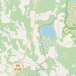
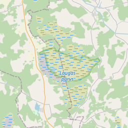
Maaüksuse kaart (katastritunnus: 66560020315)
Katastri tähis: 66560020315
Haldusterritoorium: Siguldas novads
Kinnisasja katastri määramine | |
|---|---|
Katastriobjekti tüüp | Katastriobjekti tüüp: Maa üksus |
Haldusterritoorium | |
Kinnistu katastrinumber, mille koosseisu see maaüksus kuulub | Kinnistu katastrinumber, mille koosseisu see maaüksus kuulub: 66560020314 |
|
|
|
{"7201060210":{"name":"<div class='color_dot' style='background-color: #00ffff'><\/div><span>M\u00e4\u00e4ratud maa\u00fcksus<\/span>","featureColor":"#00ffff","features":{"type":"FeatureCollection","features":[{"type":"Feature","geometry":{"type":"Polygon","coordinates":[[[24.714178638,57.300680303],[24.714338251,57.300559999],[24.715746816,57.299498308],[24.721364926,57.299898382],[24.720344391,57.301210393],[24.719786662,57.3019466],[24.714178638,57.300680303]]]},"crs":{"type":"name","properties":{"name":"urn:ogc:def:crs:EPSG:3059"}},"properties":{"style":{"color":"#00ffff","dashArray":"8,12","weight":1},"name":"Maa","object_type":"Parcel","parcel_code":"66560020682","code":null,"surveyor":null,"address":"","ownership":"<span>Omanik - F\u00fc\u00fcsiline isik<br><\/span>","pro_cadastre_nr":"66560020314"}},{"type":"Feature","geometry":{"type":"Polygon","coordinates":[[[24.697490998,57.295445889],[24.698720737,57.295380015],[24.698880688,57.295686563],[24.699141798,57.295920485],[24.699385006,57.296070457],[24.699544159,57.29613603],[24.699702053,57.296198197],[24.699946962,57.296347467],[24.700180825,57.296527503],[24.700317431,57.296608877],[24.7005633,57.296725468],[24.700916185,57.296875931],[24.701165129,57.29695074],[24.701470801,57.29704858],[24.701816928,57.29711044],[24.702108093,57.2971374],[24.702636853,57.297127467],[24.702931239,57.297099626],[24.703326489,57.297011985],[24.703978467,57.296873839],[24.704286724,57.296836494],[24.705813689,57.296632124],[24.707027783,57.296634306],[24.708067296,57.296629959],[24.713215018,57.296529616],[24.714571879,57.296493725],[24.715927952,57.2964704],[24.716250056,57.296473534],[24.716497196,57.296489024],[24.71673248,57.296518631],[24.717502297,57.296701625],[24.718703498,57.29787464],[24.718740141,57.297910418],[24.717889155,57.298409578],[24.717483674,57.298679991],[24.717401953,57.298701838],[24.717245757,57.298725564],[24.717278836,57.298801698],[24.715746816,57.299498308],[24.714338251,57.300559999],[24.714178638,57.300680303],[24.713931825,57.300872394],[24.713871023,57.300960111],[24.705969071,57.299789705],[24.705818203,57.299767357],[24.697885934,57.298582009],[24.697490998,57.295445889]]]},"crs":{"type":"name","properties":{"name":"urn:ogc:def:crs:EPSG:3059"}},"properties":{"style":{"color":"#00ffff","dashArray":"8,12","weight":1},"name":"Maa","object_type":"Parcel","parcel_code":"66560020315","code":null,"surveyor":null,"address":"","ownership":"<span>Omanik - F\u00fc\u00fcsiline isik<br><\/span>","pro_cadastre_nr":"66560020314"}},{"type":"Feature","geometry":{"type":"Polygon","coordinates":[[[24.698885566,57.295369712],[24.703956303,57.295097318],[24.710790656,57.294677957],[24.710803851,57.294740928],[24.712598487,57.294999779],[24.712635894,57.295005172],[24.716401365,57.295565272],[24.716676998,57.29602577],[24.716671401,57.296303773],[24.716653498,57.296360219],[24.716602494,57.296355398],[24.716585467,57.296408245],[24.716525608,57.296400376],[24.716261123,57.296383799],[24.715926804,57.296380546],[24.714565193,57.296403965],[24.713207988,57.296439868],[24.708061324,57.296540186],[24.707023537,57.296544461],[24.705793747,57.296542259],[24.704248679,57.296749048],[24.703929827,57.296787673],[24.703264793,57.296928587],[24.702884977,57.297012818],[24.702619613,57.297037909],[24.702119321,57.297047306],[24.701857147,57.297023023],[24.701539828,57.296966321],[24.701247647,57.29687279],[24.701008383,57.296800891],[24.700669384,57.296656352],[24.700433864,57.29654468],[24.700310584,57.296471245],[24.700077294,57.29629162],[24.699814187,57.296131276],[24.699643218,57.296063954],[24.699498717,57.296004426],[24.699276193,57.295867203],[24.699043274,57.295658548],[24.698885566,57.295369712]]]},"crs":{"type":"name","properties":{"name":"urn:ogc:def:crs:EPSG:3059"}},"properties":{"style":{"color":"#00ffff","dashArray":"8,12","weight":1},"name":"Maa","object_type":"Parcel","parcel_code":"66560020314","code":null,"surveyor":null,"address":"\"Berti\u0146as\", L\u0113durgas pag., Siguldas nov., LV-4012","ownership":"<span>Omanik - F\u00fc\u00fcsiline isik<br><\/span>","pro_cadastre_nr":"66560020314"}}]}},"5201011310":{"name":"<div class='color_dot' style='background-color: #960096'><\/div><span>Vektoriseeritud hoone<\/span>","featureColor":"#960096","features":{"type":"FeatureCollection","features":[{"type":"Feature","geometry":{"type":"Polygon","coordinates":[[[24.716308294,57.29699482],[24.716306593,57.296907314],[24.716405999,57.296906748],[24.7164077,57.296994254],[24.716308294,57.29699482]]]},"crs":{"type":"name","properties":{"name":"urn:ogc:def:crs:EPSG:3059"}},"properties":{"style":{"color":"#960096","dashArray":"0","weight":2},"name":"Hoone","object_type":"Building","parcel_code":"66560020315","code":"66560020315003","surveyor":null,"address":"","ownership":null,"pro_cadastre_nr":null}},{"type":"Feature","geometry":{"type":"Polygon","coordinates":[[[24.71611349,57.29656171],[24.716112052,57.296487669],[24.716279784,57.296486713],[24.716281223,57.296560755],[24.71611349,57.29656171]]]},"crs":{"type":"name","properties":{"name":"urn:ogc:def:crs:EPSG:3059"}},"properties":{"style":{"color":"#960096","dashArray":"0","weight":2},"name":"Hoone","object_type":"Building","parcel_code":"66560020315","code":"66560020314002","surveyor":null,"address":"","ownership":"<span>Omanik - F\u00fc\u00fcsiline isik<br><\/span>","pro_cadastre_nr":"66560020314"}},{"type":"Feature","geometry":{"type":"Polygon","coordinates":[[[24.714696148,57.296526023],[24.715039544,57.296518906],[24.715045439,57.296602112],[24.714850452,57.296606149],[24.714853146,57.296644071],[24.71470472,57.296647142],[24.714696148,57.296526023]]]},"crs":{"type":"name","properties":{"name":"urn:ogc:def:crs:EPSG:3059"}},"properties":{"style":{"color":"#960096","dashArray":"0","weight":2},"name":"Hoone","object_type":"Building","parcel_code":"66560020315","code":"66560020315001","surveyor":null,"address":"","ownership":"<span>Omanik - F\u00fc\u00fcsiline isik<br><\/span>","pro_cadastre_nr":"66560020314"}},{"type":"Feature","geometry":{"type":"Polygon","coordinates":[[[24.713630579,57.296686902],[24.713628494,57.296579204],[24.714044731,57.296576841],[24.714046818,57.29668454],[24.713630579,57.296686902]]]},"crs":{"type":"name","properties":{"name":"urn:ogc:def:crs:EPSG:3059"}},"properties":{"style":{"color":"#960096","dashArray":"0","weight":2},"name":"Hoone","object_type":"Building","parcel_code":"66560020315","code":"66560020315002","surveyor":null,"address":"","ownership":null,"pro_cadastre_nr":null}},{"type":"Feature","geometry":{"type":"Polygon","coordinates":[[[24.716453224,57.296778565],[24.716450346,57.296630482],[24.716555957,57.29662988],[24.716558836,57.296777963],[24.716453224,57.296778565]]]},"crs":{"type":"name","properties":{"name":"urn:ogc:def:crs:EPSG:3059"}},"properties":{"style":{"color":"#960096","dashArray":"0","weight":2},"name":"Hoone","object_type":"Building","parcel_code":"66560020315","code":"66560020315004","surveyor":null,"address":"","ownership":null,"pro_cadastre_nr":null}},{"type":"Feature","geometry":{"type":"Polygon","coordinates":[[[24.716669589,57.296307862],[24.716652282,57.296359974],[24.716602455,57.296355129],[24.716586418,57.296403398],[24.716419397,57.296387137],[24.716452725,57.296286756],[24.716669589,57.296307862]]]},"crs":{"type":"name","properties":{"name":"urn:ogc:def:crs:EPSG:3059"}},"properties":{"style":{"color":"#960096","dashArray":"0","weight":2},"name":"Hoone","object_type":"Building","parcel_code":"66560020314","code":"66560020314001","surveyor":null,"address":"\"Berti\u0146as\", L\u0113durgas pag., Siguldas nov., LV-4012","ownership":"<span>Omanik - F\u00fc\u00fcsiline isik<br><\/span>","pro_cadastre_nr":"66560020314"}},{"type":"Feature","geometry":{"type":"Polygon","coordinates":[[[24.715546802,57.296379034],[24.715550421,57.296149165],[24.715707813,57.296149896],[24.715704195,57.296379765],[24.715546802,57.296379034]]]},"crs":{"type":"name","properties":{"name":"urn:ogc:def:crs:EPSG:3059"}},"properties":{"style":{"color":"#960096","dashArray":"0","weight":2},"name":"Hoone","object_type":"Building","parcel_code":"66560020314","code":"66560020314003","surveyor":null,"address":"\"Berti\u0146as\", L\u0113durgas pag., Siguldas nov., LV-4012","ownership":"<span>Omanik - F\u00fc\u00fcsiline isik<br><\/span>","pro_cadastre_nr":"66560020314"}},{"type":"Feature","geometry":{"type":"Polygon","coordinates":[[[24.714696148,57.296526023],[24.715039544,57.296518906],[24.715045439,57.296602112],[24.714850452,57.296606149],[24.714853146,57.296644071],[24.71470472,57.296647142],[24.714696148,57.296526023]]]},"crs":{"type":"name","properties":{"name":"urn:ogc:def:crs:EPSG:3059"}},"properties":{"style":{"color":"#960096","dashArray":"0","weight":2},"name":"Hoone","object_type":"Building","parcel_code":"66560020315","code":"66560020315001","surveyor":null,"address":"\"Berti\u0146as\", L\u0113durgas pag., Siguldas nov., LV-4012","ownership":"<span>Omanik - F\u00fc\u00fcsiline isik<br><\/span>","pro_cadastre_nr":"66560020314"}},{"type":"Feature","geometry":{"type":"Polygon","coordinates":[[[24.715546802,57.296379034],[24.715550421,57.296149165],[24.715707813,57.296149896],[24.715704195,57.296379765],[24.715546802,57.296379034]]]},"crs":{"type":"name","properties":{"name":"urn:ogc:def:crs:EPSG:3059"}},"properties":{"style":{"color":"#960096","dashArray":"0","weight":2},"name":"Hoone","object_type":"Building","parcel_code":"66560020314","code":"66560020314003","surveyor":null,"address":"\"Berti\u0146as\", L\u0113durgas pag., Siguldas nov., LV-4012","ownership":"<span>Omanik - F\u00fc\u00fcsiline isik<br><\/span>","pro_cadastre_nr":"66560020314"}},{"type":"Feature","geometry":{"type":"Polygon","coordinates":[[[24.71611349,57.29656171],[24.716112052,57.296487669],[24.716279784,57.296486713],[24.716281223,57.296560755],[24.71611349,57.29656171]]]},"crs":{"type":"name","properties":{"name":"urn:ogc:def:crs:EPSG:3059"}},"properties":{"style":{"color":"#960096","dashArray":"0","weight":2},"name":"Hoone","object_type":"Building","parcel_code":"66560020315","code":"66560020314002","surveyor":null,"address":"\"Berti\u0146as\", L\u0113durgas pag., Siguldas nov., LV-4012","ownership":"<span>Omanik - F\u00fc\u00fcsiline isik<br><\/span>","pro_cadastre_nr":"66560020314"}}]}}}
{"7201060210":{"name":"<div class='color_dot' style='background-color: #00ffff'><\/div><span>M\u00e4\u00e4ratud maa\u00fcksus<\/span>","featureColor":"#00ffff","features":{"type":"FeatureCollection","features":[{"type":"Feature","geometry":{"type":"Polygon","coordinates":[[[24.697653013,57.295269339],[24.698697291,57.29522512],[24.698880688,57.295686563],[24.699141798,57.295920485],[24.699385006,57.296070457],[24.699544159,57.29613603],[24.699702053,57.296198197],[24.699946962,57.296347467],[24.700180825,57.296527503],[24.700317431,57.296608877],[24.7005633,57.296725468],[24.700916185,57.296875931],[24.701165129,57.29695074],[24.701470801,57.29704858],[24.701816928,57.29711044],[24.702108093,57.2971374],[24.702636853,57.297127467],[24.702931239,57.297099626],[24.703326489,57.297011985],[24.703978467,57.296873839],[24.704286724,57.296836494],[24.705813689,57.296632124],[24.707027783,57.296634306],[24.708067296,57.296629959],[24.713215018,57.296529616],[24.714571879,57.296493725],[24.715927952,57.2964704],[24.716250056,57.296473534],[24.716497196,57.296489024],[24.71673248,57.296518631],[24.71746986,57.296688218],[24.717593666,57.2967272],[24.718573793,57.29790614],[24.718611145,57.297951059],[24.717889155,57.298409578],[24.717483674,57.298679991],[24.717401953,57.298701838],[24.717245757,57.298725564],[24.717278836,57.298801698],[24.715746816,57.299498308],[24.714338251,57.300559999],[24.714178638,57.300680303],[24.713931825,57.300872394],[24.713871023,57.300960111],[24.705969071,57.299789705],[24.705818203,57.299767357],[24.697885934,57.298582009],[24.697653013,57.295269339]]]},"crs":{"type":"name","properties":{"name":"urn:ogc:def:crs:EPSG:3059"}},"properties":{"style":{"color":"#00ffff","dashArray":"8,12","weight":1},"name":"Maa","object_type":"Parcel","parcel_code":"66560020315","code":null,"surveyor":null,"address":"","ownership":null,"pro_cadastre_nr":null}},{"type":"Feature","geometry":{"type":"Polygon","coordinates":[[[24.698860102,57.295206428],[24.704136133,57.294973356],[24.710596016,57.294642693],[24.713002722,57.295060686],[24.713225616,57.29509372],[24.716356315,57.295557695],[24.716738804,57.295960603],[24.716653289,57.296279469],[24.716609631,57.296410946],[24.716525608,57.296400376],[24.716261123,57.296383799],[24.715926804,57.296380546],[24.714565193,57.296403965],[24.713207988,57.296439868],[24.708061324,57.296540186],[24.707023537,57.296544461],[24.705793747,57.296542259],[24.704248679,57.296749048],[24.703929827,57.296787673],[24.703264793,57.296928587],[24.702884977,57.297012818],[24.702619613,57.297037909],[24.702119321,57.297047306],[24.701857147,57.297023023],[24.701539828,57.296966321],[24.701247647,57.29687279],[24.701008383,57.296800891],[24.700669384,57.296656352],[24.700433864,57.29654468],[24.700310584,57.296471245],[24.700077294,57.29629162],[24.699814187,57.296131276],[24.699643218,57.296063954],[24.699498717,57.296004426],[24.699276193,57.295867203],[24.699043274,57.295658548],[24.698860102,57.295206428]]]},"crs":{"type":"name","properties":{"name":"urn:ogc:def:crs:EPSG:3059"}},"properties":{"style":{"color":"#00ffff","dashArray":"8,12","weight":1},"name":"Maa","object_type":"Parcel","parcel_code":"66560020314","code":null,"surveyor":null,"address":"\"Berti\u0146as\", L\u0113durgas pag., Siguldas nov., LV-4012","ownership":null,"pro_cadastre_nr":null}}]}},"5201011310":{"name":"<div class='color_dot' style='background-color: #960096'><\/div><span>Vektoriseeritud hoone<\/span>","featureColor":"#960096","features":{"type":"FeatureCollection","features":[{"type":"Feature","geometry":{"type":"Polygon","coordinates":[[[24.716653289,57.296279469],[24.716634336,57.29633654],[24.716599905,57.296333188],[24.716585247,57.296377326],[24.716420787,57.29636132],[24.716454381,57.296260111],[24.716653289,57.296279469]]]},"crs":{"type":"name","properties":{"name":"urn:ogc:def:crs:EPSG:3059"}},"properties":{"style":{"color":"#960096","dashArray":"0","weight":2},"name":"Hoone","object_type":"Building","parcel_code":"66560020314","code":"66560020314001","surveyor":null,"address":"\"Berti\u0146as\", L\u0113durgas pag., Siguldas nov., LV-4012","ownership":null,"pro_cadastre_nr":null}}]}}}
https://tile.openstreetmap.org/{z}/{x}/{y}.png|© OpenStreetMap contributors|minZoom: 7|maxZoom: 19
|
Maaüksuse andmeid värskendati: 23.01.2025.
Andmeallikas ja litsents: katastri infosüsteem avatud teksti- ja ruumiandmed, kinnisvaraturu andmebaasi avaandmed, avaandmete litsents Creative Commons Attribution, OpenStreetMap

