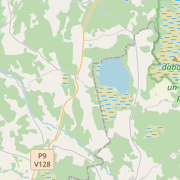
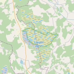
Maaüksuse kaart (katastritunnus: 66560020267)
Katastri tähis: 66560020267
Haldusterritoorium: Siguldas novads
Kinnisasja katastri määramine | |
|---|---|
Katastriobjekti tüüp | Katastriobjekti tüüp: Maa üksus |
Haldusterritoorium | |
Kinnistu katastrinumber, mille koosseisu see maaüksus kuulub | Kinnistu katastrinumber, mille koosseisu see maaüksus kuulub: 66560020267 |
|
|
|
{"7201060510":{"name":"<div class='color_dot' style='background-color: #ff00ff'><\/div><span>Vigased maa\u00fcksused<\/span>","featureColor":"#ff00ff","features":{"type":"FeatureCollection","features":[{"type":"Feature","geometry":{"type":"Polygon","coordinates":[[[24.684344956,57.324041936],[24.684353932,57.323999459],[24.684542556,57.323133423],[24.684564261,57.323097731],[24.686316357,57.323405871],[24.688841002,57.32394152],[24.68881951,57.323969756],[24.687876769,57.325180174],[24.687426006,57.325770971],[24.687376357,57.32578381],[24.68693334,57.325282716],[24.68682419,57.324213142],[24.685903614,57.324009733],[24.685803196,57.323996437],[24.685697877,57.32399375],[24.684344956,57.324041936]]]},"crs":{"type":"name","properties":{"name":"urn:ogc:def:crs:EPSG:3059"}},"properties":{"style":{"color":"#ff00ff","dashArray":"0","weight":1},"name":"Vigane maandusseade","object_type":"ParcelError","parcel_code":"66560020267","code":null,"surveyor":null,"address":"","ownership":"<span>Omanik - F\u00fc\u00fcsiline isik<br><\/span>","pro_cadastre_nr":"66560020267"}},{"type":"Feature","geometry":{"type":"Polygon","coordinates":[[[24.684344956,57.324041936],[24.684353932,57.323999459],[24.684542556,57.323133423],[24.684564261,57.323097731],[24.686316357,57.323405871],[24.688841002,57.32394152],[24.68881951,57.323969756],[24.687876769,57.325180174],[24.687426006,57.325770971],[24.687376357,57.32578381],[24.68693334,57.325282716],[24.68682419,57.324213142],[24.685903614,57.324009733],[24.685803196,57.323996437],[24.685697877,57.32399375],[24.684344956,57.324041936]]]},"crs":{"type":"name","properties":{"name":"urn:ogc:def:crs:EPSG:3059"}},"properties":{"style":{"color":"#ff00ff","dashArray":"0","weight":1},"name":"Vigane maandusseade","object_type":"ParcelError","parcel_code":"66560020267","code":null,"surveyor":null,"address":"","ownership":"<span>Omanik - F\u00fc\u00fcsiline isik<br><\/span>","pro_cadastre_nr":"66560020267"}},{"type":"Feature","geometry":{"type":"Polygon","coordinates":[[[24.684344956,57.324041936],[24.684353932,57.323999459],[24.684542556,57.323133423],[24.684564261,57.323097731],[24.686316357,57.323405871],[24.688841002,57.32394152],[24.68881951,57.323969756],[24.687876769,57.325180174],[24.687426006,57.325770971],[24.687376357,57.32578381],[24.68693334,57.325282716],[24.68682419,57.324213142],[24.685903614,57.324009733],[24.685803196,57.323996437],[24.685697877,57.32399375],[24.684344956,57.324041936]]]},"crs":{"type":"name","properties":{"name":"urn:ogc:def:crs:EPSG:3059"}},"properties":{"style":{"color":"#ff00ff","dashArray":"0","weight":1},"name":"Vigane maandusseade","object_type":"ParcelError","parcel_code":"66560020267","code":null,"surveyor":null,"address":"","ownership":"<span>Omanik - F\u00fc\u00fcsiline isik<br><\/span>","pro_cadastre_nr":"66560020267"}},{"type":"Feature","geometry":{"type":"Polygon","coordinates":[[[24.684344956,57.324041936],[24.684353932,57.323999459],[24.684542556,57.323133423],[24.684564261,57.323097731],[24.686316357,57.323405871],[24.688841002,57.32394152],[24.68881951,57.323969756],[24.687876769,57.325180174],[24.687426006,57.325770971],[24.687376357,57.32578381],[24.68693334,57.325282716],[24.68682419,57.324213142],[24.685903614,57.324009733],[24.685803196,57.323996437],[24.685697877,57.32399375],[24.684344956,57.324041936]]]},"crs":{"type":"name","properties":{"name":"urn:ogc:def:crs:EPSG:3059"}},"properties":{"style":{"color":"#ff00ff","dashArray":"0","weight":1},"name":"Vigane maandusseade","object_type":"ParcelError","parcel_code":"66560020267","code":null,"surveyor":null,"address":"","ownership":"<span>Omanik - F\u00fc\u00fcsiline isik<br><\/span>","pro_cadastre_nr":"66560020267"}},{"type":"Feature","geometry":{"type":"Polygon","coordinates":[[[24.684344956,57.324041936],[24.684353932,57.323999459],[24.684542556,57.323133423],[24.684564261,57.323097731],[24.686316357,57.323405871],[24.688841002,57.32394152],[24.68881951,57.323969756],[24.687876769,57.325180174],[24.687426006,57.325770971],[24.687376357,57.32578381],[24.68693334,57.325282716],[24.68682419,57.324213142],[24.685903614,57.324009733],[24.685803196,57.323996437],[24.685697877,57.32399375],[24.684344956,57.324041936]]]},"crs":{"type":"name","properties":{"name":"urn:ogc:def:crs:EPSG:3059"}},"properties":{"style":{"color":"#ff00ff","dashArray":"0","weight":1},"name":"Vigane maandusseade","object_type":"ParcelError","parcel_code":"66560020267","code":null,"surveyor":null,"address":"","ownership":"<span>Omanik - F\u00fc\u00fcsiline isik<br><\/span>","pro_cadastre_nr":"66560020267"}},{"type":"Feature","geometry":{"type":"Polygon","coordinates":[[[24.684344956,57.324041936],[24.684353932,57.323999459],[24.684542556,57.323133423],[24.684564261,57.323097731],[24.686316357,57.323405871],[24.688841002,57.32394152],[24.68881951,57.323969756],[24.687876769,57.325180174],[24.687426006,57.325770971],[24.687376357,57.32578381],[24.68693334,57.325282716],[24.68682419,57.324213142],[24.685903614,57.324009733],[24.685803196,57.323996437],[24.685697877,57.32399375],[24.684344956,57.324041936]]]},"crs":{"type":"name","properties":{"name":"urn:ogc:def:crs:EPSG:3059"}},"properties":{"style":{"color":"#ff00ff","dashArray":"0","weight":1},"name":"Vigane maandusseade","object_type":"ParcelError","parcel_code":"66560020267","code":null,"surveyor":null,"address":"","ownership":"<span>Omanik - F\u00fc\u00fcsiline isik<br><\/span>","pro_cadastre_nr":"66560020267"}},{"type":"Feature","geometry":{"type":"Polygon","coordinates":[[[24.684344956,57.324041936],[24.684353932,57.323999459],[24.684542556,57.323133423],[24.684564261,57.323097731],[24.686316357,57.323405871],[24.688841002,57.32394152],[24.68881951,57.323969756],[24.687876769,57.325180174],[24.687426006,57.325770971],[24.687376357,57.32578381],[24.68693334,57.325282716],[24.68682419,57.324213142],[24.685903614,57.324009733],[24.685803196,57.323996437],[24.685697877,57.32399375],[24.684344956,57.324041936]]]},"crs":{"type":"name","properties":{"name":"urn:ogc:def:crs:EPSG:3059"}},"properties":{"style":{"color":"#ff00ff","dashArray":"0","weight":1},"name":"Vigane maandusseade","object_type":"ParcelError","parcel_code":"66560020267","code":null,"surveyor":null,"address":"","ownership":"<span>Omanik - F\u00fc\u00fcsiline isik<br><\/span>","pro_cadastre_nr":"66560020267"}},{"type":"Feature","geometry":{"type":"Polygon","coordinates":[[[24.684344956,57.324041936],[24.684353932,57.323999459],[24.684542556,57.323133423],[24.684564261,57.323097731],[24.686316357,57.323405871],[24.688841002,57.32394152],[24.68881951,57.323969756],[24.687876769,57.325180174],[24.687426006,57.325770971],[24.687376357,57.32578381],[24.68693334,57.325282716],[24.68682419,57.324213142],[24.685903614,57.324009733],[24.685803196,57.323996437],[24.685697877,57.32399375],[24.684344956,57.324041936]]]},"crs":{"type":"name","properties":{"name":"urn:ogc:def:crs:EPSG:3059"}},"properties":{"style":{"color":"#ff00ff","dashArray":"0","weight":1},"name":"Vigane maandusseade","object_type":"ParcelError","parcel_code":"66560020267","code":null,"surveyor":null,"address":"","ownership":"<span>Omanik - F\u00fc\u00fcsiline isik<br><\/span>","pro_cadastre_nr":"66560020267"}},{"type":"Feature","geometry":{"type":"Polygon","coordinates":[[[24.684344956,57.324041936],[24.684353932,57.323999459],[24.684542556,57.323133423],[24.684564261,57.323097731],[24.686316357,57.323405871],[24.688841002,57.32394152],[24.68881951,57.323969756],[24.687876769,57.325180174],[24.687426006,57.325770971],[24.687376357,57.32578381],[24.68693334,57.325282716],[24.68682419,57.324213142],[24.685903614,57.324009733],[24.685803196,57.323996437],[24.685697877,57.32399375],[24.684344956,57.324041936]]]},"crs":{"type":"name","properties":{"name":"urn:ogc:def:crs:EPSG:3059"}},"properties":{"style":{"color":"#ff00ff","dashArray":"0","weight":1},"name":"Vigane maandusseade","object_type":"ParcelError","parcel_code":"66560020267","code":null,"surveyor":null,"address":"","ownership":"<span>Omanik - F\u00fc\u00fcsiline isik<br><\/span>","pro_cadastre_nr":"66560020267"}},{"type":"Feature","geometry":{"type":"Polygon","coordinates":[[[24.684344956,57.324041936],[24.684353932,57.323999459],[24.684542556,57.323133423],[24.684564261,57.323097731],[24.686316357,57.323405871],[24.688841002,57.32394152],[24.68881951,57.323969756],[24.687876769,57.325180174],[24.687426006,57.325770971],[24.687376357,57.32578381],[24.68693334,57.325282716],[24.68682419,57.324213142],[24.685903614,57.324009733],[24.685803196,57.323996437],[24.685697877,57.32399375],[24.684344956,57.324041936]]]},"crs":{"type":"name","properties":{"name":"urn:ogc:def:crs:EPSG:3059"}},"properties":{"style":{"color":"#ff00ff","dashArray":"0","weight":1},"name":"Vigane maandusseade","object_type":"ParcelError","parcel_code":"66560020267","code":null,"surveyor":null,"address":"","ownership":"<span>Omanik - F\u00fc\u00fcsiline isik<br><\/span>","pro_cadastre_nr":"66560020267"}},{"type":"Feature","geometry":{"type":"Polygon","coordinates":[[[24.684344956,57.324041936],[24.684353932,57.323999459],[24.684542556,57.323133423],[24.684564261,57.323097731],[24.686316357,57.323405871],[24.688841002,57.32394152],[24.68881951,57.323969756],[24.687876769,57.325180174],[24.687426006,57.325770971],[24.687376357,57.32578381],[24.68693334,57.325282716],[24.68682419,57.324213142],[24.685903614,57.324009733],[24.685803196,57.323996437],[24.685697877,57.32399375],[24.684344956,57.324041936]]]},"crs":{"type":"name","properties":{"name":"urn:ogc:def:crs:EPSG:3059"}},"properties":{"style":{"color":"#ff00ff","dashArray":"0","weight":1},"name":"Vigane maandusseade","object_type":"ParcelError","parcel_code":"66560020267","code":null,"surveyor":null,"address":"","ownership":"<span>Omanik - F\u00fc\u00fcsiline isik<br><\/span>","pro_cadastre_nr":"66560020267"}},{"type":"Feature","geometry":{"type":"Polygon","coordinates":[[[24.684344956,57.324041936],[24.684353932,57.323999459],[24.684542556,57.323133423],[24.684564261,57.323097731],[24.686316357,57.323405871],[24.688841002,57.32394152],[24.68881951,57.323969756],[24.687876769,57.325180174],[24.687426006,57.325770971],[24.687376357,57.32578381],[24.68693334,57.325282716],[24.68682419,57.324213142],[24.685903614,57.324009733],[24.685803196,57.323996437],[24.685697877,57.32399375],[24.684344956,57.324041936]]]},"crs":{"type":"name","properties":{"name":"urn:ogc:def:crs:EPSG:3059"}},"properties":{"style":{"color":"#ff00ff","dashArray":"0","weight":1},"name":"Vigane maandusseade","object_type":"ParcelError","parcel_code":"66560020267","code":null,"surveyor":null,"address":"","ownership":"<span>Omanik - F\u00fc\u00fcsiline isik<br><\/span>","pro_cadastre_nr":"66560020267"}},{"type":"Feature","geometry":{"type":"Polygon","coordinates":[[[24.684344956,57.324041936],[24.684353932,57.323999459],[24.684542556,57.323133423],[24.684564261,57.323097731],[24.686316357,57.323405871],[24.688841002,57.32394152],[24.68881951,57.323969756],[24.687876769,57.325180174],[24.687426006,57.325770971],[24.687376357,57.32578381],[24.68693334,57.325282716],[24.68682419,57.324213142],[24.685903614,57.324009733],[24.685803196,57.323996437],[24.685697877,57.32399375],[24.684344956,57.324041936]]]},"crs":{"type":"name","properties":{"name":"urn:ogc:def:crs:EPSG:3059"}},"properties":{"style":{"color":"#ff00ff","dashArray":"0","weight":1},"name":"Vigane maandusseade","object_type":"ParcelError","parcel_code":"66560020267","code":null,"surveyor":null,"address":"","ownership":"<span>Omanik - F\u00fc\u00fcsiline isik<br><\/span>","pro_cadastre_nr":"66560020267"}},{"type":"Feature","geometry":{"type":"Polygon","coordinates":[[[24.684344956,57.324041936],[24.684353932,57.323999459],[24.684542556,57.323133423],[24.684564261,57.323097731],[24.686316357,57.323405871],[24.688841002,57.32394152],[24.68881951,57.323969756],[24.687876769,57.325180174],[24.687426006,57.325770971],[24.687376357,57.32578381],[24.68693334,57.325282716],[24.68682419,57.324213142],[24.685903614,57.324009733],[24.685803196,57.323996437],[24.685697877,57.32399375],[24.684344956,57.324041936]]]},"crs":{"type":"name","properties":{"name":"urn:ogc:def:crs:EPSG:3059"}},"properties":{"style":{"color":"#ff00ff","dashArray":"0","weight":1},"name":"Vigane maandusseade","object_type":"ParcelError","parcel_code":"66560020267","code":null,"surveyor":null,"address":"","ownership":"<span>Omanik - F\u00fc\u00fcsiline isik<br><\/span>","pro_cadastre_nr":"66560020267"}},{"type":"Feature","geometry":{"type":"Polygon","coordinates":[[[24.684344956,57.324041936],[24.684353932,57.323999459],[24.684542556,57.323133423],[24.684564261,57.323097731],[24.686316357,57.323405871],[24.688841002,57.32394152],[24.68881951,57.323969756],[24.687876769,57.325180174],[24.687426006,57.325770971],[24.687376357,57.32578381],[24.68693334,57.325282716],[24.68682419,57.324213142],[24.685903614,57.324009733],[24.685803196,57.323996437],[24.685697877,57.32399375],[24.684344956,57.324041936]]]},"crs":{"type":"name","properties":{"name":"urn:ogc:def:crs:EPSG:3059"}},"properties":{"style":{"color":"#ff00ff","dashArray":"0","weight":1},"name":"Vigane maandusseade","object_type":"ParcelError","parcel_code":"66560020267","code":null,"surveyor":null,"address":"","ownership":"<span>Omanik - F\u00fc\u00fcsiline isik<br><\/span>","pro_cadastre_nr":"66560020267"}},{"type":"Feature","geometry":{"type":"Polygon","coordinates":[[[24.684344956,57.324041936],[24.684353932,57.323999459],[24.684542556,57.323133423],[24.684564261,57.323097731],[24.686316357,57.323405871],[24.688841002,57.32394152],[24.68881951,57.323969756],[24.687876769,57.325180174],[24.687426006,57.325770971],[24.687376357,57.32578381],[24.68693334,57.325282716],[24.68682419,57.324213142],[24.685903614,57.324009733],[24.685803196,57.323996437],[24.685697877,57.32399375],[24.684344956,57.324041936]]]},"crs":{"type":"name","properties":{"name":"urn:ogc:def:crs:EPSG:3059"}},"properties":{"style":{"color":"#ff00ff","dashArray":"0","weight":1},"name":"Vigane maandusseade","object_type":"ParcelError","parcel_code":"66560020267","code":null,"surveyor":null,"address":"","ownership":"<span>Omanik - F\u00fc\u00fcsiline isik<br><\/span>","pro_cadastre_nr":"66560020267"}},{"type":"Feature","geometry":{"type":"Polygon","coordinates":[[[24.684344956,57.324041936],[24.684353932,57.323999459],[24.684542556,57.323133423],[24.684564261,57.323097731],[24.686316357,57.323405871],[24.688841002,57.32394152],[24.68881951,57.323969756],[24.687876769,57.325180174],[24.687426006,57.325770971],[24.687376357,57.32578381],[24.68693334,57.325282716],[24.68682419,57.324213142],[24.685903614,57.324009733],[24.685803196,57.323996437],[24.685697877,57.32399375],[24.684344956,57.324041936]]]},"crs":{"type":"name","properties":{"name":"urn:ogc:def:crs:EPSG:3059"}},"properties":{"style":{"color":"#ff00ff","dashArray":"0","weight":1},"name":"Vigane maandusseade","object_type":"ParcelError","parcel_code":"66560020267","code":null,"surveyor":null,"address":"","ownership":"<span>Omanik - F\u00fc\u00fcsiline isik<br><\/span>","pro_cadastre_nr":"66560020267"}},{"type":"Feature","geometry":{"type":"Polygon","coordinates":[[[24.684344956,57.324041936],[24.684353932,57.323999459],[24.684542556,57.323133423],[24.684564261,57.323097731],[24.686316357,57.323405871],[24.688841002,57.32394152],[24.68881951,57.323969756],[24.687876769,57.325180174],[24.687426006,57.325770971],[24.687376357,57.32578381],[24.68693334,57.325282716],[24.68682419,57.324213142],[24.685903614,57.324009733],[24.685803196,57.323996437],[24.685697877,57.32399375],[24.684344956,57.324041936]]]},"crs":{"type":"name","properties":{"name":"urn:ogc:def:crs:EPSG:3059"}},"properties":{"style":{"color":"#ff00ff","dashArray":"0","weight":1},"name":"Vigane maandusseade","object_type":"ParcelError","parcel_code":"66560020267","code":null,"surveyor":null,"address":"","ownership":"<span>Omanik - F\u00fc\u00fcsiline isik<br><\/span>","pro_cadastre_nr":"66560020267"}},{"type":"Feature","geometry":{"type":"Polygon","coordinates":[[[24.684344956,57.324041936],[24.684353932,57.323999459],[24.684542556,57.323133423],[24.684564261,57.323097731],[24.686316357,57.323405871],[24.688841002,57.32394152],[24.68881951,57.323969756],[24.687876769,57.325180174],[24.687426006,57.325770971],[24.687376357,57.32578381],[24.68693334,57.325282716],[24.68682419,57.324213142],[24.685903614,57.324009733],[24.685803196,57.323996437],[24.685697877,57.32399375],[24.684344956,57.324041936]]]},"crs":{"type":"name","properties":{"name":"urn:ogc:def:crs:EPSG:3059"}},"properties":{"style":{"color":"#ff00ff","dashArray":"0","weight":1},"name":"Vigane maandusseade","object_type":"ParcelError","parcel_code":"66560020267","code":null,"surveyor":null,"address":"","ownership":"<span>Omanik - F\u00fc\u00fcsiline isik<br><\/span>","pro_cadastre_nr":"66560020267"}}]}},"7201060210":{"name":"<div class='color_dot' style='background-color: #00ffff'><\/div><span>M\u00e4\u00e4ratud maa\u00fcksus<\/span>","featureColor":"#00ffff","features":{"type":"FeatureCollection","features":[{"type":"Feature","geometry":{"type":"Polygon","coordinates":[[[24.712886325,57.305575937],[24.71319575,57.304096702],[24.713351743,57.302781079],[24.716440997,57.302868078],[24.718927238,57.303040692],[24.717503299,57.304827156],[24.717136381,57.305287471],[24.716891562,57.305437002],[24.716109997,57.305949183],[24.715610203,57.306000591],[24.712948334,57.306329854],[24.712958599,57.306173243],[24.712957656,57.305981247],[24.712888067,57.305625641],[24.712886325,57.305575937]]]},"crs":{"type":"name","properties":{"name":"urn:ogc:def:crs:EPSG:3059"}},"properties":{"style":{"color":"#00ffff","dashArray":"8,12","weight":1},"name":"Maa","object_type":"Parcel","parcel_code":"66560020268","code":null,"surveyor":null,"address":"","ownership":"<span>Omanik - F\u00fc\u00fcsiline isik<br><\/span>","pro_cadastre_nr":"66560020267"}},{"type":"Feature","geometry":{"type":"Polygon","coordinates":[[[24.684344956,57.324041936],[24.684353932,57.323999459],[24.684542556,57.323133423],[24.684564261,57.323097731],[24.686316357,57.323405871],[24.688841002,57.32394152],[24.68881951,57.323969756],[24.687876769,57.325180174],[24.687426006,57.325770971],[24.687376357,57.32578381],[24.68693334,57.325282716],[24.68682419,57.324213142],[24.685903614,57.324009733],[24.685803196,57.323996437],[24.685697877,57.32399375],[24.684344956,57.324041936]]]},"crs":{"type":"name","properties":{"name":"urn:ogc:def:crs:EPSG:3059"}},"properties":{"style":{"color":"#00ffff","dashArray":"8,12","weight":1},"name":"Maa","object_type":"Parcel","parcel_code":"66560020267","code":null,"surveyor":null,"address":"","ownership":"<span>Omanik - F\u00fc\u00fcsiline isik<br><\/span>","pro_cadastre_nr":"66560020267"}}]}}}
[]
https://tile.openstreetmap.org/{z}/{x}/{y}.png|© OpenStreetMap contributors|minZoom: 7|maxZoom: 19
|
Maaüksuse andmeid värskendati: 23.01.2025.
Andmeallikas ja litsents: katastri infosüsteem avatud teksti- ja ruumiandmed, kinnisvaraturu andmebaasi avaandmed, avaandmete litsents Creative Commons Attribution, OpenStreetMap

