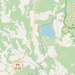
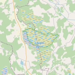
Maaüksuse kaart (katastritunnus: 66560020098)
Katastri tähis: 66560020098
Haldusterritoorium: Siguldas novads
Kinnisasja katastri määramine | |
|---|---|
Katastriobjekti tüüp | Katastriobjekti tüüp: Maa üksus |
Haldusterritoorium | |
Kinnistu katastrinumber, mille koosseisu see maaüksus kuulub | Kinnistu katastrinumber, mille koosseisu see maaüksus kuulub: 66560020097 |
|
|
|
{"7201060210":{"name":"<div class='color_dot' style='background-color: #00ffff'><\/div><span>M\u00e4\u00e4ratud maa\u00fcksus<\/span>","featureColor":"#00ffff","features":{"type":"FeatureCollection","features":[{"type":"Feature","geometry":{"type":"Polygon","coordinates":[[[24.752918561,57.310379761],[24.753601554,57.309361234],[24.754056958,57.309581751],[24.754243352,57.309629916],[24.7544425,57.309625676],[24.755676871,57.309378726],[24.755700999,57.309447924],[24.756068219,57.310501469],[24.755033191,57.310575241],[24.754555234,57.310627526],[24.753847509,57.310751284],[24.753807718,57.310728615],[24.752954308,57.310411744],[24.752918561,57.310379761]]]},"crs":{"type":"name","properties":{"name":"urn:ogc:def:crs:EPSG:3059"}},"properties":{"style":{"color":"#00ffff","dashArray":"8,12","weight":1},"name":"Maa","object_type":"Parcel","parcel_code":"66560020099","code":null,"surveyor":null,"address":"","ownership":"<span>Omanik - F\u00fc\u00fcsiline isik<br><\/span>","pro_cadastre_nr":"66560020097"}},{"type":"Feature","geometry":{"type":"Polygon","coordinates":[[[24.767167202,57.315927317],[24.7690446,57.315432361],[24.770360636,57.314656644],[24.77165844,57.314178249],[24.772418131,57.314996293],[24.768160776,57.316658025],[24.767167202,57.315927317]]]},"crs":{"type":"name","properties":{"name":"urn:ogc:def:crs:EPSG:3059"}},"properties":{"style":{"color":"#00ffff","dashArray":"8,12","weight":1},"name":"Maa","object_type":"Parcel","parcel_code":"66560020098","code":null,"surveyor":null,"address":"","ownership":"<span>Omanik - F\u00fc\u00fcsiline isik<br><\/span>","pro_cadastre_nr":"66560020097"}},{"type":"Feature","geometry":{"type":"Polygon","coordinates":[[[24.739467452,57.312487766],[24.739610006,57.31227183],[24.739762307,57.312023857],[24.740406116,57.312004699],[24.740678627,57.311978345],[24.740697437,57.312172428],[24.741730111,57.312382977],[24.742844631,57.312552591],[24.742618235,57.313042487],[24.739467452,57.312487766]]]},"crs":{"type":"name","properties":{"name":"urn:ogc:def:crs:EPSG:3059"}},"properties":{"style":{"color":"#00ffff","dashArray":"8,12","weight":1},"name":"Maa","object_type":"Parcel","parcel_code":"66560020097","code":null,"surveyor":null,"address":"Lakst\u012bgalu iela 6, L\u0113durga, L\u0113durgas pag., Siguldas nov., LV-4012","ownership":"<span>Omanik - F\u00fc\u00fcsiline isik<br><\/span>","pro_cadastre_nr":"66560020097"}}]}},"5201011310":{"name":"<div class='color_dot' style='background-color: #960096'><\/div><span>Vektoriseeritud hoone<\/span>","featureColor":"#960096","features":{"type":"FeatureCollection","features":[{"type":"Feature","geometry":{"type":"Polygon","coordinates":[[[24.742019241,57.3125247],[24.742403426,57.312596869],[24.742368176,57.312651822],[24.741983991,57.312579652],[24.742019241,57.3125247]]]},"crs":{"type":"name","properties":{"name":"urn:ogc:def:crs:EPSG:3059"}},"properties":{"style":{"color":"#960096","dashArray":"0","weight":2},"name":"Hoone","object_type":"Building","parcel_code":"66560020097","code":"66560020097002","surveyor":null,"address":"Lakst\u012bgalu iela 6, L\u0113durga, L\u0113durgas pag., Siguldas nov., LV-4012","ownership":"<span>Omanik - F\u00fc\u00fcsiline isik<br><\/span>","pro_cadastre_nr":"66560020097"}},{"type":"Feature","geometry":{"type":"Polygon","coordinates":[[[24.742397182,57.312875201],[24.742544752,57.31289651],[24.742530827,57.312924746],[24.742465992,57.312915391],[24.742450457,57.312946906],[24.742317806,57.312927755],[24.74233476,57.312893357],[24.742267044,57.312883578],[24.742293537,57.312829863],[24.74241117,57.312846848],[24.742397182,57.312875201]]]},"crs":{"type":"name","properties":{"name":"urn:ogc:def:crs:EPSG:3059"}},"properties":{"style":{"color":"#960096","dashArray":"0","weight":2},"name":"Hoone","object_type":"Building","parcel_code":"66560020097","code":"66560020097001","surveyor":null,"address":"Lakst\u012bgalu iela 6, L\u0113durga, L\u0113durgas pag., Siguldas nov., LV-4012","ownership":"<span>Omanik - F\u00fc\u00fcsiline isik<br><\/span>","pro_cadastre_nr":"66560020097"}},{"type":"Feature","geometry":{"type":"Polygon","coordinates":[[[24.742019241,57.3125247],[24.742403426,57.312596869],[24.742368176,57.312651822],[24.741983991,57.312579652],[24.742019241,57.3125247]]]},"crs":{"type":"name","properties":{"name":"urn:ogc:def:crs:EPSG:3059"}},"properties":{"style":{"color":"#960096","dashArray":"0","weight":2},"name":"Hoone","object_type":"Building","parcel_code":"66560020097","code":"66560020097002","surveyor":null,"address":"Lakst\u012bgalu iela 6, L\u0113durga, L\u0113durgas pag., Siguldas nov., LV-4012","ownership":"<span>Omanik - F\u00fc\u00fcsiline isik<br><\/span>","pro_cadastre_nr":"66560020097"}},{"type":"Feature","geometry":{"type":"Polygon","coordinates":[[[24.742397182,57.312875201],[24.742544752,57.31289651],[24.742530827,57.312924746],[24.742465992,57.312915391],[24.742450457,57.312946906],[24.742317806,57.312927755],[24.74233476,57.312893357],[24.742267044,57.312883578],[24.742293537,57.312829863],[24.74241117,57.312846848],[24.742397182,57.312875201]]]},"crs":{"type":"name","properties":{"name":"urn:ogc:def:crs:EPSG:3059"}},"properties":{"style":{"color":"#960096","dashArray":"0","weight":2},"name":"Hoone","object_type":"Building","parcel_code":"66560020097","code":"66560020097001","surveyor":null,"address":"Lakst\u012bgalu iela 6, L\u0113durga, L\u0113durgas pag., Siguldas nov., LV-4012","ownership":"<span>Omanik - F\u00fc\u00fcsiline isik<br><\/span>","pro_cadastre_nr":"66560020097"}}]}}}
{"7201060210":{"name":"<div class='color_dot' style='background-color: #00ffff'><\/div><span>M\u00e4\u00e4ratud maa\u00fcksus<\/span>","featureColor":"#00ffff","features":{"type":"FeatureCollection","features":[{"type":"Feature","geometry":{"type":"Polygon","coordinates":[[[24.767167202,57.315927317],[24.7690446,57.315432361],[24.770360636,57.314656644],[24.77165844,57.314178249],[24.772451188,57.315104798],[24.768160776,57.316658025],[24.767167202,57.315927317]]]},"crs":{"type":"name","properties":{"name":"urn:ogc:def:crs:EPSG:3059"}},"properties":{"style":{"color":"#00ffff","dashArray":"8,12","weight":1},"name":"Maa","object_type":"Parcel","parcel_code":"66560020098","code":null,"surveyor":null,"address":"","ownership":null,"pro_cadastre_nr":null}}]}}}
https://tile.openstreetmap.org/{z}/{x}/{y}.png|© OpenStreetMap contributors|minZoom: 7|maxZoom: 19
|
Maaüksuse andmeid värskendati: 23.01.2025.
Andmeallikas ja litsents: katastri infosüsteem avatud teksti- ja ruumiandmed, kinnisvaraturu andmebaasi avaandmed, avaandmete litsents Creative Commons Attribution, OpenStreetMap

