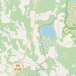
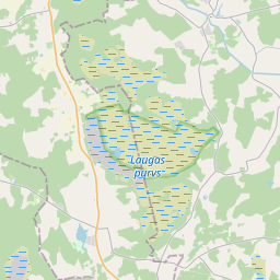
Maaüksuse kaart (katastritunnus: 66560020068)
Katastri tähis: 66560020068
Aadress: "Birzgaļi", Lēdurgas pagasts, Siguldas novads, LV-4012
Kinnisasja katastri määramine | |
|---|---|
Katastriobjekti tüüp | Katastriobjekti tüüp: Maa üksus |
Aadress | Aadress: "Birzgaļi", Lēdurgas pagasts, Siguldas novads, LV-4012 |
Kinnistu katastrinumber, mille koosseisu see maaüksus kuulub | Kinnistu katastrinumber, mille koosseisu see maaüksus kuulub: 66560020068 |
Aadress | |
|---|---|
Aadressi ID | Aadressi ID: 102723774 |
Aadressil registreeritud ettevõtted | Aadressil registreeritud ettevõtted: 0 |
Aadressil registreeritud struktuuriüksused | Aadressil registreeritud struktuuriüksused: 0 |
Asutused registreeritud aadressil | Asutused registreeritud aadressil: 0 |
Kinnisvara aadressil | |
Tehingud aadressil | Tehingud aadressil: 0 |
|
|
|
{"7201060210":{"name":"<div class='color_dot' style='background-color: #00ffff'><\/div><span>M\u00e4\u00e4ratud maa\u00fcksus<\/span>","featureColor":"#00ffff","features":{"type":"FeatureCollection","features":[{"type":"Feature","geometry":{"type":"Polygon","coordinates":[[[24.715746816,57.299498308],[24.717278836,57.298801698],[24.717245757,57.298725564],[24.717401953,57.298701838],[24.717483674,57.298679991],[24.717889155,57.298409578],[24.718740141,57.297910418],[24.719076988,57.29790896],[24.719394194,57.297922373],[24.720693138,57.298004581],[24.721964473,57.298084213],[24.722635515,57.298128734],[24.722622706,57.29819656],[24.721782886,57.299336403],[24.721364926,57.299898382],[24.715746816,57.299498308]]]},"crs":{"type":"name","properties":{"name":"urn:ogc:def:crs:EPSG:3059"}},"properties":{"style":{"color":"#00ffff","dashArray":"8,12","weight":1},"name":"Maa","object_type":"Parcel","parcel_code":"66560020307","code":null,"surveyor":null,"address":"","ownership":"<span>Omanik - F\u00fc\u00fcsiline isik<br><\/span>","pro_cadastre_nr":"66560020068"}},{"type":"Feature","geometry":{"type":"Polygon","coordinates":[[[24.735646318,57.297748151],[24.735665052,57.297679902],[24.735743942,57.297197645],[24.735960722,57.296138271],[24.738463183,57.29626704],[24.738008283,57.298005566],[24.73799041,57.298071007],[24.735900621,57.297804013],[24.735646318,57.297748151]]]},"crs":{"type":"name","properties":{"name":"urn:ogc:def:crs:EPSG:3059"}},"properties":{"style":{"color":"#00ffff","dashArray":"8,12","weight":1},"name":"Maa","object_type":"Parcel","parcel_code":"66560020069","code":null,"surveyor":null,"address":"","ownership":"<span>Omanik - F\u00fc\u00fcsiline isik<br><\/span>","pro_cadastre_nr":"66560020068"}},{"type":"Feature","geometry":{"type":"Polygon","coordinates":[[[24.726916481,57.292916874],[24.728227448,57.290073707],[24.730447401,57.290146479],[24.73050252,57.290148288],[24.73055465,57.291631949],[24.730578932,57.292580092],[24.730570895,57.293163357],[24.730509693,57.294105754],[24.730599039,57.294108666],[24.73633167,57.294295227],[24.735988107,57.294784739],[24.735880436,57.295052597],[24.735800996,57.295375619],[24.730538475,57.29514692],[24.73045791,57.295143418],[24.730456122,57.29516206],[24.73052585,57.295351383],[24.730707652,57.295655285],[24.731480762,57.296361986],[24.731516204,57.296474692],[24.731740021,57.297289349],[24.731913703,57.297835201],[24.728663057,57.297908173],[24.728634837,57.297822986],[24.728075758,57.296151249],[24.72806547,57.296127763],[24.727651651,57.295183159],[24.726916481,57.292916874]]]},"crs":{"type":"name","properties":{"name":"urn:ogc:def:crs:EPSG:3059"}},"properties":{"style":{"color":"#00ffff","dashArray":"8,12","weight":1},"name":"Maa","object_type":"Parcel","parcel_code":"66560020068","code":null,"surveyor":null,"address":"\"Birzga\u013ci\", L\u0113durgas pag., Siguldas nov., LV-4012","ownership":"<span>Omanik - F\u00fc\u00fcsiline isik<br><\/span>","pro_cadastre_nr":"66560020068"}}]}},"5201011310":{"name":"<div class='color_dot' style='background-color: #960096'><\/div><span>Vektoriseeritud hoone<\/span>","featureColor":"#960096","features":{"type":"FeatureCollection","features":[{"type":"Feature","geometry":{"type":"Polygon","coordinates":[[[24.730384613,57.296274669],[24.730476003,57.296331911],[24.730294684,57.29641676],[24.730203278,57.296359519],[24.730384613,57.296274669]]]},"crs":{"type":"name","properties":{"name":"urn:ogc:def:crs:EPSG:3059"}},"properties":{"style":{"color":"#960096","dashArray":"0","weight":2},"name":"Hoone","object_type":"Building","parcel_code":"66560020068","code":"66560020068001","surveyor":null,"address":"\"Birzga\u013ci\", L\u0113durgas pag., Siguldas nov., LV-4012","ownership":"<span>Omanik - F\u00fc\u00fcsiline isik<br><\/span>","pro_cadastre_nr":"66560020068"}},{"type":"Feature","geometry":{"type":"Polygon","coordinates":[[[24.730581077,57.296092451],[24.730659183,57.296138369],[24.730599297,57.296168622],[24.730593572,57.29616526],[24.730609486,57.29615693],[24.730537106,57.296114374],[24.730581077,57.296092451]]]},"crs":{"type":"name","properties":{"name":"urn:ogc:def:crs:EPSG:3059"}},"properties":{"style":{"color":"#960096","dashArray":"0","weight":2},"name":"Hoone","object_type":"Building","parcel_code":"66560020068","code":"66560020068003","surveyor":null,"address":"\"Birzga\u013ci\", L\u0113durgas pag., Siguldas nov., LV-4012","ownership":"<span>Omanik - F\u00fc\u00fcsiline isik<br><\/span>","pro_cadastre_nr":"66560020068"}},{"type":"Feature","geometry":{"type":"Polygon","coordinates":[[[24.730348376,57.296022798],[24.730596974,57.296159392],[24.730526447,57.296197002],[24.730443251,57.296151284],[24.730436683,57.296154789],[24.730271282,57.296063913],[24.730348376,57.296022798]]]},"crs":{"type":"name","properties":{"name":"urn:ogc:def:crs:EPSG:3059"}},"properties":{"style":{"color":"#960096","dashArray":"0","weight":2},"name":"Hoone","object_type":"Building","parcel_code":"66560020068","code":"66560020068002","surveyor":null,"address":"\"Birzga\u013ci\", L\u0113durgas pag., Siguldas nov., LV-4012","ownership":"<span>Omanik - F\u00fc\u00fcsiline isik<br><\/span>","pro_cadastre_nr":"66560020068"}},{"type":"Feature","geometry":{"type":"Polygon","coordinates":[[[24.731192211,57.296687604],[24.730912599,57.296695284],[24.730905672,57.296621257],[24.731185266,57.296613577],[24.731192211,57.296687604]]]},"crs":{"type":"name","properties":{"name":"urn:ogc:def:crs:EPSG:3059"}},"properties":{"style":{"color":"#960096","dashArray":"0","weight":2},"name":"Hoone","object_type":"Building","parcel_code":"66560020068","code":"66560020068004","surveyor":null,"address":"\"Birzga\u013ci\", L\u0113durgas pag., Siguldas nov., LV-4012","ownership":null,"pro_cadastre_nr":null}},{"type":"Feature","geometry":{"type":"Polygon","coordinates":[[[24.730581077,57.296092451],[24.730659183,57.296138369],[24.730599297,57.296168622],[24.730593572,57.29616526],[24.730609486,57.29615693],[24.730537106,57.296114374],[24.730581077,57.296092451]]]},"crs":{"type":"name","properties":{"name":"urn:ogc:def:crs:EPSG:3059"}},"properties":{"style":{"color":"#960096","dashArray":"0","weight":2},"name":"Hoone","object_type":"Building","parcel_code":"66560020068","code":"66560020068003","surveyor":null,"address":"\"Birzga\u013ci\", L\u0113durgas pag., Siguldas nov., LV-4012","ownership":"<span>Omanik - F\u00fc\u00fcsiline isik<br><\/span>","pro_cadastre_nr":"66560020068"}},{"type":"Feature","geometry":{"type":"Polygon","coordinates":[[[24.730348376,57.296022798],[24.730596974,57.296159392],[24.730526447,57.296197002],[24.730443251,57.296151284],[24.730436683,57.296154789],[24.730271282,57.296063913],[24.730348376,57.296022798]]]},"crs":{"type":"name","properties":{"name":"urn:ogc:def:crs:EPSG:3059"}},"properties":{"style":{"color":"#960096","dashArray":"0","weight":2},"name":"Hoone","object_type":"Building","parcel_code":"66560020068","code":"66560020068002","surveyor":null,"address":"\"Birzga\u013ci\", L\u0113durgas pag., Siguldas nov., LV-4012","ownership":"<span>Omanik - F\u00fc\u00fcsiline isik<br><\/span>","pro_cadastre_nr":"66560020068"}},{"type":"Feature","geometry":{"type":"Polygon","coordinates":[[[24.730384613,57.296274669],[24.730476003,57.296331911],[24.730294684,57.29641676],[24.730203278,57.296359519],[24.730384613,57.296274669]]]},"crs":{"type":"name","properties":{"name":"urn:ogc:def:crs:EPSG:3059"}},"properties":{"style":{"color":"#960096","dashArray":"0","weight":2},"name":"Hoone","object_type":"Building","parcel_code":"66560020068","code":"66560020068001","surveyor":null,"address":"\"Birzga\u013ci\", L\u0113durgas pag., Siguldas nov., LV-4012","ownership":"<span>Omanik - F\u00fc\u00fcsiline isik<br><\/span>","pro_cadastre_nr":"66560020068"}}]}}}
{"7201060210":{"name":"<div class='color_dot' style='background-color: #00ffff'><\/div><span>M\u00e4\u00e4ratud maa\u00fcksus<\/span>","featureColor":"#00ffff","features":{"type":"FeatureCollection","features":[{"type":"Feature","geometry":{"type":"Polygon","coordinates":[[[24.715746816,57.299498308],[24.717278836,57.298801698],[24.717245757,57.298725564],[24.717401953,57.298701838],[24.717483674,57.298679991],[24.717889155,57.298409578],[24.718611145,57.297951059],[24.718789783,57.297914168],[24.720012147,57.297915234],[24.722635515,57.298128734],[24.722622706,57.29819656],[24.721782886,57.299336403],[24.721364926,57.299898382],[24.715746816,57.299498308]]]},"crs":{"type":"name","properties":{"name":"urn:ogc:def:crs:EPSG:3059"}},"properties":{"style":{"color":"#00ffff","dashArray":"8,12","weight":1},"name":"Maa","object_type":"Parcel","parcel_code":"66560020307","code":null,"surveyor":null,"address":"","ownership":null,"pro_cadastre_nr":null}}]}}}
https://tile.openstreetmap.org/{z}/{x}/{y}.png|© OpenStreetMap contributors|minZoom: 7|maxZoom: 19
|
Maaüksuse andmeid värskendati: 23.01.2025.
Andmeallikas ja litsents: katastri infosüsteem avatud teksti- ja ruumiandmed, kinnisvaraturu andmebaasi avaandmed, avaandmete litsents Creative Commons Attribution, OpenStreetMap

