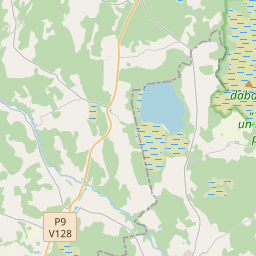
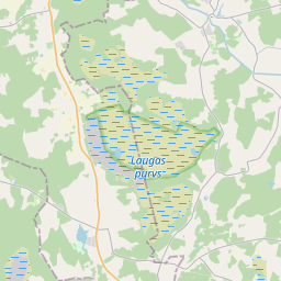
Maaüksuse kaart (katastritunnus: 66560020056)
Katastri tähis: 66560020056
Haldusterritoorium: Siguldas novads
Kinnisasja katastri määramine | |
|---|---|
Katastriobjekti tüüp | Katastriobjekti tüüp: Maa üksus |
Haldusterritoorium | |
Kinnistu katastrinumber, mille koosseisu see maaüksus kuulub | Kinnistu katastrinumber, mille koosseisu see maaüksus kuulub: 66560020054 |
|
|
|
{"7201060210":{"name":"<div class='color_dot' style='background-color: #00ffff'><\/div><span>M\u00e4\u00e4ratud maa\u00fcksus<\/span>","featureColor":"#00ffff","features":{"type":"FeatureCollection","features":[{"type":"Feature","geometry":{"type":"Polygon","coordinates":[[[24.768160776,57.316658025],[24.772418131,57.314996293],[24.772672532,57.315209919],[24.771532033,57.316055238],[24.773564666,57.317761014],[24.775634172,57.319520557],[24.777113858,57.320761121],[24.777144658,57.320786938],[24.776974356,57.320855482],[24.776887956,57.320898632],[24.776804947,57.320962451],[24.776517991,57.321220742],[24.776137829,57.321540758],[24.775897638,57.321665698],[24.775746181,57.321721798],[24.775361456,57.321849335],[24.775051697,57.32203021],[24.775023233,57.322007235],[24.772887305,57.320305099],[24.772810635,57.320246343],[24.771294942,57.319084644],[24.768160776,57.316658025]]]},"crs":{"type":"name","properties":{"name":"urn:ogc:def:crs:EPSG:3059"}},"properties":{"style":{"color":"#00ffff","dashArray":"8,12","weight":1},"name":"Maa","object_type":"Parcel","parcel_code":"66560020056","code":null,"surveyor":null,"address":"","ownership":"<span>Omanik - F\u00fc\u00fcsiline isik<br><\/span>","pro_cadastre_nr":"66560020054"}},{"type":"Feature","geometry":{"type":"Polygon","coordinates":[[[24.741270655,57.315370367],[24.74211818,57.314188129],[24.742742929,57.314283169],[24.741970925,57.315504672],[24.741270655,57.315370367]]]},"crs":{"type":"name","properties":{"name":"urn:ogc:def:crs:EPSG:3059"}},"properties":{"style":{"color":"#00ffff","dashArray":"8,12","weight":1},"name":"Maa","object_type":"Parcel","parcel_code":"66560020054","code":null,"surveyor":null,"address":"Liepu iela 10, L\u0113durga, L\u0113durgas pag., Siguldas nov., LV-4012","ownership":"<span>Omanik - F\u00fc\u00fcsiline isik<br><\/span>","pro_cadastre_nr":"66560020054"}}]}},"5201011310":{"name":"<div class='color_dot' style='background-color: #960096'><\/div><span>Vektoriseeritud hoone<\/span>","featureColor":"#960096","features":{"type":"FeatureCollection","features":[{"type":"Feature","geometry":{"type":"Polygon","coordinates":[[[24.741792589,57.315354345],[24.741844847,57.315276502],[24.741972029,57.315301498],[24.741919771,57.315379342],[24.741792589,57.315354345]]]},"crs":{"type":"name","properties":{"name":"urn:ogc:def:crs:EPSG:3059"}},"properties":{"style":{"color":"#960096","dashArray":"0","weight":2},"name":"Hoone","object_type":"Building","parcel_code":"66560020054","code":"66560020054001","surveyor":null,"address":"Liepu iela 10, L\u0113durga, L\u0113durgas pag., Siguldas nov., LV-4012","ownership":"<span>Omanik - F\u00fc\u00fcsiline isik<br><\/span>","pro_cadastre_nr":"66560020054"}},{"type":"Feature","geometry":{"type":"Polygon","coordinates":[[[24.741804317,57.315092555],[24.741888101,57.314984935],[24.741972248,57.315004112],[24.741940026,57.3150455],[24.742216968,57.315108645],[24.742168577,57.315170727],[24.742070686,57.315148388],[24.742077127,57.315140103],[24.741949381,57.315110996],[24.741939719,57.315123405],[24.741804317,57.315092555]]]},"crs":{"type":"name","properties":{"name":"urn:ogc:def:crs:EPSG:3059"}},"properties":{"style":{"color":"#960096","dashArray":"0","weight":2},"name":"Hoone","object_type":"Building","parcel_code":"66560020054","code":"66560020054002","surveyor":null,"address":"Liepu iela 10, L\u0113durga, L\u0113durgas pag., Siguldas nov., LV-4012","ownership":"<span>Omanik - F\u00fc\u00fcsiline isik<br><\/span>","pro_cadastre_nr":"66560020054"}},{"type":"Feature","geometry":{"type":"Polygon","coordinates":[[[24.741804317,57.315092555],[24.741888101,57.314984935],[24.741972248,57.315004112],[24.741940026,57.3150455],[24.742216968,57.315108645],[24.742168577,57.315170727],[24.742070686,57.315148388],[24.742077127,57.315140103],[24.741949381,57.315110996],[24.741939719,57.315123405],[24.741804317,57.315092555]]]},"crs":{"type":"name","properties":{"name":"urn:ogc:def:crs:EPSG:3059"}},"properties":{"style":{"color":"#960096","dashArray":"0","weight":2},"name":"Hoone","object_type":"Building","parcel_code":"66560020054","code":"66560020054002","surveyor":null,"address":"Liepu iela 10, L\u0113durga, L\u0113durgas pag., Siguldas nov., LV-4012","ownership":"<span>Omanik - F\u00fc\u00fcsiline isik<br><\/span>","pro_cadastre_nr":"66560020054"}},{"type":"Feature","geometry":{"type":"Polygon","coordinates":[[[24.741792589,57.315354345],[24.741844847,57.315276502],[24.741972029,57.315301498],[24.741919771,57.315379342],[24.741792589,57.315354345]]]},"crs":{"type":"name","properties":{"name":"urn:ogc:def:crs:EPSG:3059"}},"properties":{"style":{"color":"#960096","dashArray":"0","weight":2},"name":"Hoone","object_type":"Building","parcel_code":"66560020054","code":"66560020054001","surveyor":null,"address":"Liepu iela 10, L\u0113durga, L\u0113durgas pag., Siguldas nov., LV-4012","ownership":"<span>Omanik - F\u00fc\u00fcsiline isik<br><\/span>","pro_cadastre_nr":"66560020054"}}]}}}
{"7201060210":{"name":"<div class='color_dot' style='background-color: #00ffff'><\/div><span>M\u00e4\u00e4ratud maa\u00fcksus<\/span>","featureColor":"#00ffff","features":{"type":"FeatureCollection","features":[{"type":"Feature","geometry":{"type":"Polygon","coordinates":[[[24.768160776,57.316658025],[24.772451188,57.315104798],[24.772461876,57.315266909],[24.771409246,57.316125459],[24.773496326,57.317717614],[24.775583571,57.319309724],[24.777320326,57.320665844],[24.77736819,57.320703215],[24.77707327,57.320814392],[24.776668126,57.320962756],[24.776466406,57.321077839],[24.776153213,57.321214962],[24.775546728,57.321496198],[24.775023233,57.322007235],[24.772887305,57.320305099],[24.772810635,57.320246343],[24.771294942,57.319084644],[24.768160776,57.316658025]]]},"crs":{"type":"name","properties":{"name":"urn:ogc:def:crs:EPSG:3059"}},"properties":{"style":{"color":"#00ffff","dashArray":"8,12","weight":1},"name":"Maa","object_type":"Parcel","parcel_code":"66560020056","code":null,"surveyor":null,"address":"","ownership":null,"pro_cadastre_nr":null}}]}}}
https://tile.openstreetmap.org/{z}/{x}/{y}.png|© OpenStreetMap contributors|minZoom: 7|maxZoom: 19
|
Maaüksuse andmeid värskendati: 23.01.2025.
Andmeallikas ja litsents: katastri infosüsteem avatud teksti- ja ruumiandmed, kinnisvaraturu andmebaasi avaandmed, avaandmete litsents Creative Commons Attribution, OpenStreetMap

