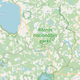
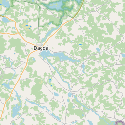
Maaüksuse kaart (katastritunnus: 60900010319)
Katastri tähis: 60900010319
Aadress: "Voloki", Svarinci, Svariņu pagasts, Krāslavas novads, LV-5698
Kinnisasja katastri määramine | |
|---|---|
Katastriobjekti tüüp | Katastriobjekti tüüp: Maa üksus |
Aadress | Aadress: "Voloki", Svarinci, Svariņu pagasts, Krāslavas novads, LV-5698 |
Kinnistu katastrinumber, mille koosseisu see maaüksus kuulub | Kinnistu katastrinumber, mille koosseisu see maaüksus kuulub: 60900010319 |
Aadress | |
|---|---|
Aadressi ID | Aadressi ID: 104220008 |
Aadressil registreeritud ettevõtted | Aadressil registreeritud ettevõtted: 0 |
Aadressil registreeritud struktuuriüksused | Aadressil registreeritud struktuuriüksused: 0 |
Asutused registreeritud aadressil | Asutused registreeritud aadressil: 0 |
Kinnisvara aadressil | |
Tehingud aadressil | Tehingud aadressil: 0 |
|
|
|
{"7201060210":{"name":"<div class='color_dot' style='background-color: #00ffff'><\/div><span>M\u00e4\u00e4ratud maa\u00fcksus<\/span>","featureColor":"#00ffff","features":{"type":"FeatureCollection","features":[{"type":"Feature","geometry":{"type":"Polygon","coordinates":[[[27.74401866,56.129476962],[27.74441428,56.129296141],[27.744765969,56.129523045],[27.74480417,56.129569309],[27.744483305,56.129760183],[27.744465685,56.129749532],[27.744463306,56.129748084],[27.744390592,56.129710006],[27.744066997,56.129508603],[27.744029063,56.129483768],[27.74401866,56.129476962]]]},"crs":{"type":"name","properties":{"name":"urn:ogc:def:crs:EPSG:3059"}},"properties":{"style":{"color":"#00ffff","dashArray":"8,12","weight":1},"name":"Maa","object_type":"Parcel","parcel_code":"60900010325","code":null,"surveyor":null,"address":"Miera iela 38, Svarinci, Svari\u0146u pag., Kr\u0101slavas nov., LV-5698","ownership":"<span>Omanik - F\u00fc\u00fcsiline isik<br><\/span>","pro_cadastre_nr":"60900010319"}},{"type":"Feature","geometry":{"type":"Polygon","coordinates":[[[27.759030205,56.130418049],[27.759035767,56.130370653],[27.759114368,56.129700569],[27.761698375,56.129736724],[27.761157164,56.128280821],[27.760415943,56.127963387],[27.763297434,56.127136288],[27.763812557,56.127381643],[27.764619136,56.127631492],[27.765746557,56.128217182],[27.765881643,56.128993171],[27.765891502,56.129049826],[27.766183051,56.128971975],[27.766775092,56.131071592],[27.766674516,56.131074662],[27.766858914,56.132075098],[27.762907919,56.131370629],[27.762162843,56.131234178],[27.761732353,56.131147821],[27.760849668,56.130977295],[27.760159091,56.130873118],[27.760168749,56.130842763],[27.760288443,56.130569523],[27.759030205,56.130418049]]]},"crs":{"type":"name","properties":{"name":"urn:ogc:def:crs:EPSG:3059"}},"properties":{"style":{"color":"#00ffff","dashArray":"8,12","weight":1},"name":"Maa","object_type":"Parcel","parcel_code":"60900010320","code":null,"surveyor":null,"address":"","ownership":"<span>Omanik - F\u00fc\u00fcsiline isik<br><\/span>","pro_cadastre_nr":"60900010319"}},{"type":"Feature","geometry":{"type":"Polygon","coordinates":[[[27.759273952,56.132968361],[27.760275486,56.130975741],[27.760857125,56.131102309],[27.761241957,56.131186048],[27.762091597,56.13134504],[27.763865077,56.131657561],[27.765280238,56.13190081],[27.766071718,56.132039393],[27.766567902,56.132126263],[27.766890851,56.132168927],[27.76689042,56.132222093],[27.766877406,56.133813933],[27.76449579,56.133622303],[27.762949894,56.133497897],[27.762170028,56.133435129],[27.759538289,56.133120816],[27.759407395,56.133105183],[27.759273952,56.132968361]]]},"crs":{"type":"name","properties":{"name":"urn:ogc:def:crs:EPSG:3059"}},"properties":{"style":{"color":"#00ffff","dashArray":"8,12","weight":1},"name":"Maa","object_type":"Parcel","parcel_code":"60900010319","code":null,"surveyor":null,"address":"\"Voloki\", Svarinci, Svari\u0146u pag., Kr\u0101slavas nov., LV-5698","ownership":"<span>Omanik - F\u00fc\u00fcsiline isik<br><\/span>","pro_cadastre_nr":"60900010319"}},{"type":"Feature","geometry":{"type":"Polygon","coordinates":[[[27.725127536,56.124985558],[27.725197283,56.124176198],[27.725901625,56.124473938],[27.72584791,56.125087364],[27.725752224,56.125075444],[27.725218817,56.124999707],[27.725127536,56.124985558]]]},"crs":{"type":"name","properties":{"name":"urn:ogc:def:crs:EPSG:3059"}},"properties":{"style":{"color":"#00ffff","dashArray":"8,12","weight":1},"name":"Maa","object_type":"Parcel","parcel_code":"60900010318","code":null,"surveyor":null,"address":"","ownership":"<span>Omanik - F\u00fc\u00fcsiline isik<br><\/span>","pro_cadastre_nr":"60900010319"}},{"type":"Feature","geometry":{"type":"Polygon","coordinates":[[[27.724971803,56.126792681],[27.725118855,56.125086314],[27.725121197,56.125059115],[27.725494249,56.125116945],[27.72584165,56.125158904],[27.725750378,56.126200961],[27.725699041,56.126787097],[27.724971803,56.126792681]]]},"crs":{"type":"name","properties":{"name":"urn:ogc:def:crs:EPSG:3059"}},"properties":{"style":{"color":"#00ffff","dashArray":"8,12","weight":1},"name":"Maa","object_type":"Parcel","parcel_code":"60900010317","code":null,"surveyor":null,"address":"","ownership":"<span>Omanik - F\u00fc\u00fcsiline isik<br><\/span>","pro_cadastre_nr":"60900010319"}},{"type":"Feature","geometry":{"type":"Polygon","coordinates":[[[27.74454,56.129793154],[27.74485978,56.129642912],[27.745079232,56.129835631],[27.745301459,56.129881642],[27.746014812,56.129923335],[27.745574784,56.130174237],[27.745557242,56.130184247],[27.745461659,56.130238763],[27.745350546,56.13030214],[27.74454,56.129793154]]]},"crs":{"type":"name","properties":{"name":"urn:ogc:def:crs:EPSG:3059"}},"properties":{"style":{"color":"#00ffff","dashArray":"8,12","weight":1},"name":"Maa","object_type":"Parcel","parcel_code":"60900010316","code":null,"surveyor":null,"address":"","ownership":"<span>Omanik - F\u00fc\u00fcsiline isik<br><\/span>","pro_cadastre_nr":"60900010319"}},{"type":"Feature","geometry":{"type":"Polygon","coordinates":[[[27.743114192,56.145469491],[27.743585859,56.144739617],[27.745163448,56.144453661],[27.746064412,56.144981871],[27.746200697,56.146320531],[27.747895993,56.146942284],[27.745048645,56.147267513],[27.744508226,56.146609518],[27.744484632,56.146588221],[27.743881919,56.145916891],[27.74386779,56.145903786],[27.743731512,56.145713909],[27.743114192,56.145469491]]]},"crs":{"type":"name","properties":{"name":"urn:ogc:def:crs:EPSG:3059"}},"properties":{"style":{"color":"#00ffff","dashArray":"8,12","weight":1},"name":"Maa","object_type":"Parcel","parcel_code":"60900010117","code":null,"surveyor":null,"address":"","ownership":"<span>Omanik - F\u00fc\u00fcsiline isik<br><\/span>","pro_cadastre_nr":"60900010319"}}]}},"5201011310":{"name":"<div class='color_dot' style='background-color: #960096'><\/div><span>Vektoriseeritud hoone<\/span>","featureColor":"#960096","features":{"type":"FeatureCollection","features":[{"type":"Feature","geometry":{"type":"Polygon","coordinates":[[[27.744463306,56.129748084],[27.744390592,56.129710006],[27.744456455,56.129670061],[27.744529135,56.129708131],[27.744463306,56.129748084]]]},"crs":{"type":"name","properties":{"name":"urn:ogc:def:crs:EPSG:3059"}},"properties":{"style":{"color":"#960096","dashArray":"0","weight":2},"name":"Hoone","object_type":"Building","parcel_code":"60900010325","code":"60900010325004","surveyor":null,"address":"Miera iela 38, Svarinci, Svari\u0146u pag., Kr\u0101slavas nov., LV-5698","ownership":"<span>Omanik - F\u00fc\u00fcsiline isik<br><\/span>","pro_cadastre_nr":"60905010325"}},{"type":"Feature","geometry":{"type":"Polygon","coordinates":[[[27.744584455,56.129675178],[27.744511775,56.129637108],[27.744619523,56.129572917],[27.744692236,56.129610995],[27.744584455,56.129675178]]]},"crs":{"type":"name","properties":{"name":"urn:ogc:def:crs:EPSG:3059"}},"properties":{"style":{"color":"#960096","dashArray":"0","weight":2},"name":"Hoone","object_type":"Building","parcel_code":"60900010325","code":"60900010325003","surveyor":null,"address":"Miera iela 38, Svarinci, Svari\u0146u pag., Kr\u0101slavas nov., LV-5698","ownership":"<span>Omanik - F\u00fc\u00fcsiline isik<br><\/span>","pro_cadastre_nr":"60905010325"}},{"type":"Feature","geometry":{"type":"Polygon","coordinates":[[[27.744584455,56.129675178],[27.744529135,56.129708131],[27.744456455,56.129670061],[27.744511775,56.129637108],[27.744584455,56.129675178]]]},"crs":{"type":"name","properties":{"name":"urn:ogc:def:crs:EPSG:3059"}},"properties":{"style":{"color":"#960096","dashArray":"0","weight":2},"name":"Hoone","object_type":"Building","parcel_code":"60900010325","code":"60900010325002","surveyor":null,"address":"Miera iela 38, Svarinci, Svari\u0146u pag., Kr\u0101slavas nov., LV-5698","ownership":"<span>Omanik - F\u00fc\u00fcsiline isik<br><\/span>","pro_cadastre_nr":"60905010325"}},{"type":"Feature","geometry":{"type":"Polygon","coordinates":[[[27.744436838,56.129469936],[27.744322669,56.129406078],[27.744405719,56.129359766],[27.744519888,56.129423625],[27.744436838,56.129469936]]]},"crs":{"type":"name","properties":{"name":"urn:ogc:def:crs:EPSG:3059"}},"properties":{"style":{"color":"#960096","dashArray":"0","weight":2},"name":"Hoone","object_type":"Building","parcel_code":"60900010325","code":"60900010325001","surveyor":null,"address":"Miera iela 38, Svarinci, Svari\u0146u pag., Kr\u0101slavas nov., LV-5698","ownership":"<span>Omanik - F\u00fc\u00fcsiline isik<br><\/span>","pro_cadastre_nr":"60905010325"}},{"type":"Feature","geometry":{"type":"Polygon","coordinates":[[[27.760258946,56.13293011],[27.760224253,56.132882736],[27.760309087,56.132863362],[27.76034378,56.132910737],[27.760258946,56.13293011]]]},"crs":{"type":"name","properties":{"name":"urn:ogc:def:crs:EPSG:3059"}},"properties":{"style":{"color":"#960096","dashArray":"0","weight":2},"name":"Hoone","object_type":"Building","parcel_code":"60900010319","code":"60900010319007","surveyor":null,"address":"\"Voloki\", Svarinci, Svari\u0146u pag., Kr\u0101slavas nov., LV-5698","ownership":null,"pro_cadastre_nr":null}},{"type":"Feature","geometry":{"type":"Polygon","coordinates":[[[27.761104587,56.133030873],[27.760993686,56.133032482],[27.760992013,56.132996583],[27.76110293,56.132994973],[27.761104587,56.133030873]]]},"crs":{"type":"name","properties":{"name":"urn:ogc:def:crs:EPSG:3059"}},"properties":{"style":{"color":"#960096","dashArray":"0","weight":2},"name":"Hoone","object_type":"Building","parcel_code":"60900010319","code":"60900010319005","surveyor":null,"address":"\"Voloki\", Svarinci, Svari\u0146u pag., Kr\u0101slavas nov., LV-5698","ownership":"<span>Omanik - F\u00fc\u00fcsiline isik<br><\/span>","pro_cadastre_nr":"60905010319"}},{"type":"Feature","geometry":{"type":"Polygon","coordinates":[[[27.761910346,56.133039068],[27.761808928,56.133043787],[27.761801393,56.132993239],[27.761902812,56.132988519],[27.761910346,56.133039068]]]},"crs":{"type":"name","properties":{"name":"urn:ogc:def:crs:EPSG:3059"}},"properties":{"style":{"color":"#960096","dashArray":"0","weight":2},"name":"Hoone","object_type":"Building","parcel_code":"60900010319","code":"60900010319003","surveyor":null,"address":"\"Voloki\", Svarinci, Svari\u0146u pag., Kr\u0101slavas nov., LV-5698","ownership":"<span>Omanik - F\u00fc\u00fcsiline isik<br><\/span>","pro_cadastre_nr":"60905010319"}},{"type":"Feature","geometry":{"type":"Polygon","coordinates":[[[27.761784828,56.132774543],[27.761788177,56.132798261],[27.761643604,56.13280462],[27.761630402,56.132711082],[27.761864424,56.132700782],[27.761874277,56.132770602],[27.761784828,56.132774543]]]},"crs":{"type":"name","properties":{"name":"urn:ogc:def:crs:EPSG:3059"}},"properties":{"style":{"color":"#960096","dashArray":"0","weight":2},"name":"Hoone","object_type":"Building","parcel_code":"60900010319","code":"60900010319001","surveyor":null,"address":"\"Voloki\", Svarinci, Svari\u0146u pag., Kr\u0101slavas nov., LV-5698","ownership":"<span>Omanik - F\u00fc\u00fcsiline isik<br><\/span>","pro_cadastre_nr":"60905010319"}},{"type":"Feature","geometry":{"type":"Polygon","coordinates":[[[27.761808928,56.133043787],[27.761674809,56.133050025],[27.761667275,56.132999477],[27.761801393,56.132993239],[27.761808928,56.133043787]]]},"crs":{"type":"name","properties":{"name":"urn:ogc:def:crs:EPSG:3059"}},"properties":{"style":{"color":"#960096","dashArray":"0","weight":2},"name":"Hoone","object_type":"Building","parcel_code":"60900010319","code":"60900010319002","surveyor":null,"address":"\"Voloki\", Svarinci, Svari\u0146u pag., Kr\u0101slavas nov., LV-5698","ownership":"<span>Omanik - F\u00fc\u00fcsiline isik<br><\/span>","pro_cadastre_nr":"60905010319"}},{"type":"Feature","geometry":{"type":"Polygon","coordinates":[[[27.76133058,56.133116495],[27.761152733,56.133124767],[27.761145259,56.133074666],[27.761323106,56.133066385],[27.76133058,56.133116495]]]},"crs":{"type":"name","properties":{"name":"urn:ogc:def:crs:EPSG:3059"}},"properties":{"style":{"color":"#960096","dashArray":"0","weight":2},"name":"Hoone","object_type":"Building","parcel_code":"60900010319","code":"60900010319006","surveyor":null,"address":"\"Voloki\", Svarinci, Svari\u0146u pag., Kr\u0101slavas nov., LV-5698","ownership":"<span>Omanik - F\u00fc\u00fcsiline isik<br><\/span>","pro_cadastre_nr":"60905010319"}},{"type":"Feature","geometry":{"type":"Polygon","coordinates":[[[27.761952378,56.132847567],[27.761877855,56.132850846],[27.761870524,56.132798925],[27.761945047,56.132795646],[27.761952378,56.132847567]]]},"crs":{"type":"name","properties":{"name":"urn:ogc:def:crs:EPSG:3059"}},"properties":{"style":{"color":"#960096","dashArray":"0","weight":2},"name":"Hoone","object_type":"Building","parcel_code":"60900010319","code":"60900010319004","surveyor":null,"address":"\"Voloki\", Svarinci, Svari\u0146u pag., Kr\u0101slavas nov., LV-5698","ownership":"<span>Omanik - F\u00fc\u00fcsiline isik<br><\/span>","pro_cadastre_nr":"60905010319"}}]}}}
{"7201060210":{"name":"<div class='color_dot' style='background-color: #00ffff'><\/div><span>M\u00e4\u00e4ratud maa\u00fcksus<\/span>","featureColor":"#00ffff","features":{"type":"FeatureCollection","features":[{"type":"Feature","geometry":{"type":"Polygon","coordinates":[[[27.74401866,56.129476962],[27.744436256,56.129286229],[27.744765969,56.129523045],[27.74480417,56.129569309],[27.744483305,56.129760183],[27.744465685,56.129749532],[27.744463306,56.129748084],[27.744390592,56.129710006],[27.744066997,56.129508603],[27.744029063,56.129483768],[27.74401866,56.129476962]]]},"crs":{"type":"name","properties":{"name":"urn:ogc:def:crs:EPSG:3059"}},"properties":{"style":{"color":"#00ffff","dashArray":"8,12","weight":1},"name":"Maa","object_type":"Parcel","parcel_code":"60900010325","code":null,"surveyor":null,"address":"Miera iela 38, Svarinci, Svari\u0146u pag., Kr\u0101slavas nov., LV-5698","ownership":"<span>Omanik - F\u00fc\u00fcsiline isik<br><\/span>","pro_cadastre_nr":"60900010319"}},{"type":"Feature","geometry":{"type":"Polygon","coordinates":[[[27.759030205,56.130418049],[27.759035767,56.130370653],[27.759114368,56.129700569],[27.761698375,56.129736724],[27.761157164,56.128280821],[27.760415943,56.127963387],[27.763297434,56.127136288],[27.763812557,56.127381643],[27.764619136,56.127631492],[27.765746557,56.128217182],[27.765881643,56.128993171],[27.765891502,56.129049826],[27.766183051,56.128971975],[27.766775092,56.131071592],[27.766674516,56.131074662],[27.766858914,56.132075098],[27.762851285,56.131423198],[27.762121006,56.131293734],[27.761718312,56.131222826],[27.760889651,56.131054217],[27.760805539,56.131037106],[27.760159091,56.130873118],[27.760168749,56.130842763],[27.760288443,56.130569523],[27.759030205,56.130418049]]]},"crs":{"type":"name","properties":{"name":"urn:ogc:def:crs:EPSG:3059"}},"properties":{"style":{"color":"#00ffff","dashArray":"8,12","weight":1},"name":"Maa","object_type":"Parcel","parcel_code":"60900010320","code":null,"surveyor":null,"address":"","ownership":"<span>Omanik - F\u00fc\u00fcsiline isik<br><\/span>","pro_cadastre_nr":"60900010319"}}]}}}
https://tile.openstreetmap.org/{z}/{x}/{y}.png|© OpenStreetMap contributors|minZoom: 7|maxZoom: 19
|
Maaüksuse andmeid värskendati: 10.01.2025.
Andmeallikas ja litsents: katastri infosüsteem avatud teksti- ja ruumiandmed, kinnisvaraturu andmebaasi avaandmed, avaandmete litsents Creative Commons Attribution, OpenStreetMap


