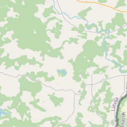
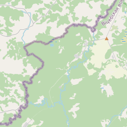
Maaüksuse kaart (katastritunnus: 60500040209)
Katastri tähis: 60500040209
Haldusterritoorium: Krāslavas novads
Kinnisasja katastri määramine | |
|---|---|
Katastriobjekti tüüp | Katastriobjekti tüüp: Maa üksus |
Haldusterritoorium | |
Kinnistu katastrinumber, mille koosseisu see maaüksus kuulub | Kinnistu katastrinumber, mille koosseisu see maaüksus kuulub: 60500040208 |
|
|
|
{"7201060210":{"name":"<div class='color_dot' style='background-color: #00ffff'><\/div><span>M\u00e4\u00e4ratud maa\u00fcksus<\/span>","featureColor":"#00ffff","features":{"type":"FeatureCollection","features":[{"type":"Feature","geometry":{"type":"Polygon","coordinates":[[[27.905441804,56.102475496],[27.905513489,56.102447102],[27.906407932,56.102072967],[27.906810907,56.102650158],[27.907754684,56.103992336],[27.907804047,56.104062543],[27.907761124,56.104103075],[27.907728655,56.104101838],[27.907383672,56.104142903],[27.907082047,56.104172801],[27.906895867,56.104181334],[27.90662332,56.103770675],[27.906244576,56.103235124],[27.906152042,56.10310428],[27.905441804,56.102475496]]]},"crs":{"type":"name","properties":{"name":"urn:ogc:def:crs:EPSG:3059"}},"properties":{"style":{"color":"#00ffff","dashArray":"8,12","weight":1},"name":"Maa","object_type":"Parcel","parcel_code":"60500040210","code":null,"surveyor":null,"address":"","ownership":"<span>Omanik - F\u00fc\u00fcsiline isik<br><\/span>","pro_cadastre_nr":"60500040208"}},{"type":"Feature","geometry":{"type":"Polygon","coordinates":[[[27.894659932,56.102674814],[27.896206548,56.103110844],[27.897685967,56.103527901],[27.897198361,56.103997989],[27.894817254,56.10367642],[27.894706232,56.102969606],[27.894659932,56.102674814]]]},"crs":{"type":"name","properties":{"name":"urn:ogc:def:crs:EPSG:3059"}},"properties":{"style":{"color":"#00ffff","dashArray":"8,12","weight":1},"name":"Maa","object_type":"Parcel","parcel_code":"60500040209","code":null,"surveyor":null,"address":"","ownership":"<span>Omanik - F\u00fc\u00fcsiline isik<br><\/span>","pro_cadastre_nr":"60500040208"}},{"type":"Feature","geometry":{"type":"Polygon","coordinates":[[[27.897421346,56.104784446],[27.898074521,56.103714124],[27.898225735,56.103778264],[27.897948319,56.104327078],[27.897873575,56.104757177],[27.897421346,56.104784446]]]},"crs":{"type":"name","properties":{"name":"urn:ogc:def:crs:EPSG:3059"}},"properties":{"style":{"color":"#00ffff","dashArray":"8,12","weight":1},"name":"Maa","object_type":"Parcel","parcel_code":"60500040208","code":null,"surveyor":null,"address":"Kalnu iela 4, Punduri, B\u0113rzi\u0146u pag., Kr\u0101slavas nov., LV-5697","ownership":"<span>Omanik - F\u00fc\u00fcsiline isik<br><\/span>","pro_cadastre_nr":"60500040208"}},{"type":"Feature","geometry":{"type":"Polygon","coordinates":[[[27.882609491,56.109440593],[27.882659969,56.107641149],[27.885284167,56.107791623],[27.885436045,56.108285559],[27.884548788,56.108794424],[27.883527308,56.109380231],[27.882609491,56.109440593]]]},"crs":{"type":"name","properties":{"name":"urn:ogc:def:crs:EPSG:3059"}},"properties":{"style":{"color":"#00ffff","dashArray":"8,12","weight":1},"name":"Maa","object_type":"Parcel","parcel_code":"60500030260","code":null,"surveyor":null,"address":"","ownership":"<span>Omanik - F\u00fc\u00fcsiline isik<br><\/span>","pro_cadastre_nr":"60500040208"}}]}},"5201011310":{"name":"<div class='color_dot' style='background-color: #960096'><\/div><span>Vektoriseeritud hoone<\/span>","featureColor":"#960096","features":{"type":"FeatureCollection","features":[{"type":"Feature","geometry":{"type":"Polygon","coordinates":[[[27.897896522,56.104441088],[27.89781625,56.104439264],[27.897820114,56.104386337],[27.897900386,56.104388161],[27.897896522,56.104441088]]]},"crs":{"type":"name","properties":{"name":"urn:ogc:def:crs:EPSG:3059"}},"properties":{"style":{"color":"#960096","dashArray":"0","weight":2},"name":"Hoone","object_type":"Building","parcel_code":"60500040208","code":"60500040208003","surveyor":null,"address":"Kalnu iela 4, Punduri, B\u0113rzi\u0146u pag., Kr\u0101slavas nov., LV-5697","ownership":"<span>Omanik - F\u00fc\u00fcsiline isik<br><\/span>","pro_cadastre_nr":"60500040208"}},{"type":"Feature","geometry":{"type":"Polygon","coordinates":[[[27.897776714,56.104741858],[27.89768292,56.104743158],[27.897679809,56.10467315],[27.897773604,56.104671849],[27.897776108,56.104728397],[27.897776714,56.104741858]]]},"crs":{"type":"name","properties":{"name":"urn:ogc:def:crs:EPSG:3059"}},"properties":{"style":{"color":"#960096","dashArray":"0","weight":2},"name":"Hoone","object_type":"Building","parcel_code":"60500040208","code":"60500040208001","surveyor":null,"address":"Kalnu iela 4, Punduri, B\u0113rzi\u0146u pag., Kr\u0101slavas nov., LV-5697","ownership":"<span>Omanik - F\u00fc\u00fcsiline isik<br><\/span>","pro_cadastre_nr":"60500040208"}},{"type":"Feature","geometry":{"type":"Polygon","coordinates":[[[27.89781625,56.104439264],[27.89770501,56.104436718],[27.897708875,56.104383791],[27.897820114,56.104386337],[27.89781625,56.104439264]]]},"crs":{"type":"name","properties":{"name":"urn:ogc:def:crs:EPSG:3059"}},"properties":{"style":{"color":"#960096","dashArray":"0","weight":2},"name":"Hoone","object_type":"Building","parcel_code":"60500040208","code":"60500040208004","surveyor":null,"address":"Kalnu iela 4, Punduri, B\u0113rzi\u0146u pag., Kr\u0101slavas nov., LV-5697","ownership":"<span>Omanik - F\u00fc\u00fcsiline isik<br><\/span>","pro_cadastre_nr":"60500040208"}},{"type":"Feature","geometry":{"type":"Polygon","coordinates":[[[27.897829441,56.104727655],[27.897776108,56.104728397],[27.897773604,56.104671849],[27.897826921,56.104671117],[27.897829441,56.104727655]]]},"crs":{"type":"name","properties":{"name":"urn:ogc:def:crs:EPSG:3059"}},"properties":{"style":{"color":"#960096","dashArray":"0","weight":2},"name":"Hoone","object_type":"Building","parcel_code":"60500040208","code":"60500040208002","surveyor":null,"address":"Kalnu iela 4, Punduri, B\u0113rzi\u0146u pag., Kr\u0101slavas nov., LV-5697","ownership":"<span>Omanik - F\u00fc\u00fcsiline isik<br><\/span>","pro_cadastre_nr":"60500040208"}},{"type":"Feature","geometry":{"type":"Polygon","coordinates":[[[27.89781625,56.104439264],[27.89770501,56.104436718],[27.897708875,56.104383791],[27.897820114,56.104386337],[27.89781625,56.104439264]]]},"crs":{"type":"name","properties":{"name":"urn:ogc:def:crs:EPSG:3059"}},"properties":{"style":{"color":"#960096","dashArray":"0","weight":2},"name":"Hoone","object_type":"Building","parcel_code":"60500040208","code":"60500040208004","surveyor":null,"address":"Kalnu iela 4, Punduri, B\u0113rzi\u0146u pag., Kr\u0101slavas nov., LV-5697","ownership":"<span>Omanik - F\u00fc\u00fcsiline isik<br><\/span>","pro_cadastre_nr":"60500040208"}},{"type":"Feature","geometry":{"type":"Polygon","coordinates":[[[27.897896522,56.104441088],[27.89781625,56.104439264],[27.897820114,56.104386337],[27.897900386,56.104388161],[27.897896522,56.104441088]]]},"crs":{"type":"name","properties":{"name":"urn:ogc:def:crs:EPSG:3059"}},"properties":{"style":{"color":"#960096","dashArray":"0","weight":2},"name":"Hoone","object_type":"Building","parcel_code":"60500040208","code":"60500040208003","surveyor":null,"address":"Kalnu iela 4, Punduri, B\u0113rzi\u0146u pag., Kr\u0101slavas nov., LV-5697","ownership":"<span>Omanik - F\u00fc\u00fcsiline isik<br><\/span>","pro_cadastre_nr":"60500040208"}},{"type":"Feature","geometry":{"type":"Polygon","coordinates":[[[27.897829441,56.104727655],[27.897776108,56.104728397],[27.897773604,56.104671849],[27.897826921,56.104671117],[27.897829441,56.104727655]]]},"crs":{"type":"name","properties":{"name":"urn:ogc:def:crs:EPSG:3059"}},"properties":{"style":{"color":"#960096","dashArray":"0","weight":2},"name":"Hoone","object_type":"Building","parcel_code":"60500040208","code":"60500040208002","surveyor":null,"address":"Kalnu iela 4, Punduri, B\u0113rzi\u0146u pag., Kr\u0101slavas nov., LV-5697","ownership":"<span>Omanik - F\u00fc\u00fcsiline isik<br><\/span>","pro_cadastre_nr":"60500040208"}},{"type":"Feature","geometry":{"type":"Polygon","coordinates":[[[27.897776714,56.104741858],[27.89768292,56.104743158],[27.897679809,56.10467315],[27.897773604,56.104671849],[27.897776108,56.104728397],[27.897776714,56.104741858]]]},"crs":{"type":"name","properties":{"name":"urn:ogc:def:crs:EPSG:3059"}},"properties":{"style":{"color":"#960096","dashArray":"0","weight":2},"name":"Hoone","object_type":"Building","parcel_code":"60500040208","code":"60500040208001","surveyor":null,"address":"Kalnu iela 4, Punduri, B\u0113rzi\u0146u pag., Kr\u0101slavas nov., LV-5697","ownership":"<span>Omanik - F\u00fc\u00fcsiline isik<br><\/span>","pro_cadastre_nr":"60500040208"}}]}}}
[]
https://tile.openstreetmap.org/{z}/{x}/{y}.png|© OpenStreetMap contributors|minZoom: 7|maxZoom: 19
|
Maaüksuse andmeid värskendati: 10.01.2025.
Andmeallikas ja litsents: katastri infosüsteem avatud teksti- ja ruumiandmed, kinnisvaraturu andmebaasi avaandmed, avaandmete litsents Creative Commons Attribution, OpenStreetMap

