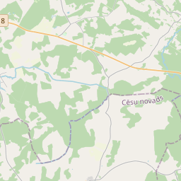
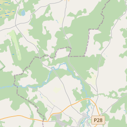
Maaüksuse kaart (katastritunnus: 42640030092)
Katastri tähis: 42640030092
Aadress: "Pieķēpi", Mārsnēnu pagasts, Cēsu novads, LV-4129
Kinnisasja katastri määramine | |
|---|---|
Katastriobjekti tüüp | Katastriobjekti tüüp: Maa üksus |
Aadress | Aadress: "Pieķēpi", Mārsnēnu pagasts, Cēsu novads, LV-4129 |
Kinnistu katastrinumber, mille koosseisu see maaüksus kuulub | Kinnistu katastrinumber, mille koosseisu see maaüksus kuulub: 42640030092 |
Aadress | |
|---|---|
Aadressi ID | Aadressi ID: 104071017 |
Aadressil registreeritud ettevõtted | Aadressil registreeritud ettevõtted: 0 |
Aadressil registreeritud struktuuriüksused | Aadressil registreeritud struktuuriüksused: 0 |
Asutused registreeritud aadressil | Asutused registreeritud aadressil: 0 |
Kinnisvara aadressil | |
Tehingud aadressil | Tehingud aadressil: 0 |
|
|
|
{"7201060210":{"name":"<div class='color_dot' style='background-color: #00ffff'><\/div><span>M\u00e4\u00e4ratud maa\u00fcksus<\/span>","featureColor":"#00ffff","features":{"type":"FeatureCollection","features":[{"type":"Feature","geometry":{"type":"Polygon","coordinates":[[[25.601865879,57.407159065],[25.602940957,57.406643189],[25.603966666,57.40615282],[25.605679592,57.405144485],[25.606546166,57.404608595],[25.607473894,57.40408012],[25.608400877,57.403535243],[25.613165167,57.401514379],[25.615158442,57.403251953],[25.611969252,57.404490193],[25.611162668,57.404835828],[25.609537351,57.405601745],[25.608418347,57.40600517],[25.606393404,57.406767873],[25.604048917,57.407696672],[25.602375687,57.407866856],[25.601865879,57.407159065]]]},"crs":{"type":"name","properties":{"name":"urn:ogc:def:crs:EPSG:3059"}},"properties":{"style":{"color":"#00ffff","dashArray":"8,12","weight":1},"name":"Maa","object_type":"Parcel","parcel_code":"42640030342","code":null,"surveyor":null,"address":"","ownership":"<span>Omanik - F\u00fc\u00fcsiline isik<br><\/span>","pro_cadastre_nr":"42640030092"}}]}},"7201060110":{"name":"<div class='color_dot' style='background-color: #00ffff'><\/div><span>M\u00f5\u00f5distatud maa\u00fcksus<\/span>","featureColor":"#00ffff","features":{"type":"FeatureCollection","features":[{"type":"Feature","geometry":{"type":"Polygon","coordinates":[[[25.593996426,57.415783982],[25.594002105,57.415776354],[25.594063597,57.415747284],[25.594171647,57.415724822],[25.594937624,57.415643225],[25.595318754,57.415605481],[25.595436041,57.415581418],[25.595637373,57.415543857],[25.595836251,57.415488168],[25.596028805,57.4154276],[25.59628964,57.415371593],[25.5964903,57.415309844],[25.596832478,57.415221153],[25.597062228,57.415166752],[25.597089003,57.415199681],[25.597501021,57.415215661],[25.597908064,57.414823102],[25.599129839,57.414065124],[25.599526326,57.413594206],[25.599766123,57.413632687],[25.599780861,57.413638124],[25.600040028,57.413687823],[25.600320009,57.413743671],[25.600467659,57.413771219],[25.600551032,57.413784032],[25.600639,57.413794172],[25.600587817,57.413883776],[25.600130929,57.414435101],[25.599836713,57.414848192],[25.600051143,57.415052702],[25.59936797,57.415540576],[25.598961646,57.415955932],[25.598475747,57.416541508],[25.598300008,57.416694944],[25.598239738,57.416731377],[25.594686609,57.416355322],[25.593996426,57.415783982]]]},"crs":{"type":"name","properties":{"name":"urn:ogc:def:crs:EPSG:3059"}},"properties":{"style":{"color":"#00ffff","dashArray":"0","weight":1},"name":"Maa","object_type":"Parcel","parcel_code":"42640030092","code":null,"surveyor":null,"address":"\"Pie\u0137\u0113pi\", M\u0101rsn\u0113nu pag., C\u0113su nov., LV-4129","ownership":"<span>Omanik - F\u00fc\u00fcsiline isik<br><\/span>","pro_cadastre_nr":"42640030092"}}]}},"7114100000":{"name":"<div class='color_dot' style='background-color: #b40000'><\/div><span>Koormatud tee servituudi ala<\/span>","featureColor":"#b40000","features":{"type":"FeatureCollection","features":[{"type":"Feature","geometry":{"type":"Polygon","coordinates":[[[25.594171647,57.415724822],[25.594937624,57.415643225],[25.595318754,57.415605481],[25.595436041,57.415581418],[25.595637373,57.415543857],[25.595836251,57.415488168],[25.596028805,57.4154276],[25.59628964,57.415371593],[25.5964903,57.415309844],[25.596832478,57.415221153],[25.597062228,57.415166752],[25.597069739,57.415176746],[25.596840813,57.415230948],[25.59649959,57.415319393],[25.596298322,57.41538133],[25.59603757,57.415437318],[25.595845886,57.415497614],[25.595645281,57.415553783],[25.595442561,57.415591605],[25.595429696,57.415608191],[25.594942295,57.415656463],[25.594178605,57.415737815],[25.59407671,57.415758996],[25.59402305,57.415784364],[25.594015754,57.41579618],[25.593996426,57.415783982],[25.594002105,57.415776354],[25.594063597,57.415747284],[25.594171647,57.415724822]]]},"crs":{"type":"name","properties":{"name":"urn:ogc:def:crs:EPSG:3059"}},"properties":{"style":{"color":"#b40000","dashArray":"4,2,1,2","weight":1},"name":"Koormatud tee servituudi ala","object_type":"WayRestriction","parcel_code":"42640030092","code":"7315030100005","surveyor":null,"address":"\"Pie\u0137\u0113pi\", M\u0101rsn\u0113nu pag., C\u0113su nov., LV-4129","ownership":"<span>Omanik - F\u00fc\u00fcsiline isik<br><\/span>","pro_cadastre_nr":"42640030092"}}]}},"5201011110":{"name":"<div class='color_dot' style='background-color: #ff0000'><\/div><span>M\u00f5\u00f5distatud hoone<\/span>","featureColor":"#ff0000","features":{"type":"FeatureCollection","features":[{"type":"Feature","geometry":{"type":"Polygon","coordinates":[[[25.597734172,57.415433566],[25.59788195,57.41542994],[25.597907244,57.415629126],[25.597759464,57.415632752],[25.597734172,57.415433566]]]},"crs":{"type":"name","properties":{"name":"urn:ogc:def:crs:EPSG:3059"}},"properties":{"style":{"color":"#ff0000","dashArray":"0","weight":1},"name":"Hoone","object_type":"Building","parcel_code":"42640030092","code":"42640030092004","surveyor":null,"address":"\"Pie\u0137\u0113pi\", M\u0101rsn\u0113nu pag., C\u0113su nov., LV-4129","ownership":"<span>Omanik - F\u00fc\u00fcsiline isik<br><\/span>","pro_cadastre_nr":"42640030092"}},{"type":"Feature","geometry":{"type":"Polygon","coordinates":[[[25.596910026,57.415521604],[25.597045458,57.415493662],[25.597070797,57.415530707],[25.59711157,57.415522589],[25.597131686,57.415553627],[25.597091887,57.415561553],[25.597122153,57.415605821],[25.596986722,57.415633763],[25.59695923,57.415593556],[25.596915816,57.415602202],[25.596893074,57.415568969],[25.596936504,57.415560324],[25.596910026,57.415521604]]]},"crs":{"type":"name","properties":{"name":"urn:ogc:def:crs:EPSG:3059"}},"properties":{"style":{"color":"#ff0000","dashArray":"0","weight":1},"name":"Hoone","object_type":"Building","parcel_code":"42640030092","code":"42640030092001","surveyor":null,"address":"\"Pie\u0137\u0113pi\", M\u0101rsn\u0113nu pag., C\u0113su nov., LV-4129","ownership":"<span>Omanik - F\u00fc\u00fcsiline isik<br><\/span>","pro_cadastre_nr":"42640030092"}},{"type":"Feature","geometry":{"type":"Polygon","coordinates":[[[25.597294739,57.415717231],[25.597441113,57.415698539],[25.597446099,57.415709418],[25.597463932,57.415749182],[25.597317557,57.415767874],[25.597299725,57.415728111],[25.597294739,57.415717231]]]},"crs":{"type":"name","properties":{"name":"urn:ogc:def:crs:EPSG:3059"}},"properties":{"style":{"color":"#ff0000","dashArray":"0","weight":1},"name":"Hoone","object_type":"Building","parcel_code":"42640030092","code":"42640030092002","surveyor":null,"address":"\"Pie\u0137\u0113pi\", M\u0101rsn\u0113nu pag., C\u0113su nov., LV-4129","ownership":"<span>Omanik - F\u00fc\u00fcsiline isik<br><\/span>","pro_cadastre_nr":"42640030092"}},{"type":"Feature","geometry":{"type":"Polygon","coordinates":[[[25.598005694,57.415853043],[25.598033866,57.415788816],[25.598093331,57.415797001],[25.598065159,57.415861229],[25.598005694,57.415853043]]]},"crs":{"type":"name","properties":{"name":"urn:ogc:def:crs:EPSG:3059"}},"properties":{"style":{"color":"#ff0000","dashArray":"0","weight":1},"name":"Hoone","object_type":"Building","parcel_code":"42640030092","code":"42640030092003","surveyor":null,"address":"\"Pie\u0137\u0113pi\", M\u0101rsn\u0113nu pag., C\u0113su nov., LV-4129","ownership":"<span>Omanik - F\u00fc\u00fcsiline isik<br><\/span>","pro_cadastre_nr":"42640030092"}},{"type":"Feature","geometry":{"type":"Polygon","coordinates":[[[25.597552069,57.415440431],[25.597541165,57.41535944],[25.597672045,57.415354313],[25.597682948,57.415435303],[25.597552069,57.415440431]]]},"crs":{"type":"name","properties":{"name":"urn:ogc:def:crs:EPSG:3059"}},"properties":{"style":{"color":"#ff0000","dashArray":"0","weight":1},"name":"Hoone","object_type":"Building","parcel_code":"42640030092","code":"42640030092005","surveyor":null,"address":"\"Pie\u0137\u0113pi\", M\u0101rsn\u0113nu pag., C\u0113su nov., LV-4129","ownership":"<span>Omanik - F\u00fc\u00fcsiline isik<br><\/span>","pro_cadastre_nr":"42640030092"}},{"type":"Feature","geometry":{"type":"Polygon","coordinates":[[[25.59565222,57.415660483],[25.595892462,57.415586904],[25.595974436,57.415664344],[25.595734194,57.415737923],[25.59565222,57.415660483]]]},"crs":{"type":"name","properties":{"name":"urn:ogc:def:crs:EPSG:3059"}},"properties":{"style":{"color":"#ff0000","dashArray":"0","weight":1},"name":"Hoone","object_type":"Building","parcel_code":"42640030092","code":"42640030092006","surveyor":null,"address":"\"Pie\u0137\u0113pi\", M\u0101rsn\u0113nu pag., C\u0113su nov., LV-4129","ownership":"<span>Omanik - F\u00fc\u00fcsiline isik<br><\/span>","pro_cadastre_nr":"42640030092"}},{"type":"Feature","geometry":{"type":"Polygon","coordinates":[[[25.59565222,57.415660483],[25.595892462,57.415586904],[25.595974436,57.415664344],[25.595734194,57.415737923],[25.59565222,57.415660483]]]},"crs":{"type":"name","properties":{"name":"urn:ogc:def:crs:EPSG:3059"}},"properties":{"style":{"color":"#ff0000","dashArray":"0","weight":1},"name":"Hoone","object_type":"Building","parcel_code":"42640030092","code":"42640030092006","surveyor":null,"address":"\"Pie\u0137\u0113pi\", M\u0101rsn\u0113nu pag., C\u0113su nov., LV-4129","ownership":"<span>Omanik - F\u00fc\u00fcsiline isik<br><\/span>","pro_cadastre_nr":"42640030092"}},{"type":"Feature","geometry":{"type":"Polygon","coordinates":[[[25.597552069,57.415440431],[25.597541165,57.41535944],[25.597672045,57.415354313],[25.597682948,57.415435303],[25.597552069,57.415440431]]]},"crs":{"type":"name","properties":{"name":"urn:ogc:def:crs:EPSG:3059"}},"properties":{"style":{"color":"#ff0000","dashArray":"0","weight":1},"name":"Hoone","object_type":"Building","parcel_code":"42640030092","code":"42640030092005","surveyor":null,"address":"\"Pie\u0137\u0113pi\", M\u0101rsn\u0113nu pag., C\u0113su nov., LV-4129","ownership":"<span>Omanik - F\u00fc\u00fcsiline isik<br><\/span>","pro_cadastre_nr":"42640030092"}},{"type":"Feature","geometry":{"type":"Polygon","coordinates":[[[25.597734172,57.415433566],[25.59788195,57.41542994],[25.597907244,57.415629126],[25.597759464,57.415632752],[25.597734172,57.415433566]]]},"crs":{"type":"name","properties":{"name":"urn:ogc:def:crs:EPSG:3059"}},"properties":{"style":{"color":"#ff0000","dashArray":"0","weight":1},"name":"Hoone","object_type":"Building","parcel_code":"42640030092","code":"42640030092004","surveyor":null,"address":"\"Pie\u0137\u0113pi\", M\u0101rsn\u0113nu pag., C\u0113su nov., LV-4129","ownership":"<span>Omanik - F\u00fc\u00fcsiline isik<br><\/span>","pro_cadastre_nr":"42640030092"}},{"type":"Feature","geometry":{"type":"Polygon","coordinates":[[[25.598005694,57.415853043],[25.598033866,57.415788816],[25.598093331,57.415797001],[25.598065159,57.415861229],[25.598005694,57.415853043]]]},"crs":{"type":"name","properties":{"name":"urn:ogc:def:crs:EPSG:3059"}},"properties":{"style":{"color":"#ff0000","dashArray":"0","weight":1},"name":"Hoone","object_type":"Building","parcel_code":"42640030092","code":"42640030092003","surveyor":null,"address":"\"Pie\u0137\u0113pi\", M\u0101rsn\u0113nu pag., C\u0113su nov., LV-4129","ownership":"<span>Omanik - F\u00fc\u00fcsiline isik<br><\/span>","pro_cadastre_nr":"42640030092"}},{"type":"Feature","geometry":{"type":"Polygon","coordinates":[[[25.597294739,57.415717231],[25.597441113,57.415698539],[25.597446099,57.415709418],[25.597463932,57.415749182],[25.597317557,57.415767874],[25.597299725,57.415728111],[25.597294739,57.415717231]]]},"crs":{"type":"name","properties":{"name":"urn:ogc:def:crs:EPSG:3059"}},"properties":{"style":{"color":"#ff0000","dashArray":"0","weight":1},"name":"Hoone","object_type":"Building","parcel_code":"42640030092","code":"42640030092002","surveyor":null,"address":"\"Pie\u0137\u0113pi\", M\u0101rsn\u0113nu pag., C\u0113su nov., LV-4129","ownership":"<span>Omanik - F\u00fc\u00fcsiline isik<br><\/span>","pro_cadastre_nr":"42640030092"}},{"type":"Feature","geometry":{"type":"Polygon","coordinates":[[[25.596910026,57.415521604],[25.597045458,57.415493662],[25.597070797,57.415530707],[25.59711157,57.415522589],[25.597131686,57.415553627],[25.597091887,57.415561553],[25.597122153,57.415605821],[25.596986722,57.415633763],[25.59695923,57.415593556],[25.596915816,57.415602202],[25.596893074,57.415568969],[25.596936504,57.415560324],[25.596910026,57.415521604]]]},"crs":{"type":"name","properties":{"name":"urn:ogc:def:crs:EPSG:3059"}},"properties":{"style":{"color":"#ff0000","dashArray":"0","weight":1},"name":"Hoone","object_type":"Building","parcel_code":"42640030092","code":"42640030092001","surveyor":null,"address":"\"Pie\u0137\u0113pi\", M\u0101rsn\u0113nu pag., C\u0113su nov., LV-4129","ownership":"<span>Omanik - F\u00fc\u00fcsiline isik<br><\/span>","pro_cadastre_nr":"42640030092"}}]}}}
[]
https://tile.openstreetmap.org/{z}/{x}/{y}.png|© OpenStreetMap contributors|minZoom: 7|maxZoom: 19
|
Maaüksuse andmeid värskendati: 10.01.2025.
Andmeallikas ja litsents: katastri infosüsteem avatud teksti- ja ruumiandmed, kinnisvaraturu andmebaasi avaandmed, avaandmete litsents Creative Commons Attribution, OpenStreetMap

