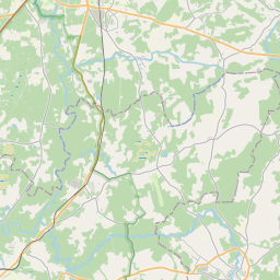
Maaüksuse kaart (katastritunnus: 42640030047)
Katastri tähis: 42640030047
Aadress: "Klētnieki", Mārsnēnu pagasts, Cēsu novads, LV-4129
Kinnisasja katastri määramine | |
|---|---|
Katastriobjekti tüüp | Katastriobjekti tüüp: Maa üksus |
Aadress | Aadress: "Klētnieki", Mārsnēnu pagasts, Cēsu novads, LV-4129 |
Kinnistu katastrinumber, mille koosseisu see maaüksus kuulub | Kinnistu katastrinumber, mille koosseisu see maaüksus kuulub: 42640030047 |
Aadress | |
|---|---|
Aadressi ID | Aadressi ID: 104070023 |
Aadressil registreeritud ettevõtted | |
Aadressil registreeritud struktuuriüksused | Aadressil registreeritud struktuuriüksused: 0 |
Asutused registreeritud aadressil | Asutused registreeritud aadressil: 0 |
Kinnisvara aadressil | |
Tehingud aadressil | Tehingud aadressil: 0 |
|
|
|
{"7201060210":{"name":"<div class='color_dot' style='background-color: #00ffff'><\/div><span>M\u00e4\u00e4ratud maa\u00fcksus<\/span>","featureColor":"#00ffff","features":{"type":"FeatureCollection","features":[{"type":"Feature","geometry":{"type":"Polygon","coordinates":[[[25.588034629,57.423061578],[25.593776989,57.421331985],[25.596688652,57.419827303],[25.598044254,57.419309877],[25.598080571,57.419351526],[25.59825832,57.419487325],[25.598498982,57.419710237],[25.598604285,57.419830478],[25.598803796,57.419999368],[25.598898268,57.42008883],[25.595267473,57.42235474],[25.591080225,57.424543324],[25.588783163,57.423411892],[25.588034629,57.423061578]]]},"crs":{"type":"name","properties":{"name":"urn:ogc:def:crs:EPSG:3059"}},"properties":{"style":{"color":"#00ffff","dashArray":"8,12","weight":1},"name":"Maa","object_type":"Parcel","parcel_code":"42640030050","code":null,"surveyor":null,"address":"","ownership":"<span>Omanik - F\u00fc\u00fcsiline isik<br><\/span>","pro_cadastre_nr":"42640030047"}},{"type":"Feature","geometry":{"type":"Polygon","coordinates":[[[25.598588139,57.419614384],[25.599960239,57.419301104],[25.600384493,57.41926746],[25.600501101,57.419360449],[25.599630742,57.419654141],[25.5996545,57.419826986],[25.599687239,57.419942307],[25.600184871,57.420270502],[25.600219384,57.420293989],[25.599923498,57.420426295],[25.599765996,57.420490727],[25.599574134,57.420542451],[25.599448947,57.420576195],[25.599434455,57.420547459],[25.599375105,57.420444712],[25.599304966,57.420356146],[25.599225298,57.420244942],[25.599140254,57.420142953],[25.599051726,57.420052724],[25.598946398,57.419952969],[25.59875031,57.419786982],[25.598646426,57.419668377],[25.598588139,57.419614384]]]},"crs":{"type":"name","properties":{"name":"urn:ogc:def:crs:EPSG:3059"}},"properties":{"style":{"color":"#00ffff","dashArray":"8,12","weight":1},"name":"Maa","object_type":"Parcel","parcel_code":"42640030047","code":null,"surveyor":null,"address":"\"Kl\u0113tnieki\", M\u0101rsn\u0113nu pag., C\u0113su nov., LV-4129","ownership":"<span>Omanik - F\u00fc\u00fcsiline isik<br><\/span>","pro_cadastre_nr":"42640030047"}},{"type":"Feature","geometry":{"type":"Polygon","coordinates":[[[25.528893475,57.424934461],[25.529049476,57.42338677],[25.529036346,57.423295928],[25.529230583,57.423227834],[25.531884667,57.422327377],[25.532400085,57.422173697],[25.533928008,57.42184709],[25.534875832,57.42287036],[25.534524119,57.422972357],[25.534532563,57.422980322],[25.532895985,57.423378271],[25.532705682,57.423427996],[25.532632469,57.423460969],[25.532627902,57.423541775],[25.53281099,57.424166872],[25.533254749,57.425539833],[25.533500752,57.426538994],[25.533627176,57.427179998],[25.533545524,57.42725787],[25.532586203,57.427916306],[25.53234524,57.428081528],[25.53222531,57.428487851],[25.532225909,57.428658813],[25.532250937,57.428697725],[25.532085538,57.428721127],[25.531874413,57.428763916],[25.531696006,57.42880965],[25.531467826,57.428858853],[25.531318574,57.428883649],[25.531223199,57.428896757],[25.531129226,57.428905535],[25.530978765,57.428907363],[25.530746343,57.428906063],[25.530469518,57.428892858],[25.530220101,57.428879446],[25.529969371,57.428850165],[25.529758515,57.428810041],[25.529558369,57.428776722],[25.529389603,57.428735404],[25.529234783,57.428679838],[25.52918878,57.428022114],[25.529269344,57.427958237],[25.529297736,57.427841098],[25.529071326,57.427201429],[25.529015615,57.427062841],[25.529061964,57.426976928],[25.529249727,57.426889291],[25.529746829,57.426604189],[25.528893475,57.424934461]]]},"crs":{"type":"name","properties":{"name":"urn:ogc:def:crs:EPSG:3059"}},"properties":{"style":{"color":"#00ffff","dashArray":"8,12","weight":1},"name":"Maa","object_type":"Parcel","parcel_code":"42640020024","code":null,"surveyor":null,"address":"","ownership":"<span>Omanik - F\u00fc\u00fcsiline isik<br><\/span>","pro_cadastre_nr":"42640030047"}}]}},"5201011310":{"name":"<div class='color_dot' style='background-color: #960096'><\/div><span>Vektoriseeritud hoone<\/span>","featureColor":"#960096","features":{"type":"FeatureCollection","features":[{"type":"Feature","geometry":{"type":"Polygon","coordinates":[[[25.597411361,57.419924957],[25.597471059,57.419968161],[25.59727086,57.420048692],[25.597211162,57.420005489],[25.597411361,57.419924957]]]},"crs":{"type":"name","properties":{"name":"urn:ogc:def:crs:EPSG:3059"}},"properties":{"style":{"color":"#960096","dashArray":"0","weight":2},"name":"Hoone","object_type":"Building","parcel_code":"42640030050","code":"42640030050002","surveyor":null,"address":"","ownership":null,"pro_cadastre_nr":null}},{"type":"Feature","geometry":{"type":"Polygon","coordinates":[[[25.597480124,57.419707177],[25.597751774,57.419603314],[25.597910591,57.419724233],[25.59763894,57.419828096],[25.597480124,57.419707177]]]},"crs":{"type":"name","properties":{"name":"urn:ogc:def:crs:EPSG:3059"}},"properties":{"style":{"color":"#960096","dashArray":"0","weight":2},"name":"Hoone","object_type":"Building","parcel_code":"42640030050","code":"42640030050001","surveyor":null,"address":"","ownership":null,"pro_cadastre_nr":null}},{"type":"Feature","geometry":{"type":"Polygon","coordinates":[[[25.599742183,57.41950691],[25.59985528,57.419461029],[25.599852788,57.419459237],[25.599874075,57.419450602],[25.599901081,57.41946998],[25.599879794,57.419478623],[25.599955327,57.419532819],[25.599842213,57.419578701],[25.599742183,57.41950691]]]},"crs":{"type":"name","properties":{"name":"urn:ogc:def:crs:EPSG:3059"}},"properties":{"style":{"color":"#960096","dashArray":"0","weight":2},"name":"Hoone","object_type":"Building","parcel_code":"42640030047","code":"42640030047005","surveyor":null,"address":"\"Kl\u0113tnieki\", M\u0101rsn\u0113nu pag., C\u0113su nov., LV-4129","ownership":"<span>Omanik - F\u00fc\u00fcsiline isik<br><\/span>","pro_cadastre_nr":"42640030047"}},{"type":"Feature","geometry":{"type":"Polygon","coordinates":[[[25.598937155,57.419820782],[25.598915732,57.419801118],[25.598949453,57.419790421],[25.598970892,57.419810085],[25.599020397,57.419794381],[25.599066798,57.419836971],[25.598942658,57.419876344],[25.598896256,57.419833754],[25.598937155,57.419820782]]]},"crs":{"type":"name","properties":{"name":"urn:ogc:def:crs:EPSG:3059"}},"properties":{"style":{"color":"#960096","dashArray":"0","weight":2},"name":"Hoone","object_type":"Building","parcel_code":"42640030047","code":"42640030047008","surveyor":null,"address":"\"Kl\u0113tnieki\", M\u0101rsn\u0113nu pag., C\u0113su nov., LV-4129","ownership":"<span>Omanik - F\u00fc\u00fcsiline isik<br><\/span>","pro_cadastre_nr":"42645030011"}},{"type":"Feature","geometry":{"type":"Polygon","coordinates":[[[25.599221273,57.419819234],[25.599095564,57.419703862],[25.59921297,57.419666632],[25.599338662,57.419782004],[25.599221273,57.419819234]]]},"crs":{"type":"name","properties":{"name":"urn:ogc:def:crs:EPSG:3059"}},"properties":{"style":{"color":"#960096","dashArray":"0","weight":2},"name":"Hoone","object_type":"Building","parcel_code":"42640030047","code":"42640030047007","surveyor":null,"address":"\"Kl\u0113tnieki\", M\u0101rsn\u0113nu pag., C\u0113su nov., LV-4129","ownership":"<span>Omanik - F\u00fc\u00fcsiline isik<br><\/span>","pro_cadastre_nr":"42645030011"}},{"type":"Feature","geometry":{"type":"Polygon","coordinates":[[[25.598772457,57.419763674],[25.598671345,57.419645627],[25.599130694,57.419531096],[25.599181572,57.41959043],[25.598841553,57.419675209],[25.598891837,57.419733913],[25.598772457,57.419763674]]]},"crs":{"type":"name","properties":{"name":"urn:ogc:def:crs:EPSG:3059"}},"properties":{"style":{"color":"#960096","dashArray":"0","weight":2},"name":"Hoone","object_type":"Building","parcel_code":"42640030047","code":"42640030047009","surveyor":null,"address":"\"Kl\u0113tnieki\", M\u0101rsn\u0113nu pag., C\u0113su nov., LV-4129","ownership":"<span>Omanik - F\u00fc\u00fcsiline isik<br><\/span>","pro_cadastre_nr":"42645030011"}},{"type":"Feature","geometry":{"type":"Polygon","coordinates":[[[25.599742183,57.41950691],[25.599635419,57.419429976],[25.599748238,57.419384215],[25.59984959,57.419456941],[25.59985528,57.419461029],[25.599742183,57.41950691]]]},"crs":{"type":"name","properties":{"name":"urn:ogc:def:crs:EPSG:3059"}},"properties":{"style":{"color":"#960096","dashArray":"0","weight":2},"name":"Hoone","object_type":"Building","parcel_code":"42640030047","code":"42640030047006","surveyor":null,"address":"\"Kl\u0113tnieki\", M\u0101rsn\u0113nu pag., C\u0113su nov., LV-4129","ownership":"<span>Omanik - F\u00fc\u00fcsiline isik<br><\/span>","pro_cadastre_nr":"42645030011"}},{"type":"Feature","geometry":{"type":"Polygon","coordinates":[[[25.599742183,57.41950691],[25.59985528,57.419461029],[25.599852788,57.419459237],[25.599874075,57.419450602],[25.599901081,57.41946998],[25.599879794,57.419478623],[25.599955327,57.419532819],[25.599842213,57.419578701],[25.599742183,57.41950691]]]},"crs":{"type":"name","properties":{"name":"urn:ogc:def:crs:EPSG:3059"}},"properties":{"style":{"color":"#960096","dashArray":"0","weight":2},"name":"Hoone","object_type":"Building","parcel_code":"42640030047","code":"42640030047005","surveyor":null,"address":"\"Kl\u0113tnieki\", M\u0101rsn\u0113nu pag., C\u0113su nov., LV-4129","ownership":"<span>Omanik - F\u00fc\u00fcsiline isik<br><\/span>","pro_cadastre_nr":"42640030047"}}]}}}
[]
https://tile.openstreetmap.org/{z}/{x}/{y}.png|© OpenStreetMap contributors|minZoom: 7|maxZoom: 19
|
Maaüksuse andmeid värskendati: 10.01.2025.
Andmeallikas ja litsents: katastri infosüsteem avatud teksti- ja ruumiandmed, kinnisvaraturu andmebaasi avaandmed, avaandmete litsents Creative Commons Attribution, OpenStreetMap
