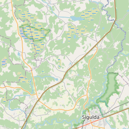
Ehituskaart (katastritunnus: 80680050076002)
Katastri tähis:80680050076002
Aadress: Gaujas iela 5, Inciems, Krimuldas pagasts, Siguldas novads, LV-2145
Kinnisasja katastri määramine | |
|---|---|
Katastriobjekti tüüp | Katastriobjekti tüüp: Ehitus |
Aadress | Aadress: Gaujas iela 5, Inciems, Krimuldas pagasts, Siguldas novads, LV-2145 |
Aadress | |
|---|---|
Aadressi ID | Aadressi ID: 101084457 |
Aadressil registreeritud ettevõtted | |
Aadressil registreeritud struktuuriüksused | Aadressil registreeritud struktuuriüksused: 0 |
Asutused registreeritud aadressil | Asutused registreeritud aadressil: 0 |
Kinnisvara aadressil | |
Tehingud aadressil | Tehingud aadressil: 0 |
| Katastriobjekti tüüp | Katastriobjekti katastritunnus | Isikliku omandiõiguse staatus | Isiklik staatus | Kinnistusraamat |
|---|---|---|---|---|
| Katastriobjekti tüüp: Ehitus | 80680050076002 | Isikliku omandiõiguse staatus: Andmed puuduvad | Isiklik staatus: Andmed puuduvad | Kinnistusraamat |
22.01.2025. Riigi maateenistuse andmed
|
|
|
{"7201070000":{"name":"<div class='color_dot' style='background-color: #00ff00'><\/div><span>Algatatud m\u00f5\u00f5distamisega alad<\/span>","featureColor":"#00ff00","features":{"type":"FeatureCollection","features":[{"type":"Feature","geometry":{"type":"Polygon","coordinates":[[[24.822443778,57.254914804],[24.822576798,57.254687899],[24.822876669,57.254330324],[24.823847263,57.253483711],[24.824207407,57.253485276],[24.82772175,57.253846144],[24.828780158,57.25393461],[24.829514789,57.254405979],[24.829543104,57.254470321],[24.834042827,57.256886563],[24.839410445,57.255674339],[24.84568257,57.254274622],[24.846377703,57.254854096],[24.846961254,57.25553559],[24.847726008,57.25701259],[24.845606856,57.257561529],[24.846067919,57.258134719],[24.84783698,57.257478455],[24.848214206,57.259243805],[24.848252291,57.259284468],[24.848054859,57.259339665],[24.846631739,57.259854735],[24.845979241,57.259841404],[24.845392373,57.259845352],[24.844720308,57.25992668],[24.844131162,57.260234855],[24.844083902,57.260201691],[24.841507418,57.258394028],[24.841538216,57.258349552],[24.841375281,57.258386747],[24.840560847,57.258392196],[24.839794066,57.258397322],[24.839669088,57.25835571],[24.83895412,57.258167913],[24.838099413,57.257931887],[24.838027648,57.25795442],[24.834058382,57.259992374],[24.833926143,57.260064437],[24.833166555,57.25990875],[24.83248061,57.259651515],[24.832005855,57.259308821],[24.831063051,57.257907729],[24.830896859,57.257756422],[24.830642707,57.257656526],[24.823215207,57.256048224],[24.822997799,57.2560202],[24.822875444,57.25544214],[24.822443778,57.254914804]]]},"crs":{"type":"name","properties":{"name":"urn:ogc:def:crs:EPSG:3059"}},"properties":{"style":{"color":"#00ff00","dashArray":"0","weight":1},"name":"Ala, kus alustati m\u00f5\u00f5distamist","object_type":"SurveyingStatus","parcel_code":"80680040006","code":null,"surveyor":"Lauku m\u0113rnieks SIA 21.02.2023.","address":"","ownership":"<span>Omanik - F\u00fc\u00fcsiline isik<br><\/span>","pro_cadastre_nr":"80680050076"}},{"type":"Feature","geometry":{"type":"Polygon","coordinates":[[[24.822443778,57.254914804],[24.822576798,57.254687899],[24.822876669,57.254330324],[24.823847263,57.253483711],[24.824207407,57.253485276],[24.82772175,57.253846144],[24.828780158,57.25393461],[24.829514789,57.254405979],[24.829543104,57.254470321],[24.834042827,57.256886563],[24.839410445,57.255674339],[24.84568257,57.254274622],[24.846377703,57.254854096],[24.846961254,57.25553559],[24.847726008,57.25701259],[24.845606856,57.257561529],[24.846067919,57.258134719],[24.84783698,57.257478455],[24.848214206,57.259243805],[24.848252291,57.259284468],[24.848054859,57.259339665],[24.846631739,57.259854735],[24.845979241,57.259841404],[24.845392373,57.259845352],[24.844720308,57.25992668],[24.844131162,57.260234855],[24.844083902,57.260201691],[24.841507418,57.258394028],[24.841538216,57.258349552],[24.841375281,57.258386747],[24.840560847,57.258392196],[24.839794066,57.258397322],[24.839669088,57.25835571],[24.83895412,57.258167913],[24.838099413,57.257931887],[24.838027648,57.25795442],[24.834058382,57.259992374],[24.833926143,57.260064437],[24.833166555,57.25990875],[24.83248061,57.259651515],[24.832005855,57.259308821],[24.831063051,57.257907729],[24.830896859,57.257756422],[24.830642707,57.257656526],[24.823215207,57.256048224],[24.822997799,57.2560202],[24.822875444,57.25544214],[24.822443778,57.254914804]]]},"crs":{"type":"name","properties":{"name":"urn:ogc:def:crs:EPSG:3059"}},"properties":{"style":{"color":"#00ff00","dashArray":"0","weight":1},"name":"Ala, kus alustati m\u00f5\u00f5distamist","object_type":"SurveyingStatus","parcel_code":"80680040006","code":null,"surveyor":"Lauku m\u0113rnieks SIA;21.02.2023","address":"","ownership":"<span>Omanik - F\u00fc\u00fcsiline isik<br><\/span>","pro_cadastre_nr":"80680050076"}},{"type":"Feature","geometry":{"type":"Polygon","coordinates":[[[24.822443778,57.254914804],[24.822576798,57.254687899],[24.822876669,57.254330324],[24.823847263,57.253483711],[24.824207407,57.253485276],[24.82772175,57.253846144],[24.828780158,57.25393461],[24.829514789,57.254405979],[24.829543104,57.254470321],[24.834042827,57.256886563],[24.839410445,57.255674339],[24.84568257,57.254274622],[24.846377703,57.254854096],[24.846961254,57.25553559],[24.847726008,57.25701259],[24.845606856,57.257561529],[24.846067919,57.258134719],[24.84783698,57.257478455],[24.848214206,57.259243805],[24.848252291,57.259284468],[24.848054859,57.259339665],[24.846631739,57.259854735],[24.845979241,57.259841404],[24.845392373,57.259845352],[24.844720308,57.25992668],[24.844131162,57.260234855],[24.844083902,57.260201691],[24.841507418,57.258394028],[24.841538216,57.258349552],[24.841375281,57.258386747],[24.840560847,57.258392196],[24.839794066,57.258397322],[24.839669088,57.25835571],[24.83895412,57.258167913],[24.838099413,57.257931887],[24.838027648,57.25795442],[24.834058382,57.259992374],[24.833926143,57.260064437],[24.833166555,57.25990875],[24.83248061,57.259651515],[24.832005855,57.259308821],[24.831063051,57.257907729],[24.830896859,57.257756422],[24.830642707,57.257656526],[24.823215207,57.256048224],[24.822997799,57.2560202],[24.822875444,57.25544214],[24.822443778,57.254914804]]]},"crs":{"type":"name","properties":{"name":"urn:ogc:def:crs:EPSG:3059"}},"properties":{"style":{"color":"#00ff00","dashArray":"0","weight":1},"name":"Ala, kus alustati m\u00f5\u00f5distamist","object_type":"SurveyingStatus","parcel_code":"80680040006","code":null,"surveyor":"Lauku m\u0113rnieks SIA;21.02.2023","address":"","ownership":"<span>Omanik - F\u00fc\u00fcsiline isik<br><\/span>","pro_cadastre_nr":"80680050076"}},{"type":"Feature","geometry":{"type":"Polygon","coordinates":[[[24.822443778,57.254914804],[24.822576798,57.254687899],[24.822876669,57.254330324],[24.823847263,57.253483711],[24.824207407,57.253485276],[24.82772175,57.253846144],[24.828780158,57.25393461],[24.829514789,57.254405979],[24.829543104,57.254470321],[24.834042827,57.256886563],[24.839410445,57.255674339],[24.84568257,57.254274622],[24.846377703,57.254854096],[24.846961254,57.25553559],[24.847726008,57.25701259],[24.845606856,57.257561529],[24.846067919,57.258134719],[24.84783698,57.257478455],[24.848214206,57.259243805],[24.848252291,57.259284468],[24.848054859,57.259339665],[24.846631739,57.259854735],[24.845979241,57.259841404],[24.845392373,57.259845352],[24.844720308,57.25992668],[24.844131162,57.260234855],[24.844083902,57.260201691],[24.841507418,57.258394028],[24.841538216,57.258349552],[24.841375281,57.258386747],[24.840560847,57.258392196],[24.839794066,57.258397322],[24.839669088,57.25835571],[24.83895412,57.258167913],[24.838099413,57.257931887],[24.838027648,57.25795442],[24.834058382,57.259992374],[24.833926143,57.260064437],[24.833166555,57.25990875],[24.83248061,57.259651515],[24.832005855,57.259308821],[24.831063051,57.257907729],[24.830896859,57.257756422],[24.830642707,57.257656526],[24.823215207,57.256048224],[24.822997799,57.2560202],[24.822875444,57.25544214],[24.822443778,57.254914804]]]},"crs":{"type":"name","properties":{"name":"urn:ogc:def:crs:EPSG:3059"}},"properties":{"style":{"color":"#00ff00","dashArray":"0","weight":1},"name":"Ala, kus alustati m\u00f5\u00f5distamist","object_type":"SurveyingStatus","parcel_code":"80680040006","code":null,"surveyor":"Lauku m\u0113rnieks SIA 21.02.2023.","address":"","ownership":"<span>Omanik - F\u00fc\u00fcsiline isik<br><\/span>","pro_cadastre_nr":"80680050076"}},{"type":"Feature","geometry":{"type":"Polygon","coordinates":[[[24.822443778,57.254914804],[24.822576798,57.254687899],[24.822876669,57.254330324],[24.823847263,57.253483711],[24.824207407,57.253485276],[24.82772175,57.253846144],[24.828780158,57.25393461],[24.829514789,57.254405979],[24.829543104,57.254470321],[24.834042827,57.256886563],[24.839410445,57.255674339],[24.84568257,57.254274622],[24.846377703,57.254854096],[24.846961254,57.25553559],[24.847726008,57.25701259],[24.845606856,57.257561529],[24.846067919,57.258134719],[24.84783698,57.257478455],[24.848214206,57.259243805],[24.848252291,57.259284468],[24.848054859,57.259339665],[24.846631739,57.259854735],[24.845979241,57.259841404],[24.845392373,57.259845352],[24.844720308,57.25992668],[24.844131162,57.260234855],[24.844083902,57.260201691],[24.841507418,57.258394028],[24.841538216,57.258349552],[24.841375281,57.258386747],[24.840560847,57.258392196],[24.839794066,57.258397322],[24.839669088,57.25835571],[24.83895412,57.258167913],[24.838099413,57.257931887],[24.838027648,57.25795442],[24.834058382,57.259992374],[24.833926143,57.260064437],[24.833166555,57.25990875],[24.83248061,57.259651515],[24.832005855,57.259308821],[24.831063051,57.257907729],[24.830896859,57.257756422],[24.830642707,57.257656526],[24.823215207,57.256048224],[24.822997799,57.2560202],[24.822875444,57.25544214],[24.822443778,57.254914804]]]},"crs":{"type":"name","properties":{"name":"urn:ogc:def:crs:EPSG:3059"}},"properties":{"style":{"color":"#00ff00","dashArray":"0","weight":1},"name":"Ala, kus alustati m\u00f5\u00f5distamist","object_type":"SurveyingStatus","parcel_code":"80680040006","code":null,"surveyor":"Lauku m\u0113rnieks SIA;21.02.2023","address":"","ownership":"<span>Omanik - F\u00fc\u00fcsiline isik<br><\/span>","pro_cadastre_nr":"80680050076"}},{"type":"Feature","geometry":{"type":"Polygon","coordinates":[[[24.822443778,57.254914804],[24.822576798,57.254687899],[24.822876669,57.254330324],[24.823847263,57.253483711],[24.824207407,57.253485276],[24.82772175,57.253846144],[24.828780158,57.25393461],[24.829514789,57.254405979],[24.829543104,57.254470321],[24.834042827,57.256886563],[24.839410445,57.255674339],[24.84568257,57.254274622],[24.846377703,57.254854096],[24.846961254,57.25553559],[24.847726008,57.25701259],[24.845606856,57.257561529],[24.846067919,57.258134719],[24.84783698,57.257478455],[24.848214206,57.259243805],[24.848252291,57.259284468],[24.848054859,57.259339665],[24.846631739,57.259854735],[24.845979241,57.259841404],[24.845392373,57.259845352],[24.844720308,57.25992668],[24.844131162,57.260234855],[24.844083902,57.260201691],[24.841507418,57.258394028],[24.841538216,57.258349552],[24.841375281,57.258386747],[24.840560847,57.258392196],[24.839794066,57.258397322],[24.839669088,57.25835571],[24.83895412,57.258167913],[24.838099413,57.257931887],[24.838027648,57.25795442],[24.834058382,57.259992374],[24.833926143,57.260064437],[24.833166555,57.25990875],[24.83248061,57.259651515],[24.832005855,57.259308821],[24.831063051,57.257907729],[24.830896859,57.257756422],[24.830642707,57.257656526],[24.823215207,57.256048224],[24.822997799,57.2560202],[24.822875444,57.25544214],[24.822443778,57.254914804]]]},"crs":{"type":"name","properties":{"name":"urn:ogc:def:crs:EPSG:3059"}},"properties":{"style":{"color":"#00ff00","dashArray":"0","weight":1},"name":"Ala, kus alustati m\u00f5\u00f5distamist","object_type":"SurveyingStatus","parcel_code":"80680040006","code":null,"surveyor":"Lauku m\u0113rnieks SIA 21.02.2023.","address":"","ownership":"<span>Omanik - F\u00fc\u00fcsiline isik<br><\/span>","pro_cadastre_nr":"80680050076"}},{"type":"Feature","geometry":{"type":"Polygon","coordinates":[[[24.822443778,57.254914804],[24.822576798,57.254687899],[24.822876669,57.254330324],[24.823847263,57.253483711],[24.824207407,57.253485276],[24.82772175,57.253846144],[24.828780158,57.25393461],[24.829514789,57.254405979],[24.829543104,57.254470321],[24.834042827,57.256886563],[24.839410445,57.255674339],[24.84568257,57.254274622],[24.846377703,57.254854096],[24.846961254,57.25553559],[24.847726008,57.25701259],[24.845606856,57.257561529],[24.846067919,57.258134719],[24.84783698,57.257478455],[24.848214206,57.259243805],[24.848252291,57.259284468],[24.848054859,57.259339665],[24.846631739,57.259854735],[24.845979241,57.259841404],[24.845392373,57.259845352],[24.844720308,57.25992668],[24.844131162,57.260234855],[24.844083902,57.260201691],[24.841507418,57.258394028],[24.841538216,57.258349552],[24.841375281,57.258386747],[24.840560847,57.258392196],[24.839794066,57.258397322],[24.839669088,57.25835571],[24.83895412,57.258167913],[24.838099413,57.257931887],[24.838027648,57.25795442],[24.834058382,57.259992374],[24.833926143,57.260064437],[24.833166555,57.25990875],[24.83248061,57.259651515],[24.832005855,57.259308821],[24.831063051,57.257907729],[24.830896859,57.257756422],[24.830642707,57.257656526],[24.823215207,57.256048224],[24.822997799,57.2560202],[24.822875444,57.25544214],[24.822443778,57.254914804]]]},"crs":{"type":"name","properties":{"name":"urn:ogc:def:crs:EPSG:3059"}},"properties":{"style":{"color":"#00ff00","dashArray":"0","weight":1},"name":"Ala, kus alustati m\u00f5\u00f5distamist","object_type":"SurveyingStatus","parcel_code":"80680040006","code":null,"surveyor":"Lauku m\u0113rnieks SIA 21.02.2023.","address":"","ownership":"<span>Omanik - F\u00fc\u00fcsiline isik<br><\/span>","pro_cadastre_nr":"80680050076"}}]}},"7201060210":{"name":"<div class='color_dot' style='background-color: #00ffff'><\/div><span>M\u00e4\u00e4ratud maa\u00fcksus<\/span>","featureColor":"#00ffff","features":{"type":"FeatureCollection","features":[{"type":"Feature","geometry":{"type":"Polygon","coordinates":[[[24.878661309,57.254766039],[24.878867796,57.254499482],[24.878675914,57.254445071],[24.87900551,57.254130004],[24.879023323,57.25411096],[24.879050799,57.254082874],[24.879769549,57.254181955],[24.879199189,57.254897489],[24.879193023,57.254905869],[24.878661309,57.254766039]]]},"crs":{"type":"name","properties":{"name":"urn:ogc:def:crs:EPSG:3059"}},"properties":{"style":{"color":"#00ffff","dashArray":"8,12","weight":1},"name":"Maa","object_type":"Parcel","parcel_code":"80680050076","code":null,"surveyor":null,"address":"Gaujas iela 5, Inciems, Krimuldas pag., Siguldas nov., LV-2145","ownership":"<span>Omanik - F\u00fc\u00fcsiline isik<br><\/span>","pro_cadastre_nr":"80680050076"}},{"type":"Feature","geometry":{"type":"Polygon","coordinates":[[[24.822443778,57.254914804],[24.822576798,57.254687899],[24.822876669,57.254330324],[24.823847263,57.253483711],[24.824207407,57.253485276],[24.82772175,57.253846144],[24.828780158,57.25393461],[24.829514789,57.254405979],[24.829543104,57.254470321],[24.834042827,57.256886563],[24.839410445,57.255674339],[24.84568257,57.254274622],[24.846377703,57.254854096],[24.846961254,57.25553559],[24.847726008,57.25701259],[24.845606856,57.257561529],[24.846067919,57.258134719],[24.84783698,57.257478455],[24.848214206,57.259243805],[24.848252291,57.259284468],[24.848054859,57.259339665],[24.846631739,57.259854735],[24.845979241,57.259841404],[24.845392373,57.259845352],[24.844720308,57.25992668],[24.844131162,57.260234855],[24.844083902,57.260201691],[24.841507418,57.258394028],[24.841538216,57.258349552],[24.841375281,57.258386747],[24.840560847,57.258392196],[24.839794066,57.258397322],[24.839669088,57.25835571],[24.83895412,57.258167913],[24.838099413,57.257931887],[24.838027648,57.25795442],[24.834058382,57.259992374],[24.833926143,57.260064437],[24.833166555,57.25990875],[24.83248061,57.259651515],[24.832005855,57.259308821],[24.831063051,57.257907729],[24.830896859,57.257756422],[24.830642707,57.257656526],[24.823215207,57.256048224],[24.822997799,57.2560202],[24.822875444,57.25544214],[24.822443778,57.254914804]]]},"crs":{"type":"name","properties":{"name":"urn:ogc:def:crs:EPSG:3059"}},"properties":{"style":{"color":"#00ffff","dashArray":"8,12","weight":1},"name":"Maa","object_type":"Parcel","parcel_code":"80680040006","code":null,"surveyor":null,"address":"","ownership":"<span>Omanik - F\u00fc\u00fcsiline isik<br><\/span>","pro_cadastre_nr":"80680050076"}}]}},"7114100000":{"name":"<div class='color_dot' style='background-color: #b40000'><\/div><span>Koormatud tee servituudi ala<\/span>","featureColor":"#b40000","features":{"type":"FeatureCollection","features":[{"type":"Feature","geometry":{"type":"Polygon","coordinates":[[[24.879012312,57.254130945],[24.879026971,57.254112435],[24.87971804,57.254243449],[24.879695048,57.254273318],[24.879689953,57.254272348],[24.879012312,57.254130945]]]},"crs":{"type":"name","properties":{"name":"urn:ogc:def:crs:EPSG:3059"}},"properties":{"style":{"color":"#b40000","dashArray":"4,2,1,2","weight":1},"name":"Koormatud tee servituudi ala","object_type":"WayRestriction","parcel_code":"80680050076","code":"7315030100004","surveyor":null,"address":"Gaujas iela 5, Inciems, Krimuldas pag., Siguldas nov., LV-2145","ownership":"<span>Omanik - F\u00fc\u00fcsiline isik<br><\/span>","pro_cadastre_nr":"80680050076"}},{"type":"Feature","geometry":{"type":"Polygon","coordinates":[[[24.848213351,57.259239795],[24.848149098,57.259249975],[24.847931534,57.259311408],[24.847614121,57.259416797],[24.847253864,57.259527774],[24.846881354,57.259658946],[24.846631873,57.259776002],[24.846483277,57.259788646],[24.846126284,57.259810912],[24.845688359,57.259797033],[24.845610757,57.259800618],[24.845275223,57.259823915],[24.845011818,57.259842835],[24.844760352,57.259901706],[24.844489533,57.259964667],[24.844279774,57.260014031],[24.844168463,57.260100777],[24.844071687,57.260193122],[24.844005776,57.260146877],[24.84408422,57.26007203],[24.844214244,57.259970694],[24.844450122,57.259915181],[24.844721024,57.259852201],[24.844985055,57.25979039],[24.845262361,57.259770468],[24.845600212,57.259747013],[24.845687038,57.259743006],[24.846123486,57.259756832],[24.846469867,57.25973523],[24.8465883,57.259725152],[24.846821429,57.259615771],[24.847202145,57.259481704],[24.847563554,57.259370379],[24.847882514,57.259264477],[24.848111804,57.25919974],[24.848201742,57.259185478],[24.848213351,57.259239795]]]},"crs":{"type":"name","properties":{"name":"urn:ogc:def:crs:EPSG:3059"}},"properties":{"style":{"color":"#b40000","dashArray":"4,2,1,2","weight":1},"name":"Koormatud tee servituudi ala","object_type":"WayRestriction","parcel_code":"80680040006","code":"7315030100007","surveyor":null,"address":"","ownership":"<span>Omanik - F\u00fc\u00fcsiline isik<br><\/span>","pro_cadastre_nr":"80680050076"}},{"type":"Feature","geometry":{"type":"Polygon","coordinates":[[[24.844083902,57.260201691],[24.844043611,57.260173143],[24.844678966,57.259898587],[24.844705862,57.259891615],[24.845377926,57.259810288],[24.84539155,57.259809424],[24.845978417,57.259805475],[24.846610769,57.259817927],[24.848018033,57.259309783],[24.848214206,57.259243805],[24.848252291,57.259284468],[24.848054859,57.259339665],[24.846631739,57.259854735],[24.845979241,57.259841404],[24.845392373,57.259845352],[24.844720308,57.25992668],[24.844083902,57.260201691]]]},"crs":{"type":"name","properties":{"name":"urn:ogc:def:crs:EPSG:3059"}},"properties":{"style":{"color":"#b40000","dashArray":"4,2,1,2","weight":1},"name":"Koormatud tee servituudi ala","object_type":"WayRestriction","parcel_code":"80680040006","code":"7315030100006","surveyor":null,"address":"","ownership":"<span>Omanik - F\u00fc\u00fcsiline isik<br><\/span>","pro_cadastre_nr":"80680050076"}}]}},"5201011310":{"name":"<div class='color_dot' style='background-color: #960096'><\/div><span>Vektoriseeritud hoone<\/span>","featureColor":"#960096","features":{"type":"FeatureCollection","features":[{"type":"Feature","geometry":{"type":"Polygon","coordinates":[[[24.879003644,57.254412963],[24.879174938,57.254461067],[24.879126355,57.254511876],[24.879028635,57.254484432],[24.879040619,57.254471906],[24.878967029,57.254451247],[24.879003644,57.254412963]]]},"crs":{"type":"name","properties":{"name":"urn:ogc:def:crs:EPSG:3059"}},"properties":{"style":{"color":"#960096","dashArray":"0","weight":2},"name":"Hoone","object_type":"Building","parcel_code":"80680050076","code":"80680050076002","surveyor":null,"address":"Gaujas iela 5, Inciems, Krimuldas pag., Siguldas nov., LV-2145","ownership":"<span>Omanik - F\u00fc\u00fcsiline isik<br><\/span>","pro_cadastre_nr":"80680050076"}},{"type":"Feature","geometry":{"type":"Polygon","coordinates":[[[24.879074297,57.254693098],[24.879063346,57.254705194],[24.879189857,57.254738797],[24.879143166,57.25479042],[24.87906056,57.254768476],[24.879045976,57.254784605],[24.879002071,57.254772945],[24.878991121,57.254785042],[24.878806293,57.254735937],[24.878889452,57.254643984],[24.879074297,57.254693098]]]},"crs":{"type":"name","properties":{"name":"urn:ogc:def:crs:EPSG:3059"}},"properties":{"style":{"color":"#960096","dashArray":"0","weight":2},"name":"Hoone","object_type":"Building","parcel_code":"80680050076","code":"80680050076001","surveyor":null,"address":"Gaujas iela 5, Inciems, Krimuldas pag., Siguldas nov., LV-2145","ownership":"<span>Omanik - F\u00fc\u00fcsiline isik<br><\/span>","pro_cadastre_nr":"80680050076"}},{"type":"Feature","geometry":{"type":"Polygon","coordinates":[[[24.87890008,57.254432445],[24.878936679,57.254394162],[24.879003644,57.254412963],[24.878967029,57.254451247],[24.87890008,57.254432445]]]},"crs":{"type":"name","properties":{"name":"urn:ogc:def:crs:EPSG:3059"}},"properties":{"style":{"color":"#960096","dashArray":"0","weight":2},"name":"Hoone","object_type":"Building","parcel_code":"80680050076","code":"80680050076003","surveyor":null,"address":"Gaujas iela 5, Inciems, Krimuldas pag., Siguldas nov., LV-2145","ownership":"<span>Omanik - F\u00fc\u00fcsiline isik<br><\/span>","pro_cadastre_nr":"80680050076"}},{"type":"Feature","geometry":{"type":"Polygon","coordinates":[[[24.87890008,57.254432445],[24.878936679,57.254394162],[24.879003644,57.254412963],[24.878967029,57.254451247],[24.87890008,57.254432445]]]},"crs":{"type":"name","properties":{"name":"urn:ogc:def:crs:EPSG:3059"}},"properties":{"style":{"color":"#960096","dashArray":"0","weight":2},"name":"Hoone","object_type":"Building","parcel_code":"80680050076","code":"80680050076003","surveyor":null,"address":"Gaujas iela 5, Inciems, Krimuldas pag., Siguldas nov., LV-2145","ownership":"<span>Omanik - F\u00fc\u00fcsiline isik<br><\/span>","pro_cadastre_nr":"80680050076"}},{"type":"Feature","geometry":{"type":"Polygon","coordinates":[[[24.879003644,57.254412963],[24.879174938,57.254461067],[24.879126355,57.254511876],[24.879028635,57.254484432],[24.879040619,57.254471906],[24.878967029,57.254451247],[24.879003644,57.254412963]]]},"crs":{"type":"name","properties":{"name":"urn:ogc:def:crs:EPSG:3059"}},"properties":{"style":{"color":"#960096","dashArray":"0","weight":2},"name":"Hoone","object_type":"Building","parcel_code":"80680050076","code":"80680050076002","surveyor":null,"address":"Gaujas iela 5, Inciems, Krimuldas pag., Siguldas nov., LV-2145","ownership":"<span>Omanik - F\u00fc\u00fcsiline isik<br><\/span>","pro_cadastre_nr":"80680050076"}},{"type":"Feature","geometry":{"type":"Polygon","coordinates":[[[24.879074297,57.254693098],[24.879063346,57.254705194],[24.879189857,57.254738797],[24.879143166,57.25479042],[24.87906056,57.254768476],[24.879045976,57.254784605],[24.879002071,57.254772945],[24.878991121,57.254785042],[24.878806293,57.254735937],[24.878889452,57.254643984],[24.879074297,57.254693098]]]},"crs":{"type":"name","properties":{"name":"urn:ogc:def:crs:EPSG:3059"}},"properties":{"style":{"color":"#960096","dashArray":"0","weight":2},"name":"Hoone","object_type":"Building","parcel_code":"80680050076","code":"80680050076001","surveyor":null,"address":"Gaujas iela 5, Inciems, Krimuldas pag., Siguldas nov., LV-2145","ownership":"<span>Omanik - F\u00fc\u00fcsiline isik<br><\/span>","pro_cadastre_nr":"80680050076"}}]}}}
[]
https://tile.openstreetmap.org/{z}/{x}/{y}.png|© OpenStreetMap contributors|minZoom: 7|maxZoom: 19
|
Ehitusandmeid värskendati: 24.01.2025.
Andmeallikas ja litsents: katastri infosüsteem avatud teksti- ja ruumiandmed, kinnisvaraturu andmebaasi avaandmed, avaandmete litsents Creative Commons Attribution, OpenStreetMapi andmed.

