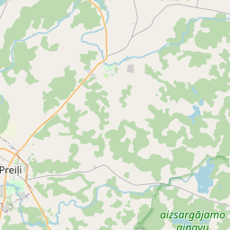
Ehituskaart (katastritunnus: 76760020201004)
Katastri tähis:76760020201004
Aadress: "Zalta Kolns", Rozalina, Silajāņu pagasts, Preiļu novads, LV-5330
Kinnisasja katastri määramine | |
|---|---|
Katastriobjekti tüüp | Katastriobjekti tüüp: Ehitus |
Aadress | Aadress: "Zalta Kolns", Rozalina, Silajāņu pagasts, Preiļu novads, LV-5330 |
Aadress | |
|---|---|
Aadressi ID | Aadressi ID: 103876072 |
Aadressil registreeritud ettevõtted | Aadressil registreeritud ettevõtted: 0 |
Aadressil registreeritud struktuuriüksused | Aadressil registreeritud struktuuriüksused: 0 |
Asutused registreeritud aadressil | Asutused registreeritud aadressil: 0 |
Kinnisvara aadressil | |
Tehingud aadressil | Tehingud aadressil: 0 |
| Katastriobjekti tüüp | Katastriobjekti katastritunnus | Isikliku omandiõiguse staatus | Isiklik staatus | Kinnistusraamat |
|---|---|---|---|---|
| Katastriobjekti tüüp: Ehitus | 76760020201004 | Isikliku omandiõiguse staatus: Andmed puuduvad | Isiklik staatus: Andmed puuduvad | Kinnistusraamat |
22.01.2025. Riigi maateenistuse andmed
|
|
|
{"7201060210":{"name":"<div class='color_dot' style='background-color: #00ffff'><\/div><span>M\u00e4\u00e4ratud maa\u00fcksus<\/span>","featureColor":"#00ffff","features":{"type":"FeatureCollection","features":[{"type":"Feature","geometry":{"type":"Polygon","coordinates":[[[26.880755994,56.368683554],[26.881142971,56.368131622],[26.881167071,56.368146208],[26.881482512,56.368093316],[26.881879662,56.368059745],[26.882196676,56.36805237],[26.882242061,56.368053912],[26.882456851,56.36891433],[26.880803727,56.36869003],[26.880755994,56.368683554]]]},"crs":{"type":"name","properties":{"name":"urn:ogc:def:crs:EPSG:3059"}},"properties":{"style":{"color":"#00ffff","dashArray":"8,12","weight":1},"name":"Maa","object_type":"Parcel","parcel_code":"76760020204","code":null,"surveyor":null,"address":"","ownership":"<span>Omanik - F\u00fc\u00fcsiline isik<br><\/span>","pro_cadastre_nr":"76760020201"}},{"type":"Feature","geometry":{"type":"Polygon","coordinates":[[[26.872206001,56.369885831],[26.872211935,56.369791023],[26.872272649,56.369455476],[26.872412606,56.369106083],[26.874069259,56.36883238],[26.874482509,56.368528392],[26.874972302,56.368724928],[26.87531306,56.368842566],[26.875348815,56.368917062],[26.875364129,56.368969192],[26.875364358,56.369004477],[26.875270856,56.369097541],[26.875173613,56.369174935],[26.875118828,56.369227272],[26.875105015,56.369275242],[26.875043377,56.369418695],[26.874991566,56.369473318],[26.874906132,56.369541071],[26.874777904,56.369655454],[26.87467493,56.369749888],[26.874618748,56.369816379],[26.874535967,56.369894219],[26.874464916,56.36993104],[26.874281566,56.370020445],[26.874064691,56.370140443],[26.873769793,56.370279122],[26.873659345,56.37032127],[26.873588404,56.370344075],[26.873516328,56.370360642],[26.873349952,56.370364725],[26.872860692,56.370336988],[26.87224606,56.370303113],[26.872255244,56.37027837],[26.872275637,56.370185214],[26.872274732,56.37006324],[26.872246365,56.369984832],[26.872206001,56.369885831]]]},"crs":{"type":"name","properties":{"name":"urn:ogc:def:crs:EPSG:3059"}},"properties":{"style":{"color":"#00ffff","dashArray":"8,12","weight":1},"name":"Maa","object_type":"Parcel","parcel_code":"76760020203","code":null,"surveyor":null,"address":"","ownership":"<span>Omanik - F\u00fc\u00fcsiline isik<br><\/span>","pro_cadastre_nr":"76760020201"}},{"type":"Feature","geometry":{"type":"Polygon","coordinates":[[[26.876652899,56.371459962],[26.876679962,56.371429194],[26.877901026,56.370040509],[26.878185569,56.369716882],[26.879733082,56.370178064],[26.87880167,56.370960872],[26.878714744,56.37103393],[26.878474196,56.371059654],[26.878401154,56.371074151],[26.87818677,56.371116705],[26.877872631,56.371184443],[26.877154535,56.371353868],[26.876652899,56.371459962]]]},"crs":{"type":"name","properties":{"name":"urn:ogc:def:crs:EPSG:3059"}},"properties":{"style":{"color":"#00ffff","dashArray":"8,12","weight":1},"name":"Maa","object_type":"Parcel","parcel_code":"76760020202","code":null,"surveyor":null,"address":"","ownership":"<span>Omanik - F\u00fc\u00fcsiline isik<br><\/span>","pro_cadastre_nr":"76760020201"}},{"type":"Feature","geometry":{"type":"Polygon","coordinates":[[[26.87516654,56.368153093],[26.875274508,56.368184116],[26.877520232,56.368829297],[26.879946553,56.369526286],[26.880001385,56.369542036],[26.879860318,56.36968697],[26.879639743,56.369952125],[26.879582476,56.369935874],[26.8793713,56.369875964],[26.878919765,56.36974199],[26.8784685,56.369604673],[26.878172744,56.369521728],[26.877647295,56.369375696],[26.87723815,56.369260308],[26.876787226,56.36912864],[26.876426006,56.369017684],[26.87592028,56.368862179],[26.875527892,56.368729355],[26.875316569,56.368649046],[26.87516654,56.368153093]]]},"crs":{"type":"name","properties":{"name":"urn:ogc:def:crs:EPSG:3059"}},"properties":{"style":{"color":"#00ffff","dashArray":"8,12","weight":1},"name":"Maa","object_type":"Parcel","parcel_code":"76760020201","code":null,"surveyor":null,"address":"\"Zalta Kolns\", Rozalina, Silaj\u0101\u0146u pag., Prei\u013cu nov., LV-5330","ownership":"<span>Omanik - F\u00fc\u00fcsiline isik<br><\/span>","pro_cadastre_nr":"76760020201"}},{"type":"Feature","geometry":{"type":"Polygon","coordinates":[[[26.849119614,56.349223218],[26.84999965,56.348228053],[26.850233779,56.347910451],[26.851006291,56.347193024],[26.851791184,56.348531191],[26.849889988,56.349368037],[26.849119614,56.349223218]]]},"crs":{"type":"name","properties":{"name":"urn:ogc:def:crs:EPSG:3059"}},"properties":{"style":{"color":"#00ffff","dashArray":"8,12","weight":1},"name":"Maa","object_type":"Parcel","parcel_code":"76760010187","code":null,"surveyor":null,"address":"","ownership":"<span>Omanik - F\u00fc\u00fcsiline isik<br><\/span>","pro_cadastre_nr":"76760020201"}},{"type":"Feature","geometry":{"type":"Polygon","coordinates":[[[26.850567851,56.352670481],[26.851455882,56.352145413],[26.852721363,56.352271679],[26.855544142,56.353755886],[26.855106397,56.354321103],[26.855043491,56.354402634],[26.854106738,56.354190875],[26.851995943,56.353766554],[26.851931216,56.353701519],[26.851417068,56.35327085],[26.850567851,56.352670481]]]},"crs":{"type":"name","properties":{"name":"urn:ogc:def:crs:EPSG:3059"}},"properties":{"style":{"color":"#00ffff","dashArray":"8,12","weight":1},"name":"Maa","object_type":"Parcel","parcel_code":"76760010186","code":null,"surveyor":null,"address":"","ownership":"<span>Omanik - F\u00fc\u00fcsiline isik<br><\/span>","pro_cadastre_nr":"76760020201"}},{"type":"Feature","geometry":{"type":"Polygon","coordinates":[[[26.86599786,56.368187376],[26.866066714,56.368134826],[26.866487812,56.367813398],[26.866671645,56.367653774],[26.866897006,56.367458851],[26.867145269,56.367271955],[26.86948003,56.368129871],[26.86806712,56.369127074],[26.867570233,56.368901444],[26.86599786,56.368187376]]]},"crs":{"type":"name","properties":{"name":"urn:ogc:def:crs:EPSG:3059"}},"properties":{"style":{"color":"#00ffff","dashArray":"8,12","weight":1},"name":"Maa","object_type":"Parcel","parcel_code":"76760010185","code":null,"surveyor":null,"address":"","ownership":"<span>Omanik - F\u00fc\u00fcsiline isik<br><\/span>","pro_cadastre_nr":"76760020201"}}]}},"5201011310":{"name":"<div class='color_dot' style='background-color: #960096'><\/div><span>Vektoriseeritud hoone<\/span>","featureColor":"#960096","features":{"type":"FeatureCollection","features":[{"type":"Feature","geometry":{"type":"Polygon","coordinates":[[[26.8793528,56.369684456],[26.879272632,56.369660063],[26.879316585,56.369615572],[26.879396753,56.369639965],[26.8793528,56.369684456]]]},"crs":{"type":"name","properties":{"name":"urn:ogc:def:crs:EPSG:3059"}},"properties":{"style":{"color":"#960096","dashArray":"0","weight":2},"name":"Hoone","object_type":"Building","parcel_code":"76760020201","code":"76760020201003","surveyor":null,"address":"\"Zalta Kolns\", Rozalina, Silaj\u0101\u0146u pag., Prei\u013cu nov., LV-5330","ownership":"<span>Omanik - F\u00fc\u00fcsiline isik<br><\/span>","pro_cadastre_nr":"76760020201"}},{"type":"Feature","geometry":{"type":"Polygon","coordinates":[[[26.879379925,56.369466108],[26.879404509,56.369442256],[26.879446924,56.369455724],[26.879422339,56.369479576],[26.879379925,56.369466108]]]},"crs":{"type":"name","properties":{"name":"urn:ogc:def:crs:EPSG:3059"}},"properties":{"style":{"color":"#960096","dashArray":"0","weight":2},"name":"Hoone","object_type":"Building","parcel_code":"76760020201","code":"76760020201006","surveyor":null,"address":"\"Zalta Kolns\", Rozalina, Silaj\u0101\u0146u pag., Prei\u013cu nov., LV-5330","ownership":"<span>Omanik - F\u00fc\u00fcsiline isik<br><\/span>","pro_cadastre_nr":"76760020201"}},{"type":"Feature","geometry":{"type":"Polygon","coordinates":[[[26.879313418,56.369724706],[26.879232537,56.369700096],[26.879272201,56.369659938],[26.879353097,56.369684539],[26.879313418,56.369724706]]]},"crs":{"type":"name","properties":{"name":"urn:ogc:def:crs:EPSG:3059"}},"properties":{"style":{"color":"#960096","dashArray":"0","weight":2},"name":"Hoone","object_type":"Building","parcel_code":"76760020201","code":"76760020201004","surveyor":null,"address":"\"Zalta Kolns\", Rozalina, Silaj\u0101\u0146u pag., Prei\u013cu nov., LV-5330","ownership":"<span>Omanik - F\u00fc\u00fcsiline isik<br><\/span>","pro_cadastre_nr":"76760020201"}},{"type":"Feature","geometry":{"type":"Polygon","coordinates":[[[26.879396753,56.369639965],[26.879316585,56.369615572],[26.879322257,56.369609822],[26.879330037,56.369601947],[26.879335484,56.369596436],[26.879415668,56.369620828],[26.879396753,56.369639965]]]},"crs":{"type":"name","properties":{"name":"urn:ogc:def:crs:EPSG:3059"}},"properties":{"style":{"color":"#960096","dashArray":"0","weight":2},"name":"Hoone","object_type":"Building","parcel_code":"76760020201","code":"76760020201002","surveyor":null,"address":"\"Zalta Kolns\", Rozalina, Silaj\u0101\u0146u pag., Prei\u013cu nov., LV-5330","ownership":null,"pro_cadastre_nr":null}},{"type":"Feature","geometry":{"type":"Polygon","coordinates":[[[26.879330037,56.369601947],[26.879322257,56.369609822],[26.879306658,56.36960507],[26.879314437,56.369597195],[26.879330037,56.369601947]]]},"crs":{"type":"name","properties":{"name":"urn:ogc:def:crs:EPSG:3059"}},"properties":{"style":{"color":"#960096","dashArray":"0","weight":2},"name":"Hoone","object_type":"Building","parcel_code":"76760020201","code":"76760020201007","surveyor":null,"address":"\"Zalta Kolns\", Rozalina, Silaj\u0101\u0146u pag., Prei\u013cu nov., LV-5330","ownership":null,"pro_cadastre_nr":null}},{"type":"Feature","geometry":{"type":"Polygon","coordinates":[[[26.879531516,56.369772905],[26.879446736,56.369853096],[26.879349033,56.369821281],[26.879436655,56.369738399],[26.879457594,56.369745221],[26.879469885,56.3697336],[26.879493613,56.369741327],[26.879481322,56.369752939],[26.879534358,56.369770214],[26.879531516,56.369772905]]]},"crs":{"type":"name","properties":{"name":"urn:ogc:def:crs:EPSG:3059"}},"properties":{"style":{"color":"#960096","dashArray":"0","weight":2},"name":"Hoone","object_type":"Building","parcel_code":"76760020201","code":"76760020201001","surveyor":null,"address":"\"Zalta Kolns\", Rozalina, Silaj\u0101\u0146u pag., Prei\u013cu nov., LV-5330","ownership":"<span>Omanik - F\u00fc\u00fcsiline isik<br><\/span>","pro_cadastre_nr":"76760020201"}},{"type":"Feature","geometry":{"type":"Polygon","coordinates":[[[26.879422173,56.369479733],[26.879446924,56.369455724],[26.879483165,56.369467232],[26.879458415,56.369491241],[26.879422173,56.369479733]]]},"crs":{"type":"name","properties":{"name":"urn:ogc:def:crs:EPSG:3059"}},"properties":{"style":{"color":"#960096","dashArray":"0","weight":2},"name":"Hoone","object_type":"Building","parcel_code":"76760020201","code":"76760020201005","surveyor":null,"address":"\"Zalta Kolns\", Rozalina, Silaj\u0101\u0146u pag., Prei\u013cu nov., LV-5330","ownership":null,"pro_cadastre_nr":null}},{"type":"Feature","geometry":{"type":"Polygon","coordinates":[[[26.879379925,56.369466108],[26.879404509,56.369442256],[26.879446924,56.369455724],[26.879422339,56.369479576],[26.879379925,56.369466108]]]},"crs":{"type":"name","properties":{"name":"urn:ogc:def:crs:EPSG:3059"}},"properties":{"style":{"color":"#960096","dashArray":"0","weight":2},"name":"Hoone","object_type":"Building","parcel_code":"76760020201","code":"76760020201006","surveyor":null,"address":"\"Zalta Kolns\", Rozalina, Silaj\u0101\u0146u pag., Prei\u013cu nov., LV-5330","ownership":"<span>Omanik - F\u00fc\u00fcsiline isik<br><\/span>","pro_cadastre_nr":"76760020201"}},{"type":"Feature","geometry":{"type":"Polygon","coordinates":[[[26.879313418,56.369724706],[26.879232537,56.369700096],[26.879272201,56.369659938],[26.879353097,56.369684539],[26.879313418,56.369724706]]]},"crs":{"type":"name","properties":{"name":"urn:ogc:def:crs:EPSG:3059"}},"properties":{"style":{"color":"#960096","dashArray":"0","weight":2},"name":"Hoone","object_type":"Building","parcel_code":"76760020201","code":"76760020201004","surveyor":null,"address":"\"Zalta Kolns\", Rozalina, Silaj\u0101\u0146u pag., Prei\u013cu nov., LV-5330","ownership":"<span>Omanik - F\u00fc\u00fcsiline isik<br><\/span>","pro_cadastre_nr":"76760020201"}},{"type":"Feature","geometry":{"type":"Polygon","coordinates":[[[26.8793528,56.369684456],[26.879272632,56.369660063],[26.879316585,56.369615572],[26.879396753,56.369639965],[26.8793528,56.369684456]]]},"crs":{"type":"name","properties":{"name":"urn:ogc:def:crs:EPSG:3059"}},"properties":{"style":{"color":"#960096","dashArray":"0","weight":2},"name":"Hoone","object_type":"Building","parcel_code":"76760020201","code":"76760020201003","surveyor":null,"address":"\"Zalta Kolns\", Rozalina, Silaj\u0101\u0146u pag., Prei\u013cu nov., LV-5330","ownership":"<span>Omanik - F\u00fc\u00fcsiline isik<br><\/span>","pro_cadastre_nr":"76760020201"}},{"type":"Feature","geometry":{"type":"Polygon","coordinates":[[[26.879531516,56.369772905],[26.879446736,56.369853096],[26.879349033,56.369821281],[26.879436655,56.369738399],[26.879457594,56.369745221],[26.879469885,56.3697336],[26.879493613,56.369741327],[26.879481322,56.369752939],[26.879534358,56.369770214],[26.879531516,56.369772905]]]},"crs":{"type":"name","properties":{"name":"urn:ogc:def:crs:EPSG:3059"}},"properties":{"style":{"color":"#960096","dashArray":"0","weight":2},"name":"Hoone","object_type":"Building","parcel_code":"76760020201","code":"76760020201001","surveyor":null,"address":"\"Zalta Kolns\", Rozalina, Silaj\u0101\u0146u pag., Prei\u013cu nov., LV-5330","ownership":"<span>Omanik - F\u00fc\u00fcsiline isik<br><\/span>","pro_cadastre_nr":"76760020201"}}]}}}
[]
https://tile.openstreetmap.org/{z}/{x}/{y}.png|© OpenStreetMap contributors|minZoom: 7|maxZoom: 19
|
Ehitusandmeid värskendati: 24.01.2025.
Andmeallikas ja litsents: katastri infosüsteem avatud teksti- ja ruumiandmed, kinnisvaraturu andmebaasi avaandmed, avaandmete litsents Creative Commons Attribution, OpenStreetMapi andmed.

