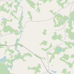
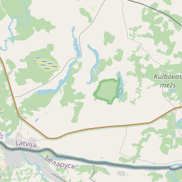
Ehituskaart (katastritunnus: 60620040069005)
Katastri tähis:60620040069005
Aadress: "Bērzpils", Vaicuļeva, Indras pagasts, Krāslavas novads, LV-5664
Kinnisasja katastri määramine | |
|---|---|
Katastriobjekti tüüp | Katastriobjekti tüüp: Ehitus |
Aadress | Aadress: "Bērzpils", Vaicuļeva, Indras pagasts, Krāslavas novads, LV-5664 |
Aadress | |
|---|---|
Aadressi ID | Aadressi ID: 102702621 |
Aadressil registreeritud ettevõtted | Aadressil registreeritud ettevõtted: 0 |
Aadressil registreeritud struktuuriüksused | Aadressil registreeritud struktuuriüksused: 0 |
Asutused registreeritud aadressil | Asutused registreeritud aadressil: 0 |
Kinnisvara aadressil | |
Tehingud aadressil | Tehingud aadressil: 0 |
| Katastriobjekti tüüp | Katastriobjekti katastritunnus | Isikliku omandiõiguse staatus | Isiklik staatus | Kinnistusraamat |
|---|---|---|---|---|
| Katastriobjekti tüüp: Ehitus | 60620040069005 | Isikliku omandiõiguse staatus: Andmed puuduvad | Isiklik staatus: Andmed puuduvad | Kinnistusraamat |
17.12.2024. Riigi maateenistuse andmed
|
|
|
{"7201060210":{"name":"<div class='color_dot' style='background-color: #00ffff'><\/div><span>M\u00e4\u00e4ratud maa\u00fcksus<\/span>","featureColor":"#00ffff","features":{"type":"FeatureCollection","features":[{"type":"Feature","geometry":{"type":"Polygon","coordinates":[[[27.56881678,55.85517806],[27.571819846,55.854355381],[27.572040842,55.855219996],[27.570631076,55.855907722],[27.569043444,55.85552734],[27.568972081,55.855534276],[27.56881678,55.85517806]]]},"crs":{"type":"name","properties":{"name":"urn:ogc:def:crs:EPSG:3059"}},"properties":{"style":{"color":"#00ffff","dashArray":"8,12","weight":1},"name":"Maa","object_type":"Parcel","parcel_code":"60620070397","code":null,"surveyor":null,"address":"","ownership":"<span>Omanik - F\u00fc\u00fcsiline isik<br><\/span>","pro_cadastre_nr":"60620040069"}},{"type":"Feature","geometry":{"type":"Polygon","coordinates":[[[27.532915343,55.869109781],[27.533277083,55.869110337],[27.534755884,55.869109425],[27.534957871,55.869172924],[27.534965735,55.869249018],[27.535037565,55.869943522],[27.535138661,55.871125575],[27.534984928,55.871190796],[27.535089192,55.871424067],[27.53520067,55.87152038],[27.535203607,55.871548807],[27.534282506,55.871620425],[27.534204642,55.871636447],[27.534199721,55.871626824],[27.532950578,55.869186554],[27.532940168,55.869163862],[27.532915343,55.869109781]]]},"crs":{"type":"name","properties":{"name":"urn:ogc:def:crs:EPSG:3059"}},"properties":{"style":{"color":"#00ffff","dashArray":"8,12","weight":1},"name":"Maa","object_type":"Parcel","parcel_code":"60620040069","code":null,"surveyor":null,"address":"\"B\u0113rzpils\", Vaicu\u013ceva, Indras pag., Kr\u0101slavas nov., LV-5664","ownership":"<span>Omanik - F\u00fc\u00fcsiline isik<br><\/span>","pro_cadastre_nr":"60620040069"}}]}},"7114100000":{"name":"<div class='color_dot' style='background-color: #b40000'><\/div><span>Koormatud tee servituudi ala<\/span>","featureColor":"#b40000","features":{"type":"FeatureCollection","features":[{"type":"Feature","geometry":{"type":"Polygon","coordinates":[[[27.568973093,55.855533635],[27.568817752,55.855178032],[27.568846206,55.855170704],[27.569003566,55.855530548],[27.568973093,55.855533635]]]},"crs":{"type":"name","properties":{"name":"urn:ogc:def:crs:EPSG:3059"}},"properties":{"style":{"color":"#b40000","dashArray":"4,2,1,2","weight":1},"name":"Koormatud tee servituudi ala","object_type":"WayRestriction","parcel_code":"60620070397","code":"7315030100005","surveyor":null,"address":"","ownership":"<span>Omanik - F\u00fc\u00fcsiline isik<br><\/span>","pro_cadastre_nr":"60620040069"}}]}},"5201011310":{"name":"<div class='color_dot' style='background-color: #960096'><\/div><span>Vektoriseeritud hoone<\/span>","featureColor":"#960096","features":{"type":"FeatureCollection","features":[{"type":"Feature","geometry":{"type":"Polygon","coordinates":[[[27.534327127,55.871205229],[27.534348256,55.871245722],[27.534256306,55.87126089],[27.534235175,55.871220388],[27.534327127,55.871205229]]]},"crs":{"type":"name","properties":{"name":"urn:ogc:def:crs:EPSG:3059"}},"properties":{"style":{"color":"#960096","dashArray":"0","weight":2},"name":"Hoone","object_type":"Building","parcel_code":"60620040069","code":"60620040069002","surveyor":null,"address":"\"B\u0113rzpils\", Vaicu\u013ceva, Indras pag., Kr\u0101slavas nov., LV-5664","ownership":"<span>Omanik - F\u00fc\u00fcsiline isik<br><\/span>","pro_cadastre_nr":"60620040069"}},{"type":"Feature","geometry":{"type":"Polygon","coordinates":[[[27.534699484,55.871185326],[27.53471301,55.871293267],[27.534556388,55.871299469],[27.534542877,55.871191528],[27.534699484,55.871185326]]]},"crs":{"type":"name","properties":{"name":"urn:ogc:def:crs:EPSG:3059"}},"properties":{"style":{"color":"#960096","dashArray":"0","weight":2},"name":"Hoone","object_type":"Building","parcel_code":"60620040069","code":"60620040069001","surveyor":null,"address":"\"B\u0113rzpils\", Vaicu\u013ceva, Indras pag., Kr\u0101slavas nov., LV-5664","ownership":"<span>Omanik - F\u00fc\u00fcsiline isik<br><\/span>","pro_cadastre_nr":"60620040069"}},{"type":"Feature","geometry":{"type":"Polygon","coordinates":[[[27.534394333,55.871334042],[27.534410954,55.871365925],[27.534319003,55.871381093],[27.534302366,55.871349211],[27.534394333,55.871334042]]]},"crs":{"type":"name","properties":{"name":"urn:ogc:def:crs:EPSG:3059"}},"properties":{"style":{"color":"#960096","dashArray":"0","weight":2},"name":"Hoone","object_type":"Building","parcel_code":"60620040069","code":"60620040069005","surveyor":null,"address":"\"B\u0113rzpils\", Vaicu\u013ceva, Indras pag., Kr\u0101slavas nov., LV-5664","ownership":"<span>Omanik - F\u00fc\u00fcsiline isik<br><\/span>","pro_cadastre_nr":"60620040069"}},{"type":"Feature","geometry":{"type":"Polygon","coordinates":[[[27.534348256,55.871245722],[27.534376789,55.871300442],[27.534284837,55.871315601],[27.534256306,55.87126089],[27.534348256,55.871245722]]]},"crs":{"type":"name","properties":{"name":"urn:ogc:def:crs:EPSG:3059"}},"properties":{"style":{"color":"#960096","dashArray":"0","weight":2},"name":"Hoone","object_type":"Building","parcel_code":"60620040069","code":"60620040069003","surveyor":null,"address":"\"B\u0113rzpils\", Vaicu\u013ceva, Indras pag., Kr\u0101slavas nov., LV-5664","ownership":"<span>Omanik - F\u00fc\u00fcsiline isik<br><\/span>","pro_cadastre_nr":"60620040069"}},{"type":"Feature","geometry":{"type":"Polygon","coordinates":[[[27.534376789,55.871300442],[27.534394333,55.871334042],[27.534302366,55.871349211],[27.534284837,55.871315601],[27.534376789,55.871300442]]]},"crs":{"type":"name","properties":{"name":"urn:ogc:def:crs:EPSG:3059"}},"properties":{"style":{"color":"#960096","dashArray":"0","weight":2},"name":"Hoone","object_type":"Building","parcel_code":"60620040069","code":"60620040069004","surveyor":null,"address":"\"B\u0113rzpils\", Vaicu\u013ceva, Indras pag., Kr\u0101slavas nov., LV-5664","ownership":"<span>Omanik - F\u00fc\u00fcsiline isik<br><\/span>","pro_cadastre_nr":"60620040069"}},{"type":"Feature","geometry":{"type":"Polygon","coordinates":[[[27.534394333,55.871334042],[27.534410954,55.871365925],[27.534319003,55.871381093],[27.534302366,55.871349211],[27.534394333,55.871334042]]]},"crs":{"type":"name","properties":{"name":"urn:ogc:def:crs:EPSG:3059"}},"properties":{"style":{"color":"#960096","dashArray":"0","weight":2},"name":"Hoone","object_type":"Building","parcel_code":"60620040069","code":"60620040069005","surveyor":null,"address":"\"B\u0113rzpils\", Vaicu\u013ceva, Indras pag., Kr\u0101slavas nov., LV-5664","ownership":"<span>Omanik - F\u00fc\u00fcsiline isik<br><\/span>","pro_cadastre_nr":"60620040069"}},{"type":"Feature","geometry":{"type":"Polygon","coordinates":[[[27.534376789,55.871300442],[27.534394333,55.871334042],[27.534302366,55.871349211],[27.534284837,55.871315601],[27.534376789,55.871300442]]]},"crs":{"type":"name","properties":{"name":"urn:ogc:def:crs:EPSG:3059"}},"properties":{"style":{"color":"#960096","dashArray":"0","weight":2},"name":"Hoone","object_type":"Building","parcel_code":"60620040069","code":"60620040069004","surveyor":null,"address":"\"B\u0113rzpils\", Vaicu\u013ceva, Indras pag., Kr\u0101slavas nov., LV-5664","ownership":"<span>Omanik - F\u00fc\u00fcsiline isik<br><\/span>","pro_cadastre_nr":"60620040069"}},{"type":"Feature","geometry":{"type":"Polygon","coordinates":[[[27.534348256,55.871245722],[27.534376789,55.871300442],[27.534284837,55.871315601],[27.534256306,55.87126089],[27.534348256,55.871245722]]]},"crs":{"type":"name","properties":{"name":"urn:ogc:def:crs:EPSG:3059"}},"properties":{"style":{"color":"#960096","dashArray":"0","weight":2},"name":"Hoone","object_type":"Building","parcel_code":"60620040069","code":"60620040069003","surveyor":null,"address":"\"B\u0113rzpils\", Vaicu\u013ceva, Indras pag., Kr\u0101slavas nov., LV-5664","ownership":"<span>Omanik - F\u00fc\u00fcsiline isik<br><\/span>","pro_cadastre_nr":"60620040069"}},{"type":"Feature","geometry":{"type":"Polygon","coordinates":[[[27.534327127,55.871205229],[27.534348256,55.871245722],[27.534256306,55.87126089],[27.534235175,55.871220388],[27.534327127,55.871205229]]]},"crs":{"type":"name","properties":{"name":"urn:ogc:def:crs:EPSG:3059"}},"properties":{"style":{"color":"#960096","dashArray":"0","weight":2},"name":"Hoone","object_type":"Building","parcel_code":"60620040069","code":"60620040069002","surveyor":null,"address":"\"B\u0113rzpils\", Vaicu\u013ceva, Indras pag., Kr\u0101slavas nov., LV-5664","ownership":"<span>Omanik - F\u00fc\u00fcsiline isik<br><\/span>","pro_cadastre_nr":"60620040069"}},{"type":"Feature","geometry":{"type":"Polygon","coordinates":[[[27.534699484,55.871185326],[27.53471301,55.871293267],[27.534556388,55.871299469],[27.534542877,55.871191528],[27.534699484,55.871185326]]]},"crs":{"type":"name","properties":{"name":"urn:ogc:def:crs:EPSG:3059"}},"properties":{"style":{"color":"#960096","dashArray":"0","weight":2},"name":"Hoone","object_type":"Building","parcel_code":"60620040069","code":"60620040069001","surveyor":null,"address":"\"B\u0113rzpils\", Vaicu\u013ceva, Indras pag., Kr\u0101slavas nov., LV-5664","ownership":"<span>Omanik - F\u00fc\u00fcsiline isik<br><\/span>","pro_cadastre_nr":"60620040069"}}]}}}
[]
https://tile.openstreetmap.org/{z}/{x}/{y}.png|© OpenStreetMap contributors|minZoom: 7|maxZoom: 19
|
Ehitusandmeid värskendati: 29.12.2024.
Andmeallikas ja litsents: katastri infosüsteem avatud teksti- ja ruumiandmed, kinnisvaraturu andmebaasi avaandmed, avaandmete litsents Creative Commons Attribution, OpenStreetMapi andmed.

