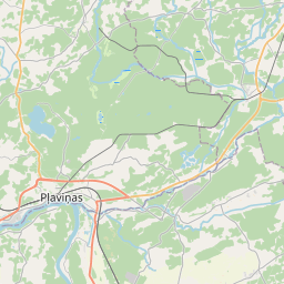
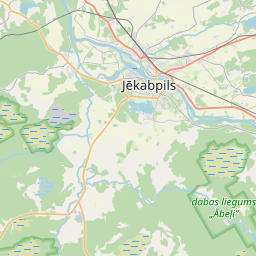
Ehituskaart (katastritunnus: 56680060002006)
Katastri tähis:56680060002006
Aadress: "Gravas", Priži, Krustpils pagasts, Jēkabpils novads, LV-5204
Kinnisasja katastri määramine | |
|---|---|
Katastriobjekti tüüp | Katastriobjekti tüüp: Ehitus |
Aadress | Aadress: "Gravas", Priži, Krustpils pagasts, Jēkabpils novads, LV-5204 |
Aadress | |
|---|---|
Aadressi ID | Aadressi ID: 104329884 |
Aadressil registreeritud ettevõtted | Aadressil registreeritud ettevõtted: 0 |
Aadressil registreeritud struktuuriüksused | Aadressil registreeritud struktuuriüksused: 0 |
Asutused registreeritud aadressil | Asutused registreeritud aadressil: 0 |
Kinnisvara aadressil | |
Tehingud aadressil | Tehingud aadressil: 0 |
| Katastriobjekti tüüp | Katastriobjekti katastritunnus | Isikliku omandiõiguse staatus | Isiklik staatus | Kinnistusraamat |
|---|---|---|---|---|
| Katastriobjekti tüüp: Ehitus | 56680060002006 | Isikliku omandiõiguse staatus: Andmed puuduvad | Isiklik staatus: Andmed puuduvad | Kinnistusraamat |
09.01.2025. Riigi maateenistuse andmed
|
|
|
{"7201060210":{"name":"<div class='color_dot' style='background-color: #00ffff'><\/div><span>M\u00e4\u00e4ratud maa\u00fcksus<\/span>","featureColor":"#00ffff","features":{"type":"FeatureCollection","features":[{"type":"Feature","geometry":{"type":"Polygon","coordinates":[[[25.829131462,56.536177593],[25.829626761,56.535757306],[25.830419427,56.535416881],[25.831122458,56.535072128],[25.835292022,56.536917632],[25.833395269,56.538198796],[25.831997643,56.5375275],[25.83093253,56.537004634],[25.829131462,56.536177593]]]},"crs":{"type":"name","properties":{"name":"urn:ogc:def:crs:EPSG:3059"}},"properties":{"style":{"color":"#00ffff","dashArray":"8,12","weight":1},"name":"Maa","object_type":"Parcel","parcel_code":"56680060010","code":null,"surveyor":null,"address":"","ownership":"<span>Omanik - F\u00fc\u00fcsiline isik<br><\/span>","pro_cadastre_nr":"56680060002"}},{"type":"Feature","geometry":{"type":"Polygon","coordinates":[[[25.776262457,56.548796971],[25.776278164,56.548745402],[25.776391523,56.548568342],[25.776941023,56.547927767],[25.778410686,56.546240438],[25.778495531,56.54624936],[25.779007216,56.546303176],[25.779138261,56.546316963],[25.779237676,56.545905219],[25.779294555,56.545909571],[25.78248956,56.54615403],[25.782508613,56.546728609],[25.782569205,56.548250149],[25.782615356,56.550113547],[25.782342759,56.550151351],[25.781277477,56.550343528],[25.78096862,56.550359636],[25.780076499,56.549884889],[25.779303828,56.549473961],[25.778673184,56.549867689],[25.778631563,56.549883525],[25.778462778,56.549769807],[25.778362393,56.549715531],[25.778209032,56.549643089],[25.778040066,56.549571625],[25.777727009,56.549464724],[25.777179134,56.549310248],[25.776914368,56.549221785],[25.776976148,56.549164336],[25.776313784,56.548850827],[25.776262457,56.548796971]]]},"crs":{"type":"name","properties":{"name":"urn:ogc:def:crs:EPSG:3059"}},"properties":{"style":{"color":"#00ffff","dashArray":"8,12","weight":1},"name":"Maa","object_type":"Parcel","parcel_code":"56680060009","code":null,"surveyor":null,"address":"","ownership":"<span>Omanik - F\u00fc\u00fcsiline isik<br><\/span>","pro_cadastre_nr":"56680060002"}},{"type":"Feature","geometry":{"type":"Polygon","coordinates":[[[25.821621755,56.52561808],[25.822174445,56.52531742],[25.822245397,56.525278818],[25.822745367,56.525533954],[25.823078478,56.525487102],[25.823634431,56.525426833],[25.824005122,56.525362893],[25.824830642,56.525754177],[25.825542648,56.52631216],[25.828453117,56.526602524],[25.828497564,56.527066399],[25.828934419,56.527608337],[25.828686554,56.527721201],[25.827747462,56.527565221],[25.826282739,56.527363073],[25.82623039,56.527357121],[25.823173134,56.527226652],[25.8231545,56.527225614],[25.822883936,56.527208772],[25.822826613,56.527201796],[25.822776583,56.527327371],[25.822711575,56.527528361],[25.822578228,56.527842085],[25.822567424,56.527877145],[25.822530025,56.527873021],[25.822066839,56.527825854],[25.822071685,56.527794377],[25.822229927,56.525826182],[25.821621755,56.52561808]]]},"crs":{"type":"name","properties":{"name":"urn:ogc:def:crs:EPSG:3059"}},"properties":{"style":{"color":"#00ffff","dashArray":"8,12","weight":1},"name":"Maa","object_type":"Parcel","parcel_code":"56680060002","code":null,"surveyor":null,"address":"\"Gravas\", Pri\u017ei, Krustpils pag., J\u0113kabpils nov., LV-5204","ownership":"<span>Omanik - F\u00fc\u00fcsiline isik<br><\/span>","pro_cadastre_nr":"56680060002"}}]}},"7114100000":{"name":"<div class='color_dot' style='background-color: #b40000'><\/div><span>Koormatud tee servituudi ala<\/span>","featureColor":"#b40000","features":{"type":"FeatureCollection","features":[{"type":"Feature","geometry":{"type":"Polygon","coordinates":[[[25.777179134,56.549310248],[25.776914368,56.549221785],[25.776955979,56.549183171],[25.777218713,56.54927098],[25.777766934,56.549425559],[25.778086273,56.549534598],[25.778260218,56.549608166],[25.778417323,56.549682378],[25.778522849,56.549739429],[25.778693721,56.549854635],[25.778673184,56.549867689],[25.778631563,56.549883525],[25.778462778,56.549769807],[25.778362393,56.549715531],[25.778209032,56.549643089],[25.778040066,56.549571625],[25.777727009,56.549464724],[25.777179134,56.549310248]]]},"crs":{"type":"name","properties":{"name":"urn:ogc:def:crs:EPSG:3059"}},"properties":{"style":{"color":"#b40000","dashArray":"4,2,1,2","weight":1},"name":"Koormatud tee servituudi ala","object_type":"WayRestriction","parcel_code":"56680060009","code":"7315030100005","surveyor":null,"address":"","ownership":"<span>Omanik - F\u00fc\u00fcsiline isik<br><\/span>","pro_cadastre_nr":"56680060002"}},{"type":"Feature","geometry":{"type":"Polygon","coordinates":[[[25.822073605,56.527771731],[25.822585923,56.527823911],[25.822578228,56.527842085],[25.822567424,56.527877145],[25.822530025,56.527873021],[25.822066839,56.527825854],[25.822071685,56.527794377],[25.822073605,56.527771731]]]},"crs":{"type":"name","properties":{"name":"urn:ogc:def:crs:EPSG:3059"}},"properties":{"style":{"color":"#b40000","dashArray":"4,2,1,2","weight":1},"name":"Koormatud tee servituudi ala","object_type":"WayRestriction","parcel_code":"56680060002","code":"7315030100002","surveyor":null,"address":"\"Gravas\", Pri\u017ei, Krustpils pag., J\u0113kabpils nov., LV-5204","ownership":"<span>Omanik - F\u00fc\u00fcsiline isik<br><\/span>","pro_cadastre_nr":"56680060002"}},{"type":"Feature","geometry":{"type":"Polygon","coordinates":[[[25.822245397,56.525278818],[25.822745367,56.525533954],[25.823078478,56.525487102],[25.823634431,56.525426833],[25.824005122,56.525362893],[25.824077894,56.525397409],[25.823654411,56.525470436],[25.823096338,56.525530934],[25.822722659,56.525583495],[25.822187426,56.525310436],[25.822245397,56.525278818]]]},"crs":{"type":"name","properties":{"name":"urn:ogc:def:crs:EPSG:3059"}},"properties":{"style":{"color":"#b40000","dashArray":"4,2,1,2","weight":1},"name":"Koormatud tee servituudi ala","object_type":"WayRestriction","parcel_code":"56680060002","code":"7315030100004","surveyor":null,"address":"\"Gravas\", Pri\u017ei, Krustpils pag., J\u0113kabpils nov., LV-5204","ownership":"<span>Omanik - F\u00fc\u00fcsiline isik<br><\/span>","pro_cadastre_nr":"56680060002"}},{"type":"Feature","geometry":{"type":"Polygon","coordinates":[[[25.822907696,56.527210239],[25.822883936,56.527208772],[25.822826613,56.527201796],[25.822776583,56.527327371],[25.822711575,56.527528361],[25.822585923,56.527823911],[25.822505942,56.527815756],[25.822631955,56.527519268],[25.822696865,56.527318584],[25.822748507,56.527188986],[25.823140237,56.526614311],[25.82340632,56.526223947],[25.823829987,56.525442402],[25.824016989,56.525409212],[25.823560435,56.526252678],[25.823292332,56.526645983],[25.822907696,56.527210239]]]},"crs":{"type":"name","properties":{"name":"urn:ogc:def:crs:EPSG:3059"}},"properties":{"style":{"color":"#b40000","dashArray":"4,2,1,2","weight":1},"name":"Koormatud tee servituudi ala","object_type":"WayRestriction","parcel_code":"56680060002","code":"7315030100003","surveyor":null,"address":"\"Gravas\", Pri\u017ei, Krustpils pag., J\u0113kabpils nov., LV-5204","ownership":"<span>Omanik - F\u00fc\u00fcsiline isik<br><\/span>","pro_cadastre_nr":"56680060002"}}]}},"5201011310":{"name":"<div class='color_dot' style='background-color: #960096'><\/div><span>Vektoriseeritud hoone<\/span>","featureColor":"#960096","features":{"type":"FeatureCollection","features":[{"type":"Feature","geometry":{"type":"Polygon","coordinates":[[[25.823583384,56.526277888],[25.823702405,56.526292927],[25.823676639,56.526355263],[25.823557602,56.526340233],[25.823583384,56.526277888]]]},"crs":{"type":"name","properties":{"name":"urn:ogc:def:crs:EPSG:3059"}},"properties":{"style":{"color":"#960096","dashArray":"0","weight":2},"name":"Hoone","object_type":"Building","parcel_code":"56680060002","code":"56680060002009","surveyor":null,"address":"\"Gravas\", Pri\u017ei, Krustpils pag., J\u0113kabpils nov., LV-5204","ownership":"<span>Omanik - F\u00fc\u00fcsiline isik<br><\/span>","pro_cadastre_nr":"56680060002"}},{"type":"Feature","geometry":{"type":"Polygon","coordinates":[[[25.822461106,56.526493143],[25.822417274,56.526386871],[25.822554174,56.526369622],[25.82259799,56.526475895],[25.822461106,56.526493143]]]},"crs":{"type":"name","properties":{"name":"urn:ogc:def:crs:EPSG:3059"}},"properties":{"style":{"color":"#960096","dashArray":"0","weight":2},"name":"Hoone","object_type":"Building","parcel_code":"56680060002","code":"56680060002002","surveyor":null,"address":"\"Gravas\", Pri\u017ei, Krustpils pag., J\u0113kabpils nov., LV-5204","ownership":"<span>Omanik - F\u00fc\u00fcsiline isik<br><\/span>","pro_cadastre_nr":"56680060002"}},{"type":"Feature","geometry":{"type":"Polygon","coordinates":[[[25.823676639,56.526355263],[25.823653013,56.52641241],[25.823533976,56.526397371],[25.823557602,56.526340233],[25.823676639,56.526355263]]]},"crs":{"type":"name","properties":{"name":"urn:ogc:def:crs:EPSG:3059"}},"properties":{"style":{"color":"#960096","dashArray":"0","weight":2},"name":"Hoone","object_type":"Building","parcel_code":"56680060002","code":"56680060002008","surveyor":null,"address":"\"Gravas\", Pri\u017ei, Krustpils pag., J\u0113kabpils nov., LV-5204","ownership":"<span>Omanik - F\u00fc\u00fcsiline isik<br><\/span>","pro_cadastre_nr":"56680060002"}},{"type":"Feature","geometry":{"type":"Polygon","coordinates":[[[25.823515447,56.526442178],[25.823475419,56.526437122],[25.823517574,56.526335178],[25.823557602,56.526340233],[25.823515447,56.526442178]]]},"crs":{"type":"name","properties":{"name":"urn:ogc:def:crs:EPSG:3059"}},"properties":{"style":{"color":"#960096","dashArray":"0","weight":2},"name":"Hoone","object_type":"Building","parcel_code":"56680060002","code":"56680060002006","surveyor":null,"address":"\"Gravas\", Pri\u017ei, Krustpils pag., J\u0113kabpils nov., LV-5204","ownership":"<span>Omanik - F\u00fc\u00fcsiline isik<br><\/span>","pro_cadastre_nr":"56680060002"}},{"type":"Feature","geometry":{"type":"Polygon","coordinates":[[[25.823280754,56.526594843],[25.823317227,56.526528611],[25.823538264,56.526565795],[25.823501775,56.526632027],[25.823280754,56.526594843]]]},"crs":{"type":"name","properties":{"name":"urn:ogc:def:crs:EPSG:3059"}},"properties":{"style":{"color":"#960096","dashArray":"0","weight":2},"name":"Hoone","object_type":"Building","parcel_code":"56680060002","code":"56680060002011","surveyor":null,"address":"\"Gravas\", Pri\u017ei, Krustpils pag., J\u0113kabpils nov., LV-5204","ownership":"<span>Omanik - F\u00fc\u00fcsiline isik<br><\/span>","pro_cadastre_nr":"56680060002"}},{"type":"Feature","geometry":{"type":"Polygon","coordinates":[[[25.823653013,56.52641241],[25.823634485,56.526457216],[25.823515447,56.526442178],[25.823533976,56.526397371],[25.823653013,56.52641241]]]},"crs":{"type":"name","properties":{"name":"urn:ogc:def:crs:EPSG:3059"}},"properties":{"style":{"color":"#960096","dashArray":"0","weight":2},"name":"Hoone","object_type":"Building","parcel_code":"56680060002","code":"56680060002007","surveyor":null,"address":"\"Gravas\", Pri\u017ei, Krustpils pag., J\u0113kabpils nov., LV-5204","ownership":"<span>Omanik - F\u00fc\u00fcsiline isik<br><\/span>","pro_cadastre_nr":"56680060002"}},{"type":"Feature","geometry":{"type":"Polygon","coordinates":[[[25.822593667,56.526342894],[25.822564298,56.52627168],[25.822753058,56.526247901],[25.822782427,56.526319116],[25.822593667,56.526342894]]]},"crs":{"type":"name","properties":{"name":"urn:ogc:def:crs:EPSG:3059"}},"properties":{"style":{"color":"#960096","dashArray":"0","weight":2},"name":"Hoone","object_type":"Building","parcel_code":"56680060002","code":"56680060002001","surveyor":null,"address":"\"Gravas\", Pri\u017ei, Krustpils pag., J\u0113kabpils nov., LV-5204","ownership":"<span>Omanik - F\u00fc\u00fcsiline isik<br><\/span>","pro_cadastre_nr":"56680060002"}},{"type":"Feature","geometry":{"type":"Polygon","coordinates":[[[25.823142915,56.526419959],[25.823178146,56.526350196],[25.823338737,56.526374968],[25.82330349,56.526444731],[25.823142915,56.526419959]]]},"crs":{"type":"name","properties":{"name":"urn:ogc:def:crs:EPSG:3059"}},"properties":{"style":{"color":"#960096","dashArray":"0","weight":2},"name":"Hoone","object_type":"Building","parcel_code":"56680060002","code":"56680060002003","surveyor":null,"address":"\"Gravas\", Pri\u017ei, Krustpils pag., J\u0113kabpils nov., LV-5204","ownership":"<span>Omanik - F\u00fc\u00fcsiline isik<br><\/span>","pro_cadastre_nr":"56680060002"}},{"type":"Feature","geometry":{"type":"Polygon","coordinates":[[[25.8235584,56.526568663],[25.823590269,56.526514225],[25.823578773,56.526512165],[25.823536543,56.526504608],[25.82355791,56.526468117],[25.823742211,56.526501086],[25.823688959,56.526592015],[25.8235584,56.526568663]]]},"crs":{"type":"name","properties":{"name":"urn:ogc:def:crs:EPSG:3059"}},"properties":{"style":{"color":"#960096","dashArray":"0","weight":2},"name":"Hoone","object_type":"Building","parcel_code":"56680060002","code":"56680060002010","surveyor":null,"address":"\"Gravas\", Pri\u017ei, Krustpils pag., J\u0113kabpils nov., LV-5204","ownership":"<span>Omanik - F\u00fc\u00fcsiline isik<br><\/span>","pro_cadastre_nr":"56680060002"}},{"type":"Feature","geometry":{"type":"Polygon","coordinates":[[[25.823280754,56.526594843],[25.823317227,56.526528611],[25.823538264,56.526565795],[25.823501775,56.526632027],[25.823280754,56.526594843]]]},"crs":{"type":"name","properties":{"name":"urn:ogc:def:crs:EPSG:3059"}},"properties":{"style":{"color":"#960096","dashArray":"0","weight":2},"name":"Hoone","object_type":"Building","parcel_code":"56680060002","code":"56680060002011","surveyor":null,"address":"\"Gravas\", Pri\u017ei, Krustpils pag., J\u0113kabpils nov., LV-5204","ownership":"<span>Omanik - F\u00fc\u00fcsiline isik<br><\/span>","pro_cadastre_nr":"56680060002"}},{"type":"Feature","geometry":{"type":"Polygon","coordinates":[[[25.8235584,56.526568663],[25.823590269,56.526514225],[25.823578773,56.526512165],[25.823536543,56.526504608],[25.82355791,56.526468117],[25.823742211,56.526501086],[25.823688959,56.526592015],[25.8235584,56.526568663]]]},"crs":{"type":"name","properties":{"name":"urn:ogc:def:crs:EPSG:3059"}},"properties":{"style":{"color":"#960096","dashArray":"0","weight":2},"name":"Hoone","object_type":"Building","parcel_code":"56680060002","code":"56680060002010","surveyor":null,"address":"\"Gravas\", Pri\u017ei, Krustpils pag., J\u0113kabpils nov., LV-5204","ownership":"<span>Omanik - F\u00fc\u00fcsiline isik<br><\/span>","pro_cadastre_nr":"56680060002"}},{"type":"Feature","geometry":{"type":"Polygon","coordinates":[[[25.823583384,56.526277888],[25.823702405,56.526292927],[25.823676639,56.526355263],[25.823557602,56.526340233],[25.823583384,56.526277888]]]},"crs":{"type":"name","properties":{"name":"urn:ogc:def:crs:EPSG:3059"}},"properties":{"style":{"color":"#960096","dashArray":"0","weight":2},"name":"Hoone","object_type":"Building","parcel_code":"56680060002","code":"56680060002009","surveyor":null,"address":"\"Gravas\", Pri\u017ei, Krustpils pag., J\u0113kabpils nov., LV-5204","ownership":"<span>Omanik - F\u00fc\u00fcsiline isik<br><\/span>","pro_cadastre_nr":"56680060002"}},{"type":"Feature","geometry":{"type":"Polygon","coordinates":[[[25.823676639,56.526355263],[25.823653013,56.52641241],[25.823533976,56.526397371],[25.823557602,56.526340233],[25.823676639,56.526355263]]]},"crs":{"type":"name","properties":{"name":"urn:ogc:def:crs:EPSG:3059"}},"properties":{"style":{"color":"#960096","dashArray":"0","weight":2},"name":"Hoone","object_type":"Building","parcel_code":"56680060002","code":"56680060002008","surveyor":null,"address":"\"Gravas\", Pri\u017ei, Krustpils pag., J\u0113kabpils nov., LV-5204","ownership":"<span>Omanik - F\u00fc\u00fcsiline isik<br><\/span>","pro_cadastre_nr":"56680060002"}},{"type":"Feature","geometry":{"type":"Polygon","coordinates":[[[25.823653013,56.52641241],[25.823634485,56.526457216],[25.823515447,56.526442178],[25.823533976,56.526397371],[25.823653013,56.52641241]]]},"crs":{"type":"name","properties":{"name":"urn:ogc:def:crs:EPSG:3059"}},"properties":{"style":{"color":"#960096","dashArray":"0","weight":2},"name":"Hoone","object_type":"Building","parcel_code":"56680060002","code":"56680060002007","surveyor":null,"address":"\"Gravas\", Pri\u017ei, Krustpils pag., J\u0113kabpils nov., LV-5204","ownership":"<span>Omanik - F\u00fc\u00fcsiline isik<br><\/span>","pro_cadastre_nr":"56680060002"}},{"type":"Feature","geometry":{"type":"Polygon","coordinates":[[[25.823515447,56.526442178],[25.823475419,56.526437122],[25.823517574,56.526335178],[25.823557602,56.526340233],[25.823515447,56.526442178]]]},"crs":{"type":"name","properties":{"name":"urn:ogc:def:crs:EPSG:3059"}},"properties":{"style":{"color":"#960096","dashArray":"0","weight":2},"name":"Hoone","object_type":"Building","parcel_code":"56680060002","code":"56680060002006","surveyor":null,"address":"\"Gravas\", Pri\u017ei, Krustpils pag., J\u0113kabpils nov., LV-5204","ownership":"<span>Omanik - F\u00fc\u00fcsiline isik<br><\/span>","pro_cadastre_nr":"56680060002"}},{"type":"Feature","geometry":{"type":"Polygon","coordinates":[[[25.823142915,56.526419959],[25.823178146,56.526350196],[25.823338737,56.526374968],[25.82330349,56.526444731],[25.823142915,56.526419959]]]},"crs":{"type":"name","properties":{"name":"urn:ogc:def:crs:EPSG:3059"}},"properties":{"style":{"color":"#960096","dashArray":"0","weight":2},"name":"Hoone","object_type":"Building","parcel_code":"56680060002","code":"56680060002003","surveyor":null,"address":"\"Gravas\", Pri\u017ei, Krustpils pag., J\u0113kabpils nov., LV-5204","ownership":"<span>Omanik - F\u00fc\u00fcsiline isik<br><\/span>","pro_cadastre_nr":"56680060002"}},{"type":"Feature","geometry":{"type":"Polygon","coordinates":[[[25.822461106,56.526493143],[25.822417274,56.526386871],[25.822554174,56.526369622],[25.82259799,56.526475895],[25.822461106,56.526493143]]]},"crs":{"type":"name","properties":{"name":"urn:ogc:def:crs:EPSG:3059"}},"properties":{"style":{"color":"#960096","dashArray":"0","weight":2},"name":"Hoone","object_type":"Building","parcel_code":"56680060002","code":"56680060002002","surveyor":null,"address":"\"Gravas\", Pri\u017ei, Krustpils pag., J\u0113kabpils nov., LV-5204","ownership":"<span>Omanik - F\u00fc\u00fcsiline isik<br><\/span>","pro_cadastre_nr":"56680060002"}},{"type":"Feature","geometry":{"type":"Polygon","coordinates":[[[25.822593667,56.526342894],[25.822564298,56.52627168],[25.822753058,56.526247901],[25.822782427,56.526319116],[25.822593667,56.526342894]]]},"crs":{"type":"name","properties":{"name":"urn:ogc:def:crs:EPSG:3059"}},"properties":{"style":{"color":"#960096","dashArray":"0","weight":2},"name":"Hoone","object_type":"Building","parcel_code":"56680060002","code":"56680060002001","surveyor":null,"address":"\"Gravas\", Pri\u017ei, Krustpils pag., J\u0113kabpils nov., LV-5204","ownership":"<span>Omanik - F\u00fc\u00fcsiline isik<br><\/span>","pro_cadastre_nr":"56680060002"}}]}}}
{"7201060210":{"name":"<div class='color_dot' style='background-color: #00ffff'><\/div><span>M\u00e4\u00e4ratud maa\u00fcksus<\/span>","featureColor":"#00ffff","features":{"type":"FeatureCollection","features":[{"type":"Feature","geometry":{"type":"Polygon","coordinates":[[[25.821621755,56.52561808],[25.822174445,56.52531742],[25.822245397,56.525278818],[25.822745367,56.525533954],[25.823078478,56.525487102],[25.823634431,56.525426833],[25.824005122,56.525362893],[25.824830642,56.525754177],[25.825542648,56.52631216],[25.828453117,56.526602524],[25.828497564,56.527066399],[25.828934419,56.527608337],[25.828686554,56.527721201],[25.827747462,56.527565221],[25.826282739,56.527363073],[25.82623039,56.527357121],[25.823173134,56.527226652],[25.8231545,56.527225614],[25.822883936,56.527208772],[25.822826613,56.527201796],[25.822776583,56.527327371],[25.822711575,56.527528361],[25.822578228,56.527842085],[25.822567424,56.527877145],[25.822530025,56.527873021],[25.822066839,56.527825854],[25.822071685,56.527794377],[25.822229927,56.525826182],[25.821621755,56.52561808]]]},"crs":{"type":"name","properties":{"name":"urn:ogc:def:crs:EPSG:3059"}},"properties":{"style":{"color":"#00ffff","dashArray":"8,12","weight":1},"name":"Maa","object_type":"Parcel","parcel_code":"56680060002","code":null,"surveyor":null,"address":"\"Gravas\", Pri\u017ei, Krustpils pag., J\u0113kabpils nov., LV-5204","ownership":"<span>Omanik - F\u00fc\u00fcsiline isik<br><\/span>","pro_cadastre_nr":"56680060002"}}]}}}
https://tile.openstreetmap.org/{z}/{x}/{y}.png|© OpenStreetMap contributors|minZoom: 7|maxZoom: 19
|
Ehitusandmeid värskendati: 12.01.2025.
Andmeallikas ja litsents: katastri infosüsteem avatud teksti- ja ruumiandmed, kinnisvaraturu andmebaasi avaandmed, avaandmete litsents Creative Commons Attribution, OpenStreetMapi andmed.

