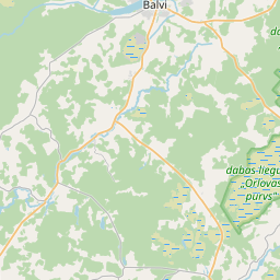
Ehituskaart (katastritunnus: 38580020022006)
Katastri tähis:38580020022006
Aadress: "Torņi", Tīreļi, Kubulu pagasts, Balvu novads, LV-4566
Kinnisasja katastri määramine | |
|---|---|
Katastriobjekti tüüp | Katastriobjekti tüüp: Ehitus |
Aadress | Aadress: "Torņi", Tīreļi, Kubulu pagasts, Balvu novads, LV-4566 |
Aadress | |
|---|---|
Aadressi ID | Aadressi ID: 104604014 |
Aadressil registreeritud ettevõtted | Aadressil registreeritud ettevõtted: 0 |
Aadressil registreeritud struktuuriüksused | Aadressil registreeritud struktuuriüksused: 0 |
Asutused registreeritud aadressil | Asutused registreeritud aadressil: 0 |
Kinnisvara aadressil | |
Tehingud aadressil | Tehingud aadressil: 0 |
| Katastriobjekti tüüp | Katastriobjekti katastritunnus | Isikliku omandiõiguse staatus | Isiklik staatus | Kinnistusraamat |
|---|---|---|---|---|
| Katastriobjekti tüüp: Ehitus | 38580020022006 | Isikliku omandiõiguse staatus: Andmed puuduvad | Isiklik staatus: Andmed puuduvad | Kinnistusraamat |
09.01.2025. Riigi maateenistuse andmed
|
|
|
{"7201060210":{"name":"<div class='color_dot' style='background-color: #00ffff'><\/div><span>M\u00e4\u00e4ratud maa\u00fcksus<\/span>","featureColor":"#00ffff","features":{"type":"FeatureCollection","features":[{"type":"Feature","geometry":{"type":"Polygon","coordinates":[[[27.194228445,57.198363815],[27.194234081,57.198312902],[27.194419728,57.1966352],[27.19795341,57.196690509],[27.197254766,57.198278963],[27.197273632,57.198588764],[27.197300369,57.199020938],[27.197309446,57.19904451],[27.197277808,57.199403761],[27.195076666,57.199400073],[27.195003897,57.198558275],[27.194572703,57.198492229],[27.194228445,57.198363815]]]},"crs":{"type":"name","properties":{"name":"urn:ogc:def:crs:EPSG:3059"}},"properties":{"style":{"color":"#00ffff","dashArray":"8,12","weight":1},"name":"Maa","object_type":"Parcel","parcel_code":"38580020022","code":null,"surveyor":null,"address":"\"Tor\u0146i\", T\u012bre\u013ci, Kubulu pag., Balvu nov., LV-4566","ownership":"<span>Omanik - F\u00fc\u00fcsiline isik<br><\/span>","pro_cadastre_nr":"38580020022"}},{"type":"Feature","geometry":{"type":"Polygon","coordinates":[[[27.15682183,57.199358111],[27.159290638,57.199375029],[27.162331291,57.200712843],[27.162906793,57.201793097],[27.162174892,57.202343067],[27.158946856,57.202485062],[27.157437977,57.201688998],[27.15682183,57.199358111]]]},"crs":{"type":"name","properties":{"name":"urn:ogc:def:crs:EPSG:3059"}},"properties":{"style":{"color":"#00ffff","dashArray":"8,12","weight":1},"name":"Maa","object_type":"Parcel","parcel_code":"38580010100","code":null,"surveyor":null,"address":"","ownership":"<span>Omanik - F\u00fc\u00fcsiline isik<br><\/span>","pro_cadastre_nr":"38580020022"}}]}},"7114100000":{"name":"<div class='color_dot' style='background-color: #b40000'><\/div><span>Koormatud tee servituudi ala<\/span>","featureColor":"#b40000","features":{"type":"FeatureCollection","features":[{"type":"Feature","geometry":{"type":"Polygon","coordinates":[[[27.194586178,57.198466304],[27.195017372,57.198532349],[27.195703933,57.198558044],[27.196348047,57.198542515],[27.197272067,57.198231051],[27.197254766,57.198278963],[27.196364641,57.198579289],[27.195708477,57.198593938],[27.195010541,57.198586097],[27.195003897,57.198558275],[27.194572703,57.198492229],[27.194586178,57.198466304]]]},"crs":{"type":"name","properties":{"name":"urn:ogc:def:crs:EPSG:3059"}},"properties":{"style":{"color":"#b40000","dashArray":"4,2,1,2","weight":1},"name":"Koormatud tee servituudi ala","object_type":"WayRestriction","parcel_code":"38580020022","code":"7315030100002","surveyor":null,"address":"\"Tor\u0146i\", T\u012bre\u013ci, Kubulu pag., Balvu nov., LV-4566","ownership":"<span>Omanik - F\u00fc\u00fcsiline isik<br><\/span>","pro_cadastre_nr":"38580020022"}}]}},"5201011310":{"name":"<div class='color_dot' style='background-color: #960096'><\/div><span>Vektoriseeritud hoone<\/span>","featureColor":"#960096","features":{"type":"FeatureCollection","features":[{"type":"Feature","geometry":{"type":"Polygon","coordinates":[[[27.195682742,57.198380557],[27.195310954,57.198390028],[27.195306922,57.198343388],[27.195517602,57.198338021],[27.195520858,57.198375692],[27.195681966,57.198371588],[27.195682742,57.198380557]]]},"crs":{"type":"name","properties":{"name":"urn:ogc:def:crs:EPSG:3059"}},"properties":{"style":{"color":"#960096","dashArray":"0","weight":2},"name":"Hoone","object_type":"Building","parcel_code":"38580020022","code":"38580020022006","surveyor":null,"address":"\"Tor\u0146i\", T\u012bre\u013ci, Kubulu pag., Balvu nov., LV-4566","ownership":"<span>Omanik - F\u00fc\u00fcsiline isik<br><\/span>","pro_cadastre_nr":"38580020022"}},{"type":"Feature","geometry":{"type":"Polygon","coordinates":[[[27.196073835,57.198239661],[27.195884911,57.198227547],[27.195968733,57.197842329],[27.195765025,57.197829271],[27.195781319,57.197754364],[27.196173947,57.197779535],[27.196073835,57.198239661]]]},"crs":{"type":"name","properties":{"name":"urn:ogc:def:crs:EPSG:3059"}},"properties":{"style":{"color":"#960096","dashArray":"0","weight":2},"name":"Hoone","object_type":"Building","parcel_code":"38580020022","code":"38580020022013","surveyor":null,"address":"\"Tor\u0146i\", T\u012bre\u013ci, Kubulu pag., Balvu nov., LV-4566","ownership":"<span>Omanik - F\u00fc\u00fcsiline isik<br><\/span>","pro_cadastre_nr":"38580020022"}},{"type":"Feature","geometry":{"type":"Polygon","coordinates":[[[27.195979176,57.198451668],[27.195831247,57.198444255],[27.195837191,57.198409379],[27.195985103,57.198416793],[27.195979176,57.198451668]]]},"crs":{"type":"name","properties":{"name":"urn:ogc:def:crs:EPSG:3059"}},"properties":{"style":{"color":"#960096","dashArray":"0","weight":2},"name":"Hoone","object_type":"Building","parcel_code":"38580020022","code":"38580020022009","surveyor":null,"address":"\"Tor\u0146i\", T\u012bre\u013ci, Kubulu pag., Balvu nov., LV-4566","ownership":"<span>Omanik - F\u00fc\u00fcsiline isik<br><\/span>","pro_cadastre_nr":"38580020022"}},{"type":"Feature","geometry":{"type":"Polygon","coordinates":[[[27.195250381,57.198200618],[27.19515785,57.198203002],[27.195155374,57.198174749],[27.195247905,57.198172366],[27.195250381,57.198200618]]]},"crs":{"type":"name","properties":{"name":"urn:ogc:def:crs:EPSG:3059"}},"properties":{"style":{"color":"#960096","dashArray":"0","weight":2},"name":"Hoone","object_type":"Building","parcel_code":"38580020022","code":"38580020022005","surveyor":null,"address":"\"Tor\u0146i\", T\u012bre\u013ci, Kubulu pag., Balvu nov., LV-4566","ownership":"<span>Omanik - F\u00fc\u00fcsiline isik<br><\/span>","pro_cadastre_nr":"38580020022"}},{"type":"Feature","geometry":{"type":"Polygon","coordinates":[[[27.194801043,57.198263344],[27.194735774,57.198265006],[27.19473306,57.198233614],[27.194798329,57.198231952],[27.194801043,57.198263344]]]},"crs":{"type":"name","properties":{"name":"urn:ogc:def:crs:EPSG:3059"}},"properties":{"style":{"color":"#960096","dashArray":"0","weight":2},"name":"Hoone","object_type":"Building","parcel_code":"38580020022","code":"38580020022002","surveyor":null,"address":"\"Tor\u0146i\", T\u012bre\u013ci, Kubulu pag., Balvu nov., LV-4566","ownership":"<span>Omanik - F\u00fc\u00fcsiline isik<br><\/span>","pro_cadastre_nr":"38580020022"}},{"type":"Feature","geometry":{"type":"Polygon","coordinates":[[[27.195456361,57.198154885],[27.195416882,57.1981526],[27.195420311,57.198135182],[27.195391934,57.198133541],[27.195412994,57.198026404],[27.195516134,57.19803238],[27.195495058,57.198139517],[27.195459774,57.198137476],[27.195456361,57.198154885]]]},"crs":{"type":"name","properties":{"name":"urn:ogc:def:crs:EPSG:3059"}},"properties":{"style":{"color":"#960096","dashArray":"0","weight":2},"name":"Hoone","object_type":"Building","parcel_code":"38580020022","code":"38580020022001","surveyor":null,"address":"\"Tor\u0146i\", T\u012bre\u013ci, Kubulu pag., Balvu nov., LV-4566","ownership":"<span>Omanik - F\u00fc\u00fcsiline isik<br><\/span>","pro_cadastre_nr":"38580020022"}},{"type":"Feature","geometry":{"type":"Polygon","coordinates":[[[27.195681966,57.198371588],[27.195628264,57.198372956],[27.195625007,57.198335285],[27.195678709,57.198333917],[27.195681966,57.198371588]]]},"crs":{"type":"name","properties":{"name":"urn:ogc:def:crs:EPSG:3059"}},"properties":{"style":{"color":"#960096","dashArray":"0","weight":2},"name":"Hoone","object_type":"Building","parcel_code":"38580020022","code":"38580020022008","surveyor":null,"address":"\"Tor\u0146i\", T\u012bre\u013ci, Kubulu pag., Balvu nov., LV-4566","ownership":"<span>Omanik - F\u00fc\u00fcsiline isik<br><\/span>","pro_cadastre_nr":"38580020022"}},{"type":"Feature","geometry":{"type":"Polygon","coordinates":[[[27.195628264,57.198372956],[27.195520858,57.198375692],[27.195517602,57.198338021],[27.195625007,57.198335285],[27.195628264,57.198372956]]]},"crs":{"type":"name","properties":{"name":"urn:ogc:def:crs:EPSG:3059"}},"properties":{"style":{"color":"#960096","dashArray":"0","weight":2},"name":"Hoone","object_type":"Building","parcel_code":"38580020022","code":"38580020022007","surveyor":null,"address":"\"Tor\u0146i\", T\u012bre\u013ci, Kubulu pag., Balvu nov., LV-4566","ownership":"<span>Omanik - F\u00fc\u00fcsiline isik<br><\/span>","pro_cadastre_nr":"38580020022"}},{"type":"Feature","geometry":{"type":"Polygon","coordinates":[[[27.194934066,57.19827344],[27.194886147,57.19827466],[27.194884984,57.198261206],[27.194801043,57.198263344],[27.194798329,57.198231952],[27.19493019,57.198228594],[27.194934066,57.19827344]]]},"crs":{"type":"name","properties":{"name":"urn:ogc:def:crs:EPSG:3059"}},"properties":{"style":{"color":"#960096","dashArray":"0","weight":2},"name":"Hoone","object_type":"Building","parcel_code":"38580020022","code":"38580020022003","surveyor":null,"address":"\"Tor\u0146i\", T\u012bre\u013ci, Kubulu pag., Balvu nov., LV-4566","ownership":"<span>Omanik - F\u00fc\u00fcsiline isik<br><\/span>","pro_cadastre_nr":"38580020022"}},{"type":"Feature","geometry":{"type":"Polygon","coordinates":[[[27.196073835,57.198239661],[27.195884911,57.198227547],[27.195968733,57.197842329],[27.195765025,57.197829271],[27.195781319,57.197754364],[27.196173947,57.197779535],[27.196073835,57.198239661]]]},"crs":{"type":"name","properties":{"name":"urn:ogc:def:crs:EPSG:3059"}},"properties":{"style":{"color":"#960096","dashArray":"0","weight":2},"name":"Hoone","object_type":"Building","parcel_code":"38580020022","code":"38580020022013","surveyor":null,"address":"\"Tor\u0146i\", T\u012bre\u013ci, Kubulu pag., Balvu nov., LV-4566","ownership":"<span>Omanik - F\u00fc\u00fcsiline isik<br><\/span>","pro_cadastre_nr":"38580020022"}},{"type":"Feature","geometry":{"type":"Polygon","coordinates":[[[27.195979176,57.198451668],[27.195831247,57.198444255],[27.195837191,57.198409379],[27.195985103,57.198416793],[27.195979176,57.198451668]]]},"crs":{"type":"name","properties":{"name":"urn:ogc:def:crs:EPSG:3059"}},"properties":{"style":{"color":"#960096","dashArray":"0","weight":2},"name":"Hoone","object_type":"Building","parcel_code":"38580020022","code":"38580020022009","surveyor":null,"address":"\"Tor\u0146i\", T\u012bre\u013ci, Kubulu pag., Balvu nov., LV-4566","ownership":"<span>Omanik - F\u00fc\u00fcsiline isik<br><\/span>","pro_cadastre_nr":"38580020022"}},{"type":"Feature","geometry":{"type":"Polygon","coordinates":[[[27.195681966,57.198371588],[27.195628264,57.198372956],[27.195625007,57.198335285],[27.195678709,57.198333917],[27.195681966,57.198371588]]]},"crs":{"type":"name","properties":{"name":"urn:ogc:def:crs:EPSG:3059"}},"properties":{"style":{"color":"#960096","dashArray":"0","weight":2},"name":"Hoone","object_type":"Building","parcel_code":"38580020022","code":"38580020022008","surveyor":null,"address":"\"Tor\u0146i\", T\u012bre\u013ci, Kubulu pag., Balvu nov., LV-4566","ownership":"<span>Omanik - F\u00fc\u00fcsiline isik<br><\/span>","pro_cadastre_nr":"38580020022"}},{"type":"Feature","geometry":{"type":"Polygon","coordinates":[[[27.195628264,57.198372956],[27.195520858,57.198375692],[27.195517602,57.198338021],[27.195625007,57.198335285],[27.195628264,57.198372956]]]},"crs":{"type":"name","properties":{"name":"urn:ogc:def:crs:EPSG:3059"}},"properties":{"style":{"color":"#960096","dashArray":"0","weight":2},"name":"Hoone","object_type":"Building","parcel_code":"38580020022","code":"38580020022007","surveyor":null,"address":"\"Tor\u0146i\", T\u012bre\u013ci, Kubulu pag., Balvu nov., LV-4566","ownership":"<span>Omanik - F\u00fc\u00fcsiline isik<br><\/span>","pro_cadastre_nr":"38580020022"}},{"type":"Feature","geometry":{"type":"Polygon","coordinates":[[[27.195682742,57.198380557],[27.195310954,57.198390028],[27.195306922,57.198343388],[27.195517602,57.198338021],[27.195520858,57.198375692],[27.195681966,57.198371588],[27.195682742,57.198380557]]]},"crs":{"type":"name","properties":{"name":"urn:ogc:def:crs:EPSG:3059"}},"properties":{"style":{"color":"#960096","dashArray":"0","weight":2},"name":"Hoone","object_type":"Building","parcel_code":"38580020022","code":"38580020022006","surveyor":null,"address":"\"Tor\u0146i\", T\u012bre\u013ci, Kubulu pag., Balvu nov., LV-4566","ownership":"<span>Omanik - F\u00fc\u00fcsiline isik<br><\/span>","pro_cadastre_nr":"38580020022"}},{"type":"Feature","geometry":{"type":"Polygon","coordinates":[[[27.195250381,57.198200618],[27.19515785,57.198203002],[27.195155374,57.198174749],[27.195247905,57.198172366],[27.195250381,57.198200618]]]},"crs":{"type":"name","properties":{"name":"urn:ogc:def:crs:EPSG:3059"}},"properties":{"style":{"color":"#960096","dashArray":"0","weight":2},"name":"Hoone","object_type":"Building","parcel_code":"38580020022","code":"38580020022005","surveyor":null,"address":"\"Tor\u0146i\", T\u012bre\u013ci, Kubulu pag., Balvu nov., LV-4566","ownership":"<span>Omanik - F\u00fc\u00fcsiline isik<br><\/span>","pro_cadastre_nr":"38580020022"}},{"type":"Feature","geometry":{"type":"Polygon","coordinates":[[[27.194934066,57.19827344],[27.194886147,57.19827466],[27.194884984,57.198261206],[27.194801043,57.198263344],[27.194798329,57.198231952],[27.19493019,57.198228594],[27.194934066,57.19827344]]]},"crs":{"type":"name","properties":{"name":"urn:ogc:def:crs:EPSG:3059"}},"properties":{"style":{"color":"#960096","dashArray":"0","weight":2},"name":"Hoone","object_type":"Building","parcel_code":"38580020022","code":"38580020022003","surveyor":null,"address":"\"Tor\u0146i\", T\u012bre\u013ci, Kubulu pag., Balvu nov., LV-4566","ownership":"<span>Omanik - F\u00fc\u00fcsiline isik<br><\/span>","pro_cadastre_nr":"38580020022"}},{"type":"Feature","geometry":{"type":"Polygon","coordinates":[[[27.194801043,57.198263344],[27.194735774,57.198265006],[27.19473306,57.198233614],[27.194798329,57.198231952],[27.194801043,57.198263344]]]},"crs":{"type":"name","properties":{"name":"urn:ogc:def:crs:EPSG:3059"}},"properties":{"style":{"color":"#960096","dashArray":"0","weight":2},"name":"Hoone","object_type":"Building","parcel_code":"38580020022","code":"38580020022002","surveyor":null,"address":"\"Tor\u0146i\", T\u012bre\u013ci, Kubulu pag., Balvu nov., LV-4566","ownership":"<span>Omanik - F\u00fc\u00fcsiline isik<br><\/span>","pro_cadastre_nr":"38580020022"}},{"type":"Feature","geometry":{"type":"Polygon","coordinates":[[[27.195456361,57.198154885],[27.195416882,57.1981526],[27.195420311,57.198135182],[27.195391934,57.198133541],[27.195412994,57.198026404],[27.195516134,57.19803238],[27.195495058,57.198139517],[27.195459774,57.198137476],[27.195456361,57.198154885]]]},"crs":{"type":"name","properties":{"name":"urn:ogc:def:crs:EPSG:3059"}},"properties":{"style":{"color":"#960096","dashArray":"0","weight":2},"name":"Hoone","object_type":"Building","parcel_code":"38580020022","code":"38580020022001","surveyor":null,"address":"\"Tor\u0146i\", T\u012bre\u013ci, Kubulu pag., Balvu nov., LV-4566","ownership":"<span>Omanik - F\u00fc\u00fcsiline isik<br><\/span>","pro_cadastre_nr":"38580020022"}}]}}}
[]
https://tile.openstreetmap.org/{z}/{x}/{y}.png|© OpenStreetMap contributors|minZoom: 7|maxZoom: 19
|
Ehitusandmeid värskendati: 11.01.2025.
Andmeallikas ja litsents: katastri infosüsteem avatud teksti- ja ruumiandmed, kinnisvaraturu andmebaasi avaandmed, avaandmete litsents Creative Commons Attribution, OpenStreetMapi andmed.

