Deal ID: 980243
Transaction object type | Transaction object type: The land |
|---|---|
Object | Object: Land |
Property cadastral number | |
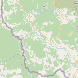
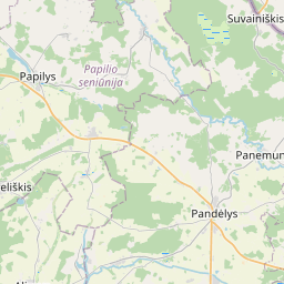
Administrative area | Administrative area: Pilskalnes pag., Aizkraukles nov. |
Transaction date | Transaction date: |
Administrative area | |
|---|---|
Address ID | Address ID: 100010113 |
Companies registered at the address | |
Departments registered at the address | |
Institutions registered at the address | |
Real estate registered at the address | |
Transactions with real estate at the address |
| Cadastral object type | Cadastre designation of the cadastral object | Person's property right status | Person status | Land Register |
|---|---|---|---|---|
| Cadastral object type: Real Estate | 32740050102 | Person's property right status: Owner | Person status: Natural person | Land Register |
22.01.2025. State land service data
|
{"7201060110":{"name":"<div class='color_dot' style='background-color: #00ffff'><\/div><span>Measured land unit<\/span>","featureColor":"#00ffff","features":{"type":"FeatureCollection","features":[{"type":"Feature","geometry":{"type":"Polygon","coordinates":[[[25.139775708,56.21255558],[25.140997782,56.212276865],[25.142317567,56.211976048],[25.143318544,56.211748996],[25.144723921,56.211429158],[25.145345548,56.211268901],[25.146005996,56.211082232],[25.146643331,56.210887894],[25.147325345,56.210660953],[25.147852485,56.210472636],[25.148343515,56.210273861],[25.148433054,56.210453239],[25.148429105,56.21061237],[25.148283476,56.21117472],[25.148180809,56.211538501],[25.148067664,56.211849527],[25.147934119,56.212135125],[25.147862355,56.212350998],[25.147864531,56.212416283],[25.147843502,56.212416164],[25.146174456,56.212406329],[25.145872808,56.213406593],[25.145857562,56.213457124],[25.146153941,56.213503115],[25.146713166,56.213593562],[25.147067114,56.213652621],[25.147809205,56.213713279],[25.147779416,56.213879748],[25.147723636,56.214037679],[25.147631983,56.214191945],[25.147498526,56.214368074],[25.147210297,56.214698361],[25.14701278,56.214885515],[25.146724296,56.215096253],[25.146430857,56.215244284],[25.146199772,56.215322639],[25.145971945,56.215367556],[25.145760219,56.215376552],[25.145070876,56.215010306],[25.144303152,56.214643091],[25.14384728,56.214914441],[25.143710837,56.214929765],[25.143647178,56.214929266],[25.143281823,56.214916236],[25.142371102,56.214865922],[25.141976199,56.214842837],[25.141908583,56.214850264],[25.141612439,56.214873133],[25.141442761,56.214886236],[25.142821764,56.214148712],[25.143035397,56.214034943],[25.141921246,56.213512944],[25.141287404,56.213218729],[25.139775708,56.21255558]]]},"crs":{"type":"name","properties":{"name":"urn:ogc:def:crs:EPSG:3059"}},"properties":{"style":{"color":"#00ffff","dashArray":"0","weight":1},"name":"Land","object_type":"Parcel","parcel_code":"32740050102","code":null,"surveyor":null,"address":"","ownership":"<span>Owner - Natural person<br><\/span>","pro_cadastre_nr":"32740050102"}},{"type":"Feature","geometry":{"type":"Polygon","coordinates":[[[25.109853193,56.209100519],[25.110566531,56.20872554],[25.110899934,56.208538743],[25.111519303,56.208193616],[25.111888242,56.207983827],[25.112120835,56.20785144],[25.112208828,56.207803566],[25.112302375,56.2077894],[25.112389178,56.207913155],[25.112754263,56.208130532],[25.113437282,56.208537259],[25.113847959,56.208769218],[25.113969745,56.208824818],[25.113647719,56.209077779],[25.113158804,56.209441915],[25.112590547,56.209771181],[25.111995772,56.210089783],[25.111336831,56.209783503],[25.111055483,56.209655492],[25.110557325,56.209423824],[25.110059291,56.209196214],[25.110035208,56.209185172],[25.10990328,56.209123818],[25.109853193,56.209100519]]]},"crs":{"type":"name","properties":{"name":"urn:ogc:def:crs:EPSG:3059"}},"properties":{"style":{"color":"#00ffff","dashArray":"0","weight":1},"name":"Land","object_type":"Parcel","parcel_code":"32740040089","code":null,"surveyor":null,"address":"","ownership":"<span>Owner - Natural person<br><\/span>","pro_cadastre_nr":"32740050102"}}]}}}
[]
https://tile.openstreetmap.org/{z}/{x}/{y}.png|© OpenStreetMap contributors|minZoom: 7|maxZoom: 19
|
Data source and license: Open data of the real estate market database, Open data of the cadastral information system, open data license: Creative Commons Attribution, OpenStreetMap

