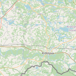
Deal ID: 943435
Transaction object type | Transaction object type: The land |
|---|---|
Object | Object: Land |
Property cadastral number | |
Administrative area | Administrative area: Andrupenes pag., Krāslavas nov. |
Transaction date | Transaction date: |
Administrative area | |
|---|---|
Address ID | Address ID: 100011806 |
Companies registered at the address | |
Departments registered at the address | |
Institutions registered at the address | |
Real estate registered at the address | |
Transactions with real estate at the address |
|
{"7201060210":{"name":"<div class='color_dot' style='background-color: #00ffff'><\/div><span>Specified land unit<\/span>","featureColor":"#00ffff","features":{"type":"FeatureCollection","features":[{"type":"Feature","geometry":{"type":"Polygon","coordinates":[[[27.453180976,56.153062941],[27.453382834,56.15264729],[27.454032415,56.152395344],[27.455050048,56.152852917],[27.456286765,56.153267423],[27.456344349,56.153286723],[27.456159596,56.153515608],[27.456152811,56.153539229],[27.456158306,56.153814934],[27.456107902,56.153809387],[27.453348439,56.153505645],[27.453180976,56.153062941]]]},"crs":{"type":"name","properties":{"name":"urn:ogc:def:crs:EPSG:3059"}},"properties":{"style":{"color":"#00ffff","dashArray":"8,12","weight":1},"name":"Land","object_type":"Parcel","parcel_code":"60420060176","code":null,"surveyor":null,"address":"","ownership":"<span>Owner - Legal entity<br><\/span>","pro_cadastre_nr":"60420060329"}},{"type":"Feature","geometry":{"type":"Polygon","coordinates":[[[27.346862195,56.201966551],[27.346943118,56.199956061],[27.34710809,56.198792302],[27.347867161,56.198942419],[27.348657582,56.199098731],[27.35142064,56.199645087],[27.350956093,56.200202109],[27.350875637,56.200220474],[27.351009361,56.200447094],[27.351106795,56.200625079],[27.351184604,56.200812884],[27.35127772,56.201211695],[27.346862195,56.201966551]]]},"crs":{"type":"name","properties":{"name":"urn:ogc:def:crs:EPSG:3059"}},"properties":{"style":{"color":"#00ffff","dashArray":"8,12","weight":1},"name":"Land","object_type":"Parcel","parcel_code":"60420010112","code":null,"surveyor":null,"address":"","ownership":"<span>Owner - Legal entity<br><\/span>","pro_cadastre_nr":"60420060329"}}]}},"7114100000":{"name":"<div class='color_dot' style='background-color: #b40000'><\/div><span>Burdened access road servitude area<\/span>","featureColor":"#b40000","features":{"type":"FeatureCollection","features":[{"type":"Feature","geometry":{"type":"Polygon","coordinates":[[[27.456107902,56.153809387],[27.456104543,56.153539528],[27.456111933,56.153511341],[27.456298966,56.153271612],[27.456344349,56.153286723],[27.456251973,56.153401166],[27.456159596,56.153515608],[27.456152811,56.153539229],[27.456158306,56.153814934],[27.456107902,56.153809387]]]},"crs":{"type":"name","properties":{"name":"urn:ogc:def:crs:EPSG:3059"}},"properties":{"style":{"color":"#b40000","dashArray":"4,2,1,2","weight":1},"name":"Burdened access road servitude area","object_type":"WayRestriction","parcel_code":"60420060176","code":"7315030100004","surveyor":null,"address":"","ownership":"<span>Owner - Legal entity<br><\/span>","pro_cadastre_nr":"60420060329"}}]}}}
[]
https://tile.openstreetmap.org/{z}/{x}/{y}.png|© OpenStreetMap contributors|minZoom: 7|maxZoom: 19
|
Data source and license: Open data of the real estate market database, Open data of the cadastral information system, open data license: Creative Commons Attribution, OpenStreetMap


