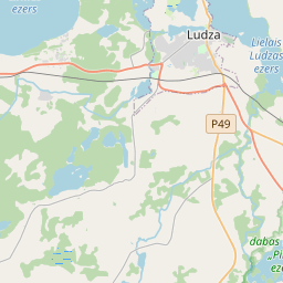
Deal ID: 886233
Transaction object type | Transaction object type: The land |
|---|---|
Object | Object: Land |
Property cadastral number | |
Administrative area | Administrative area: Cirmas pag., Ludzas nov. |
Transaction date | Transaction date: |
Administrative area | |
|---|---|
Address ID | Address ID: 100012607 |
Companies registered at the address | |
Departments registered at the address | |
Institutions registered at the address | |
Real estate registered at the address | |
Transactions with real estate at the address |
|
{"7201060210":{"name":"<div class='color_dot' style='background-color: #00ffff'><\/div><span>Specified land unit<\/span>","featureColor":"#00ffff","features":{"type":"FeatureCollection","features":[{"type":"Feature","geometry":{"type":"Polygon","coordinates":[[[27.621933493,56.516280029],[27.621926106,56.516117522],[27.621896418,56.515781945],[27.621841358,56.515078811],[27.62182118,56.514730747],[27.621776917,56.512974128],[27.621763119,56.512798447],[27.621762918,56.512682916],[27.621939261,56.512683523],[27.622724086,56.512686265],[27.622972012,56.512029437],[27.623246033,56.511304197],[27.623270635,56.511273529],[27.623430885,56.511317177],[27.624921367,56.511718487],[27.626725832,56.512117688],[27.62698826,56.51217114],[27.627353223,56.512234983],[27.627829842,56.512357797],[27.628015336,56.512421966],[27.628385432,56.512543667],[27.628696531,56.512696836],[27.629086534,56.513072621],[27.630208523,56.514198173],[27.63053727,56.514511189],[27.630694756,56.514622569],[27.630952277,56.514746163],[27.630991611,56.514765449],[27.630962499,56.514784814],[27.628084627,56.516219202],[27.627331386,56.516665852],[27.625859988,56.518005406],[27.624889022,56.518891157],[27.624881462,56.518893572],[27.624713953,56.518782505],[27.624495559,56.518648881],[27.624411182,56.51860112],[27.623293052,56.517915947],[27.622748926,56.517587082],[27.622590528,56.517489196],[27.622444567,56.517374557],[27.622376834,56.517315897],[27.622223269,56.517149043],[27.622123254,56.516989419],[27.622046121,56.516818355],[27.621991816,56.516643461],[27.621954865,56.51644319],[27.621933493,56.516280029]]]},"crs":{"type":"name","properties":{"name":"urn:ogc:def:crs:EPSG:3059"}},"properties":{"style":{"color":"#00ffff","dashArray":"8,12","weight":1},"name":"Land","object_type":"Parcel","parcel_code":"68500070075","code":null,"surveyor":null,"address":"","ownership":"<span>Owner - Natural person<br><\/span>","pro_cadastre_nr":"68500070075"}},{"type":"Feature","geometry":{"type":"Polygon","coordinates":[[[27.610715589,56.517907351],[27.610767234,56.517829333],[27.610673211,56.517113889],[27.610614653,56.516477273],[27.610561288,56.515513676],[27.610561854,56.51536107],[27.610614824,56.515038526],[27.610958258,56.514555606],[27.614824055,56.514395017],[27.61505031,56.514402731],[27.615196116,56.514393934],[27.615250691,56.514368131],[27.615570692,56.513884369],[27.615670393,56.513711467],[27.615694617,56.513666012],[27.616169165,56.513417298],[27.616208401,56.513375614],[27.617079823,56.512449773],[27.617110192,56.512407052],[27.617347832,56.512127035],[27.62160779,56.51268239],[27.621652373,56.512682815],[27.621657297,56.512802857],[27.621661148,56.512974342],[27.62167235,56.513323648],[27.621677109,56.513680245],[27.62167885,56.514026698],[27.621678808,56.514210714],[27.621681921,56.514388604],[27.621674844,56.514564859],[27.621694004,56.514697046],[27.621676905,56.514697321],[27.618348684,56.515782292],[27.616711664,56.516315988],[27.619127106,56.517420126],[27.615754221,56.518734845],[27.614239501,56.519467361],[27.61086902,56.517946548],[27.610715589,56.517907351]]]},"crs":{"type":"name","properties":{"name":"urn:ogc:def:crs:EPSG:3059"}},"properties":{"style":{"color":"#00ffff","dashArray":"8,12","weight":1},"name":"Land","object_type":"Parcel","parcel_code":"68500070074","code":null,"surveyor":null,"address":"","ownership":"<span>Owner - Natural person<br><\/span>","pro_cadastre_nr":"68500070075"}}]}},"7114100000":{"name":"<div class='color_dot' style='background-color: #b40000'><\/div><span>Burdened access road servitude area<\/span>","featureColor":"#b40000","features":{"type":"FeatureCollection","features":[{"type":"Feature","geometry":{"type":"Polygon","coordinates":[[[27.615753793,56.518730353],[27.615607976,56.518786634],[27.616131568,56.518379191],[27.617055284,56.517852298],[27.617439308,56.517747785],[27.618414136,56.517691142],[27.618323957,56.517730608],[27.617457259,56.517782858],[27.61712058,56.51787201],[27.616715777,56.518100613],[27.616181573,56.518402289],[27.615753793,56.518730353]]]},"crs":{"type":"name","properties":{"name":"urn:ogc:def:crs:EPSG:3059"}},"properties":{"style":{"color":"#b40000","dashArray":"4,2,1,2","weight":1},"name":"Burdened access road servitude area","object_type":"WayRestriction","parcel_code":"68500070074","code":"7315030100005","surveyor":null,"address":"","ownership":"<span>Owner - Natural person<br><\/span>","pro_cadastre_nr":"68500070075"}}]}}}
[]
https://tile.openstreetmap.org/{z}/{x}/{y}.png|© OpenStreetMap contributors|minZoom: 7|maxZoom: 19
|
Data source and license: Open data of the real estate market database, Open data of the cadastral information system, open data license: Creative Commons Attribution, OpenStreetMap
