Deal ID: 734079
Transaction object type | Transaction object type: The land |
|---|---|
Object | Object: Land |
Property cadastral number | |
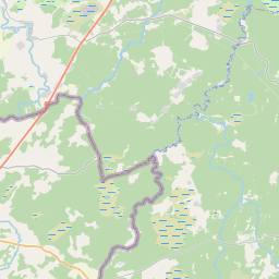
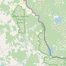
Administrative area | Administrative area: "STA 8287", Baranovka, Goliševas pag., Ludzas nov., LV-5704 |
Actual address | Actual address : Goliševa, Goliševas pag., Ludzas nov. |
Transaction date | Transaction date: |
Administrative area | |
|---|---|
Address ID | Address ID: 100149780 |
Companies registered at the address | |
Departments registered at the address | |
Institutions registered at the address | |
Real estate registered at the address | |
Transactions with real estate at the address |
| Cadastral object type | Cadastre designation of the cadastral object | Person's property right status | Person status | Land Register |
|---|---|---|---|---|
| Cadastral object type: Real Estate | 68540030140 | Person's property right status: Owner | Person status: Natural person | Land Register |
22.01.2025. State land service data
|
{"7201060210":{"name":"<div class='color_dot' style='background-color: #00ffff'><\/div><span>Specified land unit<\/span>","featureColor":"#00ffff","features":{"type":"FeatureCollection","features":[{"type":"Feature","geometry":{"type":"Polygon","coordinates":[[[27.908225176,56.74488656],[27.908246425,56.744603627],[27.908308648,56.744347896],[27.908355801,56.744360704],[27.908357901,56.74435839],[27.908605634,56.744426264],[27.90860462,56.744427375],[27.909399525,56.744636044],[27.90900035,56.7451012],[27.908976545,56.745128951],[27.908239784,56.744946322],[27.908225176,56.74488656]]]},"crs":{"type":"name","properties":{"name":"urn:ogc:def:crs:EPSG:3059"}},"properties":{"style":{"color":"#00ffff","dashArray":"8,12","weight":1},"name":"Land","object_type":"Parcel","parcel_code":"68540040507","code":null,"surveyor":null,"address":"","ownership":"<span>Owner - Natural person<br><\/span>","pro_cadastre_nr":"68540030140"}},{"type":"Feature","geometry":{"type":"Polygon","coordinates":[[[27.847688219,56.733864109],[27.847686704,56.73375128],[27.847725786,56.733692263],[27.847785157,56.733635361],[27.848091226,56.733496236],[27.8488697,56.733134071],[27.848972796,56.733190644],[27.849688497,56.733460986],[27.849771222,56.733541324],[27.849893056,56.73356901],[27.849979635,56.733598776],[27.850354508,56.733714076],[27.851142408,56.733947665],[27.851182236,56.73396724],[27.851258337,56.734008569],[27.851364878,56.734093933],[27.851437621,56.734139529],[27.851517489,56.734180741],[27.851580787,56.734207907],[27.85172643,56.734263728],[27.851730937,56.734264929],[27.851705738,56.734294905],[27.851464469,56.735512995],[27.851414656,56.735545631],[27.850868404,56.735234314],[27.85056256,56.735074015],[27.849549445,56.734679192],[27.848887621,56.734448583],[27.848332165,56.734224573],[27.847867259,56.734057891],[27.847760133,56.733996946],[27.847711297,56.733931213],[27.847688219,56.733864109]]]},"crs":{"type":"name","properties":{"name":"urn:ogc:def:crs:EPSG:3059"}},"properties":{"style":{"color":"#00ffff","dashArray":"8,12","weight":1},"name":"Land","object_type":"Parcel","parcel_code":"68540030140","code":null,"surveyor":null,"address":"","ownership":"<span>Owner - Natural person<br><\/span>","pro_cadastre_nr":"68540030140"}}]}},"7114100000":{"name":"<div class='color_dot' style='background-color: #b40000'><\/div><span>Burdened access road servitude area<\/span>","featureColor":"#b40000","features":{"type":"FeatureCollection","features":[{"type":"Feature","geometry":{"type":"Polygon","coordinates":[[[27.849752818,56.733564184],[27.849771222,56.733541324],[27.849893056,56.73356901],[27.849979635,56.733598776],[27.850354508,56.733714076],[27.851142408,56.733947665],[27.851182236,56.73396724],[27.851258337,56.734008569],[27.851364878,56.734093933],[27.851437621,56.734139529],[27.851517489,56.734180741],[27.851580787,56.734207907],[27.85172643,56.734263728],[27.851730937,56.734264929],[27.851710375,56.734289385],[27.851701578,56.73428704],[27.851551677,56.73422958],[27.851485574,56.734201214],[27.851402354,56.734158271],[27.851326116,56.734110491],[27.851220572,56.734025922],[27.851148664,56.733986874],[27.851114055,56.733969862],[27.850330913,56.733737681],[27.849959856,56.733623549],[27.849860677,56.733588634],[27.849752818,56.733564184]]]},"crs":{"type":"name","properties":{"name":"urn:ogc:def:crs:EPSG:3059"}},"properties":{"style":{"color":"#b40000","dashArray":"4,2,1,2","weight":1},"name":"Burdened access road servitude area","object_type":"WayRestriction","parcel_code":"68540030140","code":"7315030100005","surveyor":null,"address":"","ownership":"<span>Owner - Natural person<br><\/span>","pro_cadastre_nr":"68540030140"}}]}}}
[]
https://tile.openstreetmap.org/{z}/{x}/{y}.png|© OpenStreetMap contributors|minZoom: 7|maxZoom: 19
|
Data source and license: Open data of the real estate market database, Open data of the cadastral information system, open data license: Creative Commons Attribution, OpenStreetMap

