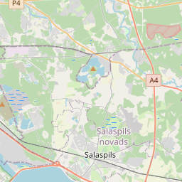
Deal ID: 669825
Transaction object type | Transaction object type: Land and buildings |
|---|---|
Object | Object: Buildings |
Property cadastral number | |
Address record | Address record: Radiostacijas iela 21, Ulbroka, Stopiņu pag., Ropažu nov., LV-2130 |
Actual address | Actual address : Acones iela 20, Ulbroka, Stopiņu pag., Ropažu nov., LV-2130 |
Transaction date | Transaction date: |
Address | |
|---|---|
Address ID | Address ID: 105206330 |
Companies registered at the address | Companies registered at the address: 0 |
Departments registered at the address | |
Institutions registered at the address | Institutions registered at the address: 0 |
Real estate registered at the address | |
Transactions with real estate at the address |
|
{"7201060110":{"name":"<div class='color_dot' style='background-color: #00ffff'><\/div><span>Measured land unit<\/span>","featureColor":"#00ffff","features":{"type":"FeatureCollection","features":[{"type":"Feature","geometry":{"type":"Polygon","coordinates":[[[24.28656345,56.934595516],[24.28642024,56.934726511],[24.286493338,56.934885713],[24.285738336,56.935406757],[24.285263047,56.935734747],[24.285140214,56.935819518],[24.284942584,56.936153136],[24.284701737,56.936619305],[24.284002172,56.936422304],[24.283826911,56.936372915],[24.286162904,56.934102172],[24.28625485,56.934012781],[24.286530234,56.934078153],[24.286383428,56.934102071],[24.286023364,56.934401224],[24.28656345,56.934595516]]]},"crs":{"type":"name","properties":{"name":"urn:ogc:def:crs:EPSG:3059"}},"properties":{"style":{"color":"#00ffff","dashArray":"0","weight":1},"name":"Land","object_type":"Parcel","parcel_code":"80960031656","code":null,"surveyor":null,"address":"Acones iela 20, Ulbroka, Stopi\u0146u pag., Ropa\u017eu nov., LV-2130","ownership":"<span>Owner - Legal entity<br><\/span>","pro_cadastre_nr":"80960030238"}},{"type":"Feature","geometry":{"type":"Polygon","coordinates":[[[24.286530234,56.934078153],[24.286600232,56.934094774],[24.286963751,56.934229333],[24.28656345,56.934595516],[24.286023364,56.934401224],[24.286383428,56.934102071],[24.286530234,56.934078153]]]},"crs":{"type":"name","properties":{"name":"urn:ogc:def:crs:EPSG:3059"}},"properties":{"style":{"color":"#00ffff","dashArray":"0","weight":1},"name":"Land","object_type":"Parcel","parcel_code":"80960031655","code":null,"surveyor":null,"address":"Acones iela 18, Ulbroka, Stopi\u0146u pag., Ropa\u017eu nov., LV-2130","ownership":"<span>Owner - Legal entity<br><\/span>","pro_cadastre_nr":"80960030238"}},{"type":"Feature","geometry":{"type":"Polygon","coordinates":[[[24.28292375,56.93990601],[24.28306625,56.939820253],[24.283916317,56.939705223],[24.284405872,56.93963897],[24.284452907,56.939701344],[24.284466703,56.939719639],[24.28415169,56.939786107],[24.28410281,56.939777162],[24.283596933,56.939845615],[24.283111381,56.939911326],[24.283001734,56.939923253],[24.282941204,56.93992984],[24.28292375,56.93990601]]]},"crs":{"type":"name","properties":{"name":"urn:ogc:def:crs:EPSG:3059"}},"properties":{"style":{"color":"#00ffff","dashArray":"0","weight":1},"name":"Land","object_type":"Parcel","parcel_code":"80960031578","code":null,"surveyor":null,"address":"","ownership":"<span>Owner - Legal entity<br><\/span>","pro_cadastre_nr":"80960030238"}},{"type":"Feature","geometry":{"type":"Polygon","coordinates":[[[24.285807335,56.938749945],[24.285855307,56.938743484],[24.285927496,56.93873376],[24.285971925,56.938801171],[24.286026062,56.938900163],[24.286071442,56.939005896],[24.286091392,56.939074341],[24.28609999,56.939111199],[24.286124001,56.939179815],[24.286123839,56.939248908],[24.286123648,56.939320463],[24.286086942,56.939471984],[24.285950206,56.939706365],[24.285858549,56.939695866],[24.285897279,56.939628248],[24.285948717,56.939522564],[24.285993498,56.939363119],[24.286007193,56.939222],[24.2859451,56.938989691],[24.285807335,56.938749945]]]},"crs":{"type":"name","properties":{"name":"urn:ogc:def:crs:EPSG:3059"}},"properties":{"style":{"color":"#00ffff","dashArray":"0","weight":1},"name":"Land","object_type":"Parcel","parcel_code":"80960031577","code":null,"surveyor":null,"address":"","ownership":"<span>Owner - Legal entity<br><\/span>","pro_cadastre_nr":"80960030238"}},{"type":"Feature","geometry":{"type":"Polygon","coordinates":[[[24.285644285,56.940069814],[24.285784885,56.93982442],[24.285876939,56.939839688],[24.285860679,56.939871159],[24.285768881,56.940037709],[24.285644285,56.940069814]]]},"crs":{"type":"name","properties":{"name":"urn:ogc:def:crs:EPSG:3059"}},"properties":{"style":{"color":"#00ffff","dashArray":"0","weight":1},"name":"Land","object_type":"Parcel","parcel_code":"80960031576","code":null,"surveyor":null,"address":"","ownership":"<span>Owner - Legal entity<br><\/span>","pro_cadastre_nr":"80960030238"}},{"type":"Feature","geometry":{"type":"Polygon","coordinates":[[[24.284542825,56.941134844],[24.284559592,56.941130844],[24.284596122,56.941112758],[24.2847157,56.941053571],[24.285154147,56.940725488],[24.285274706,56.940674456],[24.285282602,56.940684023],[24.285331547,56.94071857],[24.285225553,56.940763434],[24.284789378,56.941089823],[24.28461385,56.941176699],[24.284578433,56.941155318],[24.284554876,56.94114177],[24.284542825,56.941134844]]]},"crs":{"type":"name","properties":{"name":"urn:ogc:def:crs:EPSG:3059"}},"properties":{"style":{"color":"#00ffff","dashArray":"0","weight":1},"name":"Land","object_type":"Parcel","parcel_code":"80960031575","code":null,"surveyor":null,"address":"","ownership":"<span>Owner - Legal entity<br><\/span>","pro_cadastre_nr":"80960030238"}},{"type":"Feature","geometry":{"type":"Polygon","coordinates":[[[24.283146783,56.937330269],[24.284002172,56.936422304],[24.284701737,56.936619305],[24.284522442,56.936966356],[24.28499419,56.938201123],[24.285047818,56.938341513],[24.285052217,56.938381705],[24.285152366,56.938598898],[24.28568389,56.938766559],[24.285807335,56.938749945],[24.2859451,56.938989691],[24.286007193,56.939222],[24.285993498,56.939363119],[24.285948717,56.939522564],[24.285897279,56.939628248],[24.285858549,56.939695866],[24.285763604,56.939684989],[24.285717383,56.939813228],[24.285784885,56.93982442],[24.285644285,56.940069814],[24.284928051,56.940254354],[24.284617438,56.940007841],[24.284942037,56.939885635],[24.284667235,56.939617165],[24.284483502,56.939670236],[24.284452907,56.939701344],[24.284405872,56.93963897],[24.284452335,56.939632684],[24.284717033,56.939509365],[24.284790388,56.939553236],[24.284862111,56.93953391],[24.284316928,56.939209414],[24.283294061,56.938422524],[24.283146783,56.937330269]]]},"crs":{"type":"name","properties":{"name":"urn:ogc:def:crs:EPSG:3059"}},"properties":{"style":{"color":"#00ffff","dashArray":"0","weight":1},"name":"Land","object_type":"Parcel","parcel_code":"80960031574","code":null,"surveyor":null,"address":"Radiostacijas iela 23, Ulbroka, Stopi\u0146u pag., Ropa\u017eu nov., LV-2130","ownership":"<span>Owner - Legal entity<br><\/span>","pro_cadastre_nr":"80960030238"}},{"type":"Feature","geometry":{"type":"Polygon","coordinates":[[[24.265813827,56.934498349],[24.265873074,56.934467041],[24.267116851,56.935304467],[24.26783829,56.936895298],[24.274155663,56.937577552],[24.277010727,56.939235045],[24.276912131,56.939243322],[24.274114059,56.937618824],[24.267773945,56.936933239],[24.267041038,56.935324249],[24.265813827,56.934498349]]]},"crs":{"type":"name","properties":{"name":"urn:ogc:def:crs:EPSG:3059"}},"properties":{"style":{"color":"#00ffff","dashArray":"0","weight":1},"name":"Land","object_type":"Parcel","parcel_code":"80960030743","code":null,"surveyor":null,"address":"","ownership":"<span>Owner - Legal entity<br><\/span>","pro_cadastre_nr":"80960030238"}}]}},"7114100000":{"name":"<div class='color_dot' style='background-color: #b40000'><\/div><span>Burdened access road servitude area<\/span>","featureColor":"#b40000","features":{"type":"FeatureCollection","features":[{"type":"Feature","geometry":{"type":"Polygon","coordinates":[[[24.28461385,56.941176699],[24.284578433,56.941155318],[24.284752539,56.941071697],[24.285189858,56.940744461],[24.285300342,56.940697728],[24.285331547,56.94071857],[24.285225553,56.940763434],[24.284789378,56.941089823],[24.28461385,56.941176699]]]},"crs":{"type":"name","properties":{"name":"urn:ogc:def:crs:EPSG:3059"}},"properties":{"style":{"color":"#b40000","dashArray":"4,2,1,2","weight":1},"name":"Burdened access road servitude area","object_type":"WayRestriction","parcel_code":"80960031575","code":"7315030100004","surveyor":null,"address":"","ownership":"<span>Owner - Legal entity<br><\/span>","pro_cadastre_nr":"80960030238"}}]}},"5201011110":{"name":"<div class='color_dot' style='background-color: #ff0000'><\/div><span>Measured building<\/span>","featureColor":"#ff0000","features":{"type":"FeatureCollection","features":[{"type":"Feature","geometry":{"type":"Polygon","coordinates":[[[24.284839516,56.939644317],[24.285073518,56.939584186],[24.285070334,56.939580366],[24.28509866,56.939572926],[24.285093952,56.939567574],[24.285230186,56.93953158],[24.285213127,56.939512358],[24.285210017,56.939511862],[24.2851931,56.939491724],[24.285372994,56.939444023],[24.285391049,56.939464662],[24.285390333,56.93946558],[24.285395953,56.939471973],[24.285437781,56.939461304],[24.285449208,56.939474951],[24.285468854,56.9394693],[24.28547338,56.939474437],[24.285490668,56.939469897],[24.285486192,56.939464805],[24.285505775,56.93945954],[24.285510334,56.939464723],[24.285532149,56.939458995],[24.285525362,56.939452686],[24.285538578,56.939448667],[24.285545959,56.939455361],[24.285576614,56.939447305],[24.285580331,56.939451959],[24.285853298,56.939381011],[24.285858285,56.939386327],[24.285873851,56.939382258],[24.285936689,56.939454172],[24.285689308,56.939520363],[24.285711585,56.939545026],[24.285672796,56.939555437],[24.285677404,56.939560511],[24.285509826,56.939604698],[24.285518762,56.93961491],[24.285469588,56.93962777],[24.285496957,56.939658449],[24.285390919,56.939686477],[24.285428738,56.939729764],[24.285244345,56.939778256],[24.285207108,56.939735803],[24.28513556,56.939754365],[24.285108259,56.939723838],[24.285071489,56.939708102],[24.285064238,56.939709879],[24.285063226,56.939708651],[24.285025058,56.939718584],[24.285026119,56.939719803],[24.285019853,56.93972138],[24.285018825,56.939720152],[24.284980952,56.939730102],[24.284982062,56.939731304],[24.28497647,56.939732844],[24.284975359,56.939731642],[24.284932847,56.939743005],[24.284933908,56.939744224],[24.284927724,56.939745846],[24.284926647,56.93974469],[24.284912769,56.939748108],[24.284905251,56.939740723],[24.284918768,56.939737341],[24.28488127,56.939692976],[24.284883665,56.939692377],[24.284865195,56.9396712],[24.284863112,56.939671735],[24.284839516,56.939644317]]]},"crs":{"type":"name","properties":{"name":"urn:ogc:def:crs:EPSG:3059"}},"properties":{"style":{"color":"#ff0000","dashArray":"0","weight":1},"name":"Building","object_type":"Building","parcel_code":"80960031574","code":"80960030238015","surveyor":null,"address":"Radiostacijas iela 23, Ulbroka, Stopi\u0146u pag., Ropa\u017eu nov., LV-2130","ownership":"<span>Owner - Legal entity<br><\/span>","pro_cadastre_nr":"80960030238"}},{"type":"Feature","geometry":{"type":"Polygon","coordinates":[[[24.284839516,56.939644317],[24.285073518,56.939584186],[24.285070334,56.939580366],[24.28509866,56.939572926],[24.285093952,56.939567574],[24.285230186,56.93953158],[24.285213127,56.939512358],[24.285210017,56.939511862],[24.2851931,56.939491724],[24.285372994,56.939444023],[24.285391049,56.939464662],[24.285390333,56.93946558],[24.285395953,56.939471973],[24.285437781,56.939461304],[24.285449208,56.939474951],[24.285468854,56.9394693],[24.28547338,56.939474437],[24.285490668,56.939469897],[24.285486192,56.939464805],[24.285505775,56.93945954],[24.285510334,56.939464723],[24.285532149,56.939458995],[24.285525362,56.939452686],[24.285538578,56.939448667],[24.285545959,56.939455361],[24.285576614,56.939447305],[24.285580331,56.939451959],[24.285853298,56.939381011],[24.285858285,56.939386327],[24.285873851,56.939382258],[24.285936689,56.939454172],[24.285689308,56.939520363],[24.285711585,56.939545026],[24.285672796,56.939555437],[24.285677404,56.939560511],[24.285509826,56.939604698],[24.285518762,56.93961491],[24.285469588,56.93962777],[24.285496957,56.939658449],[24.285390919,56.939686477],[24.285428738,56.939729764],[24.285244345,56.939778256],[24.285207108,56.939735803],[24.28513556,56.939754365],[24.285108259,56.939723838],[24.285071489,56.939708102],[24.285064238,56.939709879],[24.285063226,56.939708651],[24.285025058,56.939718584],[24.285026119,56.939719803],[24.285019853,56.93972138],[24.285018825,56.939720152],[24.284980952,56.939730102],[24.284982062,56.939731304],[24.28497647,56.939732844],[24.284975359,56.939731642],[24.284932847,56.939743005],[24.284933908,56.939744224],[24.284927724,56.939745846],[24.284926647,56.93974469],[24.284912769,56.939748108],[24.284905251,56.939740723],[24.284918768,56.939737341],[24.28488127,56.939692976],[24.284883665,56.939692377],[24.284865195,56.9396712],[24.284863112,56.939671735],[24.284839516,56.939644317]]]},"crs":{"type":"name","properties":{"name":"urn:ogc:def:crs:EPSG:3059"}},"properties":{"style":{"color":"#ff0000","dashArray":"0","weight":1},"name":"Building","object_type":"Building","parcel_code":"80960031574","code":"80960030238015","surveyor":null,"address":"Radiostacijas iela 23, Ulbroka, Stopi\u0146u pag., Ropa\u017eu nov., LV-2130","ownership":"<span>Owner - Legal entity<br><\/span>","pro_cadastre_nr":"80960030238"}}]}}}
{"7201060110":{"name":"<div class='color_dot' style='background-color: #00ffff'><\/div><span>Measured land unit<\/span>","featureColor":"#00ffff","features":{"type":"FeatureCollection","features":[{"type":"Feature","geometry":{"type":"Polygon","coordinates":[[[24.28292375,56.93990601],[24.28306625,56.939820253],[24.283916317,56.939705223],[24.284405872,56.93963897],[24.284452907,56.939701344],[24.284466703,56.939719639],[24.28415169,56.939786107],[24.28410281,56.939777162],[24.283596933,56.939845615],[24.283111381,56.939911326],[24.282941204,56.93992984],[24.28292375,56.93990601]]]},"crs":{"type":"name","properties":{"name":"urn:ogc:def:crs:EPSG:3059"}},"properties":{"style":{"color":"#00ffff","dashArray":"0","weight":1},"name":"Land","object_type":"Parcel","parcel_code":"80960031578","code":null,"surveyor":null,"address":"","ownership":"<span>Owner - Legal entity<br><\/span>","pro_cadastre_nr":"80960030238"}},{"type":"Feature","geometry":{"type":"Polygon","coordinates":[[[24.285644285,56.940069814],[24.285784885,56.93982442],[24.285876939,56.939839688],[24.285860679,56.939871159],[24.285768881,56.940037709],[24.285644285,56.940069814]]]},"crs":{"type":"name","properties":{"name":"urn:ogc:def:crs:EPSG:3059"}},"properties":{"style":{"color":"#00ffff","dashArray":"0","weight":1},"name":"Land","object_type":"Parcel","parcel_code":"80960031576","code":null,"surveyor":null,"address":"","ownership":"<span>Owner - Legal entity<br><\/span>","pro_cadastre_nr":"80960030238"}},{"type":"Feature","geometry":{"type":"Polygon","coordinates":[[[24.284542825,56.941134844],[24.284559592,56.941130844],[24.284596122,56.941112758],[24.2847157,56.941053571],[24.285154147,56.940725488],[24.285274706,56.940674456],[24.285282602,56.940684023],[24.285331547,56.94071857],[24.285225553,56.940763434],[24.284789378,56.941089823],[24.28461385,56.941176699],[24.284578433,56.941155318],[24.284554876,56.94114177],[24.284542825,56.941134844]]]},"crs":{"type":"name","properties":{"name":"urn:ogc:def:crs:EPSG:3059"}},"properties":{"style":{"color":"#00ffff","dashArray":"0","weight":1},"name":"Land","object_type":"Parcel","parcel_code":"80960031575","code":null,"surveyor":null,"address":"","ownership":"<span>Owner - Legal entity<br><\/span>","pro_cadastre_nr":"80960030238"}},{"type":"Feature","geometry":{"type":"Polygon","coordinates":[[[24.283146783,56.937330269],[24.284002172,56.936422304],[24.284701737,56.936619305],[24.284522442,56.936966356],[24.28499419,56.938201123],[24.285047818,56.938341513],[24.285052217,56.938381705],[24.285152366,56.938598898],[24.28568389,56.938766559],[24.285807335,56.938749945],[24.2859451,56.938989691],[24.286007193,56.939222],[24.285993498,56.939363119],[24.285948717,56.939522564],[24.285897279,56.939628248],[24.285858549,56.939695866],[24.285763604,56.939684989],[24.285717383,56.939813228],[24.285784885,56.93982442],[24.285644285,56.940069814],[24.284928051,56.940254354],[24.284617438,56.940007841],[24.284942037,56.939885635],[24.284667235,56.939617165],[24.284483502,56.939670236],[24.284452907,56.939701344],[24.284405872,56.93963897],[24.284452335,56.939632684],[24.284717033,56.939509365],[24.284790388,56.939553236],[24.284862111,56.93953391],[24.284316928,56.939209414],[24.283294061,56.938422524],[24.283146783,56.937330269]]]},"crs":{"type":"name","properties":{"name":"urn:ogc:def:crs:EPSG:3059"}},"properties":{"style":{"color":"#00ffff","dashArray":"0","weight":1},"name":"Land","object_type":"Parcel","parcel_code":"80960031574","code":null,"surveyor":null,"address":"Radiostacijas iela 23, Ulbroka, Stopi\u0146u pag., Ropa\u017eu nov., LV-2130","ownership":"<span>Owner - Legal entity<br><\/span>","pro_cadastre_nr":"80960030238"}}]}}}
https://tile.openstreetmap.org/{z}/{x}/{y}.png|© OpenStreetMap contributors|minZoom: 7|maxZoom: 19
|
Data source and license: Open data of the real estate market database, Open data of the cadastral information system, open data license: Creative Commons Attribution, OpenStreetMap


