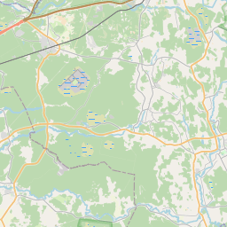
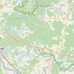
Deal ID: 635193
Transaction object type | Transaction object type: The land |
|---|---|
Object | Object: Land |
Property cadastral number | |
Address record | Address record: Mālpils pag., Mālpils nov. |
Actual address | Actual address : Mālpils pag., Siguldas nov. |
Transaction date | Transaction date: |
Address | |
|---|---|
Address ID | Address ID: 105520033 |
Companies registered at the address | Companies registered at the address: 0 |
Departments registered at the address | Departments registered at the address: 0 |
Institutions registered at the address | Institutions registered at the address: 0 |
Real estate registered at the address | |
Transactions with real estate at the address |
| Cadastral object type | Cadastre designation of the cadastral object | Person's property right status | Person status | Land Register |
|---|---|---|---|---|
| Cadastral object type: Real Estate | 80740010525 | Person's property right status: Owner | Person status: Natural person | Land Register |
09.01.2025. State land service data
|
{"7201060110":{"name":"<div class='color_dot' style='background-color: #00ffff'><\/div><span>Measured land unit<\/span>","featureColor":"#00ffff","features":{"type":"FeatureCollection","features":[{"type":"Feature","geometry":{"type":"Polygon","coordinates":[[[24.978562777,57.000844602],[24.978971983,57.000752676],[24.979280786,57.000666583],[24.979687275,57.000577273],[24.979838238,57.000530919],[24.98014819,57.000438608],[24.980257204,57.00040976],[24.980398055,57.000392728],[24.980793182,57.000275365],[24.980992889,57.000153351],[24.981031009,57.000191234],[24.981869426,57.001024245],[24.98304336,57.001133979],[24.985140431,57.001353315],[24.985796398,57.001442806],[24.987564619,57.001675246],[24.989340737,57.001865087],[24.989423601,57.001873946],[24.989265414,57.002078379],[24.989030628,57.002347608],[24.988729603,57.002588818],[24.988522461,57.002670869],[24.988223119,57.002782039],[24.988154855,57.002766298],[24.984911621,57.002026635],[24.980190199,57.000929345],[24.978765234,57.000855147],[24.978562777,57.000844602]]]},"crs":{"type":"name","properties":{"name":"urn:ogc:def:crs:EPSG:3059"}},"properties":{"style":{"color":"#00ffff","dashArray":"0","weight":1},"name":"Land","object_type":"Parcel","parcel_code":"80740030429","code":null,"surveyor":null,"address":"","ownership":"<span>Owner - Natural person<br><\/span>","pro_cadastre_nr":"80740010525"}},{"type":"Feature","geometry":{"type":"Polygon","coordinates":[[[24.92211462,57.042389964],[24.922197769,57.042242366],[24.92228903,57.042073686],[24.922393446,57.041875847],[24.922489093,57.041696677],[24.922578756,57.041518782],[24.922712906,57.041281994],[24.922685747,57.041216225],[24.924436715,57.039522353],[24.926595573,57.037113923],[24.929454293,57.037416171],[24.929441798,57.03744441],[24.928737377,57.039036365],[24.928664924,57.03910006],[24.928591145,57.039177374],[24.928483285,57.039394713],[24.928276055,57.039643334],[24.928039592,57.039856441],[24.927814283,57.040043116],[24.927641088,57.04018241],[24.927498167,57.04034225],[24.927347376,57.0404978],[24.927235707,57.040609003],[24.92714614,57.040746742],[24.92710867,57.040802585],[24.926958187,57.040979927],[24.926722231,57.041202758],[24.926461385,57.041419619],[24.926205465,57.041623964],[24.925911233,57.041816715],[24.925699405,57.041968455],[24.925590056,57.042034145],[24.925488794,57.042094978],[24.924192046,57.042296395],[24.923246202,57.042458684],[24.922763784,57.042474663],[24.92211462,57.042389964]]]},"crs":{"type":"name","properties":{"name":"urn:ogc:def:crs:EPSG:3059"}},"properties":{"style":{"color":"#00ffff","dashArray":"0","weight":1},"name":"Land","object_type":"Parcel","parcel_code":"80740010303","code":null,"surveyor":null,"address":"","ownership":"<span>Owner - Natural person<br><\/span>","pro_cadastre_nr":"80740010525"}}]}},"7114100000":{"name":"<div class='color_dot' style='background-color: #b40000'><\/div><span>Burdened access road servitude area<\/span>","featureColor":"#b40000","features":{"type":"FeatureCollection","features":[{"type":"Feature","geometry":{"type":"Polygon","coordinates":[[[24.925488517,57.042094441],[24.925401293,57.042107438],[24.92566135,57.041951209],[24.925872547,57.041799931],[24.926165952,57.041607708],[24.926420288,57.041404632],[24.926680117,57.041188624],[24.926914254,57.040967513],[24.927062944,57.040792278],[24.927099636,57.040737608],[24.927190441,57.040597964],[24.92730383,57.040485033],[24.927454075,57.040330044],[24.927598199,57.040168874],[24.927773171,57.040028148],[24.927997786,57.039842053],[24.928232251,57.039630739],[24.928436616,57.039385563],[24.928544822,57.039167521],[24.928621925,57.039086723],[24.928691186,57.039025837],[24.929398728,57.037426816],[24.929447054,57.037432476],[24.92944201,57.037443654],[24.92873726,57.039036303],[24.928665688,57.039099012],[24.928591127,57.039176674],[24.928481489,57.039394726],[24.928276044,57.039642884],[24.928040603,57.039855356],[24.927817375,57.040040218],[24.927641088,57.04018241],[24.927498156,57.040341774],[24.927348334,57.040496535],[24.927235652,57.040606757],[24.92714614,57.040746742],[24.92710867,57.040802585],[24.926957776,57.04097993],[24.926722231,57.041202758],[24.926461385,57.041419619],[24.926205465,57.041623964],[24.925911233,57.041816715],[24.925699405,57.041968455],[24.925488517,57.042094441]]]},"crs":{"type":"name","properties":{"name":"urn:ogc:def:crs:EPSG:3059"}},"properties":{"style":{"color":"#b40000","dashArray":"4,2,1,2","weight":1},"name":"Burdened access road servitude area","object_type":"WayRestriction","parcel_code":"80740010303","code":"7315030100004","surveyor":null,"address":"","ownership":"<span>Owner - Natural person<br><\/span>","pro_cadastre_nr":"80740010525"}}]}}}
[]
https://tile.openstreetmap.org/{z}/{x}/{y}.png|© OpenStreetMap contributors|minZoom: 7|maxZoom: 19
|
Data source and license: Open data of the real estate market database, Open data of the cadastral information system, open data license: Creative Commons Attribution, OpenStreetMap


