Deal ID: 530361
Transaction object type | Transaction object type: Land and buildings |
|---|---|
Object | Object: Land with buildings |
Property cadastral number | |
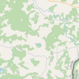
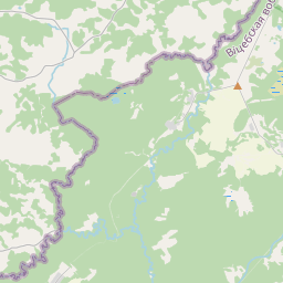
Address record | Address record: "Rūta", Podvigailova, Bērziņu pag., Krāslavas nov., LV-5697 |
Transaction date | Transaction date: |
Address | |
|---|---|
Address ID | Address ID: 102758002 |
Companies registered at the address | Companies registered at the address: 0 |
Departments registered at the address | Departments registered at the address: 0 |
Institutions registered at the address | Institutions registered at the address: 0 |
Real estate registered at the address | |
Transactions with real estate at the address |
|
{"7201060210":{"name":"<div class='color_dot' style='background-color: #00ffff'><\/div><span>Specified land unit<\/span>","featureColor":"#00ffff","features":{"type":"FeatureCollection","features":[{"type":"Feature","geometry":{"type":"Polygon","coordinates":[[[27.854247706,56.087701249],[27.855363129,56.085202617],[27.857520661,56.086161135],[27.861630983,56.085222321],[27.86166487,56.085252023],[27.862499763,56.085563738],[27.862668057,56.085640433],[27.862949492,56.085821871],[27.862491918,56.086049276],[27.862113992,56.086237098],[27.86221872,56.086551929],[27.866500743,56.087284027],[27.866229044,56.087604787],[27.861827506,56.086896457],[27.861690854,56.086797377],[27.860400604,56.086798214],[27.859941593,56.086897654],[27.859756993,56.08696505],[27.85963026,56.087073375],[27.859226554,56.087651309],[27.858868731,56.087874597],[27.858620293,56.087996352],[27.858032565,56.088185215],[27.857818553,56.088188],[27.857578672,56.088170326],[27.857020034,56.088118911],[27.856120091,56.088045003],[27.855423275,56.087987767],[27.854614474,56.087907933],[27.854247706,56.087701249]]]},"crs":{"type":"name","properties":{"name":"urn:ogc:def:crs:EPSG:3059"}},"properties":{"style":{"color":"#00ffff","dashArray":"8,12","weight":1},"name":"Land","object_type":"Parcel","parcel_code":"60500030291","code":null,"surveyor":null,"address":"\"R\u016bta\", Podvigailova, B\u0113rzi\u0146u pag., Kr\u0101slavas nov., LV-5697","ownership":"<span>Owner - Legal entity<br><\/span>","pro_cadastre_nr":"60500030291"}},{"type":"Feature","geometry":{"type":"Polygon","coordinates":[[[27.837307298,56.07961379],[27.837404856,56.079277718],[27.837501234,56.079173265],[27.837555047,56.079122141],[27.837637785,56.079065638],[27.837766852,56.078994455],[27.837951722,56.078909756],[27.838123292,56.078847016],[27.83827344,56.078775365],[27.838403149,56.07870436],[27.83845937,56.078650939],[27.838544394,56.078585615],[27.838615392,56.078508776],[27.838678422,56.07842071],[27.838744222,56.078329304],[27.838846451,56.078222797],[27.838985412,56.078111496],[27.839127789,56.077996086],[27.839308079,56.077885332],[27.839509923,56.077783375],[27.8397073,56.077632054],[27.839718456,56.077747143],[27.839780251,56.078385085],[27.839918391,56.078982746],[27.839966595,56.079346608],[27.83863925,56.079697581],[27.837307298,56.07961379]]]},"crs":{"type":"name","properties":{"name":"urn:ogc:def:crs:EPSG:3059"}},"properties":{"style":{"color":"#00ffff","dashArray":"8,12","weight":1},"name":"Land","object_type":"Parcel","parcel_code":"60500020077","code":null,"surveyor":null,"address":"","ownership":"<span>Owner - Legal entity<br><\/span>","pro_cadastre_nr":"60500030291"}}]}},"5201011110":{"name":"<div class='color_dot' style='background-color: #ff0000'><\/div><span>Measured building<\/span>","featureColor":"#ff0000","features":{"type":"FeatureCollection","features":[{"type":"Feature","geometry":{"type":"Polygon","coordinates":[[[27.861027246,56.086216397],[27.861063314,56.086166231],[27.861251336,56.086205944],[27.861215268,56.08625611],[27.861027246,56.086216397]]]},"crs":{"type":"name","properties":{"name":"urn:ogc:def:crs:EPSG:3059"}},"properties":{"style":{"color":"#ff0000","dashArray":"0","weight":1},"name":"Building","object_type":"Building","parcel_code":"60500030291","code":"60500030291002","surveyor":null,"address":"\"R\u016bta\", Podvigailova, B\u0113rzi\u0146u pag., Kr\u0101slavas nov., LV-5697","ownership":null,"pro_cadastre_nr":null}},{"type":"Feature","geometry":{"type":"Polygon","coordinates":[[[27.861034904,56.08634583],[27.860920243,56.086295879],[27.860979634,56.086262752],[27.861094296,56.086312703],[27.861034904,56.08634583]]]},"crs":{"type":"name","properties":{"name":"urn:ogc:def:crs:EPSG:3059"}},"properties":{"style":{"color":"#ff0000","dashArray":"0","weight":1},"name":"Building","object_type":"Building","parcel_code":"60500030291","code":"60500030291003","surveyor":null,"address":"\"R\u016bta\", Podvigailova, B\u0113rzi\u0146u pag., Kr\u0101slavas nov., LV-5697","ownership":null,"pro_cadastre_nr":null}},{"type":"Feature","geometry":{"type":"Polygon","coordinates":[[[27.86104154,56.086601522],[27.860983233,56.086572432],[27.861015121,56.086552135],[27.861073427,56.086581226],[27.86104154,56.086601522]]]},"crs":{"type":"name","properties":{"name":"urn:ogc:def:crs:EPSG:3059"}},"properties":{"style":{"color":"#ff0000","dashArray":"0","weight":1},"name":"Building","object_type":"Building","parcel_code":"60500030291","code":"60500030291005","surveyor":null,"address":"\"R\u016bta\", Podvigailova, B\u0113rzi\u0146u pag., Kr\u0101slavas nov., LV-5697","ownership":null,"pro_cadastre_nr":null}},{"type":"Feature","geometry":{"type":"Polygon","coordinates":[[[27.861329675,56.086553804],[27.861222395,56.086480098],[27.86132721,56.086431592],[27.86143454,56.086500665],[27.861329675,56.086553804]]]},"crs":{"type":"name","properties":{"name":"urn:ogc:def:crs:EPSG:3059"}},"properties":{"style":{"color":"#ff0000","dashArray":"0","weight":1},"name":"Building","object_type":"Building","parcel_code":"60500030291","code":"60500030291001","surveyor":null,"address":"\"R\u016bta\", Podvigailova, B\u0113rzi\u0146u pag., Kr\u0101slavas nov., LV-5697","ownership":null,"pro_cadastre_nr":null}},{"type":"Feature","geometry":{"type":"Polygon","coordinates":[[[27.861094296,56.086312703],[27.861019021,56.086279908],[27.861050978,56.086262082],[27.861118601,56.086295557],[27.861094296,56.086312703]]]},"crs":{"type":"name","properties":{"name":"urn:ogc:def:crs:EPSG:3059"}},"properties":{"style":{"color":"#ff0000","dashArray":"0","weight":1},"name":"Building","object_type":"Building","parcel_code":"60500030291","code":"60500030291004","surveyor":null,"address":"\"R\u016bta\", Podvigailova, B\u0113rzi\u0146u pag., Kr\u0101slavas nov., LV-5697","ownership":null,"pro_cadastre_nr":null}}]}}}
{"7201060210":{"name":"<div class='color_dot' style='background-color: #00ffff'><\/div><span>Specified land unit<\/span>","featureColor":"#00ffff","features":{"type":"FeatureCollection","features":[{"type":"Feature","geometry":{"type":"Polygon","coordinates":[[[27.854247706,56.087701249],[27.855363129,56.085202617],[27.857520661,56.086161135],[27.861630983,56.085222321],[27.86166487,56.085252023],[27.862499763,56.085563738],[27.862668057,56.085640433],[27.862949492,56.085821871],[27.862491918,56.086049276],[27.862113992,56.086237098],[27.86221872,56.086551929],[27.866500743,56.087284027],[27.866229044,56.087604787],[27.861868815,56.086903104],[27.861739005,56.086804717],[27.860706151,56.086800184],[27.860346787,56.086812983],[27.860005413,56.086839192],[27.859716213,56.086987297],[27.859609701,56.087095016],[27.859373516,56.087497128],[27.859027794,56.087791618],[27.858962274,56.087835052],[27.858620293,56.087996352],[27.858032565,56.088185215],[27.857818553,56.088188],[27.857578672,56.088170326],[27.857020034,56.088118911],[27.856120091,56.088045003],[27.855423275,56.087987767],[27.854614474,56.087907933],[27.854247706,56.087701249]]]},"crs":{"type":"name","properties":{"name":"urn:ogc:def:crs:EPSG:3059"}},"properties":{"style":{"color":"#00ffff","dashArray":"8,12","weight":1},"name":"Land","object_type":"Parcel","parcel_code":"60500030291","code":null,"surveyor":null,"address":"\"R\u016bta\", Podvigailova, B\u0113rzi\u0146u pag., Kr\u0101slavas nov., LV-5697","ownership":null,"pro_cadastre_nr":null}}]}}}
https://tile.openstreetmap.org/{z}/{x}/{y}.png|© OpenStreetMap contributors|minZoom: 7|maxZoom: 19
|
Data source and license: Open data of the real estate market database, Open data of the cadastral information system, open data license: Creative Commons Attribution, OpenStreetMap

