Deal ID: 1224483
Transaction object type | Transaction object type: The land |
|---|---|
Object | Object: Land |
Property cadastral number | |
Administrative area | Administrative area: Mārkalnes pag., Alūksnes nov. |
Transaction date | Transaction date: |
Administrative area | |
|---|---|
Address ID | Address ID: 100010322 |
Companies registered at the address | |
Departments registered at the address | |
Institutions registered at the address | |
Real estate registered at the address | |
Transactions with real estate at the address |
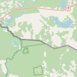 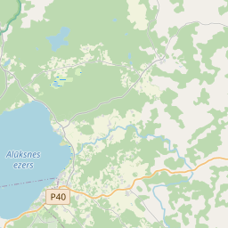 {"7201060210":{"name":"<div class='color_dot' style='background-color: #00ffff'><\/div><span>Specified land unit<\/span>","featureColor":"#00ffff","features":{"type":"FeatureCollection","features":[{"type":"Feature","geometry":{"type":"Polygon","coordinates":[[[27.130275336,57.501178603],[27.133215127,57.50114692],[27.13952522,57.501078688],[27.139261643,57.501812832],[27.139083316,57.502309535],[27.13894974,57.502681541],[27.134867071,57.502752403],[27.131177496,57.50281222],[27.131041291,57.502449243],[27.130698798,57.501856404],[27.130275336,57.501178603]]]},"crs":{"type":"name","properties":{"name":"urn:ogc:def:crs:EPSG:3059"}},"properties":{"style":{"color":"#00ffff","dashArray":"8,12","weight":1},"name":"Land","object_type":"Parcel","parcel_code":"36760010009","code":null,"surveyor":null,"address":"","ownership":"<span>Owner - Legal entity<br><\/span>","pro_cadastre_nr":"36760010008"}},{"type":"Feature","geometry":{"type":"Polygon","coordinates":[[[27.120535291,57.504313283],[27.12057325,57.504309224],[27.120676311,57.504306673],[27.120758024,57.504323185],[27.120889773,57.504387867],[27.120980844,57.504379437],[27.1212447,57.504298778],[27.121278516,57.504291766],[27.121336824,57.504302681],[27.121375379,57.504351136],[27.121399871,57.504369064],[27.121745982,57.504391378],[27.121806397,57.504426942],[27.121844953,57.504475396],[27.121901681,57.504467817],[27.121930756,57.504405328],[27.122060242,57.504309469],[27.122465818,57.504158541],[27.123380825,57.503866071],[27.124180819,57.503136443],[27.124136379,57.502985038],[27.125592235,57.50344479],[27.125662846,57.503483964],[27.125679173,57.503504017],[27.125803104,57.504712943],[27.125868395,57.504860855],[27.126163951,57.505136842],[27.127308224,57.505693988],[27.127759897,57.506736164],[27.130229997,57.506466187],[27.132999528,57.506216621],[27.133068372,57.506342699],[27.133676624,57.506673547],[27.133798395,57.50679226],[27.134016703,57.50713279],[27.13417327,57.507725488],[27.134195746,57.508579443],[27.132327091,57.508707963],[27.13137527,57.508737412],[27.13013389,57.508664492],[27.12953641,57.508614517],[27.128953616,57.508594034],[27.12692456,57.508693547],[27.125519775,57.50874293],[27.123700705,57.508776361],[27.122944155,57.508799156],[27.122130234,57.507677228],[27.121795679,57.50721603],[27.120778797,57.505544814],[27.120552368,57.504399616],[27.120535291,57.504313283]]]},"crs":{"type":"name","properties":{"name":"urn:ogc:def:crs:EPSG:3059"}},"properties":{"style":{"color":"#00ffff","dashArray":"8,12","weight":1},"name":"Land","object_type":"Parcel","parcel_code":"36760010008","code":null,"surveyor":null,"address":"","ownership":"<span>Owner - Legal entity<br><\/span>","pro_cadastre_nr":"36760010008"}}]}}}
[]
https://tile.openstreetmap.org/{z}/{x}/{y}.png|© OpenStreetMap contributors|minZoom: 7|maxZoom: 19
|
Data source and license: Open data of the real estate market database, Open data of the cadastral information system, open data license: Creative Commons Attribution, OpenStreetMap