Deal ID: 1221167
Transaction object type | Transaction object type: The land |
|---|---|
Object | Object: Land |
Property cadastral number | |
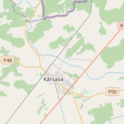
Administrative area | Administrative area: Mežvidu pag., Ludzas nov. |
Transaction date | Transaction date: |
Administrative area | |
|---|---|
Address ID | Address ID: 100012672 |
Companies registered at the address | |
Departments registered at the address | |
Institutions registered at the address | |
Real estate registered at the address | |
Transactions with real estate at the address |
|
{"7201060210":{"name":"<div class='color_dot' style='background-color: #00ffff'><\/div><span>Specified land unit<\/span>","featureColor":"#00ffff","features":{"type":"FeatureCollection","features":[{"type":"Feature","geometry":{"type":"Polygon","coordinates":[[[27.655737707,56.725760032],[27.662446849,56.725925999],[27.6632559,56.726572794],[27.661997749,56.727589546],[27.661080263,56.728329857],[27.660886887,56.728283628],[27.659690599,56.727922605],[27.659028736,56.727722855],[27.658245645,56.727638065],[27.657448032,56.727567732],[27.656811375,56.727526149],[27.656661274,56.727483678],[27.65648489,56.727277629],[27.656146686,56.726965022],[27.655930359,56.726375476],[27.655737707,56.725760032]]]},"crs":{"type":"name","properties":{"name":"urn:ogc:def:crs:EPSG:3059"}},"properties":{"style":{"color":"#00ffff","dashArray":"8,12","weight":1},"name":"Land","object_type":"Parcel","parcel_code":"68700050229","code":null,"surveyor":null,"address":"","ownership":"<span>Owner - Legal entity<br><\/span>","pro_cadastre_nr":"68700050293"}},{"type":"Feature","geometry":{"type":"Polygon","coordinates":[[[27.649081058,56.721278372],[27.649574015,56.721280275],[27.649895106,56.721296674],[27.650383348,56.721345205],[27.651630825,56.721463229],[27.651903031,56.721480553],[27.652453542,56.721493623],[27.652817504,56.721538229],[27.653306412,56.722637869],[27.6535974,56.723292329],[27.654767418,56.725735995],[27.653440182,56.725703465],[27.653269413,56.725107939],[27.650706864,56.72530321],[27.650018458,56.723740612],[27.649459545,56.72254001],[27.649362102,56.72250416],[27.649526611,56.722393664],[27.649743771,56.722192072],[27.649778375,56.72206091],[27.649698902,56.721746311],[27.649631753,56.721750492],[27.649295392,56.721733155],[27.649081058,56.721278372]],[[27.650451427,56.722505685],[27.650458995,56.722553017],[27.650661291,56.72284435],[27.650952162,56.723094396],[27.651124283,56.723189123],[27.651571011,56.723290036],[27.651796559,56.723362821],[27.651945653,56.723454796],[27.651971815,56.723430993],[27.651849181,56.722447955],[27.650566319,56.722500904],[27.650451427,56.722505685]]]},"crs":{"type":"name","properties":{"name":"urn:ogc:def:crs:EPSG:3059"}},"properties":{"style":{"color":"#00ffff","dashArray":"8,12","weight":1},"name":"Land","object_type":"Parcel","parcel_code":"68700050228","code":null,"surveyor":null,"address":"","ownership":"<span>Owner - Legal entity<br><\/span>","pro_cadastre_nr":"68700050293"}},{"type":"Feature","geometry":{"type":"Polygon","coordinates":[[[27.641057183,56.729848788],[27.643110353,56.730071548],[27.646250807,56.726554887],[27.647560267,56.726431524],[27.647633376,56.728215814],[27.651598783,56.727944044],[27.651593697,56.727926022],[27.651599001,56.727929777],[27.651887834,56.728139143],[27.652265168,56.728402034],[27.652415824,56.728521845],[27.652499951,56.728634122],[27.652486756,56.728738788],[27.652334312,56.729214658],[27.652263669,56.729461299],[27.652216204,56.729592218],[27.652022449,56.730267869],[27.651959784,56.730296645],[27.648699342,56.731796804],[27.648909423,56.731916236],[27.657257516,56.730428325],[27.657400158,56.730466627],[27.657496498,56.730514228],[27.657572267,56.730633041],[27.657512332,56.730800896],[27.657556498,56.730988153],[27.657454786,56.730985755],[27.653572321,56.732137684],[27.651159677,56.732853073],[27.651230132,56.735081172],[27.651237857,56.735164294],[27.650837936,56.735178979],[27.650766165,56.73518566],[27.650685152,56.735205505],[27.650321562,56.735353676],[27.646682941,56.736960355],[27.645924981,56.737258643],[27.644985785,56.73588982],[27.644697672,56.735489769],[27.644086265,56.734689518],[27.643677522,56.734137082],[27.643625928,56.734139787],[27.643340375,56.733838139],[27.642736389,56.732554671],[27.642484552,56.73202937],[27.642014085,56.731139913],[27.641754567,56.730397357],[27.641057183,56.729848788]],[[27.642611744,56.730684084],[27.645387476,56.733246968],[27.645461353,56.733308111],[27.64686162,56.732655454],[27.646789957,56.73260518],[27.643521278,56.730158695],[27.642611744,56.730684084]]]},"crs":{"type":"name","properties":{"name":"urn:ogc:def:crs:EPSG:3059"}},"properties":{"style":{"color":"#00ffff","dashArray":"8,12","weight":1},"name":"Land","object_type":"Parcel","parcel_code":"68700050201","code":null,"surveyor":null,"address":"","ownership":"<span>Owner - Legal entity<br><\/span>","pro_cadastre_nr":"68700050293"}}]}},"7114100000":{"name":"<div class='color_dot' style='background-color: #b40000'><\/div><span>Burdened access road servitude area<\/span>","featureColor":"#b40000","features":{"type":"FeatureCollection","features":[{"type":"Feature","geometry":{"type":"Polygon","coordinates":[[[27.650269834,56.721335668],[27.650341521,56.721824168],[27.650361434,56.722172567],[27.650405041,56.722445761],[27.650479354,56.722503445],[27.650448062,56.722504713],[27.65045595,56.722553655],[27.65065854,56.722845321],[27.65094941,56.723095367],[27.65112197,56.723190395],[27.651569363,56.723291586],[27.651794124,56.723364016],[27.651944481,56.723457042],[27.651921881,56.723460421],[27.651784162,56.723374432],[27.651561705,56.723302492],[27.651106956,56.72319864],[27.650931525,56.723101655],[27.650638405,56.722849157],[27.650434596,56.7225542],[27.65042307,56.722506525],[27.650357382,56.722455305],[27.650312514,56.722174172],[27.650292592,56.721825684],[27.650219806,56.721331066],[27.650269834,56.721335668]]]},"crs":{"type":"name","properties":{"name":"urn:ogc:def:crs:EPSG:3059"}},"properties":{"style":{"color":"#b40000","dashArray":"4,2,1,2","weight":1},"name":"Burdened access road servitude area","object_type":"WayRestriction","parcel_code":"68700050228","code":"7315030100007","surveyor":null,"address":"","ownership":"<span>Owner - Legal entity<br><\/span>","pro_cadastre_nr":"68700050293"}},{"type":"Feature","geometry":{"type":"Polygon","coordinates":[[[27.650071991,56.723854821],[27.650241684,56.723644991],[27.650408928,56.72343792],[27.650472422,56.723270127],[27.650535933,56.723102332],[27.65055596,56.722951071],[27.650570139,56.722843867],[27.650555064,56.722736353],[27.650615972,56.722822734],[27.650619279,56.722843676],[27.650604818,56.722953028],[27.650584571,56.723106067],[27.650520397,56.723275616],[27.650455817,56.72344622],[27.650370071,56.723552384],[27.650286458,56.723655924],[27.650202828,56.723759464],[27.650091185,56.723897919],[27.650071991,56.723854821]]]},"crs":{"type":"name","properties":{"name":"urn:ogc:def:crs:EPSG:3059"}},"properties":{"style":{"color":"#b40000","dashArray":"4,2,1,2","weight":1},"name":"Burdened access road servitude area","object_type":"WayRestriction","parcel_code":"68700050228","code":"7315030100008","surveyor":null,"address":"","ownership":"<span>Owner - Legal entity<br><\/span>","pro_cadastre_nr":"68700050293"}},{"type":"Feature","geometry":{"type":"Polygon","coordinates":[[[27.657531531,56.730987079],[27.657488297,56.730798302],[27.657548232,56.730630448],[27.657480117,56.73052424],[27.65738941,56.73047873],[27.657225223,56.730434677],[27.657254373,56.730429478],[27.657398728,56.730468242],[27.657494321,56.73051556],[27.65756906,56.730632695],[27.657509099,56.730801126],[27.657553168,56.730987387],[27.657531531,56.730987079]]]},"crs":{"type":"name","properties":{"name":"urn:ogc:def:crs:EPSG:3059"}},"properties":{"style":{"color":"#b40000","dashArray":"4,2,1,2","weight":1},"name":"Burdened access road servitude area","object_type":"WayRestriction","parcel_code":"68700050201","code":"7315030100001","surveyor":null,"address":"","ownership":"<span>Owner - Legal entity<br><\/span>","pro_cadastre_nr":"68700050293"}},{"type":"Feature","geometry":{"type":"Polygon","coordinates":[[[27.648670693,56.728147042],[27.651108219,56.729076473],[27.651870718,56.729323564],[27.652302585,56.729310895],[27.65229603,56.729338061],[27.651858568,56.729350894],[27.651081782,56.729099169],[27.648598599,56.728152454],[27.648670693,56.728147042]]]},"crs":{"type":"name","properties":{"name":"urn:ogc:def:crs:EPSG:3059"}},"properties":{"style":{"color":"#b40000","dashArray":"4,2,1,2","weight":1},"name":"Burdened access road servitude area","object_type":"WayRestriction","parcel_code":"68700050201","code":"7315030100002","surveyor":null,"address":"","ownership":"<span>Owner - Legal entity<br><\/span>","pro_cadastre_nr":"68700050293"}},{"type":"Feature","geometry":{"type":"Polygon","coordinates":[[[27.644086591,56.730580628],[27.644057702,56.730558646],[27.645282271,56.730184316],[27.645775482,56.729950508],[27.646596923,56.729086435],[27.647600425,56.727587157],[27.647603573,56.727660441],[27.646641818,56.729097375],[27.645814573,56.729967543],[27.645310478,56.730206516],[27.644086591,56.730580628]]]},"crs":{"type":"name","properties":{"name":"urn:ogc:def:crs:EPSG:3059"}},"properties":{"style":{"color":"#b40000","dashArray":"4,2,1,2","weight":1},"name":"Burdened access road servitude area","object_type":"WayRestriction","parcel_code":"68700050201","code":"7315030100003","surveyor":null,"address":"","ownership":"<span>Owner - Legal entity<br><\/span>","pro_cadastre_nr":"68700050293"}}]}}}
[]
https://tile.openstreetmap.org/{z}/{x}/{y}.png|© OpenStreetMap contributors|minZoom: 7|maxZoom: 19
|

Data source and license: Open data of the real estate market database, Open data of the cadastral information system, open data license: Creative Commons Attribution, OpenStreetMap