Deal ID: 1220416
Transaction object type | Transaction object type: The land |
|---|---|
Object | Object: Land |
Property cadastral number | |
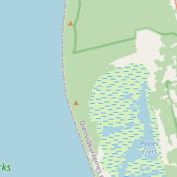
Administrative area | Administrative area: Nīcas pag., Dienvidkurzemes nov. |
Transaction date | Transaction date: |
Administrative area | |
|---|---|
Address ID | Address ID: 100012326 |
Companies registered at the address | |
Departments registered at the address | |
Institutions registered at the address | |
Real estate registered at the address | |
Transactions with real estate at the address |
|
{"7201060210":{"name":"<div class='color_dot' style='background-color: #00ffff'><\/div><span>Specified land unit<\/span>","featureColor":"#00ffff","features":{"type":"FeatureCollection","features":[{"type":"Feature","geometry":{"type":"Polygon","coordinates":[[[21.04870023,56.263358548],[21.048711506,56.263332101],[21.051572922,56.256624602],[21.051943235,56.250932255],[21.056953891,56.251580825],[21.058465204,56.251774846],[21.059976532,56.251968858],[21.062423744,56.252292154],[21.063709932,56.252462389],[21.064055467,56.252499312],[21.064183509,56.252506361],[21.064367238,56.252458037],[21.065137402,56.252247823],[21.067443604,56.251668351],[21.068200502,56.251477237],[21.068555342,56.251390967],[21.06853775,56.251442579],[21.068232264,56.252338695],[21.067802667,56.253309533],[21.067393297,56.25423817],[21.066120347,56.257181405],[21.066069239,56.257299676],[21.065665587,56.258233054],[21.06442476,56.261163841],[21.062697525,56.265203672],[21.062676473,56.265254509],[21.06262251,56.265247304],[21.055431692,56.264287225],[21.048765735,56.263396813],[21.04870023,56.263358548]]]},"crs":{"type":"name","properties":{"name":"urn:ogc:def:crs:EPSG:3059"}},"properties":{"style":{"color":"#00ffff","dashArray":"8,12","weight":1},"name":"Land","object_type":"Parcel","parcel_code":"64780210176","code":null,"surveyor":null,"address":"","ownership":"<span>Owner - Legal entity<br><\/span>","pro_cadastre_nr":"64780210176"}}]}},"7114100000":{"name":"<div class='color_dot' style='background-color: #b40000'><\/div><span>Burdened access road servitude area<\/span>","featureColor":"#b40000","features":{"type":"FeatureCollection","features":[{"type":"Feature","geometry":{"type":"Polygon","coordinates":[[[21.066050543,56.257338631],[21.066027715,56.257391476],[21.051650189,56.255450136],[21.051653394,56.255394408],[21.066050543,56.257338631]]]},"crs":{"type":"name","properties":{"name":"urn:ogc:def:crs:EPSG:3059"}},"properties":{"style":{"color":"#b40000","dashArray":"4,2,1,2","weight":1},"name":"Burdened access road servitude area","object_type":"WayRestriction","parcel_code":"64780210176","code":"7315030100002","surveyor":null,"address":"","ownership":"<span>Owner - Legal entity<br><\/span>","pro_cadastre_nr":"64780210176"}}]}}}
[]
https://tile.openstreetmap.org/{z}/{x}/{y}.png|© OpenStreetMap contributors|minZoom: 7|maxZoom: 19
|

Data source and license: Open data of the real estate market database, Open data of the cadastral information system, open data license: Creative Commons Attribution, OpenStreetMap