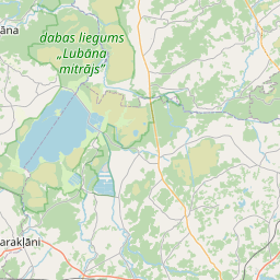
Deal ID: 1220338
Transaction object type | Transaction object type: The land |
|---|---|
Object | Object: Land |
Property cadastral number | |
Administrative area | Administrative area: Sokolku pag., Rēzeknes nov. |
Transaction date | Transaction date: |
Administrative area | |
|---|---|
Address ID | Address ID: 100013512 |
Companies registered at the address | |
Departments registered at the address | |
Institutions registered at the address | |
Real estate registered at the address | |
Transactions with real estate at the address |
|
{"7201060110":{"name":"<div class='color_dot' style='background-color: #00ffff'><\/div><span>Measured land unit<\/span>","featureColor":"#00ffff","features":{"type":"FeatureCollection","features":[{"type":"Feature","geometry":{"type":"Polygon","coordinates":[[[27.048486175,56.467940532],[27.048786928,56.466689626],[27.048946656,56.466759484],[27.050328443,56.466914811],[27.05415604,56.467635429],[27.056482356,56.468035921],[27.056708524,56.468072868],[27.058663742,56.468558809],[27.058604541,56.468631787],[27.058686216,56.469778339],[27.057540194,56.469668055],[27.05575739,56.469678874],[27.055070917,56.469682369],[27.054952885,56.469080866],[27.053306922,56.469134629],[27.053360469,56.469795737],[27.053365265,56.46982896],[27.052388524,56.469873086],[27.052364477,56.469875566],[27.052353022,56.469842138],[27.051670098,56.468694618],[27.051042706,56.467640367],[27.051058925,56.46761381],[27.049713863,56.467361386],[27.048486175,56.467940532]]]},"crs":{"type":"name","properties":{"name":"urn:ogc:def:crs:EPSG:3059"}},"properties":{"style":{"color":"#00ffff","dashArray":"0","weight":1},"name":"Land","object_type":"Parcel","parcel_code":"78900050239","code":null,"surveyor":null,"address":"","ownership":"<span>Owner - Legal entity<br><\/span>","pro_cadastre_nr":"78900010179"}},{"type":"Feature","geometry":{"type":"Polygon","coordinates":[[[26.975592799,56.554368627],[26.976057292,56.55339789],[26.978924514,56.553380554],[26.980605868,56.553012531],[26.981704986,56.554828763],[26.981857591,56.557318255],[26.981881807,56.557344659],[26.980429095,56.557750852],[26.979357674,56.557789416],[26.977980779,56.557818583],[26.97774747,56.55685706],[26.977514175,56.555895546],[26.977314367,56.555044556],[26.977175116,56.554632283],[26.977035868,56.554220009],[26.97631811,56.554304149],[26.975600348,56.554388285],[26.975592799,56.554368627]]]},"crs":{"type":"name","properties":{"name":"urn:ogc:def:crs:EPSG:3059"}},"properties":{"style":{"color":"#00ffff","dashArray":"0","weight":1},"name":"Land","object_type":"Parcel","parcel_code":"78900010179","code":null,"surveyor":null,"address":"","ownership":"<span>Owner - Legal entity<br><\/span>","pro_cadastre_nr":"78900010179"}}]}},"7114100000":{"name":"<div class='color_dot' style='background-color: #b40000'><\/div><span>Burdened access road servitude area<\/span>","featureColor":"#b40000","features":{"type":"FeatureCollection","features":[{"type":"Feature","geometry":{"type":"Polygon","coordinates":[[[27.052804829,56.469833439],[27.053362233,56.469808808],[27.053365215,56.469828943],[27.052388555,56.469873068],[27.052364555,56.469875537],[27.052357784,56.469855729],[27.052383294,56.469853052],[27.052493504,56.469846826],[27.052804829,56.469833439]]]},"crs":{"type":"name","properties":{"name":"urn:ogc:def:crs:EPSG:3059"}},"properties":{"style":{"color":"#b40000","dashArray":"4,2,1,2","weight":1},"name":"Burdened access road servitude area","object_type":"WayRestriction","parcel_code":"78900050239","code":"7315030100002","surveyor":null,"address":"","ownership":"<span>Owner - Legal entity<br><\/span>","pro_cadastre_nr":"78900010179"}}]}}}
{"7201060110":{"name":"<div class='color_dot' style='background-color: #00ffff'><\/div><span>Measured land unit<\/span>","featureColor":"#00ffff","features":{"type":"FeatureCollection","features":[{"type":"Feature","geometry":{"type":"Polygon","coordinates":[[[27.048486245,56.467940189],[27.048786928,56.466689626],[27.048946656,56.466759484],[27.050328443,56.466914811],[27.05415604,56.467635429],[27.056482356,56.468035921],[27.056708524,56.468072868],[27.058663742,56.468558809],[27.058604541,56.468631787],[27.058686216,56.469778339],[27.057540194,56.469668055],[27.05575739,56.469678874],[27.055070917,56.469682369],[27.054952885,56.469080866],[27.053306922,56.469134629],[27.053360469,56.469795737],[27.053365265,56.46982896],[27.052388524,56.469873086],[27.052364544,56.4698756],[27.052353104,56.469842145],[27.051042719,56.467640322],[27.051058971,56.467613773],[27.049713847,56.467361386],[27.048486245,56.467940189]]]},"crs":{"type":"name","properties":{"name":"urn:ogc:def:crs:EPSG:3059"}},"properties":{"style":{"color":"#00ffff","dashArray":"0","weight":1},"name":"Land","object_type":"Parcel","parcel_code":"78900050239","code":null,"surveyor":null,"address":"","ownership":"<span>Owner - Legal entity<br><\/span>","pro_cadastre_nr":"78900010179"}}]}}}
https://tile.openstreetmap.org/{z}/{x}/{y}.png|© OpenStreetMap contributors|minZoom: 7|maxZoom: 19
|
Data source and license: Open data of the real estate market database, Open data of the cadastral information system, open data license: Creative Commons Attribution, OpenStreetMap

