Deal ID: 1204125
Transaction object type | Transaction object type: The land |
|---|---|
Object | Object: Land |
Property cadastral number | |
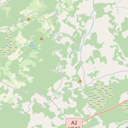
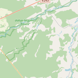
Administrative area | Administrative area: Launkalnes pag., Smiltenes nov. |
Actual address | Actual address : Palsmanes pag., Smiltenes nov. |
Transaction date | Transaction date: |
Administrative area | |
|---|---|
Address ID | Address ID: 100014362 |
Companies registered at the address | |
Departments registered at the address | |
Institutions registered at the address | |
Real estate registered at the address | |
Transactions with real estate at the address |
| Cadastral object type | Cadastre designation of the cadastral object | Person's property right status | Person status | Land Register |
|---|---|---|---|---|
| Cadastral object type: Real Estate | 94700020140 | Person's property right status: Owner | Person status: Natural person | Land Register |
22.01.2025. State land service data
|
{"7201060210":{"name":"<div class='color_dot' style='background-color: #00ffff'><\/div><span>Specified land unit<\/span>","featureColor":"#00ffff","features":{"type":"FeatureCollection","features":[{"type":"Feature","geometry":{"type":"Polygon","coordinates":[[[26.038140188,57.388105197],[26.038204261,57.387802056],[26.0384002,57.387624838],[26.038592034,57.387567003],[26.039062852,57.387554329],[26.039539741,57.387566795],[26.03992217,57.387798773],[26.039828613,57.38785129],[26.039834996,57.387922449],[26.039963593,57.388026509],[26.040141105,57.388062791],[26.040320988,57.388034241],[26.040899346,57.388091503],[26.041167812,57.388086504],[26.041397147,57.388048686],[26.041692693,57.388042331],[26.041930206,57.388106992],[26.042066317,57.388184781],[26.042200161,57.388294792],[26.042290911,57.388338732],[26.042480062,57.388386161],[26.042769918,57.38839083],[26.042938497,57.388356503],[26.04323589,57.388367455],[26.043665797,57.388452775],[26.043921639,57.388478912],[26.044144286,57.388439922],[26.044298259,57.388318717],[26.044388944,57.388134915],[26.047030592,57.388065011],[26.047226017,57.388099231],[26.047431715,57.388069712],[26.047939627,57.387881943],[26.048588968,57.387751713],[26.04907004,57.387702749],[26.04853671,57.388920252],[26.048293822,57.388911076],[26.047814627,57.389038151],[26.047237851,57.389291437],[26.047049388,57.389238352],[26.04658681,57.389153224],[26.046311638,57.389111781],[26.044235314,57.388875212],[26.04385522,57.388884348],[26.043134727,57.388859129],[26.042810792,57.388837762],[26.042547611,57.388807438],[26.041987851,57.388718613],[26.040961431,57.388509131],[26.040572106,57.388447926],[26.040034516,57.388392257],[26.039088474,57.388236493],[26.038140188,57.388105197]]]},"crs":{"type":"name","properties":{"name":"urn:ogc:def:crs:EPSG:3059"}},"properties":{"style":{"color":"#00ffff","dashArray":"8,12","weight":1},"name":"Land","object_type":"Parcel","parcel_code":"94700020030","code":null,"surveyor":null,"address":"","ownership":"<span>Owner - Natural person<br><\/span>","pro_cadastre_nr":"94700020140"}},{"type":"Feature","geometry":{"type":"Polygon","coordinates":[[[26.029745873,57.379814353],[26.029870696,57.37978135],[26.030004657,57.379815841],[26.030186714,57.379927441],[26.030320975,57.380130149],[26.030440879,57.380222112],[26.030538034,57.380344614],[26.030943533,57.380570217],[26.031145098,57.380733607],[26.031040491,57.380864782],[26.03082302,57.38134186],[26.030848167,57.381557425],[26.030613215,57.381553901],[26.029809409,57.379941746],[26.029745873,57.379814353]]]},"crs":{"type":"name","properties":{"name":"urn:ogc:def:crs:EPSG:3059"}},"properties":{"style":{"color":"#00ffff","dashArray":"8,12","weight":1},"name":"Land","object_type":"Parcel","parcel_code":"94700020029","code":null,"surveyor":null,"address":"","ownership":"<span>Owner - Natural person<br><\/span>","pro_cadastre_nr":"94700020140"}},{"type":"Feature","geometry":{"type":"Polygon","coordinates":[[[26.031369413,57.382704409],[26.031504614,57.382665181],[26.031845267,57.382704476],[26.032428771,57.382807814],[26.032752341,57.382854633],[26.033143894,57.382969738],[26.033474201,57.383137882],[26.033484759,57.383328533],[26.033849535,57.383539483],[26.034214298,57.383750432],[26.034487388,57.38375469],[26.034730317,57.383794128],[26.03481433,57.383862163],[26.034857025,57.384003944],[26.0347323,57.384121457],[26.03464891,57.384217213],[26.034567223,57.384326276],[26.034521215,57.384667329],[26.034661788,57.384766708],[26.034837009,57.384786358],[26.034981886,57.384797342],[26.035121789,57.38483148],[26.035219736,57.384913415],[26.035217091,57.385016681],[26.03516002,57.385061371],[26.035100769,57.385135774],[26.035087887,57.385241973],[26.035113524,57.385306469],[26.03433088,57.387990016],[26.034318455,57.388029734],[26.032140924,57.384078148],[26.031805051,57.383421559],[26.031369413,57.382704409]]]},"crs":{"type":"name","properties":{"name":"urn:ogc:def:crs:EPSG:3059"}},"properties":{"style":{"color":"#00ffff","dashArray":"8,12","weight":1},"name":"Land","object_type":"Parcel","parcel_code":"94700020028","code":null,"surveyor":null,"address":"","ownership":"<span>Owner - Natural person<br><\/span>","pro_cadastre_nr":"94700020140"}}]}},"7114100000":{"name":"<div class='color_dot' style='background-color: #b40000'><\/div><span>Burdened access road servitude area<\/span>","featureColor":"#b40000","features":{"type":"FeatureCollection","features":[{"type":"Feature","geometry":{"type":"Polygon","coordinates":[[[26.038140188,57.388105197],[26.038149715,57.388060159],[26.03911094,57.388193244],[26.04005453,57.388348605],[26.040591603,57.38840422],[26.040987795,57.388466505],[26.042014312,57.388676007],[26.04256804,57.388763875],[26.042824538,57.388793428],[26.043142465,57.3888144],[26.043856063,57.388839377],[26.044242159,57.388830097],[26.046331413,57.389068139],[26.046611414,57.389110309],[26.047082223,57.389196952],[26.047308158,57.389260554],[26.047237851,57.389291437],[26.047049388,57.389238352],[26.046586811,57.389153222],[26.046311639,57.389111778],[26.044235315,57.388875198],[26.043855227,57.388884318],[26.043134732,57.388859108],[26.042810801,57.388837737],[26.042547638,57.388807359],[26.04198786,57.388718596],[26.040961479,57.388509072],[26.040572125,57.38844788],[26.040034537,57.388392214],[26.039088483,57.388236473],[26.038140188,57.388105197]]]},"crs":{"type":"name","properties":{"name":"urn:ogc:def:crs:EPSG:3059"}},"properties":{"style":{"color":"#b40000","dashArray":"4,2,1,2","weight":1},"name":"Burdened access road servitude area","object_type":"WayRestriction","parcel_code":"94700020030","code":"7315030100004","surveyor":null,"address":"","ownership":"<span>Owner - Natural person<br><\/span>","pro_cadastre_nr":"94700020140"}}]}}}
[]
https://tile.openstreetmap.org/{z}/{x}/{y}.png|© OpenStreetMap contributors|minZoom: 7|maxZoom: 19
|
Data source and license: Open data of the real estate market database, Open data of the cadastral information system, open data license: Creative Commons Attribution, OpenStreetMap

